Canadian Sign Language – Part 3

October 14, 2019

Canadians love pictures on their road signs.  My previous posts on this topic were comprised mainly of signs which I had seen during my trip.  Where practical, I took the photos I posted but there were times that for some reason I couldn’t, or I thought perhaps I would see the sign again and didn’t.  In those situations I tried to find photos online and when that method didn’t immediately lead me to find a suitable replacement I got desperate in my quest and started searching driver’s manuals for certain provinces.

I looked at more photos of actual road signs online than I care to remember but did make it a point to save some memorable or humorous signs.  Here are more examples with my own interpretations:

ArmpitSniffing

Armpit-sniffing at next exit?

CowMorphing

Cow-cloning at next exit?

GiamtBongZone

Giant bong at next exit?

NudeBeach

Nude beach

That one’s accurate!

IHaveNoIdea

I have no idea – but that image was actually in a driver’s manual…

JustADistraction

Again – I have no idea.  Perhaps just a math quiz or something to distract you from the fact that there is a speed trap ahead….

PolicemanEatDonuts

Safety Stop Ahead – I hope you brought doughnuts or you may get a ticket…

YouWonTheIndy500

Congratulations – You just won the Indianapolis 500!!

3 Things – First impressions

October 14, 2019

Before I left on my 7-week trip to Canada I found a photo online which inspired me to form three impressions (thoughts, places or experiences) about each province.  These are things which come to mind when I think about my time spent in each place.  Now that I have finished posting photos from that trip here are my lists, in the order in which I visited each province.

NEW BRUNSWICK

  1. Tides
  2. Flowerpot rocks
  3. Curling clubs

NOVA SCOTIA

  1. Cabot Trail – Cape Breton
  2. Tidal bores
  3. Casual

NEWFOUNDLAND

  1. Mountains
  2. Rugged
  3. Animals (moose, puffins, whales)

PRINCE EDWARD ISLAND

  1. Mussels
  2. Potatoes
  3. Farming

QUÉBEC

  1. French influence (language, signage, food)
  2. Fast drivers
  3. Gaspé Peninsula coastline

ONTARIO

  1. Architecture
  2. Modern
  3. Artistic


Welcome to the United States

August 27, 2019

Tuesday morning I left Toronto on a rainy, foggy morning and started my trek back to the United States.  I had a stop planned at an unusual spot a considerable distance northwest of town and did drive most of the way there, but as I was about to exit a major highway to a much smaller road there were signs warning of a road construction project which was to continue for many miles and that I was to expect MAJOR delays.  Given the weather and the fact that I still had to drive to Niagara Falls, and then to my brother’s house in northeast Ohio I decided to bail out and turned around.  Over the “off season” I will probably put together a post about the venue I didn’t make it to.

This was the scene when I arrived at the border crossing at Niagara Falls, NY:

IMG_20190827_105657613

I was able to pass through about a half-hour later without incident and the remainder of my trip went as planned.

I am going to make two more posts about my 7 weeks in Canada.  First, I promised to list three memorable things, places or impressions about each of the provinces I visited.  Second, I still have another Canadian Sign Language post to make so I might as well go out on a high note.

I am planning to return to many of the same spots in Canada again next year and I will put together a post with some of the reasons I want to go back so soon.

Toronto – BAPS Hindu Temple

August 26, 2019

The proper name for this place of worship is BAPS Shri Swanimarayan Mandir.  In researching this post I discovered there is a Hindu Temple with an identical name in Morrisville, NC, out near the Raleigh-Durham airport, and evidently similar facilities share the common name.  I have no idea what ‘BAPS’ stands for.  Worshipers at this temple follow the Swanimarayan branch of the Hindu religion.

Although the temple I visited has a Toronto mailing address it is physically located quite a ways northwest from downtown in a suburb named Etobicoke.  MapQuest indicates that driving to this temple from downtown would cover about 20 miles and take 24 minutes using major roads.  I used public transportation and it took me considerably longer.

Two ladies from South America who now live in Israel told me about this place when I met them one of the days I was in Ottawa when we shared stories of where we had been and where we were going next.

Monday afternoon I took the subway system’s northwest route to a stop near where that line ends.  From there I took a city bus several miles west.  On one of maps I was using I was under the impression that I might be able to walk to the temple from where that route ends but the driver suggested I get out a few stops before that and take another bus south, then yet another bus northwest.  He was pretty sure that bus would drop me off right in front of the place, and he was right.  I think I might have been in for a long walk and probably would have gotten lost if I had stuck to my original plan.

This was the sign which greeted me at the main gate.

IMG_20190826_131208423

There was another sign just past an unoccupied security gatehouse which advised visitors that they were entering a place of worship and that there were rules which must be followed.  I followed instructions on that sign to use the intercom to declare my intentions to a security guard who ultimately told me to walk to the main entrance and come inside to discuss my plans (the intercom barely worked and this was the easiest solution).  Upon entering the “Haveli,” a cultural center and meeting hall, I immediately removed my shoes as instructed and found my way to the Information desk.

DSCN2496

I had already decided that I wasn’t going to enter any of the interior portions of the temple as it sounded like there are always things going on there and I didn’t want to intrude.  I told the guard that I simply wanted to take pictures of the exterior and he said that was fine.

I put my shoes back on once I was outside the building and walked next door to the “Mandir,” or Temple.

DSCN2494

It took 18 months to build this structure using hand carved Italian marble, Turkish limestone and Indian pink stone.  A chain link fence wouldn’t permit me to get too close to the building so I relied on my digital camera to get some close up shots.  The mid-day sun was on the opposite side of the building so the photos are a little “washed out”.

DSCN2498

DSCN2501

DSCN2505

DSCN2507

DSCN2511

DSCN2518

DSCN2516

The Haveli next door also had many elaborate wood carvings near the main entrance doors.  These carvings consisted of many, many themes, some containing people and others featuring various animals.  There was way more variety than the few shots I am posting.

DSCN2530

DSCN2532

DSCN2534

DSCN2540

The city bus which took me to the entrance of this facility didn’t run very often so I pretty much just scrambled to get my photos and walked back out to catch the next one that came along.  I reversed the transportation sequence to get back downtown.  All things considered, it took me much longer to get there and get back downtown than I actually spent on the property but it had been highly recommended and if I hadn’t made the trip I would have always wondered what I had missed.  There are a few, but not many, photos of the interior online.


Toronto – Day 3

August 26, 2019

Monday was my last full day in Toronto (and in Canada).  Here are some of the things I saw throughout the morning.  My afternoon venue took a while to get to and will appear in a separate post.

This is the Frank Gehry-designed façade on the front of the Art Gallery of Ontario (AGO).  I didn’t know until I researched this post that Mr. Gehry is a native of Toronto.

IMG_20190826_081751495

IMG_20190826_081757141

The building is so large (and faces a narrow city street) that it was difficult to get it all in one photo.

IMG_20190826_083901682

I would have missed this next venue if my Airbnb hostess hadn’t made me aware of it.  It is located right behind the AGO.  This is Ontario College of Art and Design (OCAD) University:

IMG_20190826_082254236_HDR

While much of the school is located inside a “normal” building, part of it is suspended on stilts, several stories in the air!

IMG_20190826_082505093_HDR

Admittance to the upper floors appears to be achieved by an escalator and perhaps stairs and/or elevators in the main street-level building.

IMG_20190826_082937990_HDR

DSCN2432

And this being an art school and all, we may have found the artists responsible for some of the artwork in Graffiti Alley!  These images were found outside next to the stairs and handicap-access ramp:

IMG_20190826_082821083

IMG_20190826_082847713

IMG_20190826_082910768

I went back up to the front of the AGO building and saw this clever way to secure one’s bicycle without blocking the sidewalk:

IMG_20190826_083526531

This piece of art was located outside, across the street from AGO.  While the first photo shows what appears to be a flat painting of a man’s face, there is more to it than that.

IMG_20190826_083549280

The side you see above is actually three-dimensional.  It is concave, as it curves in from the sides of the painting:

IMG_20190826_083602154

The opposite side of the painting shows a similar image but is convex, in that it protrudes outward from the flat surface of the border.

IMG_20190826_083637693

After I took those photos I hopped back on a bus to head further north.  There was a restaurant where I wanted to eat lunch and I then wanted to revisit the art museum I had seen Sunday evening.

This was not the restaurant where I ate but I was amused by their signage.  Somehow I think if this is going to be your tagline….

IMG_20190826_090750942

…. then you may want to rethink the name of your restaurant….

IMG_20190826_090738653

Here is another look at the exterior of the Royal Ontario Museum (ROM).

IMG_20190826_100216807_HDR

IMG_20190826_100152633

I didn’t go inside any of the museums in Toronto except to inquire about the availability of photos at the shoe museum (see previous post).  Next year when I return to eastern Canada I will budget days to visit many of the museums along my route, regardless of the weather.


Toronto – Bata Shoe Museum Display

August 25, 2019

When I was in northern Toronto Sunday evening I walked past this museum and noticed an impressive display in their windows.  I tried taking my own photos, both Sunday evening and again on Monday but there are two reasons why they are not blogworthy – 1) since they were taken during the day the reflection in the windows of what was behind me is too much of a distraction, and 2) what I was seeing was best viewed from a distance.  I don’t want the creativity behind the display to go unmentioned, though, so I have downloaded a few photos I found online and will post two of my own at the end.

The display I am talking about, called “In Full Bloom,” was created back in 2017 to help celebrate Canada’s 150th birthday.  Students from the Department of Architectural Science at Ryerson University put together a display of the official flowers of Canada’s various provinces and territories.  This display consists of over 2,000 shoes created on a 3-D printer in various colors.  When viewed from a distance the flower images are quite impressive.  The “flowers” are arranged left-to-right based on the location of each province or territory (west-to-east) in the country.

BataShoe twitter

(Photo credit: twitter.com)

BataShoeMuseum RemiCarreiro

(Photo credit: Remi Carreiro)

BataShoe occasionalontario blogspot com

(Photo credit: museumnotes.blogspot.com)

The photo above is a prime example of the reflection in the upper right corner of the window distracting from the subject of the photo.

BataShoe museumnotes

(Photo credit: occasionaltoronto.blogspot.com)

The photo above is the first closeup which clearly shoes the solid-colored shoes which are used to create the image of a flower when viewed from a distance.

Bata TravelWithClem

(Photo credit: travelwithclem.com)


The two photos below were taken by me Sunday evening around 7pm.

IMG_20190825_185348899

IMG_20190825_185401223

When I went back to the museum Monday I went inside to ask if professional photos (postcards, perhaps) were available but was told they were not.


Toronto – Day 2 – Street Art

August 25, 2019

Here are some examples of various murals, graffiti and a sculpture I saw while visiting various parts of Toronto on Sunday:

I saw this sculpture on the side of a building as I was riding the street car through the west side of town.  I made note of the location and got off on the return trip so I could get a photo.

DSCN2390

I had also seen a cool mural so I got off the streetcar again so I could get a photo.  I had to take the shot on an angle to get it all in (without the clutter of cars parked in front of it).

IMG_20190825_101855409

This was on an apartment building on a side street (perhaps where the artist lives?).

IMG_20190825_102121962

Those were all taken in the morning.  Let me jump ahead to my trip home at the end of the day and show this mural which is on the side of a building about 4 blocks from where my Airbnb was located.

IMG_20190825_165133313_HDR

The reason I wanted to jump ahead in time with the photo above is that all the others photos in the remainder of this post were found in “Graffiti Alley,” a 3-block alley on the west side of town just a short distance from the main east-west street.  Yes, there really is such a place:

IMG_20190825_103837191

IMG_20190825_104123593

IMG_20190825_104217256_HDR

IMG_20190825_104151666

IMG_20190825_104235300

IMG_20190825_104305797_HDR

IMG_20190825_104345007

These next two go together.  Because I was literally in an alley I couldn’t get far enough back to get the entire theme (a lobster DJ) in one shot, and shooting it in an angle didn’t do it justice.

IMG_20190825_104417883

IMG_20190825_104424700

IMG_20190825_104502766

IMG_20190825_104722348

IMG_20190825_104817424

IMG_20190825_104941115


Toronto – Day 2

August 25, 2019

Sunday I rode the street car downtown and made a variety of side trips.  Rather than getting off in the middle of town I rode it as far west as I could.  This gave me a chance to see a part of town that I hadn’t seen the day before as well as part of the waterfront (Toronto is situated along Lake Ontario) to see if perhaps I’d want to spend more time there later in the day.  I made note of the locations of a few things I wanted to take pictures of and got off the street car a few times as I rode back downtown.

One of the places I spent some time at was a large plaza with a reflecting pond and a huge Toronto sign (no A holes here…).

IMG_20190825_110406540

Every time I rode the street car downtown I passed right by this ornate municipal building, Old City Hall:

IMG_20190825_111527950_HDR

IMG_20190825_111541862_HDR

IMG_20190825_111625578_HDR

IMG_20190825_111759496

The preceding photos were all of the front of the building which faced the main street through town.  The following photos were taken of the right side of the building.

IMG_20190825_111629914_HDR

IMG_20190825_111856194

IMG_20190825_112205686_HDR

Next I went inside Eaton Centre, a multi-story indoor shopping mall located about a block away from Old City Hall.  I only went in to use the bathroom (in Canada they call them washrooms) and to find some free wifi.  While there I took notice of yet another occurrence of a phenomenon which I have seen in shopping centers in various places.  This was the scene at the Apple Store:

IMG_20190825_112605592_HDR

Elsewhere in the same complex (and it wasn’t even listed on the Directory) was the Microsoft Store:

IMG_20190825_120756083

Pretty sad, especially when you consider that most of the people in the second photo work there.

In the same “feast or famine” vain, when I was down near Union Station on Sunday I noticed that all the rental bicycles were safely in their little storage slots:

IMG_20190825_124246389

That photo was taken around 1245pm.  Later in the afternoon, at around 645pm, this was the scene at a similar rental bicycle site next to the University of Toronto:

IMG_20190825_185818520

I had walked up north of the main downtown area to check out some of the many museums in that part of town to scope out the exteriors for possible photos on Monday.  I wanted to see how the various buildings were situated so I could determine the best time of day to take the photos.  I had seen a photo of this next object online a few weeks before getting to Toronto and since I was roughly in the neighborhood I decided to go see it for myself.

“Condo Man” has created a bit of a buzz in town, with a debate raging as to whether it is art or advertising.  It is in front of a building being converted to condominiums which is also home to the construction company doing the work.  The larger-than-life man is holding an office tower.

IMG_20190825_180823363_HDR

I couldn’t find any verbiage promoting anything and may not have even taken notice of it if I hadn’t read about it online.

One of the museums I had walked up to this part of town to see was evidently hosting some kind of after-hours gala as there was a large crowd of “pretty people” gathered outside the entrance:

IMG_20190825_184124600_HDR

IMG_20190825_184227280_HDR

Just up the street from the museum (which you’ll see more of in my Day 3 post) is the University of Toronto – St. George campus and there was a nice view of the city skyline as I looked out over their football field:

IMG_20190825_185100469_HDR

As I walked back down to Queen Street to catch the street car back to my Airbnb I had this view of the CN Tower, reflecting the late afternoon sun:

DSCN2422a

Toronto – Day 1

August 24, 2019

Although I don’t have many pictures to show for it, I was quite surprised to learn that at the end of the day Saturday I had walked more on my first full day in Toronto than I had on my first full day in Québec.  There are two reasons for that – first, I needed to get a new SD card for my digital camera and while I had kept my eye out for a Staples or Office Depot store between Gananoque and Toronto there were none without going well out of my way.  Once in Toronto I determined that there was both a Staples and a Walmart in the same building not far from where I was staying.  I lingered in that part of town until Walmart opened at 9am so I didn’t get any significant sightseeing done until after that purchase was completed.  The second reason I didn’t take as many photos was that I hadn’t been to Toronto for 30 years and needed to get the “lay of the land” again.

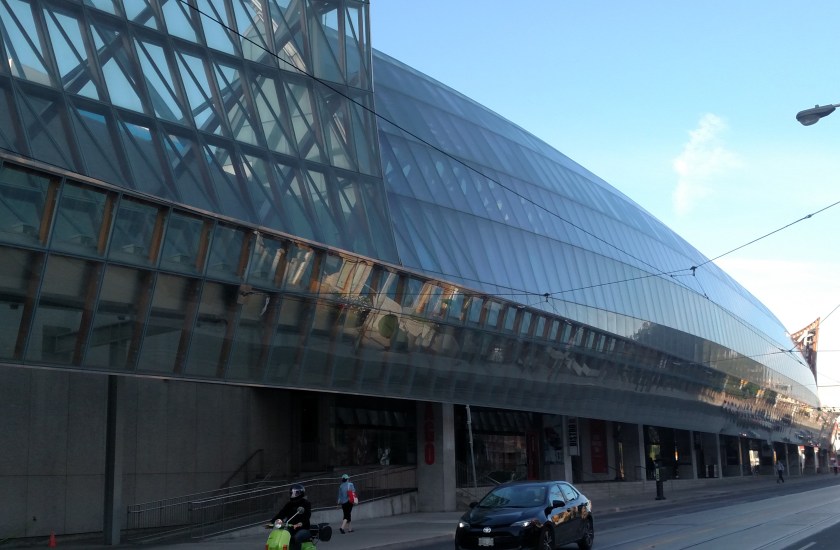
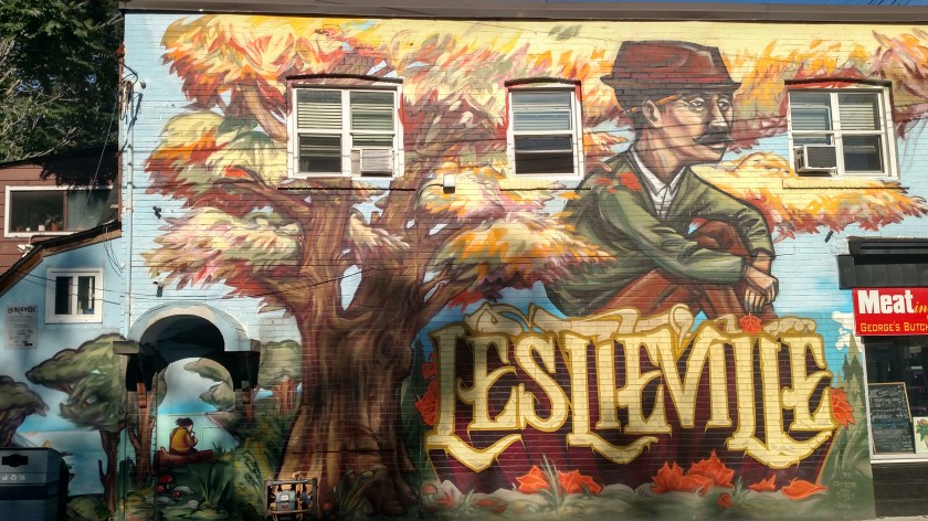
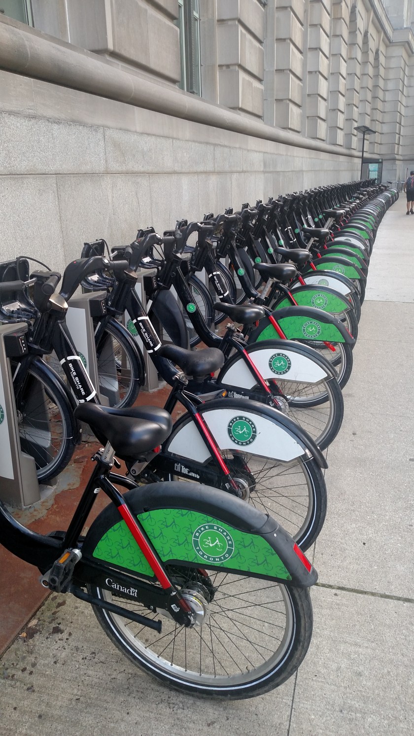
Toronto covers a much larger area than Québec City and pre-trip research had indicated that the cheapest and most efficient way to get around was by using public transportation.  For $13/day I could get a Day Pass which allowed me to ride buses, street cars and the subway system as much as I wanted.  I left my car parked at my Airbnb for the three full days I was in town and walked to the closest street car stop, only a few blocks away.  From there I could easily go just about anywhere in the city and not have to worry about traffic or parking.  I would ride a route and just observe the various things to see, making notes of where I wanted to get off to take photos when I came back.  I would then walk to another nearby venue or to a nearby stop to catch a ride to another part of the city.  So much of the first day was spent riding and walking to various parts of the city and forming a game plan for the next two days.

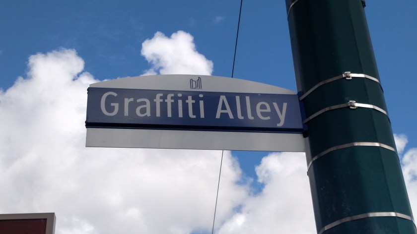
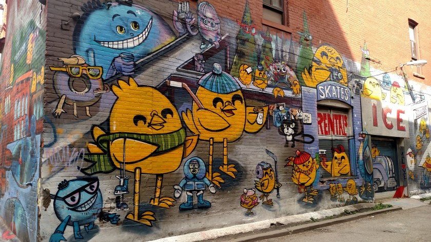
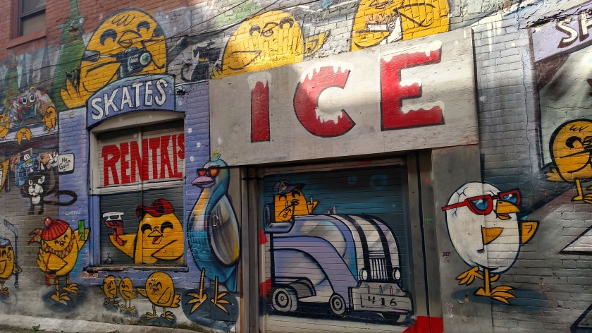
Enough talk – here are my photos from Day One:

One of my first stops downtown was the St. Lawrence Farmers Market which was on my short-list.  PEI has mussels and Québec has poutine.  Toronto is known for it’s Peameal Bacon sandwich and I went right to the creator, the Carousel Bakery in that market.

IMG_20190824_104233453

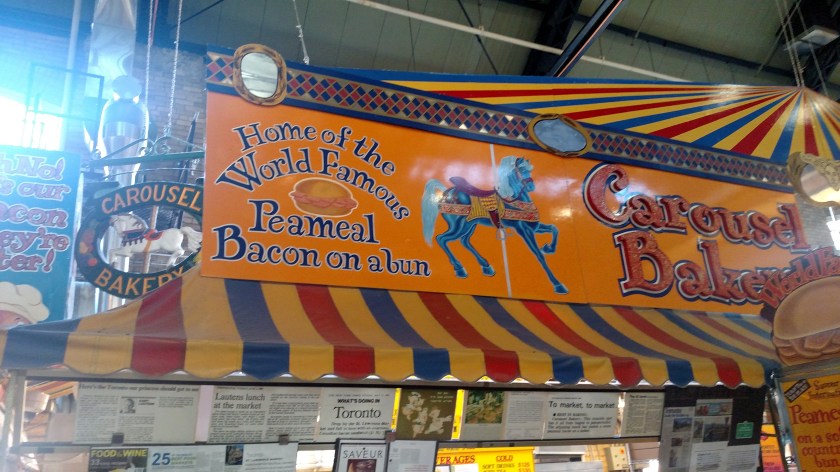
Peameal bacon is unsmoked Canadian bacon, and this place puts LOTS of it, with mustard, on a fresh Kaiser roll.  It was yummy!

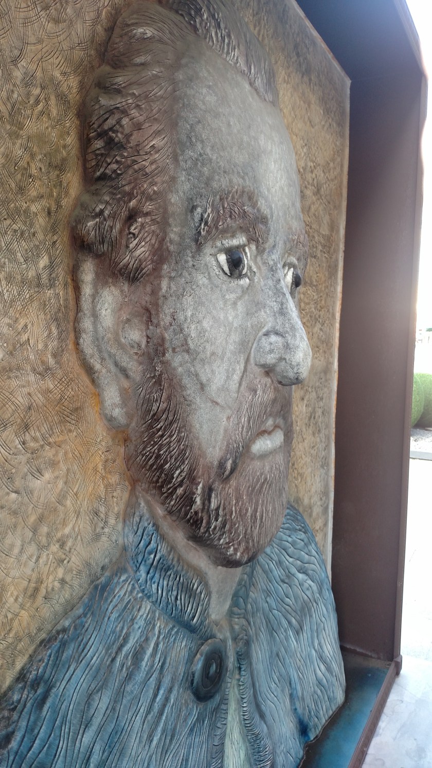
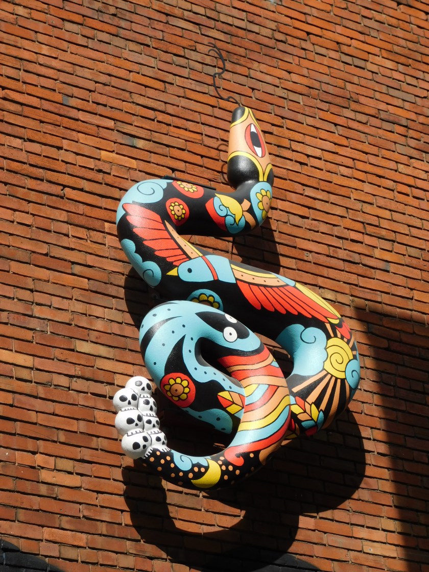
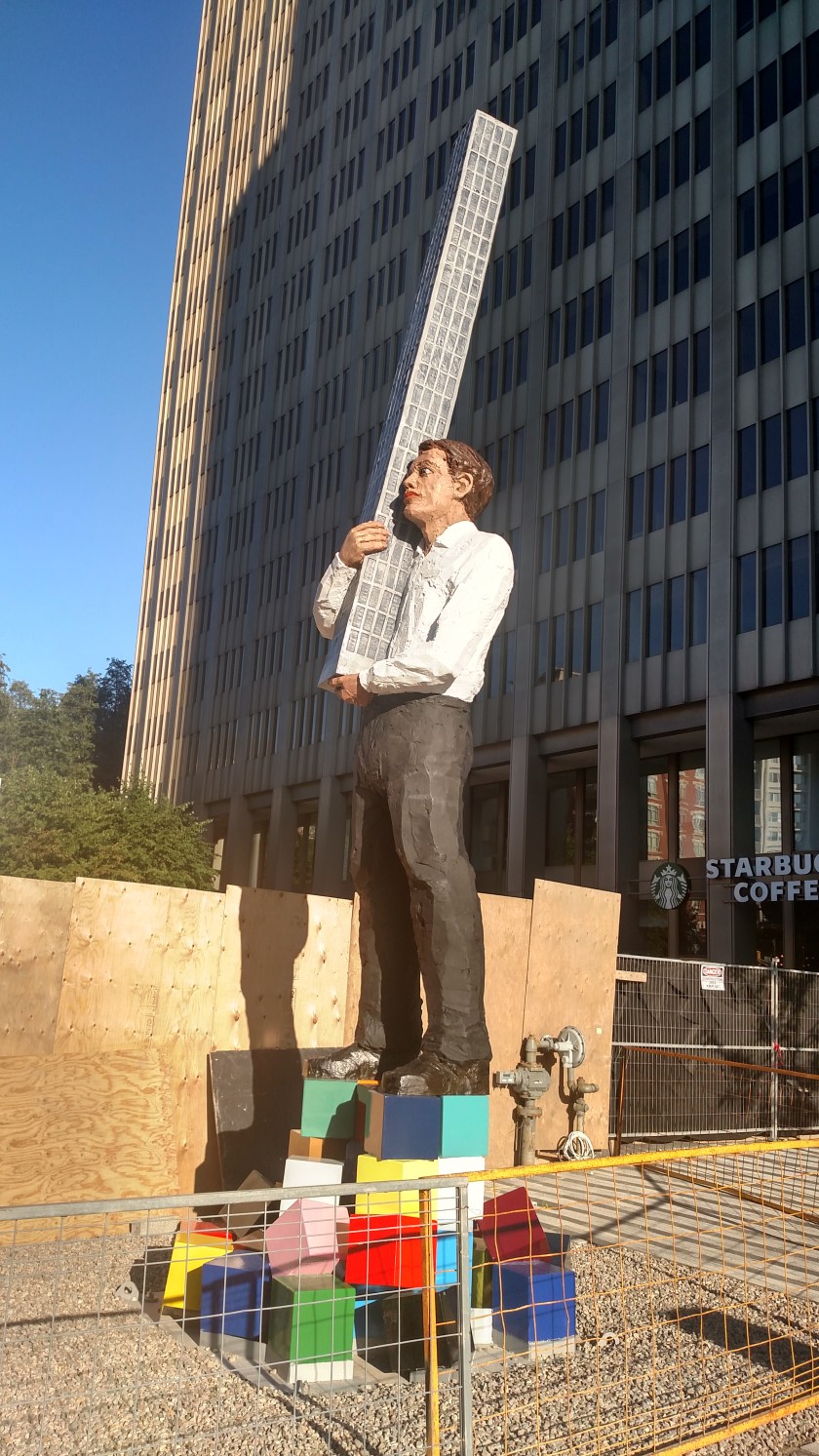
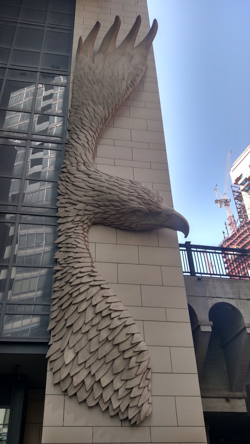
Now that I was downtown I walked around for a while before exploring other parts of the city.  As I headed towards Union Station, the main train station and a major surface transportation hub, I saw this huge sculpture on the side of an office building:

IMG_20190824_110018424_HDR

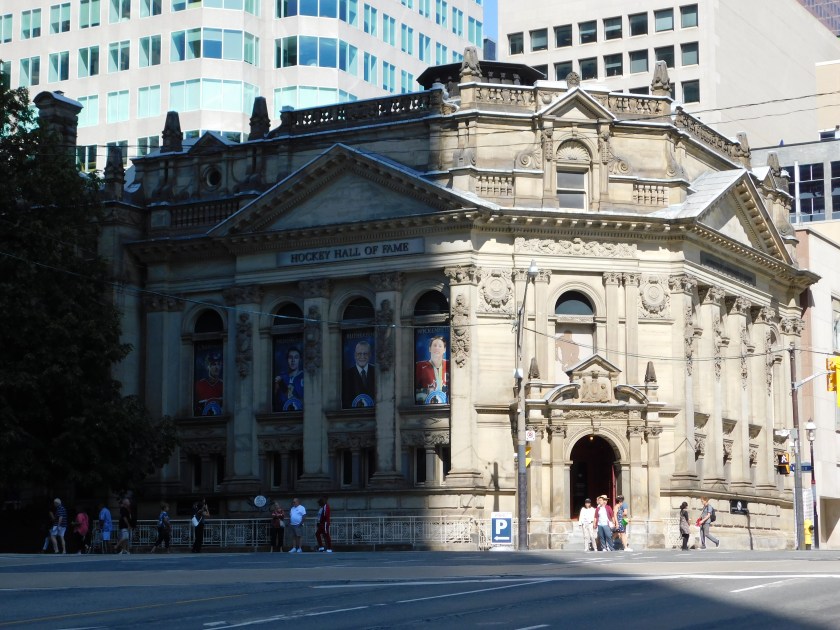
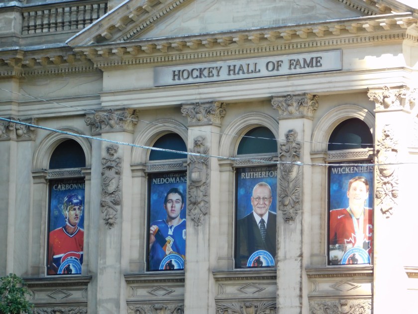
A short distance from Union Station was the Ice Hockey Hall of Fame:

DSCN2361

DSCN2363

IMG_20190824_110737698_HDR

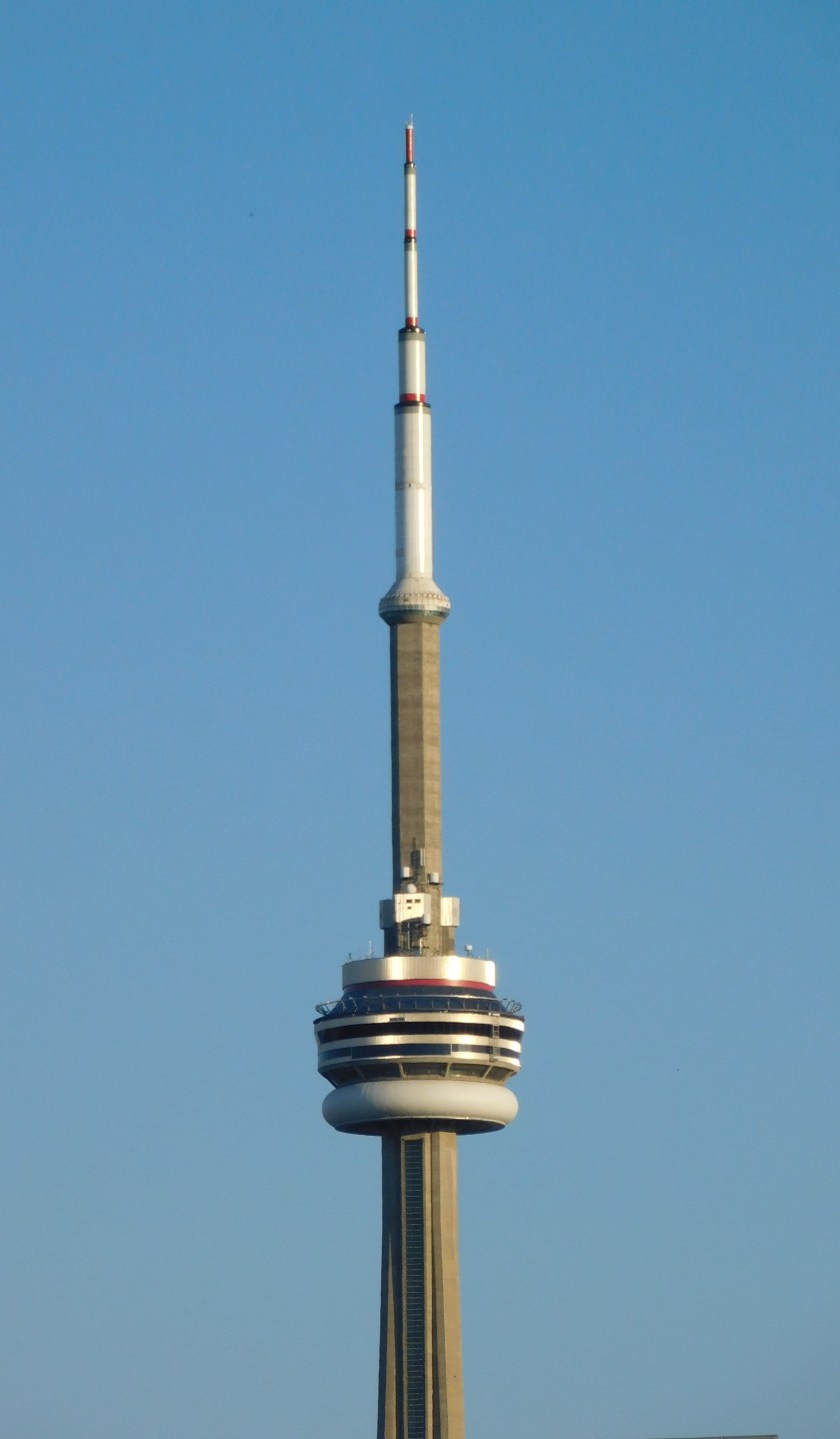
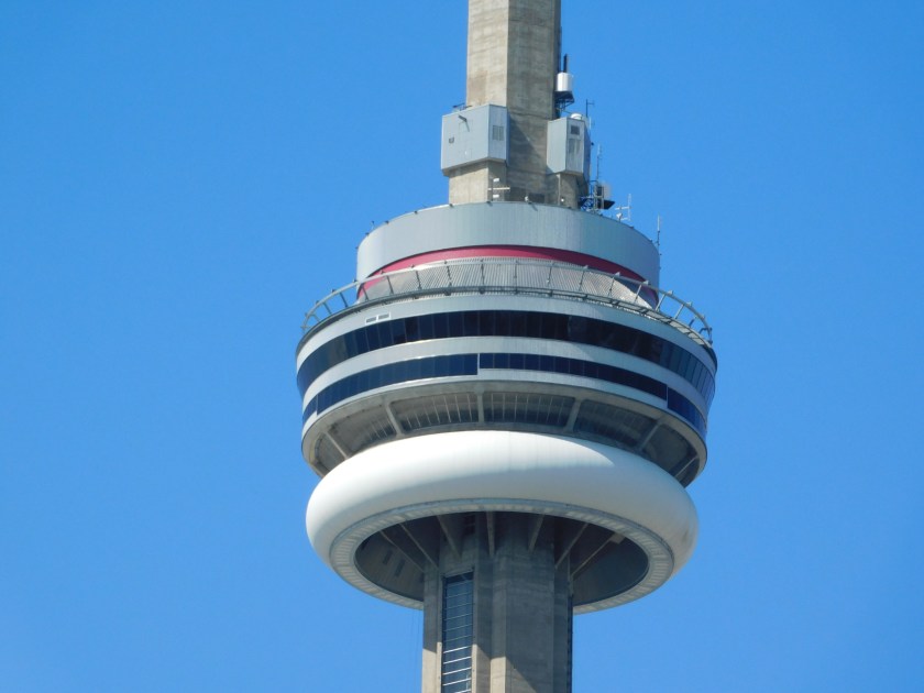
And it’s hard to go anywhere in Toronto without seeing the iconic CN Tower:

DSCN2355

DSCN2360

IMG_20190824_123352995

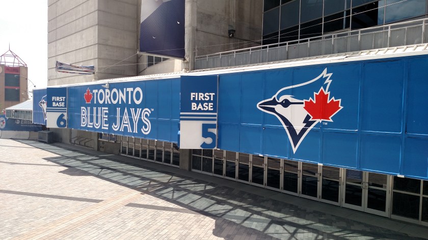
Near the base of the tower is a stadium which is the home of the Toronto Blue Jays baseball team:

IMG_20190824_123302172

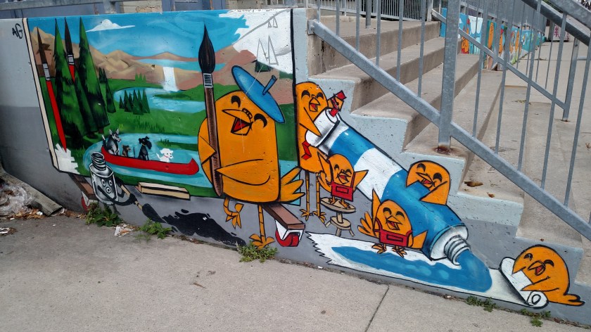
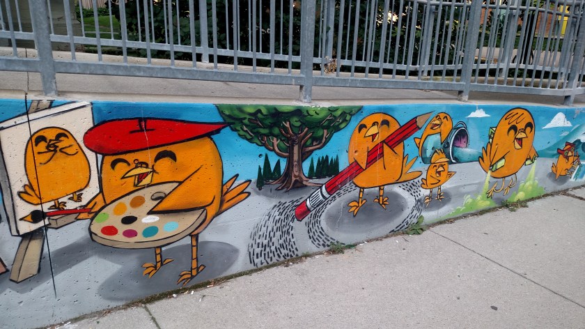
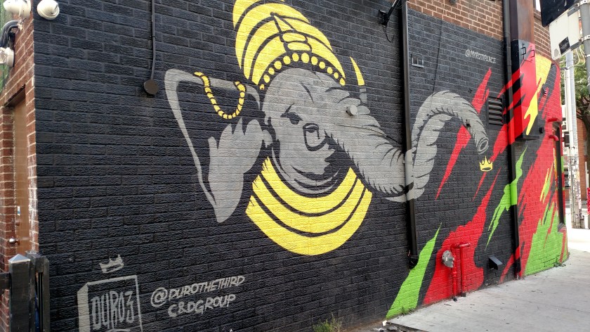
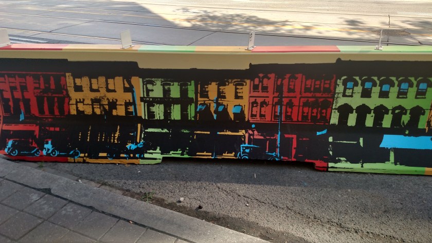
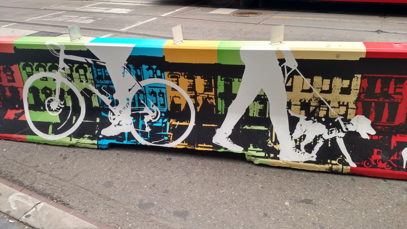
As I walked to another part of town I noticed that the concrete barriers sometimes used to deflect vehicular traffic from pedestrians and folks on bicycles had an artistic touch:

IMG_20190824_101929630_HDR

IMG_20190824_130741736_HDR

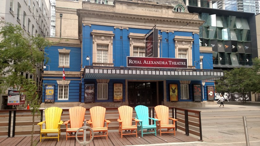
This is one of the oldest Performing Arts venues in the city:

IMG_20190824_132413427

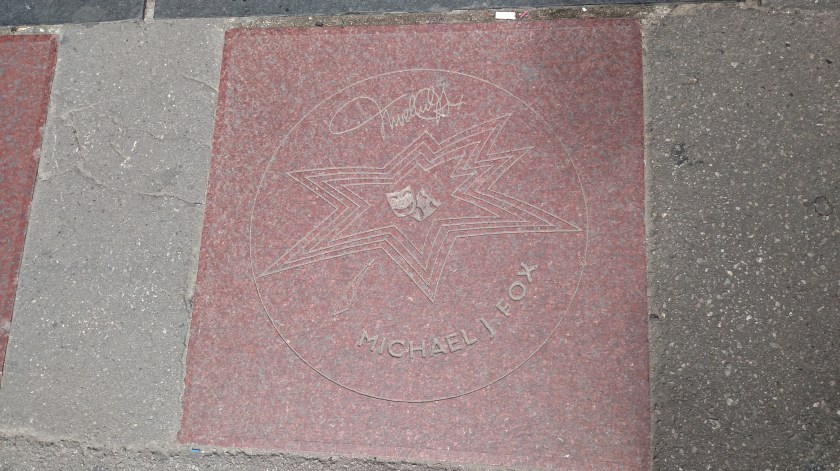
Embedded in the sidewalk out front are the names and signatures of many famous Canadian performers:

IMG_20190824_125526101

IMG_20190824_125520256

IMG_20190824_125606269

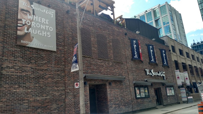
And speaking of John Candy, not far from the theater is the Second City comedy club:

IMG_20190824_131054845_HDR

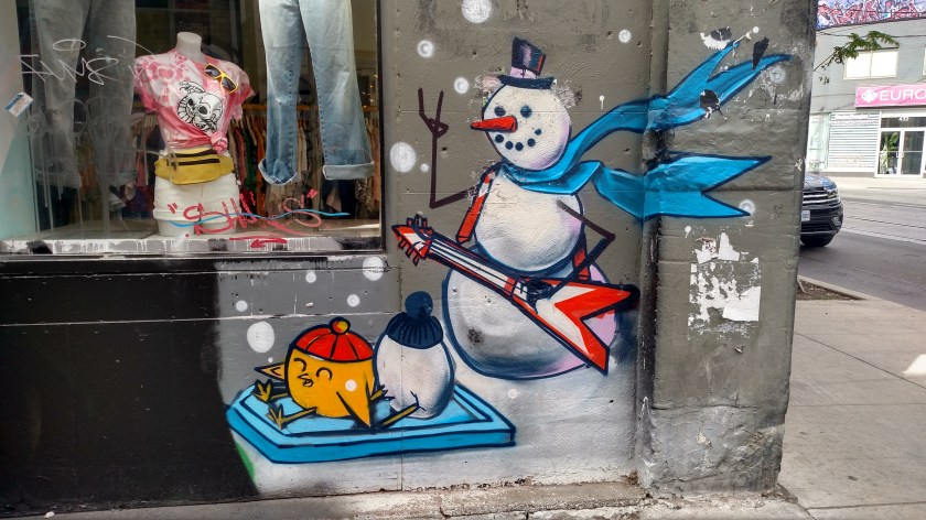
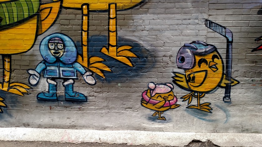
After walking around town I worked my way back to where I was staying to regroup before taking the streetcar back downtown and the subway north a few blocks to another small take-out restaurant where I ordered one of the sandwiches they are known for and took it to a nearby park to eat and enjoy the evening.

As I headed back home I stopped to get a photo of a traffic signal box which I had seen at a trolley stop which had been painted (all four sides) by a local artist:

IMG_20190824_194958127_HDR

When I got home I learned that even with riding public transportation much of the day I had also walked over 25,600 steps, compared with 23,800 my first day in Québec.  Sunday I would walk over 28,000 and Monday “only” 21,800.


1,000 Islands – Smartphone Pics

August 23, 2019

As I mentioned in previous posts, with an hour to go of my 2 1/2 hour boat ride on the St. Lawrence River (near it’s starting point at the northeast end of Lake Ontario) my digital camera informed me that the SD card on which pictures are stored was full.  I started taking pictures with my smartphone, although in reviewing them I see that it was pretty much just more of the same things I had seen earlier in the trip.

I knew I couldn’t zoom in on targets like I can with the digital camera so I spent more time observing my surroundings and talking with a couple which had been standing near where I was positioned on the boat.  They take at least one of these boat rides every year and had been telling me lots of stories and bits of trivia about what we were seeing.  That was very helpful as we were outside at the front of the ship and with the wind, we couldn’t hear the play-by-play which was given by the crew via loudspeakers in the interior portions of the boat.

For example, I learned that the bridge from the island with the house to the other island at this private residence shows the dividing line between Canada (on the left) and the United States (on the right).  The owner can rightfully claim owning property in both countries and can fly the respective national flag on each.  Another perk – they probably don’t need a passport or have to wait in line to travel between them.

IMG_20190823_130306525

We had a little excitement during the last hour of our trip, too.  Shortly after the digital stopped working I nudged the woman standing next to me, pointed, and said “I think one of us needs to change course pretty soon,” not referring to her and I but to our boat and the boat which was approaching and was crossing right in front of us.  Our boat was traveling lower left to upper right in the photo below:

IMG_20190823_130407489

As far as I could tell, our ship never changed course and the approaching tour boat passed very closely, probably closer than it should have.  Maybe they do this every trip to thrill the paying customers but I would think there are rules against such things….

IMG_20190823_130420359

IMG_20190823_130427629

And one other thing I noticed as I paid more attention to my surroundings – there were more clouds forming in the sky than had been present when we started our cruise and there was quite a bit more wind.  As we approached some of the larger islands (with trees which helped block the wind) there were areas where the water was incredibly calm right next to areas where the wind was creating lots of waves.

IMG_20190823_132509889

IMG_20190823_132516043

We finally made it back to our starting point in Gananoque.  Once back on land I continued driving west towards Toronto.  I got on Highway 401 until I passed the town of Kingston, then went south to a small scenic road which kept me out near the water as I approached Prince Edward County, a large body of land which appears to be an island on the map but is actually a peninsula (technically called a headland).  I needed to take a ferry to cross between Adolphustown and Glenora but didn’t need to take a major bridge or ferry to get to the town of Trenton at the northwest end of the county.

Once in Trenton I still had quite a ways to go to make it to my destination before nightfall so I hopped back on Highway 401 and completed my drive to Toronto.