So here I am, in west-central Wyoming, in the town of Lander for the next month (at least):
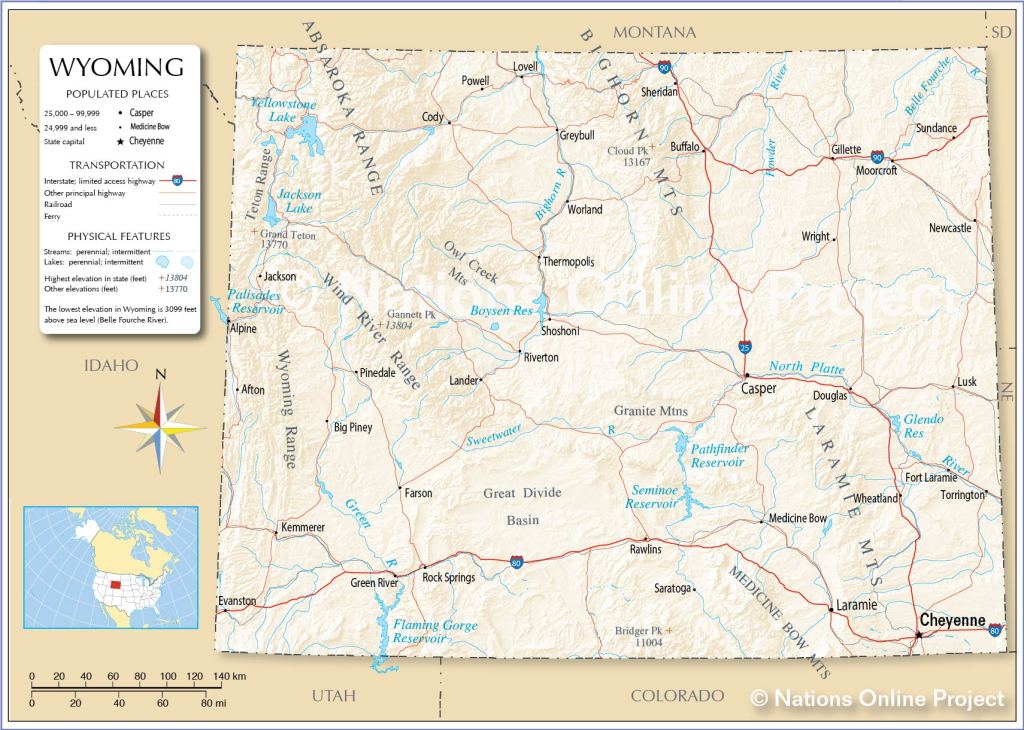
(Photo credit: NationsOnline.org)
There are lots of interesting places I can be in just a few hours, though there isn’t often a direct route from Point A to Point B. So you CAN get there from here, it just may take a while. As I mentioned shortly after arrival, just the county I am in is slightly larger the state of Vermont (Fremont County WY 9,266 square miles vs. State of Vermont 9,217 square miles). Fremont County makes up 9.5% of Wyoming’s 97,093 square miles, so just getting out of the county is an undertaking.
Some popular points of interest:
Yellowstone National Park – itself a big place:
West Thumb of Lake Yellowstone, in the southwest part of the Park: 180 miles, 3 hrs 30 minutes driving time, elevation 7,795 feet. West Thumb is at the bottom of the “figure-8” shaped roads in the western part of the Park. Those roads take you to where most of the popular tourist destinations are (Old Faithful, etc). The southwest entrance to the Park is closer than that.
Jackson, WY (aka, incorrectly, Jackson Hole) is adjacent to Grand Teton National Park: 160 miles, 2 hours 45 minute drive time, elevation 6,237 feet. For the record, Jackson is the town – Jackson Hole is the area surrounding the town.
Riverton, WY – 26 miles, 29 minutes drive time, elevation 4,956 feet.
Green River, WY (SW of Lander and near Flaming Gorge National Recreation Area) – 130 miles, 2 hour drive time, elevation 6,115 feet.
Salt Lake City, Utah – 296 miles, 4 hour 18 minute drive time, elevation 4,226 feet.
Gardiner, MT (outside the northwest entrance of Yellowstone) – 252 miles, drive time just under 6 hours, elevation 5,259 feet.
Fort Collins, CO – 287 miles, 4 hour 14 minute drive time, elevation 5,003 feet.
Cody, WY (Rodeo capital of the world and near the southeast entrance to Yellowstone) 168 miles, 3 hour drive time, elevation 4,997 feet. A few years ago I drove through Cody, briefly, and decided that I would return someday to see a rodeo (and wear a t-shirt proclaiming “This IS my first rodeo”).
Sheridan, WY – 238 miles, 4 hour drive time, elevation (near the base of the Bighorn mountains) 3,743 feet.
Gillette, WY (northeast part of the state) – 274 miles, 4 hour 24 minute drive time, elevation 4,554 feet.
Casper, WY (east central part of the state)- 146 miles, 2 hour 20 minute drive time, elevation 5,118 feet.
Laramie, WY (which I drove through getting here, and home to the University of Wyoming, whose logo the “bucking bronco,” is the state logo) – 223 miles, 3 hour 14 minute drive time, elevation 7,165 feet.
Cheyenne, WY (the state capital and just east Laramie on Route 80) – 274 miles, drive time just under 4 hours, elevation 6,063 feet.
Rawlins, WY (where I left Route 80 to drive northwest to Lander) – 126 miles, drive time 1 hour 52 minutes, elevation 6,834 feet.

Hope you make it to Cody. Seeing a rodeo should be a prerequisite for anyone with YeeHaa on their license plate. 😆
LikeLike
Indeed
LikeLike