Cheyenne Mountain (final thoughts)

No photo.

At the risk of beating a dead horse, I thought of something I forgot to mention about Cheyenne Mountain Complex which I wanted to share.  That led me to do some further research online:

Inside the mountain (one mile in and 2,000 feet below the peak) is a 5 1/2 acre campus consisting of 15 buildings.  Most are 3 stories tall.  These modular buildings sit on huge springs.  The mountain is solid granite and will shield the bunker not only from a nuclear blast but also the resulting EMF (Electro Magnetic Field) which would normally disrupt electricity and computer operations.  There are tunnels leading in to the bunker and two 23-ton blast doors can be closed very quickly when an alarm is sounded (they are actually recessed in side tunnels so they would not face a direct blast).  The doors were last closed (other than for practice) on September 11, 2001.  Facility tours have not been conducted since that date.

In addition to the buildings, there are 3 giant lakes inside the mountain.  One, a 1.5 million gallon spring-fed fresh water lake, provides drinking water for the workers.  Another 4.5 million gallon lake (of water) is used as a heatsink to absorb and dissipate the heat created by generators, computer equipment, vehicles, etc.  A third lake (of undisclosed size) contains diesel fuel for the vehicles and generators used inside the complex.


Great Sand Dunes National Park

Today I traveled from Colorado Springs south and west towards Durango, where I’ll be spending the next 5 nights.  The major attraction for the day was this National Park, located northeast of Alamosa, Colorado.

After I turned off Route 160 onto the access road it was a 16-mile drive north to the Park entrance.  This was about 6 miles off the main road, headed right for the Park.  You can see the light colored dunes sitting at the base of the much larger Sangre de Cristo mountain range behind them.  Don’t be deceived by the dunes apparent lack of height.  These are the tallest dunes in North America, as you’ll soon see.

IMG_20170824_111453969

IMG_20170824_112654109_HDR

First stop was the Visitor Center.  It was built using “Tromble Wall” technology, which is a passive solar collection system.

IMG_20170824_120738917

As you would expect, inside were displays and photographs pertaining to the Park.  This is a photo on display of the colorful Great Sand Dunes Tiger Beetle.  This is the only place in the world where it is found.

IMG_20170824_115206470

IMG_20170824_115212572

Another curious creature which was on display (in 3D, though stuffed, not moving about) was this Ord’s Kangaroo Rat.  Not very big, but look at those feet!!

IMG_20170824_120244204

The Dunes were created as the result of sand blowing east from the Rio Grande river (which I crossed after leaving the Park) and it’s tributaries, as well as High Desert further west.  The sand can’t make it over the mountain range and gathers near the base of the tall mountain and, voila…  sand dunes.

IMG_3361

IMG_3392

The dunes are constantly changing, shaped by the wind and contours of the land.  And these dunes aren’t exactly what you’ll find at the beach.  The highest peak visible as you drive in from the main road is approximately 650 feet tall (that’s higher than a 60 story building, folks), and there is another set of dunes about a mile and a half further back which is 100 feet taller.

Here is a series of photos to demonstrate the size of these dunes.  This was taken from the side of the road after leaving the Visitor Center.

IMG_3395

Now I’m going to zoom in to an area just a tad to the right of center.

IMG_3396

And zooming closer, towards the very top of the dune.

IMG_3397

IMG_3404

I turned around and went back to a parking area between the road and the dunes themselves.

IMG_3419

IMG_3422

After parking my car I walked towards the dunes and almost immediately found Medano Creek.  It is a wide, very shallow stream which is also ever-changing.  Because of the continuous addition of fresh sand the creek never establishes a permanent route.  Little sand dunes form underwater but are then broken by the flowing water.  Everyone has to wade across the creek to get to the dunes.  Sand temperatures can reach 140 degrees so the Park does not recommend going barefoot.

IMG_20170824_123246956

IMG_3440

IMG_20170824_124042560

You’ll see some other folks enjoying the Park in the next post.

Although I saw trailers transporting dune buggies (they are very sophisticated these days) and other ATV’s when I was getting gas in Fort Garland, they are NOT allowed in the Park.  There are other areas nearby where those folks can have their fun.  Parents and visitors without kids can rest assured they are safe while climbing on the dunes.  In fact, this is one of the quietest National Parks in the contiguous United States.


Various locations today

On the way from Colorado Springs to Durango I stopped in the little town of Fort Garland for gas.  I noticed this dog, Nia, sitting on the toolbox of a pickup truck at the pump next to me.  Before leaving I asked Nia’s chauffeur if I could take her picture.  He said “Sure, but good luck because she always turns away when I try to get her picture”.  She was a little more cooperative for me.

IMG_20170824_100724439_HDR

IMG_20170824_100742426_HDR

This is the entrance to Sunny Daze Ranch, on the access road to Grand Sand Dunes National Park.  I thought it looked cool with all the sunflowers (there were more between the road and the gate, which is what caught my eye).

IMG_20170824_104318874

This little guy was just having a blast playing in the shallow waters of Medano Creek between the parking area and the dunes..

IMG_3448

IMG_3449

IMG_3457

IMG_3456

And this couple was here from Wisconsin to do a little sand-surfing.

IMG_20170824_123728925

After leaving the Park I started driving out the 16-mile road I had come in on.  When I reached Route 6N my GPS suggested, no, she INSISTED that I take it instead of continuing on Route 150.  I looked at my map and saw that it was basically just the top side of a rectangle and wouldn’t really be any benefit timewise BUT it would take me to the little town of Hooper.  That made me think of another favorite movie, “Hooper” (what a coincidence) starring Burt Reynolds as aging stuntman Sonny Hooper and featuring an all-star cast.  James Best (Sheriff Rosco P. Coltrane from The Dukes of Hazzard) as his sidekick Cully, Jan-Michael Vincent (from Airwolf) as Ski, his younger competition, Adam West (the original TV Batman), as Adam, Robert Klein……. oh…. you get the idea.

IMG_3505

A clever billboard made to look like a postcard (it’s even copyrighted!).

IMG_3503

And as I took Route 17 south from Hooper towards Alamosa there was a liquor store with this sign out front.  Ah, the power of suggestion…..

IMG_3511

And no, I didn’t go in.  I reached over to my on-board cooler and grabbed a cold one of my own (water, that is).

Finally, as I got closer to Durango I passed Chimney Rock National Monument.  I’ll probably be getting a closer look at it tomorrow.

IMG_3519

IMG_3518


Sunset in Durango, Colorado

It was around 7 o’clock local time when I arrived at my Airbnb a few miles south of Durango.  A big rain storm was nearby and created some interesting contrasts of clouds and sun.  These were taken from the guest room windows and the back deck of the house.

IMG_3539

IMG_20170824_194037794

IMG_20170824_194042609

IMG_3537

IMG_3556

IMG_3555


Peterson Air Force Base Redux

First off, I want to say a big THANK YOU to Andrew at the Verizon Wireless store in Divide, Colorado.  Andrew helped me figure out how to recover the hundreds of photos I had taken which wouldn’t transfer to my computer from my phone.

I want everyone to stop what they’re doing and say out loud, “Thank you Andrew”

I thoroughly enjoyed a lengthy (2 1/2 hour) private tour of this base’s museum.  The base is located just east of Colorado Springs, near the airport.  It used to be a municipal airport serving both military and civilian aircraft.  It is named for an Air Force pilot whose plane crashed here shortly after takeoff.

There was a short video in the museum (which was the original passenger terminal) and explanations of much of the memorabilia housed in it.  There is also a hangar which has many displays of aircraft, spacecraft and an overview of Cheyenne Mountain Complex operations and missile defense systems.  Outdoors were numerous aircraft and missile displays.

IMG_20170822_115852980_HDR

This is a Lockheed EC-121T “Warning Star”.  It is a radar reconnaissance aircraft which was manned by two crews, one on duty, one resting, in order to stay in the air longer.  It still contains almost all of it’s original equipment.  The Warning Star was the predecessor to current AWAC’s aircraft.

President Eisenhower had three airplanes which were variations of this platform at his disposal for official air travel.  They each had their own designation but after an incident with an Eastern Airlines plane in 1953 (a near-miss caused by call-sign confusion) the official “Air Force One” designation was created.  Any fixed-wing aircraft the President of the United States is on (even a private prop plane) is called Air Force One.  Helicopters are called Marine One.

IMG_20170822_120736993_HDR

IMG_20170822_120810849_HDR

IMG_20170822_120826759_HDR

My VERY knowledgeable guide, Jim

IMG_20170822_102253481

One of 4 identical radar stations.

IMG_20170822_102749153

This is a private residence which used to belong to the caretaker for the old municipal airport.  It has been renovated and is currently used to house VIV’s (Very Important Visitors).  Maybe if I hadn’t already had my Airbnb booked I could have stayed here….

IMG_20170822_123933738_HDR

Schriever Air Force Base

210 Falcon Parkway, Colorado Springs, Colorado.

That’s what your GPS unit enters into it’s GPS unit when it wants to go home.  This is where GPS lives.

Schriever AFB is where the 50th Space Wing, formerly known as the Consolidated Space Operations Center, is located.  It is the nerve center of the worldwide Global Positioning Satellite (GPS) network.  Here they monitor 31 satellites in orbit all around the Earth.  As my guide, Jim, at the nearby Peterson AFB museum put it, Schreiver (pronounced Sh-REE-ver) is the only Air Force Base without a runway.  He told me GPS technology has advanced to the point where it is accurate to within 24 centimeters.

Jim said that this was another facility I shouldn’t even try to photograph.  I had heard about this base on an NPR “Science Friday” episode about a year ago. In it they said that because of the worldwide reliance on GPS, guards here also have standing shoot-to-kill orders against intruders.

Here are some photos I found from the relative safety of the internet.

SchrieverAFB Gate

(Photo credit: pinterest.com)

Schriever-AFB Overview

(Photo credit: cobbmechanical.com)

SchrieverAFB

(Photo credit: hpeinc.com)

Thunderbirds-F-16-Schriever-AFB

(Photo credit: cobases.com)

Fine Arts Center Redux

Here are more photos I took at Colorado College’s Fine Arts Center.

IMG_20170822_140657372

IMG_20170822_140748050

IMG_20170822_141936137

IMG_20170822_140444945

IMG_20170822_142932548

IMG_20170822_142515771

IMG_20170822_142033633

This was one of my favorites.  It was done by a local artist.  I examined it closely for quite a while.  As my friend Shawn once said when describing an architectural design in Indiana, simple yet elegant.

IMG_20170822_142229530

There were some folks constructing a new exhibit in an open courtyard.  It will consist of bicycle wheels suspended above the ground with plastic scoops attached to make them rock in the wind.  Hanging below will be fiberoptic strands illuminated by an led light.

IMG_20170822_141249014

IMG_20170822_141038227

There was a gentleman standing on the sidewalk talking to the guy up on the scissor-lift.  I half jokingly asked him if he was the artist and he said “Yes, I am”.  His name is Buck Walsky.

IMG_20170822_140939548

Pikes Peak

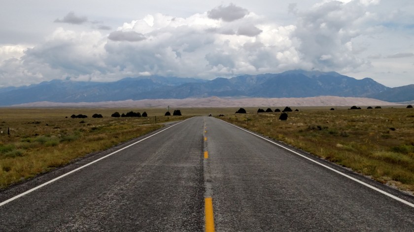
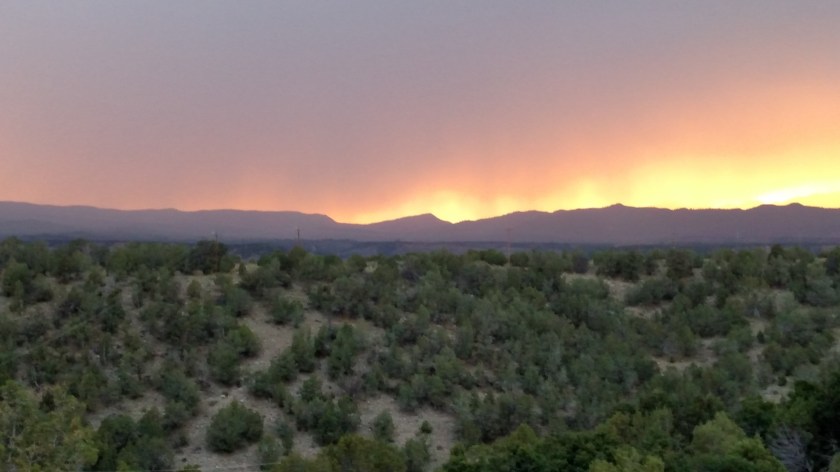
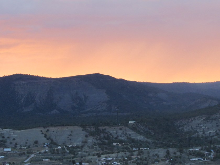
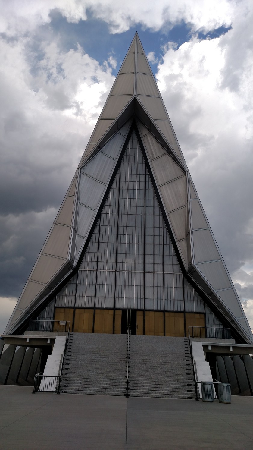
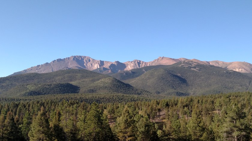
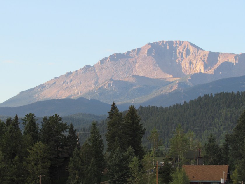
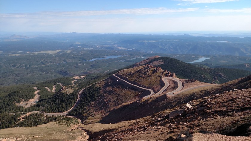
No trip to Colorado Springs would be complete without driving up to the top of nearby Pikes Peak, a world renowned road course which has hosted rallies and hill climbs (and descents) for various types of vehicles.

IMG_20170823_081423396

IMG_3277

ARE WE THERE YET??

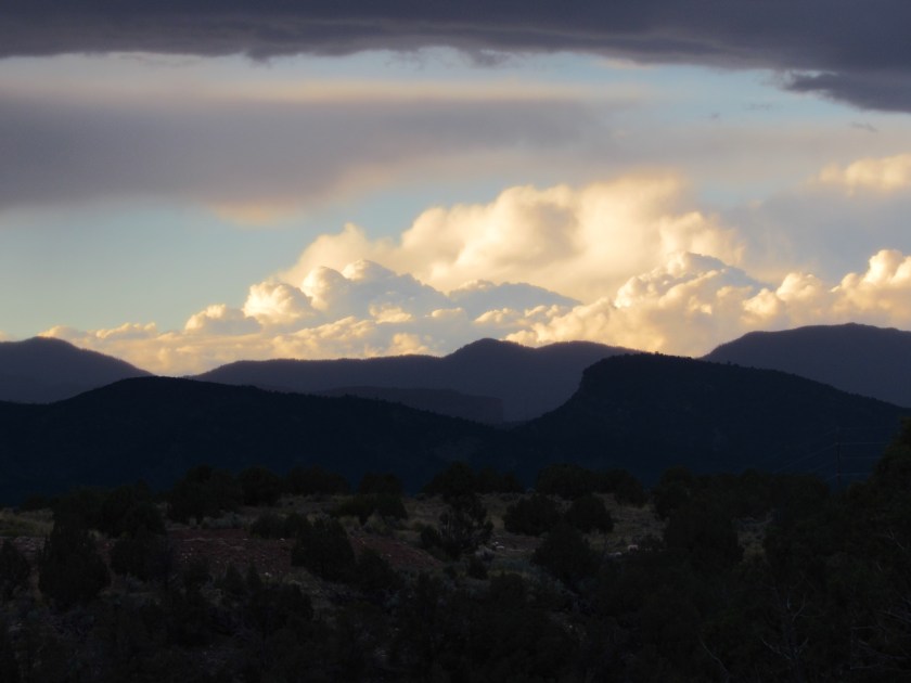
This was taken from “only” 12,973 feet.  I’m afraid of heights and had already started driving on the wrong side of the road at times in order to stay away from the edge.  There are guard rails only at some of the sharp turns, not along other parts of the road.  It takes a very brave person to drive this road at high speed (and it used to be a dirt road!!).

IMG_20170823_090042493

With frequent breaks, and deep breathing, I finally made it to the top.

IMG_20170823_100159246_HDR

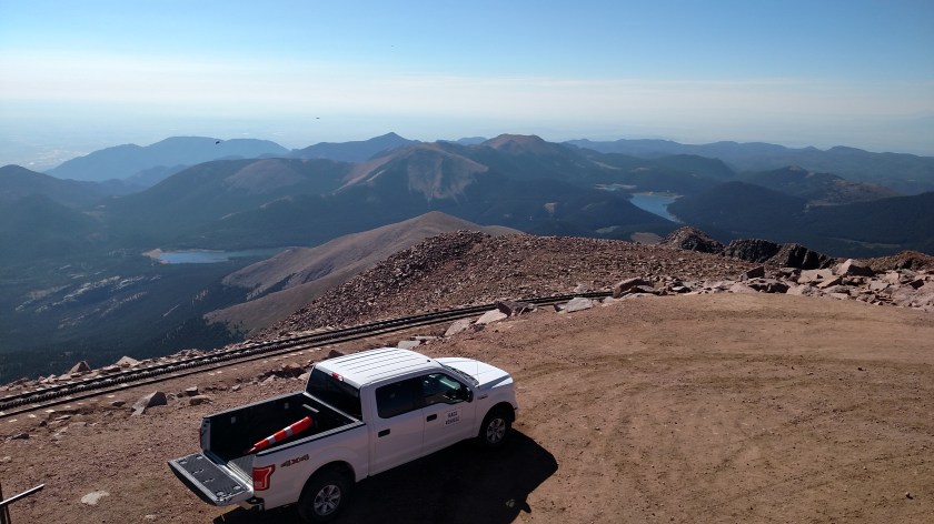
When I parked my car my GPS said I was actually at 14,192 feet.  The views, as you would expect, were spectacular.

IMG_20170823_100310628

IMG_20170823_095102735

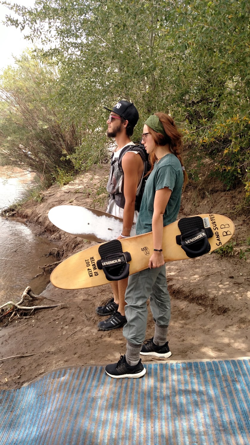
At one of my photo op stops on the way up the mountain another vehicle also stopped to take pictures and I offered to take a family photo for them.  That is how I met Brooks.

IMG_20170823_092531355

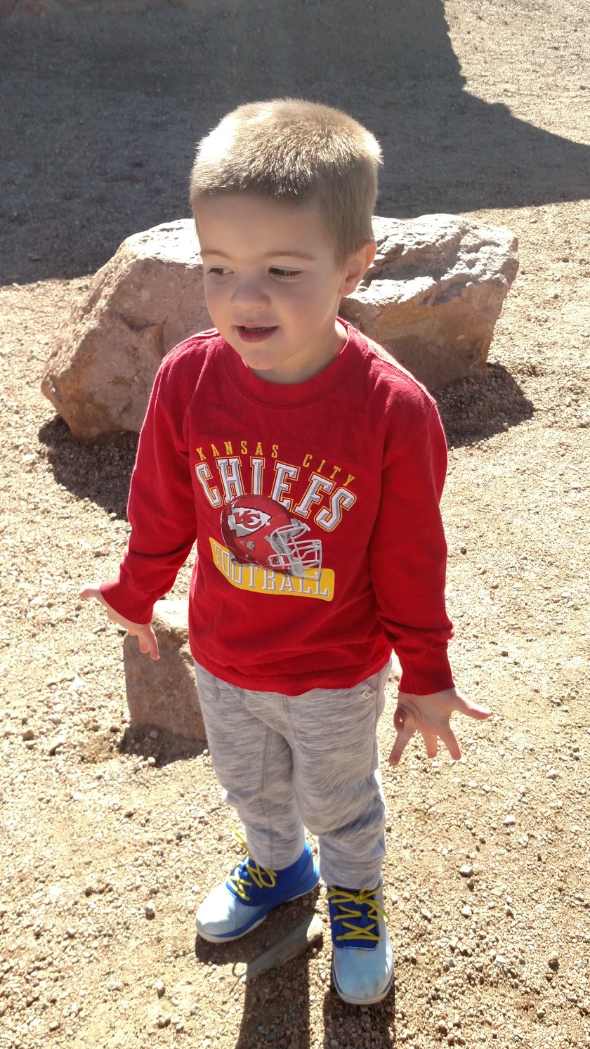
He’s the world’s biggest Tom Brady fan (well, after my sister-in-law Kendra…).  He’s wearing a Kansas City Chiefs sweatshirt because they live in KC.  Brooks loves to play golf.  When we got on that subject he wanted to play RIGHT NOW.  I told him I thought it would be tough to maintain the greens at 14,000 feet.

IMG_20170823_095039012

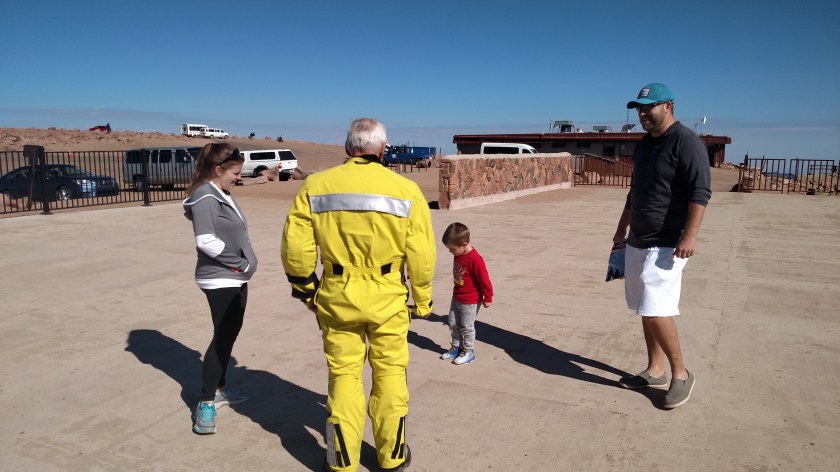
Here’s Brooks with his Mom and Dad talking to a motorcycle rider from northern Virginia.  I also had an interesting conversation with him regarding the reflective tape he has on his bike, helmet and jumpsuit, as well as the difficulty I was having offloading pictures from my cell phone.  He is on an even bigger road trip than I am.

There was some added excitement on the mountain today as there was a crew filming footage to be used as part of the Gran Turismo video game.  They told me at the entrance that portions of the road might be closed for short periods as they were filming (that’s what it means when you see “Professional Driver on a Closed Course” in fine print in commercials.  They are also quick to add “Do Not Attempt”).

At one point I drove by the parked vehicle which was covered by a large blue tarp.

IMG_20170823_091555203

SPOILER ALERT:  I saw the car briefly later in the morning.  It was a low, wide, souped up silver Mustang with the number 43 on the doors.  Sorry, guys.

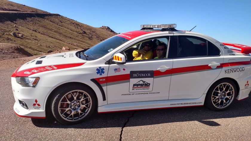
Before getting to the video shoot I passed some emergency and rescue vehicles (fire, ambulance, etc) which were stationed at various places.

IMG_20170823_091257048_HDR

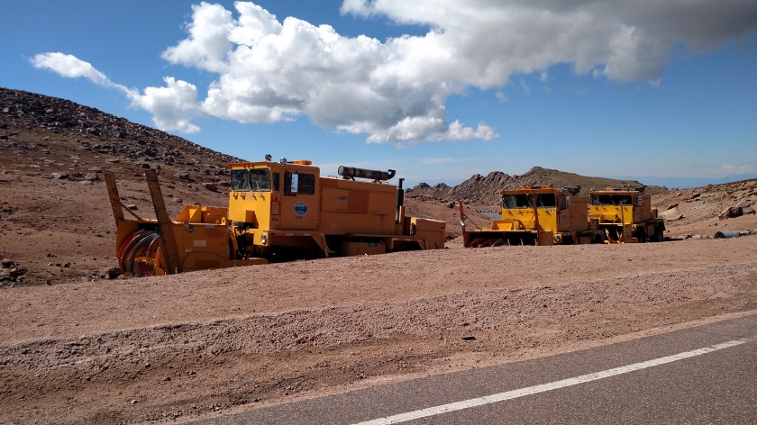
At one point I had to weave past three big snowplows which were staggered on the roadway.  I couldn’t get my camera on in time to document that, but here they were parked off the road on my way down.

IMG_20170823_104229434

There was also a really cool tricked out flat-black Porsche with a huge camera boom mounted on it.

IMG_20170823_103052933

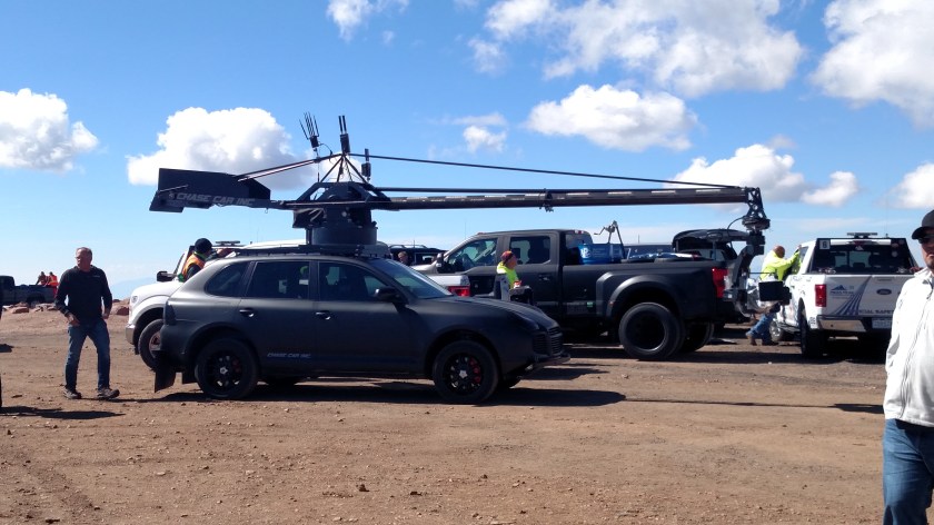
Check out their website at Chase Car Inc.  You can rent it for parties starting at $ 6,515 per day.

And there was evidence of the Mustang’s performance at various places on the road.

IMG_20170823_104348908

Finally, on the way down the mountain was a mandatory brake check at the Glen Cove Inn, located at 11,450 feet.  The young lady there had a heat sensor gun and said my brakes measured 496 degrees.  The target number is 300 degrees so she suggested I park near the Inn and cool my heels (and my brakes) for about a half hour before proceeding.

IMG_20170823_083359403

Fear of heights notwithstanding, it was a great way to spend the morning.

Colorado Wolf and Wildlife Center

IMG_20170823_132103214_HDR

This facility is in the little town of Divide, Colorado, about 40 minutes west of Colorado Springs.  It is a non-profit sanctuary for wolves and other forms of wildlife.

I arrived in the early afternoon and just missed a tour.  It would have been a long wait to do the next one and I had other places to visit so I didn’t stick around.  Since it was mid-day the animals were pretty lethargic (although they perk up for feedings during the tours) and I didn’t see any in the few minutes I was there.  I am planning to come back to this area in a few weeks to do the things I didn’t get to this week and will come back in time to see the animals.

US Air Force Academy

The only areas non-military personnel can access without special permission (or to attend sporting events) are the Barry Goldwater Visitor Center, which contains many photos and displays addressing life, training and discipline as a cadet, and the iconic Chapel.

IMG_20170823_144744704

IMG_20170823_144526026_HDR

IMG_20170823_144615014_HDR

IMG_20170823_144822530_HDR

The Air Force is the only military branch to prominently utilize sabres as part of their ceremonies.

IMG_20170823_144933014_HDR

The Air Force mascot is the falcon, and falconry plays a part in a cadet’s training.

IMG_20170823_145037604

IMG_20170823_145000667

From the visitor center it is only a short walk to the Chapel, which hosts services for all denominations.

IMG_20170823_151221754

IMG_20170823_151349180

IMG_20170823_151416276

IMG_20170823_151759099

And the cross over the altar is actually a huge sabre.

IMG_20170823_151845755