Wind Surfing on the Pistol River

The brochures for this area in Oregon promise “world class wind surfing” and I got a small taste of it when I arrived at Pistol River State Park around 530pm Friday.  The water in the foreground is where the Pistol River empties into the Pacific Ocean (which, as you may have guessed, is in the background).

IMG_20180727_173806753

The first place I parked I saw these two wind surfers, a man and a woman, zipping back and forth across the river.

DSCN4242

DSCN4228

The sky was clear and it was extremely windy so they both took advantage of that to practice some literal wind surfing – getting airborne:

DSCN4237

DSCN4246

DSCN4262

DSCN4270

DSCN4283

In this next photo she is easily 6 to 8 feet off the water:

DSCN4287

DSCN4293

I’ll be in the area two more days, and there are supposed to be some great wind surfing spots further north, so I imagine I’ll be seeing more of this.


Jedediah Smith Redwoods State Park

Thank you to an alert viewer who noticed that I incorrectly named this Park Jedediah Scott in the original post, not Jedediah Smith.  I stand corrected!

Thursday morning I revisited this Park, which I had driven through the day before.  I posted one of these in another post but want to show them again.  When I first entered the Park on the rough, dusty dirt road the accumulation of gray dust kicked by by other vehicles on the ferns near the road made for an interesting sight:

IMG_20180726_111750762

IMG_20180726_111754985

Further in the Park I decided to stop and get out of the car in a few places to take some pictures:

IMG_20180726_112435404_HDR

IMG_20180726_113100619_HDR

IMG_20180726_113504530_HDR

The guy’s wife was standing behind the tree trunk on the right taking his picture and as I was going back to get my car out of their way I discovered that their two daughters were actually up in the tree trunk on the left, which had a huge hollow area in it (like a gigantic wooden straw).

As is often the case, the pictures don’t do it justice.  There were times I felt like, but for the road, I was in a Lord of the Rings movie and Frodo and Sam would come marching out of the woods at any moment.

IMG_20180726_113907639

IMG_20180726_113936286

IMG_20180726_113958213

IMG_20180726_115808017

Once I got back out to the paved road I went over a bridge.  I had stopped both yesterday and today to get a picture of the river (which didn’t meet my expectations either day) but today I noticed some folks down enjoying a day by the water.

IMG_20180726_121548929

The ladies are on the right, catching some rays while the guys are on the left, “runnin’ the dogs.”

IMG_20180726_121550488

Point St. George Lighthouse

Thursday afternoon, after driving through Jedediah Smith Redwoods State Park again, I thought I’d check out this lighthouse which is just north of Crescent City:

IMG_20180726_134157682

Trust me, it’s out there folks.  This lighthouse was built 6 miles out in the ocean (and right now I doubt if I can see a half mile).

Here is the view looking south:

IMG_20180726_134153441

And looking north:

IMG_20180726_134218162

And it was the craziest thing…. as I stood there looking out at the rock formation I could barely see ahead of me (first photo) I thought I could hear music!  I listened for a while and thought maybe someone was out there in a boat with a boombox cranked up, but after a few minutes I think I figured it out.

It was “seal music”.

Now I’m not talking about Henry Olusegun Adeola Samuel, born February 19, 1963.  I’m talking about what had to have been a huge group of seals barking.  I asked a young lady who was parking in a car nearby and she confirmed it.  And when I got home I was telling my Airbnb hostess and she said that if the conditions are right they can sometimes hear them when they are out in their yard (they live about a mile inland), and they can also hear the waves crashing if the surf if really powerful.

I drove further out to the point itself and walked a little ways north to watch and listen to just the ocean for a while:

IMG_20180726_135049173

IMG_20180726_135053660_HDR

IMG_20180726_135236420

IMG_20180726_135257928

Crescent Beach Overlook

Thursday evening I went out in search of dinner and to run my car through a car wash (after two trips through the dusty road in Jedediah Smith Redwoods State Park it REALLY needed a bath) I drove south of town to this overlook.  The coastal fog had moved out into the ocean a bit so visibility right by the beach was better than it had been all day:

This was looking south, towards Enderts Beach, which I thought I could drive to but found out I had to walk.  It is a little ways further south and not visible in the photo.  There was something specific there I was hoping to see but it will have to wait for another time.  I’m told I may find it somewhere else in the next few days.

IMG_20180726_164444511_HDR

IMG_20180726_164558022

And this is the beach looking north:

IMG_20180726_164914745_HDR

And way off in the distance, shrouded by fog from this vantage point, is Crescent City (left half of photo).

IMG_20180726_164918612_HDR


Seals and Pelicans

Thursday night on the way home from Crescent Beach I stopped by the Harbor to check out a restaurant that several people had told me about. They said there was also a spot next to the restaurant to see seals up close. I went to the spot they told me about and out on the old dock (a platform there specifically to keep the seals away from people – apparently they can be pretty nasty) there were not the tens or hundreds I was expecting, but exactly two.

DSCN4124

DSCN4125

DSCN4126

Well, three. There was one in the water that would stick his head up for a few seconds then disappear underwater only to pop up somewhere else about a minute later (and I think it may actually be a sea lion).

DSCN4129

Since that one was unpredictable I went back to the two on the dock, who were VERY predictable. The gray one did move his head around a bit but the other seemed to be sound asleep.

DSCN4131

DSCN4134

I believe I need a drink.

DSCN4136

I heard that…

DSCN4141

I’d hate for you to drink alone…

DSCN4156

Then I changed my attention to a brown pelican which was flying around and in the course of a few minutes plunged into the water several times to catch fish. This was just after the first successful catch I witnessed:

DSCN4142

Then he took off to try again:

DSCN4144

DSCN4145

I missed the next landing but shortly after it he took off yet again:

DSCN4149

DSCN4150

DSCN4151

DSCN4162

And it wasn’t long after that when he struck again:

DSCN4170

Before I left the harbor I snagged two more pictures of the Battery Point Light, across the harbor from where I was. I had taken a picture from this vantage point Tuesday afternoon when I arrived in town and it was just a tad clearer Thursday evening when I took these.

DSCN4175

DSCN4177

Redwood National Park

I drove through this Park on my way north to Crescent City on Tuesday afternoon but wanted to study the Park map and figure out my strategy before tackling it. Wednesday I drove south and started exploring the Parks (and I say Parks plural because there are also many State Parks centered around Redwood trees in this area and, in total, they cover a much larger area than the National Park).

First up was the Newton P. Drury Scenic Parkway which runs parallel to “The 101”. It is actually within Prairie Creek Redwoods State Park. There were many places to pull off the road and marvel at the tall trees around you.

IMG_20180725_105036167

Here is a two-shot panorama, top to bottom, of a very tall Redwood tree:

IMG_20180725_110135361_HDR

IMG_20180725_110131403

Like Sequoias, these can live to be thousands of years old but many can grow to be as much as 380 feet tall, almost 70 feet higher than the tallest Sequoia. And while Sequoia cones are only about the size of a large chicken egg, Redwood cones are even smaller – about the size of a large olive.

I drove further down the Parkway and stopped at the parking area for the “Corkscrew Tree”. I short walk took me past an area of ferns on the way to the tree itself:

IMG_20180725_110429181

Let me sidetrack for a moment while I’m thinking about it – later in the day, while in Jedediah Smith Redwoods State Park these were the ferns I saw:

IMG_20180726_111750762

As they used to say about TV’s, don’t adjust your set. And no, I didn’t switch to taking black & white photos. The road through this State Park was dirt and gravel and since it has been so long since they have had measurable rain these ferns were covered in gray dust, kicked up by the vehicles driving back and forth on the road.

There is also an area near the coast called Fern Canyon which I’ve been told by several people that I need to see. Well, snakes love to hang out near ferns and I DON’T like to hang out near snakes so I’m unsure whether or not I will attempt it.

Back to the “Corkscrew Tree”: As I approached it I saw two people sitting next to the path at the base of the tree (wearing blue & white).

IMG_20180725_110607445

I thanked them for “volunteering” to be my size reference points. The woman commented that she’d have her agent call me. (I’m pretty sure she said “agent” and not “attorney”…). They were actually a very nice couple from Carson City, Nevada who were here doing some mild hiking and were taking a snack break. Ironically they had also been in Redding on Monday (and had to detour around Hwy. 299 which was closed as a result of the wildfire that started near there Monday afternoon) and they are also staying in Crescent City!

Here is a shot looking up at the tree from where the first photo was taken:

IMG_20180725_110613501_HDR

And here are shots from two more angles, looking up, showing the twisted trunks:

Angle One:

IMG_20180725_110711110

IMG_20180725_110717012

Angle Two:

IMG_20180725_111645634

IMG_20180725_111659687

Trinidad Redux

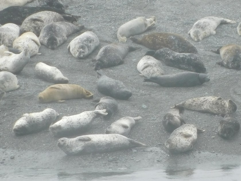
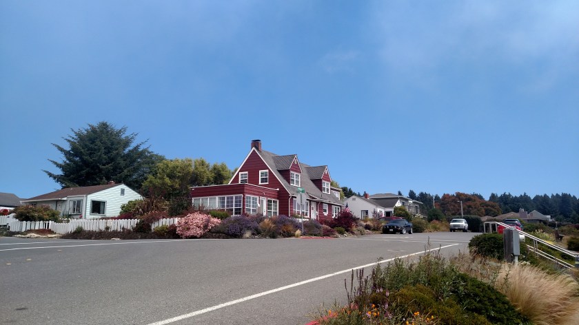
Wednesday morning I drove back down to Trinidad, about an hour south of where I am now staying in Crescent City, California.  When reviewing the photos I took down there on Tuesday I realized I missed something important.

This is a replica of the old lighthouse which used to sit out at the end of Trinidad Head.

IMG_20180725_120601986_HDR

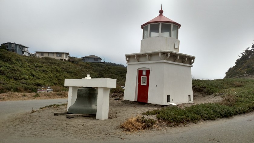
I had seen this when I was here on Tuesday (sitting down near the beach – between the photo I took looking right towards the beach and left towards the dock and Bay).  The building is a replica but the bell sitting in front of it is the real deal – a 4,000 pound bell which was kind of like a foghorn, warning ships at sea.  By the way, when I stood on the wooden planks under the bell the top of it (under the white concrete support) was right at my beltline.

We’ll get back to the lighthouse in a minute, but while I’m down by the water let me show you some other things.

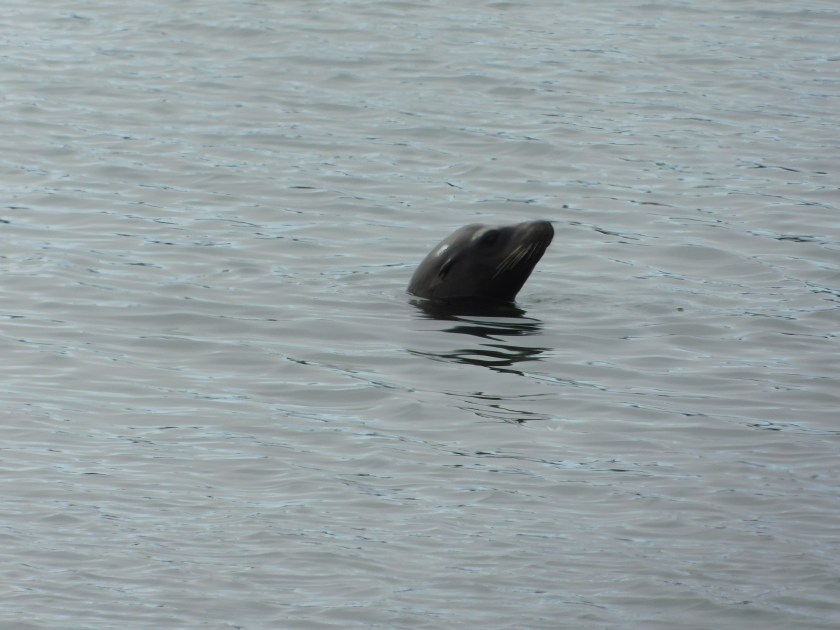
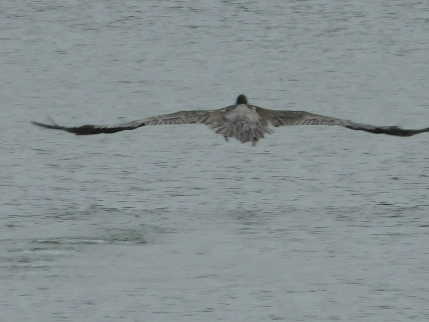
This was a large group of kayakers returning to land:

IMG_20180725_121329601

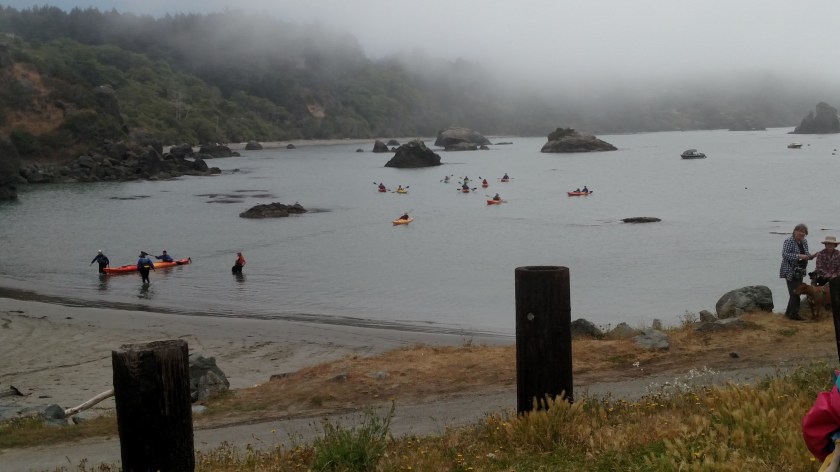
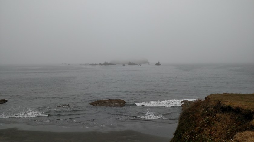
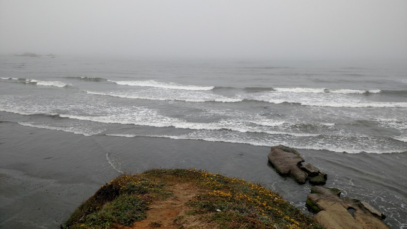
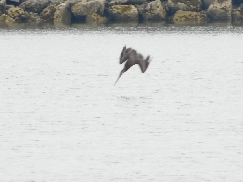
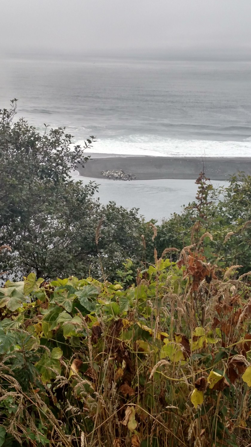
As you can see, conditions by the water were foggy – as they were when I was here Tuesday.

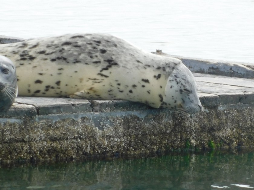
Next – more boats being raised from and lowered to the ocean via a pulley system:

This one was on it’s way down:

IMG_20180725_121455372_HDR

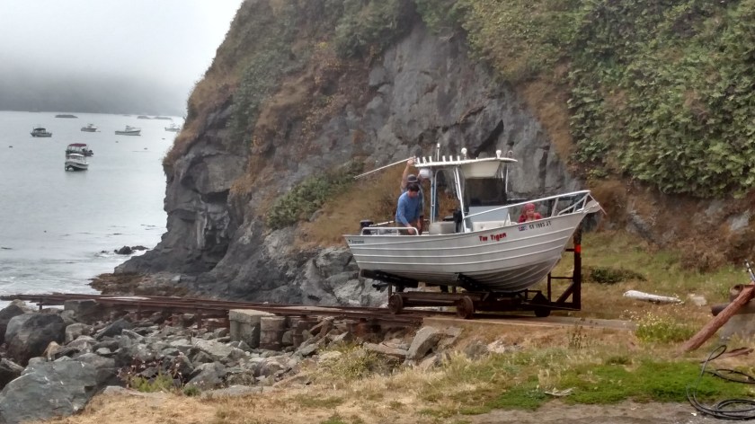
This one was getting ready to be brought up about 5 minutes later:

IMG_20180725_121900960_HDR

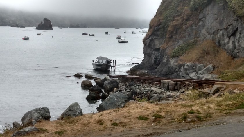
And this one had come up a few minutes earlier but was being pressure washed to get potential aquatic “hitchhikers” off the hull.

IMG_20180725_124038626

As I learned last year, most states out West have an extensive network of boat inspection stations along highways coming in to their state and near rivers and lakes where boating occurs in an attempt to control and eliminate invasive species of plants and animals (mussels seems to be a particular concern this year) from being transported into a water source and contaminating it.

I thought I had more pictures of this pulley system but must confess I had gotten into a lengthy and enjoyable conversation with a fellow traveler while his wife was off entertaining their two young children (who had started making seagull noises non-stop) and was temporarily distracted from my picture-taking responsibilities.

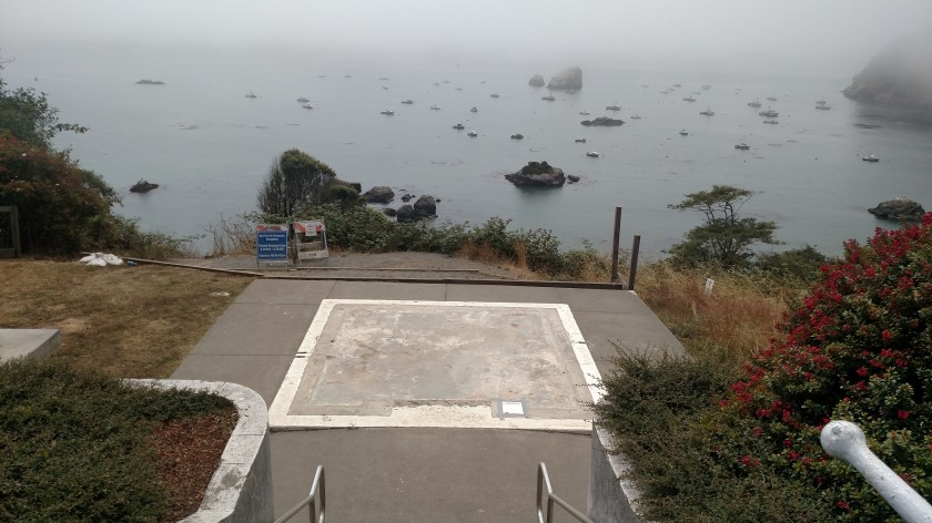
After we went our separate ways I went back up to where the lighthouse replica used to be.  This was taken looking away from the water:

IMG_20180725_124617177

And by turning just a few degrees right (and keeping the metal staircase railing in view) this was the view:

IMG_20180725_124620635_HDR

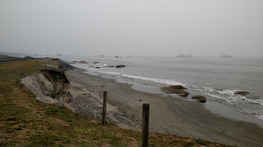
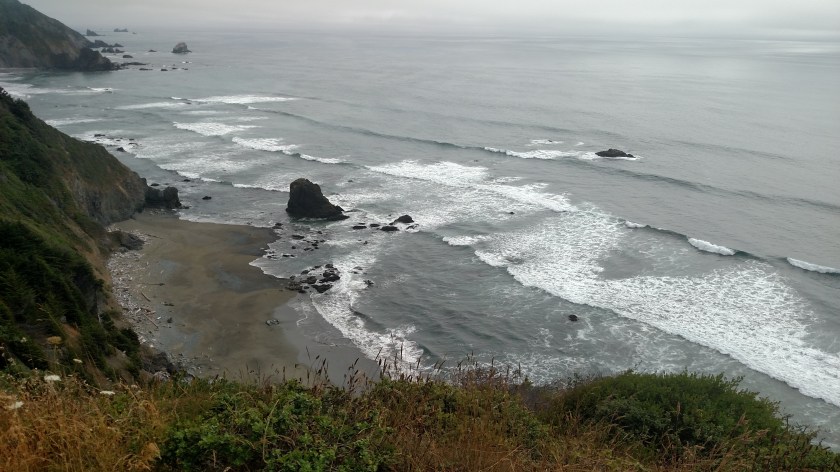
Another example of the marine layer just sitting off the coast but inland being sunny and clear.

Here is the view looking down those stairs to the right, towards the Bay:

IMG_20180725_124722737

That white square is where the replica of the lighthouse used to be.  Just to the left of it is where the bell used to be:

IMG_20180725_124735253

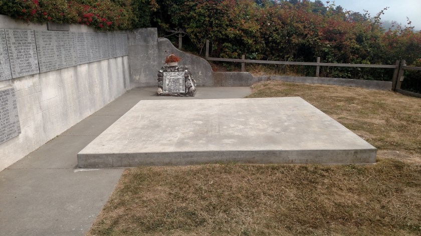
And on the wall left of that concrete slab is a memorial to people lost at sea.

The replica and bell was at this location for many years and apparently have been moved to reinforce the supporting platforms.

Here is a photo taken from the center of the platform where the lighthouse replica once stood:

IMG_20180725_124743663_HDR

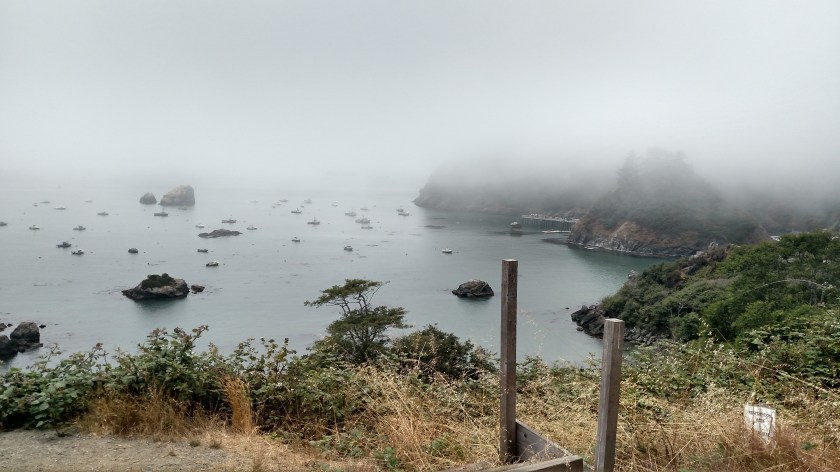
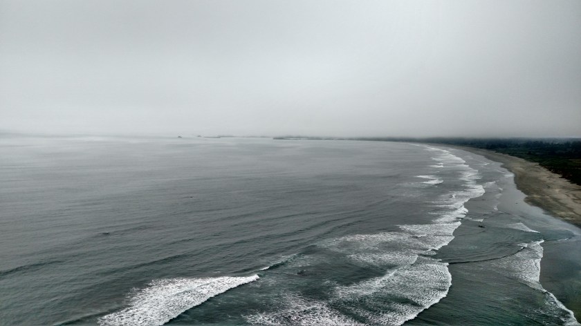
It is virtually identical to a shot I posted from Tuesday, though I had taken a few steps forward to eliminate the two wooden posts.

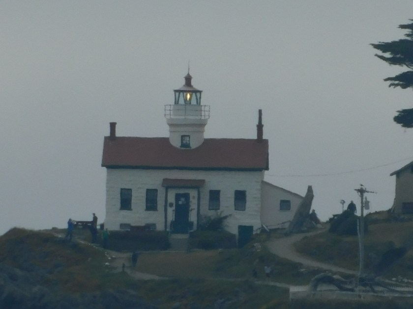
Wednesday I learned that the old lighthouse has been replaced by a new, automated light source which is on the other side of Trinidad Head, a huge rock which juts out into the ocean between the dock and Bay to the left and the beach which was further to the right (north).  That was the location of the original lighthouse but it was damaged by the highest recorded wave to ever hit the California coast back in 1914.  The lighthouse was later automated and a more powerful light source was constructed.


Bigfoot Country

As I’ve been traveling around extreme northern California I have seen many businesses with “Bigfoot” included in their name, as well as gift shops and tourist traps selling trinkets and souvenirs.

IMG_20180725_102916874_HDR

Evidently this part of the world is known for “Bigfoot” sightings.

I used to have a cat named Bigfoot, which is the only one I’ve ever seen.  Personally, given what I’ve learned about this area – I think it’s the marijuana talking….

Water Hazards

No photo.

Anyone who has played golf is probably aware of that term – something you want to avoid when you are enjoying a round of golf.  Well, near the ocean there are water hazards which can do much more than add strokes to your score…. they can take years off your life.

The most innocent is High Tide.  There are signs many places warning visitors who may not be familiar with the rhythms of the ocean to be mindful of incoming tides which can leave them trapped against a cliff with no possibility of escape.

Next on the list – “sneaker waves”.  I had never heard this term before but these are random waves much larger and more powerful than ones preceding them.  A cute term, perhaps, but this is the warning written on the official Redwood National Park map:

“Very large, powerful “sneaker” waves can occur at any time.  They will probably pull you into the water and survival is unlikely.  Never turn your back on the ocean.”

Ok, now you have my attention….

I have not seen surfers since I was in southern California, largely because much the coastline is extremely rocky.  If you get sucked out into the water you will likely be battered about the rocks, both above and below the surface.  There are even warning signs advising people who aren’t trained lifeguards to resist the temptation to try and rescue a stranded swimmer because they may not survive the attempt.

Last on the list – tsunami’s.  I stopped at the Visitor Center in downtown Crescent City Wednesday morning and saw a sign with a summary of the March 28, 1964 tsunami which struck the city.  That tsunami, triggered by a series of powerful earthquakes up near Alaska, sent waves racing towards the coast of California at 500 miles per hour.  Those waves (several waves of waves, actually) struck the unsuspecting community a little before midnight and destroyed 29 city blocks.  11 people lost their lives.  Crescent City also experienced a much milder tsunami a few years ago after the earthquakes which triggered the major tsunami’s in Japan.

I’ve seen tsunami signs all up and down the coast while I’ve been in California and they tell you when you are going into a tsunami zone (low elevation, close to the water) and when you are leaving it (getting back to higher ground).  The rule of thumb is – be mindful of where you are and what your options are, especially if you feel what might have been an earthquake.  The potential of deadly tsunami waves could follow soon thereafter.

More seals!

Wednesday I spent the day driving south, then north in and around Redwood National Park in extreme northwestern California.  As I was driving north around 4 o’clock local time I took a scenic road out towards the ocean and stopped at an overlook called Flint Ridge.  Napping down by the water was another large group of seals.  I was closer to them than the ones I posted photos of yesterday, and I also wasn’t as high off the ground, so these pictures turned out a little better:

IMG_20180725_155458581_HDR

DSCN4094

DSCN4095

Every now and then this one would raise his head and look at me like “What are you lookin’ at, pal??”

DSCN4098

And in this group there was a very noticeable brown one, unlike any I had seen at previous seal sightings.

DSCN4100

DSCN4101

DSCN4104

Quite the life of leisure….

DSCN4105

DSCN4107