Just north of White Bird (where I was staying for two nights) is the town of Nezperce (see previous post), and just northwest of that is the current center of the Nez Perce Reservation. Nez Perce is one of five federally recognized Native American tribes located in Idaho. It has a rich, and at times, turbulent history.
The tribe was peaceful (when left alone) and it’s members were known as extraordinary horsemen. They are credited with the development of the Appaloosa horse breed. Their name literally means “pierced nose” in French, though there is no evidence that that trait was ever exhibited by their members.
Chief Lawyer, and other members of the tribe, assisted explorers Lewis and Clark in their trek west. Their best known leader was Chief Joseph and there are numerous places named for him throughout the northwest US, as well as references to the tribe itself. At their peak the Nez Perce numbered about 12,000 and at their lowest, 2,000 on the early 1900’s. Today there are about 3,500 members of the Nez Perce tribe.
The Nez Perce homeland originally included most of central Idaho as well as parts of western Montana, southeast Washington and northeast Oregon. In 1855 a treaty established approximately 17 million acres as being the “official” reservation. Later, in 1863, another treaty slashed the size of the reservation down to only 750,000 acres. Many tribe members, including leader Chief Joseph, called it the “Steal” treaty and refused to acquiesce and move to the smaller area. This conflict eventually escalated to become the Nez Perce War, which started about a half mile from current day White Bird on June 17, 1877.
There is a scenic overlook on “new” Highway 95, just north of White Bird which has an information shelter explaining the conflict. It calls this the White Bird Battlefield.
US Army cavalry members approached a Nez Perce settlement here and, though the peaceful tribe members tried to surrender, shots were fired and the conflict quickly got out of control. The tribe members successfully held off the US forces (with loss of life on both sides) and the battle continued at other venues until Chief Joseph finally surrendered to US troops in Montana on October 5, 1877, ending the war. Chief White Bird (aka White Pelican), led this portion of the tribe and had a loyal following of about 50 men, second to Chief Joseph with 60 and ahead of Chief Looking Glass with 40. Chief White Bird led the battle here which is why the battlefield, and now the town, are named for him.
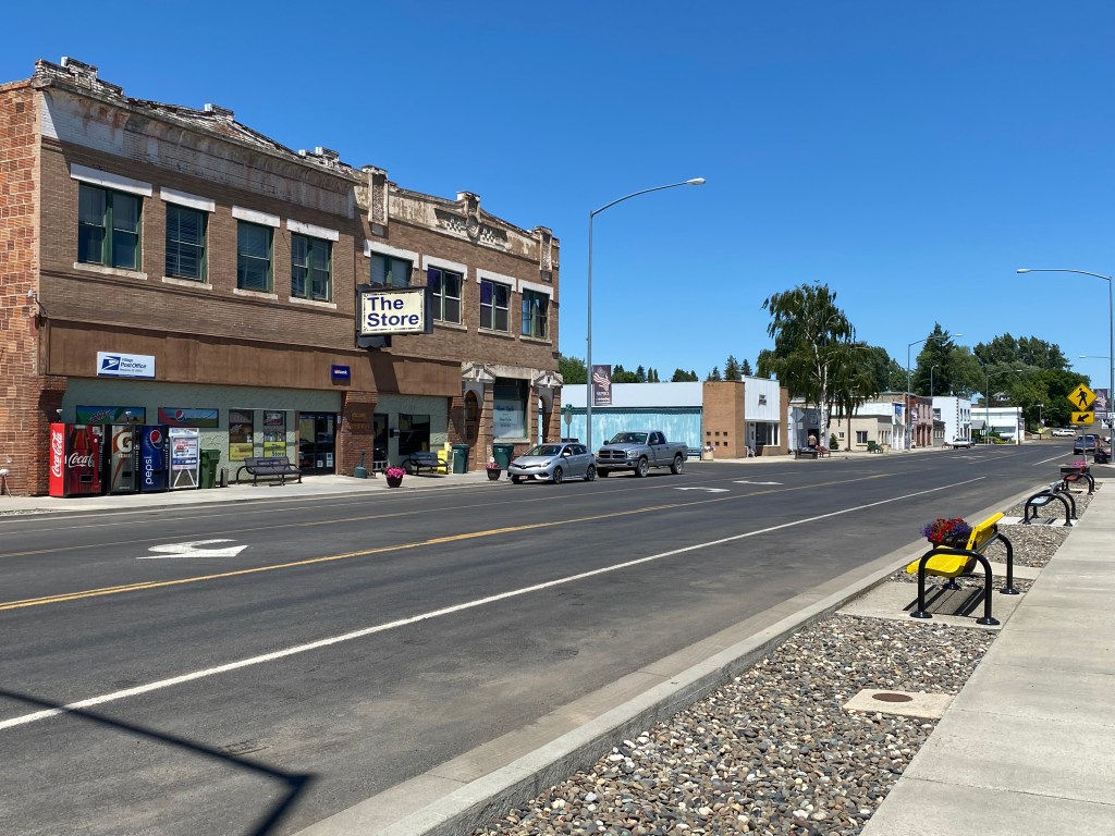
This post is about Nezperce (the town) as opposed to Nez Perce (the Native American tribe). The tribe plays a HUGE role in the history of the area and I will address it in a future post. The town of about 500 residents is located just southeast of the current reservation and apparently has nothing to do with the tribe itself. Curiously the town and (much of) the reservation are located in Lewis County while the “headquarters” of the tribe is located in the town of Lapwai which is in Nez Perce County, immediately to the west of Lewis County.
I kind of stumbled upon the town as I was out driving through farmland north of Grangeville. I saw a sign for it and I knew the name from previous trips out west.
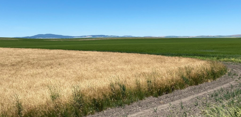
Much of the farmland in Idaho is for growing potatoes (this IS Idaho after all…). I believe the green field in the photo below is potatoes.
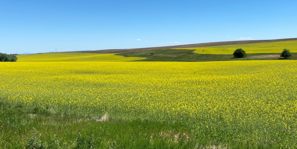
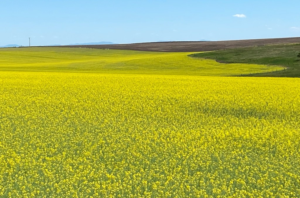
That I expected, but I was surprised at the number of fields in this region where canola is grown. As you will see, canola fields are a very impressive yellow in color.
I finally arrived in little Nezperce. By the way, the town (and the tribe) are pronounced NAY pear-SAY. The town name is presented as one word but the tribe is two words.
And this is the arena where they undoubtedly hold rodeos and such:
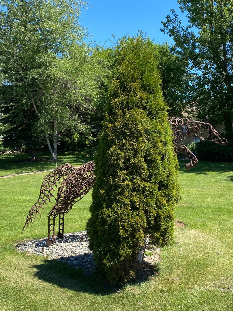
I drove through town (it didn’t take long!) and when I turned around to head back out the way I came in I noticed this piece of artwork in someone’s front yard:
If you zoom in you will see that the horse is made completely of old horseshoes welded together! Very clever and impressive. Later in my trip I would see a pickup truck in New Mexico which belonged to an artist who constructs such pieces of art.
My second surprise in the region north of White Bird and Grangeville was learning about and seeing some of the amazing railroad bridges. First, a word about the name. Camas is short for Camassia – a plant which thrives in open, moist fields (the bluish-purple blooms in the photo below).
There are many such areas in Idaho, Montana, Oregon, Washington and the southern portions of the western Canadian provinces. Tolo Lake, west of Grangeville, is also located on the “Camas Prairie”.
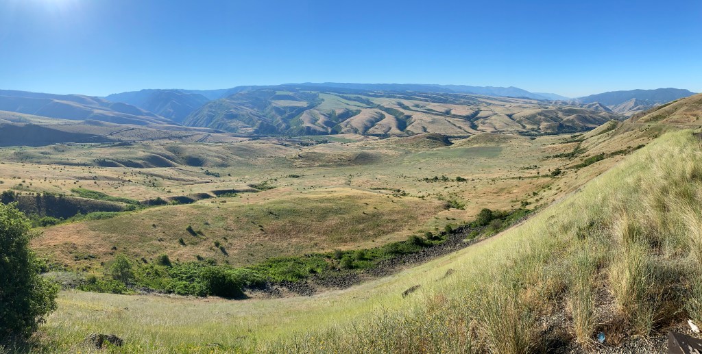
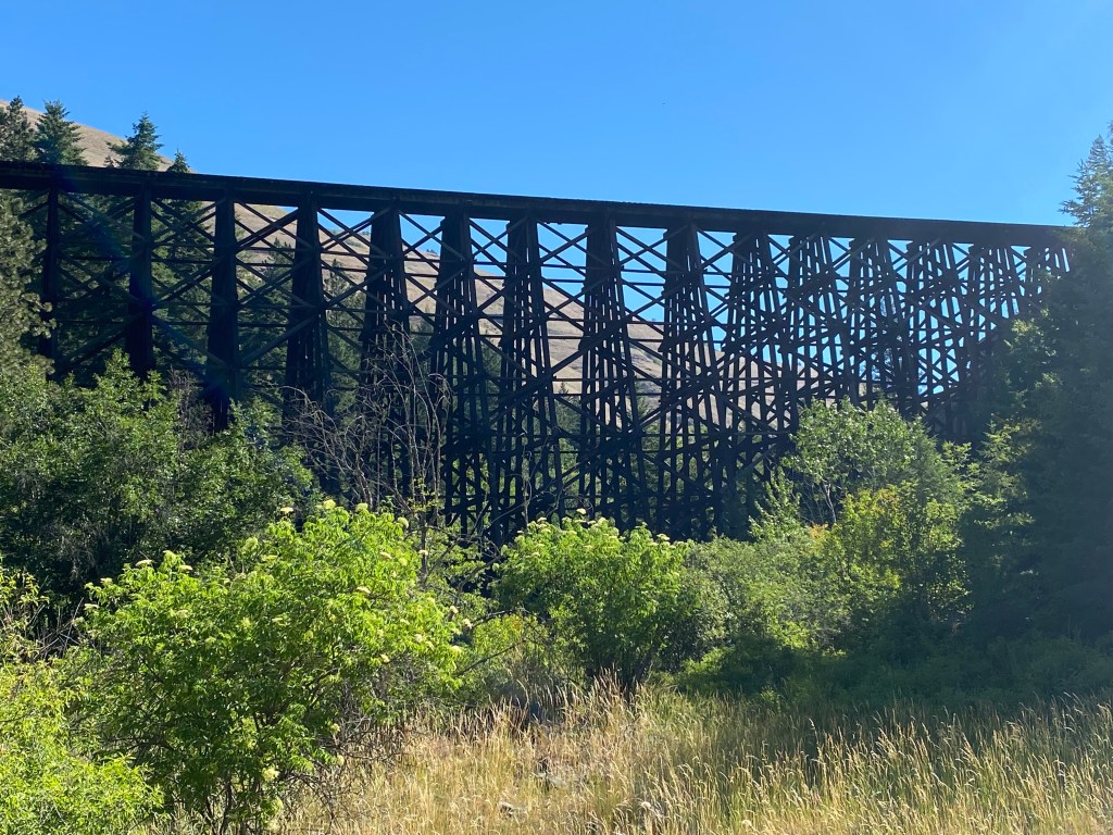
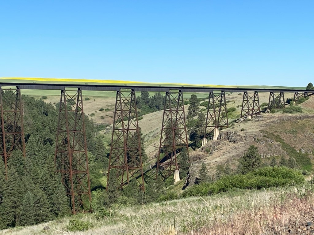
I started seeing some tall, wooden railroad trestles way up high on the hills as I drove along Highway 95, between Cottonwood and Lewiston.
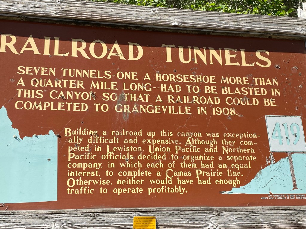
The Camas Prairie Railroad was a joint project of the Western Pacific and Union Pacific Railroads and operated for almost 80 years until 1975. Much of it was built up high on the mountains and many trestles were needed to carry the tracks over canyons and valleys between hilltops. As you will see on a sign later in this post, in one 5-mile stretch there were more than a dozen wooden trestles, some very long and tall, earning the railroad the nickname “the railroad on stilts”.
It is hard to see the wooden trestle in the photo above. It is actually the first one I saw and my eyes were drawn up to it because it was being lit by the (then) late afternoon sun. I’m still kicking myself for not stopping to take a photo of it at that time but I didn’t learn about the others until later. The photo above wasn’t taken until the next morning, when the sun was behind the trestle.
Here are some of the other trestles I could see from the highway:
In addition to the wooden trestles, tunnels were built through some of the mountaintops – including one which was in the shape of a horseshoe. Also, there were some places, such as over Lawyer’s Canyon, which required a metal bridge be built. That bridge still stands today:
The yellow line above the tracks is actually actually comprised of plants in a field way off in the distance. You’ll see more of them in another post.
Here are two signs about the railroad which I found next to the highway:
Unfortunately the railroad, as well as several smaller ones which connected to it, was never profitable and was eventually abandoned. While most of the trestles still stand (one wooden one was destroyed in a wildfire and was never rebuilt) the tracks between them have largely been removed.
Books have been written about the railroad and you can find many other photos of some of the huge, in some cases curved, trestles, by searching the internet for the name of the railroad and adding “bridges”.
While I was to be based in White Bird for two days all of my road trips were north of there. With my early start I arrived in the area by mid-day Sunday so I had some time to start exploring.
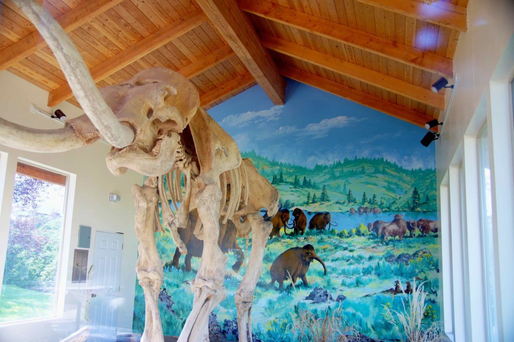
Grangeville is a larger town, located 17 miles north of White Bird on (new) Highway 95. My first surprise when I drove up to Grangeville after I arrived in the area was a sign pointing west to Tolo Lake, about 5 miles away. It was at that lake where remains of Columbian mammoths were found when the lake was being worked on by volunteers for “fishing and wildlife improvements” in 1994. Experts were brought in and the lake was drained. Many skeletal remains were found and it is one of the largest Columbian mammoth “graveyards” to be discovered in the United States.
Male Columbian mammoths were about 14 feet tall and 17 feet long and were believed to have weighed about 10 tons. My first encounter with mammoth research was when I visited “The Mammoth Site” in South Dakota back in 2017.
Tolo Lake was later refilled with water and is now a “protected site” pending the receipt of more funds to continue the research. I drove out to the lake but there is nothing there to see except a few signs discussing the findings. There is a building behind the Grangeville Chamber of Commerce Visitor Center downtown which houses a full-size replica of a Columbian mammoth skeleton:
(Photo credit: blog.goodsam.com)
I took some photos of my own but the display is surrounded by glass and it reflected the outdoor scenery behind me. Signage at the display suggested returning at night to get better photos when the display is lit up from inside the building but I try not to go out at night when I am traveling in areas with which I am not familiar.
Sunday morning, after a warm night and a cold shower in Horseshoe Bend, I headed north for my next stop in tiny White Bird, Idaho. The key word there is “tiny”. When I Googled the name to get some information about it I learned that in 2019 the population was only 53 – half what it was in the year 2000. Also, the town only covers 42 acres! Nevertheless, I found a great Airbnb there and got a great rate because it was a new listing and there was a discount for the first few guests that made reservations.
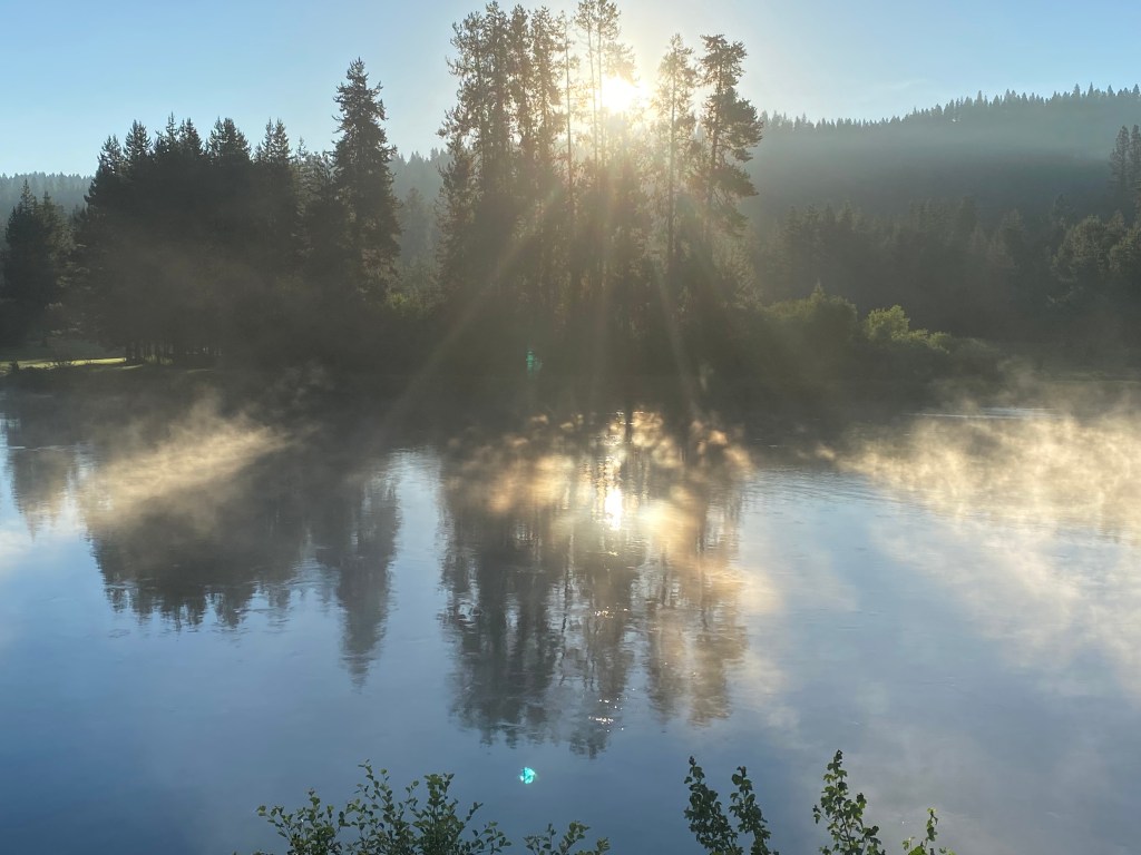
I left Horseshoe Bend and proceeded north on Route 55. I had driven part of this route back in 2017 when I traveled from Boise up to McCall, ID. Today I would continue on past McCall where I picked up Route 95 towards White Bird, about 150 miles from Horseshoe Bend. For the first part of the trip I would be driving parallel to the Payette River. In the early hours of Sunday morning there was a mist rising above the water:
The drive to McCall is very nice, with some great views of the river, but I posted photos back in 2017 and won’t repeat them. There was one section of the road which was under construction (to blast away part of a mountain cliff adjacent to the roadway) and I didn’t feel very comfortable while driving it so I made a note to change my route in order to avoid it on my way south in a few days.
I did make it safely to McCall, then took Highway 95 further north to Riggins. There I crossed the “Time Zone Bridge” and was now in the Pacific Time zone.
I had been to Coeur d’Alene in northern Idaho back in 2017 but forgot that the northern half of Idaho is in the Pacific Time zone while the southern half is in the Mountain Time zone. Seems kind of screwy to split a state horizontally rather than vertically but then I don’t make the rules…. I had been through Riggins back in 2017 but on that trip I had arrived from the west, via Oregon, when I stopped at Hell’s Canyon, and the Snake River, which separates Oregon and Idaho. The Snake River is only about 8 miles west of this bridge.
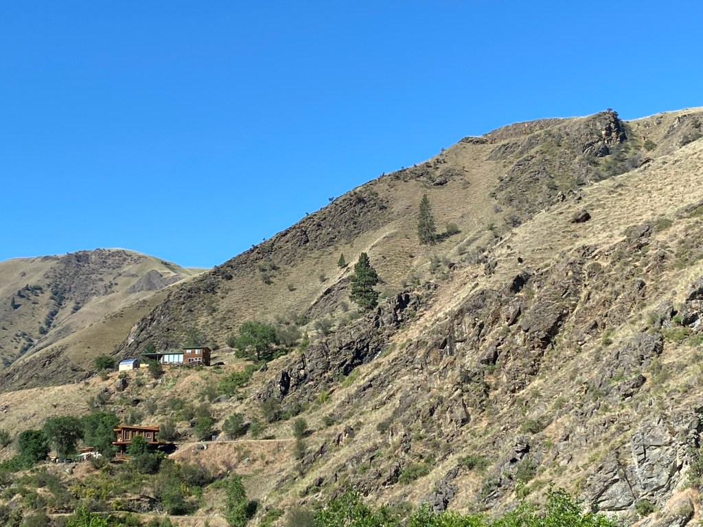
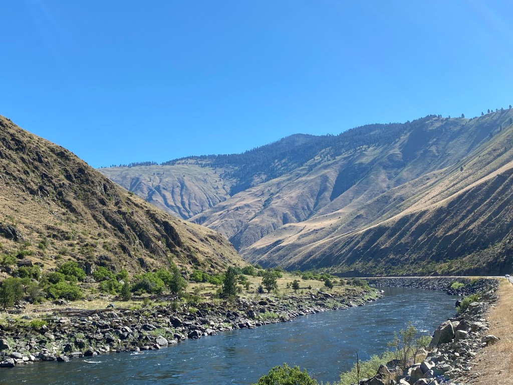
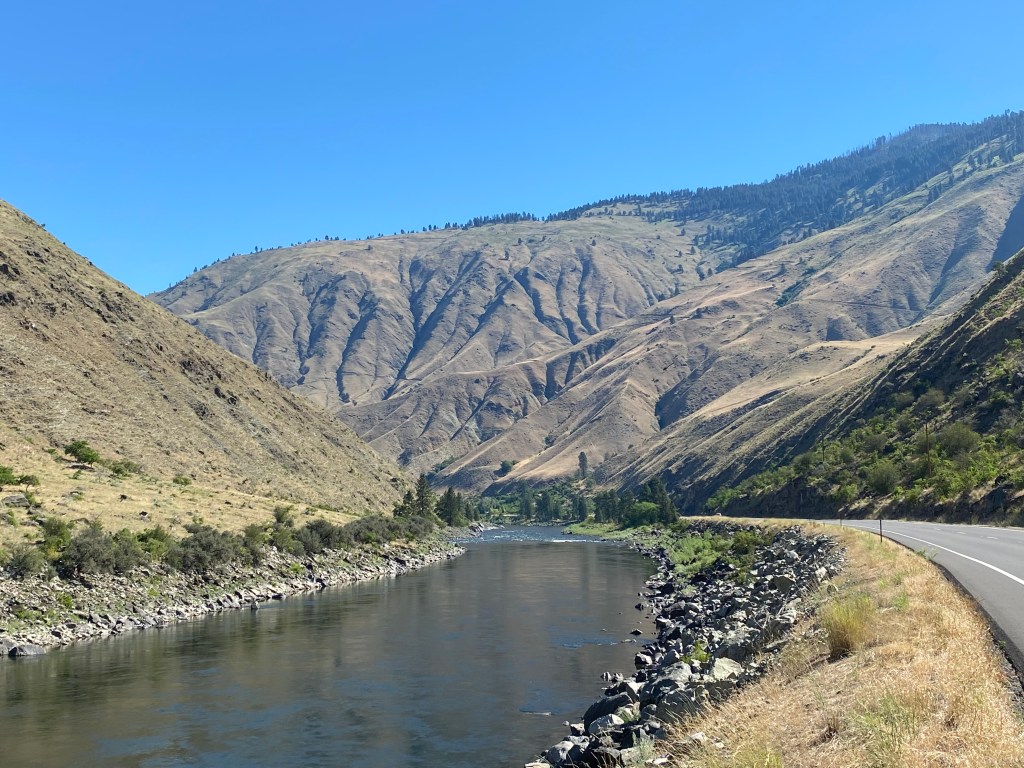
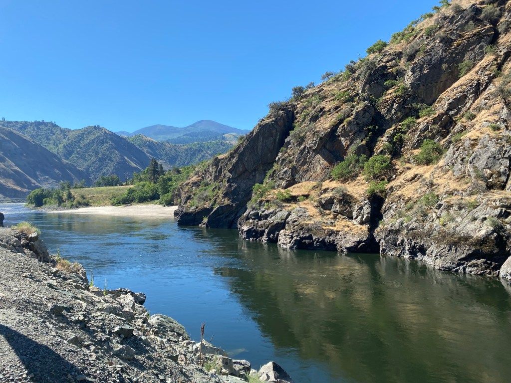
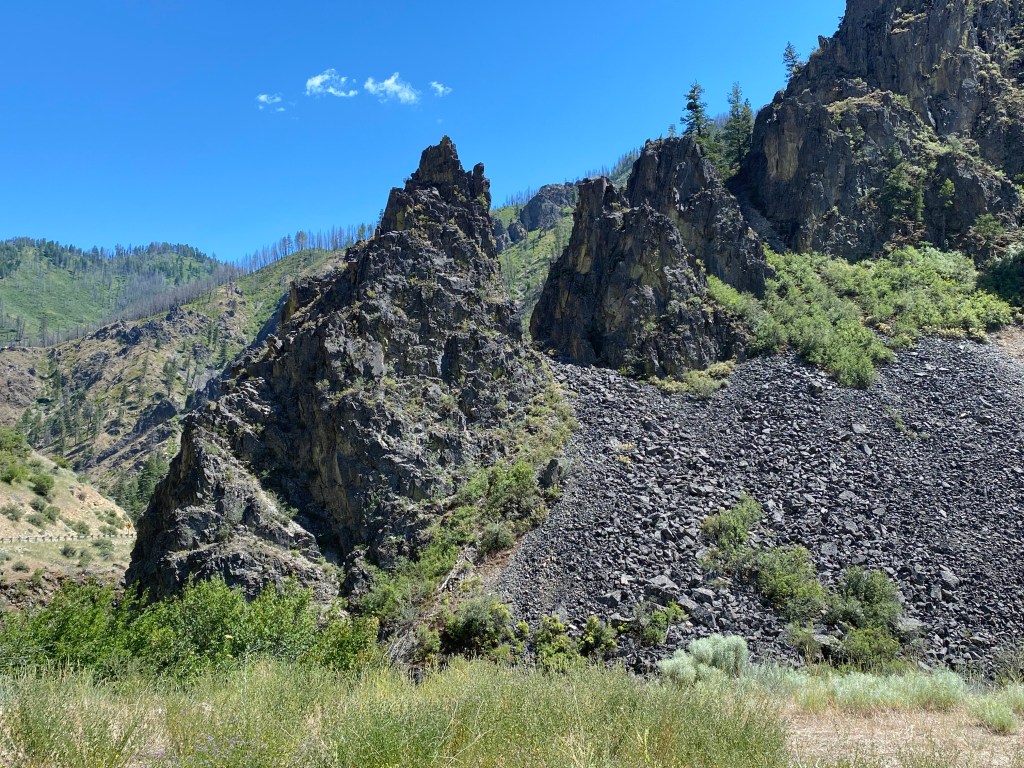
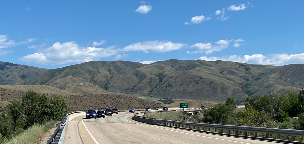
From this point northward I would be driving on Route 95 alongside the Salmon River until I got to White Bird. There were some beautiful places to stop and enjoy the view along the way:
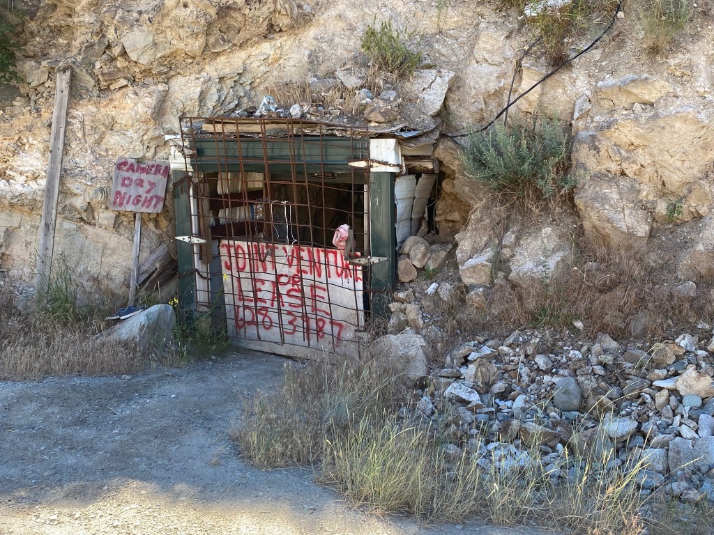
At one place where I parked to take some photos I spotted the entrance to an old mine just off the road:
There’s contact information on the sign if you want to lease it or enter into a joint venture with the owner….
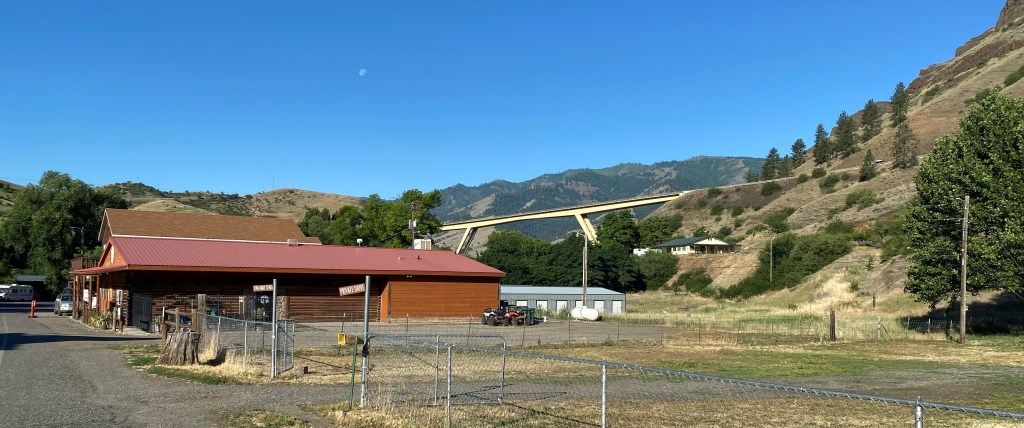
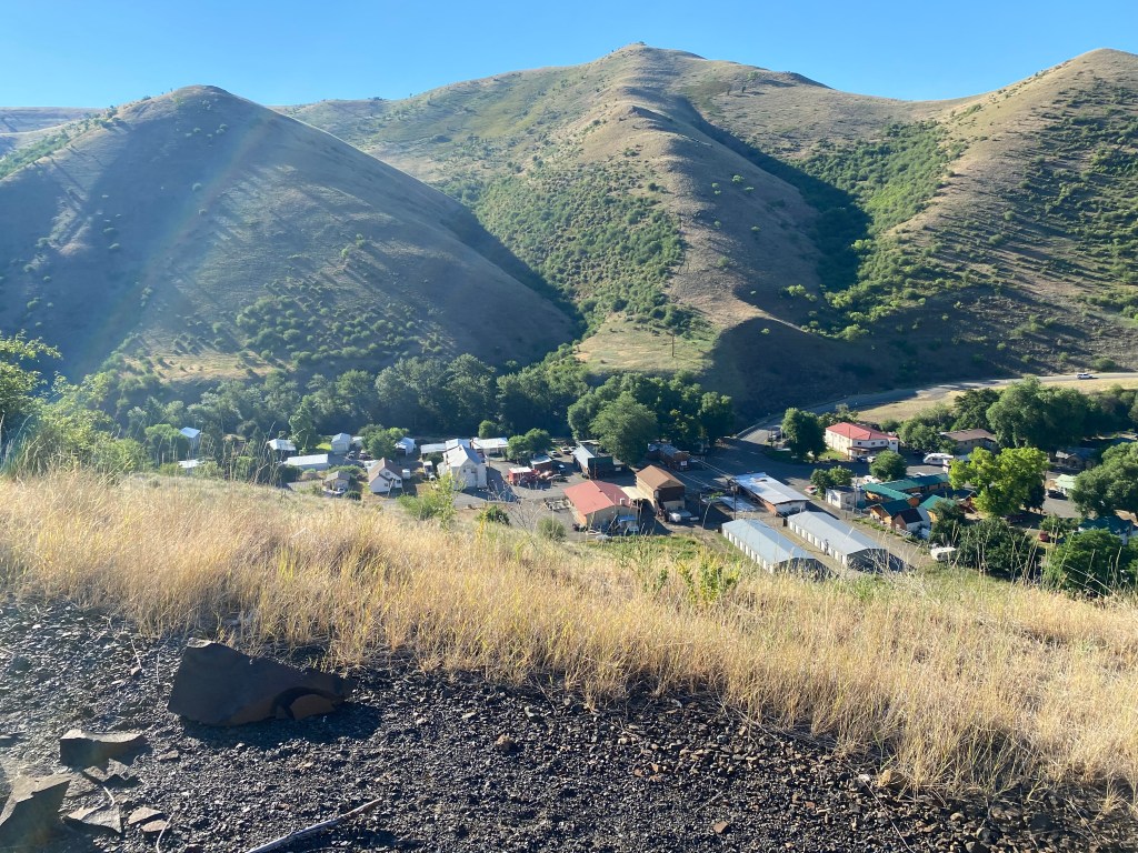
I finally reached the turnoff for White Bird. The town itself is located below the level of the highway, at an elevation of 1,581 feet, in White Bird Canyon.
The turnoff for White Bird is left of the new highway bridge in the photo above (photo is looking south). That bridge takes Route 95 onto the new road which was completed in 1975. More on that in a minute. Here are some photos of town taken from a scenic turnout on the new highway.
Old Route 95 used to go right through town and then proceeded up the mountain. The old highway was completed in 1915 and gained almost 2,900 feet in elevation, to it’s highest point of 4,429 feet, in just 14 miles. It achieved that through a series of long switchbacks. If all the turns were combined into circles there would be 37 of them! It was a narrow, dangerous road and it is hard to imagine cars, much less large trucks, trying to navigate it in both directions. I would drive up Old Highway 95 before I left town and will post some photos in a few days.
The new Highway 95 is much wider, including long passing lanes, and is steeper but with fewer turns. It only attains a height of 4,245 feet before descending on the north side of the mountain.
White Bird would be my base for the next two nights and I would be making several scenic drives north of town in the next two days and learn about some new and interesting things.
As opposed to Horseshoe Bend in Page, Arizona, which I will visit for the second time later in this year’s trip, this is a small town in southwest Idaho, about 30 miles north of Boise. As I was planning my trip this was a logical place to spend the night after a day of traveling on scenic backroads. More on that later.
I approached from the northeast, passing through parts of Boise National Forest. I had been at higher elevations earlier in the day and enjoyed very pleasant temperatures but as I got back down to Horseshoe Bend’s elevation of “only” 2,631 feet things heated up quite a bit – close to 100 degrees in the late afternoon. But the drive getting there was quite nice:
Parts of the forest had experienced wildfires in 1989 and 2016 and there were some areas near the road which were prone to mudslides as a result of the “burn scars”:
Once I got out to Route 55 it was a short drive south to Horseshoe Bend itself.
When I got in to town I saw this parked in front of a local establishment. My youngest brother used to hoist my niece up on his shoulders when she was little and said she was “riding high”. I thought of that when I took this photo:
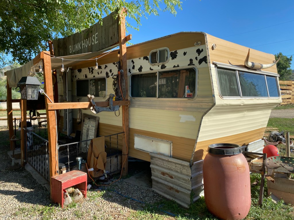
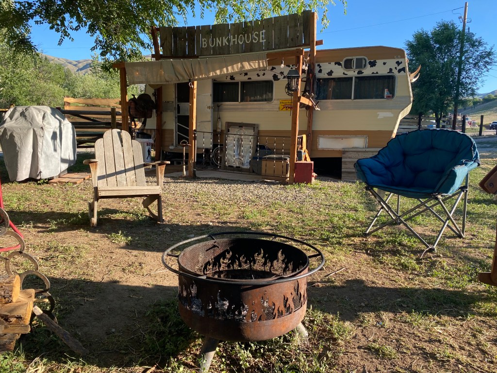
I finally reached my Airbnb – at a campground which specializes in having various campers and tiny-houses already set up on-site to accommodate guests. This would be my home-away-from-home for the evening:
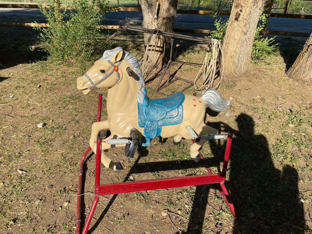
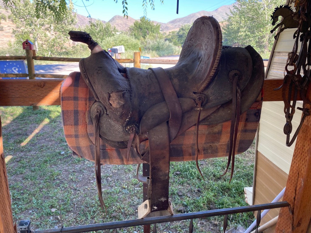
There were some interesting items strewn about my “front yard”
And keeping with the horse theme, there were some live ones right next to my camper which are used for giving child-guests rides:
It was a fun, albeit hot, evening. My host recommended a great restaurant in town and after dinner I settled in for the evening, after talking with some of the other guests.
And the next morning I had the unique experience of a c-o-l-d outdoor shower! Silly me thought that the bladder of water suspended over my head would at least be somewhat warm after absorbing some of the previous day’s heat but I was sadly mistaken:
I will say that I was wide awake and alert when I hit the road.
After I completed my house-sitting obligation in Lander WY in late June, I set off on a tour of several western states. The day after my house-sitting host returned home from her trip I drove north, to Yellowstone National Park, to meet up with my friend, Max, who was in the midst of his own month-long trip through the western US.
We arranged to meet at Old Faithful at 11am and for the rest of the day I drove him around various parts of the Park since I had been there several times and this was his first visit. He had arrived at the Park the day before and was able to get a sneak-preview of some of the attractions on his own. He, too, had been traveling alone and I thought it would be nice to give him a break from driving for a day and let him enjoy the scenery. Once we finished making our “rounds” we each drove to our respective Airbnb’s in St. Anthony, Idaho, located south of the western entrance to Yellowstone. The next day he went east, towards South Dakota, to continue his journey and I went deeper west into Idaho, to continue mine.
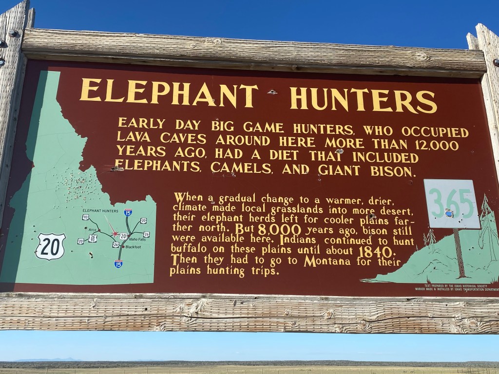
I drove south, to Idaho Falls, then west on Route 20, towards the little town of Arco, which I had visited in 2017. Along the way I spotted this sign, which I had missed on my first trip through this part of Idaho:
Evidently elephants and camels once roamed these parts, in addition to bison, until a change in the environment drove them further north.
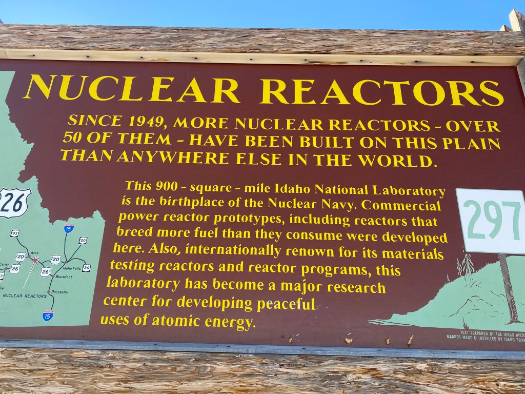
Further west I saw this sign in a rest stop as I approached Arco.
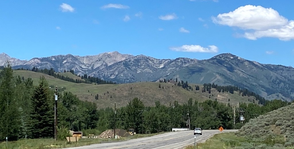
A reminder that this part of Idaho was key in the development of nuclear energy in this country. It still hosts the Idaho National Laboratory, a huge complex which is off-limits to tourists. A smaller facility nearby, which I had toured several years ago, was closed due to COVID. I continued west, past Arco and past the Craters of the Moon National Monument, which I had stopped at briefly in 2017. When I reached Route 75 I turned right and headed north to cover some new territory – namely a scenic route which would take me past the Sun Valley ski resort and up into some of the mountains which make up part of the Sawtooth National Recreation Area.
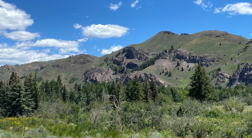
The landscape quickly changed from relatively flat, open desert-like space and farmland to grass-covered fields and tree-covered mountains. As I started to gain altitude I was able to open the windows and sunroof as the temperatures dropped into the 70’s. I didn’t know it at the time but this would be the last of the pleasant temperatures for a while as I was about to attract the “heat dome” which had been plaguing the southwest US and apparently decided it might be fun to head north and follow ol’ JohnBoy around for a while…
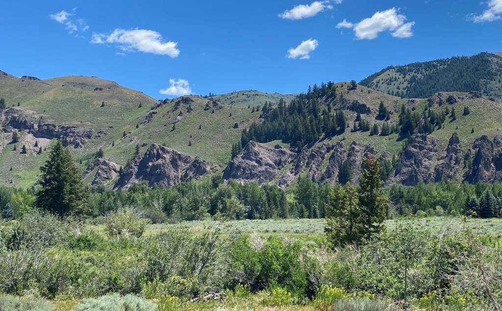
After I passed the little towns around the Sun Valley resort I worked my way up to the Galena Pass.
Galena Peak would soon be on my right. It tops out at a little over 11,150 feet:
The road I was on would traverse Galena Pass, where I would reach an elevation of about 8,700 feet. This was the view looking back as I approached the summit:
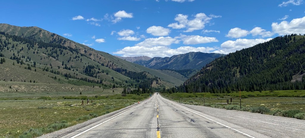
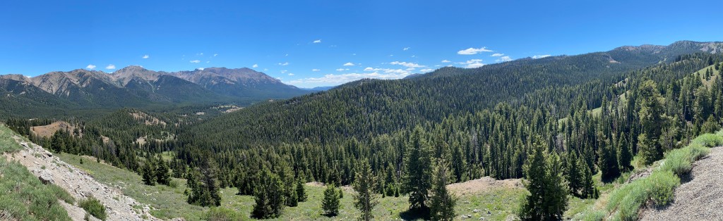
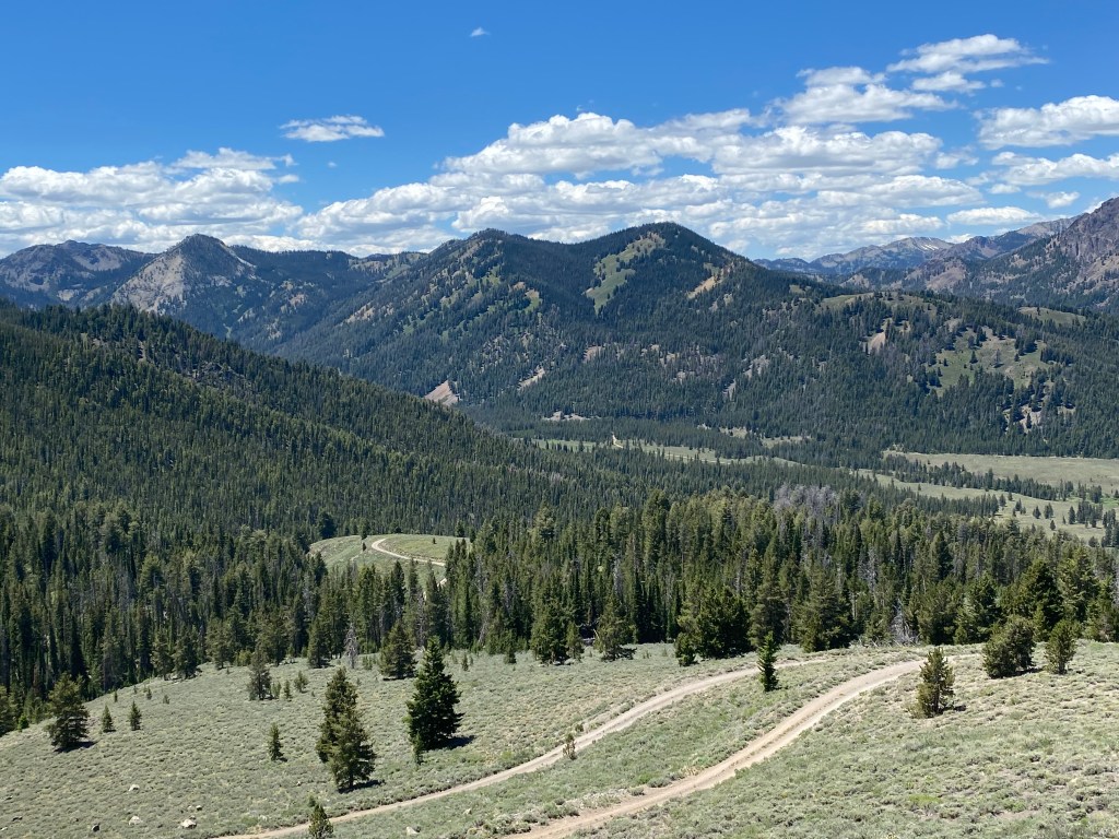
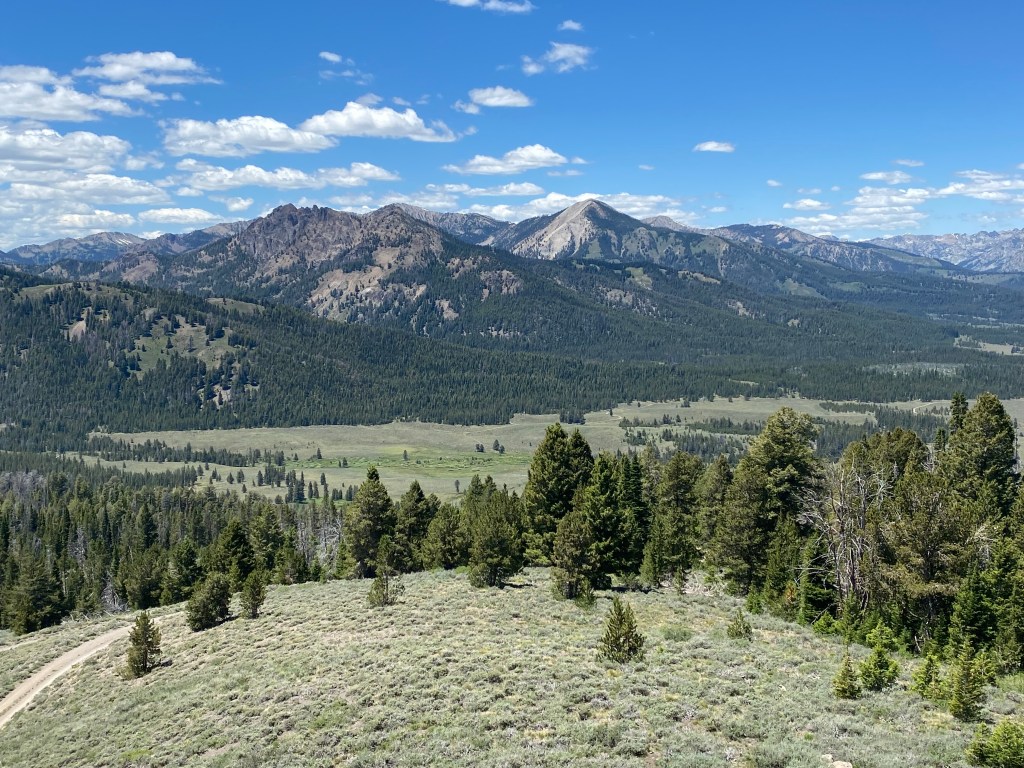
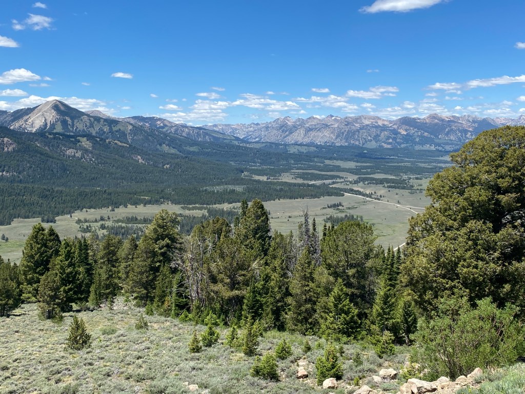
I would soon come to an overlook which would give me a sweeping view of the valley into which I was about to drive as I continued northwest towards the town of Stanley. This is a three-shot panorama looking ahead, from left to right. In the third shot you will see the road I was on extending out into the valley below, with even more mountains off in the distance.
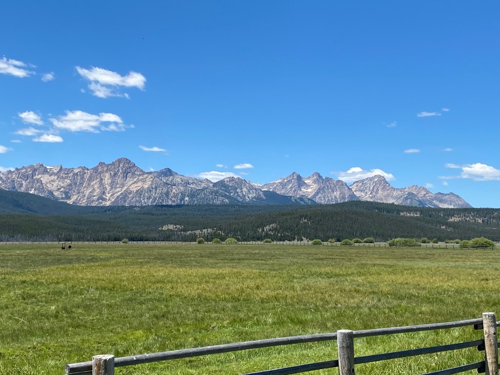
And this is the view of some of the mountains off to my left once I got all the way down into the valley.
I continued on, past Stanley and the road turned southwest before taking me over to Route 55 which I would then take south to my one-night stop in the little town of Horseshoe Bend, where I would spend the night at an unusual (for me) Airbnb.
I am back home from my latest trip, having arrived in North Carolina almost a week ago. I have unpacked my car (it was so full that I think people in Walmart parking lots and various gas stations thought I was living in it), finally got the car washed (BADLY needed) and enjoyed a few days of pleasant weather just sitting on my porch. Durham has had an extremely hot summer but it took a break the day after I got back and we’ve had cool mornings and less humid afternoons. The heat and humidity are back now so I will be reviewing and posting photos from the remainder of my trip from the comfort of my apartment.
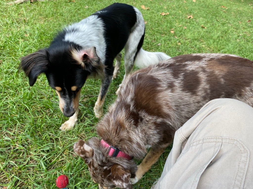
I will start at the end – I visited some family members and friends in the northeast on my way home and my next-to-last stop included a visit from one of my friends family members and their two dogs. My friends were preparing for a party at their new “tiki bar” and I was tasked with entertaining the dogs while they were busy working. I mostly sat in the back yard throwing balls of various sizes which the dogs retrieved and returned (more or less) to me.
They were tireless, despite my pleas to “take a break” periodically. Towards the end I did manage to wear them down a bit and they did sleep for short periods, although when they were awake they insisted on playing some more.
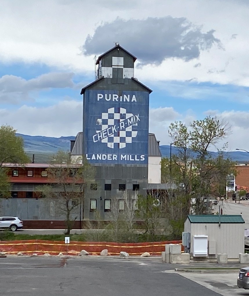
As my time in Lander winds down I looked back through pictures from my time there and found some that I should have posted earlier. First, the iconic Grain Tower which is one of the first things one sees when driving into town from the south. I see this when I check the traffic cameras from Durham to see how much snow they’ve gotten during the winter months and I smiled the first time I laid eyes on it as I drove into town back on May 20 as I knew I had truly arrived!
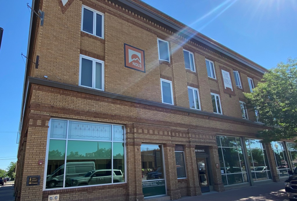
And one of the many things I like about Lander is that many of the buildings in town have stickers in their window stating the historic significance of the building. Many of these buildings have a rich history.
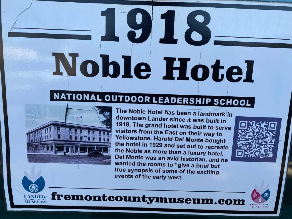
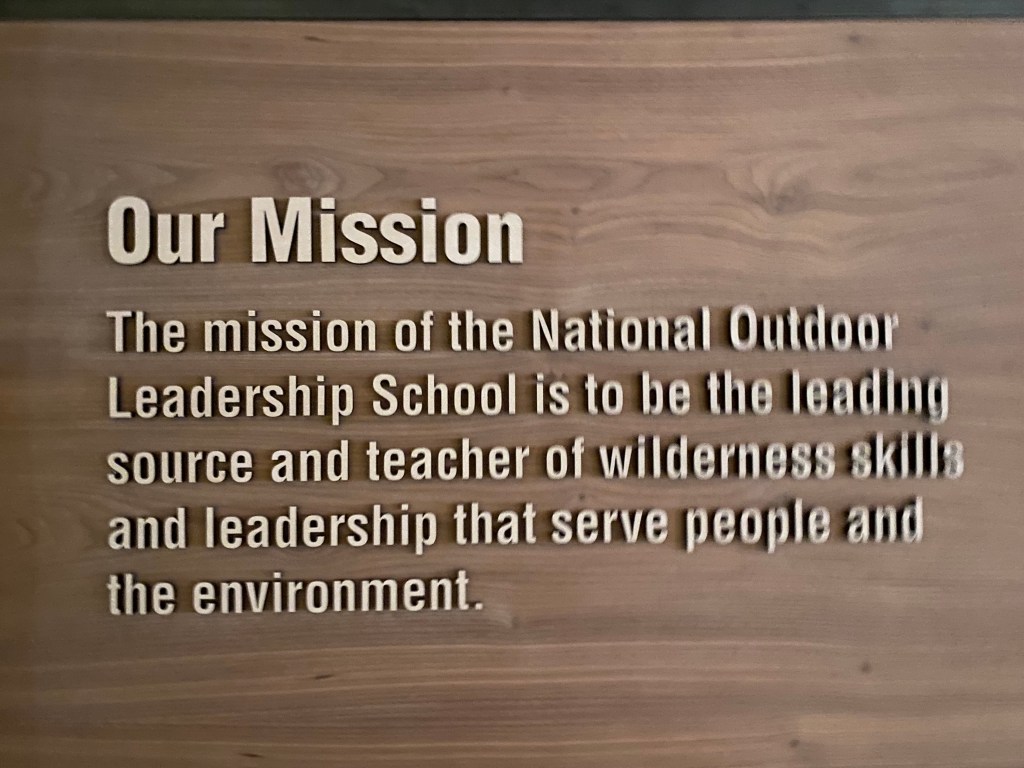
This is the Noble Hotel, right on Main Street. It is one of many buildings now owned and inhabited by NOLS, the National Outdoor Leadership School, whose World Headquarters is located here. NOLS is where my brother and my nephew, Sam, work.
Their headquarters, which I have posted photos of previously, is on the street immediately behind the hotel, which they use as an education and meeting venue. In their HQ I found their “mission statement”:
When I visited the Pioneer Village (see previous post) and spoke with the ladies there they said that they hoped that when NOLS renovated the hotel for their use that the red furniture, which had been custom made for the hotel, was still being used. After taking these photos I returned there and assured them that the furniture was still intact.
This is something I passed every time I departed or returned home using the “south” route – tire tracks going up a steep, 45 degree incline. My brother said he has seen the person who evidently lived atop the hill zip up it in his (or her) Jeep like there was nothing to it!
These were baby chicks I saw at the Ace Hardware store in town the first time I went in to buy bird seed:
This is the official state logo, courtesy of the University of Wyoming in Laramie. This was part of a sign in front of a bank on Main Street:
And that image now adorns my car – in the rear window:
And this isn’t from Lander proper, but from nearby Riverton. I should have posted this on July 4 or Memorial Day…
And this was on the side of a building in little Hudson, between Lander and Riverton. Although I’ve lived in Pennsylvania most of my life I had no idea Sinclair is considered a “Pennsylvania Motor Oil”. This is how we learn…
I actually passed the town of Sinclair, and a Sinclair refinery, on Route 80 in southern Wyoming on my way to Lander, another reason I was surprised by the Pennsylvania reference. There are lots of Sinclair gas stations out west, many with a big green dinosaur somewhere on the property. I don’t recall seeing any on my recent visits to Pennsylvania and will have to keep an eye out on my way back east in late August.
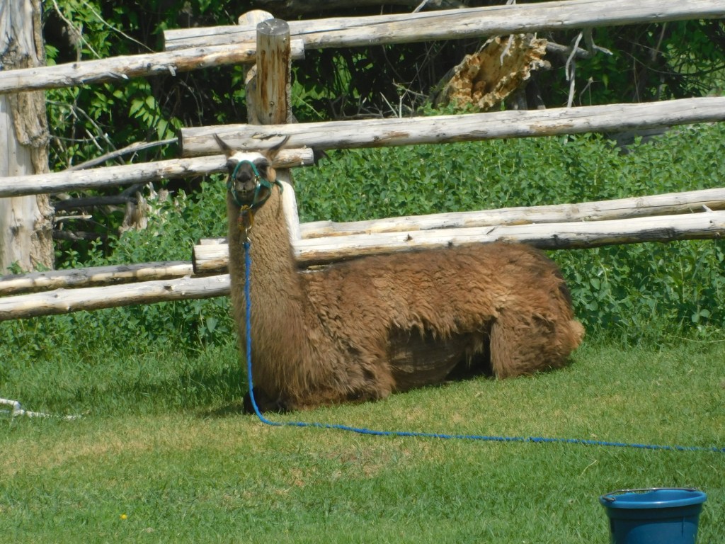
I went back and did get some photos at “Lander Llamas”
And it is fitting that I end with a photo taken on my last night in Lander (for now…???). The town moved the performance stage from behind the Chamber of Commerce downtown to City Park, a popular multi-use park. The night I left was the first free concert at the new location and judging by the attendance, it was the right choice. Great music from a very good local band and a chance to spend a final evening with Steve, Jen, Sam and, of course, Ellie.
There were lots more people there than shown. I took this photo to send to Sam to show him where we were sitting in relation to the stage.
After my big birthday weekend I knew my time in Lander was winding down. When my house-sitting responsibilities ended I was planning to drive up to Yellowstone to meet a friend from Durham who was also traveling out west. When I learned that my stint in Lander would end Thursday night rather than Wednesday night I knew I would then only have one day in Yellowstone with my friend so I decided to drive up on Monday and try to check off the two things I hadn’t been able to see while I was there on previous trips and get those out of the way. It was a long drive for a relatively short time there but I knew I’d be kicking myself later if I didn’t do it so I headed out bright and early.
It started out cloudy but soon became a beautiful day for a road trip. I had already covered some of this territory when I drove up through Jackson and back home through Dubois earlier in this trip but I learned later that I had driven right past one spot where I should have stopped – the Tie Hack Memorial:
This monument is a tribute to the men who used to cut railroad ties from tree trunks, by hand, long before the process was mechanized. They made them for the Chicago & Northwestern Railroad. The work was normally done in the winter. The ties were then sent down a series of water flumes to the Wind River where, with the elevated water levels from the snowmelt in the Spring, the ties were then floated downstream in a process called Tie Drives. It was a dangerous undertaking and always ran the risk of inadvertently damming the river and causing a flood.
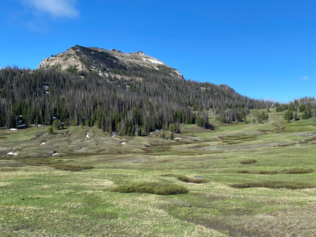
I continued driving towards Yellowstone and these were some of the things I saw along the way:
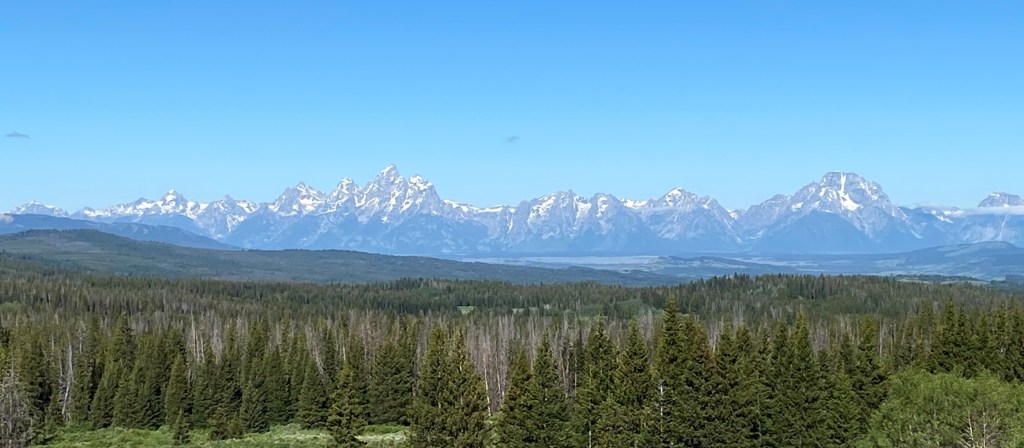
I finally reached an overlook where I could see the Grand Tetons in the distance:
If some of these photos look familiar it may be because I posted some of them in my earlier “Hurry Up and Wait” post. A handful of friends also received photos via text throughout the day while I was traveling. That process will probably not continue as I later learned what effect it had on my cellphone data useage!!
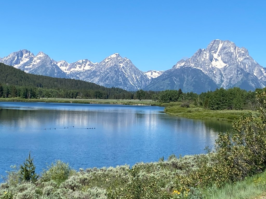
This view of the Tetons, with the Snake River in the foreground, taken from the Oxbow Overlook never gets old….
And this is a shot of the Tetons “in profile” from a little further up the road:
Now the body of water in front of the mountains is Jackson Lake.
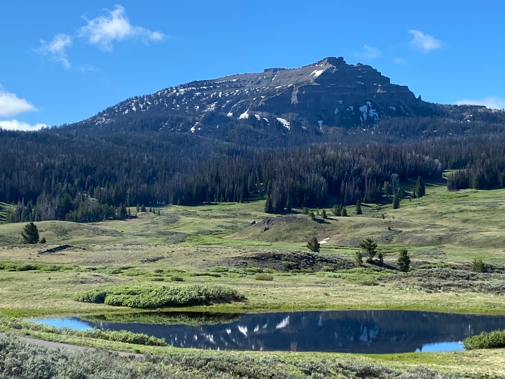
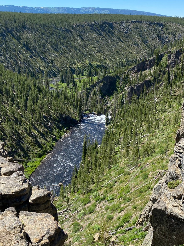
I continued driving north up to the entrance to Yellowstone. For a while after entering the Park the road runs alongside the Snake River, then the Lewis River. This is a deep gorge down to the Lewis River located just off the highway:
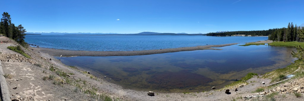
I finally reached an area called West Thumb, which is a thumb-shaped extension of Yellowstone Lake. At Grant Village I turned right and drove north along the west shore of the lake.
The “smoke” you see is actually from gases released by the Thumb Geyser, one of many in the area. This is a panoramic photo of Yellowstone Lake, without the geyser:
I continued north on Route 20 and could soon see Avalanche Peak, and possibly Silvertip Peak, across the lake:
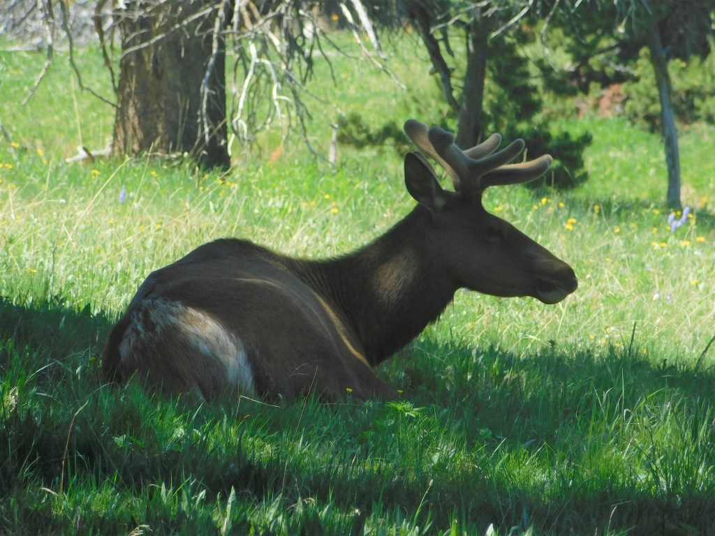
My goal was to continue north to Canyon Village and, from there, hike the short distance to a magnificent waterfall which I had been too lazy to hike to before. Unfortunately my plan was soon thwarted by traffic coming to a halt behind a seemingly miles long line of vehicles. This had happened to me in this same area before, 4 years ago, when a huge herd of bison crossed Route 20 bringing traffic to a standstill. Rangers were there to ensure than tourists didn’t get too close or harass the bison in any way. They basically let the bison do whatever the bison want to do (since this is their domain, after all) so there was no telling how long this stoppage might last. I only had a limited time so I finally decided to turn around and retreat. As I was driving south on Route 20 I saw some vehicles stopped and people out walking around so I figured it must be an animal sighting. Sure enough, this young bull elk was resting in the shade just off the road:
I drove to Old Faithful to access the status of a bridge construction project there, and to determine the effect it might have on our visit to the Park later in the week. I ended up meeting my friend, Max, there on Friday and so I was able to give him specific instructions on how to get there and where to park. When I saw how many people were at Old Faithful I decided against driving further northwest to get to the Grand Prismatic Spring, my other “short list” project, and headed back to Lander. – both daily goals unfulfilled. It was still a lovely day and I was glad I did it.
I did stop in Dubois at the “Cowboy Cafe,” a very popular restaurant known for their homemade pies. It did not disappoint, and if I hadn’t known that I had a yummy teriyaki-marinated tuna steak dinner with all the fixin’s (and it really was yummy!) waiting for me in Lander I would have eaten dinner there too, as I was there at 5pm and what everyone else was having looked really good.
Oh, and one more thing about Yellowstone Lake – in researching this post I discovered that there is a “shipwreck” in the lake! That’s actually not an accurate term given the circumstances, but back in the early 1900’s a man started a “ferryboat” operation on the lake, carrying tourists around to see the sights from the water. He built an even larger vessel, the E.C. Waters, which could carry 500 passengers, much to the dismay of Park authorities. They wouldn’t license it as a passenger ferry so he abandoned it at Stevenson Island. Years later it was driven aground and some wreckage can still be found there.