After I completed my house-sitting obligation in Lander WY in late June, I set off on a tour of several western states. The day after my house-sitting host returned home from her trip I drove north, to Yellowstone National Park, to meet up with my friend, Max, who was in the midst of his own month-long trip through the western US.
We arranged to meet at Old Faithful at 11am and for the rest of the day I drove him around various parts of the Park since I had been there several times and this was his first visit. He had arrived at the Park the day before and was able to get a sneak-preview of some of the attractions on his own. He, too, had been traveling alone and I thought it would be nice to give him a break from driving for a day and let him enjoy the scenery. Once we finished making our “rounds” we each drove to our respective Airbnb’s in St. Anthony, Idaho, located south of the western entrance to Yellowstone. The next day he went east, towards South Dakota, to continue his journey and I went deeper west into Idaho, to continue mine.
I drove south, to Idaho Falls, then west on Route 20, towards the little town of Arco, which I had visited in 2017. Along the way I spotted this sign, which I had missed on my first trip through this part of Idaho:
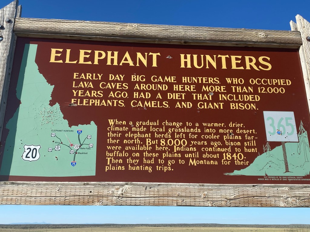
Evidently elephants and camels once roamed these parts, in addition to bison, until a change in the environment drove them further north.
Further west I saw this sign in a rest stop as I approached Arco.
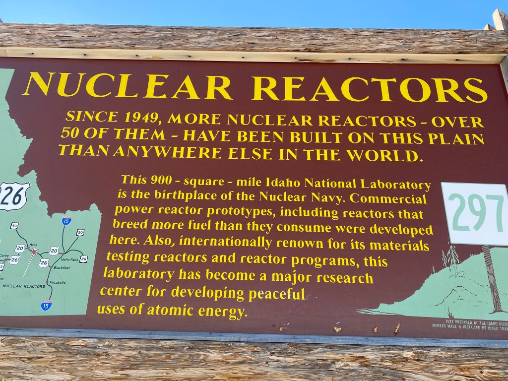
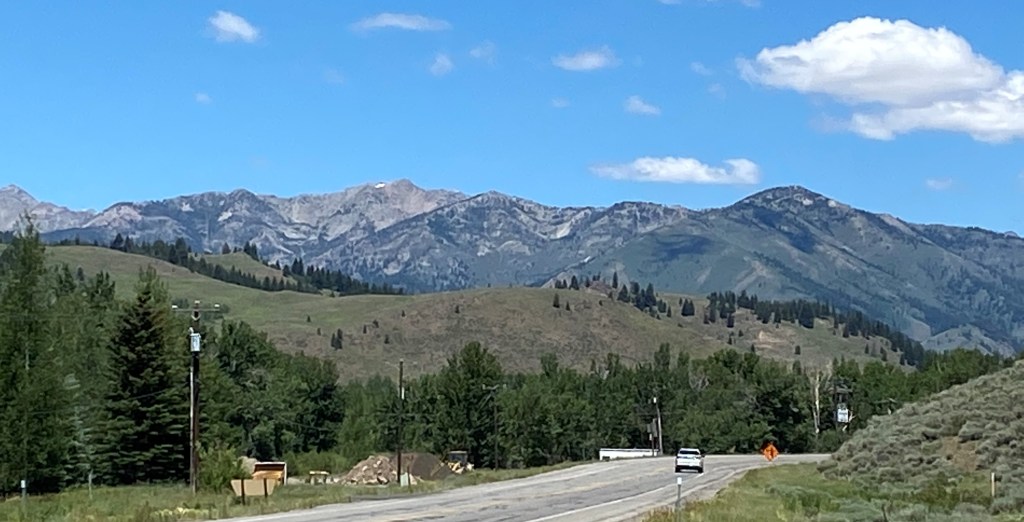
A reminder that this part of Idaho was key in the development of nuclear energy in this country. It still hosts the Idaho National Laboratory, a huge complex which is off-limits to tourists. A smaller facility nearby, which I had toured several years ago, was closed due to COVID. I continued west, past Arco and past the Craters of the Moon National Monument, which I had stopped at briefly in 2017. When I reached Route 75 I turned right and headed north to cover some new territory – namely a scenic route which would take me past the Sun Valley ski resort and up into some of the mountains which make up part of the Sawtooth National Recreation Area.
The landscape quickly changed from relatively flat, open desert-like space and farmland to grass-covered fields and tree-covered mountains. As I started to gain altitude I was able to open the windows and sunroof as the temperatures dropped into the 70’s. I didn’t know it at the time but this would be the last of the pleasant temperatures for a while as I was about to attract the “heat dome” which had been plaguing the southwest US and apparently decided it might be fun to head north and follow ol’ JohnBoy around for a while…
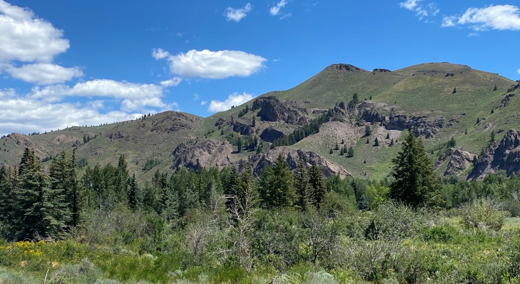
After I passed the little towns around the Sun Valley resort I worked my way up to the Galena Pass.
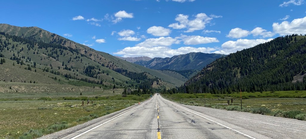
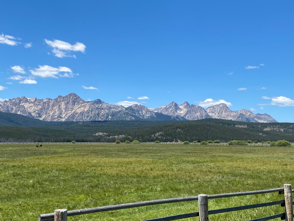
Galena Peak would soon be on my right. It tops out at a little over 11,150 feet:

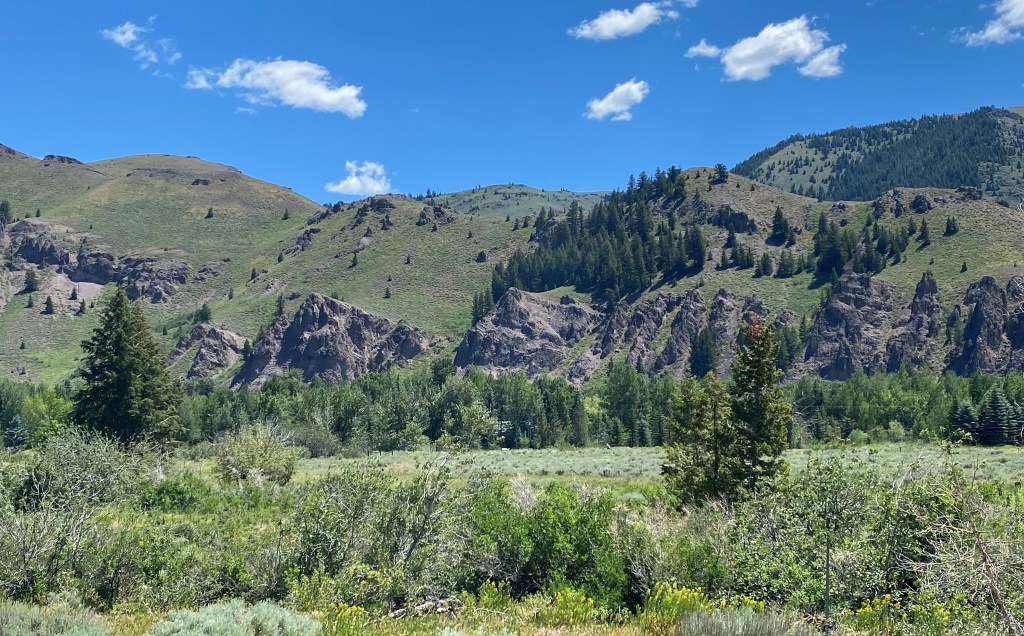
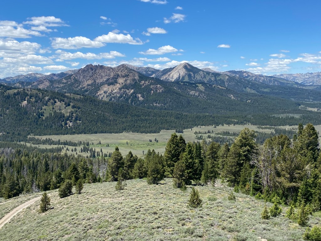
The road I was on would traverse Galena Pass, where I would reach an elevation of about 8,700 feet. This was the view looking back as I approached the summit:
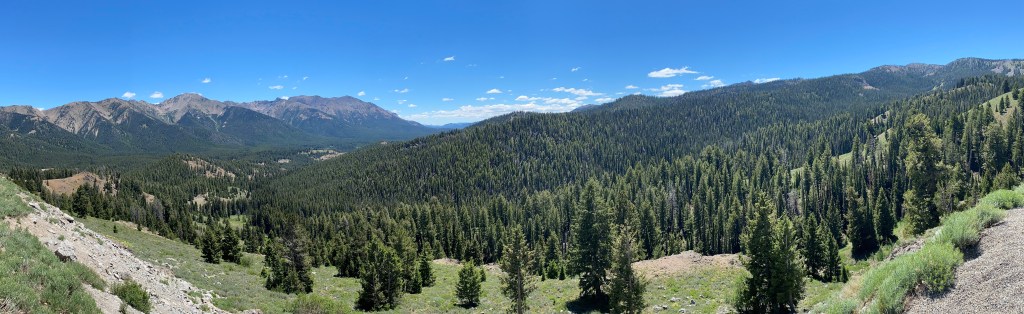
I would soon come to an overlook which would give me a sweeping view of the valley into which I was about to drive as I continued northwest towards the town of Stanley. This is a three-shot panorama looking ahead, from left to right. In the third shot you will see the road I was on extending out into the valley below, with even more mountains off in the distance.
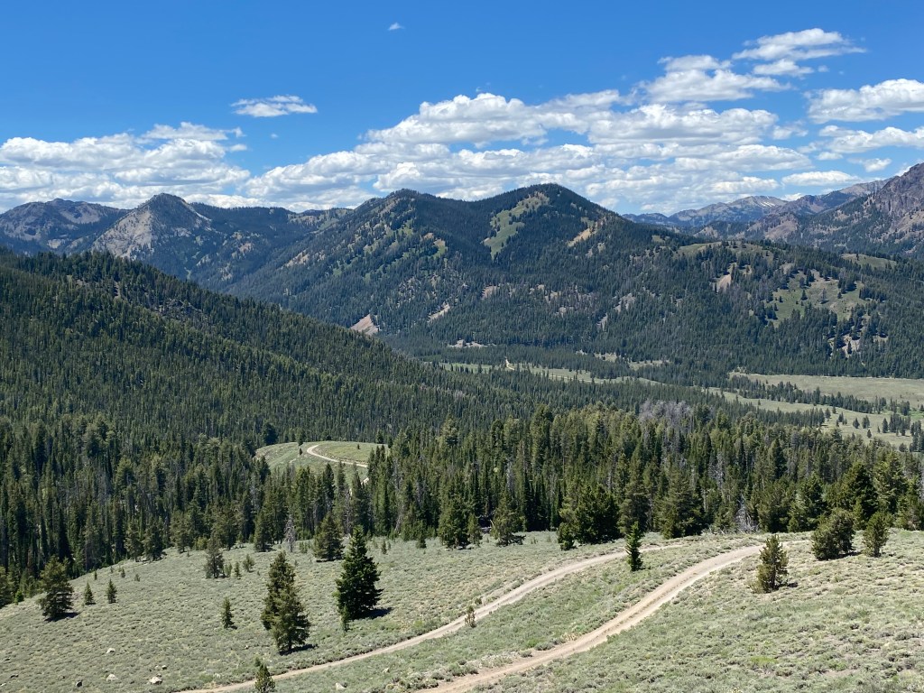
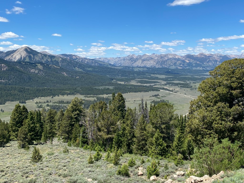
And this is the view of some of the mountains off to my left once I got all the way down into the valley.

I continued on, past Stanley and the road turned southwest before taking me over to Route 55 which I would then take south to my one-night stop in the little town of Horseshoe Bend, where I would spend the night at an unusual (for me) Airbnb.
