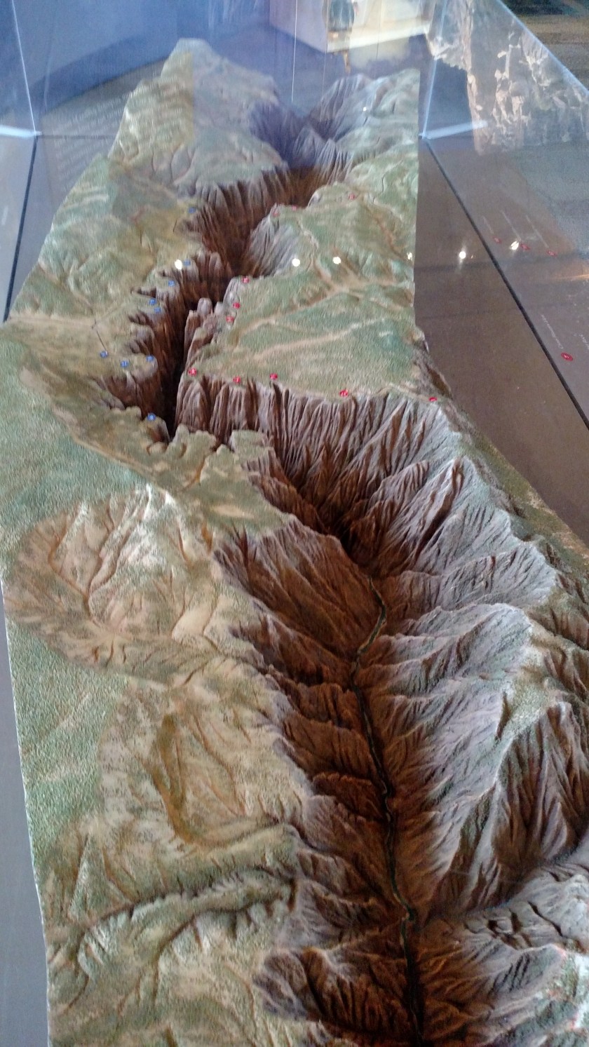
Wednesday I spent much of the day in Black Canyon of the Gunnison National Park. On Tuesday I learned that there are actually two entrances – North and South. I first popped in the South Rim entrance to get a map and take some pictures of the three-dimensional model they have there. I was on that side briefly last year (see posts on September 5, 2017) but felt I had to come back and spend more time here.
The red dots on the model represent overlooks and other landmarks on the South Rim. The blue dots represent overlooks and other landmarks on the North Rim. The Visitor Center (where I took these) in on the South Rim. After taking these initial pictures I traveled over to the North Rim where I spent most of the afternoon. It takes over two hours to get from one side to the other.

This a view of the model looking from the end. I believe I read that the distance from one end to the other (scenic overlooks, accessible by car) is about 12 miles. The Canyon is longer than that but other areas are only accessible my hiking.
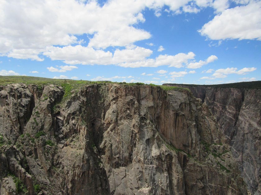
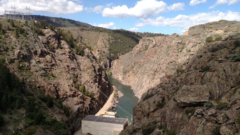
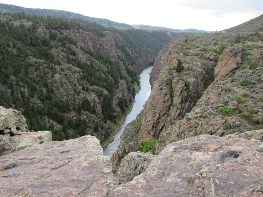
There were 6 overlooks on the North Rim. The vertical drop to the river from the second one I stopped at (The Narrows) is approximately 1,750 feet. And believe me – if you climbed over the safety fence at the overlook you are going approximately 1,750 feet STRAIGHT DOWN.
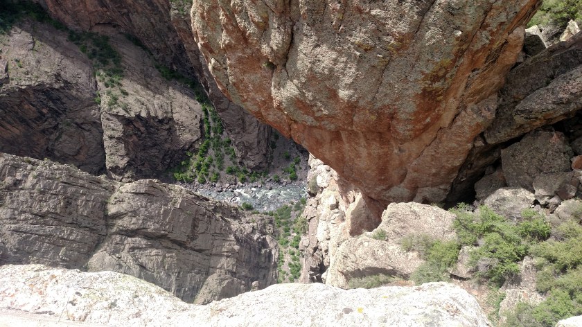
As I took that picture I was thinking “please don’t drop the phone, please don’t drop the phone, please don’t drop the phone…..”
The largest vertical drop in the Park is around 2,700 feet at Warner Point, accessible only by hiking (hence – no photos!).
Black Canyon got it’s name because at some points it is so narrow that certain spots only get 33 minutes of direct sunlight per day. Because of shadows, and when there are clouds overhead, the rock walls appear to be very dark in color. Someone was quoted as saying that “No other canyon combines the depth, narrowness, and sheerness of Black Canyon”.
The Gunnison River drops an average of 95 feet per mile while traversing the Canyon. It one spot, close to the “vertical drop” picture above, the river drops 48o feet in just a two-mile stretch. This gives the river “cutting power” to push downward faster than erosion can widen it.
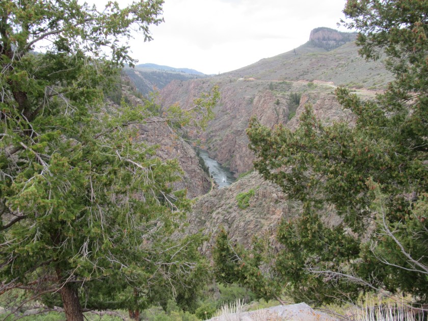
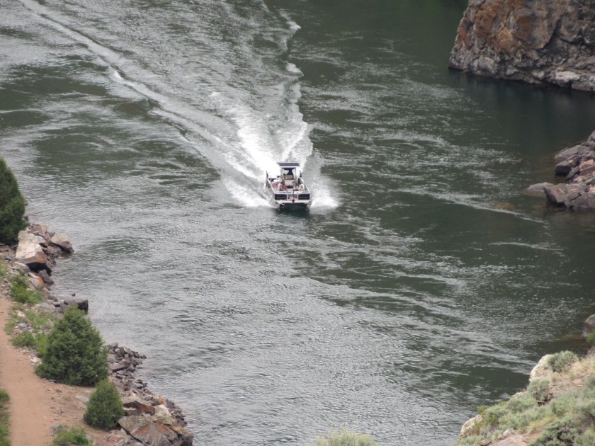
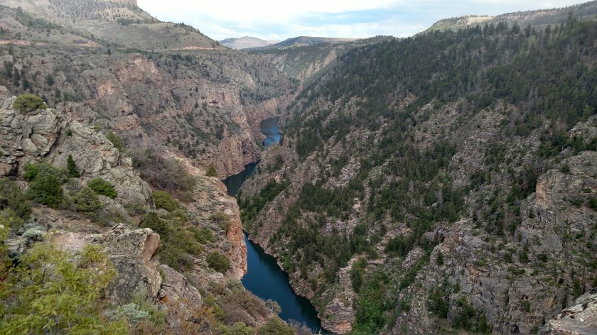
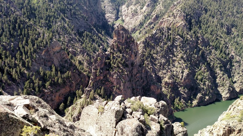
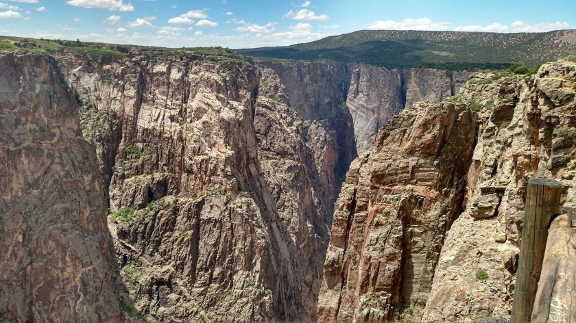
Here are a few pictures I took Wednesday from the North Rim overlooks. I tried to pick the best ones and may post more later after I review them again. I will be spending the day Thursday on the South Rim and will post more pictures from that vantage point (see also the September 5, 2017 posts from when I was here last year).

In the photo above, the river approaches from the left and curves to the left about 3/4 of the way toward the right of the picture. In other words, if I were further to the right you’d be looking out through that part of the Canyon.


I’ll have to go through my pictures and post more. It is hard to grasp just how deep and narrow the Canyon is at some spots. The pictures really don’t do it justice. There is nothing like seeing it with your own eyes. After I took pictures I just stood and looked at the scenery and watched the birds and lizards. When I got home I was kind of bummed that the photos just don’t convey what I actually saw.
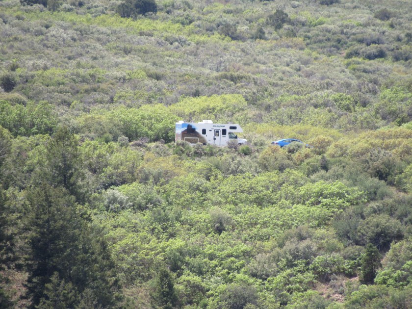
It was also interesting to note that I probably only saw about a dozen cars driving around to the overlooks on the North Rim whereas I saw a dozen cars just in the parking lot at the Visitor Center on the South Rim. The South Rim gets far more traffic because it is easier to get to. I also expect business to pick up this weekend now that Memorial Day is upon us….