Travel Day

No photo.

Today (Saturday) is a travel day when I leave where I have been staying all week in Sonora, California and head up towards Reno, Nevada.  Although Reno is northeast of Sonora I am actually driving north on the continuation of Route 49 and will turn east when I get further north than Reno and loop back.  Route 49 is the “Gold Rush Trail”.

Sonora is in the heart of Gold Rush country.  Gold was discovered in this area back in 1849 and triggered a huge influx of people who hoped to literally strike it rich.  In fact, many of the businesses in the Sonora area include the term “Mother Lode” in their name.  The area is rich (pun intended) in gold mining history.  The people who came to this area became known as “49ers” (because of the discovery year) and the Trail was designated as California Route 49.  I now know why the San Francisco 49ers football team is called that, and why gold is part of their team’s color scheme.

Today I will be heading north of Sonora through the towns of Angels Camp, San Andreas (don’t ever try to blame anything on the people who live there, as they’ll say it’s never their fault.  Get it??  San Andreas??  Fault??) and Jackson, which I have been through already, and continue on through Plymouth, Placerville, Auburn and Nevada City before arching over to the east to where the road ends in little Vinton.  I will then double back a short ways and take another scenic road south to the dreaded interstate west of Reno and head east into Nevada.

Although I have plans to do several things while I’m up in that area for three days I will hopefully have some time (and a faster internet connection) to try and get caught up on some picture posting.

Calaveras Big Trees State Park

Last Sunday, my first full day in this area, I decided to forego returning to Yosemite National Park because it was so crazy the day before (the 3rd Saturday in June) and instead drove on two of the beautiful scenic roads north of where I am staying in Sonora.  There are actually three such roads, Routes 88, 4 and 108, each about 80 miles in length.  I would drive all three at least twice during the coming week, and will post pictures of some of the beautiful things I saw in subsequent posts.

This post focuses on one destination which is located along Route 4, just north of the little town of Arnold, California.  Although I had just been to see some Giant Sequoias a week ago when I was staying in Visalia, this Park was still impressive.

This is what’s left of the Discovery Tree, a Giant Sequoia which fell in 1853 – and took 3 weeks to cut up and remove (with the technology available at that time).  The cut surface, where the man is standing, is so big it once served as a dance floor!

IMG_20180624_122109010

IMG_20180624_122121053

Here is a portion of the trunk.  If you look closely you’ll see a young child on the far right.

IMG_20180624_122140329_HDR

And believe it or not, this is all the bigger a cone of a Giant Sequoia is:

IMG_20180624_122211452

IMG_20180624_122216895

According to the information in the Visitor Center, these cones only grow to be 1.5 to 3 inches in length.  Unlike most pine cones, these are “closed” and require intense heat from a fire to open and release the seeds inside.

On the other hand (actually still in my left hand but you know what I mean – Eric) this is the cone of a Sugar Pine which can grow to 22 inches in length:

IMG_20180624_122316163

IMG_20180624_122322344

El Capitan – Morning Pictures

These were taken Monday and Wednesday mornings using my smartphone camera.

The “nose” of El Capitan faces south so the southwest exposure is shaded in the morning:

IMG_20180625_084930397_HDR

As I move further east along the one-way road leading in to the Valley I start to see more of the southeast exposure (to the right of the “nose” from this vantage point).  It was also hard to position myself to get clear shots looking through the trees.

IMG_20180625_085804909_HDR

IMG_20180627_093505261

IMG_20180627_093521443

IMG_20180627_094622440_HDR

You will see slightly closer, slightly fuller views of the southeast exposure in the early afternoon pictures in the next post.

El Capitan – Afternoon Pictures

These were all taken Wednesday afternoon using my smartphone camera.  I will be posting pictures taken with the digital camera later.

The “nose” of El Capitan faces south so pictures in the morning highlight the southeastern face of the formation.  These were taken in the afternoon, so the first two (taken around 2 o’clock) have both the southeast (right side of photo) and southwest (left side of photo) getting sunshine.

IMG_20180627_140605427

IMG_20180627_140700225

These next shots were taken around 230 pm so as the sun moves west across the sky the southeast exposure falls into shade.

IMG_20180627_143754778

IMG_20180627_143950711

Here is a three-shot panorama, top to bottom, of the southwest face which is now getting more direct sunlight:

IMG_20180627_144014548

IMG_20180627_144017743

IMG_20180627_144020796

And before leaving the Park for the day, here are the final two pictures, taken around 5 o’clock.

IMG_20180627_165116512

IMG_20180627_165647808


Half Dome – Morning Pictures

This post contains pictures taken Wednesday morning.  You may want to print a map of Yosemite Valley to follow along at home with the references I will be making in this post and the next one (Half Dome – Afternoon Pictures).  To print the map, Google “NPS Yosemite Map” then click on “Official Map for Yosemite Valley”.

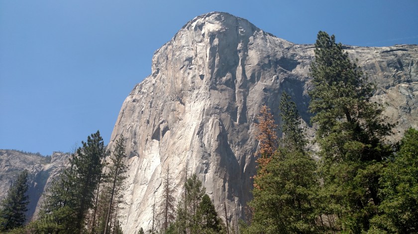
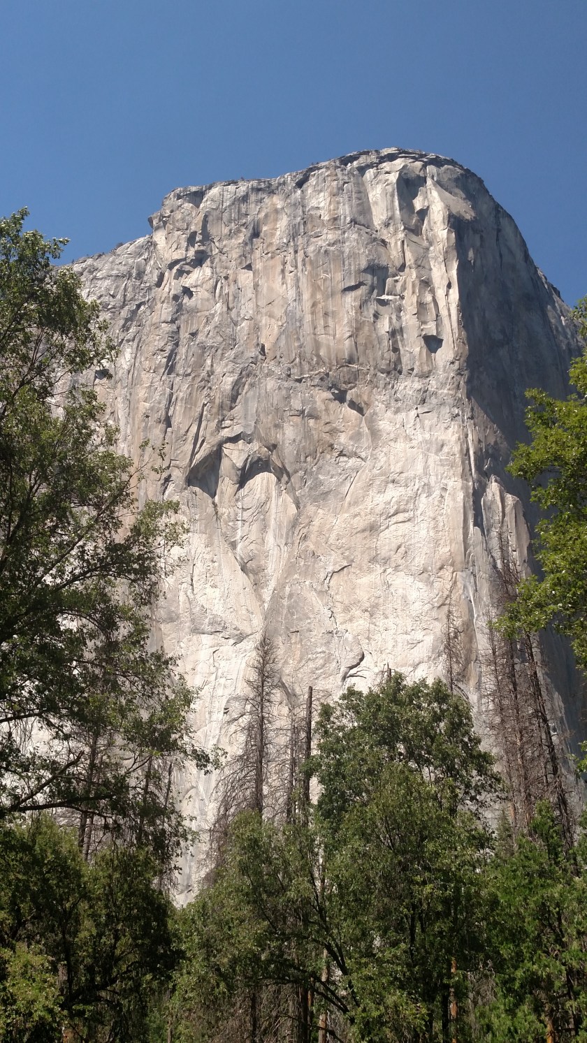
But before I post Wednesday’s photos let me revisit the first picture I posted of Yosemite which I took from the Tunnel View vantage point.  This was taken Saturday afternoon around 230 but I want to use it to put distances in perspective.

IMG_20180623_143633632

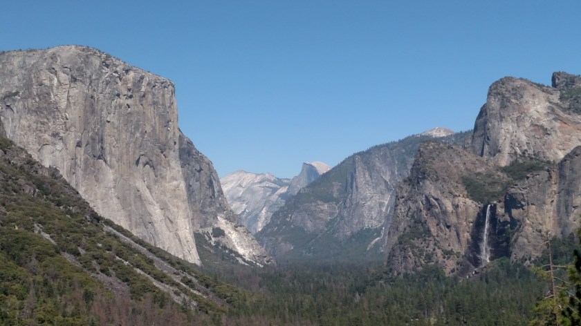
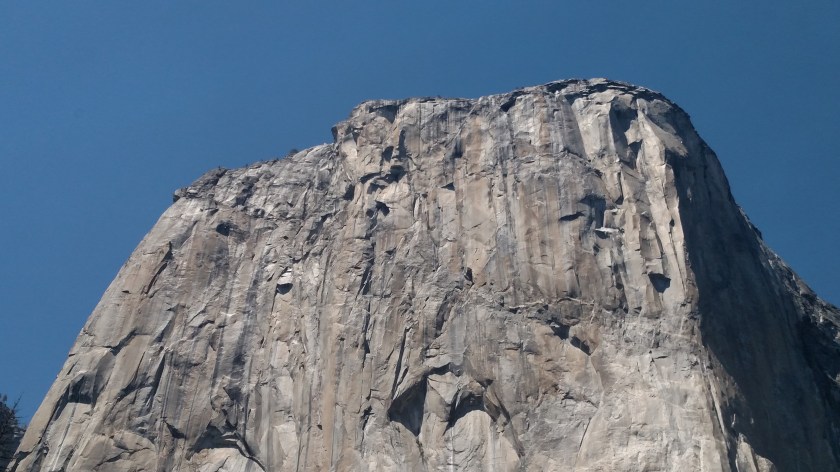
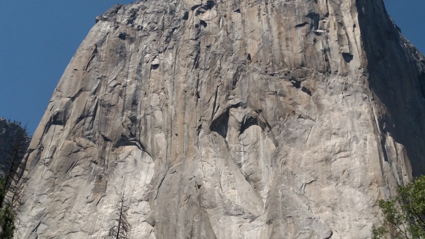
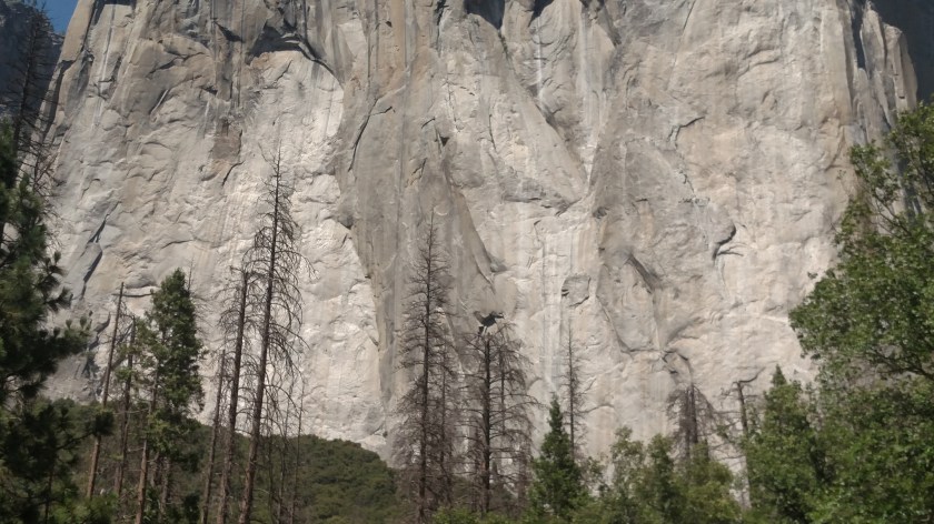
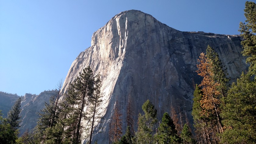
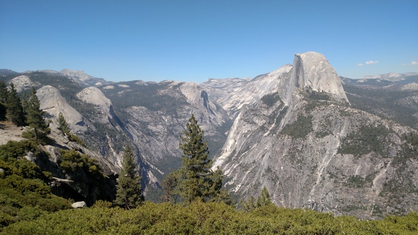
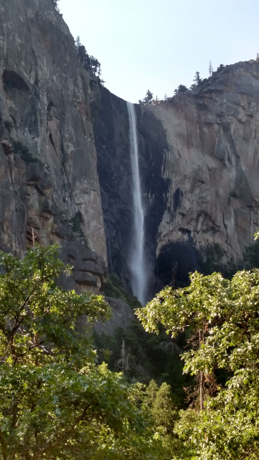
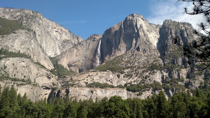
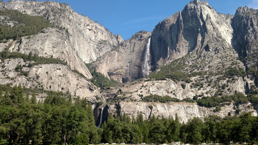
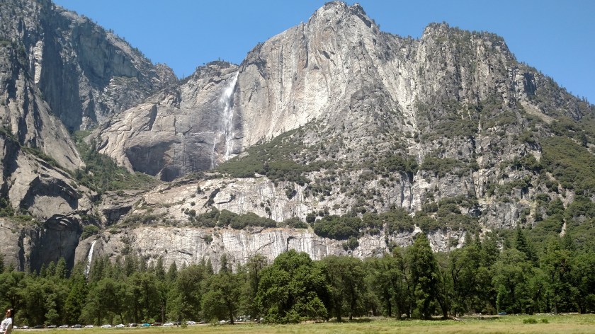
In the photo above, Bridal Veil Fall (on the right) is only about 2 1/3 miles away as the crow flies.  El Capitan (on the left) is about 3 1/2 miles away and Half Dome (in the center) is a whopping 9 1/2 miles away – well beyond the Yosemite Valley.

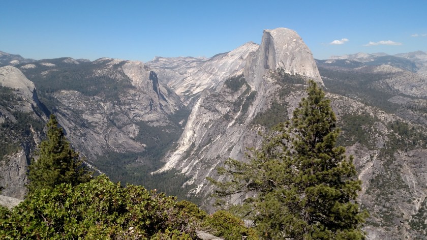
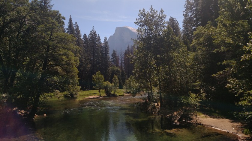
I didn’t go deep enough into the Valley on Saturday to see Half Dome again.  On Monday, when I was riding the Shuttle Bus around the Valley, I learned that I could see Half Dome from the middle of the Sentinel Bridge, though I never returned there that day to get any pictures.  Well the next picture is from that bridge on Wednesday morning, around 1030.  The sun is still behind Half Dome so you can’t see it very well because of the fact I was shooting from sunlight into shadows, but at least it gives you a slightly closer look.  Half Dome is now about 4 miles away.  I will be posting pictures taken with the digital camera later.

IMG_20180627_102712847

These next two shots are taken from the area around Mirror Lake, which is the closest I ever got to Half Dome.  For me, Mirror Lake was a big disappointment.  On Monday I got off the bus at the Mirror Lake stop when the driver said it was an easy hike of about a mile with not much elevation change, which in my opinion was wrong and wrong.  It is actually about a mile and a quarter (and not being a hiker that added a half mile to the round trip) and it started off easy and relatively flat but became rocky and steeper, about 100 feet of elevation change and, again, for “not in very good shape” JohnBoy, now walking at 4,000 feet elevation, that was more than I was expecting.  Well, when I got up there I learned much to my dismay that I was on the wrong side of the damn lake to get the “mirror” effect of seeing Half Dome in the lake’s reflection!  There was no way to get to the other side other than to go way around (and I mean WAY around) on that trail, or go back down and walk back up on the other side.  I can’t believe they don’t tell you which way to go to see the reflection when you get off the bus.

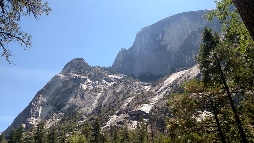
This is a small lake I got to just before Mirror Lake.  Wednesday, having learned from my mistake on Monday, I walked up the PAVED ROAD on the west side of Tenaya Creek which ends with a short, level trail which put me on the correct side for seeing reflections.  Well, kinda sortof.

IMG_20180627_114208061

Here is a shot looking up at Half Dome from the little lake shown above (it had another name on the sign up there but I don’t remember what it was and can’t seem to find it online).  Mirror Lake itself is supposedly just beyond this one.  From the vantage point of the photo above Half Dome can now be seen by looking up and to the right.  It is still over a mile away and you are looking up (into the midday sun) from around 4,000 feet elevation near the lake toward the 8,836 foot peak.

IMG_20180627_115257933

Well, we (I had joined a group of fellow travelers for my walk up to the lake, and I told everyone getting off the bus to take the road, NOT the trail closest to the bus stop) started walking further back to see the reflection in the “real” Mirror Lake only to be told that the Park’s new credo is to let nature take it’s course and rather than maintaining the much touted Mirror Lake as a lake they are letting it drain and return to being a meadow through which Tenaya Creek will run, in effect, undammed.  So no reflection today for Mr. “I walked up here twice and I’m not doing it again” JohnBoy.

You’ll see more pictures of Half Dome, taken in the afternoon, in the next post.


Half Dome – Afternoon Pictures

These first two photos were taken Wednesday afternoon from Sentinel Bridge with the Merced River in the foreground, in the heart of the Yosemite Valley.  The sun had now moved far enough west in the sky to start illuminating the flat portion of Half Dome.  From the bridge Half Dome is about 4 miles due east.

IMG_20180627_134826058

IMG_20180627_134908102

These next 4 photos were taken from Glacier Point.  Getting there takes about an hour from the Valley floor and involves driving west then south on Route 41, the road I came in to the Park on initially last Saturday, then driving up another road to where it ends at the Point.  Glacier Point is at 7,214 feet elevation and you are now looking East/Northeast at Half Dome which tops out at 8,836 feet.  These 4 pictures were taken within about 6 minutes of each other, all with the smartphone camera, zoomed in a little bit more each shot. From this vantage point Half Dome is about 3 1/4 miles away as the crow flies.

IMG_20180627_153500574

IMG_20180627_154058003

IMG_20180627_153524001

IMG_20180627_154110516

And this last photo is from Washburn Point as I started driving back down Glacier Point Road, and really illustrates how Half Dome got it’s name.  You are now look Northeast at Half Dome which is about 3 2/3 miles away.

IMG_20180627_160021720

‘Tis the season…

No photos (and hopefully none forthcoming).

Wildfires are starting to appear on the maps and I will be keeping a close eye on them. There is one right now in the Ansel Adams Wilderness, on the opposite side of Yosemite from where I am. There is also the Pawnee Fire up near Ukiah CA, where I have an Airbnb reservation in about two weeks (although right now it isn’t very close to town). It started only a few days ago and is already over 13,000 acres. It is being shown on the news and the Weather Channel because it has grown so quickly and has already destroyed numerous structures.

I see CalFire, Forest Service and Park Service fire trucks everywhere (not firetrucks like you would see in your home town but pickup or utility trucks owned by those agencies), and when I have been driving on the three scenic routes just north of where I am staying I often see Rangers at overlooks, from which you can see across wide areas, scanning the landscape with binoculars.

I will be closer to the coast after I leave here, except when I go to northeastern California to visit Lassen Volcanic National Park although, as the people who live near the coast near Montecito CA will tell you, that doesn’t guarantee you are immune from the fire danger.

And with the upcoming July 4 holiday looming there are signs everywhere advising that fireworks are not legal and should not be used EVER.

More Yosemite Pictures Tomorrow

No photos (yet!)

I have LOTS more El Capitan and Half Dome pictures to share but my internet connection this week is very slow and it is taking forever to upload pictures to the blog (even in the wee hours of the morning local time).  I’m going back to bed as I have another very busy day today.  I will post the additional pictures Friday morning.

Bridal Veil Fall (Yosemite)

Here are two more photos of Bridal Veil Fall.  It is in the Cathedral Mountains and is the first attraction you get to when you enter the Park from the west.  It has a vertical drop of 620 feet.

IMG_20180623_144730103

IMG_20180625_084527580_HDR

Upper & Lower Yosemite Falls

Many of the attractions, and the two big hotels, at Yosemite National Park are located in the dead-end Yosemite Valley.  I didn’t venture into the Valley when I arrived in the area on Saturday because of signs warning of up to 3 hour delays driving in and out (it was the 3rd Saturday of June, after all, and I had already sat in line for an hour and a half just to get in the main entry gate).  In addition to the three popular attractions I have discussed earlier (El Capitan, Half Dome and Bridal Veil Fall) another big hit with tourists are these two Falls, located deep in the Valley.  Upper Yosemite Fall is at 5,404 feet elevation and has a vertical drop of 1,430 feet – the largest in the Park.  Lower Yosemite Fall (which you can see in the lower left hand corner of several of these photos) has a vertical drop of 320 feet.  There are what are called the Middle Cascades between them which drop 675 feet for a combined 2,425 foot drop.

Here are photos taken at various times on Monday and Wednesday:

IMG_20180625_093207443_HDR

IMG_20180625_093218881

IMG_20180625_102004531

IMG_20180627_095735584

IMG_20180627_101308444

IMG_20180627_101643340

These were taken Wednesday afternoon at around 145 when the sun was fully hitting the face of the mountain (Yosemite Point, 6,936 feet elevation).

IMG_20180627_134421855

IMG_20180627_134434168