Coos Bay, Oregon

For three nights I have been staying in Glasgow, just north of this town in southwest Oregon.  With a population of just over 16,000, Coos Bay is the largest town on the Oregon coast.  It also has the largest deep-draft coastal harbor in the state.  As I write this there is a huge cargo ship down on the inland portion of the Bay which is loading an incredible amount of logs to be taken somewhere in the world.  The Coos River creates a large bay on the east (inland) side of the city, then bends around on the north side (I have to cross a bridge there to get to where I’m staying) and creates another bay on the west side of town before opening up out into the ocean.  That west bay, between Coos Bay and Charleston is where most of the fishing boats dock.  The two big industries here are fishing and logging.

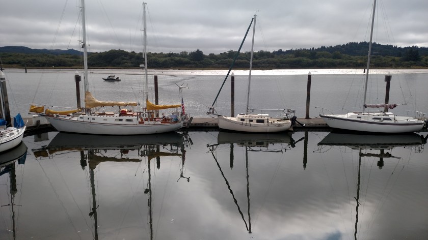
Monday morning I went downtown and spent some time along the boardwalk, which runs along the inland bay.  This is the calmer side where most people dock their pleasure crafts.

IMG_20180730_095049783

IMG_20180730_095101926

IMG_20180730_095107010

IMG_20180730_095553448

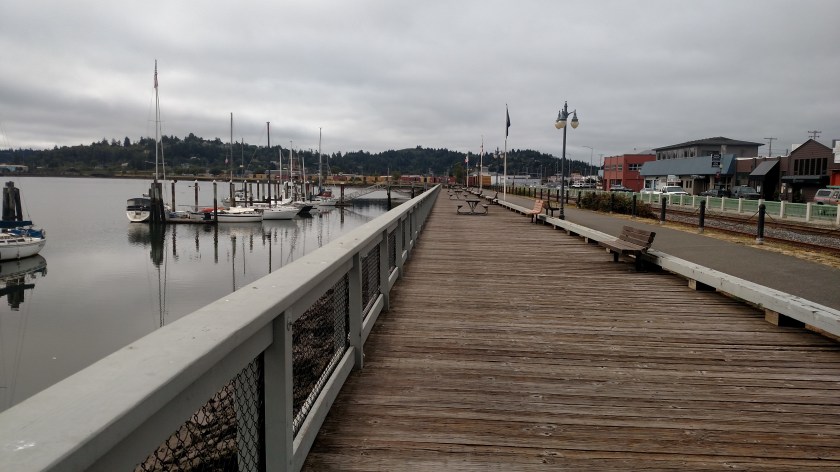
This is a little restaurant which sits right down by the water:

IMG_20180730_095848701_HDR

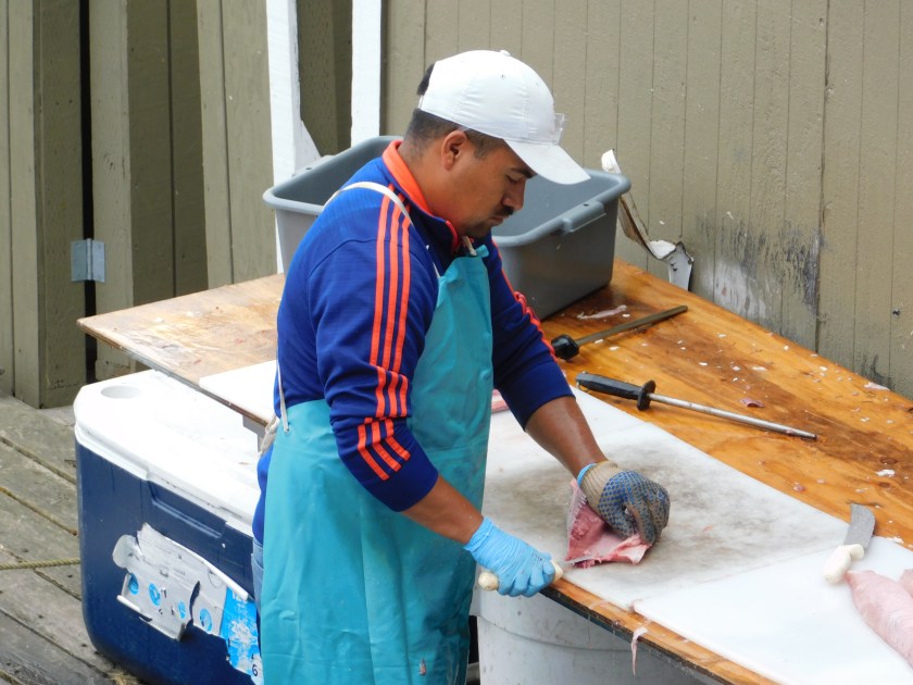
Before they opened at 11 o’clock I could watch this guy skillfully cleaning fish outside the building:

DSCN4776

DSCN4778

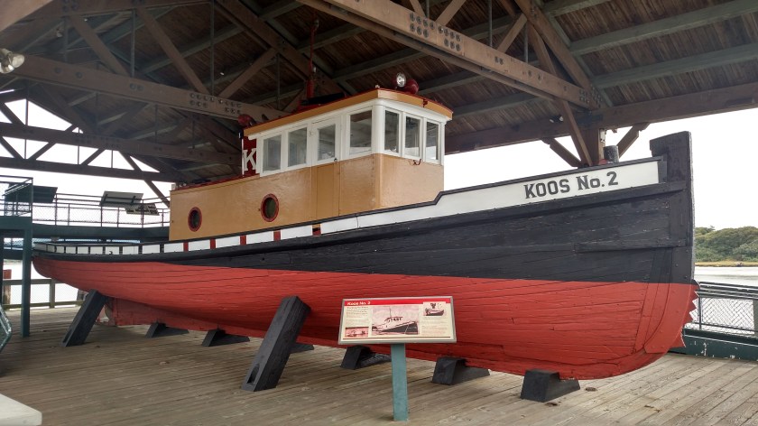
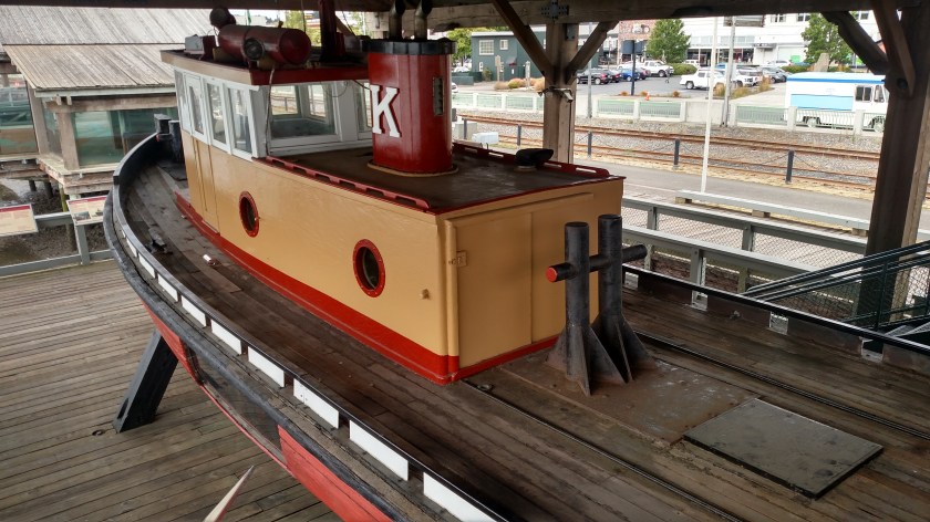
I hung around until they opened and had a bowl of clam chowder.  While I waited I checked out this old, restored tugboat which was on display under cover up along the boardwalk:

IMG_20180730_100234175_HDR

IMG_20180730_100345754_HDR

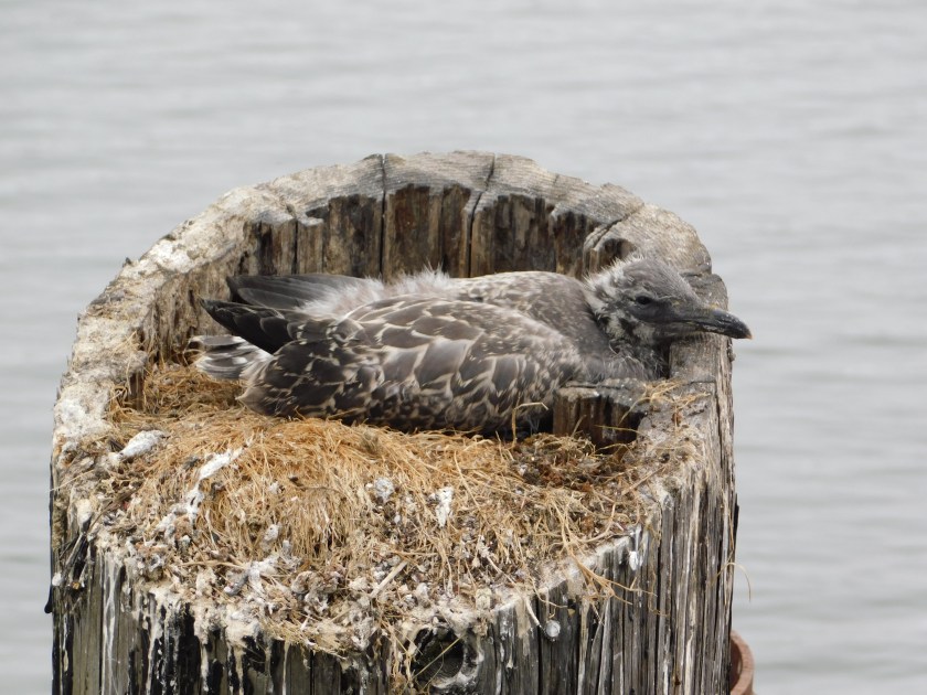
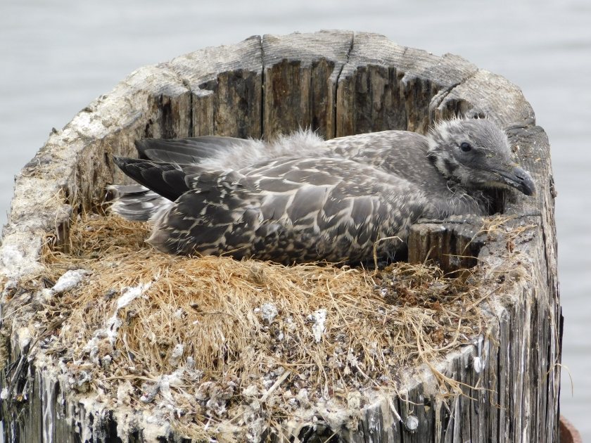
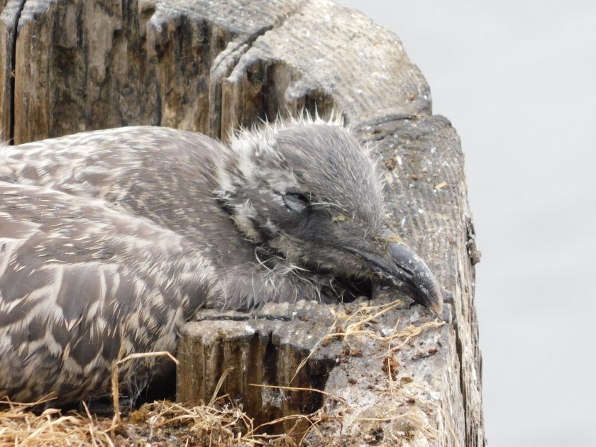
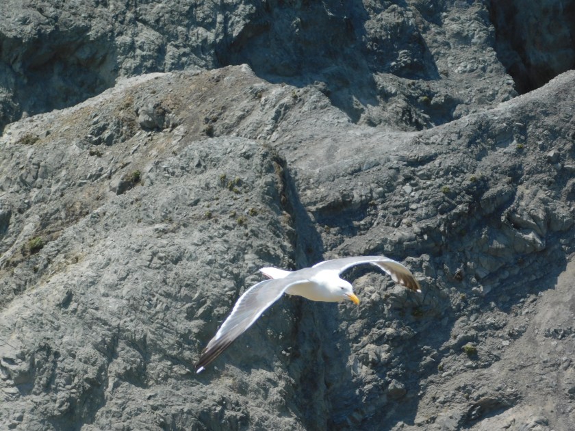
And while I was on the upper platform looking down on the boat I caught these birds out on the posts which support the dock:

DSCN4740

DSCN4745

DSCN4747

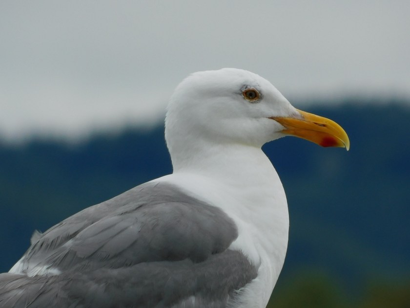
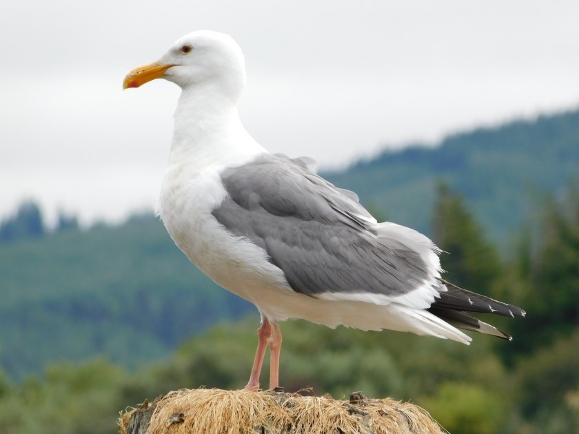
At first I thought this gray bird was lying on eggs but he or she got up at one point to shift positions before taking a siesta and I didn’t see any eggs.

DSCN4750

DSCN4752

DSCN4761

DSCN4769

Simpson Reef

There is a scenic road which takes you south along the coast a few miles from Charleston, Oregon, not far from Coos Bay.  This was the area from which I could view the Cape Arago lighthouse and also has two State Parks, one of which I will be posting pictures from tomorrow.

Along that road is an overlook which allows people to watch and hear the activity out on the rocks offshore.  This is where literally hundreds of seals and sea lions like to play in the water and, more often, nap and “sing” on the rocks.

IMG_20180731_091059992

The photo above was taken Tuesday at low tide, when a much larger area of rocks is exposed and the seals and sea lions were on the rocky areas much further out in the ocean.  The rest of these photos were taken Sunday at high tide when the water came almost all the way up to the mainland and the seals and sea lions were much closer.

DSCN4794

DSCN4795

DSCN4798

DSCN4800

DSCN5324

There are different types of both animals which hang out along this part of the coast and their “barking” goes on non-stop.  It sometimes has a very rhythmic, musical quality to it.  Sea lions are generally smaller in size that seals and the easiest way to tell them apart is how they use their flippers to move around on land.

This seal evidently had barked himself to the point of exhaustion. This sequence of shots were all taken within a minute:

DSCN4806

DSCN4807

DSCN4808

DSCN4809

Face Rock State Scenic Viewpoint

Monday afternoon I returned to this State Park, just south “Old Town” Bandon, Oregon.  The views from atop the beachside cliffs are incredible:

IMG_20180730_140408682

IMG_20180730_140414382

IMG_20180730_140419275

Since it was sunny (it was socked in by coastal fog the day before when I was here) I got another photo of “Cosmo,” a larger than life Tufted Puffin made entirely of litter found along the beach.

IMG_20180730_140555474

IMG_20180730_140623782_HDR

IMG_20180730_140632119_HDR

IMG_20180730_140703851

IMG_20180730_140718313_HDR

There is an organization in Bandon which specializes in making these art pieces out of trash from the beach.  Here is another one I saw downtown:

IMG_20180730_152004390

But let’s go back to the nice ocean views:

IMG_20180730_141058699

IMG_20180730_141149830

Here is a rock formation I’m going to be talking about in the next post:

IMG_20180730_142614243

IMG_20180730_142617853

This was an absolutely gorgeous spot to hang out, even if you never set foot on the sand below.  I preferred standing atop the cliffs watching the seagulls soar by above and, more often, below me along the hill.

DSCN4811

Coast Guard Helicopter

Monday when I went back to the Face Rock Scenic Viewpoint near Bandon, Oregon the visibility was considerably better than it had been the day before:

Sunday at 220pm:

IMG_20180729_141959584

Monday at 204pm:

IMG_20180730_140419275

I was standing out on a cliff at a point close to the ocean, watching the seagulls fly by close to me as they had the day before.  I noticed a red Coast Guard helicopter flying down the coast, maybe a mile out over the ocean – a fairly common sight.  When it got south of the major rock formations it made a wide turn left, towards the beach.

DSCN4856

I presumed it was just turning around to head back north.  I went back to watching the birds but after a minute or so I could still hear it.  I walked north on the hill I was on and saw that it had taken a position low by the water on the opposite side of a big rock formation which had been blocking my view.

The fact that you can see a small part of that formation in this next photo is just due to the alignment of it between me and the helicopter, the heli was probably a quarter mile or more further out over the ocean.

DSCN4861

The chopper was hovering “tail-in” in radio control helicopter pilot-speak, meaning the tail would be facing me if this were one of my models and I were controlling it.  I didn’t see any boats in distress (although there were some floating nearby which could have come to the aid of anyone stranded in the water) so I ultimately decided that this was likely just a training exercise.

Shortly after taking the photo above I could see a diver exit the right side of the aircraft and he or she was ultimately lowered down to the ocean.

DSCN4867

The helicopter hovered where it was for a while, probably only 40 feet above the water.

DSCN4874

After a few minutes the helicopter rose higher and made a slow “orbit” clockwise:

DSCN4883

DSCN4886

DSCN4888

DSCN4893

Then it resumed it’s position hovering above the spot where it had dropped the diver:

DSCN4906

It sat there for a good 20 minutes more, systematically raising and lowering people to the ocean below:

DSCN4937

DSCN4940

DSCN4945

The entire exercise lasted about 45 minutes, at which point the helicopter raised up high and flew north up the coast.