North of Salida

Wednesday I started the day with the intention of driving a scenic loop north of Salida, up towards Buena Vista, Leadville, Vail and Frisco before returning to Salida.  The theme for the day quickly became apparent.  Mountains.  Big ones.

There are 58 mountains taller than 14,000 feet in Colorado, more than in any other state.  The locals call them “14ers”.  Today I saw at least 8 of them (I think I saw lots more than that but there just wasn’t enough room on my map to print all their names!).

From south to north (the order in which I saw them) Shavano 14,229, Antero 14,269, Princeton 14,197, Yale 14,196, Harvard 14,420 (they call this road the Collegiate Byway), LaPlata 14,361, Elbert 14,433 (the highest point in Colorado) and Massive 14,421.

Here are some of them, taken with my smartphone camera (you’ll see some better detail shots when I post close-ups, taken with the digital camera):

IMG_20171004_101019625

IMG_20171004_101027236

IMG_20171004_112421867

IMG_20171004_132834733

IMG_20171004_134228793

IMG_20171004_134243919

IMG_20171004_133809703

IMG_20171004_141930026_HDR

These next two were taken looking down, showing the road as I approached, and started to climb, Independence Pass.

IMG_20171004_150301097_HDR

IMG_20171004_150330414

It turns out I never made it any further north than Independence Pass today.  Thursday I hope to pick up where I left off and finish the loop before heading over to Colorado Springs for 4 more nights there.


Independence Pass – Panorama

As I neared the top of Independence Pass I stopped after making a hard left turn at one of the final switchbacks.  The first photo is from the driver’s seat, looking back towards the switchback itself.  I was parked safely off the road at 11,977 feet (allegedly).

IMG_20171004_151714031

The next picture was taken after I got out of the car and walked back towards the area beyond the curve which, as you will note, has NO GUARDRAIL (a scarily common practice out west).

IMG_20171004_151742920

No need for one.  Just pay attention to the goofy yellow arrows as you drive down off the mountain, trying not to pay attention to the spectacular views, and you’ll be just fine…

Next, I decided to take one of my famous panorama series of pictures.  Normally I would do them all from one spot but here I did move a little bit between some shots to keep those pesky yellow signs out of the pictures (and to dodge cars which were careening off the edge).  The sequence is basically panning left to right, 180 degrees from where it starts.

IMG_20171004_151806590

IMG_20171004_151810960

IMG_20171004_151817609

IMG_20171004_151844452

IMG_20171004_151921638

IMG_20171004_152000341_HDR

IMG_20171004_152004299_HDR


Independence Pass

After taking Route 285 North out of Salida and continuing on Route 24 North past Buena Vista towards Leadville I turned left when I got to Route 82.  This road would take me over Independence Pass, yet another threshold of the Continental Divide (and eventually on to Aspen, Colorado if I had continued on it).  The CD is the ridge which runs in a serpentine manner up the Rocky Mountains.  Water on the west side of the Divide flows towards the Pacific Ocean, whereas water on the east side flows towards the Gulf of Mexico.  I’ve crossed the CD several times during my trip, sometimes more than once a day.

These were all taken at or near the peak of the Continental Divide.  This was around 330pm local time and it was 53 degrees and windy (it was 68 degrees at 9,300 feet before I started the climb).

IMG_20171004_152554023

This lake was on the right side of the road, next to where I parked:

IMG_20171004_152732574

This little pond was behind the sign on the opposite side of the road, where a path lead even higher to a scenic overlook.

IMG_20171004_153022019

IMG_20171004_152903016

IMG_20171004_152841327_HDR

IMG_20171004_152910862

The sign itself tells you the elevation is 12,095 feet.

IMG_20171004_152952240

Which presented me with a dilemma.  I don’t know exactly where they measured the elevation, I would like to think it was at the highest point of this ridge, up where the scenic overlook is or perhaps on the ridge behind the pond behind the sign which may be a tad higher.  Well here I am parked on the opposite side of the road, about level with the sign, and my GPS is telling me I’m at 12,171 feet.  Yet ANOTHER thing my GPS apparently lies to me about.  I’m telling you, her days are numbered….

IMG_20171004_153709661_HDR

I joke about tossing my GPS units out the window when I get frustrated with them.  Well, as tempted as I get sometimes, that’s not true.  Unit #2, the TomTom, is in my trunk, ready to serve as a backup (albeit with maps which are now over 72 months old in her little brain).  And Unit #1, the original Magellan my brother gave me as a Christmas present, is back in Durham.


Buena Vista, Colorado

About 25 miles north of Salida is the little town of Buena Vista.  First of all, let’s get the name straight.  Most times, such as where Disney World in Florida is located, people pronounce it as if the U were a W.  Bwena Vista.  Well, they like to be a little different here in Colorado so they actually pronounce the U as a U, as if you were saying Beauty, or perhaps “Bueller…. Bueller… Bueller…”.  So it’s b-U-na Vista, thank you very much.  A person working in a shop in town told me she believes it is even in the city charter that the founders specifically wanted it to be pronounced that way.

The main street in Buena Vista is really quite charming, with many of the original buildings restored and beautifully painted.

IMG_20171004_102823042

IMG_20171004_102903476

IMG_20171004_102933664

I really like the triangular building above.  A guy came out of it to get something out of his vehicle (it is now home to Blue Tail Technology, a computer repair company) and I commented that I liked it.  He invited me inside to see a picture which had been in the local paper showing what it looked like back in the day.  Note that there was a spiral staircase in front, though it is actually a drawing, not a photograph.

IMG_20171004_103041923

IMG_20171004_103607335_HDR

And the photo below may well be the last photograph ever taken of the Green Parrot Bar sign (the building on the left).  Workers were taking it down as I was driving out of town about a half hour after I took this picture.

IMG_20171004_103835870

IMG_20171004_103931008

And I thought this was a neat idea.  Where a building used to be there is now the “People’s Stage”.  Want to vent about Trump or gun violence in America?  Want to try out your comedy monologue?  Want to play your harmonica for the masses?  Here’s your chance to grab the spotlight…

IMG_20171004_103950647

IMG_20171004_104017170

IMG_20171004_104107844

IMG_20171004_104259614

IMG_20171004_104409685_HDR

IMG_20171004_104522211

And the owner of this vehicle clearly knows where and how to have fun.  I actually found him inside the building this truck was parked in front of.  His name is Brian and he hosts a website which talks about camping, hiking, and other fun things known as “Overlanding”.  You can find it at coloradobackcountryadventures.com.

IMG_20171004_111029817

IMG_20171004_111039278_HDR

IMG_20171004_111052477

IMG_20171004_111107269

Before I die I want to…

While I was in Buena Vista this morning I noticed something in the courtyard of an ice cream shop which I have seen a few times at various places around the country.  A wall full of head-to-toe blackboards with the phrase in the post title pre-written, followed by a blank space.  People use chalk to “fill in the blank”.  I took pictures of all the spaces (as I did in previous spots, I’ll post them eventually as I find them after I get home) but I got some closeups of some of the answers which I thought were particularly poignant.

Some were obviously written by children, or on their behalf.  Miles, age 6, wants to “be a superhero,” for example.  I did not write anything myself – at any of the venues I’ve found in my travels – who am I to judge which one to erase?.  I noticed that someone wrote “see the world” and I guess that’s exactly what I’m doing…..

IMG_20171004_105156080

IMG_20171004_105219553

IMG_20171004_105227722

IMG_20171004_105242115

IMG_20171004_105301161

What would your answer be?

And think about this sign the next time you eat a chicken nugget….  Careful what you wish for.

Durango to Salida

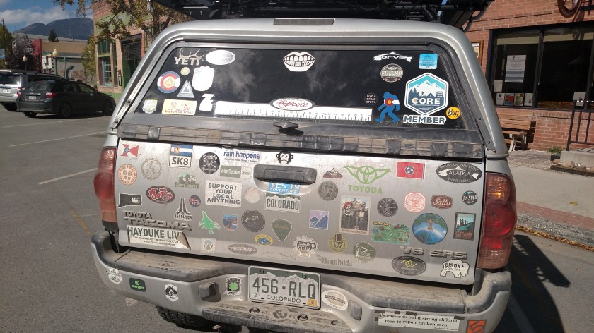
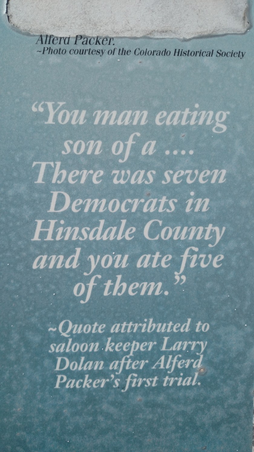
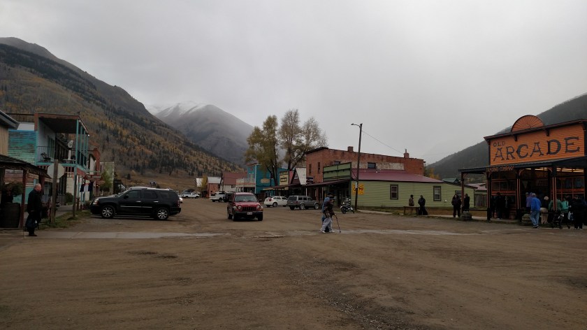
Tuesday was a travel day.  I finally had to say goodbye to Durango and start heading northeast, deeper into Colorado, to my next stop, the little town of Salida (pronounced sa-LIE-da, according to the majority of people I asked, although opinions seem to differ).  A friend of mine told me about this town and I didn’t get to see it when I was in Colorado a little over a month ago so I decided to add it as a destination on my trip addendum.  I’ll be here two nights before continuing on to Colorado Springs for some bonus time there.

To get to Salida I drove east from Durango, past Pagosa Springs to the little town of South Fork.  There I turned left and proceeded north on Route 149, one of my “purple roads”.  My trips are mainly based on scenic roads and I have an old road atlas in which I have highlighted various roads in various colors.  That is how I plan my routes and stopovers.  Orange roads are my primary focus.  They are listed in my National Geographic book of 275 Scenic Roads in America, my “bible”.  Yellow roads are those which are marked as scenic on the state map but aren’t orange.  They get highlighted if they help “connect the dots” or get me to places which sounds interesting.  Purple roads, like Route 149, are listed in a book which my friend Shawn (a frequent blog commenter) saw at a library and told me about.  I bought a copy and it lists some other scenic roads which weren’t already on my radar.  They become “purple roads”.  I was glad that drew my attention to today’s route, otherwise I would have gone a different way and missed most of what you are about to see.

I actually started out with the intent of driving this route the first time I was in Durango about a month ago but that was as part of a loop which would take me back to Durango and when I got to South Fork I learned that if I stuck to Plan A I wouldn’t get back to Durango until quite a bit after dark, so I abandoned that plan.  Today I am going to Salida so driving this road makes perfect sense.  It was a beautiful, clear day and it was a VERY enjoyable trip.  This is why I do what I do…..

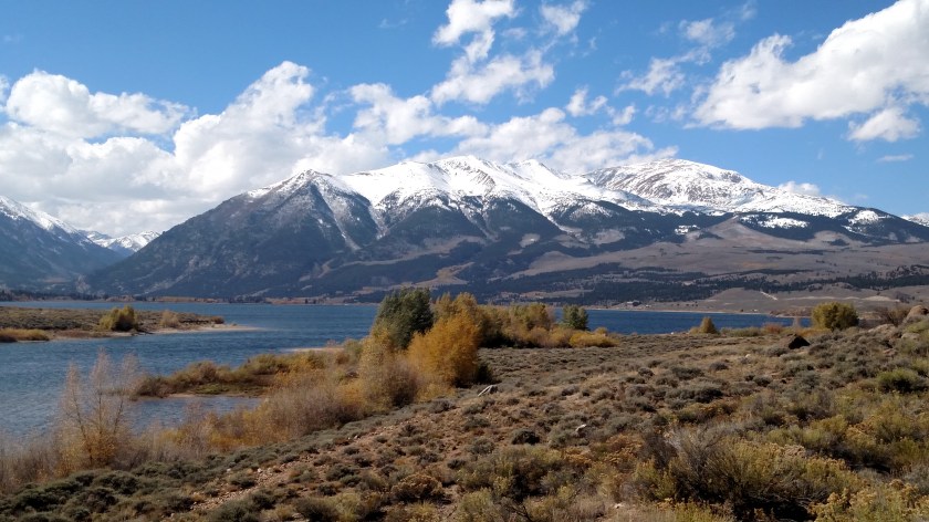
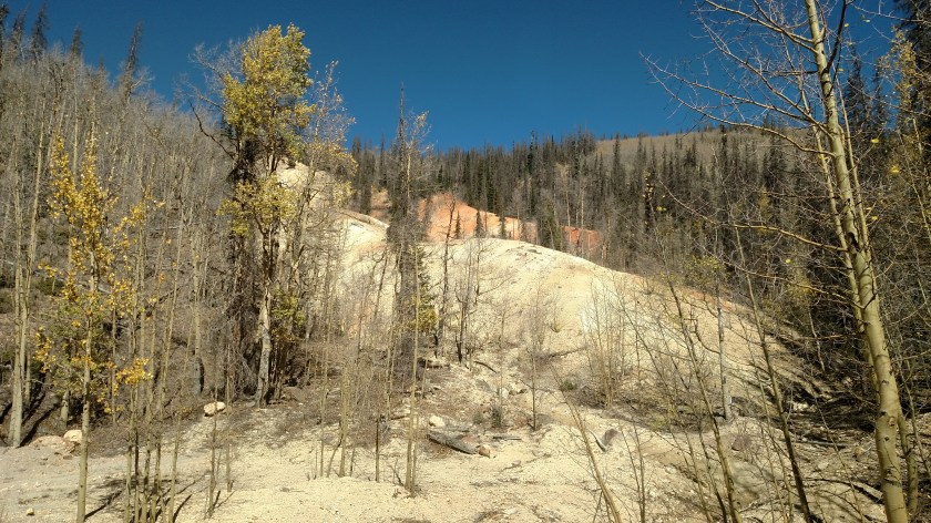
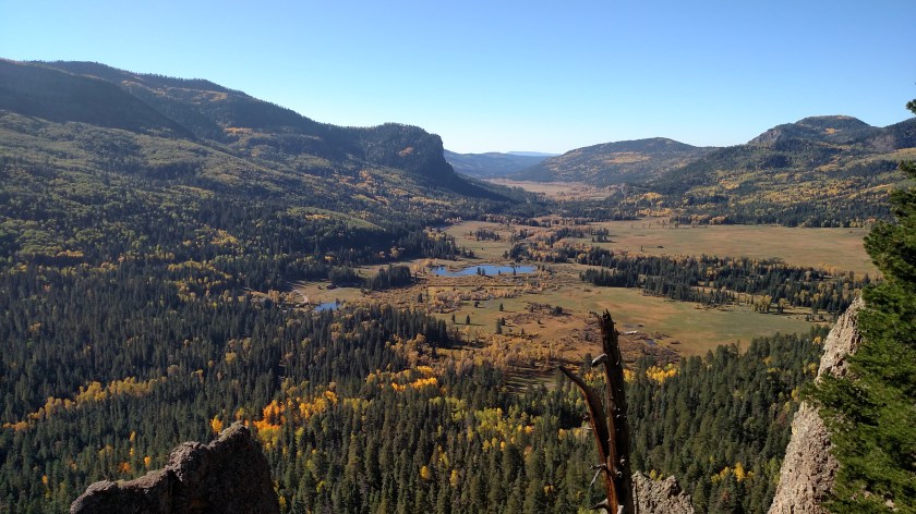
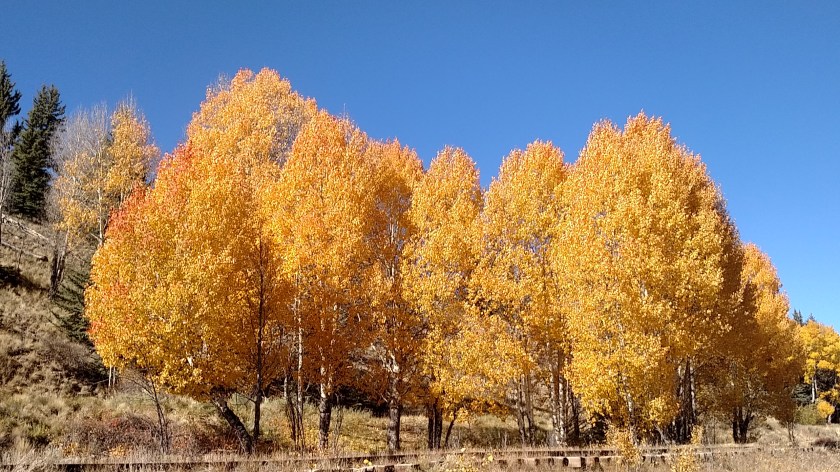
You’ve seen pictures from this overlook before but now there is a little fall color added.

IMG_20171003_093238594

IMG_20171003_104217241

IMG_20171003_113732855

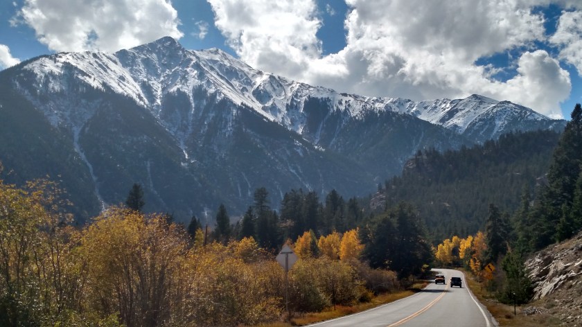
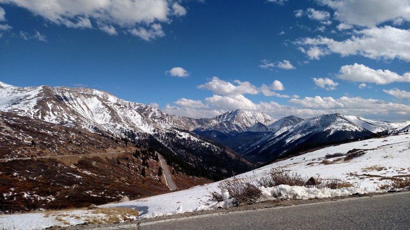
The next picture was taken right after I crossed the Continental Divide for the second time today.

IMG_20171003_115605834

Shortly after taking it I drove through an open area a saw a hawk flying low over a field.  I turned around and went back, with the intent of parking for a while and watching the hawk with my binoculars.  Well, by the time I went back and parked it was gone.  Evidently it caught it’s prey and went off to have a nice picnic lunch.

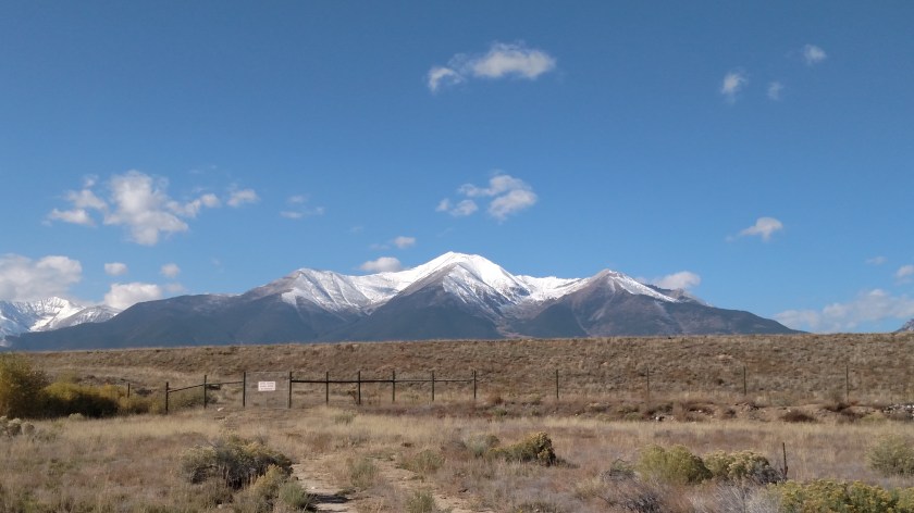
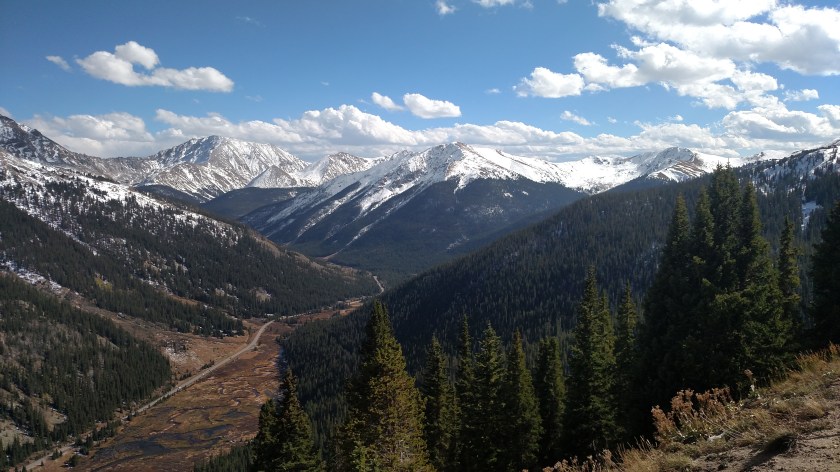
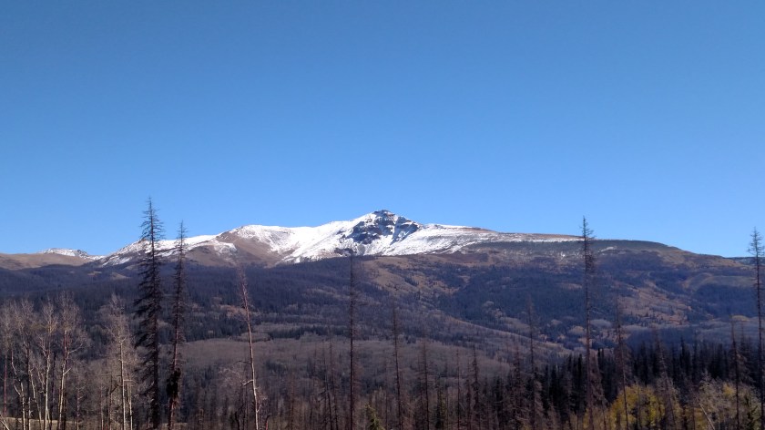
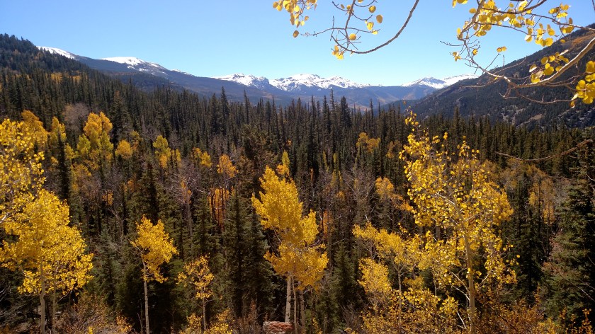
That thought made me hungry, and it was midday, so I stopped a little further up the road to have a picnic lunch of my own.  This was the view looking left from where I was parked.  You are looking at Mount Baldy Cinco, which tops out at 13,383 feet.  When I took this I was parked at 10,935 feet and it was 51 degrees at 1230pm local time.  The sun was out (duh) and it wasn’t all that windy so it was great place to take a break, enjoy the view, and get some fresh air.

IMG_20171003_122118755

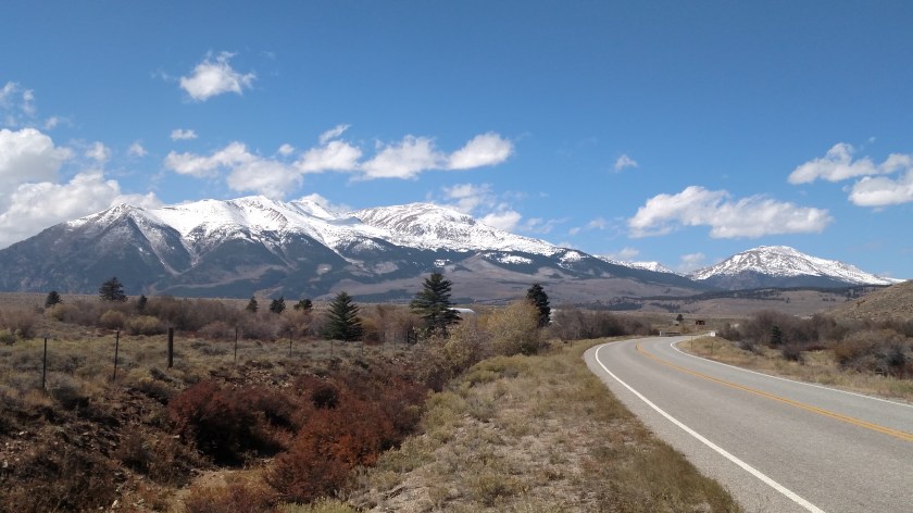
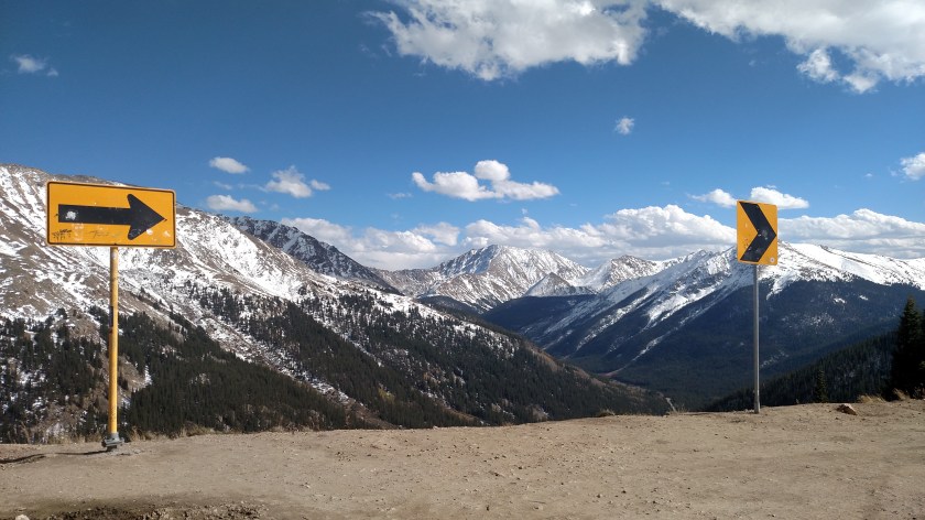
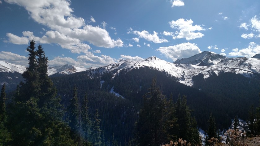
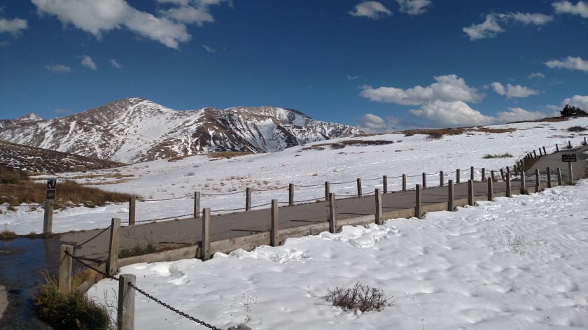
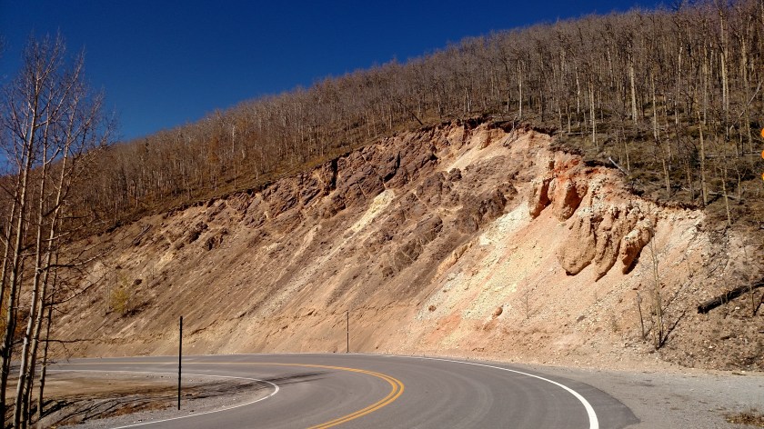
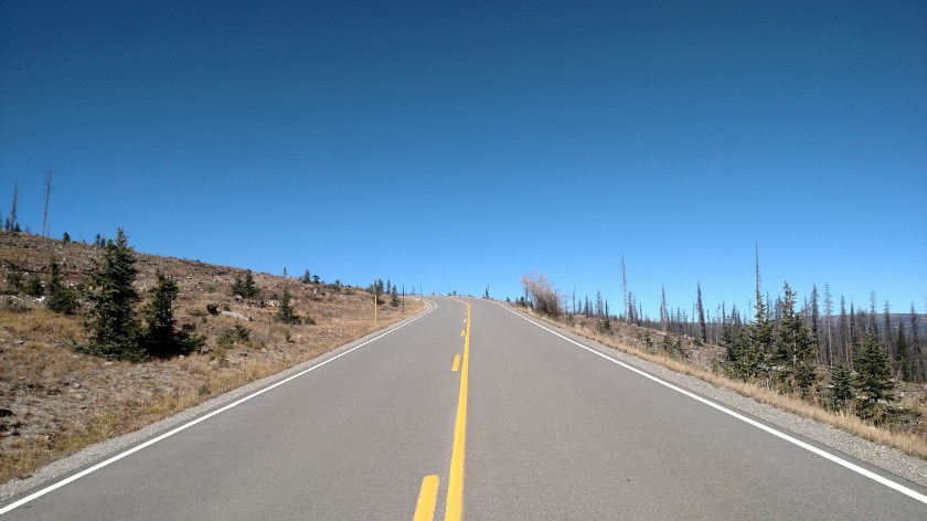
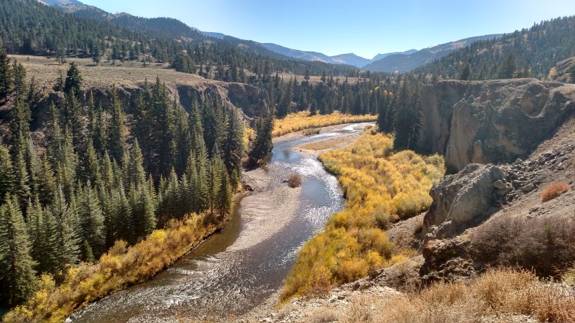
This was taken (stopped in the road, Shawn) after resuming my drive and just before reaching Slumgullion Pass, which is at 11,530 feet.

IMG_20171003_123539796

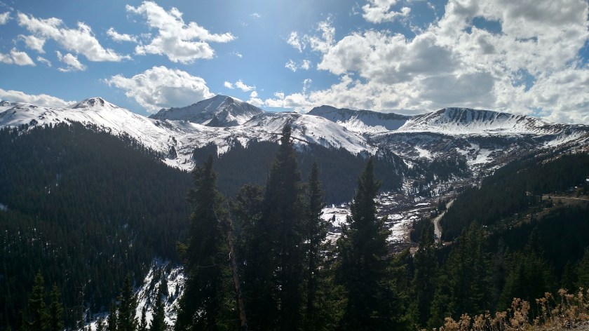
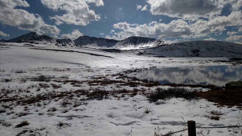
This was from an overlook just before I reached the little town of Lake City.  While I was stopped here another vehicle pulled in and I talked with those folks for a little while.  They are from Nashville and are on their way to Salt Lake City to attend a college football game.  They told me they had driven south from Denver to get away from the snow which hit west of there yesterday.  Apparently the town of Dillon, up in the mountains near Breckenridge, got 15 inches of snow while I was riding the train north of Durango yesterday!  I am heading north over the next two weeks and will have to closely monitor the weather, as well as develop a Plan B in case I need to hunker down or change my route.  I may need to buy chains for the car (they are mandatory to travel some roads in Colorado under certain conditions).  Good thing I just put new all-season tires on my car!

IMG_20171003_125918289

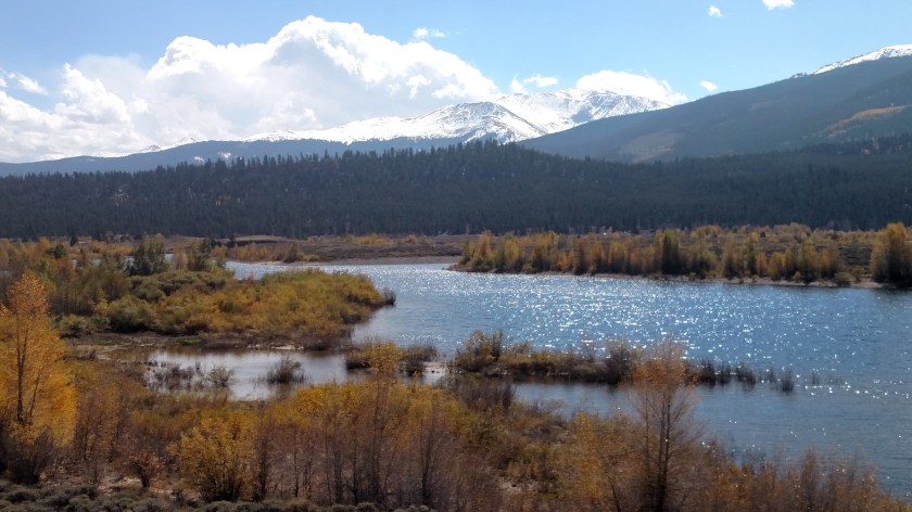
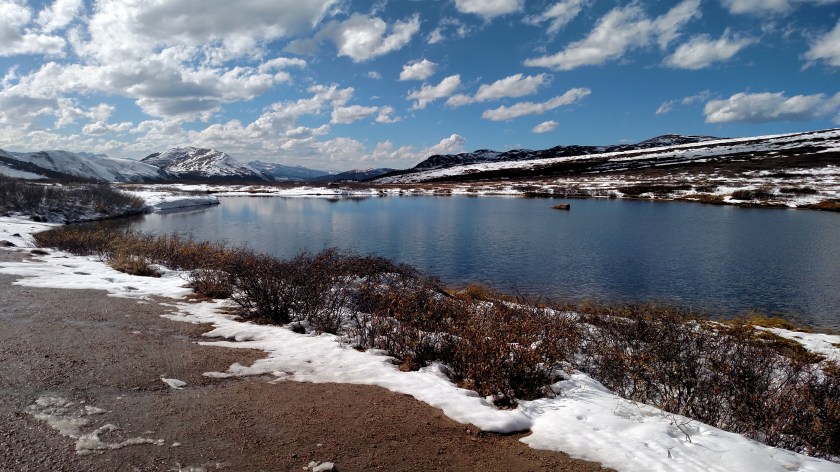
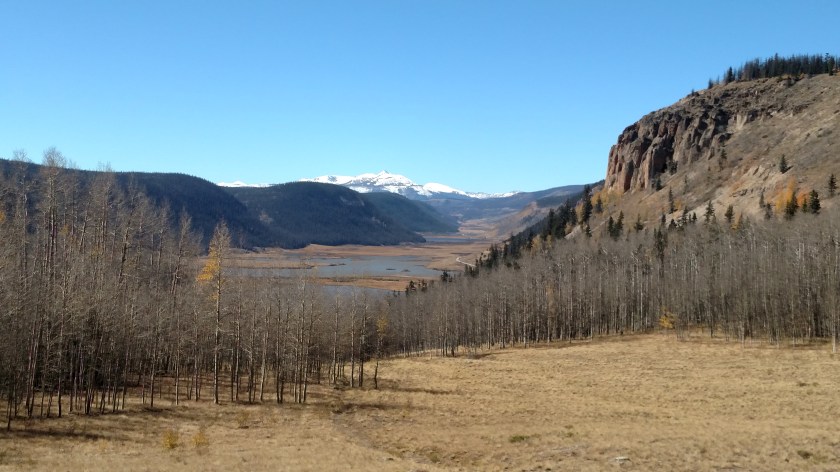
This is looking down on Lake Cristobal, which you will learn more about in the next post.

IMG_20171003_130951369_HDR

IMG_20171003_131823992

IMG_20171003_134920303_HDR

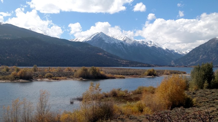
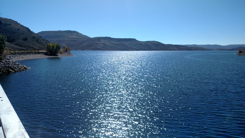
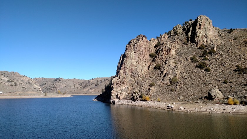
This is a small part of the Blue Mesa Reservoir, the largest body of water in Colorado.  It stretches east-to-west along Route 50 and it was at the point where Route 149 ended after reaching Route 50.  From here I took Route 50 east to Salida.  Next year when I come back to Grand Junction in May to revisit Black Canyon of the Gunnison National Park I will have to add some time to visit parts of this lake, which is part of the Curecanti National Recreation Area.  I stopped in parts of it today to kill time before getting to Salida in time for dinner before it got dark, and it is a great place to relax.

IMG_20171003_145131830

IMG_20171003_150746532

I will post some pictures taken today with the digital camera in the near future (perhaps when I get snowed in somewhere!).  Tomorrow I may drive north on some scenic roads towards Dillon but I’ll have to check the weather and road conditions first.  They are well equipped to handle snow on the roads out here and I think what happened Monday may have just been a freak, early Fall event.  It got up to almost 70 here today, although it cools down quickly when the sun starts going down.  As I post this at 538am local time it is 46 degrees in Salida.  Yesterday morning it was 39 degrees when I left Durango.


Slumgullion Earthflow

That is the fancy name given to this massive landslide which occurred over 850 years ago.  A large portion of the top of Mesa Seco, weakened by rain, finally gave way and 4,000 tons of dirt slide down the hill.  This dammed up a river and created Lake Cristobal, the second largest natural lake in Colorado.

A second slide occurred approximately 350 years ago.  That clump of dirt is still moving downhill at about 20 feet per year.

IMG_20171003_125120223

This is from the bottom of the hill looking up:

IMG_20171003_130412494

And looking 45 degrees to the left from where I took that picture I saw this more recent area, right next to the road:

IMG_20171003_130417689

I decided I’d better keep on moving down the road before the road started moving on it’s own….  Besides, I was anxious to get to my next stop (see next post).

Alferd Packer site

This was my “never saw that coming” find for the day.  As I was saying goodbye to some folks I was talking to at a scenic overlook one of them said – “Oh, and be sure to check out the cannibalism memorial before you get in to the next town…”.

Okay.

I’ll let the signage at the site tell the story.  This was just south of Lake City, Colorado.

IMG_20171003_132917171

IMG_20171003_132947944

IMG_20171003_132852124

And while this is all very serious and disturbing I found this quote on the sign to be even more strange:

IMG_20171003_132931362

Hmmm… Cannibalism…  Eating Democrats…  I hope Trump doesn’t get any ideas.

Durango-to-Silverton train

Monday I spent all day on the Durango & Silverton Narrow Gauge Railroad.  This train is very similar to the one I rode about a week and a half ago down in New Mexico.  Many of these trains which run over high mountains are “narrow gauge,” meaning that the track rails are only 3 feet apart as opposed to conventional trains whose track rails are 4 feet 8 inches apart.  This allows them to lay tracks on and navigate much tighter spaces.

I left home in plenty of time to get downtown and park a few blocks away from the station (for free, as opposed to paying $8 to park in their lot).  Our train departed at 845am for the slightly more than 4-hour ride north to Silverton (which is featured in the next post).  Durango is at about 6,500 feet elevation and Silverton is at about 9,300 feet so it was all uphill on the way north.  The train stopped three times to take on water for the coal-fired steam engine.

Speaking of coal, I learned during the Yard tour on Friday that on an average round-trip each train (and they run several each day, depending on demand) goes through 4-6 tons of coal.  TONS!   And the car attendant today told us that some poor soul up in the engine throws a 20-pound shovelful of coal into the engine every 4 seconds!  Yikes!  And when the trains are in Durango overnight they put wood pellets in the engines to keep them warm for the next day.

We had a 90-minute layover in Silverton for lunch.  The trip back to Durango went a little quicker (although the train averages less than 15 mph) as we only had to stop once for water and the engine didn’t have to work as hard going downhill.  We got back to Durango a little past 630pm.

This is the car I rode in, which inside was almost identical to the one I rode in on the Chama train.

IMG_20171002_081108565_HDR

The couple I shared a table with, Harry and Beverly, were visiting from Oklahoma.  They come to this area every year in their Jeep and like to travel on old mining roads and other off-road type places, mainly north of Silverton and Ouray, which is about 25 miles further north.  Beverly is a veterinarian and owns her own practice.  Her jacket had an emblem for an organization which is studying Golden Retrievers.  It is following the lives of 3,000 dogs as research into why they develop certain diseases.  Her daughter has a Golden and is participating in the study.

Ironically the couple sitting across the aisle from our table is in the process of moving to Durango from Durham!

IMG_20171002_085818127

He used to work at Fullsteam Brewery, an establishment which which I am somewhat familiar.  They are staying at another Airbnb as they hunt for a place to live.  Small world.

The scenery during the ride was a little different from what I saw on the Chama train.  We were in the mountains for most of the trip and there were trees and rocks which made it hard to take pictures at times.  There were some dramatic views as we paralleled the Animas River for most of the trip and there were great cliff views as we climbed and descended the mountain.  The windows on this car opened up, not down and it was colder outside so I rarely had the window open.  I stayed in my seat most of the time and just enjoyed the ride (and talked too much, I’m sure….).  Despite my preparations I didn’t take nearly as many pictures as I thought I would.

IMG_20171002_101037258

IMG_20171002_103421135

IMG_20171002_170448564_HDR

IMG_20171002_170532847

IMG_20171002_171554319

IMG_20171002_174527060


Silverton, Colorado

We had a 90-minute layover in Silverton before taking the train back to Durango.  Silverton is a small mining town about 45 miles north of Durango.  It sits at 9,318 feet elevation and the weather today was cold and windy, with low clouds and light precipitation.  The year-round population is only around 600, although during the peak summer months there is probably an increase with temporary workers for the restaurants and shops whose owners largely depend on train riders for their livelihood.  Silverton is accessible by car but I’m sure several trainloads of eager tourists each day is their bread and butter.

My table-mates have taken the train to Silverton for several years and said they wouldn’t mind if I tagged along with them for lunch.  They knew of a nice restaurant a few blocks from where we disembarked from the train.  There had been a train which left Durango about 45 minutes before ours and those folks were finishing up their meals so there was a brief wait for a table.  We were seated in front of a big open fireplace (which was very nice on a cold, blustery day) and I had an elk burger and a cup of green chile soup, both of which were very good.

After we ate there was only about 15 minutes before we had to be back on the train so I took a quick walk through town and took these photos.  There were tall mountains in all directions, most of which had a little bit of snow on them and some of the peaks were hard to see because of the low clouds.  I now wish I had stopped here when I drove past town about a month ago as I would have liked to have had more time to see the Victorian architecture and visit some of the shops.  I thought the train layover was longer but I was mistaken.

IMG_20171002_140500056_HDR

IMG_20171002_140505585_HDR

IMG_20171002_140513503_HDR

IMG_20171002_140531855

IMG_20171002_140538309_HDRIMG_20171002_140552581_HDR

IMG_20171002_140733456

IMG_20171002_140840759

IMG_20171002_140845070

IMG_20171002_140850843