You must be this tall to ride this ride

I saw this old flume in the Sierra Nevada mountain range southeast of Visalia, CA on Friday.  I was revisiting an area I had been to earlier in the week.  This flume was originally built in the early 1920’s and carried water down to the little town of Springville (and later to a hydroelectric power plant east of there).

IMG_20180622_112057659

IMG_20180622_112155460

Further up the mountainside I could see portions of a newer, 15-mile long flume which was built starting in 2011.  It provides water directly to the SoCalEdison Hydroelectric station east of Springville.  That flume is located within a completely enclosed pipe.

DSCN1861

DSCN1862

Unfortunately, portions of this flume were destroyed in the Pier Fire last year, with damages estimated at 11 million dollars (when they built it they had to use several helicopters to lift sections of the pipe up into the rugged terrain, including a SkyCrane which rents for $10,000 per hour).

Bryce Canyon – Post 1 of 4

Thursday was a “chores” day. I did two loads of laundry, had the oil changed in my car, had the tires rotated, replaced my water bottles, booked more Airbnb’s for the remainder of August through Labor Day weekend, and backed up old photos from my computer so I could delete them to make room for more! So today is a good chance to get caught up posting some of my backlog of pictures from earlier in the trip.

I know these are out of sequence but, finally, here are more photos of Bryce Canyon National Park in southwest Utah, which I visited back on May 30.

IMG_20180530_120151193

IMG_20180530_120318217

IMG_20180530_120335168

IMG_20180530_120342879

IMG_20180530_120444229

IMG_20180530_123151996

IMG_20180530_123244580

IMG_20180530_123251083

IMG_20180530_124527060

IMG_20180530_124543449

Bryce Canyon – Post 2 of 4

I know these are out of sequence but, finally, here are more photos of Bryce Canyon National Park in southwest Utah, which I visited back on May 30.

IMG_20180530_124838313_HDR

IMG_20180530_125033864

If you look very closely in the upper right hand corner of the photo above you will see several naturally occurring holes in the relatively thin wall of a formation.  These holes are called “windows” (I sure hope the government didn’t pay some fancy consultant a half million dollars to come up with THAT term!).

DSCN0135

DSCN0137

DSCN0156

DSCN0158

IMG_20180530_125228722

Here is one formation when a cloud was blocking the sun:

IMG_20180530_132947778

And the same formation from a slightly different angle about 30 seconds later when the cloud had passed:

IMG_20180530_133019404

Bryce Canyon – Post 3 of 4

I know these are out of sequence but, finally, here are more photos of Bryce Canyon National Park in southwest Utah, which I visited back on May 30.

And to keep the size of this massive amphitheater in perspective, if you look closely at the first photo below there are people way down the path, next to the big formation which looks like a castle.  Remember, these formations were all formed by nature.

IMG_20180530_133435013

IMG_20180530_133751498

IMG_20180530_140501833

IMG_20180530_140515107

IMG_20180530_153040029

IMG_20180530_153054674

IMG_20180530_153051714

IMG_20180530_153932413

IMG_20180530_155150582

IMG_20180530_155223190

Bryce Canyon – Post 4 of 4

I know these are out of sequence but, finally, here are more photos of Bryce Canyon National Park in southwest Utah, which I visited back on May 30.

IMG_20180530_160344511

IMG_20180530_161454729

IMG_20180530_162547565

IMG_20180530_163321515_HDR

IMG_20180530_163336910_HDR

IMG_20180530_163354314_HDR

Here is “Natural Bridge” after the sun came back out:

IMG_20180530_163538006_HDR

I had passed this formation on my way in to the Park in the morning and made a note to stop here on the way home when the sun would be behind me:

DSCN0213

DSCN0216

DSCN0217

Kings Canyon – Post 1 of 4

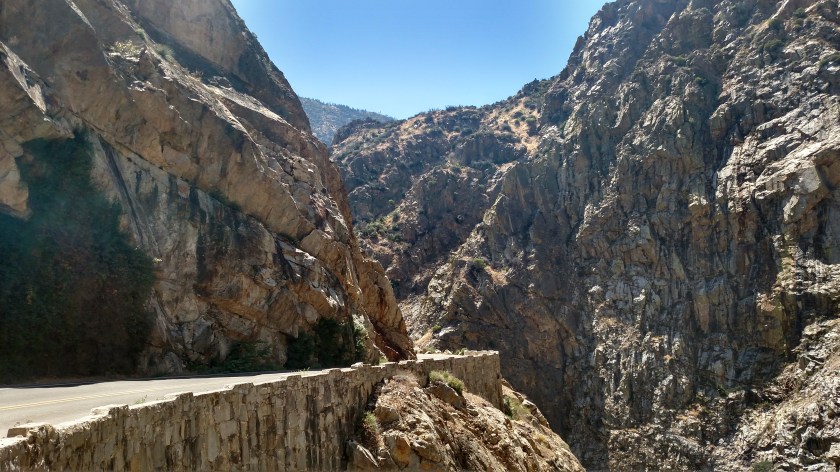
Wednesday I planned to spend the day at Kings Canyon National Park.  It shares a border with Sequoia National Park which I had visited on Monday and Tuesday.  I was actually in the Park for only about 26 of the 220 miles I drove on Wednesday, yet I enjoyed a full day of incredible scenery.  You may want to go online and print a map of the area (Google: NPS Sequoia map, then click on Driving Map).

Of the 220 miles I drove on Wednesday, 112 were just round trip getting there and back from Visalia.  Only 26 miles were spent in Kings Canyon proper (14 miles round trip at the END of the Kings Canyon Scenic Byway and the rest entering and exiting near the Kings Canyon Visitor Center in the little finger which sticks up on the left side of the map).  The remainder of the drive, 82 miles, was through the Sequoia National Forest, technically the Giant Sequoia National Monument – North Unit.

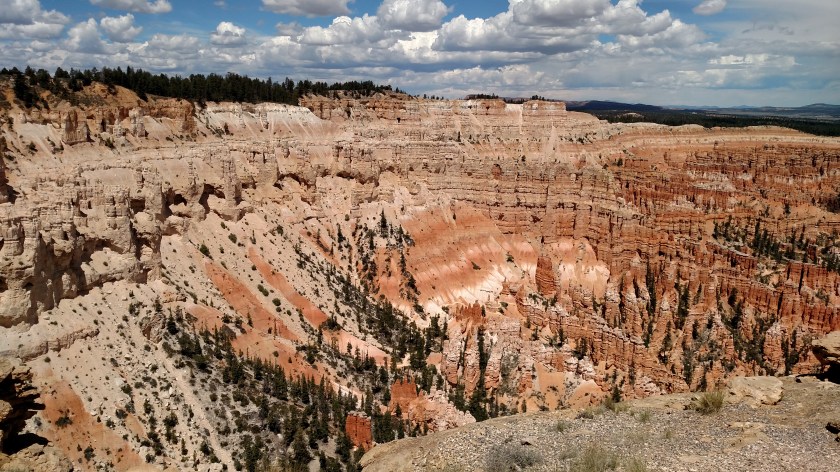
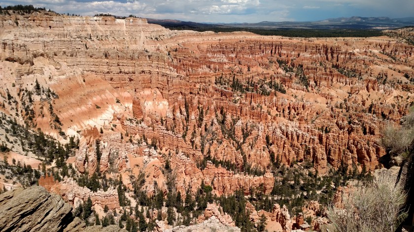
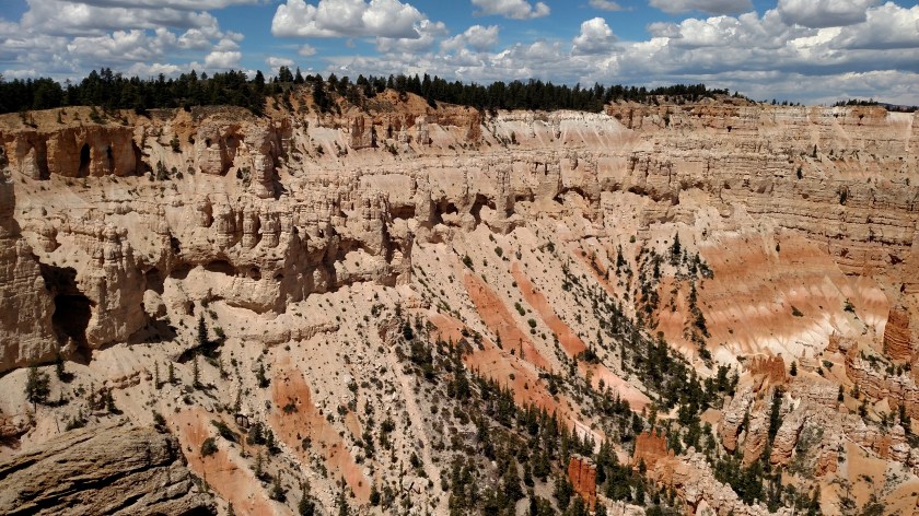
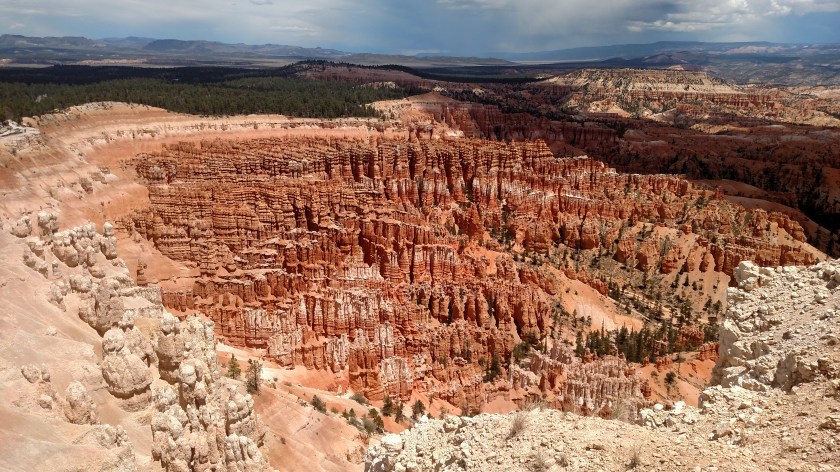
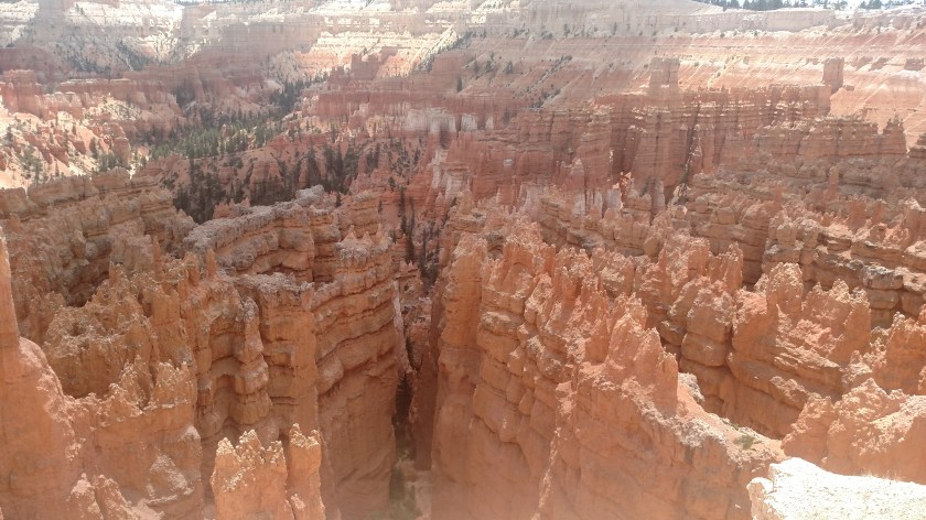
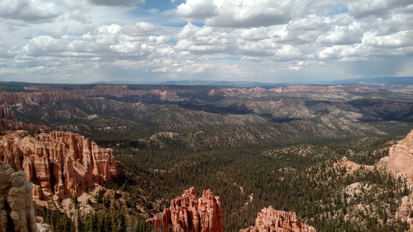
Sequoia National Park covers 631 square miles and Kings Canyon, 721 square miles.  Combined, they are slightly larger than the state of Rhode Island.  You only get to see a small portion of either Park from the road.  The eastern part of Sequoia and the northern part of Kings Canyon can only be enjoyed on foot or horseback (or the animal of your choice, assuming they are willing participants).  There is much more to both Parks than you can see on the Driving Map (click on the Area Map to get the “bigger picture”).

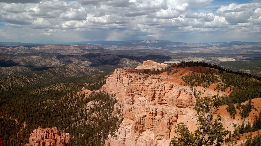
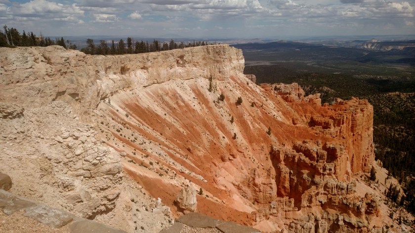
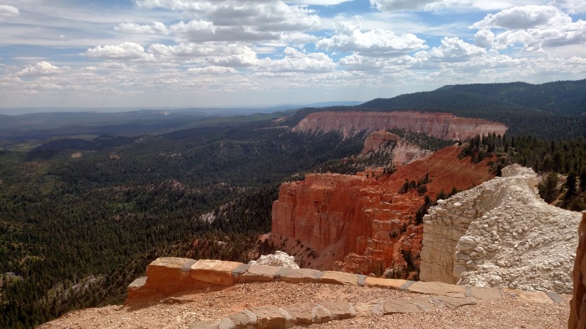
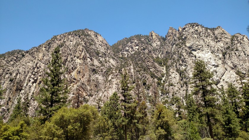
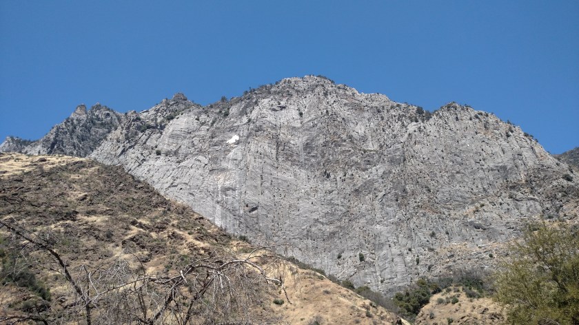
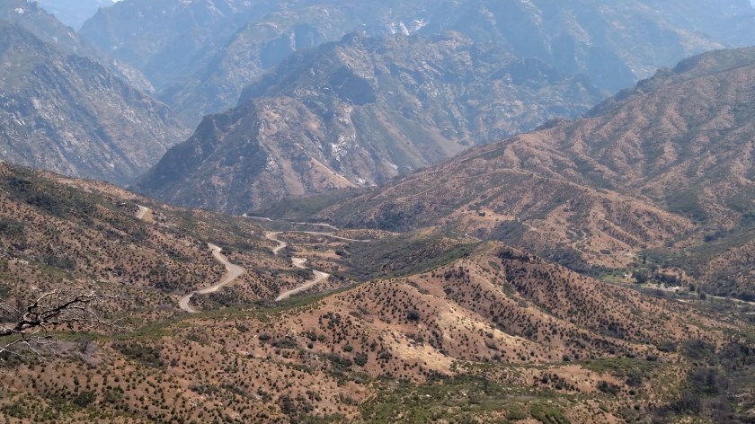
The thing that I found very confusing on Wednesday was figuring out exactly what I was looking at.  There are all kinds of peaks, but based on where I was and the direction I was looking it was difficult to figure out which peaks were which.  I opted to just enjoy the views!!

IMG_20180620_102009112

IMG_20180620_102013458

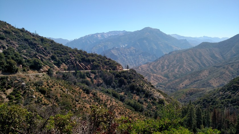
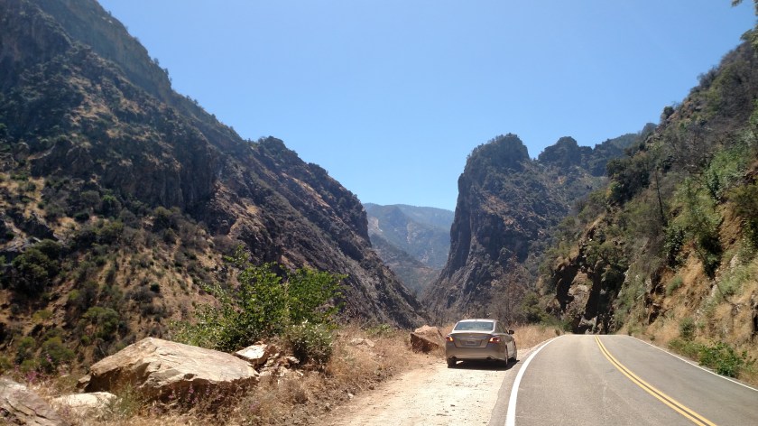
Down below I could see the road I would be traveling on.  I descended from up around 6,000 feet where these were taken, down to the valley below, then up again once I got in to Kings Canyon proper.

IMG_20180620_102544814

IMG_20180620_112517022

IMG_20180620_112523477

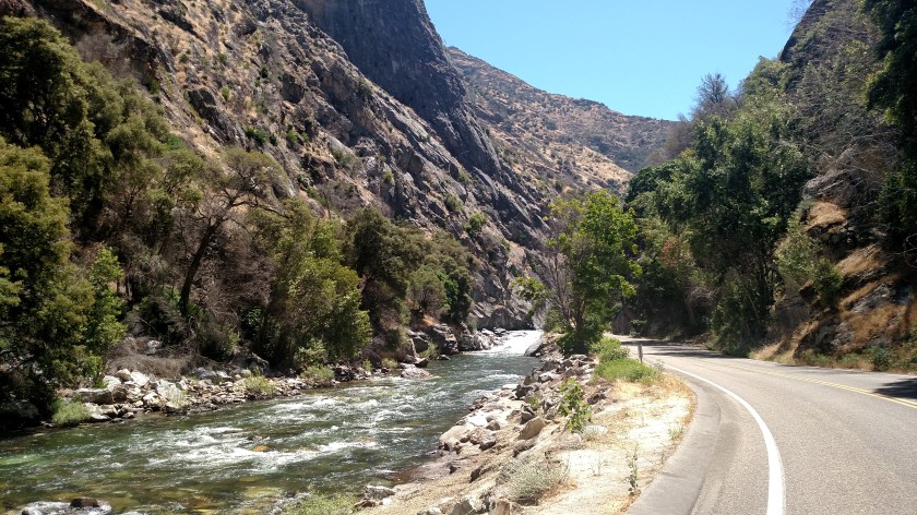
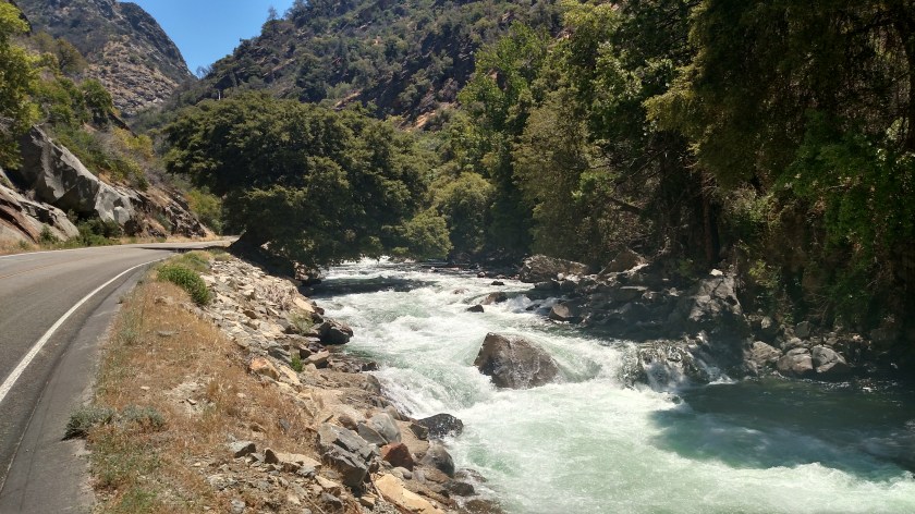
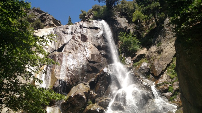
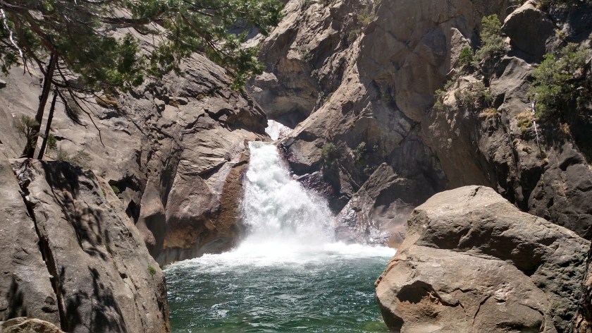
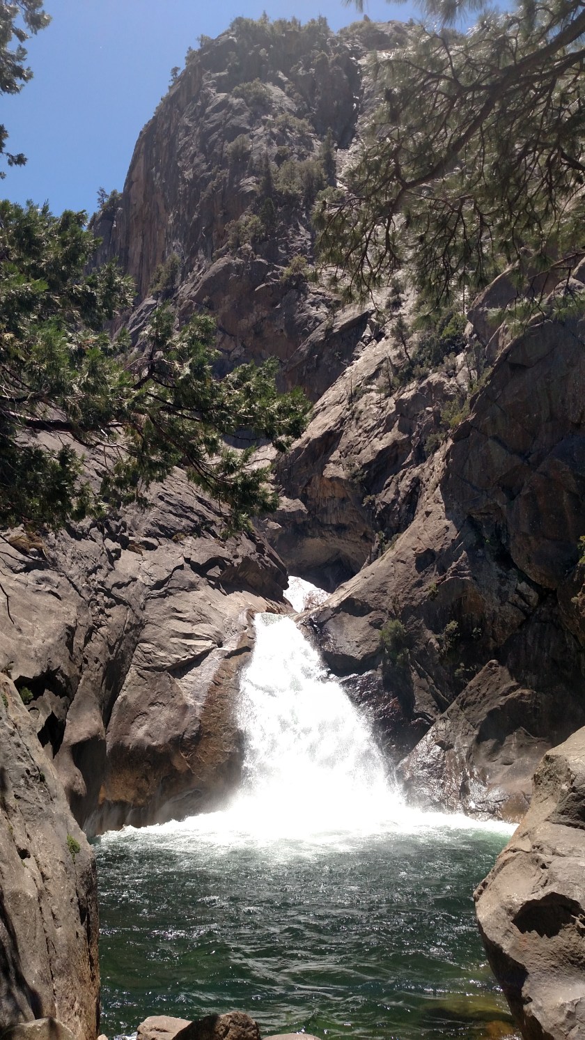
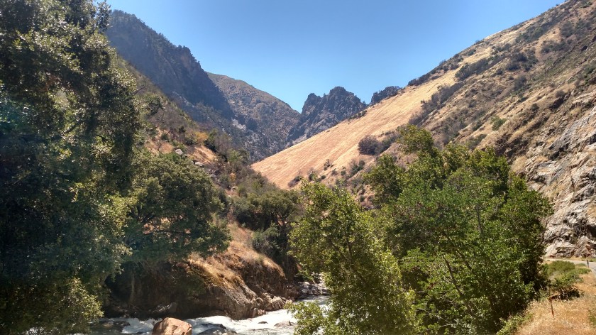
Once I got down in the valley I could see, and hear, 10-Mile Creek below:

IMG_20180620_112916345

IMG_20180620_113041196


Kings Canyon – Post 2 of 4

Here are photos taken Wednesday in both Sequoia National Forest and Kings Canyon National Park.

I still haven’t reached Kings Canyon National Park itself, but I can see it in the distance.

IMG_20180620_113411939

This is the South Fork of the Kings River which runs parallel to the Scenic Byway in many places.  With only still pictures it is hard to give you the sensation of the water cascading downstream.  I usually get a few video clips of waterfalls and rivers to record the full effect of their beauty but I can’t post them on the blog.

There were warning signs when I entered the Park that the water was very cold and very swift, and that swimming and rafting were not allowed.

IMG_20180620_113648689

IMG_20180620_115502515_HDR

This is Grizzly Falls.  There is a picnic area right in front of the falls and I commented to someone there that I hoped the grizzlies wouldn’t be picnicking on us!

IMG_20180620_120427829

IMG_20180620_120526128

And at 1230, two hours after my first “Oh wow” moment viewing the Canyons when starting my drive on the Kings Canyon Scenic Byway, I finally reached the entrance to Kings Canyon National Park – although I had driven less than 20 miles.

IMG_20180620_135720286_HDR

IMG_20180620_123756479

IMG_20180620_124839516


Kings Canyon – Post 3 of 4

Here are photos taken Wednesday in both Sequoia National Forest and Kings Canyon National Park.

This is Roaring River Falls:

IMG_20180620_125535918_HDR

IMG_20180620_125539829

IMG_20180620_130928978

The next photo doesn’t do the juxtaposition justice.  The dry, brown grass sloping down the mountain from the right, the cold, wet water rushing down the river below and the harsh rocks on the mountains in the background.

IMG_20180620_141843520_HDR

And looking up at this towering rock face from the canyon below gives you the impression it is the highest peak in the world, but from other vantage points in the area you realize it is only a small fish in the pond.

IMG_20180620_142832218

IMG_20180620_142955926

IMG_20180620_143040853_HDR