July 13, 2019

(Photo credit: hlanderz.blogspot.com)
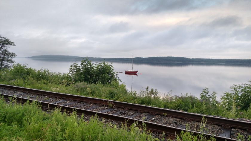
Saturday morning I set out from Rothesay (just northeast of Saint John) to drive down to the coast and check out the Fundy Trail Parkway (aka Fundy Coastal Drive). First I had to take a secondary highway southeast to the little town of St. Martins.
This was taken before I crossed NB-1, which I arrived on the day before.
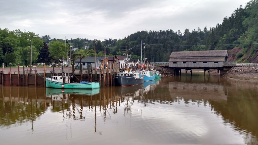
And these were taken in St. Martins:

The second photo is actually a different covered bridge, behind and to the left of the first one. I didn’t even know it was there until I was on my way back to the highway after driving the Parkway.
This is the waterfront in St. Martins:


The big circle you see in the first photo above is one of several Sea Caves:


The tide was going down so I still couldn’t have walked out to them without getting my tootsies wet, but at low tide people can walk out and explore them.
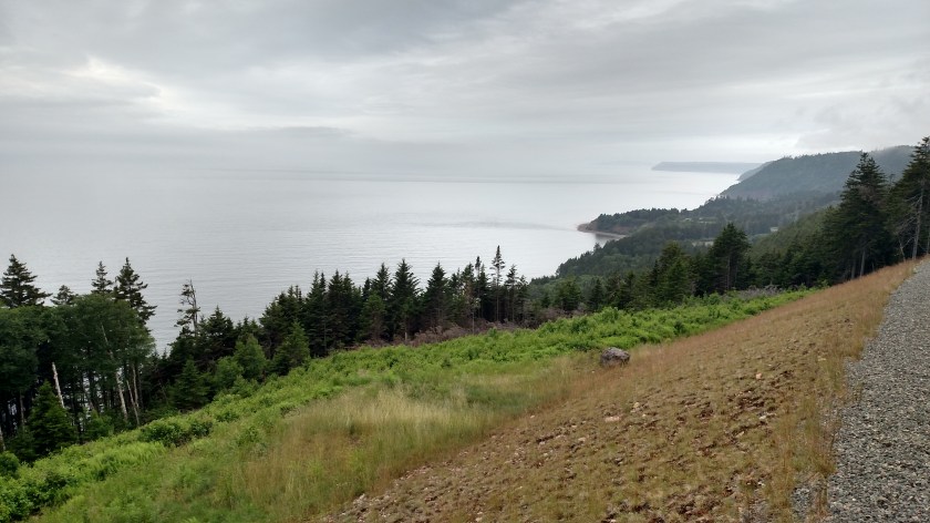
Shortly after taking those photos I continued up the road a short distance and arrived at the entrance to the Parkway. The road getting there wasn’t too great (very rough) but the roadway once you get in is great – not paved exactly, but fairly new crushed gravel (compacted, not loose) which was in excellent shape. Admission was $8 (for me, now a Senior!) and it was worth every Canadian nickel (they don’t use pennies – they round cash purchases up to the nearest nickel). A gorgeous 17-mile drive with lots and lots of scenic overlooks. No billboards or human residents – just you and Mother Nature. On the way in I didn’t even see another vehicle except in parking areas and I saw very few people coming in as I was on the way out. The road currently ends before reaching Fundy National Park but it will hopefully get all the way there in the next year or two.

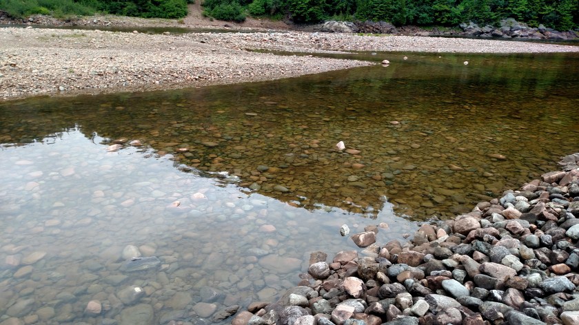
This is the view of the Big Salmon River as it drains into the Bay of Fundy near the Visitor Center for the Parkway.

Since this is river water it is crystal clear:
I saw these Red-Breasted Mersangers swimming in the river – Mother with one young’un hitching a ride on her back and two others swimming behind.


This is a “flowerpot rock,” so named because when the tide is low you can see it is attached to the ground but when the tide is high it looks like a freestanding flowerpot with trees growing out of it:
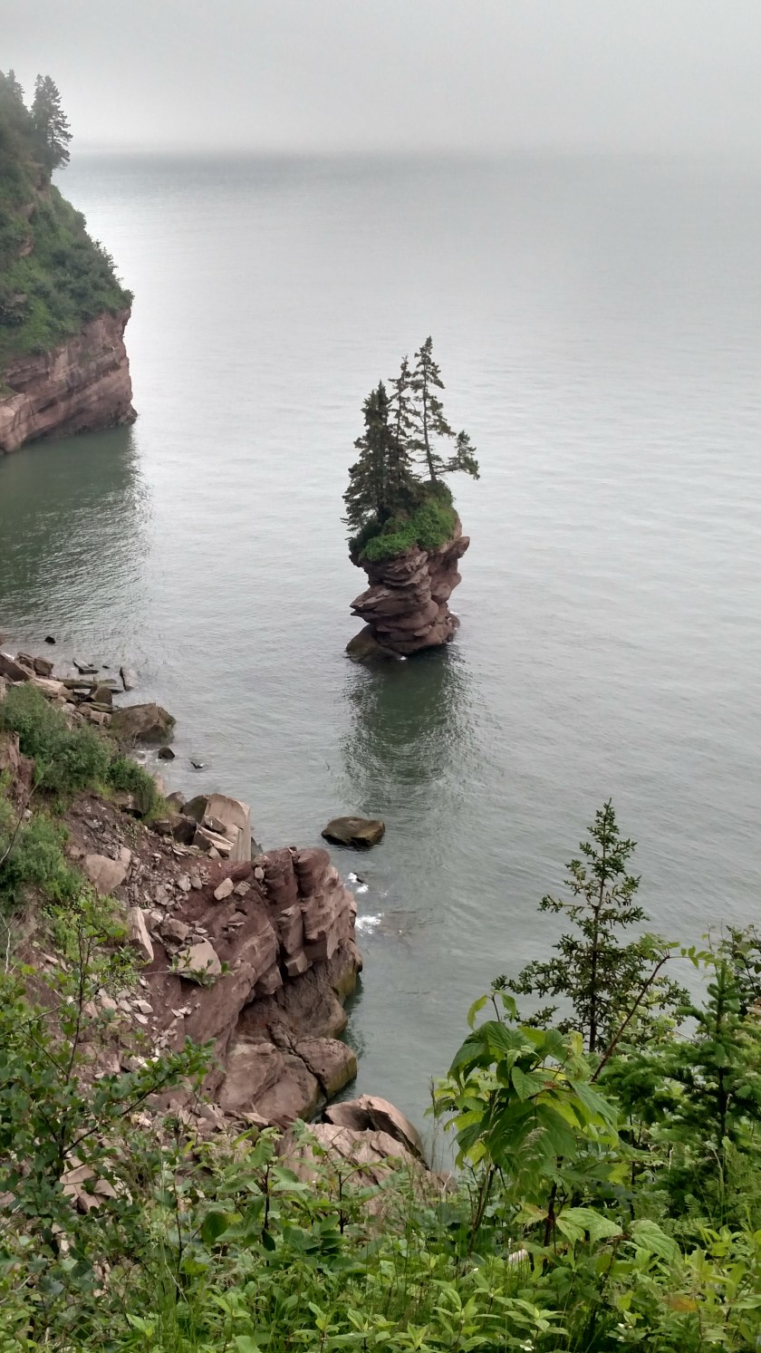
And as seen from the other side (from further up the trail):

Pretty cool, eh?
