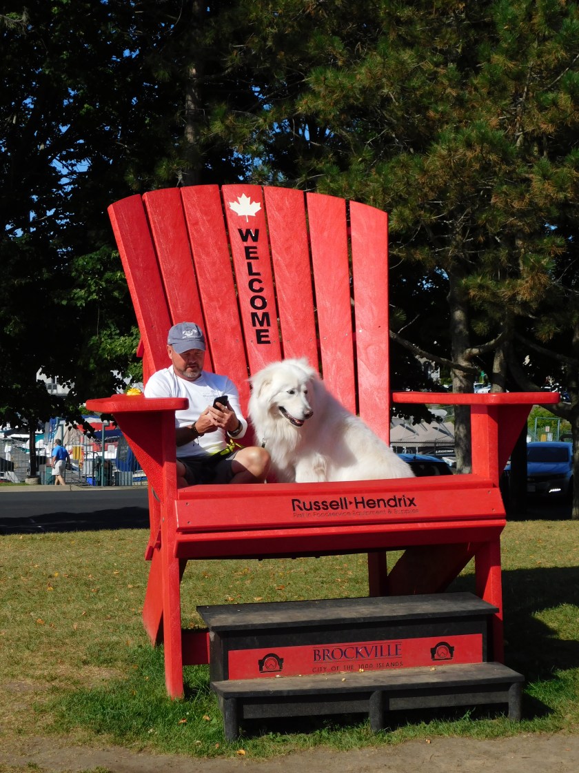
1,000 Islands – Digital – Post 1 of 4

August 23, 2019

Friday, as I traveled between Ottawa and Toronto, I stopped to take a boat tour of this portion of the St. Lawrence River, part of which is actually a Canadian National Park (a real Canadian National Park…).   These were taken with my digital camera during the first hour and a half of a 2 1/2 hour boat ride, after which I was informed by my camera that the SD card on which the photos are stored was FULL (after being put into service only 3 weeks previously!).  For the final hour I took photos with my smartphone and will post those photos (not as many) in another set of posts.

My boat trip started and ended in Gananoque, (pronounced gannon-AQUA) Canada, on the right side of the map below.

IMG_20191009_131150573

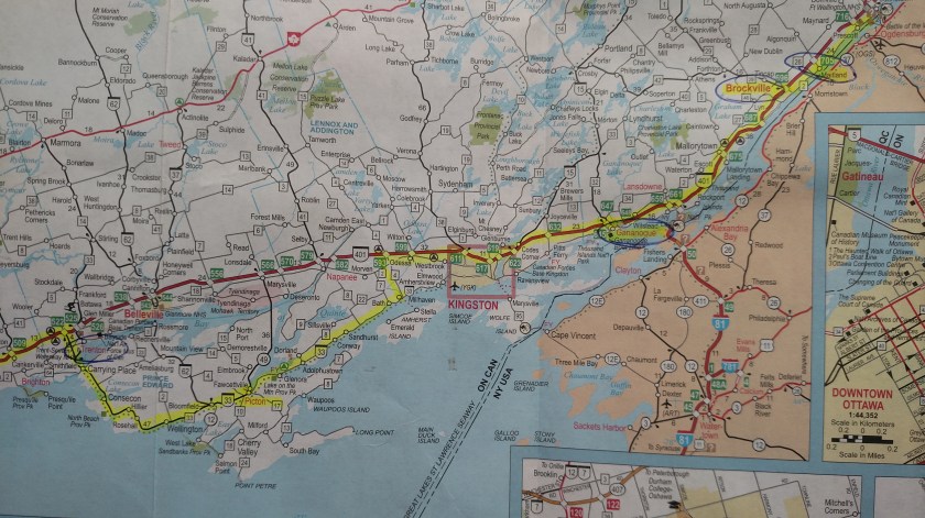
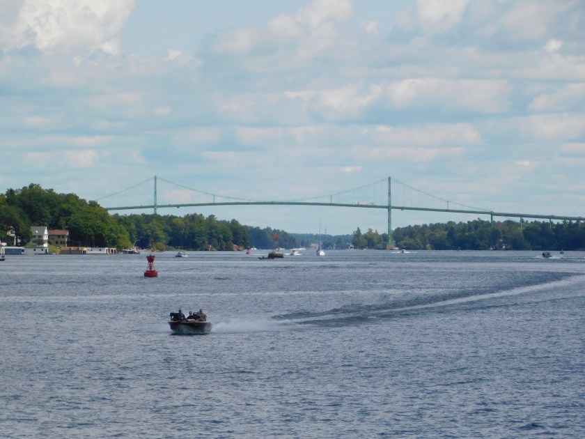
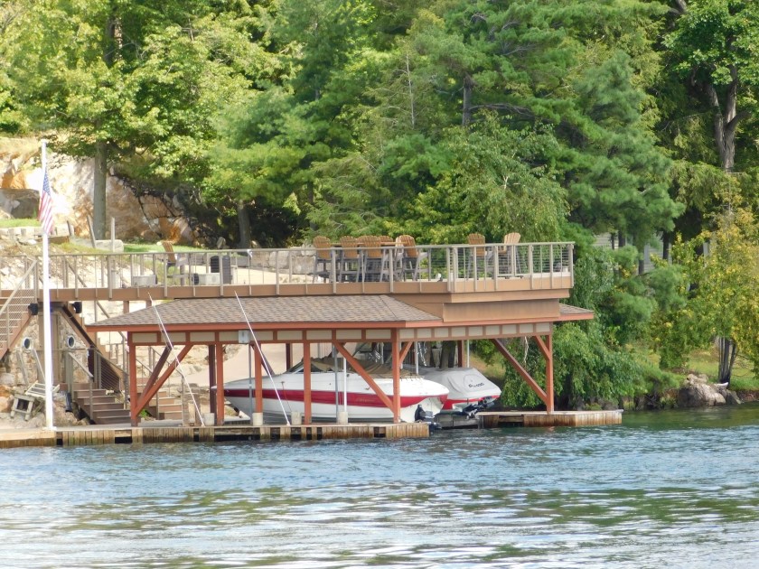
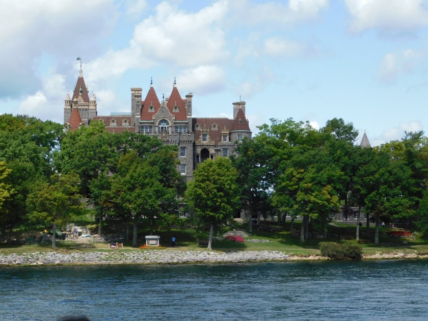
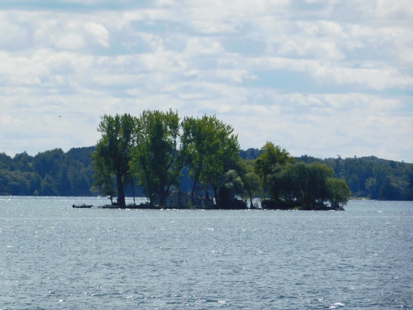
Many of the tour boats operate from the New York side of the river but my pre-trip research indicated that the boat company I used was the best.  We basically made a huge counter-clockwise loop – heading west towards Toronto, turning left towards New York State and left again to go back east near the US mainland and eventually turning around again and returning to Gananoque on the Canadian side of the river.  We spent part of the time in Canadian waters and part is US waters.  As you may have guessed, the area is called 1,000 Islands because there are LOTS of islands, some quite large, some only big enough to build a small house on (and I mean that quite literally, as you will see) and some not even big enough for a house, except maybe a plastic Barbie house.

These photos are posted in the order in which they were taken and continue over the next 3 posts.

DSCN1528

DSCN1541

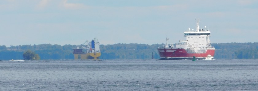
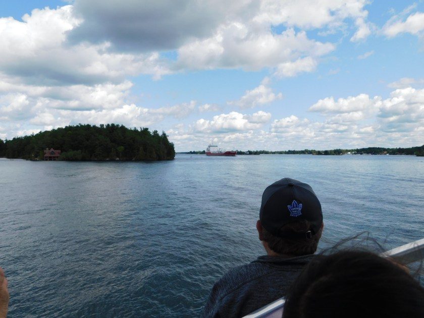
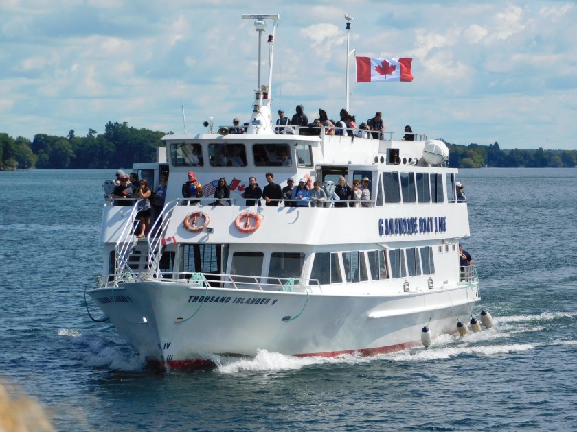
The photo below is of a ship similar to, but slightly smaller than, the ship I was on.  If some of these photos look familiar it is because a few were posted in a “real-time” post the day after I took this ride in a post titled “The best $29 (USD) I ever spent”, a teaser post to give a brief overview of what I had done during part of my day.

DSCN1555

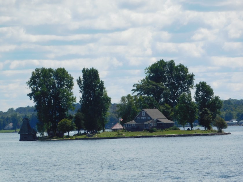
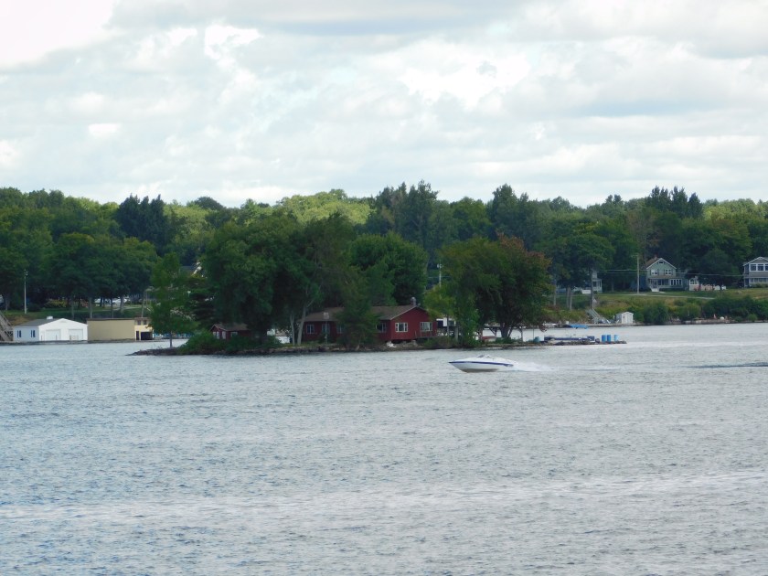
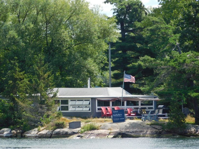
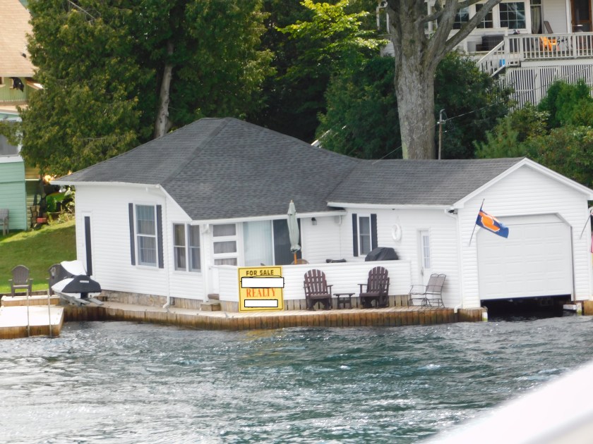
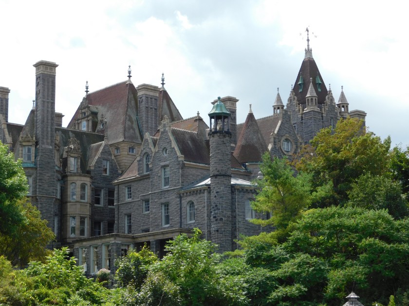
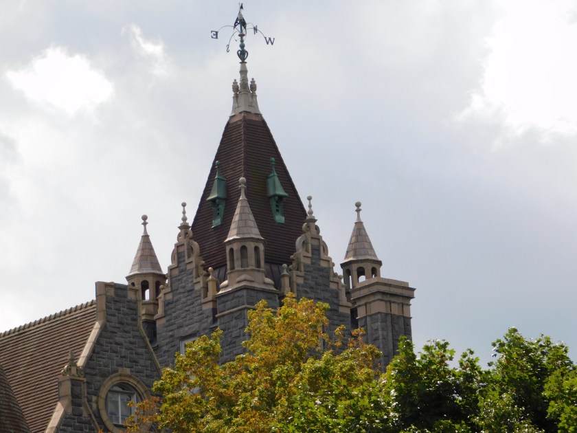
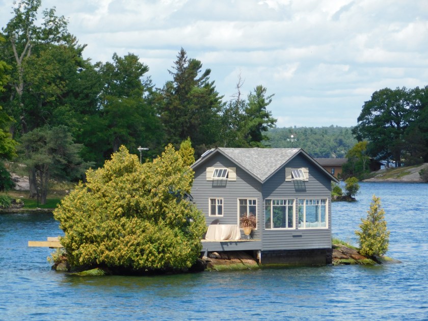
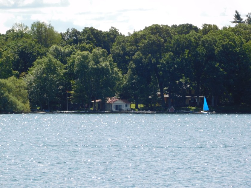
The photo below is of the first of many houses I saw built on small islands.

DSCN1581

DSCN1599

DSCN1653

DSCN1657

DSCN1672

DSCN1714

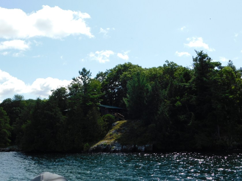
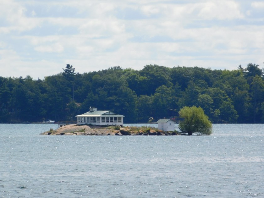
One of the pros of the house shown above – the leaves probably just float away rather than needing to be raked.  One of the cons – you’d better have curtains on your windows if you want any privacy…..

DSCN1721

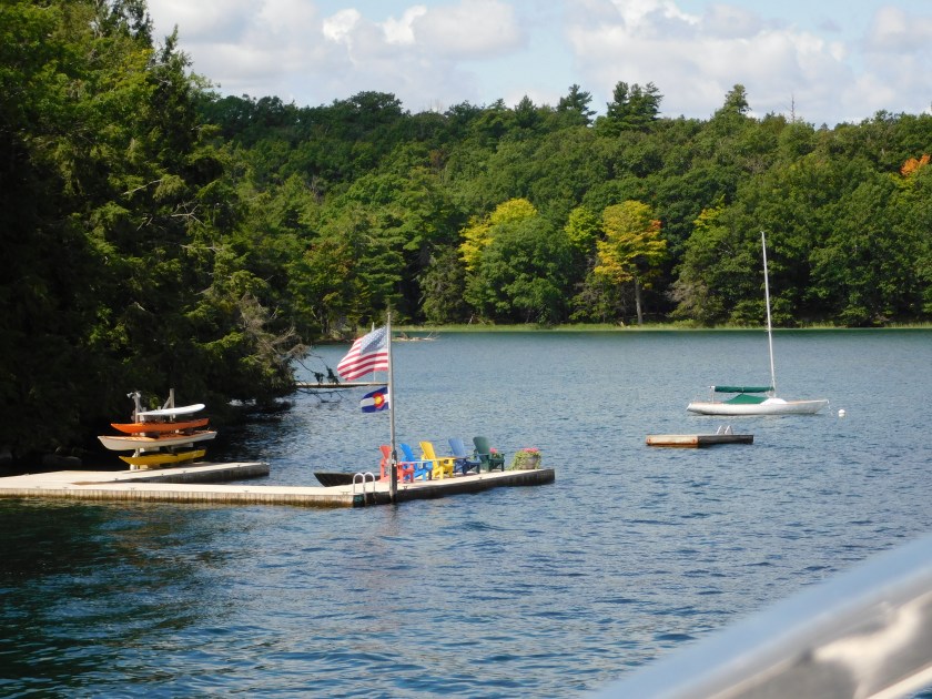
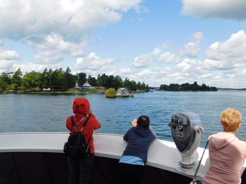
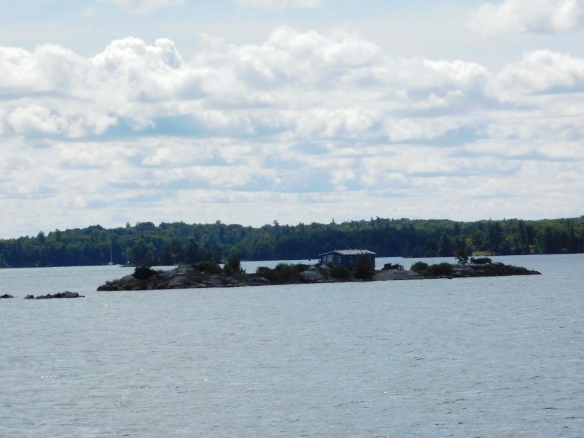
The photo below is the view we had much of the time – navigating between the larger islands.  I had snagged an outside bench seat in the front of our ship and was able to take most of these photos by standing and holding my camera up above the people on my deck.  Fortunately I have a viewing screen which tilts downward so I can see what my camera “sees”.

DSCN1751


1,000 Islands – Digital – Post 2 of 4

August 23, 2019

Friday, as I traveled between Ottawa and Toronto, I stopped to take a boat tour of this portion of the St. Lawrence River, part of which is actually a Canadian National Park (a real National Park…).   These were taken with my digital camera during the first hour and a half of a 2 1/2 hour boat ride, after which I was informed by my camera that the SD card on which the photos are stored was FULL (after being put into service only 3 weeks previously!).  For the final hour I took photos with my smartphone and will post those photos (not as many) in the next set of posts.

These are posted in the order in which they were taken.

DSCN1801

DSCN1819

Same house and island, from another angle:

DSCN1847

We would eventually go under the bridge in the distance before circling around and passing under it again on our way back to where we started.  The bridge you see connects US Interstate Highway 81 in New York State to Canada.

DSCN1879

The houses in the photo below are in New York State, on the US mainland.  Subsequent photos continue to show houses located on small islands.

DSCN1859

DSCN1862

DSCN1889

DSCN1924

DSCN1952

And here’s the hot setup… a deck built out over top of your boats (to protect them from the sun and elements).

DSCN2007

We snuck up on the folks in this small powerboat…

DSCN2058

Once they realized we were approaching the captain hit the throttle.

DSCN2067

1,000 Islands – Digital – Post 3 of 4

August 23, 2019

Friday, as I traveled between Ottawa and Toronto, I stopped to take a boat tour of this portion of the St. Lawrence River, part of which is actually a Canadian National Park (a real National Park…).   These were taken with my digital camera during the first hour and a half of a 2 1/2 hour boat ride, after which I was informed by my camera that the SD card on which the photos are stored was FULL (after being put into service only 3 weeks previously!).  For the final hour I took photos with my smartphone and will post those photos (not as many) in the next set of posts.

These are posted in the order in which they were taken.

The photo below is of a small waterfront house with a For Sale sign in front of it.  I have blanked out the name and phone number of the realtor as I doubt they would split the commission with me if a blog reader buys the house.

DSCN2082

I looked up the property (a month and a half after I took the photo) and as of the date of this post, it is still available.  2 bedrooms, 1 bathroom, curiously a one story 891 sq. ft. house on a 871 sq. ft. lot!  I guess the dock isn’t living space, nor is the boat “garage”.  Asking price?  $299,900 USD (it’s in New York State if that affects your possible consideration).

Here is another private home, presumable NOT for sale.

DSCN2159

And here is the first look at Boldt Castle, located on a private island on the New York side of the St. Lawrence River.  Our boat made a lap around the island so you will see several photos from various angles.  FYI – Boldt Castle is the BIG one in the background….

DSCN2165

The photo below is of the Boldt Yacht House, located on another nearby island.  You’ll see another photo of it in the next post (4 of 4).


DSCN2178

DSCN2196

DSCN2205

DSCN2208

DSCN2212

The 2 photos below are of the Power House, one of the most photographed items on the tour and a popular spot for wedding photos.

DSCN2216a

DSCN2224a


1,000 Islands – Digital – Post 4 of 4

August 23, 2019

Friday, as I traveled between Ottawa and Toronto, I stopped to take a boat tour of this portion of the St. Lawrence River, part of which is actually a Canadian National Park (a real National Park…).   These were taken with my digital camera during the first hour and a half of a 2 1/2 hour boat ride, after which I was informed by my camera that the SD card on which the photos are stored was FULL (after being put into service only 3 weeks previously!).  For the final hour I took photos with my smartphone and will post those photos (not as many) in the next set of posts.

These are posted in the order in which they were taken.

We saw two large cargo ships in the distance.  The red one is traveling west, towards me,  and the yellow one is traveling east, towards the Atlantic Ocean.  You’ll see more photos of these ships later in this post.

DSCN2227a

These are more photos of Boldt Castle, in a private island on the New York side of the St. Lawrence River.  One can take a boat tour which includes a stop on the island, and with an opportunity to visit the castle, but I did not take that tour.

DSCN2249

DSCN2250

The photo below is of the Yacht House, part of the Boldt complex but located on another nearby island.

DSCN2259

DSCN2270

DSCN2274

DSCN2310

This is another small house located on it’s own little island.

DSCN2313

To help put the size in perspective to it’s surroundings, here is a photo showing some of the other people on my boat taking photos of the house in the distance.

DSCN2315

DSCN2345

And to put the size of the red cargo ship in perspective, here is a photo showing it full frame as seen from the boat I was on and near a small island.

DSCN2346

More of Brockville, Ontario

August 23, 2019

In addition to the railroad tunnel here are some other things I saw as I walked around Brockville.

They had some enormous red chairs out by the river (NOT part of the Parks Canada program!):

DSCN1450

DSCN1453

DSCN1457

DSCN1460

Not far from the large chairs was a very nice little harbor next to a hotel and restaurant complex.

DSCN1465

DSCN1478

DSCN1480

DSCN1489

After spending some time in Brockville I decided to drive up to Highway 401 on which I would make better time heading west.  I generally prefer scenic roads, and what I had seen from Route 2 was very nice, but I had lots of ground to cover in one day and wanted to include a 2 1/2 hour boat ride on part of the St. Lawrence River before driving on to Toronto.

Maitland & Brockville, Ontario

August 23, 2019

Friday was a travel day as I made my way south from Ottawa, then southwest along the north bank of the St. Lawrence River on scenic Highway 2 (to start, anyway) with my ultimate destination being Toronto.   The map below only shows about half of the total distance but includes the towns about which the next few posts will be about.

IMG_20191009_131150573

Ottawa is off the map above the top right corner (not far via “interstate” highway) and Toronto is off the map left of and below the bottom left corner.

Shortly after getting on Route 2 after taking a major highway down from Ottawa I came across the remnants of this old grist mill in Maitland, Ontario.

IMG_20190823_090629459

Even though it was early in the morning there were already several people there working on the grounds near the tower.  This sign tells a little bit about the history of the tower and the mill it was part of.

IMG_20190823_090601164

As you can see, the mill was converted to a distillery in 1863 and two years later was “seized by authorities for irregularities”.  Gee, do you think we could do that in Washington, DC???

I continued on Route 2 until I reached the little town of Brockville.  I parked in front of the Visitor Information center to confirm whether or not my choice of boat tours was the best one (it was, as my pre-trip research had led me to believe) and I had a little time to kill before leaving in enough time to arrive before the tour started so I grabbed both cameras and walked around town a bit.

The first thing I found was this recently renovated railroad tunnel, the oldest in Canada.

DSCN1422

DSCN1426

DSCN1423

For safety they had removed the original rails and ties to convert this into a pedestrian tunnel.  They did put in a flat floor with the appearance of a railroad track.

DSCN1448

Along the base of the tunnel walls they installed LED lights which can be programmed to create a number of effects.  Here is a series of photos showing what I saw while I was there.  This sequence of 7 photos was taken over a period of just a few seconds.  If you scroll down quickly you can see the motion of the colored lights coming towards you.


DSCN1431

DSCN1432

DSCN1433

DSCN1434

DSCN1435

DSCN1436

DSCN1437

And yes, the floor was wet in some places and there were warnings signs to that effect in plain view before entering the tunnel.

Ottawa – Loose Ends

August 22, 2019

Here are some odds and ends from my two days in Ottawa.

This street is parallel to Wellington Street but one block east.  It runs for several blocks and is primarily for pedestrians.  There were some nice restaurants and shops, including one coffee shop I went to several times throughout the two days I was downtown – to mooch their wifi and enjoy several of their beverages (fruit drinks, London Fog – a hot tea drink I’ve taken a liking to, and a mystery drink which was for charity and was supposed to change color).

IMG_20190822_081828113_HDR

There was a beauty shop which offered a multitude of services.

IMG_20190822_090416523

I briefly debated getting the Eyebrow Threading (and would have sprung the extra $5 to throw in the moustache) but I had already gotten a bad haircut in Sydney, Nova Scotia a few weeks earlier and spent two weeks apologizing to my Airbnb hosts for my hair (much to their amusement) so I decided to leave well enough alone.

Further down the street they were having a silent auction for charity.  I briefly considered writing in the phone numbers of some folks in Durham with ridiculously high bids but payback is a bitch and I knew there would be hell to pay later.  Besides, it was for charity so I thought I’d better not play my little game.

IMG_20190822_095911067

After two days walking around Ottawa this moose looks about how I felt…

IMG_20190822_102731836

IMG_20190822_102903052a

Here’s the mystery drink I paid $5 for (for charity, they said).  Just a juice, not a cocktail.  It had some clever name which is what drew my attention to it in the first place.  I was told it was supposed to change color when I stirred it or when the temperature changed but nothing ever happened and I think I got hoo-dooed.  Oh well, not the first time….

IMG_20190822_102557803

This riddle appeared inside the building next to the Ottawa Locks.  The answer was – YES.

IMG_20190822_110608624

Another riddle of sorts – perhaps a candidate for Canadian Sign Language.  I’m thinking “if you want a doughnut back away from the train”…

DSCN1304

This statue of Samuel Champlain was high on a hill behind the art museum.

DSCN1380

And who doesn’t like colorful cookies – even if only to look at.  These were back at the Farmers Market which I made one last pass through before bailing my car out of the parking garage and heading back to my Airbnb for the night.

IMG_20190822_113250675

IMG_20190822_113259621

IMG_20190822_113303129

This clever water fountain was outside the Farmers Market.  Two for adults, one for kids and one for pets!

IMG_20190822_115525271_HDR

And I don’t know how I missed this the first day.  For a few bucks parents could pay to cram themselves in a “tiny car” with their kids for a several-block ride around the Farmer’s Market area.  Everyone except the engineer seemed to be having a good time.

DSCN1404

DSCN1406

DSCN1408

This concludes my brief time in Ottawa.  Friday would be a travel day as I headed further west for a few busy days in Toronto before returning to the United States.  I did take a 2 1/2 hour boat ride so I will be posting a bunch of pictures of it in the next day or two.  It is ripe for repetition so I will try to select only the best photos which won’t put you to sleep.

Ottawa – Garden of the Provinces…

August 22, 2019

… and Territories.

Wednesday morning I walked further down Wellington Street, southwest from the Parliamentary complex, to this city park.  This project is an attempt to illustrate the vast differences in the provinces and territories of Canada.  There are several areas with large flower and grass plantings to physically represent certain regions.  There is also a large courtyard and engraved in the substantial stone “railing” are the names of the various jurisdictions and below the name a depiction of that jurisdiction’s official flower.


IMG_20190822_093141193

DSCN1252

DSCN1256

I won’t show them all because the display seems to be incomplete.  Perhaps this park is still “under construction” there was no indication that there was more to come.  Although I didn’t count them it didn’t seem that I saw all provinces represented, though most were.  Of particular interest was this area of the courtyard, way off in a back corner:

DSCN1284

DSCN1281

The name “Newfoundland” is not centered, especially if they plan to add “and Labrador” to correctly reflect the true name of that province.  There also appears to be room for expansion to perhaps add another province or territory.  I’ll have to go back to this park next year when I return to Ottawa to see if any changes have occurred.

Ottawa – Terry Fox

August 22, 2019

I saw this statue in front of the main Visitor Information Center in Ottawa.  It is of a young man of which Canada is justifiably very proud.

DSCN1165

Terry Fox was born in Winnipeg in 1958.  As a high school and college student he was active as a distance runner and basketball player (despite being only 5 feet tall).  He was extremely dedicated to all endeavors which interested him and by all accounts was loved and respected by everyone who knew him.

He was involved in a traffic accident while in his late teens and was diagnosed with a rare form of cancer about a year later.  The debate continues as to whether it was cause and effect (the injury to his knee making him more susceptible to the disease) or just a coincidence.  Nevertheless, he had to have his right leg amputated and became an advocate for cancer awareness and raising money for research.  He also became involved in “wheelchair basketball” and helped his team win three national championships.  As I said, he applied himself fully to things which interested him.

I had seen a similar statue in St. John’s, Newfoundland but didn’t understand the significance of it.

IMG_20190801_094858065

In April of 1980 Terry Fox embarked on a “Marathon of Hope” project in which he planned to run all the way across Canada, from Newfoundland in the east to British Columbia in the west.  His goal – to raise $1 for every man, woman and child in Canada – roughly $24 million dollars.

He began his project in St. John’s, hence the statue there.  He filled two bottles with water from the Atlantic Ocean, one to keep and one to dump in the Pacific Ocean when he arrived on the west coast.

IMG_20190801_094925609

He attempted to run the distance of a marathon, 26 miles, every day.  Keep in mind, artificial limb technology in the late 70’s/early 80’s wasn’t what it is now.  He had to do a “double-step” on his good leg to allow the springs in his right, prosthetic limb time to “reset” after EVERY STEP.  There were reports that he was almost run over, more than once, by drivers in Québec province (proud of yourselves, Québec???).  I saw this poster when I was in Toronto, promoting an annual Terry Fox Run to continue his fund-raising efforts.  The poster shows how police in some provinces would follow him to try and avoid further incidents as he ran.

DSCN2408

Weather, as well as physical and health complications, prevented him from running every day and his marathon carried over to 1981.

As you may have guessed by the fact that I have been referring to him in the past tense, Terry Fox didn’t make it all the way across Canada as he had hoped.  His health took a turn for the worse in mid-June, 1981 while he was in Thunder Bay, Ontario.  He was subsequently hospitalized, slipped into a coma and passed away in late June, 1981, a month shy of his 23rd birthday.  In 143 days he had covered 3,339 miles (over 5,300 kilometers), roughly 2/3 of his goal.

Annual Terry Fox Run’s are held in over 60 countries worldwide and remain the largest single fundraiser for cancer research.  As of the end of January 2018 over $750 million dollars (CAD) have been raised in his name.


Ottawa – Parliament (next 6 posts)

The next 6 posts contain pictures taken at the Parliament complex in Ottawa.  I started with the two buildings of which I had taken the most pictures and they appeared first so they are now below the subsequent posts if you are scrolling down through the blog.  If this is the first “Parliament” post you are seeing you may want to jump to the Overview post to see a map of the area and learn more about my “backwards” posting logic before revisiting the other posts.

Something I didn’t mention in any of those posts is the “Northern Lights” show which takes place nightly, July through September, on the Parliament grounds.  This has nothing to do with the “real” Northern Lights, a natural phenomenon whose presence is unpredictable but is a light show of laser projections on the main Parliament building, including the Peace Tower.

I didn’t observe this show personally but did see these posters while I was in town.

IMG_20190821_115157395

IMG_20190821_115232172

IMG_20190821_115247406

IMG_20190821_115226086

I did find a 3-minute video on YouTube with part of the display which was put on back in 2017 and I presume there are probably others.

While I still have a few more things to post from Ottawa I am now finished with the Parliament buildings.