What 3 Words

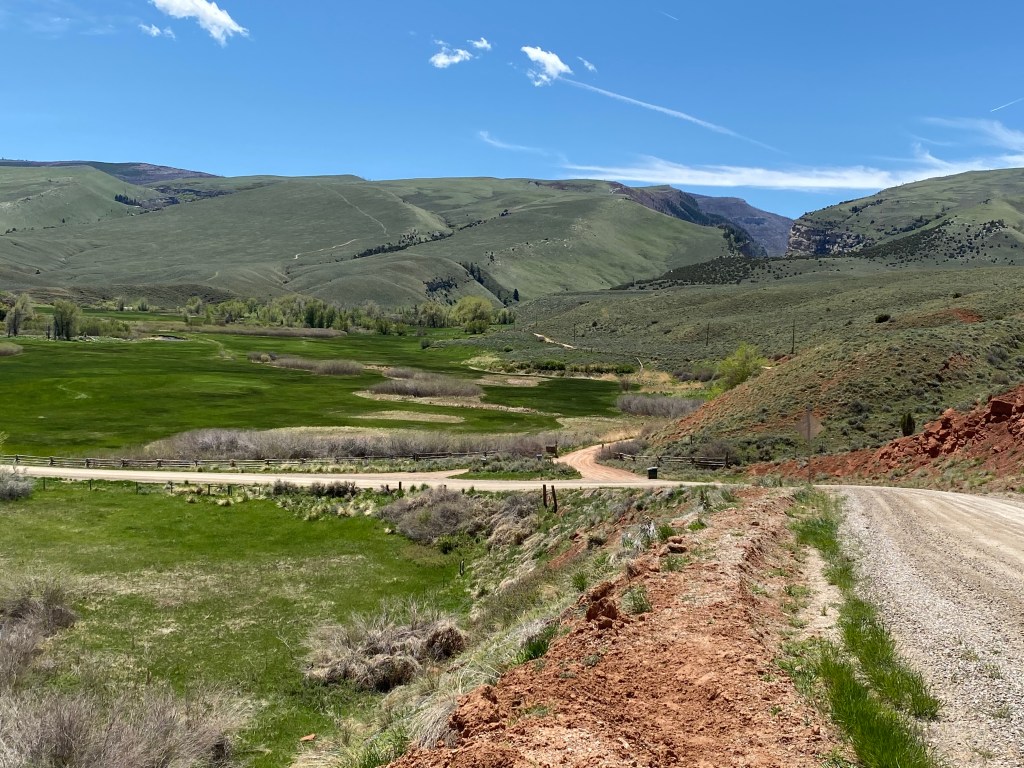
This app/website caught my attention as part of a news story about a woman in England whose husband was in medical distress and she tried to summon help by calling “911” (999 in England, I believe). When the inevitable question “where are you” came up, she had no idea. She was on a beach and the 999 operator wasn’t familiar with the hotel reference the woman provided. Fortunately, both people were familiar with “what3words.”

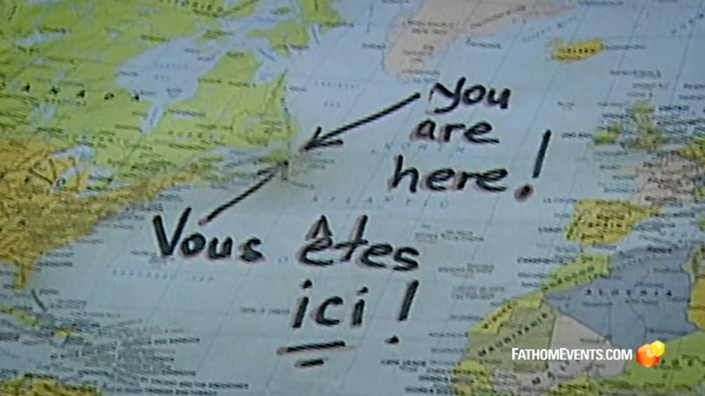
(Photo credit: IMDb.com and FathomEvents.com) I borrowed the map from “Come From Away,” about the passenger jets which were forced to land in Gander, Newfoundland, Canada during the September 11 attacks.

What3words software has plotted 3-meter (about 10 foot) squares over the entire surface of the planet and assigned 3 random words to each square. Think about that…. 57 trillion squares covering anywhere on Earth you could possibly be. The words, 40,000 of them, were assigned randomly but stay with a location forever.

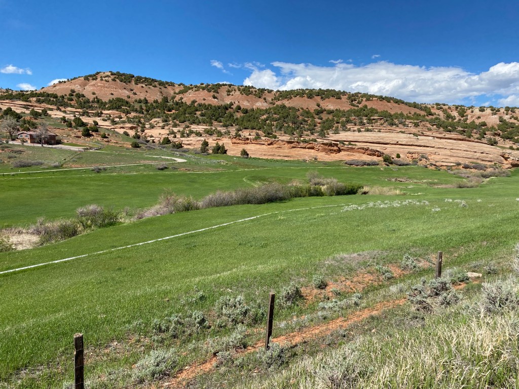
For example, if you bring up the what3words website on your computer and enter: rich.soup.noble it will take you to the Oval Office in the White House (the left side of the resolute desk. pill.hung.during is the right side, as seated at the desk). So if I am out walking in my neighborhood back in Durham and collapse on the path near a lake across the road from where I live, I could say: lengthen mistreat yardstick, and Durham 911 could enter that and bring up a map showing where I am (and a new feature is a satellite image of that location, in some places, not more remote areas).

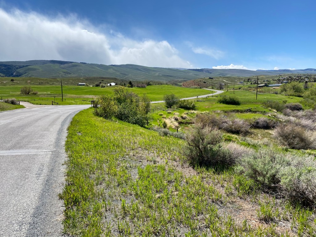
This method is a little less tedious than GPS coordinates, which a person under duress may not be able to quickly or accurately establish, but with the app on your phone you just open it up and it will tell you the three words where you happen to be at the moment. Accuracy is important, though, and that leads to an apparent weakness in using the “words” method. Spelling matters. Plurals matter. Changing one word to a plural may send first responders to Ogallala, Nebraska or the middle of the Pacific Ocean rather than Durham, North Carolina. And there is the problem of distinguishing band/banned, bear/bare, beat/beet, etc. – but if used properly it can get help to your approximate location (say, a on beach or in the mountains).

Here are some of the more unusual words I have seen used to try and thwart word confusion: floodplain, meerkat, sunblock, tofu, thermostats, crikey, bifocal, astronomers, backpackers, hogwash, hamburger, intestine, snippets, gazebo, coconuts, chandelier, helicopter, zealous, matchmaker, pistachio, roulette, gargle, thanksgiving, underrated, instrumental, riverbeds, considerably.

It’s also something you can have a little fun with on a rainy day. Klaatu Barada Nikto takes you to eastern India, near Bangladesh (and it changes the first two words to other words/spellings- the same way bacon.lettuce.tomato becomes beacon.lettuce.tomato). Pathetic Loser President takes you to a remote location in Russia (and let’s just say I learned about this before the most recent election). Certified Public Accountant takes you to Planada, California (between that town and Yosemite National Park). International Space Station to western Australia. I was looking up words for a friend of mine and their neighbor’s house was at peaches.waffle.grits.

I like doing crossword puzzles and difficult.crossword.puzzle and easy.crossword.puzzle both took me to different places in Alaska. The Dildo Brewing Company in Dildo, Newfoundland, Canada had some funny combinations in it’s vicinity (as if Dildo Brewing Company isn’t a funny combination of words on it’s own…): psychiatry.upbeat.cafeteria, devoid.giggles.machining, and dozen.sludge.honeybees. Ah, the unintended consequence of random, computer generated words!

Try it sometime and have some fun. green.eggs.ham, peanut.butter.jelly, sliced.cherry.cheesecake. But in an emergency, choose (or say) your words carefully. It could save your life!

Sinks Canyon State Park

This is by far the closest State Park to Lander and my brother and sister-in-law have posted some great photos of it on their Facebook pages. I took a quick drive up on Friday to see how much I could see from the road. My nephew, Sam, has already given me hiking tips for this Park (and others) which I will do some of in the coming days. I am not much of a hiker but will try to get to some areas which don’t require a long or strenuous walk.

The entrance to the Park is only 10 miles from where I am living! I wasn’t 200 yards in to the Park when I had my first photo op.

On the same side as I was parked, to the right of my car, there was a small group of mountain climbers (can you find them in the first photo?).

There they are….

And across the road was a small picnic area

And while I was taking the photo above I could hear water running and lo and behold, the Popo Agie River was running right along side the picnic area!

This is the same river I saw Thursday up near the NOLS Wyss campus and you will learning something very interesting about it later in this post.

Just a short distance from the picnic area (and there were others nearby, as well as a small camping area) was a children’s playground.

I kind of suspected that the real rock climbers had something to do with NOLS and sure enough, before I left this initial parking area I noticed that the two white trucks at the far end of the parking area in the first photo above were, in fact, NOLS vehicles. I don’t know if it was just NOLS staff enjoying a “Friday afternoon of Memorial Day weekend” break for some personal time or NOLS training. You will see more photos later in this post and I now suspect it was the latter.

I drove deeper into the Park and stopped at the Visitor Center. It wasn’t open but there was still things to see and learn.

There was an outdoor display of various rocks in the area (certainly of interest to mountain climbers who rely on the strength of the rock to support them):

To the left of the Visitor Center was the Popo Agie River. A sign I saw Thursday which stated that it is pronounced “po-po-zshuw,” which didn’t help me one iota. The Sinks Canyon brochure says it is pronounced “Po PO-shuh” (two words, my emphasis added based on another reference) which makes a little more sense and which I would NEVER have guessed. It is a Crow Indian term which has a different meaning every time I read about it.

Here is the river flowing down the mountain behind the Visitor Center:

Which then made a right turn and disappeared into a cave!!

I’m going to keep you in suspense for a little while but you will see the river again later in this post and learn something unique about this Park.

I started driving further up the mountain into the Park and was surprised to see this:

What?!? I’m leaving already? I just got here, and I haven’t even driven 2 miles!….

Turns out Sinks Canyon State Park (proper) isn’t all that big, but I was now entering Shoshone National Forest and there was still plenty of things to see. I continued driving and was also surprised to see this:

Waaaiiitttt a minute…. Did I make a wrong turn somewhere or is the altitude playing games with my mind? Well, while Missouri has some beautiful mountains, I guess they may not have the rock and soil composition variety that these mountains have.

From this position there was an interesting rock formation way up high to the left of the highway.

I don’t know about you but to me this looks like the profile of a person looking off to the right.

I have seen formations like this before, including the Delaware Water Gap near where I used to live in Pennsylvania. On the New Jersey side of the Delaware River, which separates NJ and PA, is Indian Head mountain, much larger than this formation but the same premise.

I continued on up the road and while I was hoping to drive much further today, the road was closed at a place called Bruce’s Camping Area. Sam thought that I might not get much further than this but hopefully before my obligations in Lander conclude in late June I will be able to drive further into the Shoshone National Forest because there is MUCH more to see.

I couldn’t continue as far as the switchbacks, shown on the map below, or the points beyond.

I was currently at 7,150 feet elevation but had to turn around and start going back down the road to Lander.

Not to worry, Shawn. I STOPPED in the road to take those two photos. (She gets upset with me, as she should, when I take pictures out the windshield while driving).

But there was one more stop to make…..

To the left of the road, where I took the following photos, was a little ranger station with an interesting audience participation site behind it. I didn’t take pictures of the building because I was more interested in what was behind it. This is also where I can tell you more about the Popo Agie River, which went underground into a cave further up the mountain. It now emerges to continue it’s downhill run towards Lander. The spot where it went underground is called the “Sinks,” hence the name of the State Park which I was now back in. This spot, where it emerges, is called the “Rise.” In between, the water runs underground about a quarter mile and crosses under the road, a process which takes two hours! Where is scientists aren’t sure, and more water comes out at the Rise than goes in at the Sinks. One of nature’s little mysteries…..

This is not a very big area where it come out of the hill but the river soon widens considerably.

This is where the fun begins. Sam told me to be sure to brings quarters so I could feed the fish. Well, right after the river comes out of the mountain there are lots of trout which kids (and adults) love to feed. There is a vending machine which dispenses food (for quarters) to throw down to the fish.

There was one lone Canadian goose down there but if you look closely you will see some of the dark brown trout which, if you have ever seen a Canadian goose up close, are HUGE because they are about the same size.

There is a trout just below and to the right of the goose. They were scattered around the river but the majority had congregated just below the wooden platform which people walk out on because small kids don’t always have a long throwing range and the food invariably goes straight down. The trout are aware of that and know where to find the yummies.

There was also signage here which explained that in 1919, the Sinks Canyon Hydro Electric Company build a plant here to harness the power of the river to generate power for nearby Lander. That plant continued in operation until 1955 when it was closed. Remnants are still on-site, though I wouldn’t have know if I hadn’t read about it.

I continued on down the road to the Park entrance to see how the mountain climbers were making out. The original NOLS group was right where they were when I saw them initially but there was another pair of climbers to the left of where they were:

If you look closely at the photo above you will see one person just above the square shadow to the right of center. His or her climbing buddy is below the shadow, to the left.

I was hoping some of the NOLS climbers might have been going up the mountainside but there were two that descended from where they were down to the level of the road:

After the person in the blue shirt made it all the way down another climber started to descend:

Just an incredible visit to a place I plan to return to, maybe even later today! From the highest point I was at today back to the house was only 13.7 miles.

And after I passed through the Park exit this was the view looking off to the left of the road:

It seems like the natural beauty out here just never ends.

Atlantic City

There aren’t any casinos in this Atlantic City, Indian or otherwise. Nor is there any pricey oceanfront property. This is Atlantic City, Wyoming.

The good will ambassador I met when I first arrived in Wyoming last week (the “crazy old man” at the Welcome Center in Pine Bluffs) had told me about this place and based on what he said I was expecting a ghost town, like I had seen in western Nevada. When I had looked at the map before heading out to the Wyss campus yesterday I noticed that Atlantic City was further out Route 28 so I thought I’d take a drive out to check it out. My nephew Sam knew about it too and said “Oh no, not deserted. People still live there”.

I continued driving on Route 28 past Red Canyon and the road climbed to just over 8,000 feet in elevation (high enough that there was snow off the sides of the road in protected areas away from the sun’s rays). The temperature was 62 degrees, about 10 degrees below what it would be when I got back into town.

I drove about 2 1/2 miles down a well maintained dirt road (as was Red Canyon Road) and sure enough, found little Atlantic City.

I drove a little further into town and the signage told the story of when this was a gold mining town and had a brief boom period. The town “boasted of beer breweries and one of Wyoming Territory’s first public schools”. Those good times were short-lived, however, and despite two revival attempts with newer mining technology it never relived it’s glory days.

There was a brochure rack with a flyer about a self-guided walking tour of the town but I think I will see if Stephen and Jen (or Sam) have been here yet and maybe bring them with me when I come back another time.

As I was driving back to Route 28 I saw evidence of some kind of mining off to the left of the dirt road I was on:

As best I can tell from the maps, the snow covered mountain in the distance is probably Wind River Peak, elevation 13,192 and at the southern end of the Wind River range. The other nearby mountains on the map are below the apparent snow line.

Further on down the road…

After I left the Wyss Campus on Thursday, Sam suggested that I turn right instead of left at the bottom of the driveway and continue further out Red Canyon Road, the dirt road which took me to the Wyss Campus from Route 28.

First, a photo I had taken from out on Route 28 as I was getting further and further lost before our meeting (I was already past the turnoff for Red Canyon Road when I took this. In fact, Red Canyon Road, which I was supposed to be on, is visible up on a hill in the upper right hand side of the photo below).

I was intrigued by the deep canyon in the distance.

You will see other photos of it shortly. From local brochures and maps I knew it wasn’t Red Canyon, which you will also see shortly. I asked Sam about it and he said that as far as he knows it doesn’t have a name. I think I might know what it is after having gotten a little closer to it.

Anyway, when I turned right at the bottom of the driveway here are some of the things I saw:

Once I got down to the little bridge you see in the photo above I had a closer view of the deep canyon I had seen from out on Route 28:

I drove further down Red Canyon Road until I reached a private residence and decided to turn around. There are two ways in to Red Canyon and Sam had told me that neither one is suitable for my Nissan Altima.

That little bridge, which I was standing on when I took the photo above, crosses the Little Popo Agie River.

My theory is that the river carved that deep canyon after flowing down from the top of the mountain over a gazillion years or so. The force of moving water is a powerful thing.

Once I finished my drive on this portion of Red Canyon Road I turned right on Route 28 to retrace my steps from earlier in the day and visit another site which Sam had told me about.

When I got further away from Lander on Route 28 there was a scenic overlook off to the right side of the highway. The elevation at that overlook is 6,975 feet and this was the view below. THIS is Red Canyon:

And to put the size into perspective, if you zoom in to the upper third of the first photo you will see a white tractor-trailer traveling on Route 28 which passes above the red rock cliff.

Petroglyph Hill

After my nephew Sam had taken me on my personal tour of NOLS’s Wyss Wilderness Medicine Campus on Thursday he led me on a short hike up to “Petroglyph Hill”, a short distance from the main building and at the northwest edge of NOLS’s 242 acre property.

Here is a 3 shot panorama, left-to-right, of where we were headed. Sam tried to talk me into using the panorama feature of my new iPhone but I will need to experiment with it first before I put it to use.

And here is my trusty tour guide, Sam, who patiently waited for me when I was 30 minutes late arriving and then spent 2 1/2 hours on his partial day off to show me around. Thanks, Sam!!

That black canister on his belt is Bear Spray, which Sam calls “pepper spray on steroids”. I bought a can up in Riverton on Tuesday and it was on the outside of my backpack, though I will start using the belt holster to strap it on my belt, just like Sam. I am supposed to take it with me anywhere I go outside (in the wild, not downtown Lander!) as there are bears, mountain lions, coyotes, wolves and other critters lurking out there. There is a plastic “safety” clip to prevent accidental discharge and knowing JohnBoy as well as I do, if something can go wrong it will, so it will stay affixed until such time as I need to spray something! Who knows, perhaps another amusing JohnBoy story in the making….

I have seen petroglyphs in other parts of the country during my travels but I always find them interesting. I always wonder what was going through the person’s mind to want them make a lasting image. Some are drawings and others are actually carved into the rock. I’ve tried to eliminate the modern day entries which are nothing more than vandalism and graffiti (I know what was going through those people’s minds…). There is a place for creative expression (i.e. murals or art exhibits) but not on rock formations or other public places in our National Parks and elsewhere which takes away from their natural beauty.

Wyss Wilderness Medicine Campus

Today my nephew Sam gave me a personal tour of this off-the-grid NOLS facility, located about 12 miles south of Lander. Did you hear that JohnBoy – 12 miles not 24 miles! Your blog host overshot the access road off of Route 28 and ended up being 30 minutes late for our 1030am appointment. And where was my trusty GPS unit? Sitting on the dining room table at home, awaiting an update of new maps (a mistake which will not happen again!).

And when I said off-the-grid, I meant it. NOLS main purpose is wilderness survival training and when they teach students the skills they will need not only for themselves but to assist others in distress, why not take them out into the wilderness to do it in that environment? No sign out by the road, you need to know where you are going to get there. And what a gorgeous place it is!

This is the view of the campus from what I call “Petroglyph Hill” which you will see in detail in the next post. Sam took me on a short hike up to where the drawings (actually carvings in to the stone in some cases) are and this was the view looking back at the campus.

The Wyss (pronounced Weese [rhymes with geese] – I had it wrong in an earlier post) campus is located on 242 acres owned by NOLS, a non-profit organization with it’s world headquarters in Lander.

The main building is located just right of center of the photograph above, in the upper third of the lower square. Petroglyph Hill is in the extreme upper left corner of the upper rectangle.

Students, primarily from the United States since the pandemic but from other parts of the world prior to travel restrictions, come here roughly 30 at a time for courses (17 actual class days in a little under a month) in various aspects of wilderness medical training. And get this – if they traveled here with their own vehicle they must leave it in Lander. Even though there was a class in session there were only about 6 or 7 vehicles on-site (including mine). Again, wilderness means wilderness. No joyrides into town at night or on weekends – students are here to learn and must demonstrate their dedication to their education and hands-on training.

When I arrived the class was actually outside the building in 3 groups of about 10 each, learning how to safely assess a persons injury and get them up off the ground and transported to a treatment facility. Today’s lesson: the spine.

Here is another, wider view of the campus (2 shots):

The large building on the left is where the classrooms are, as well as a cafeteria and smaller meeting rooms. There is a reception area and small administrative office. You will see photos of all of it. I believe Sam told me that the main building was built in 2012. It is LEEDS Certified Platinum (my friends Shawn and Eric, both architects, will understand the significance of that) and is incredibly well designed and constructed. Very energy efficient, using solar panels and a sloped roof to harvest rainwater (though with the small amount of rain this area gets in a year, I think he said 13 inches, they’ve had to supplement that with a well).

The white building in the center is under construction and will house additional washer/dryer facilities, a large meeting room with a big TV for Zoom meetings and such, a gym, and a lounge area for students to relax and socialize. Again, they are here for the duration of the course so NOLS decided to build a complex where they can relax a bit after a hard day of training.

The small buildings on the right are cabins where the students live. Their course fee includes room and board so they eat, sleep and learn here. We didn’t go in the older, larger cabins bit we did go in the smaller ones currently being built. They were designed for four people, a small open area and two bedrooms, each with two single beds on either side. Very sparse. Current pandemic distancing rules means that for a while there may only be 2 students per cabin, not 4.

NOLS attendance took a HUGE hit when the pandemic struck – worldwide. Since then, interest in NOLS courses has skyrocketed so they are slowly getting back to normal operations, at least here in the United States. As mentioned in an earlier post, there are NOLS facilities (not all as elaborate as this one) in several parts of the US including Alaska, Canada, Mexico, South America, Australia and New Zealand.

So lets see some photos, JohnBoy!

A gorgeous tile piece of art of the Wyss logo, made by a former instructor, just inside the entry door.

The reception/common area. Even the fabric on the furniture is environmentally friendly!

The view out the window between the cafeteria/outdoor dining area on the left and the classrooms on the right.

The indoor portion of the cafeteria (and the seats and backs of the chairs are made of recycled material). There is a large covered outdoor deck on the right with lots of tables and seating.

The “Mission Wall” with information about what NOLS does.

And a little NOLS humor about social distancing. Six feet is the length of a mountain lion!

The classroom where most of the teaching takes place. The configuration is to promote social distancing. Class size is about 30 students but used to be slightly higher. The students were in another room (open space) reviewing their earlier outdoor training when I took these photos.

The outdoor area previously mentioned. I didn’t take photos of the students out of respect for their privacy.

A closer look at the new student building under construction.

And a closer look at the new cabins being constructed.

An outside look at the classroom side of the main building.

An outside look at the outdoor dining and cafeteria side of the main building.

Being on a private “All Access” tour of the facility meant I even got to see the behind the scenes (i.e. in the basement) technical workings of this elaborate facility. My nephew Sam is in facilities management so he has to know about and maintain all systems: heat pumps, water filtration and circulation – for heating and cooling, both of the water itself and the building, electrical equipment including solar panels, backup systems, etc – and even including the elaborate composting toilet system which he explained in detail (but I’ll spare you the photos!)

The lay of the land

So here I am, in west-central Wyoming, in the town of Lander for the next month (at least):

(Photo credit: NationsOnline.org)

There are lots of interesting places I can be in just a few hours, though there isn’t often a direct route from Point A to Point B. So you CAN get there from here, it just may take a while. As I mentioned shortly after arrival, just the county I am in is slightly larger the state of Vermont (Fremont County WY 9,266 square miles vs. State of Vermont 9,217 square miles). Fremont County makes up 9.5% of Wyoming’s 97,093 square miles, so just getting out of the county is an undertaking.

Some popular points of interest:

Yellowstone National Park – itself a big place:

West Thumb of Lake Yellowstone, in the southwest part of the Park: 180 miles, 3 hrs 30 minutes driving time, elevation 7,795 feet. West Thumb is at the bottom of the “figure-8” shaped roads in the western part of the Park. Those roads take you to where most of the popular tourist destinations are (Old Faithful, etc). The southwest entrance to the Park is closer than that.

Jackson, WY (aka, incorrectly, Jackson Hole) is adjacent to Grand Teton National Park: 160 miles, 2 hours 45 minute drive time, elevation 6,237 feet. For the record, Jackson is the town – Jackson Hole is the area surrounding the town.

Riverton, WY – 26 miles, 29 minutes drive time, elevation 4,956 feet.

Green River, WY (SW of Lander and near Flaming Gorge National Recreation Area) – 130 miles, 2 hour drive time, elevation 6,115 feet.

Salt Lake City, Utah – 296 miles, 4 hour 18 minute drive time, elevation 4,226 feet.

Gardiner, MT (outside the northwest entrance of Yellowstone) – 252 miles, drive time just under 6 hours, elevation 5,259 feet.

Fort Collins, CO – 287 miles, 4 hour 14 minute drive time, elevation 5,003 feet.

Cody, WY (Rodeo capital of the world and near the southeast entrance to Yellowstone) 168 miles, 3 hour drive time, elevation 4,997 feet. A few years ago I drove through Cody, briefly, and decided that I would return someday to see a rodeo (and wear a t-shirt proclaiming “This IS my first rodeo”).

Sheridan, WY – 238 miles, 4 hour drive time, elevation (near the base of the Bighorn mountains) 3,743 feet.

Gillette, WY (northeast part of the state) – 274 miles, 4 hour 24 minute drive time, elevation 4,554 feet.

Casper, WY (east central part of the state)- 146 miles, 2 hour 20 minute drive time, elevation 5,118 feet.

Laramie, WY (which I drove through getting here, and home to the University of Wyoming, whose logo the “bucking bronco,” is the state logo) – 223 miles, 3 hour 14 minute drive time, elevation 7,165 feet.

Cheyenne, WY (the state capital and just east Laramie on Route 80) – 274 miles, drive time just under 4 hours, elevation 6,063 feet.

Rawlins, WY (where I left Route 80 to drive northwest to Lander) – 126 miles, drive time 1 hour 52 minutes, elevation 6,834 feet.

Snow in them thar hills

I am living for the next month in Lander, Wyoming. Elevation in town is officially listed as 5,357 feet. To the south southwest of where I am sitting as I write this there is a row of smaller mountains which range in elevation from 7,000 to 9,000 feet. Behind that (further southwest from my vantage point) is the Wind River Mountain range. Those mountains range from 12,103 feet at the southern end (locally), then 12,631, 13,192 and finally 13,804 at the northern end, the highest point in Wyoming. Those mountains all have snow on them and in the week I have been here when it has rained here in Lander there has been radar-indicated snow up in the Wind River range (and I suspect the snow pack up there was, in fact, added to).

As I was leaving town to drive to Riverton (northeast of Lander) on Tuesday I noticed that I could see the snow covered mountains much better from a distance and stopped to take these photos (left to right is south to north):

The darker mountains in the foreground are in the 7,000 to 9,000 foot range and the snow covered mountains are 12,000 to 13,804 feet in elevation. Lander, and where I am staying, is at the base of the darker mountains.

And to illustrate how flat it is once one gets away from those mountains, as I drove northwest to Riverton (which is actually just below 5,000 feet, at 4,956) here was the view as I turned right at 45 degree angles from where I took the photos above.

Looking northwest:

Looking northeast, the direction I was traveling (my car is facing me because I had turned around on the highway before pulling over to take these photos. The hill in the distance is my direction of travel to Riverton):

And finally, looking southeast:

And to add some interesting off-topic photos to the mix, here is a baby bunny which was out on the front porch as I was writing this post:

And a family of mule deer I took photos of yesterday morning, and who are daily visitors at various times of the day:

Lander humor, perhaps

Or is it????

I actually took these first two photos yesterday after I took the northern approach to and from town (see earlier post). When I came back home I overshot the turn off to check out the shorter southern approach for photo ops. I decided to wait and post these two with the other southern route photos, which I took this afternoon.

First, I must apologize to the person or persons who live in the little cabin in the first photo because I thought they were responsible for what you will see in the second photo. When I took the photo of the cabin I assumed the access road I was parked near lead off to the left and then curved back along the base of the hill to the cabin. Today, when I came home using the southern route I saw that I was mistaken. The access road to my left actually leads to the hill behind the cabin but then goes up and over it to an unseen location. So here is the cabin photo:

And here is the sign posted at the access road:

Now maybe the sign owner is dead serious and I don’t plan to push the envelope and find out. What’s that saying – leave no trace behind?

NEW photos added beyond this point (except for the pronghorn at the end).

On a lighter note, here are some other photos from the southern approach to town. This is a three shot panorama, left to right:

Here is the road I got to that spot on (coming towards the viewer)

Here are some rock formations a little further up the road, which you may have spotted in picture 1 of 3, above.

Here is the picture above a little more head-on

And here is the same angle but slight askew to show a good sized house on the left, to give you some perspective of size.

Here is a shot of the road ahead.

Here is a pronghorn I saw running through a field on the other side of the road – my first pronghorn sighting this year. I took these two photos with the digital camera.

And now that I have fresh batteries in the digital camera I will carry it with me everywhere. Tomorrow morning I will use it to get some shots of some other critters I have seen here at the house.

So what brings you to Lander?

I’ve only been here a few days and Monday was my first extended stay in town (other than dinner Thursday night and picking up groceries on Saturday). I must say the people here are extremely friendly! The question above is invariably asked and is best answered in one word, or more accurately – an acronym: NOLS, which all the locals understand.

NOLS is the National Outdoor Leadership School, founded in 1965. It’s International Headquarters is here in Lander.

And I should really say that what brings me to Lander is my family, two members of which work for NOLS.

My older-younger brother (a term which other people struggle with but which makes perfect sense to me. I have two younger brothers and Steve is the older of the two), I am very proud to say, is the new CFO (Chief Financial Officer) of NOLS!! He started his new job in March of last year after a 25-year career at Vassar College in New York. He retired from that job in January of last year and while looking for his next position (he was open to ideas as to what it might be) he saw a listing with NOLS, a company he was familiar with because my niece, his daughter, had taken one of their wilderness survival course a few years ago.

Steve’s arrival at NOLS was bittersweet. While he was excited about his new position and could tell he would enjoy the people he works with, he faced the unpleasant task of recommending the temporary furlough of a large part of NOLS staff, not only here in Lander but elsewhere. March of 2020, of course, was when the true impact of the COVID pandemic really started to sink into people’s minds, and had a major impact on the company’s operations with global travel restrictions and shelter-in-place orders.

NOLS teaches courses in wilderness survival skills, including medical implications which I will explain later. According to a local news article from a few years ago, NOLS is the largest employer in Lander and occupies four large buildings in town.

Before the pandemic, NOLS employed a large number of people locally, full time, and over 1,000 seasonal workers in the summer months, worldwide. It is truly an international company with campuses or facilities in the western US (Rocky Mountain region, desert southwest, Pacific northwest and Alaska), Canada (Yukon), Mexico, Patagonia in South America, Australia and New Zealand. Now, more than a year later, NOLS is feverishly working on it’s plan to reopen facilities as the COVID threat lessens and their facilities can resume hosting students at the various locations. It is estimated that NOLS is responsible for 20% of the passenger traffic at Riverton Regional Airport, about 25 miles from Lander, as people fly in and out of here for training.

In addition to the NOLS offices and facilities downtown there is the large Wyss Wilderness Medicine Campus located about 12 miles south of town. That is where my nephew, Sam, works. He is giving me a tour of that facility Thursday morning so I will have photos of it and more details about what they do there this weekend.

As part of Sam’s 18-month position in facilities management at Wyss (pronounced Weese [rhymes with geese]), he was asked to take one of NOLS training courses. NOLS likes all of it’s employees to fully relate to what it is they do, regardless of what they do for the company. When I had dinner with Sam Thursday evening after I arrived, he told me he will be taking a course in layman’s medical training – to assess injuries, stabilize a patient and assist with transport to a proper medical facility. He said one of the highlights of that course is when the Med Evac helicopter arrives for real-life in-person training of what to do at that stage of evacuation. NOLS trains park rangers, skyjumpers and other fire-fighters, camp supervisors, and other first responders.

I will have more details about NOLS, and hope to get a tour of their downtown Lander facilities when my brother gets back to town next week. Details and photos will appear in future posts.