Tuesday I headed northeast from Lander again, past Riverton, and on up to the tiny town of Shoshoni. There I turned left on Route 20 towards the town of Thermopolois, about which which I will make a separate post.
After I got past Riverton I saw these horses, including two young foals, just off the highway to the left:


Then the road really opened up. Off to my left, in the distance, was a mountain range and I didn’t realize at the time that that was exactly where I was going.
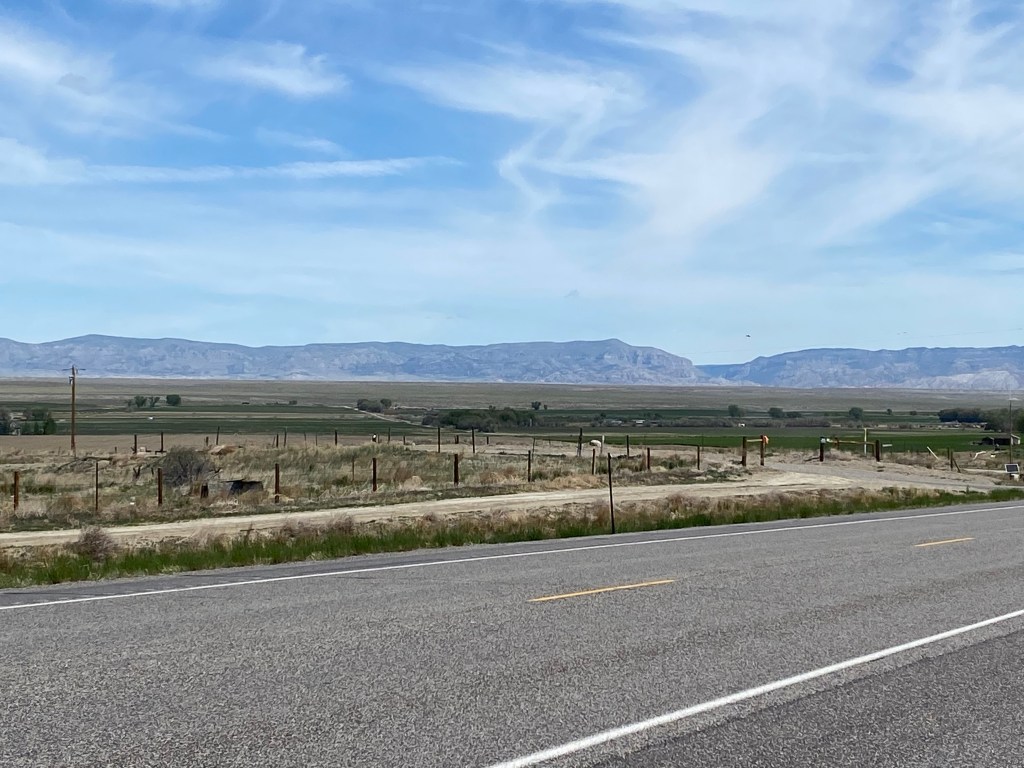
As you can see, between where I was and the mountains there is lots of flat, open space. Just a little further up the road this is how it looked of to my right:

On the left side of the highway at that spot was this large rock formation:

I continued northeast on Highway 26 and when I got to the one-light town of Shoshoni I turned left on Highway 20.
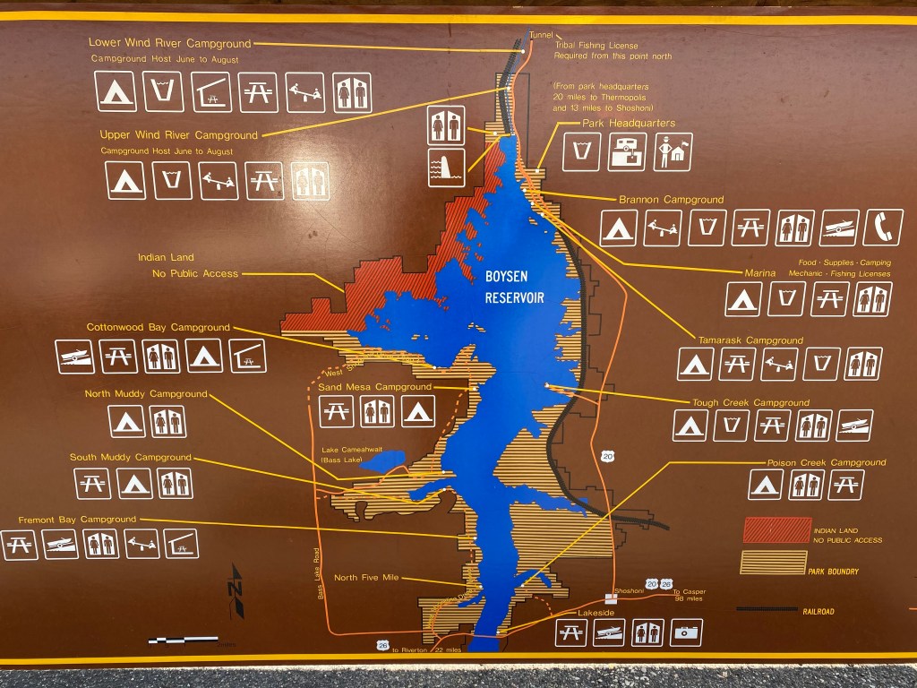
I started seeing more and more water on my left as I drove near the Boysen Reservoir. I didn’t have my Boysen brochure with me so I didn’t venture onto any of the access roads but I may make a separate trip up later this month and will add that to the blog in a future post. It is a popular recreation and camping area as evidenced by this map.
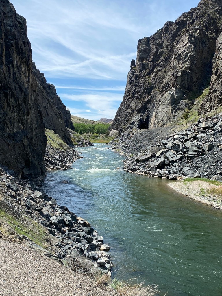
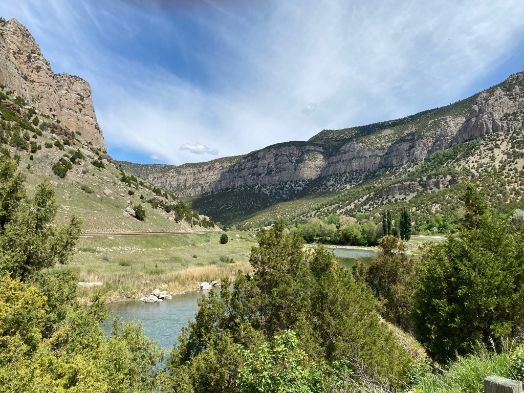
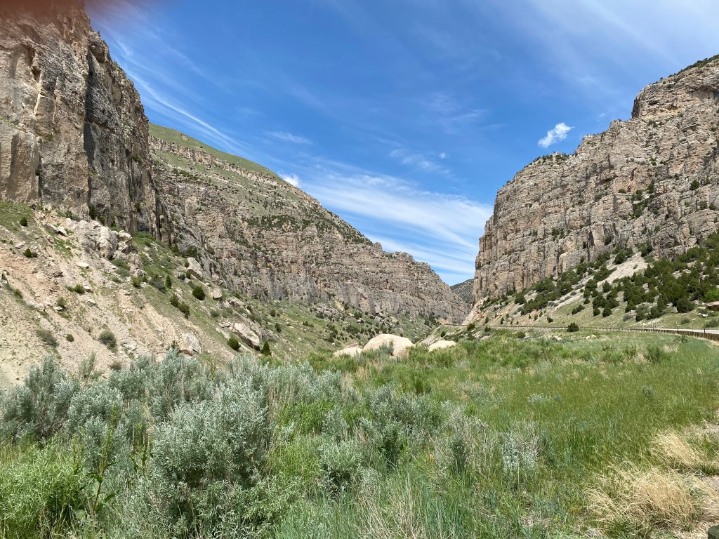
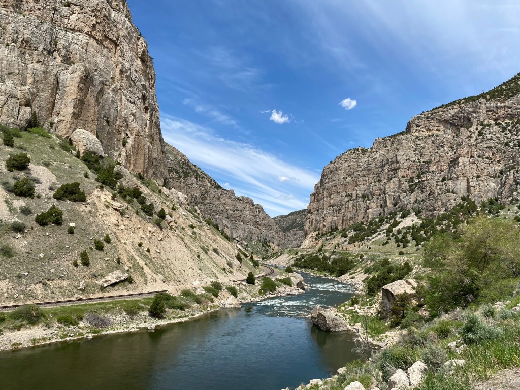
Now the fun part of my day was going to begin – my drive through 14 miles of Wind River Canyon. As you may have guessed, the canyon was created by the Wind River which carved a slot through the Owl Creek Mountains which run roughly west-to-east. Route 20 runs up the east side of the river and there is a single railroad track on the western side.
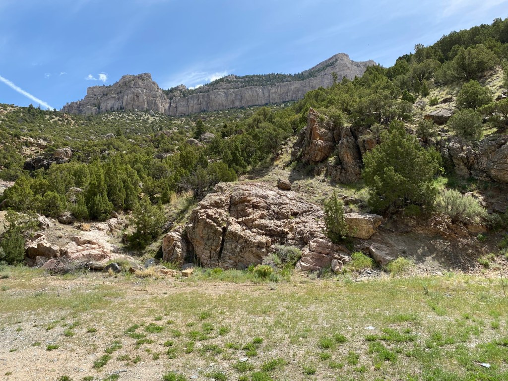
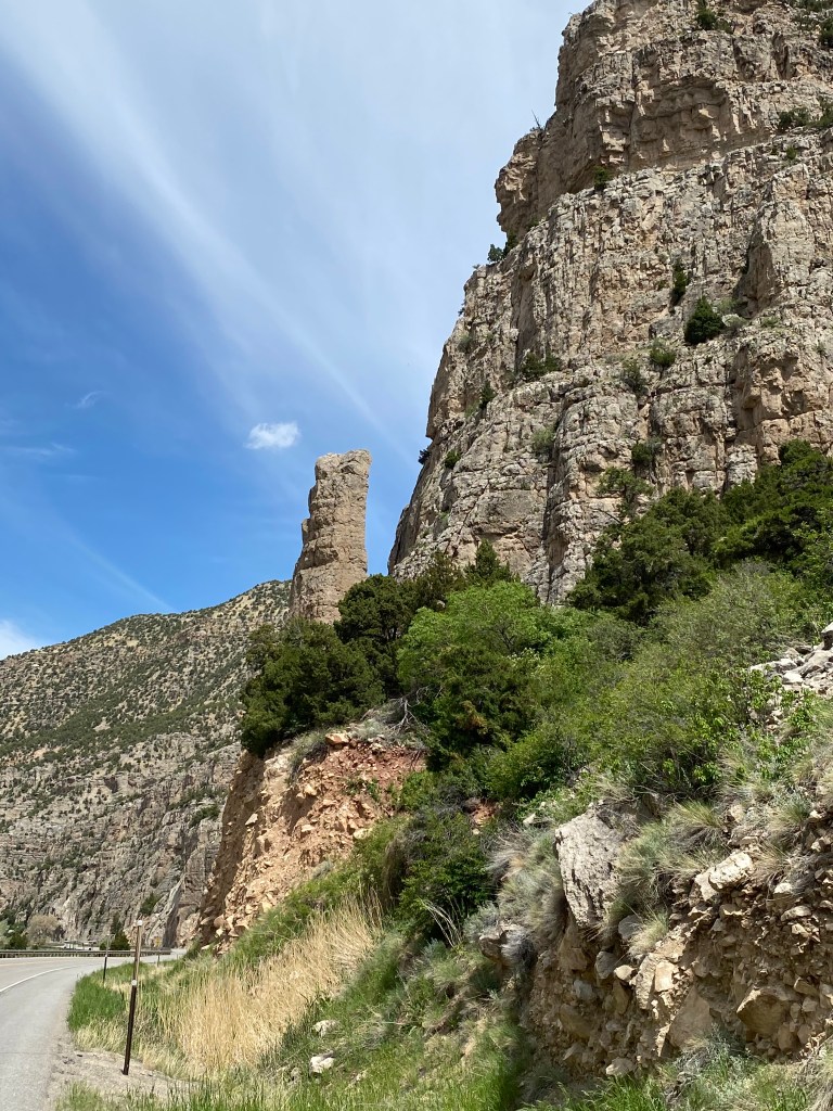
Here is some of the things I saw as I drove through the Canyon:

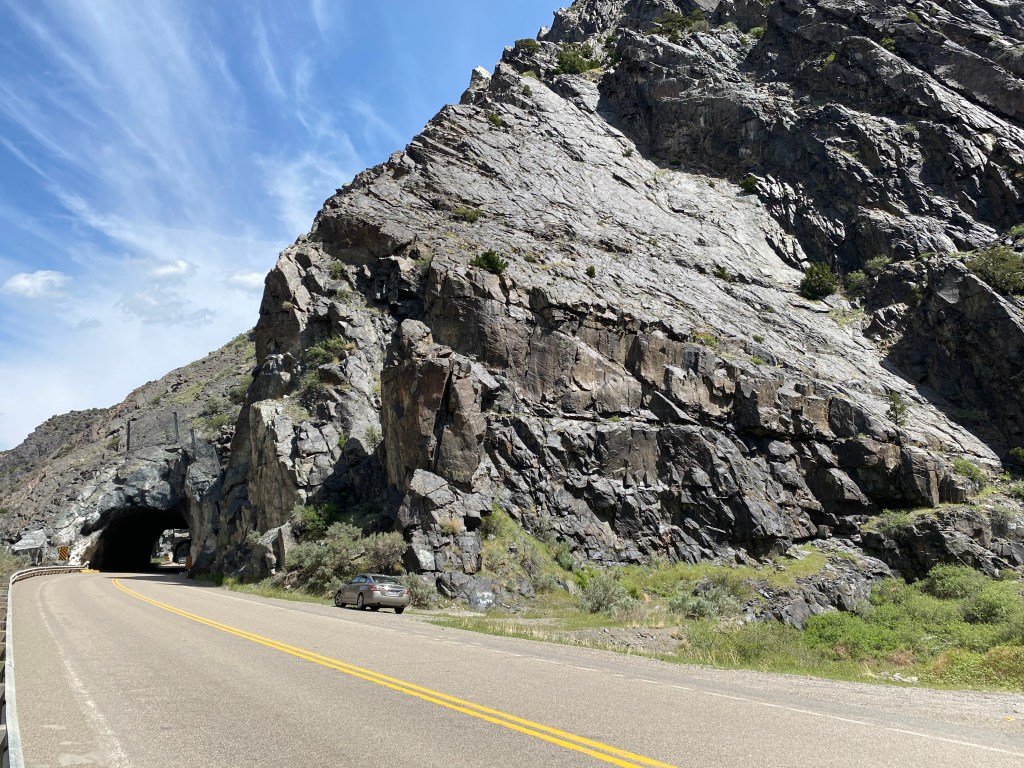
I had turned around so my car is facing the “wrong” way, and my headlights were on because I had already driven through some small tunnels which you will see shortly.

The photo below is one of three short tunnels I drive through. To the left you can see a similar tunnel for the trains.
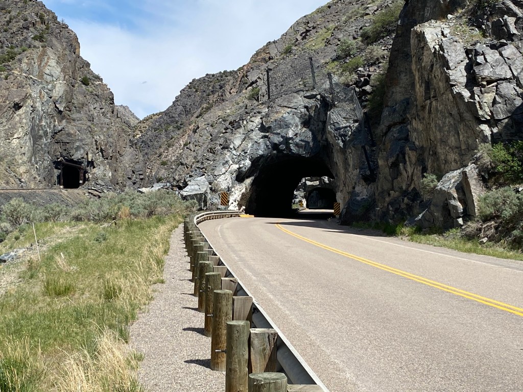
And from where I took that photo you can see how tiny my car is compared to just part of the mountain to the right of the road.
At this point on today’s trip I was only 70 miles from home. As I have learned in the last two weeks, within 100 miles of wherever you are, the terrain can change quite a bit.
After I got through the narrow, rocky southern portion of the canyon it opened up a bit and there was vegetation and trees at various elevations.


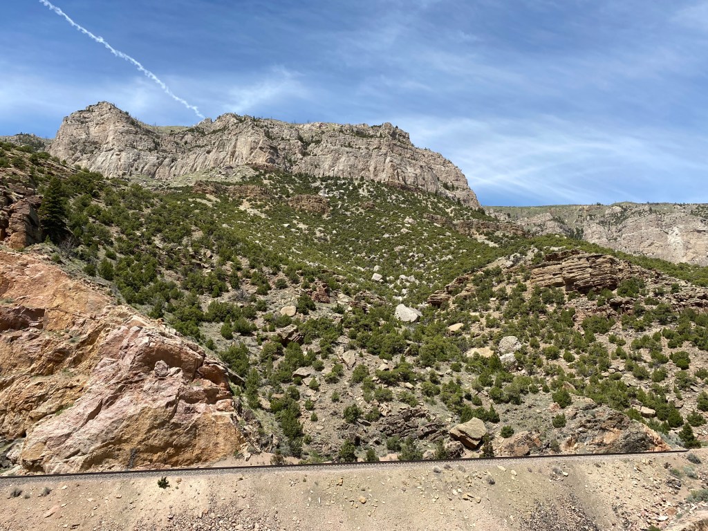
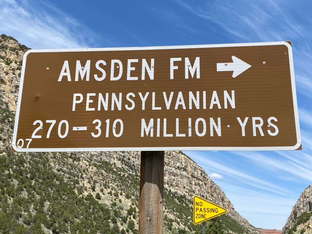
Every mile or so there was a sign indicating the approximate age of the rocks exposed on the right side of the road:
At one point I could see where there had been a small rock slide which would have blocked the railroad tracks on the other side of the river. I had already taken a photo from further back so I knew it had been cleared or else I would have called 911 and had them report it to the railroad:

And the fact that it was clear was confirmed a short while later when a train came roaring through:
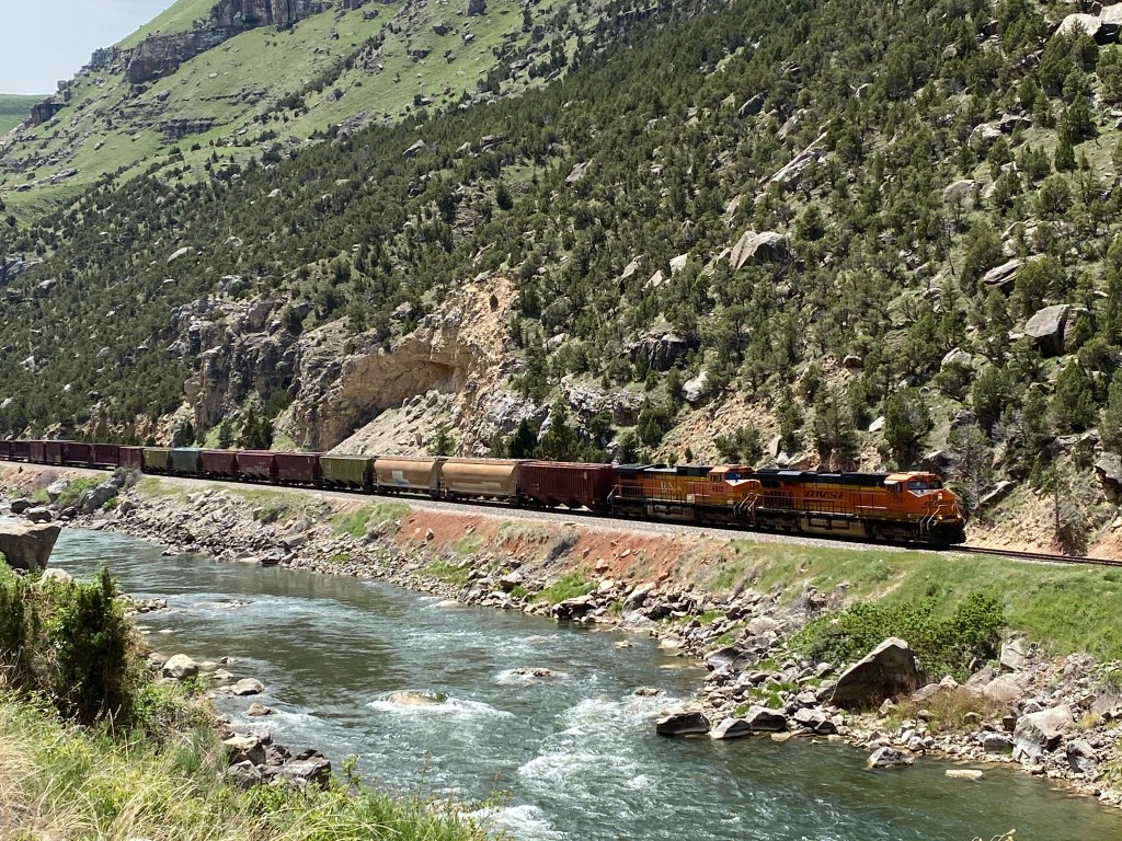
And my guess is that train was about a mile long.
An absolutely gorgeous drive on a beautiful day, which would have been even more fun in my brother’s Mustang convertible! He’s offered to let me use it but I am still at the “oh, look at that over there” stage and am scared to death I’d wreck it.
