As I traveled to Thermopolis on Tuesday I drifted on and off of Wind River Indian Reservation land. I also stopped, for the second time, at their Wind River casino which is 2 miles south of Riverton and a little more than 20 miles from Lander. Wednesday I drove northwest from Lander, to the little town of Dubois, which I will be making a separate post about. Thermopolis and Dubois are both about 85 miles from the house in Lander and while I drifted on and off of Indian land on Tuesday I was on it almost all day on Wednesday, except for the towns at each end. Turns out the Wind River Reservation is ENORMOUS – over 3,500 square miles – almost three times the size of Rhode Island!
The Wind River Reservation is home to two tribes – the Eastern Shoshone and Northern Arapaho. But as we say in Durham, with Duke and Carolina fans sometimes living under the same roof – it is a house divided. Those two tribes are bitter enemies and the result is a reservation which is considered the most dangerous in the country. The crime rate is 5 to 7 times higher than normal and gang violence, unemployment and drug use are systemic problems.
But it is a beautiful place. The land is, for the most part, very open and sprawling with an occasional small house or two, most often a trailer, and the Wind River makes frequent appearances as it meanders through the property. As I was driving north towards DuBois I was traveling along the western edge of the reservation and wasn’t far from the Wind River Mountain range.
There was a second casino on this, the west side of the reservation, and it turns out that Shoshone Rose (north of Lander) and Wind River (south of Riverton) are the only two casinos in the state of Wyoming. Wind River had a few gaming tables (only blackjack was in use both times I was there, with only a few players). It had one roulette table and a few card games I was not familiar with but the casino contained mostly slot machines. Shoshone Rose appeared to be exclusively slot machines, and both casinos had a small hotel attached. Both had only recently reopened after having been closed for a long time due to the pandemic and masks were mandatory at both facilities. The Indigenous American tribes throughout the United States were hit particularly hard by the coronavirus and I just recently learned that one of the places I hoped to visit in Arizona is still closed due to COVID concerns (it is on Navaho land).
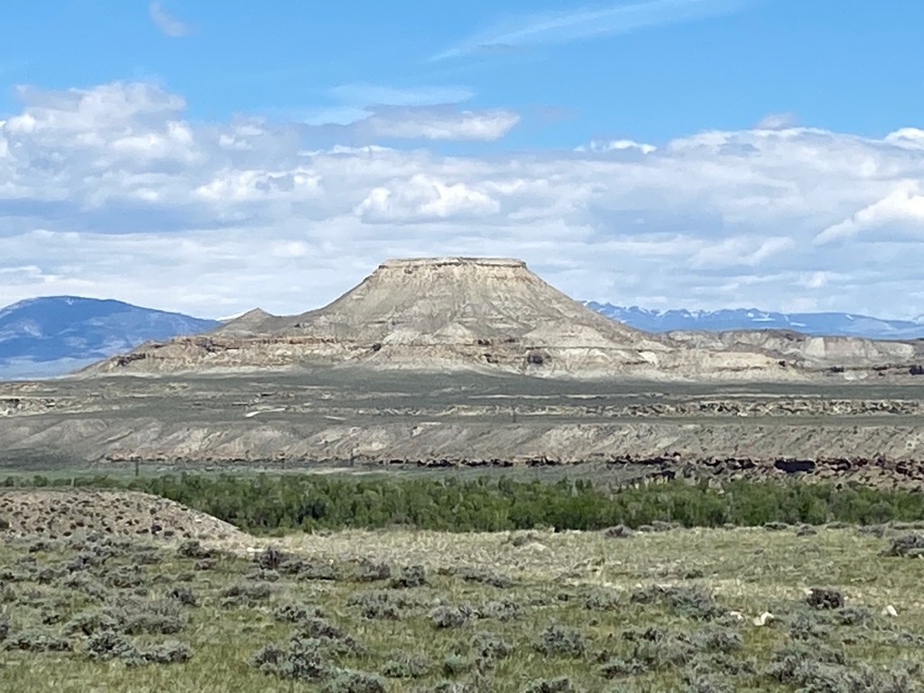
As I drove further north I started to see large formations in the distance and reached some of them eventually. This is Crowheart Butte:

And just up the road from that was this little non-denominational church:

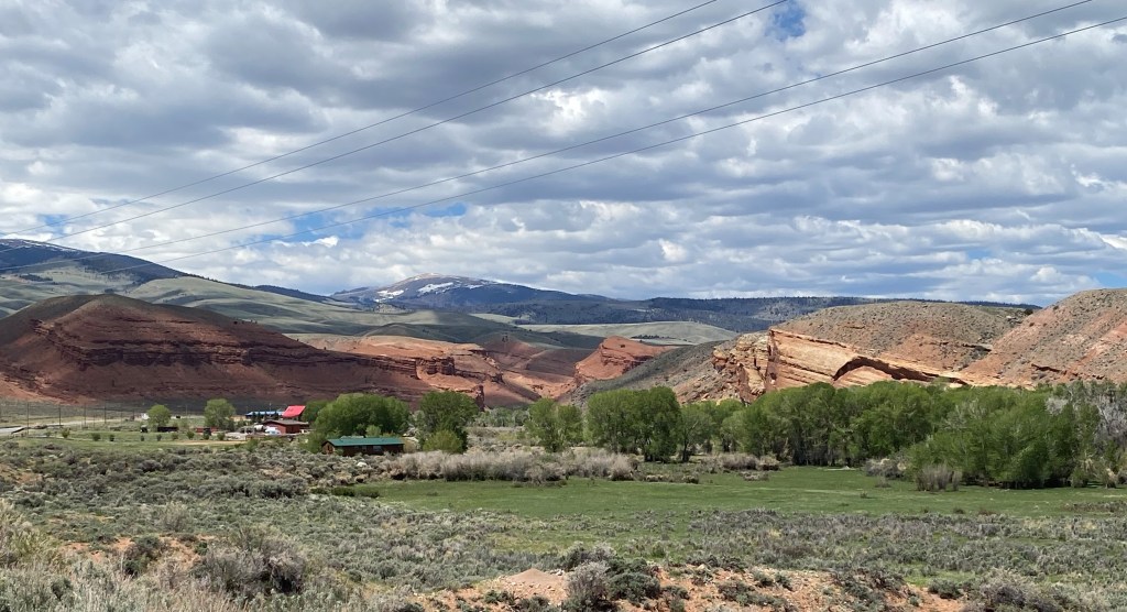
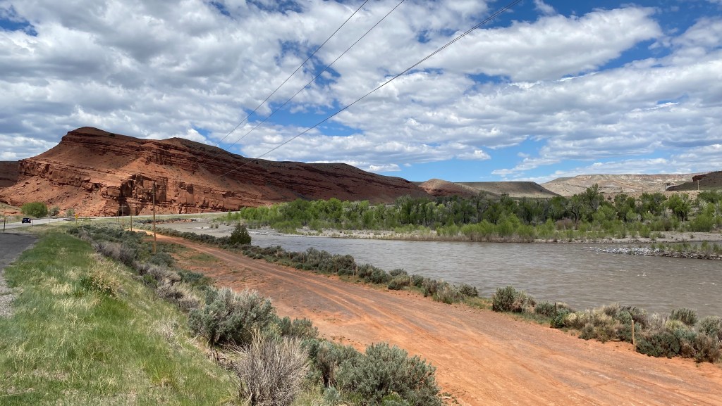
The scenery got a little more interesting as I approached the northwest corner of the reservation.


And I got to try my hand at using my new iPhone 11 to take a one-shot panorama (hopefully no more two or three shot left-to-right single pics for you to combine in your mind). Let’s give it a try and see what happens:
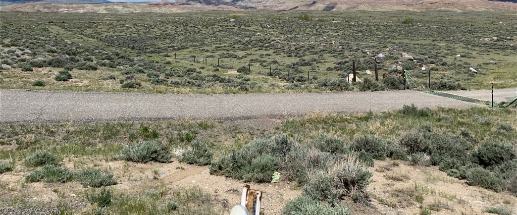
I’m afraid I’ll have to call that a FAIL! Nice shot of the access road in front of you there, JohnBoy… Silly me thought I should hold the phone in a horizontal orientation, as I do for wide shots. Evidently the phone will only take a panorama with the phone held in a vertical orientation while moving it left to right. Let’s try this again:
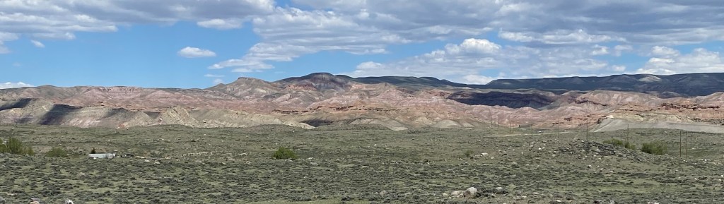

I cropped out some from the top and bottom and, while tiny, they do give a nice wide view. I was pretty far away from the target and it will probably be better the closer I get. Let’s just see about that:
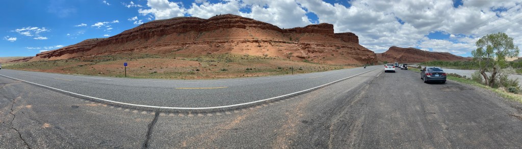

I’m going to go ahead and post these and take a look at them as everyone sees it online. I believe those last two photos were actually taken after I had left the Wind River reservation and was just a few miles from Dubois so let me wrap up this post and start a new one about that town.
