Yosemite National Park – Various

There are lots of other things to see in Yosemite besides the 3 or 4 most popular sites.  Here are a variety of pictures taken at various times and places throughout the Park during the three days I have been there so far (and I plan to go back on Friday).  I’ve tried to pick the best of the 425 pictures I have taken with my smartphone camera.  We’ll deal with the 322 I’ve taken with the digital camera later!

IMG_20180627_081754963

IMG_20180623_151331275

IMG_20180623_151504507

IMG_20180627_165629800

IMG_20180625_090651231

IMG_20180625_105611303_HDR

IMG_20180625_115604617

IMG_20180625_120332648

IMG_20180625_120337833

IMG_20180627_090740099

The waterfalls seen in the next two photos are Nevada on the top (at 5,907 feet elevation with a 594 foot drop) and Vernal (at 5,044 feet elevation with a 317 foot drop) below it.  The other day I talked about mountain-climbing fatalities at El Capitan and Half Dome.  Well, these waterfalls are not without their victims as many people get swept to their death by getting too close or not taking proper precautions.

IMG_20180627_154043154

IMG_20180627_155837086

The eagle had landed

And yes, I am using the proper tense – unlike the White House in their erroneous press release concerning Iran’s nuclear program.

Sunday while on a scenic drive on Route 4, north of Sonora I stopped at Alpine Lake, a very nice spot where many folks were enjoying the day near, in and on the water.

IMG_20180624_132935883

IMG_20180624_132946401

Shortly after taking those photos, and more which I will post later, a bald eagle swooped over the lake from left to right, probably only 20 feet above the surface and maybe 40 yards ahead of me.  Here is a photo of the eagle in flight:

DSCN1979

Well damn.   That didn’t exactly work out.   Getting a bird in flight, zoomed in and focused is very difficult, especially when you weren’t expecting it.

Well, the eagle flew up and landed at the top of a dead tree:

DSCN1982

DSCN1985

He or she (it’s hard to tell adult eagles apart) sat up there looking out over the lake.  When some folks I had been talking to alerted me that if I walked up the path next to lake I could get a closer look I changed positions:

DSCN1992

Then I walked even further up the path to see if I could get photos looking at it from the front.  Well, just as I found the perfect spot the eagle flew away.  I waited a while to see if it would come back and then walked back down to where I had seen it originally.  Well, sure enough, it came swooping by again and although it headed for the same tree it turned left and headed for another tall, dead tree.  I scooted up the path but again, when I got to the perfect spot it flew away.  I waited 45 minutes (in a shaded spot where I could see both trees) but had to move on as I still had lots of territory to cover.

Here is what could have been.  Just picture the eagle sitting on both of these spots facing the camera:

DSCN1996

DSCN2003

Depending on how much I get done in the next two days I may well go back up to Alpine Lake and try again.  It really was a perfect spot on the path to watch both trees and at 2 o’clock in the afternoon I was on the shade and the sun was in a perfect spot for pictures.

I have been keeping an eye on tall, dead trees as I drive around but haven’t seen any more eagles.


To see the bald eagle pictures I took last year near Yakima, Washington search “Eagle Redux” on the Home page or use the calendar there to go back to July 28, 2017.  For the eagle pictures from Arapahoe National Wildlife Refuge search for that name on the Home page or use the calendar to go back to August 17, 2017.

Don’t get too close to the edge there JohnBoy

We don’t want AAA to have to perform another “extraction”.

Tuesday I took one of the scenic roads I had driven on Sunday north instead of south, and in the morning rather than in the afternoon, to get a different perspective.  At one point I saw a nice scene off to the left so I crossed the road to park on the shoulder and out of harm’s way so I wouldn’t have to walk across the highway.  For added safety I drove off the paved shoulder and onto the dirt (the paved areas are often “turnouts” where slow moving vehicles going uphill are required, by law, to pull into when more than 5 vehicles are behind them), then noticed the steep dropoff and the fact that there was no guardrail:

IMG_20180626_103844008_HDR

IMG_20180626_103728089

Here was the reward:

IMG_20180626_104048989

For those of you who may be new to the blog and don’t understand the “extraction” reference, search for “Delay of Game” on the Home page, or use the calendar there to go back to August 20, 2017 to read another amusing JohnBoy story.

Maybe my next contest should be to guess when the next time I need to be “extracted” will occur….  Also for you newcomers, don’t forget we currently have a contest going on with $20 to the winner and with a “double or nothing” option.  For details search “While you’re waiting” on the Home page, or use the calendar there to go back to May 29, 2018 to read the details.  You will have to use the “Contact” link on the Home page to send me your guess (see “Comments” on that post to see other people’s guesses).  When I reach the northern part of my coastal drive at the end of August I will start driving east along the Canadian border which opens up all kinds of snake, moose, mountain lion, grizzly bear and bobcat scenarios.


Further north on Highway 88 Tuesday morning I came to this spot which I had seen on Sunday:

IMG_20180626_105224529

In the foreground is Silver Lake whose surface is at 7,300 feet elevation.  Towering behind it is Deadwood Peak which tops out at a rugged 9,846 feet.

Here is a view from down by the lake:

IMG_20180626_105954313

And here is what it looked like on Sunday, in the afternoon when the sun was behind me:

IMG_20180624_174103954


Uh oh…

Somebody’s been playing games with the road signs again….

DSCN2205

I chuckled to myself Monday night when I drove past this sign while driving home from Yosemite National Park, but I was “on the clock” and didn’t have time to stop and get a picture of it.  Well, I came back to drive this road again on Tuesday so here it is.  At first I thought that someone just turned the sign to make the effect more dramatic, but as I post this I realize that this sign, when seen set on it’s side, should be at the TOP of the hill warning of a steep downhill grade ahead:

DSCN2208

Maybe the highway department ran out of UPHILL grade signs to place at the bottom of the hill so just improvised and used this sign instead….

The sign was just off Route 395 where it intersects with Hwy 108, which takes travelers over the Sonora Pass.  The elevation very quickly goes from 6,800 feet to 9,624 at the peak and there are multiple warning signs along the road advising people driving big trucks NOT to even attempt using this road, even in good conditions.


About 4 miles south on Route 108 I found this facility:

DSCN2221

DSCN2222

I took some other photos of the facility but choose not to post them here for fear that DJT may think I am an Enemy Combatant, perhaps working for KJU.

You can see some of the housing facilities in the photo above (which for all I know could just be a Red Roof Inn in a very remote location…).  Next to that building were administration and other buildings which undoubtedly house supplies and food for the trainees.  There was also a landing pad for helicopters:

DSCN2218

And weren’t not talking little JetRangers like the sign shows.  Oh no, we’re talking CH-35E Super Stallions:

MWTC YouTube

(Photo credit: YouTube)

SuperStallions defense.gov

(Photo credit: http://www.defense.gov)

The Marines don’t fool around.

To see other photos of this facility and the work that goes on here you can Google it and look at Images.

Monday when I drove further south I saw a camp set up next to the road where a large number of troops were probably preparing for night training (this was in the late afternoon, which is why I was “on the clock”).  Tuesday as I drove further south on 108 the camp I had seen yesterday was deserted but even further down the road were maybe 60 troops, walking in a line along the highway.  They were wearing full fatigues, boots, floppy hats and carrying what were probably heavy, fully loaded backpacks.  I didn’t stop to take pictures of them for several reasons:

1 – They were working

2 – They were also all carrying assault rifles

3 – THEY might have thought I was an Enemy Combatant

Further down the road I just enjoyed the views and this time did stop to take pictures which I will post at a future date.


Yosemite National Park – Saturday

Well, progress is being made, albeit slowly.  When I got home after spending the day at Yosemite on Monday I got the password for my Airbnb host’s private modem so I am now able to access the internet using my computer to post to the blog (the posts the past two days were made using only my phone).

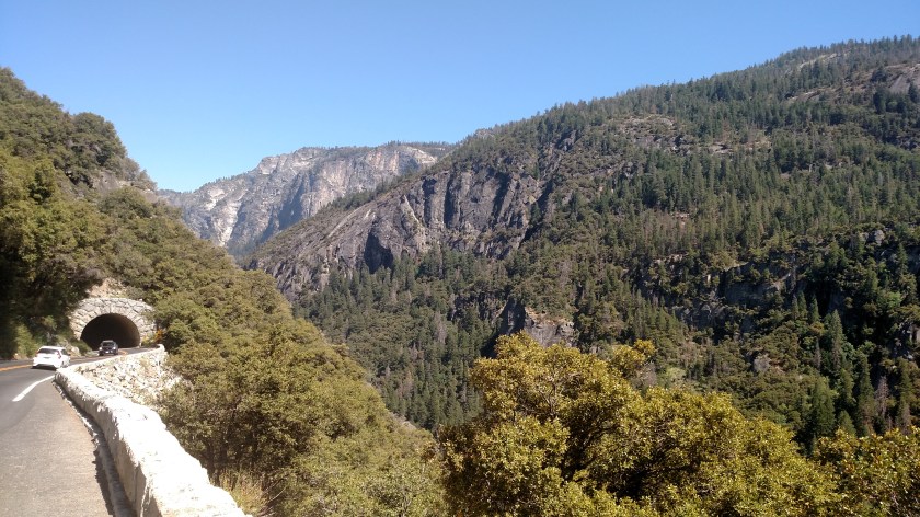
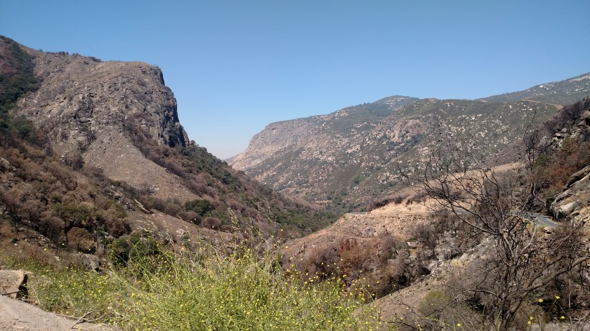
Saturday was a travel day as I went from Visalia, CA to where I am staying this week near Sonora.  I had not been planning to go to Yosemite on Saturday or Sunday, fearing 3rd weekend in June crowds, but my Airbnb host advised me that one of the local roads which would have allowed me to go around the Park was closed due to problems it experienced over the winter.  So after going near Fresno I drove up Route 41 and, reluctantly, enter the Park.  I had to sit in line for an hour and a half just to get in the entrance gate.  After driving a while I went through one of the many tunnels in the Park and experienced my first “Oh wow” moment, the picture I posted on Sunday.  Here is an even closer look at that same scene:

IMG_20180623_143633632

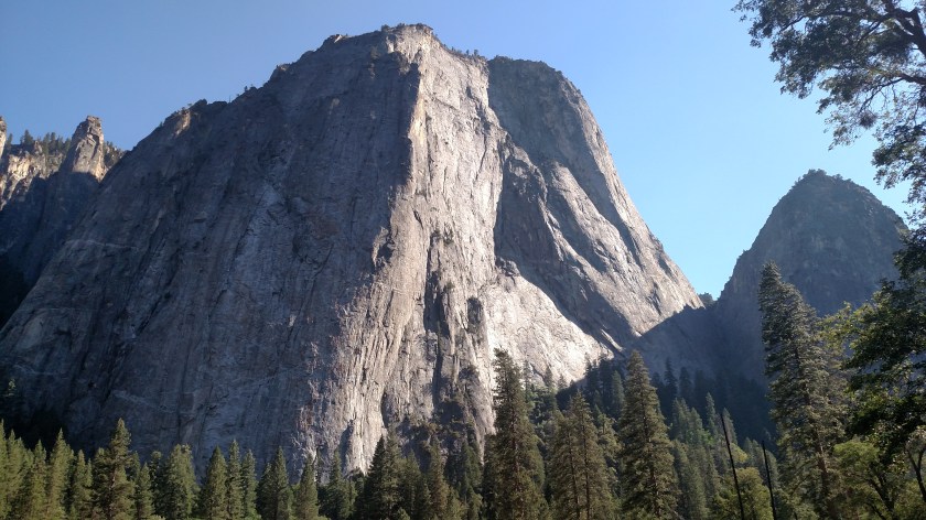
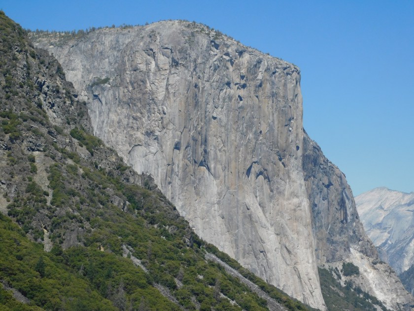
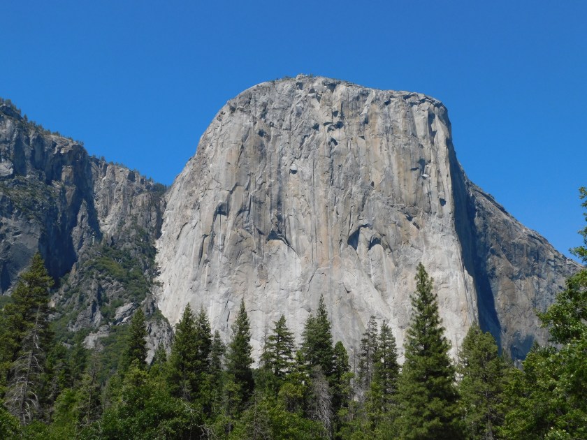
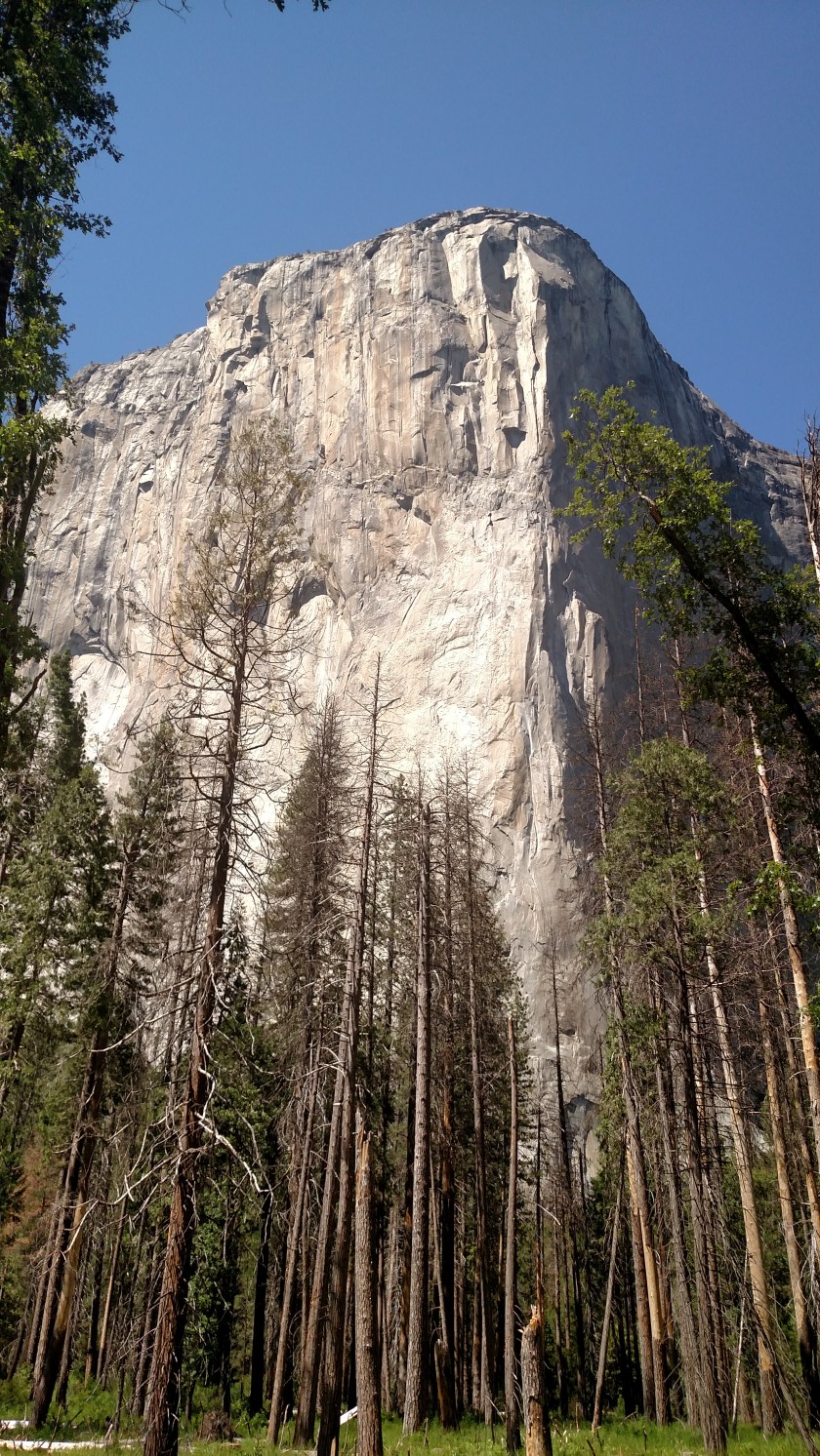
As I mentioned yesterday, this vantage point shows the three main attractions in Yosemite, El Capitan on the left, Half Dome in the center, and Bridal Veil Falls on the right.  Here, now, is a closer look at all three:

The El Capitan peak towers 3,000 feet over the Park floor with a maximum elevation of 7,569 feet.  It is a popular rock climbing destination and earlier this month two climbers set a new world record by climbing it in less than two hours.  And get this – they did it with their bare hands and NOT using ropes or safety equipment (definitely do NOT try this at home!).  Alex Honnold, who I have seen featured on 60 Minutes and several other shows, and his buddy Tommy Caldwell climbed “The Nose” several times earlier this year, each time breaking their own record.  Well, on June 8 they did it in 1 hour, 58 minutes and 7 seconds.  El Capitan is more than 5 times taller than the Washington Monument and I don’t think I could climb the STAIRS in it 5 times in two hours…

DSCN1892

DSCN1896

IMG_20180623_150203858

Here is a picture I found online indicating where “The Nose” route goes:

The-Nose-El-Capitan Gripped Magazine

(Photo credit: Gripped.com – Photo copyright protected)

As you can imagine, rock climbing – even with safety equipment – is a very risky proposition and El Capitan has many victims.  Two experienced climbers were killed earlier this year when they fell from the face of the formation, and a British climber was killed last year when a large chunk of the rock wall gave way during his ascent.  Base jumping off the top has been banned because of several fatalities.  I prefer to just look at El Capitan from a safe distance, thank you very much.

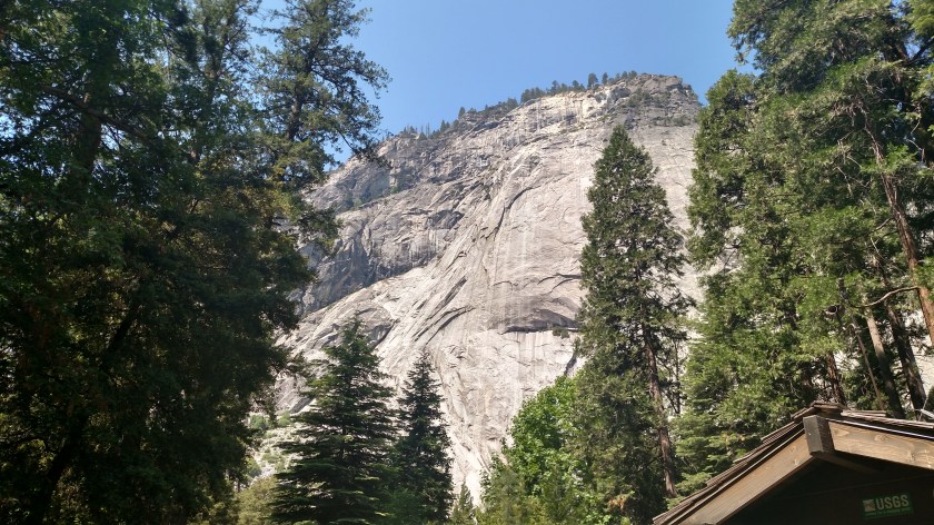
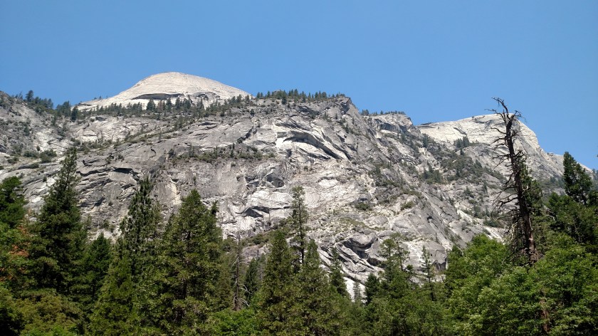
Way off in the distance is Half Dome:

DSCN1889

I am hoping to get a better shot of it on Wednesday.  This is also a popular rock climbing destination and has it’s victims as well.  As the TV ads used to say “It’s not nice to fool with Mother Nature”.

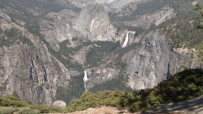
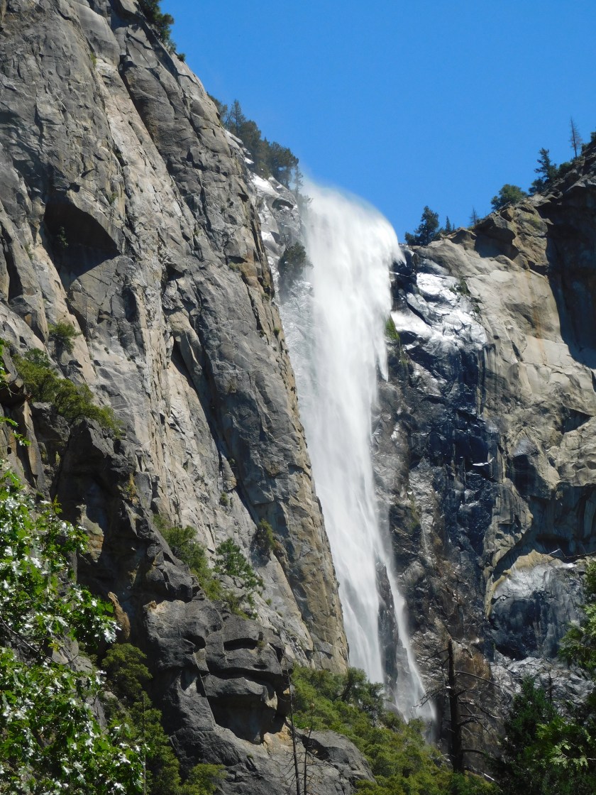
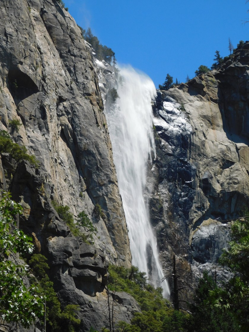
And finally, Bridal Veil Falls – one of several falls with that name throughout the United States (we have a rather unique one in western North Carolina, near Brevard, and I saw a really cool one last year in extreme northern Oregon.  They each have their merits.)

IMG_20180623_145317631

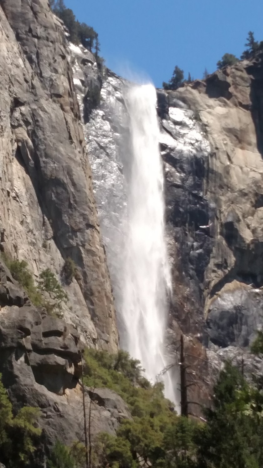
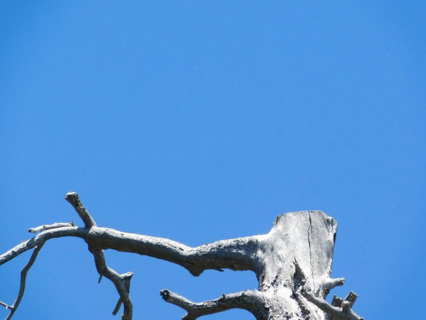
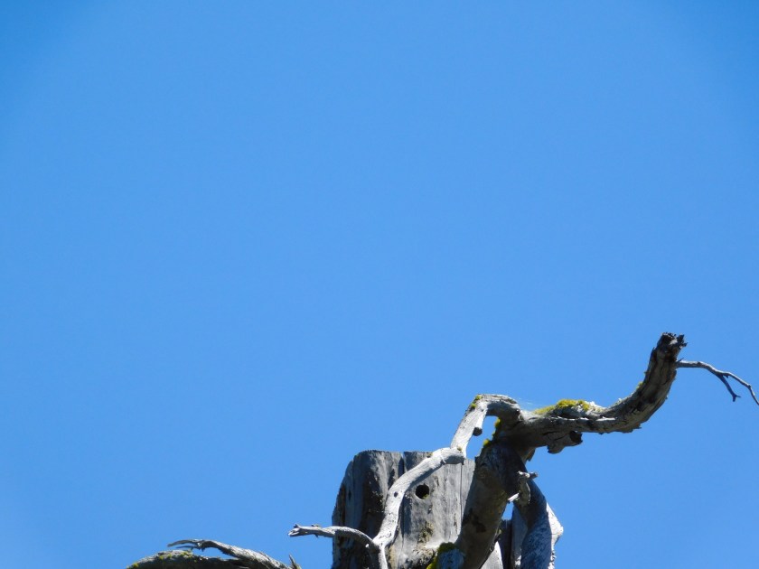
These next two may look the same but were actually taken just seconds apart:

DSCN1909

DSCN1910

I spent a good part of the day in the Park on Monday and plan to go back in on Wednesday.  I will have lots more pictures to post, although the bulk of them may have to wait until I get to Reno, Nevada this weekend.  My Airbnb host here warns guests that the internet connection is rather slow.  They actually live in Tuttletown, which even more remote than Sonora, and the service isn’t exactly “blazing fast”.

Monday update

Well, I have good news and bad news…

The good news is that I made progress getting access to the internet using my computer. The bad news is that my computer doesn’t remember the password for the personal network that my host entered last night (usually it remembers passwords once it successfully connects). I just tried all available networks out in the living room (close to the primary modem) and still no luck.

The best news is that I had a spectacular day Sunday driving two scenic roads north of where I am staying in Sonora. I have lots of photos to share eventually.

An observant friend of mine noticed a waterfall on the right side of the picture I posted yesterday. I hadn’t even noticed it from the spot where I took that photo but it means I caught all three of the top attractions in Yosemite in one shot – El Capitan on the left, Half Dome in the center, and Bridal Veil Falls on the right.

Here are two of the 337 pictures I took yesterday.

This guy was out fishing in a small boat and was approaching the place where I was standing on shore. When he got close enough to me I told him he’d be on the blog today – so here he is:

Monday I go in to Yosemite for the whole day. My host says it is definitely a “Park and Ride” Park where I need to get there early and ride their Shuttle buses around to the various overlooks. I am going back to bed (422am local time) and will hit the road early!

Hopefully more very soon!! Thanks for your patience.

US Forest Service Ranger Station

Friday I drove back down to an area I had visited earlier in the week to get pictures I didn’t feel I had time to stop and take on that occasion.  Along the way I saw this sign outside a Ranger Station as I entered the Sequoia National  Forest and stopped to ask what it meant:

IMG_20180622_101234634

I had a nice long conversation with a man named Gabriel, who works there.  He explained that it is a restriction on the use of chainsaws.  In hot, dry conditions like the area is currently experiencing, the use of chainsaws is prohibited due to the additional air pollution it would cause.  Worse conditions could lead to even more restrictions on other activities and use of machinery.

Gabriel told me about the Pier Fire which occurred last year in the area I was about to revisit, and we talked about a wide range of topics including his history with the Forest Service and other organizations leading up to his current job.

I also had a chance to buy this spiffy Smokey the Bear hat:

IMG_20180622_152038109


Saturday is a travel day as I say goodbye to my EXCELLENT Airbnb hosts Chris and Nicole in Visalia and head north to my next stop in Sonora, California, where I will be spending the next 7 nights.  I will drive many of the scenic roads up that way today and tomorrow and will probably wait until Monday to start spending time in Yosemite National Park, which evidently has LOTS of spectacular scenery to offer from the road.

Air quality

On Wednesday as I drove up to Kings Canyon National Park I stopped again on a stretch of road which is up at around 5,000 feet (many of the roads in this area have signs advising you of the elevation in 1,000 foot increments) and offered a spectacular view to the southwest.  The day before I had taken photos at around 330pm, looking partially into the afternoon sun.  Wednesday I passed the same spot around 915am.  Here are both three-shot panoramas (looking left to right).  The areas closer to me are fairly visible but it was obvious that in the distance were even more things to see, but the view was diminished by haze and air pollution.  Earlier in the week as I drove towards Sequoia National Park in the morning (driving east towards the sun) I could barely see that there were huge peaks in the distance but it was too hazy to see them clearly (pun intended).  Too bad that instead of flamethrowers Elon Musk can’t invent something to eradicate pollutants in the air.  Or maybe Trump could direct Scott Pruitt, the lame EPA Secretary, to actually do something GOOD for the environment….

Afternoon:

IMG_20180619_152914417

IMG_20180619_152919058

IMG_20180619_152923518

Morning:

IMG_20180620_091631032_HDR

IMG_20180620_091635744_HDR

IMG_20180620_091640116_HDR

This year I don’t think I can blame any of this on wildfire smoke.  I have been keeping an eye on active fires and so far it looks like the immediate future doesn’t have me very close to any, although that can change very quickly.  A friend of mine sent me a link to another resource and it gives me even more information about active fires than the ones I had bookmarked last year.  The two fires which had been burning in Colorado earlier this month, near Durango and Silverthorne, have dropped off the “Large Fire” map and, while still burning, are getting further under control.  Durango recently got some much needed rain which helped with the fire control effort there.

Pier Fire

This has nothing to do with the fire on the Santa Barbara pier which I posted information about several days ago.

Earlier in the week I drove through the Giant Sequoia National Monument – South Unit which is located southeast of Visalia and east of Porterville CA.  I had noticed that a large section of the hillside had burned, presumably in a wildfire.  Friday I stopped at the US Forest Service Ranger Station and got the whole story.

The Pier Fire (wildfires get names, based largely on where they occur.  There is a resort nearby called Pierpoint Springs which, fortunately, was spared fire damage).  The Pier Fire started August 29 of last year when four thugs plunged a stolen 2017 Dodge Challenger down an embankment and set it on fire.  It seems the young men (three of them age 21 and one only 19) had a stolen rental car scam going.  Well, fire doesn’t destroy fingerprints and the four young men were quickly arrested and are cooling their heels in jail, to give them time to think about what they did.  I seriously doubt they will ever pay any restitution for the estimated $ 36.5 MILLION dollar cost of extinguishing the fire, plus the property damage it caused (see post below).  The fire consumed over 36,500 acres and wasn’t fully contained until October 6, 2017.

IMG_20180622_110257795

IMG_20180622_110734621

IMG_20180622_110738908

IMG_20180622_110920518

IMG_20180622_110938854

And to add some color to this post, this lone poppy plant was growing at one of the little pullout areas next to the road:

IMG_20180622_110420679

IMG_20180622_110443947_HDR

And when I reached a high point on my drive I stopped to take another picture from about the same vantage point as I had posted a few days ago.  That day I took the photo around 6pm, looking towards the late afternoon sun.  This photo was taken at 1107am with the sun behind me.  A very different image!

IMG_20180622_110715820

IMG_20180618_164911573