Santa Barbara, California

I spent a good part of the day Wednesday in Santa Barbara, California on my way up the coast to Nipomo.  Here are various things I saw throughout the day.

In North Carolina we have hurricane evacuation route signs.  Last year in Washington and Oregon I saw volcano evacuation route signs.  Now this:

IMG_20180613_092657083

IMG_20180613_111149722_HDR

An interesting house (or apartment building, perhaps) downtown:

IMG_20180613_104414652

IMG_20180613_104434325

IMG_20180613_104442314_HDR

The pier, near Stearns Wharf:

IMG_20180613_111407816_HDR

Part of this pier burned on November 18, 1998.  This photo on the new pier shows the damage from the air.  The fire started in a restaurant.  It took the city almost two years to rebuild the pier:

IMG_20180613_113512573

I had lunch (a yummy bowl of clam chowder) at another popular restaurant on the pier.

IMG_20180613_111411428_HDR

As I walked out onto the pier I noticed a young lady starting what will be an elaborate sand sculpture.  I made note of her website and will wait and post pictures from it once this is complete.  I won’t tell you what it will be.

IMG_20180613_112304683

Further out the pier, on the sand off to the side, was this quiz, written on a large piece of fabric:

IMG_20180613_112633191

And more things from around town:

IMG_20180613_115501216

IMG_20180613_120013336

IMG_20180613_134942805

IMG_20180613_140627492_HDR

IMG_20180613_141431642_HDR

IMG_20180613_141703467_HDR

Getting around Santa Barbara

There are a number of ways to get around Santa Barbara – both on and off the water.

Or in this case, BOTH on and off the water…

This is an amphibious vehicle, often called a “Duck,” which is street legal but can also “drive” right out onto the water and become a boat:

IMG_20180613_115045463_HDR

Here are some more conventional methods:

IMG_20180613_120502991

IMG_20180613_120541800

IMG_20180613_111645371

IMG_20180613_111703189

IMG_20180613_120915562

Or how about this stylish ride?

IMG_20180613_125237847

IMG_20180613_125250083

IMG_20180613_125308601

IMG_20180613_125320392

This fog is as thick as pea soup…

As I drove north of Santa Barbara on Wednesday on my way up to Nipomo I saw a sign along the highway which mentioned that Buellton, California was the home of split pea soup.  I love pea soup (a memory of working at the company my father worked for during the summer when I was in high school and we went out for lunch at either of the two restaurants in that small town, where the lunch special was often a hamburger, a bowl of pea soup and an ice cold Coke.  To this day I often buy a can of Progresso pea soup, go to one of the better burger joints in Durham and get two hamburgers, and enjoy them with an ice cold Coke) so of course I had to stop at Andersen’s Restaurant in Buellton.  It was yummy!!  Probably the best pea soup I’ve ever had.  Nice and thick, not watery like canned soup often is.

IMG_20180613_154643661

Their logo (splitting pea’s… the guy on the right looking nervous….)

IMG_20180613_162147231_HDR

IMG_20180613_162311806


Accessing the blog – suggestions

I spoke with a friend of mine in Pennsylvania today who mentioned that sometimes he has trouble seeing the pictures I post.  I think it is a good time to review some pointers to enhance your blog experience.

First – do NOT open the blog using e-mails you receive indicating that I have posted something.  I often initiate a series of posts from my phone, then populate them with pictures and written text using my computer (and must upload each photo I plan to post).  Sometimes that process takes 2 to 3 hours.  If you open a post and it says “Photos  and/or  More” then that post is not complete.  The best way to open the blog and review posts is to bookmark it and open it via a web browser.  You will get to the Home page first, then scroll down to see posts – from the most recent, backwards through time.  Continue scrolling down until you see something you’ve already read.

Second – If you are tired of getting so many e-mails every time I post things, simply take your e-mail address off the list.  I appreciate having loyal, or even just periodic, followers but totally understand if you don’t want to delete a series of e-mails every day.  If it were me, I wouldn’t have my name on the list!  But rest assured that when I am traveling I try to post something every day.  Sometimes I have reasons for not posting (poor or unsecure internet access, my shoes are hurting my feet, I have hat-hair from being out in the sun taking pictures, etc, etc).  If nothing else, I will posting something (as I did earlier today) indicating that posts will be delayed.

Third – You may contact me via the “Contact” link at the top of the Home page with questions or private comments.  You may comment publicly on posts up to 14 days after I make the post (I am going to increase that timeframe).

UPDATE – I just changed it to 28 days.  That may be too late for my contest, but people may send me their guess via “Contact” on the Home Page and I will update the post with their information.  For contest info search “While you’re waiting” from the Home Page.

Fourth – You may go back and look at old posts at any time.  I started the blog a few days after July 5, 2017.  There is a calendar grid on the Home page where you may select a date and see the posts for that day.  You may also enter a word or phrase in the Search box on the Home page (i.e. Grand Canyon, or Meow Wolf) to see post(s) containing that word or phrase.

Fifth – I highly recommend you view the blog on a computer or tablet, not your phone.  The pictures will be much bigger and you will see more detail.  I believe you can save pictures I post to your computer.  I can right-click on a photo and save it.  I use Windows 7 on my laptop.  I don’t know the procedure for Apples.

I hope this is helpful.  If you can think of a question I haven’t addressed, please let me know.  And as always, please SHARE the blog with anyone you think might enjoy it.


Channel Islands National Park

The first place I went on Tuesday morning was the Visitor Center for the Channel Islands National Park.  The Park itself is a set of five islands off the coast of southern California.  The Visitor Center is on the mainland, in Ventura, only a few miles from where I was staying on Oxnard.

The only way to get to the islands is by boat (or seaplane, although I haven’t seen any of those around yet).  There are some charter boats which will ferry you out there or you can take your own boat.  Once you are on the islands the only way to get around is on foot or by kayak.  The only vehicles allowed on the islands are official Park Service vehicles.

I didn’t plan to go out there this trip but some day I would like to.  This time of year advance reservations are needed to take a charter boat out and, given that I don’t have the stamina to walk much, I wasn’t sure how much of the islands I’d actually get to see.  I have seen a show on public television about the islands and they appear to be amazing, including plants which aren’t found anywhere else.

The Visitor Center is on a peninsula which includes several shops and restaurants, a large marina, the Ventura Yacht Club, public beaches, and of course the Visitor Center.

IMG_20180612_100851310_HDR

Looking at nearby things in the water was no problem, but the visibility looking back at the coast wasn’t so good:

IMG_20180612_094053282

The Visitor Center has a 3rd floor observation deck from which I took these photos:

IMG_20180612_100827045

IMG_20180612_100847029

And when I got off the elevator on the 3rd floor I saw this poster, showing formations just off the coast of one of the islands.

IMG_20180612_101115475

After gathering my information and asking questions at the Visitor Center I walked out to the beach to watch the surfers.  The guys (and so far I have only seen male surfers) when I was there around 10am local time appeared to be young (teenagers) and weren’t having very good luck.  I waited quite a while but didn’t get any good shots.  Surfing can apparently be quite time consuming.  There appears to be a lot of “bob and wait, bob and wait” until you see the right wave coming at you.  And if you don’t time it just right, the wave passes you by but pushes you inland and then you must swim back out to your spot, while getting pushed back by even more waves, and wait some more.  The kids I saw in the morning would no sooner get up on their boards then they would wipe out (fall off).  By the way, the surfboards are attached to their ankles by long cords so they don’t have to track them down after getting separated from them.

After a while I gave up and did some other things in town but returned later when I found some slightly older guys there.  The waves were even higher and these guys seemed to be pretty good.  It can be hard to track them when you are zoomed in with the camera but I managed to get some decent shots.

DSCN1266

DSCN1269

DSCN1283

DSCN1288

And then – bob and wait, bob and wait….

DSCN1335

I should get more practice later in the trip.  When I click off a shot there is a slight delay before I can take another one and I often lose my target (same with trying to get photos of birds or helicopters in flight).  I tried putting my camera in “machine gun mode” which clicks off continuous shots but still didn’t have much luck (and it only takes about 7 shots).  I may need to suck it up and get a more expensive camera.

Mission San Buenaventura

I was told that the Mission in Ventura was a good one to stop and see so I made it a point to go there.  Built in 1782, this was the 9th Mission to have been established by the Spanish in California.  It sits right on Main Street in present day Ventura.

IMG_20180612_111108490

IMG_20180612_111211329_HDR

Right across the street from the Mission was a beautiful fountain adorned in blue and white tile.

IMG_20180612_110649233_HDR

Unlike other fountains I have seen, this one also had a little aquaduct while carried the water down to an identical fountain at the other end of a pedestrian walkway.

IMG_20180612_110723112

IMG_20180612_110833807

And the walkway was lined with several large flower planters, covered in the same blue and white tile.  Very impressive.

IMG_20180612_110802236

IMG_20180612_110813876


Olivas Adobe

This is a large “upscale” adobe near Ventura, California.  It sits out in the middle of a group of large farms (many of which were being prepped for planting).

IMG_20180612_122828719

IMG_20180612_122914114_HDR

IMG_20180612_123002718

IMG_20180612_123341829_HDR

Next to the adobe was a huge rose garden:

IMG_20180612_124051649

And there was also what looked like a foundation for a fountain but was filled with various succulents:

IMG_20180612_123958800

IMG_20180612_124009357

IMG_20180612_124018455


Ventura, California

I spent most of the day Tuesday in and around Ventura (only a few miles north of where I was staying in Oxnard).  Most of the day’s activities are covered in other posts, but mid-day I went out on the Ventura Pier and had a yummy Ahi taco at one of the restaurants there which was on my short list of places to eat.

IMG_20180612_143439084

This is looking north from the shore:

IMG_20180612_145535787

And this is looking north from out on the end of the pier itself:

IMG_20180612_150209932

Camarillo Ranch House

Tuesday afternoon I visited this house in Camarillo, CA, which was built in 1892.  The gentleman who originally lived here operated a ranch for 78 years, eventually transitioning from cattle to crops.  I got here too late in the day to tour the inside of the house (too nice of a day to be indoors anyway) but I mainly came to see the outside.

IMG_20180612_155805134

IMG_20180612_155937604

IMG_20180612_160038392

DSCN1304

Curiously, the exterior of the third floor room was embedded with colored stones and glass:

DSCN1302

DSCN1303

And in the yard stands a HUGE pine tree (almost half-again as tall as the house), unlike any I have ever seen before:

IMG_20180612_155901273

It’s called a Bunya-Bunya pine tree, and was to the right of the house as I took the first photo of the house seen in this post, and there is another one immediately behind the house.  If you look very closely you’ll see a sign on the base of the tree which says “Warning – Beware of Falling Objects”!  Not very comforting…

And I hope of the tree ever comes down in it’s entirety that it doesn’t fall on the house!


Monday – Joshua Tree to CA Coast

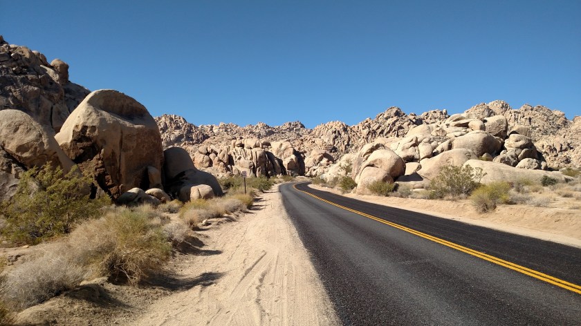
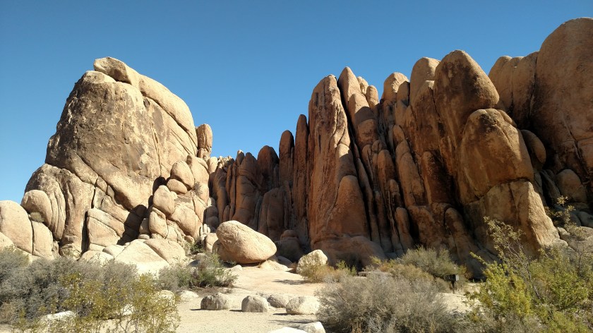
Monday was a travel day, as I went from Yucca Valley, near Joshua Tree, west past Los Angeles to the coast.  Before leaving Yucca Valley I had 2 more quick stops to make at Joshua Tree.  There are two areas accessible from the main road north of the Park, not from the roads within the Park itself.

I drove east towards the town of Twentynine Palms to the access road for the 49 Palms (not a misprint) Oasis.  A short ride in on the paved road took me to a parking lot from which I would have to hike up a very rocky hillside (can you say “rattlesnakes”?) and out to the Oasis itself.  It sounded real nice, but it’s not gonna happen.

IMG_20180611_081729282

IMG_20180611_081744594

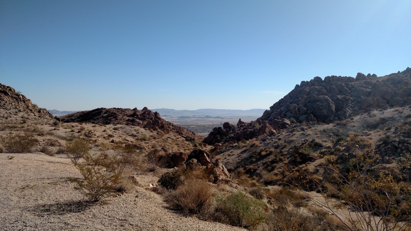
Next I drove to Indian Cove.  The paved road took me in as far as the campground, which was all I needed to see.

IMG_20180611_083443882

IMG_20180611_083712068

Then I hit the road for LA.  It was a short drive west to get to “The 10” and it only took about 15 miles from there to get to the town of Banning, there a taco joint was waiting for me (those of you who know me know that I LOVE tacos).

IMG_20180611_103233029_HDR

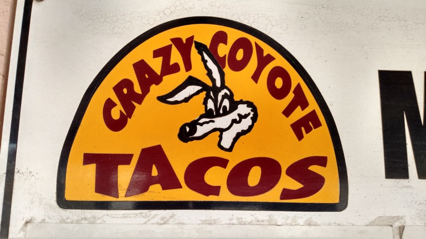
Well, the taco joint may have been waiting for me but then I had to wait for them, as they didn’t open until 11am and it was only 1030 when I got there.  No problem – as this would make the timing of my day work out perfectly.  Los Angeles was another 90 minutes up the road and I didn’t want to get through there until after lunch hour anyway so after eating I embarked for the big city.

Although “The 10” would have taken me very close to the city and directly out to the coast I opted to take somewhat of a bypass (well, an alternate route) around the main part of downtown.  I went north on “The 5,” west on 134 “The Ventura Freeway” through Hollywood and past the West Coast headquarters for ABC, NBC and CBS, then south on “The 405” to get back to “The 10,” which took me out to Santa Monica and the Pacific.  Although traffic slowed in spots it never stopped for long and I made it to the coast 13 minutes ahead of schedule, at 147pm.

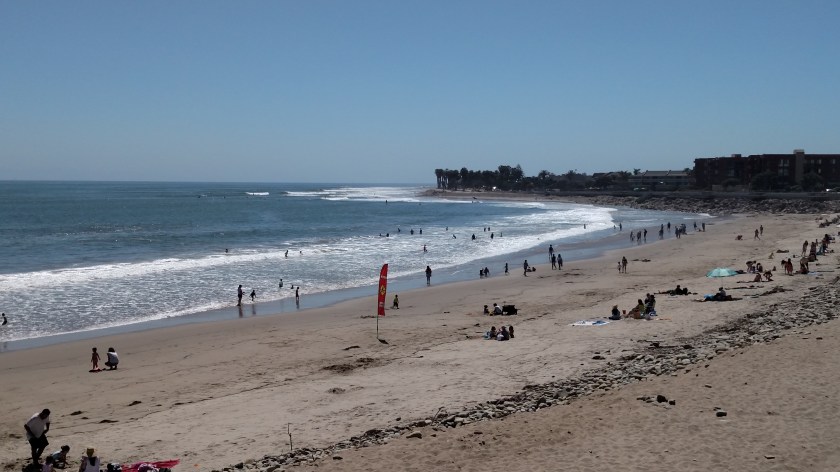
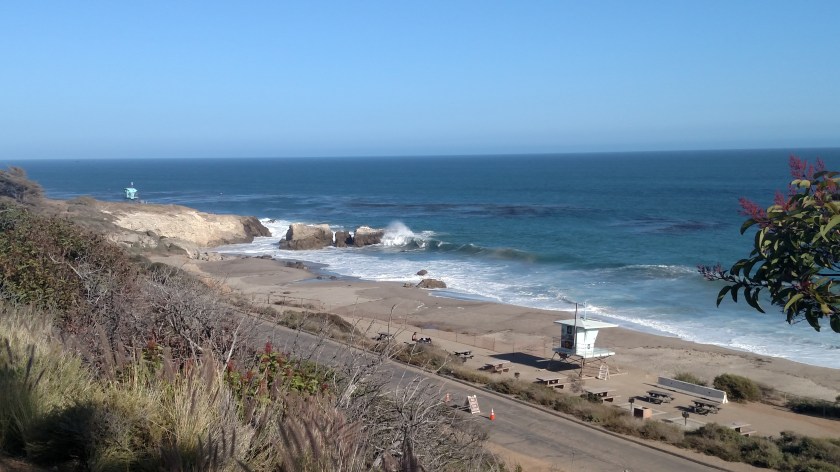
In Santa Monica I picked up Route 1, the Pacific Coast Highway – or PCH, and started heading north.  There were signed indicating that there had been an accident on the PCH earlier in the day and that traffic there was jammed.  I decided to suck it up and get through it before afternoon rush hour got any closer.  I guess the locals heeded the advice to avoid the area as getting past the trouble spot didn’t take long at all (crews were replacing downed power lines and they had one lane open each direction).

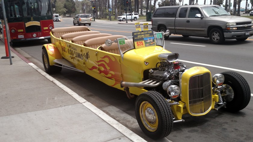
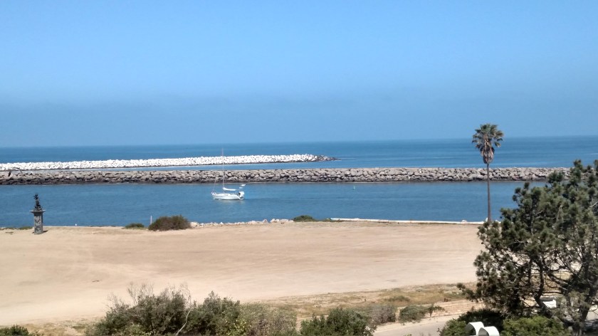
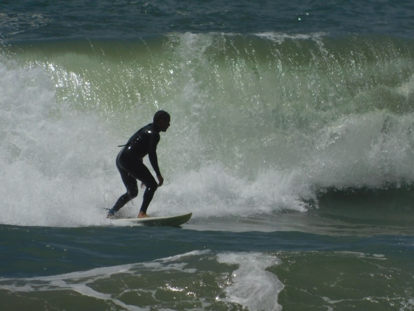
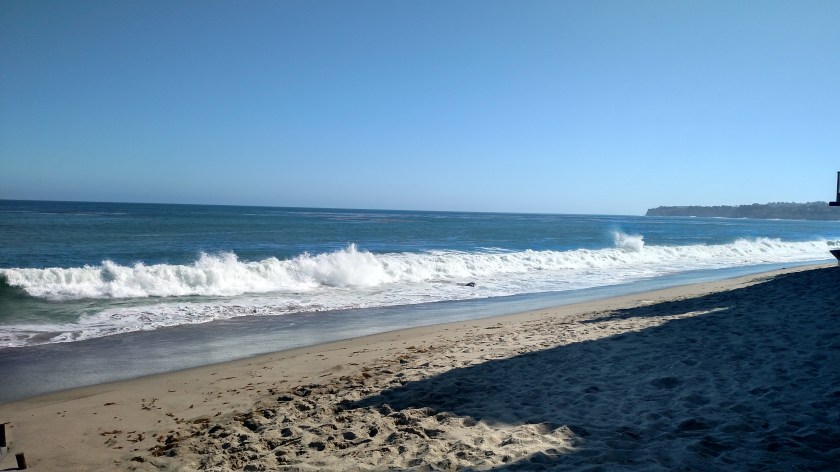
Then I started taking pictures.

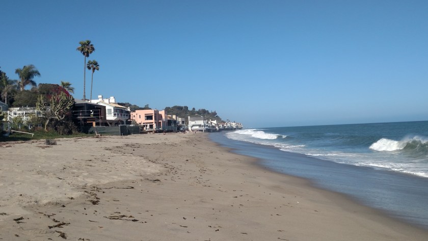
Real estate in California is expensive, especially near the ocean.  Parking is at a premium and you even have to pay to park at State beaches.  But as you drive along the PCH there are brown signs every so often which say “Beach Access” and you may park along the highway there all day for free!  Those areas are lined with cars, but every so often I’d spot an opening, park, and walk a short distance to the sand.

IMG_20180611_164133918

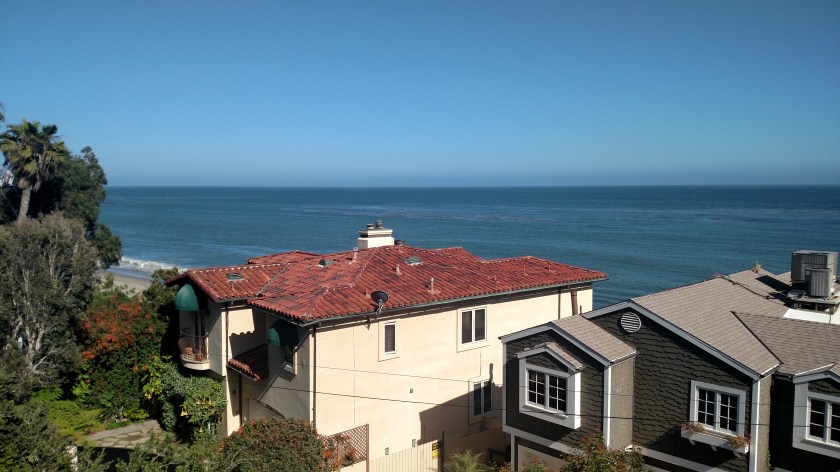
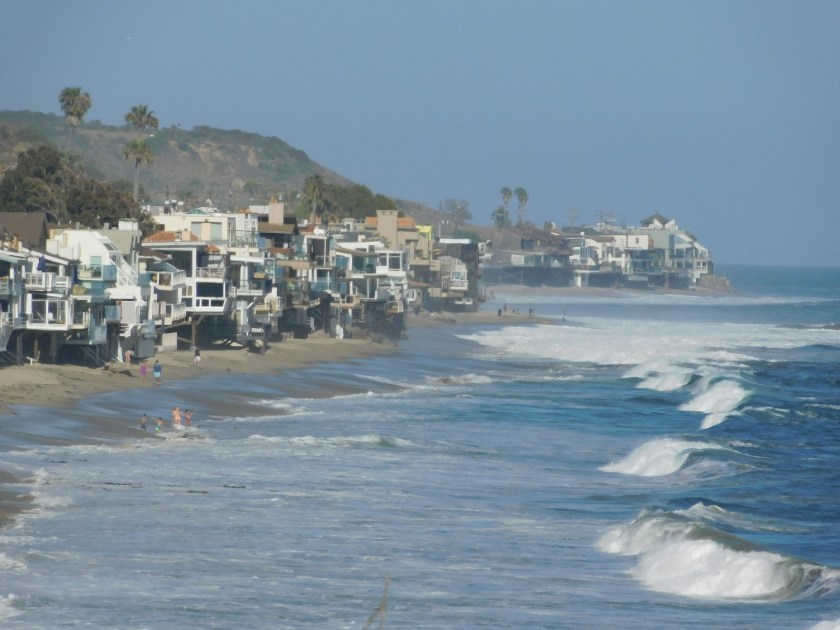
To get to the spot where I took the photo above I had to walk through the valet parking lot of a fancy restaurant to get to the path to the beach.  There was a Ferrari, a Bentley and a Corvette all parked next to each other so I knew I was in Malibu…

I didn’t see any “celebrity” houses in Malibu but they are usually built in places where you can’t see them anyway, and more importantly so they can’t see you.

DSCN1192

IMG_20180611_164302597_HDR

IMG_20180611_164901475

IMG_20180611_165825348

IMG_20180611_174319262

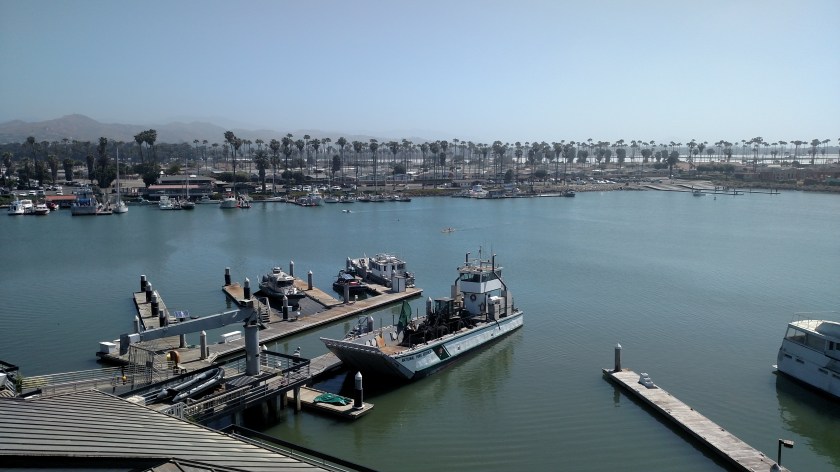
I drove further north, some pictures of which I posted earlier, and ended up in the town of Oxnard where I would spend Monday and Tuesday nights.