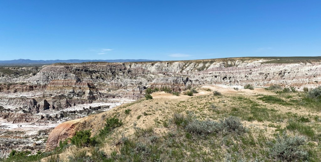
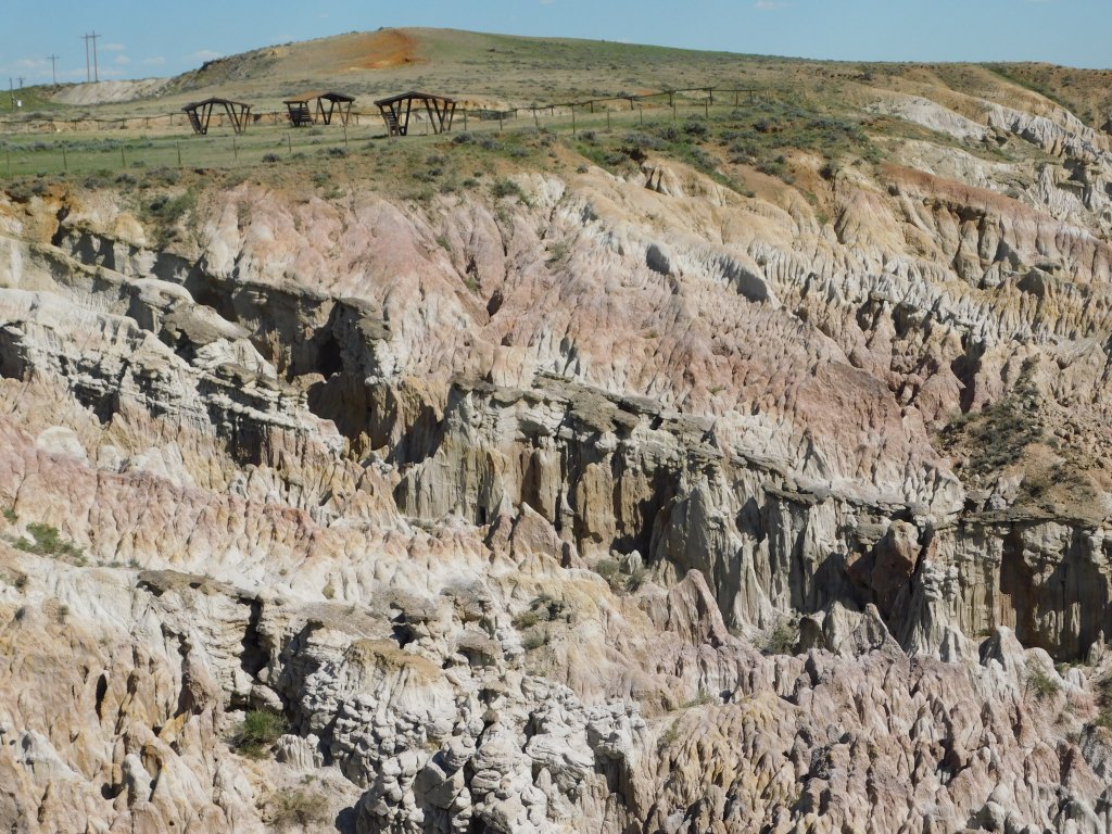
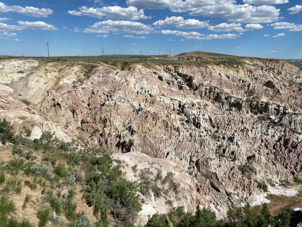
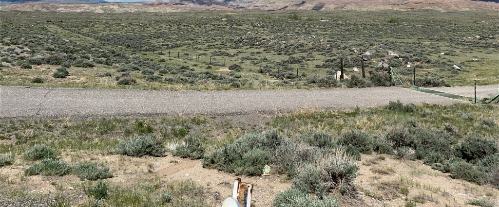
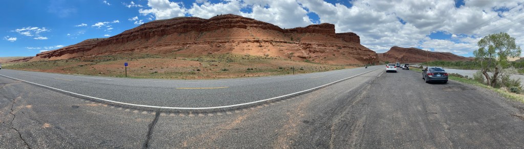
I had seen this in my Road Atlas and when I asked my nephew Sam about it he was familiar with it but had never been to it. Turn’s out it was on my way to Casper on Friday so I stopped to take a look. Despite the name, this is actually a 320 acre depression in the earth’s surface which Indigenous Americans would drive bison into for slaughter. Remnants of their weapons and animal bones have been found on this site.
I was the only person here when I arrived but there were soon other vehicles with travelers who stopped for a brief look. It is located right next to Highway 20 on the way to Casper. There was a large dirt parking area surrounded by a chained link fence topped with barbed wire. The entire depression area is also surrounded by a fence so evidently the state does not want people wandering down into it. It doesn’t look very forgiving anyway…
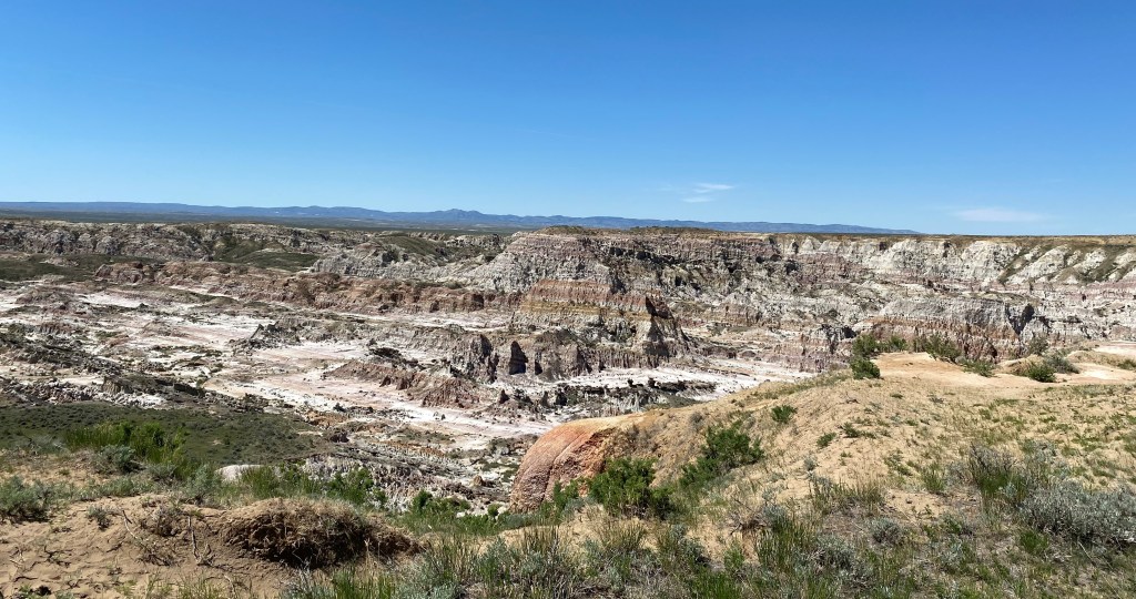
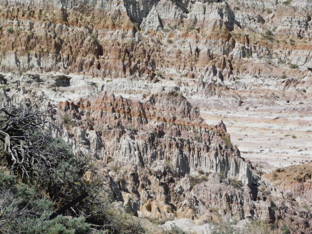
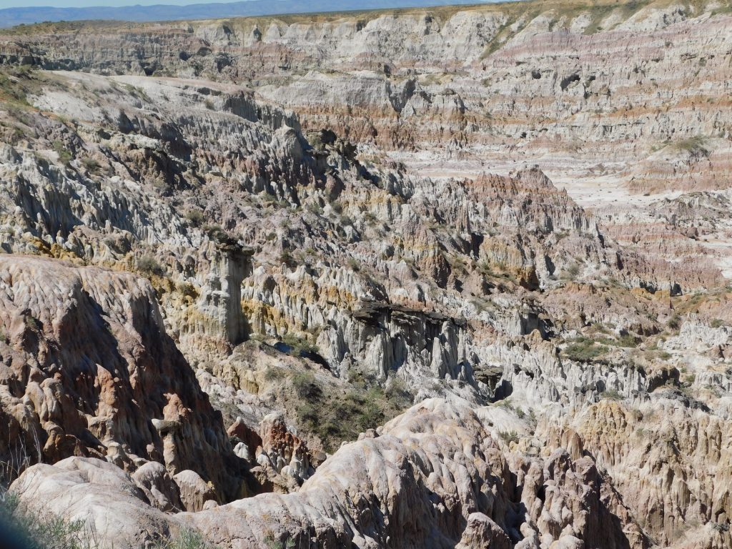
When I took a photo to text to Sam I described it as a miniature Bryce Canyon (a National Park in southwest Utah) but after examining my photos on my computer I now say it resembles a mini-Grand Canyon:
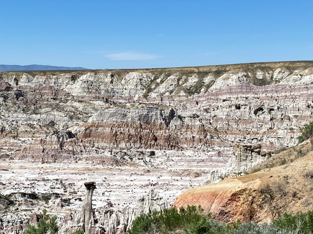
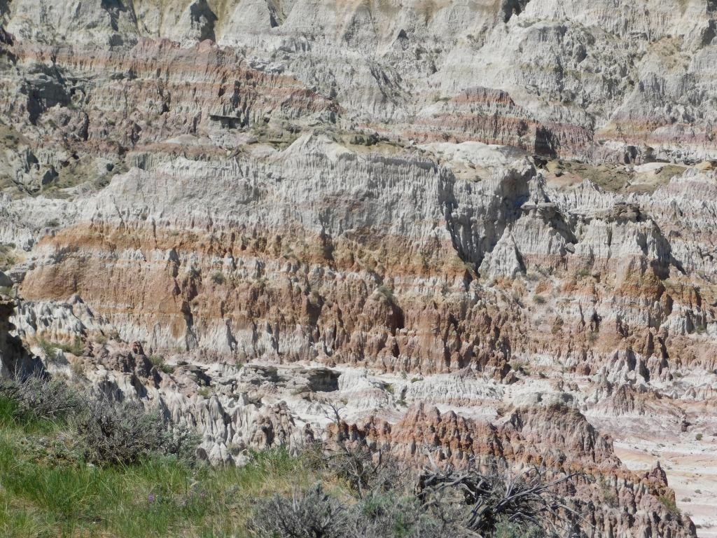
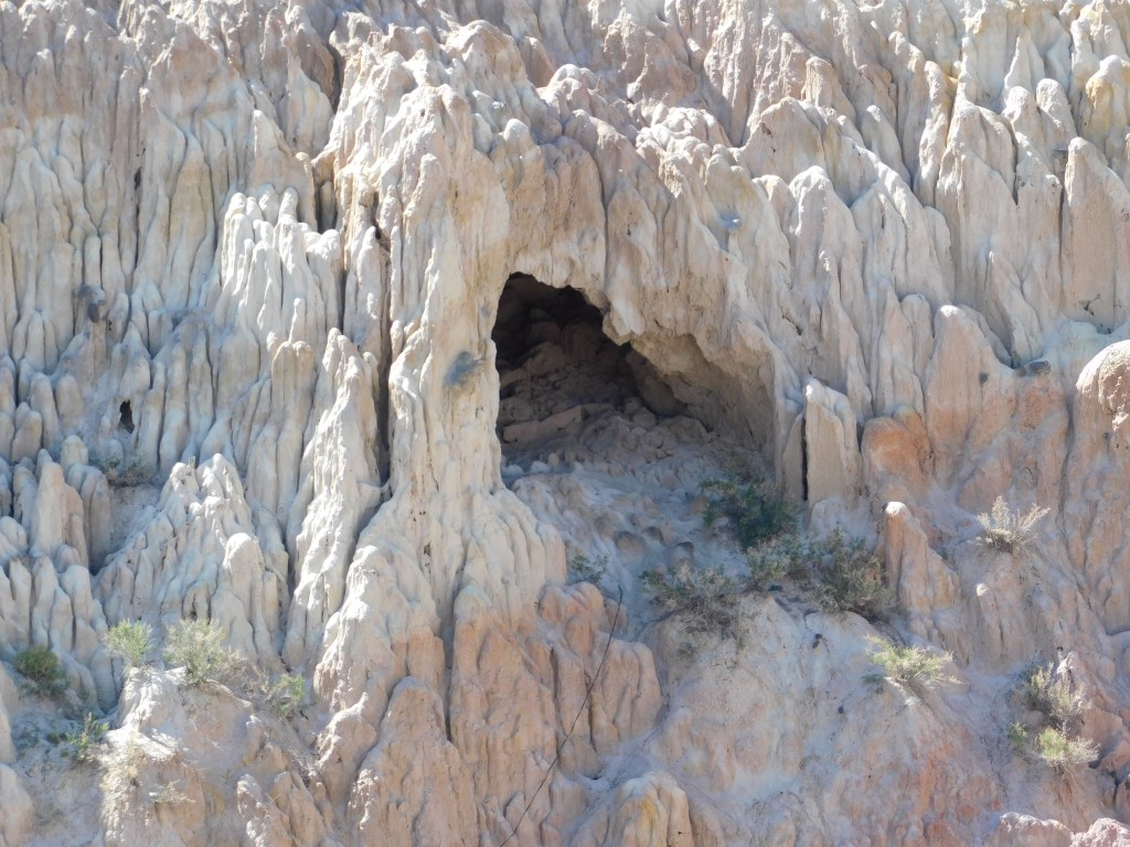
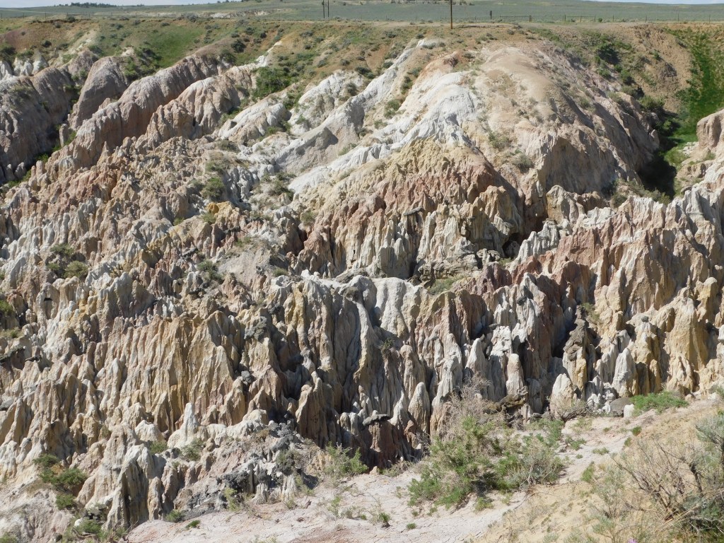
The photos above were taken in the morning, on my way east to Casper and were taken using my iPhone camera. I was able to reach up and hold the phone between the strands of barbed wire to get an unobstructed view. While in Casper I stopped in a Walmart and bought a 3-step ladder to enable me to get up even higher and reach up over the barbed wire with my digital camera. This enabled me to get closeup photos using the zoom lens and this brought out the amazing colors on the rock formations. I believe if you click on any of my photos on the blog it will open them full size on your device so you can see them in greater detail.
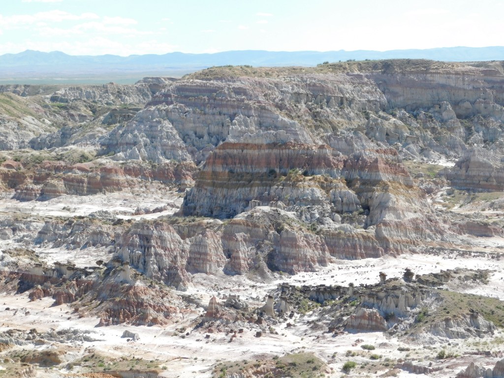
I stopped here again on the way home in the afternoon so the sun was now in a different position. I used the ladder to take more photos up and over the barbed wire fence with both cameras:
Friday I made the 146 mile, 2 1/2 hour drive east-southeast of Lander to Casper. I drove through Riverton to Shoshoni, as I had done when I went up to Thermopolis, but then continued straight on Highway 20 instead of turning left. There were some interesting rock formations to the left of the road shortly after I got through Shoshoni but other than that it was pretty much wide open road with not a whole lot to see. A pleasant drive nonetheless. For some reason it reminded me of the movie Vanishing Point.
I stopped briefly at a rest area about two thirds of the way between Lander and Casper and learned more there than I did at the Visitor Center/Chamber of Commerce in Casper. They, the rest area, had a great map of the state (not a highway map, which I have several of, but a map highlighting things in various parts of the state). There was also a map of the general Casper area (not a street map) which they, the Visitor Center, didn’t seem to have either. I learned that there are more pronghorn antelope in Wyoming than there are people (just as there are more hogs in my current home state of North Carolina than there are people – and fortunately most of the hogs are east of interstate 95 and not near Durham!). I learned that pronghorn have been clocked at 80 mph and coyotes at 30. But so much for trivia.
When I got to town it was mid-day and it was already over 90 degrees (it ultimately reached 96). The first thing I saw as I was searching for the Visitor Center was a bunch of kids enjoying this fountain downtown:
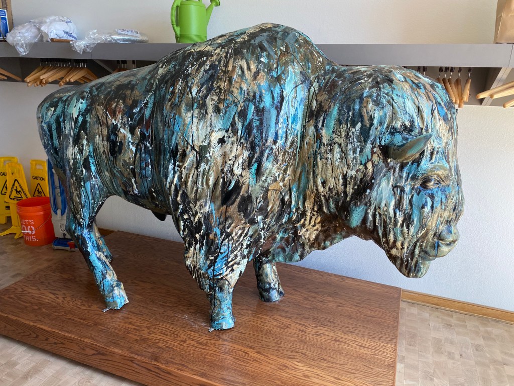
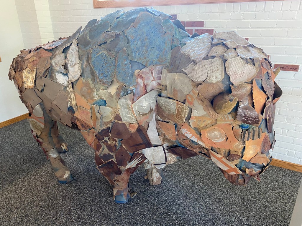
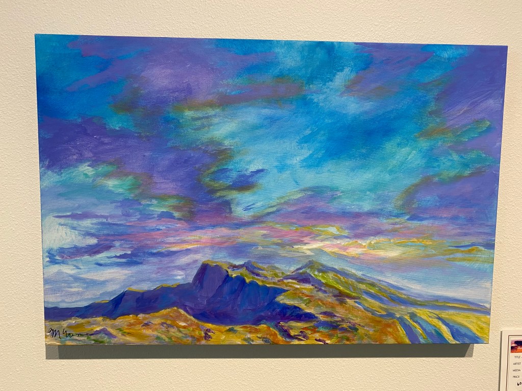
After talking with the folks at the Visitor Center I decided to go to an art museum in order to get out of the heat. I usually save museums for rainy days but this seemed like a good exception. I chose the Nicolaysen Museum of Modern Art and was not disappointed.
This bison was actually in a storage area! Several years ago many American cities had outdoor art objects with a different theme for each city. Apparently Casper chose bison.
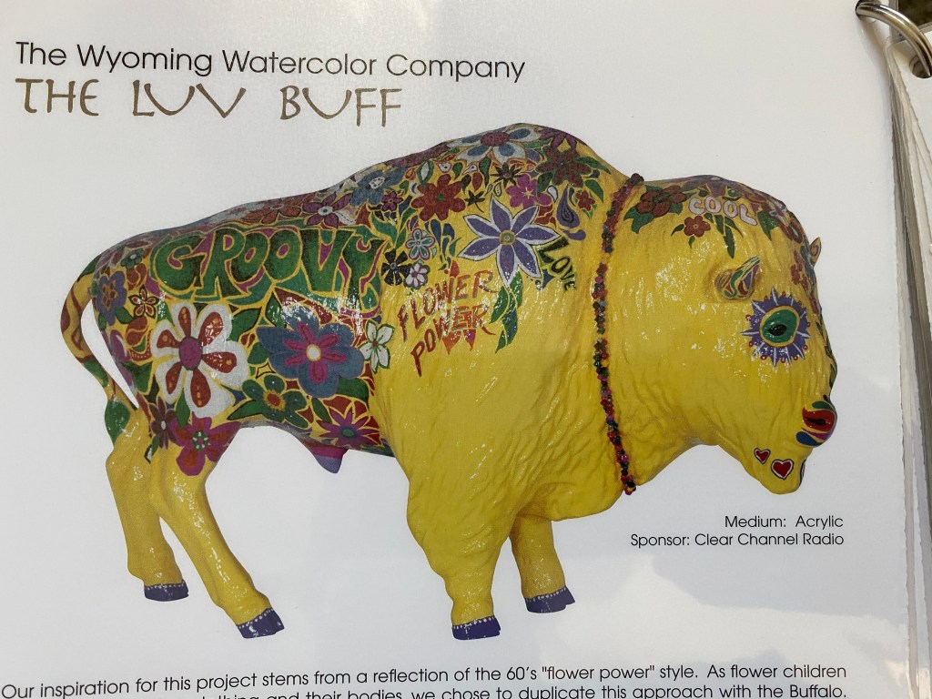
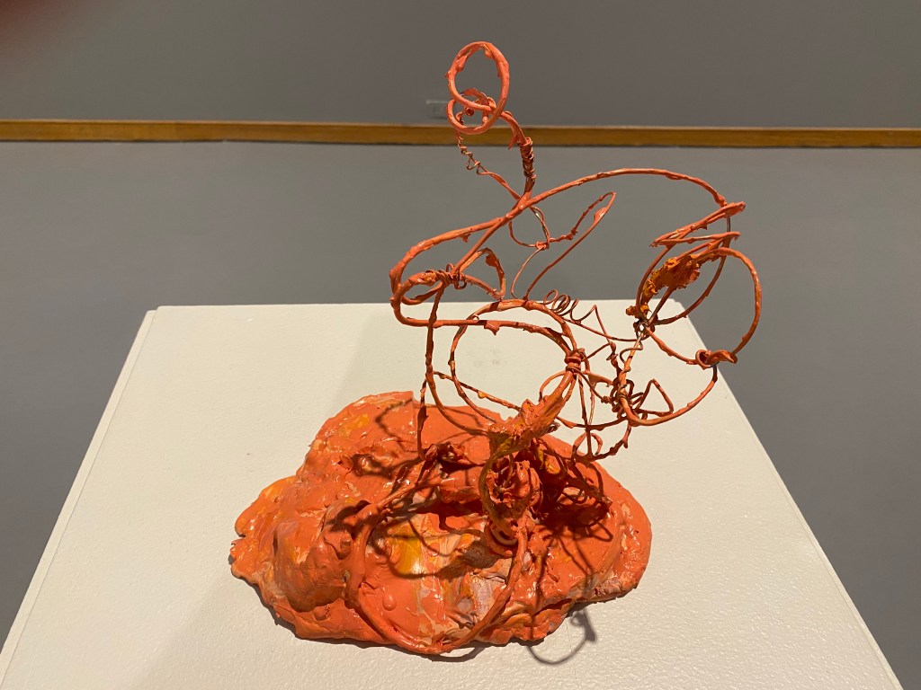
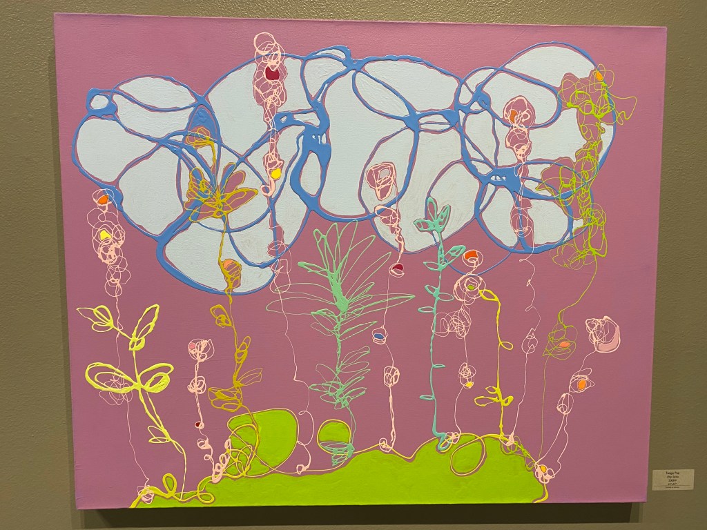
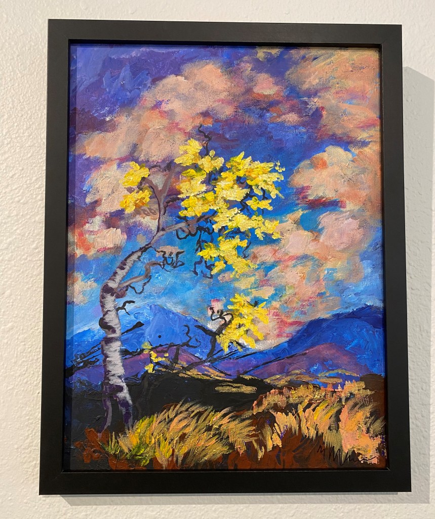
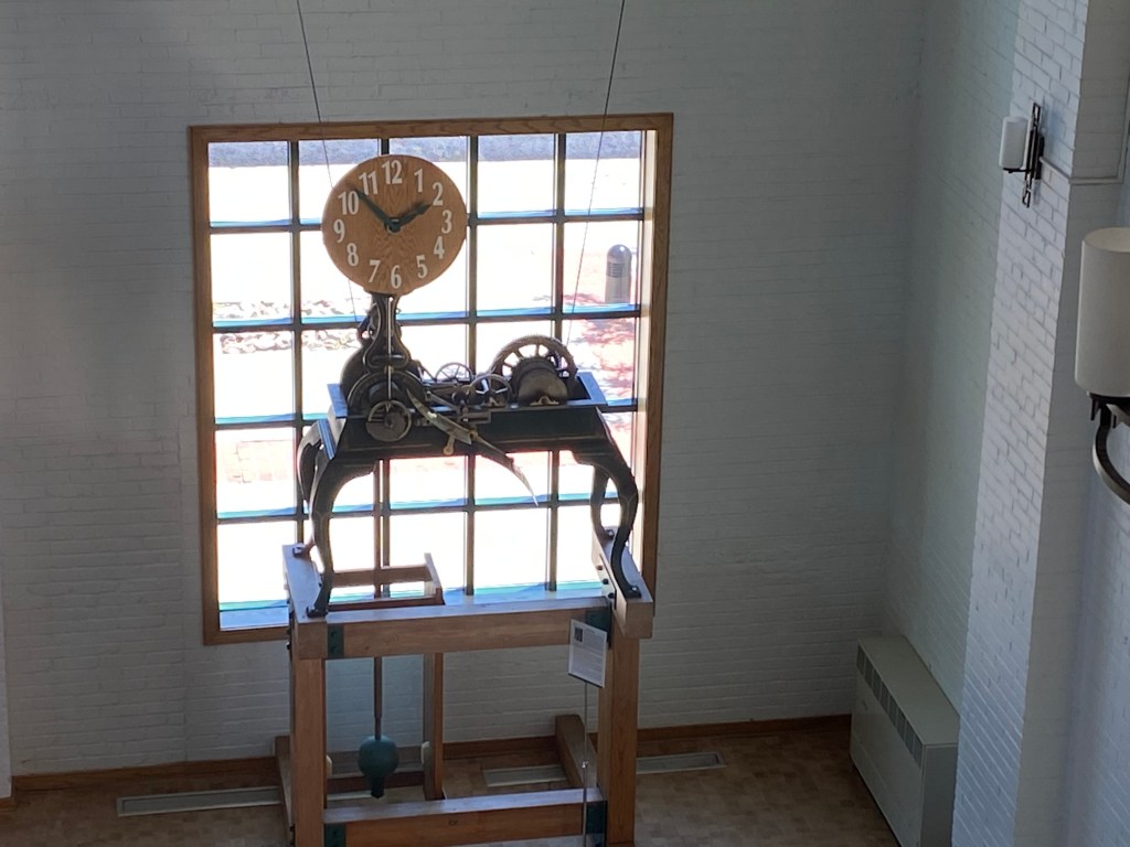
And there were plenty of other things to enjoy:
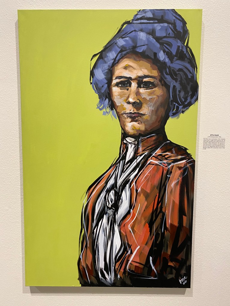
There was also a display of “Women of the West” and these were some of my favorites:
Etta Place (Butch Cassidy and the Sundance Kid):
Annie Oakley:
Sacajawea (who assisted Lewis & Clark, and who is buried at Fort Washakie, not far from Lander):
It was a nice, leisurely afternoon enjoying some great pieces of art. Some people are so talented!
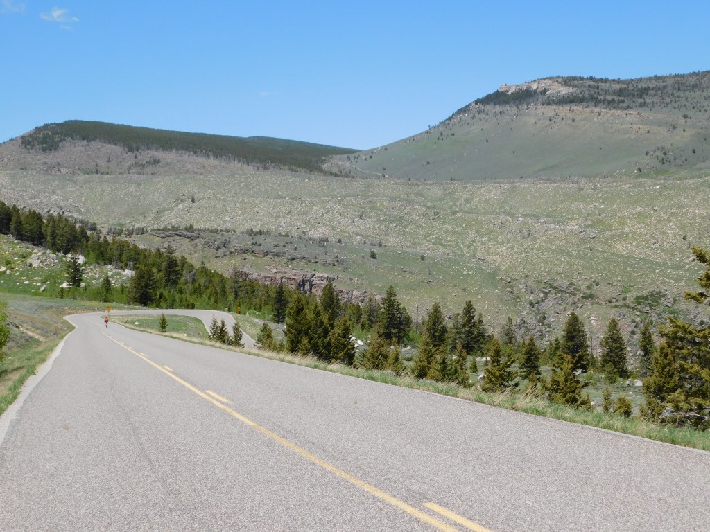
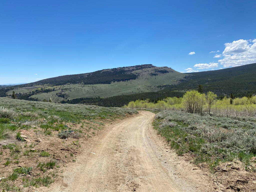
Thursday afternoon, after my trip up through the switchbacks in Shoshone National Forest, I headed southwest of Lander, on Route 28 past the turnoff for the Wyss Wilderness Medicine Campus but before the turnoff for Atlantic City and turned right on Limestone Road (24 miles from town). This relatively well maintained dirt road would take me up to Wild Iris, an extremely popular rock climbing venue.
After driving a short ways, and when offered the choice, I turned right to climb the mountain to the parking area at the top. There was no cell service here (in lots of places I’ve been to in the last two weeks, actually), but my GPS still worked as did the altitude app on my phone. At last I saw a few vehicles parked along the road so I got out and went to join the mountaineers.
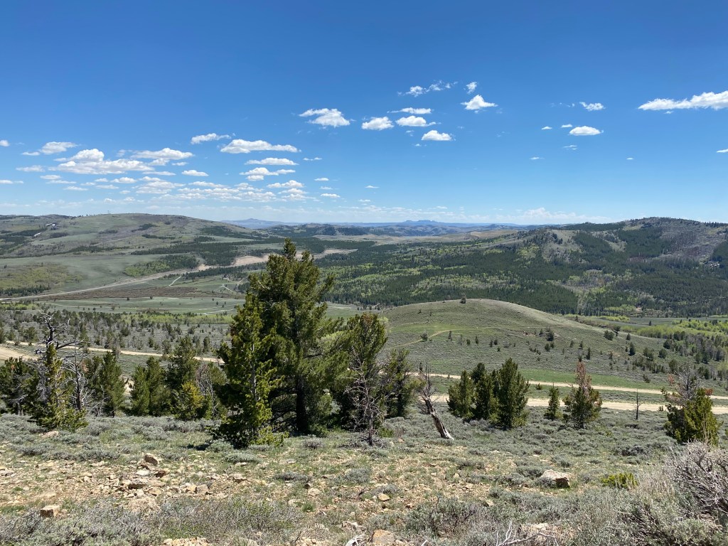
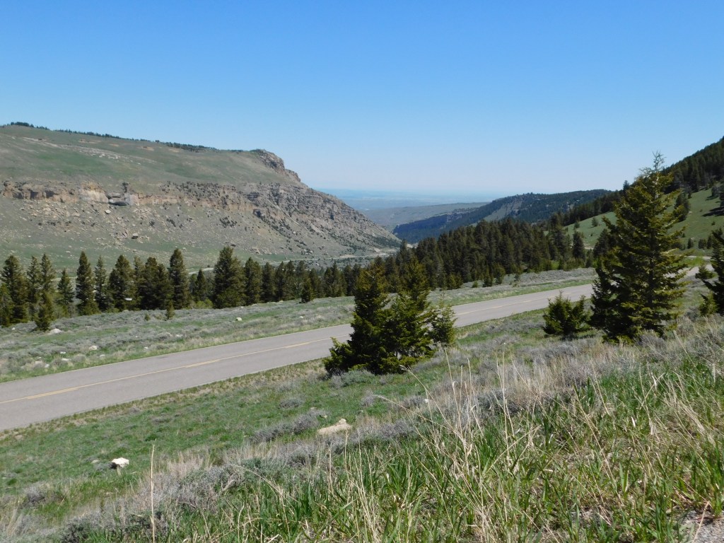
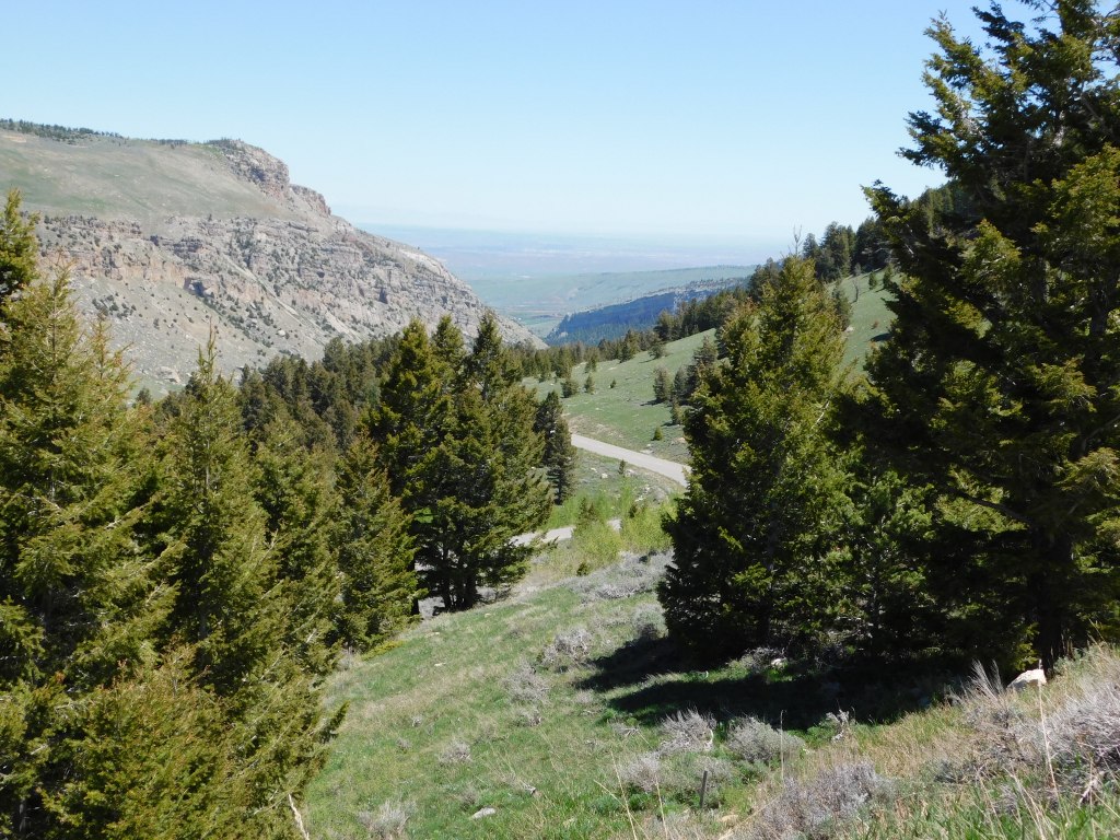
This was the view looking down towards Highway 28 (trust me, it’s down there somewhere):
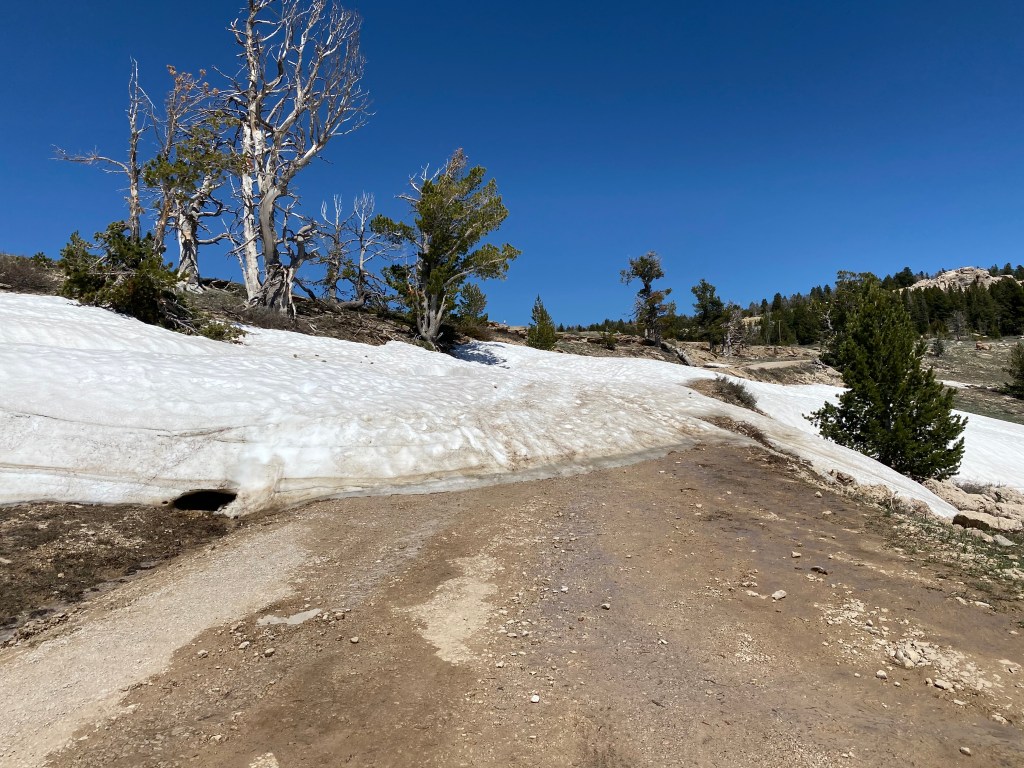
As you can see, the road ahead was blocked by a pile of snow so I had to walk a short ways up to the actual parking area.
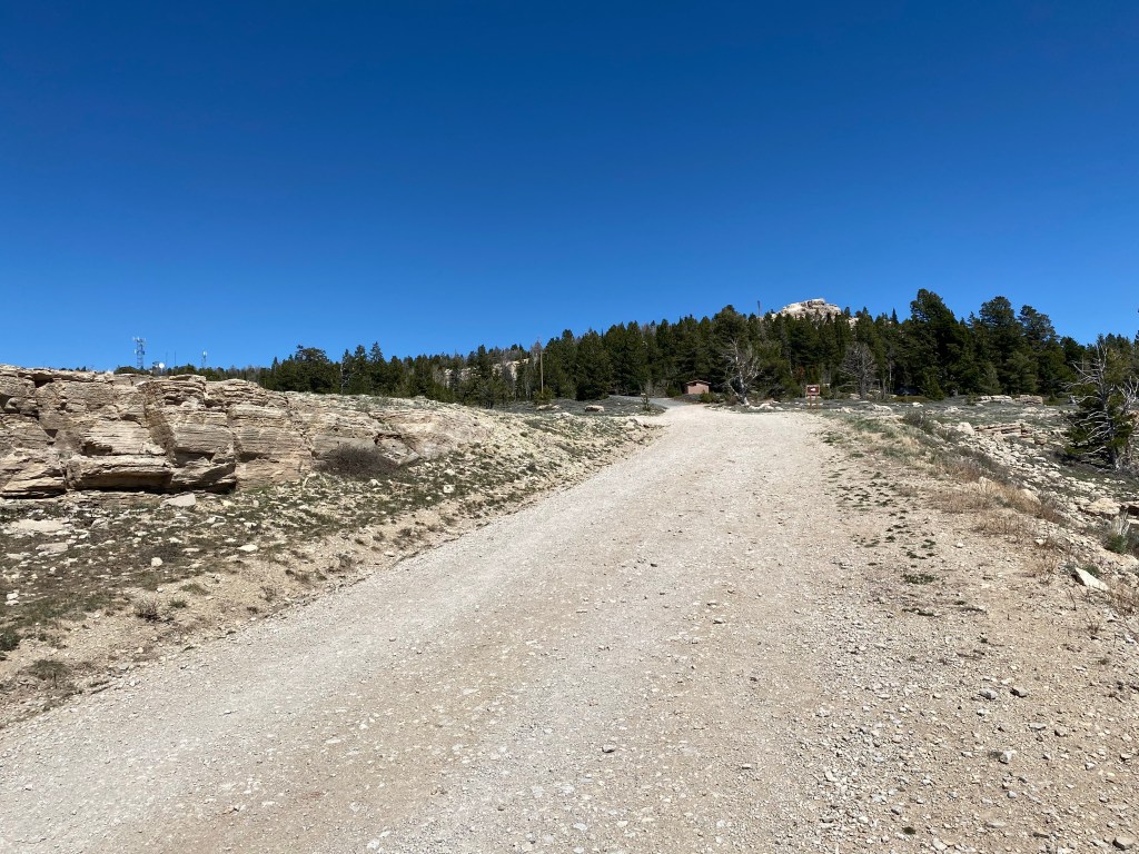
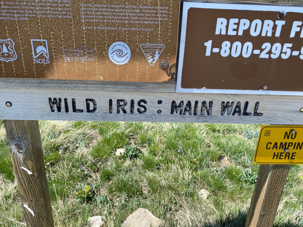
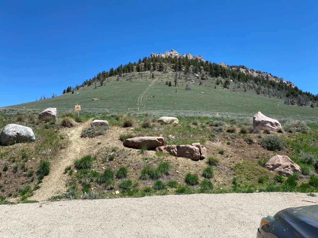
And sure enough, I found the parking area and a sign which confirmed I was in the right place:
There was a walking path off to the left which continued up a moderate grade to the horizon. At this point I was up at about 8,700 feet elevation.
I started walking up the path, keeping my head “on a swivel,” as Sam had instructed me, to keep an eye out for snakes. I also turned around periodically to make sure nothing was sneaking up on me from behind. Despite the vehicles, there wasn’t a soul in sight and I was feeling quite vulnerable.
I finally reached the apparent horizon and learned that there was another path, continuing uphill to another horizon.
Not knowing the area, or if it was much further to reach the “wall,” I opted to bail out and walked back to my car.
I drove down the mountain and turned right to continue taking the dirt road to what I guessed was the area below the “wall,” and followed two vehicles with trailers which I assumed were climbers who wanted to climb up rather than down. Sure enough, they pulled off into a wooded area where there were lots of other vehicles parked but there was no view looking up (blocked by trees) so I continued driving back the dirt road.
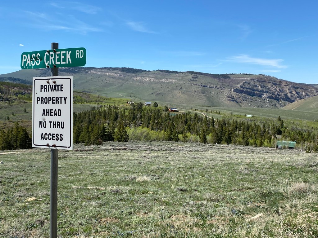
I drove a considerable ways before I had any vertical view and by that point I was sure I had passed the “wall”. I drove through two switchbacks and came to a sign indicating that I would then be crossing onto private property and would not be welcome.
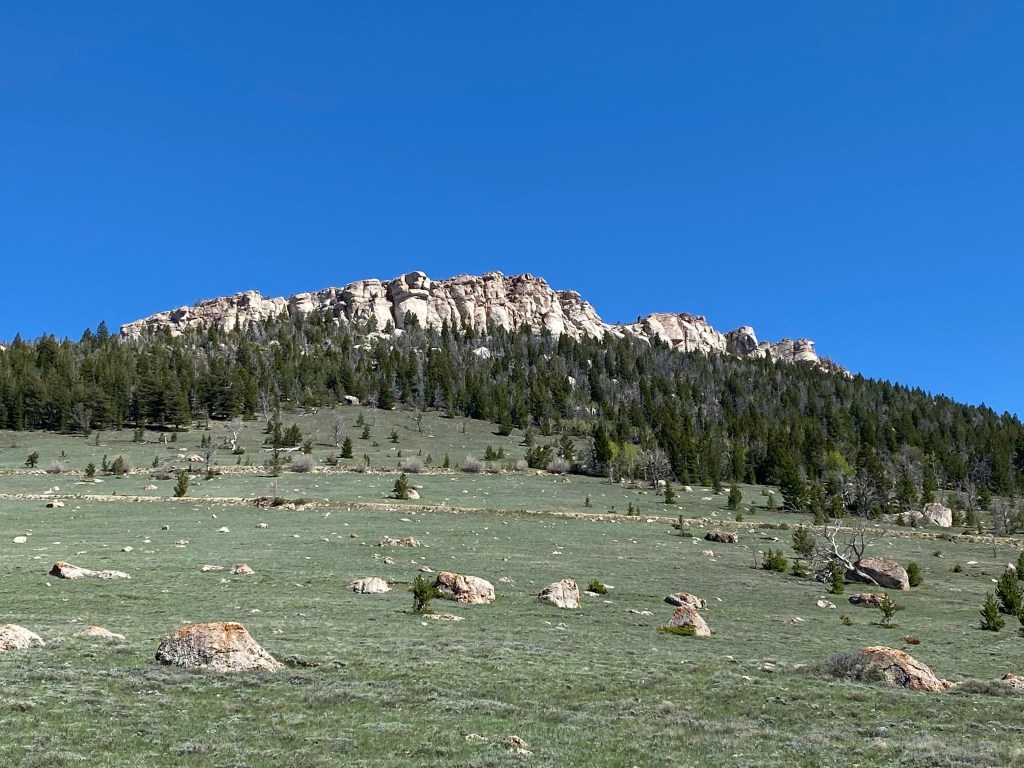
Now that I was further away from the slope of the mountain I could finally see a row of rocks way up on the mountain”
I zoomed in with my digital camera and took some photos but never saw any climbers, though I am pretty sure this was the “wall” I was looking for. There is a climbing outfitter in Lander (ironically named Wild Iris – go figure…) and I will stop in there to ask if there is an area I can safely get to which will afford me a view of climbers up on the mountain. There are apparently many different climbing options which is what makes this place attractive to climbers.
I drove back out the dirt road and stopped in town on the way home to give my car a well deserved wash.
Thursday I decided to stay close to home and revisited the area above Sinks Canyon State Park. The Park itself isn’t very big but the road through the area beyond the Park, Shoshone National Forest, goes on for quite a distance. Last week it was only open to Bruce’s Camp but just after Memorial Day weekend the “switchbacks” opened. For those of you unfamiliar with mountain roads, switchbacks are where the road makes a series of sharp U-turns as elevation rapidly changes. This enables vehicles to navigate an incline/decline which is not as steep as a more direct route. As I write this post it is now a little over a week later and the remainder of the road, the “Loop Road,” has now opened all the way out to Highway 28 near where my nephew works. Sam, Ellie (my brother and sister-in-law’s corgi) and I will be making that drive this afternoon using my brother’s high-clearance F-150 truck. Those photos will appear in a future post. But for now, let’s take a look at what I saw as I drove “the switchbacks”:
Looking back as I drove uphill you can see a switchback below. If you look real close at the left side of the photo you will see a bicyclist who had just zipped past me as he coasted downhill. That’s the reward for pedaling all the way up!
This was the view down the canyon I had just driven through to get up this far:
And this was the view as I continued to drive uphill:
Note that there is NO GUARDRAIL (except on the curves). I went through a few more curves, climbing even higher, and soon found myself facing the formation which contained the outward looking “face” I showed in an earlier post. At this point I was at 7,680 feet elevation and the temperature had dropped from 82 degrees when I left the house, down to 73 degrees.
I soon crested top of road over this mountain and was in a parking area looking up at the back of the aforementioned rock formation. I was now at 8,442 feet:
This was the view looking east-southeast, away from the mountain I was on.
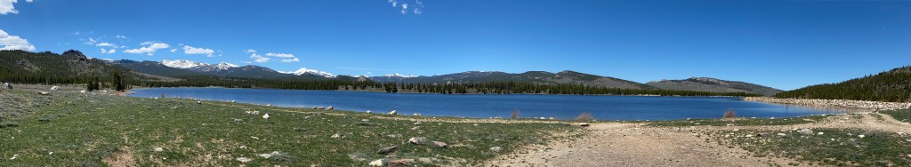
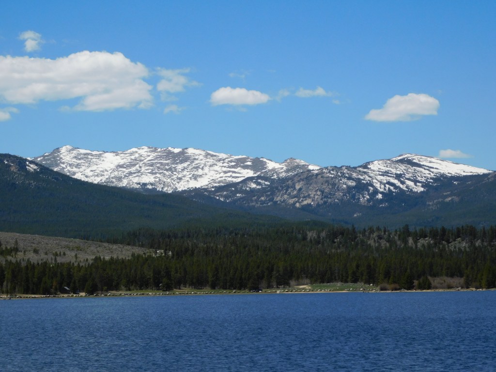
The paved road then started to descend a short ways before climbing again to where there was a beautiful lake, with the snow-covered Wind River mountain range in the background:
And while I was on a paved road, I was in the mountains and in bear country so I had my trusty bear spray on my belt.
Here is a wide, panoramic photo of the lake:
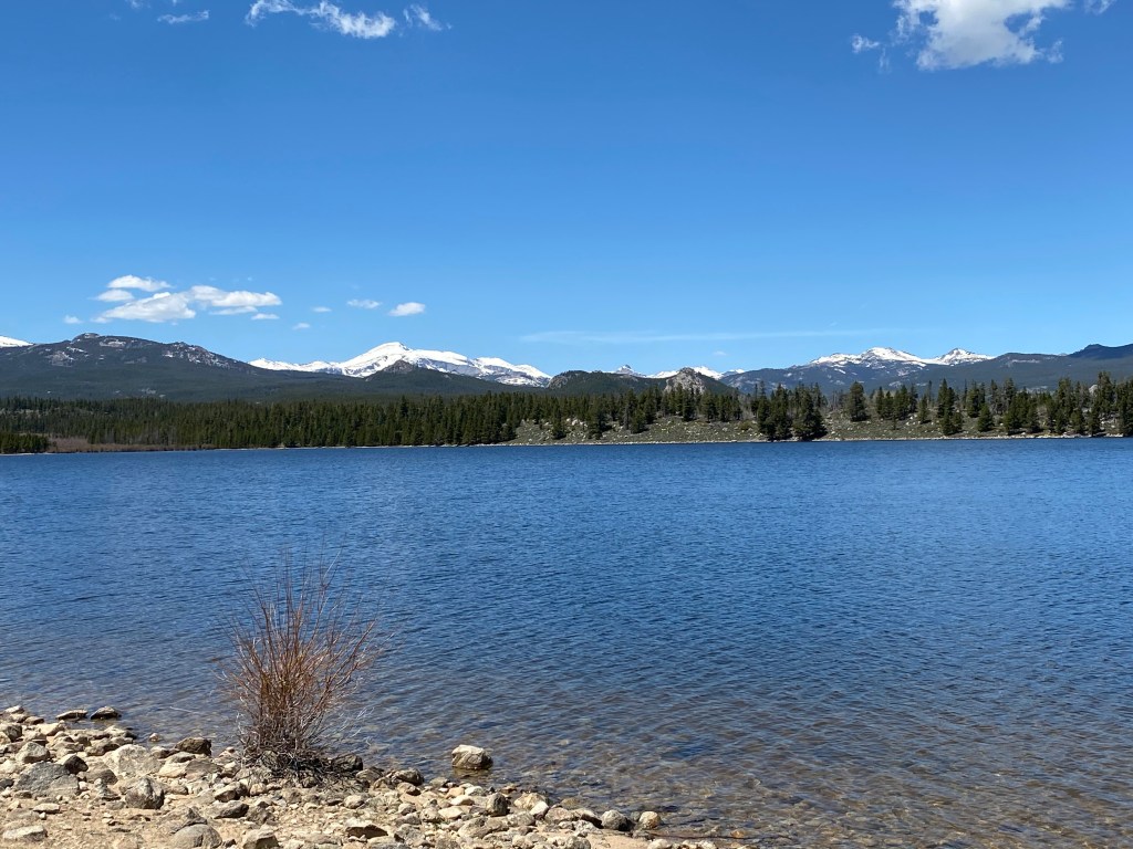
And some single shots showing more detail:
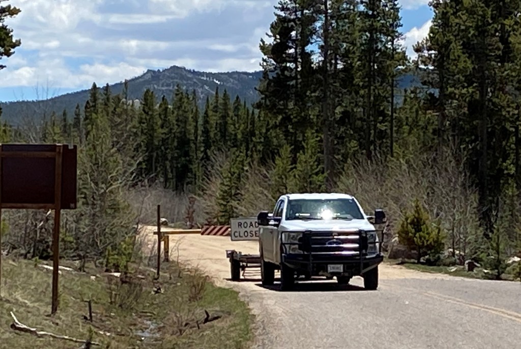
The lake is at 8,541 feet and when I resumed driving I got to the point where the road was again closed, at 8,690 feet.
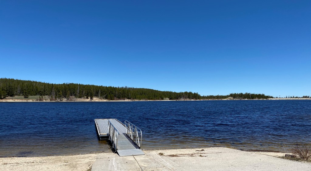
I did have the option to turn right and drive 2 1/2 miles back a rocky dirt road to the Worthen Reservoir, which I did.
That boat ramp and dock is at 8,830 feet elevation and I had only traveled about 20 miles from home.
I may come back up here to hike near the reservoir (Sam tells me it is fairly level, albeit at high elevation) but today I was here alone and there weren’t too many other people nearby. Even after living at 5,700 feet elevation for two weeks I’m still not quite ready for a long walk at 8,800 feet.
I headed back in to Lander, turned right, and set off on my next adventure, southwest of town.
Wednesday I drove northwest from Lander, about 85 miles, to the little town of Dubois (pronounced DO-boys). And little is a fitting description – I was quite surprised when I rolled in to town and saw on the sign that the population is less than 1,000. There were two particular things I wanted to see while here but I decided to skip both of them as it was a nice day and I didn’t want to spend it indoors. I ended up going through Dubois a week later and will show photos of that trip in future posts.
Here were some more of the things I saw as I drove in to town (I was now outside of the Wind River reservation):
Meet Becka. She had a lemonade stand set up in front of her house and was selling the “best lemonade from east to west”. When I drove in to town the road made a 90-degree turn to the left. I kept going straight in to a small residential area and after I drove a few blocks – there she was:
I got mad at the UPS driver whose truck I parked behind when I bought a cup. When he drove away I asked Becka if he had bought a glass and she said no. Maybe he’s not allowed to drink on the job….
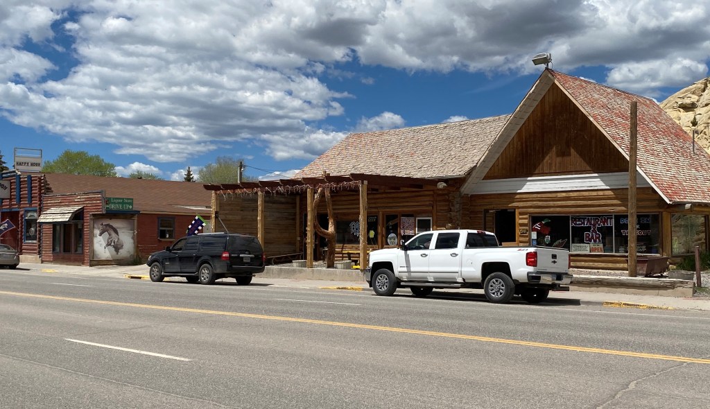
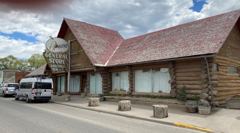
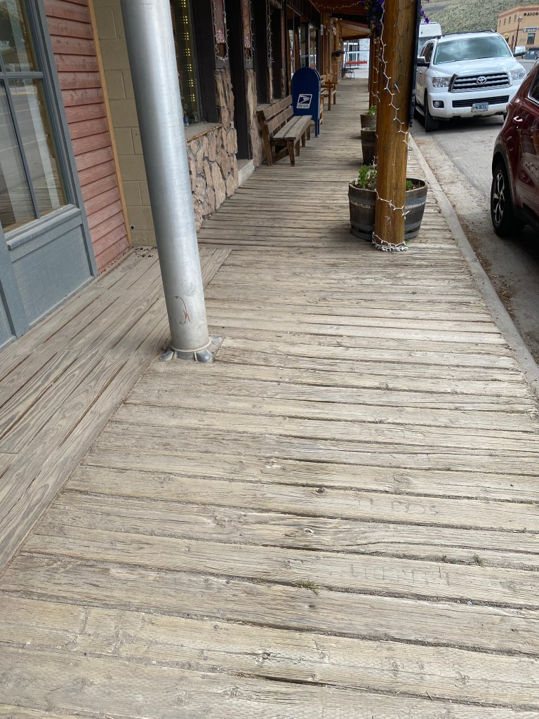
I headed back to town and walked around a bit:
The sidewalks in part of the town were wooden boards:
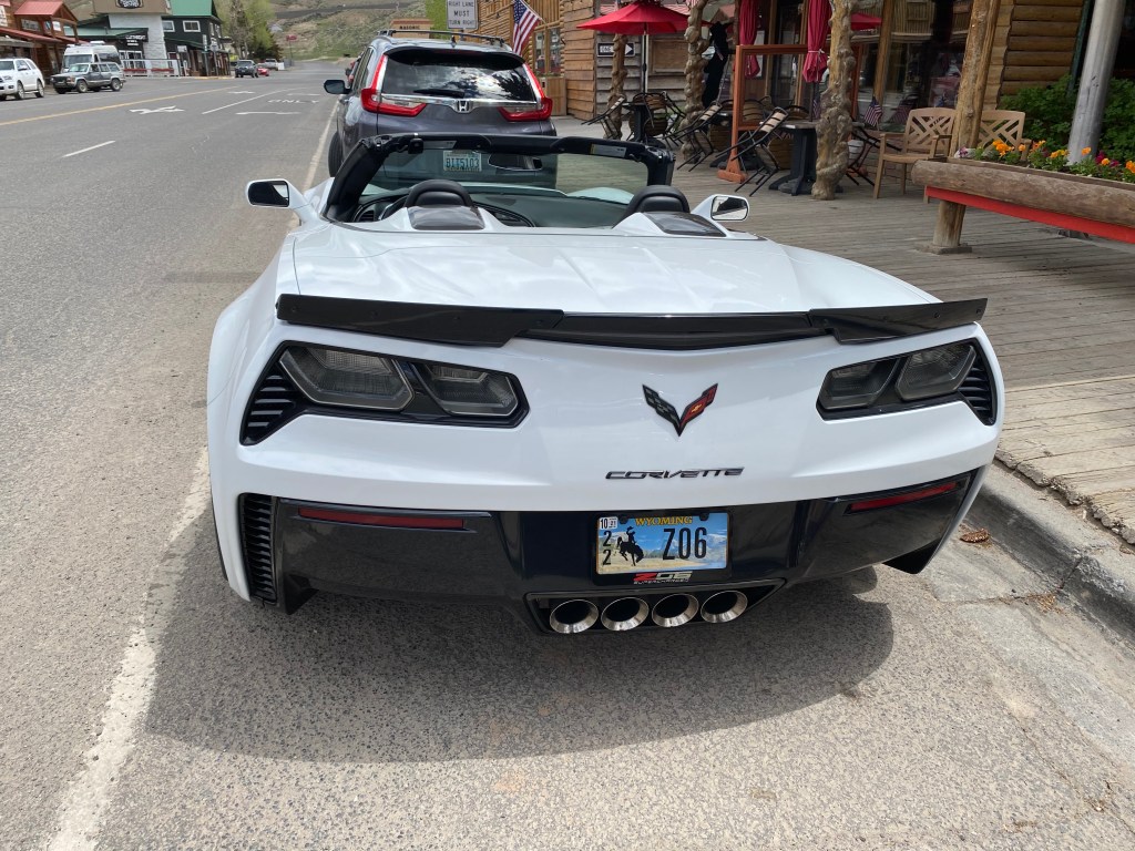
While I was in town I saw two vehicles that made me think it might be time for a JohnBoy upgrade:
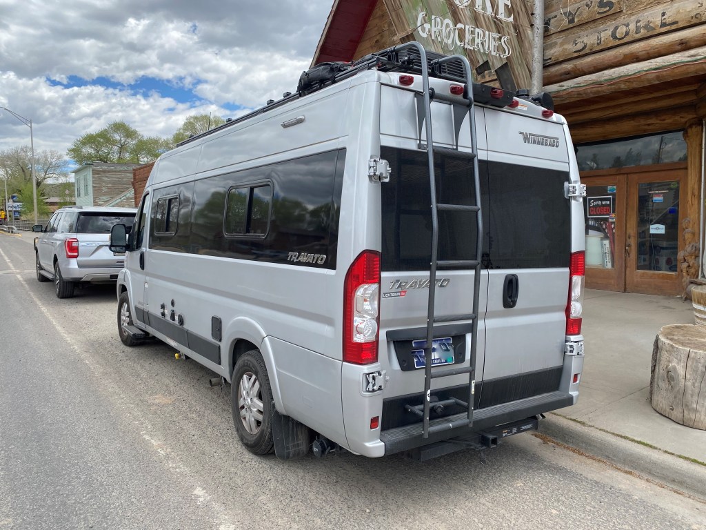
And the more practical of the two:
The couple that owns the van shown above was just getting back in the vehicle as I took the photo of the front. They are from South Carolina but also own a home here in Wyoming and were on their way there. I asked them how they like their van and she said it is great but they always feel so puny whenever they pull into a campground. I told her size wasn’t everything and that they probably get far better gas mileage, which her husband agreed was the case.
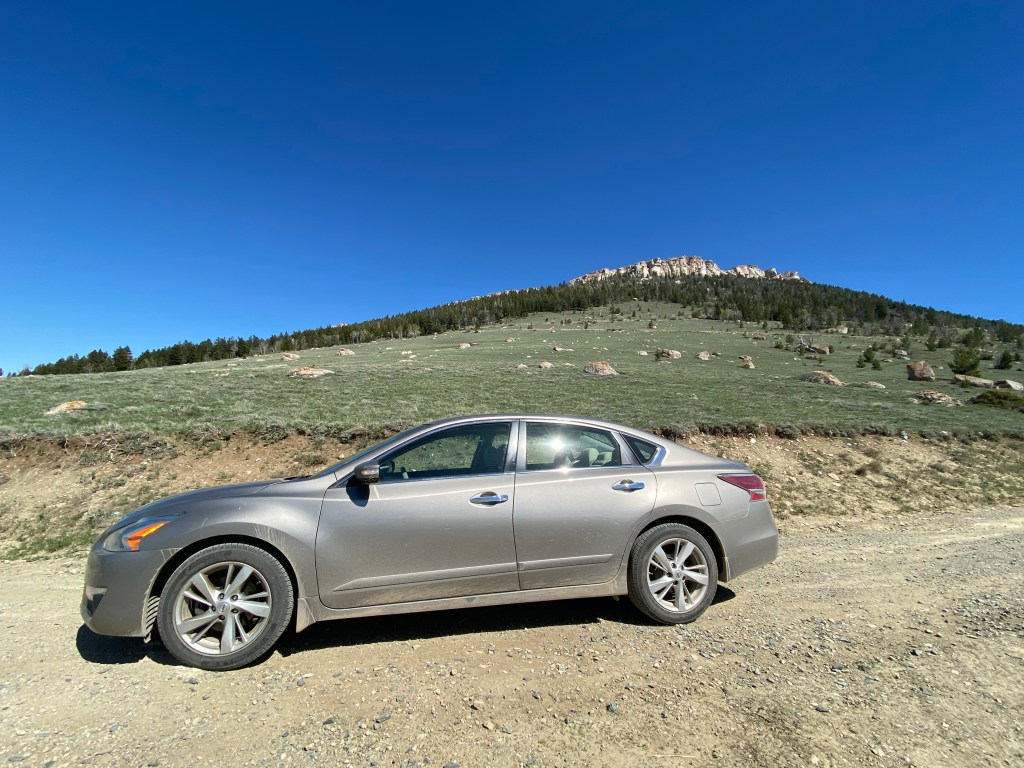
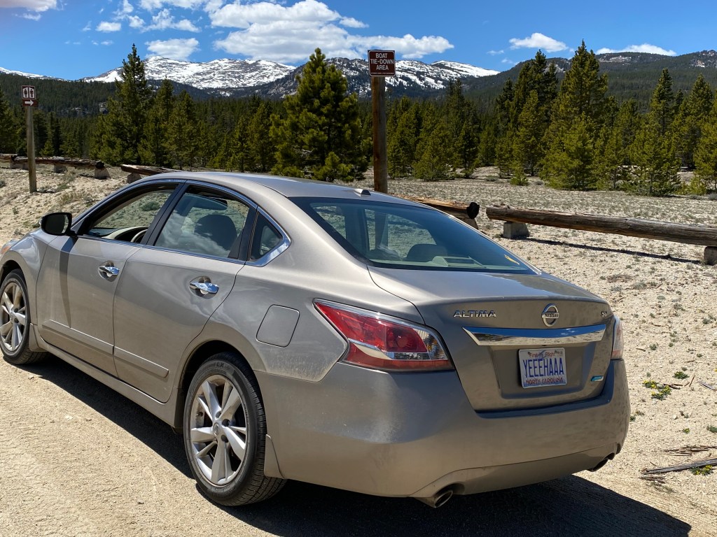
So what do you think? (Can you say johnboystravelblog GoFundMe page??) NO – I do NOT want that but it is nice to dream of what could be some day. I like my Nissan Altima very much and it has been very reliable (** knocking on wood **). I got 39 mpg on one tank of gas two days ago (I know I am several days behind posting photos but I have been somewhere just about every day).
As I was walking around town I saw this sports bracket in a store window:
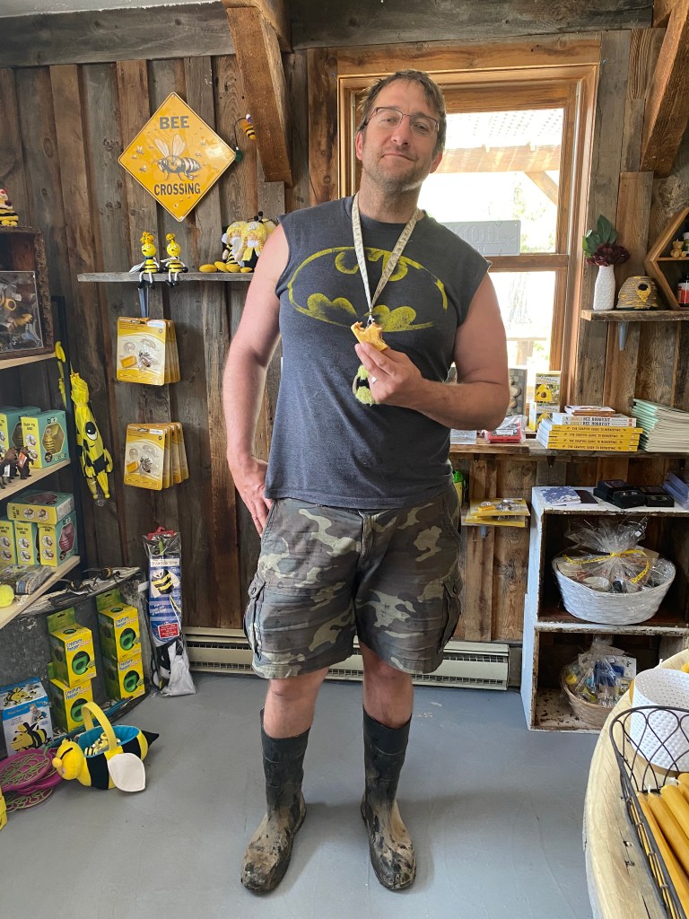
I know it is hard to read because of the reflection but I went inside the store to ask what it is all about. Lo and behold, the guy I asked (who was just finishing a sandwich, and owns the store I was in) said “boys basketball – we beat Worland!”. He is the very proud coach!!
In addition to being the high school (go Rams!!) basketball coach he is also a 3rd generation beekeeper and their family sells local honey and maintains hives here in Dubois and over in Jackson.
I walked across the street to talk to a guy who was flying a drone (multi-rotor helicopter) shooting video of Main street. We were standing in front of a restaurant which had this sign in the window, reminding patrons of proper cowboy etiquette:
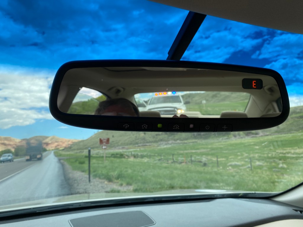
I decided to start heading back to Lander so I’d be home in time for dinner with the family (chicken on the grill!). As I was just a few miles out of town, this happened:
Eerily reminiscent of my experience in Rocky Mountain National Park a few years ago, the long arm of the law was behind me. This time, however, I wasn’t being scolded by the officer. He “ran my plates,” got out of his truck (he was a Fremont County deputy sheriff) and cautiously approached my door with his hand on his (holstered) weapon. I put my window down, placed my hands on the steering wheel at the 11 o’clock position with my fingers extended to show that I wasn’t a threat. He said “Good afternoon, sir. I saw your hazards on and just wanted to make sure you weren’t needing any help”. I thanked him for stopping but explained that I had just pulled off the road to return a text message to my sister-in-law in Lander. He said “OK – we thank you for doing that. Have a nice day,” returned to his vehicle and left.
Here are some things I saw on the way home:
The cabin above appears to have been abandoned for some time but was near a small stream and seems like it would have been a great place to live.
I was actually headed the other direction but this had been the view I had driving northwest earlier in the day and I had made a mental note to stop and get a photo on the way home. I had just crested a hill and there was a long slope downward before this road turned left and merged with another road to take me to Dubois.
As I traveled to Thermopolis on Tuesday I drifted on and off of Wind River Indian Reservation land. I also stopped, for the second time, at their Wind River casino which is 2 miles south of Riverton and a little more than 20 miles from Lander. Wednesday I drove northwest from Lander, to the little town of Dubois, which I will be making a separate post about. Thermopolis and Dubois are both about 85 miles from the house in Lander and while I drifted on and off of Indian land on Tuesday I was on it almost all day on Wednesday, except for the towns at each end. Turns out the Wind River Reservation is ENORMOUS – over 3,500 square miles – almost three times the size of Rhode Island!
The Wind River Reservation is home to two tribes – the Eastern Shoshone and Northern Arapaho. But as we say in Durham, with Duke and Carolina fans sometimes living under the same roof – it is a house divided. Those two tribes are bitter enemies and the result is a reservation which is considered the most dangerous in the country. The crime rate is 5 to 7 times higher than normal and gang violence, unemployment and drug use are systemic problems.
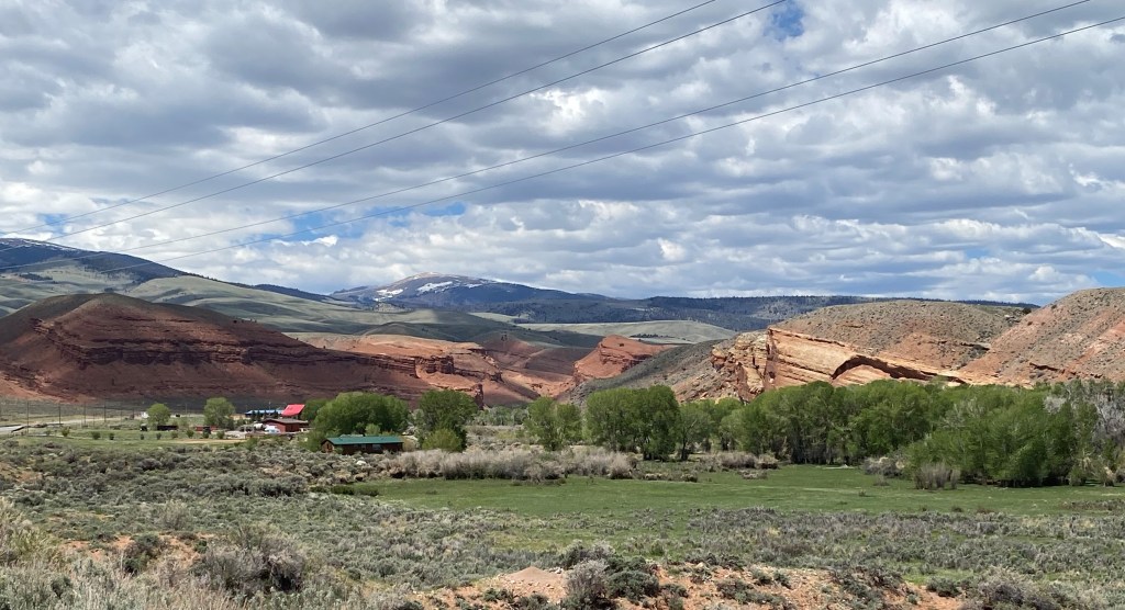
But it is a beautiful place. The land is, for the most part, very open and sprawling with an occasional small house or two, most often a trailer, and the Wind River makes frequent appearances as it meanders through the property. As I was driving north towards DuBois I was traveling along the western edge of the reservation and wasn’t far from the Wind River Mountain range.
There was a second casino on this, the west side of the reservation, and it turns out that Shoshone Rose (north of Lander) and Wind River (south of Riverton) are the only two casinos in the state of Wyoming. Wind River had a few gaming tables (only blackjack was in use both times I was there, with only a few players). It had one roulette table and a few card games I was not familiar with but the casino contained mostly slot machines. Shoshone Rose appeared to be exclusively slot machines, and both casinos had a small hotel attached. Both had only recently reopened after having been closed for a long time due to the pandemic and masks were mandatory at both facilities. The Indigenous American tribes throughout the United States were hit particularly hard by the coronavirus and I just recently learned that one of the places I hoped to visit in Arizona is still closed due to COVID concerns (it is on Navaho land).
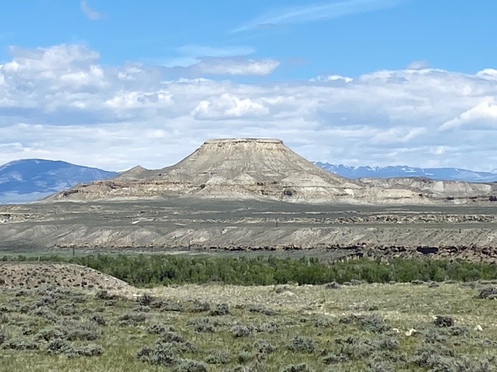
As I drove further north I started to see large formations in the distance and reached some of them eventually. This is Crowheart Butte:
And just up the road from that was this little non-denominational church:
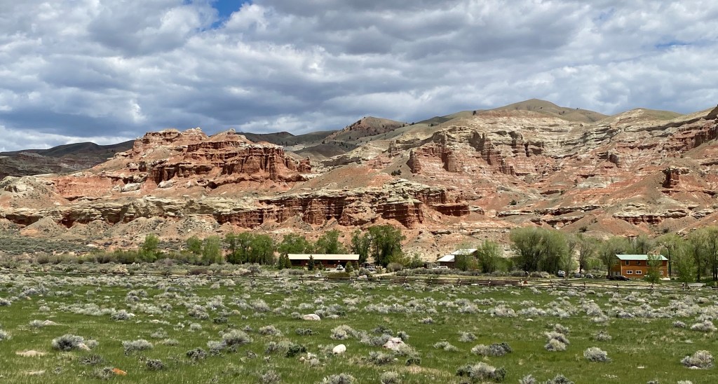
The scenery got a little more interesting as I approached the northwest corner of the reservation.
And I got to try my hand at using my new iPhone 11 to take a one-shot panorama (hopefully no more two or three shot left-to-right single pics for you to combine in your mind). Let’s give it a try and see what happens:
I’m afraid I’ll have to call that a FAIL! Nice shot of the access road in front of you there, JohnBoy… Silly me thought I should hold the phone in a horizontal orientation, as I do for wide shots. Evidently the phone will only take a panorama with the phone held in a vertical orientation while moving it left to right. Let’s try this again:
I cropped out some from the top and bottom and, while tiny, they do give a nice wide view. I was pretty far away from the target and it will probably be better the closer I get. Let’s just see about that:
I’m going to go ahead and post these and take a look at them as everyone sees it online. I believe those last two photos were actually taken after I had left the Wind River reservation and was just a few miles from Dubois so let me wrap up this post and start a new one about that town.
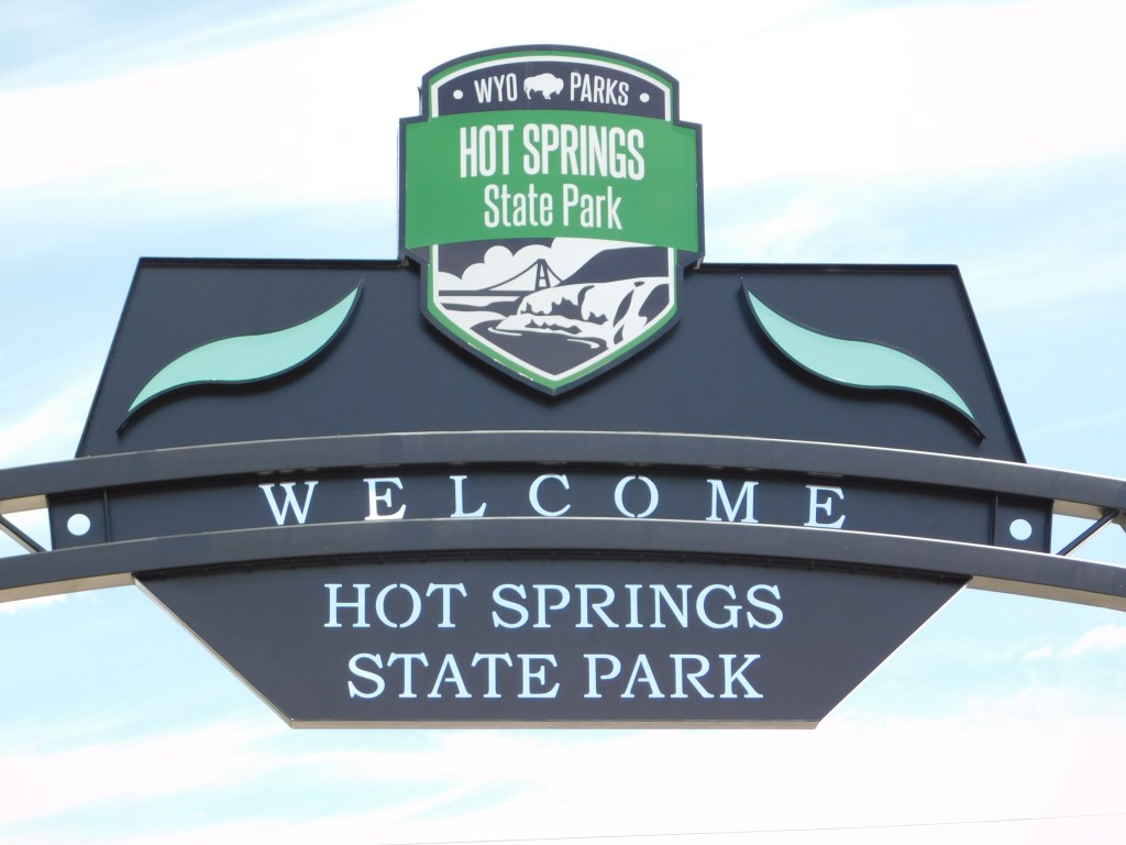
As you may have guessed from the town’s name of Thermopolis, there is indeed something warm here. Just east of town, on the opposite side of the Big Horn River, is this gorgeous State Park. It is open, free to the public, although there are a few commercial enterprises within. Indigenous Americans feel that water has therapeutic powers. The Shoshone and Arapahoe tribes gave Wyoming the hot springs which are on this land in a treaty in 1896 with the provision that they remain accessible to the public. Visitors may still use the State Bath House free of charge. I tried to go in the State Bath House because there was a sign indicating that there was local travel information and maps inside, but it was only open from 8 to 1! But at least it’s free….
With mineral-laden waters of up to 127 degrees Fahrenheit, this is the world’s largest hot springs. I have been surprised that throughout my travels in the United States the past few years how many places I come across with hot springs. Silly me, I always assumed Hot Springs, Arkansas was the largest.
I just kind of meandered through the lower area of the park, just inside the entrance. There is lots of open lawn space for kids to run around and play and a few playground areas. There are a few for-charge places which offer various services as well as a few entertainment venues which we’ll get to shortly.
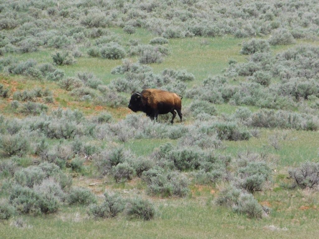
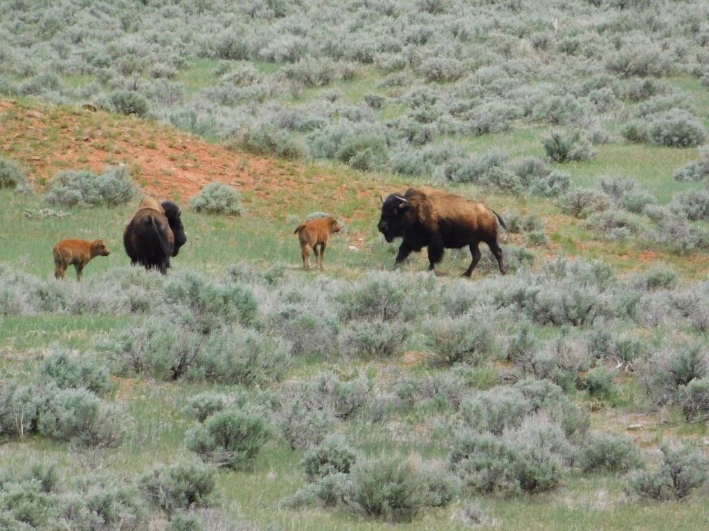
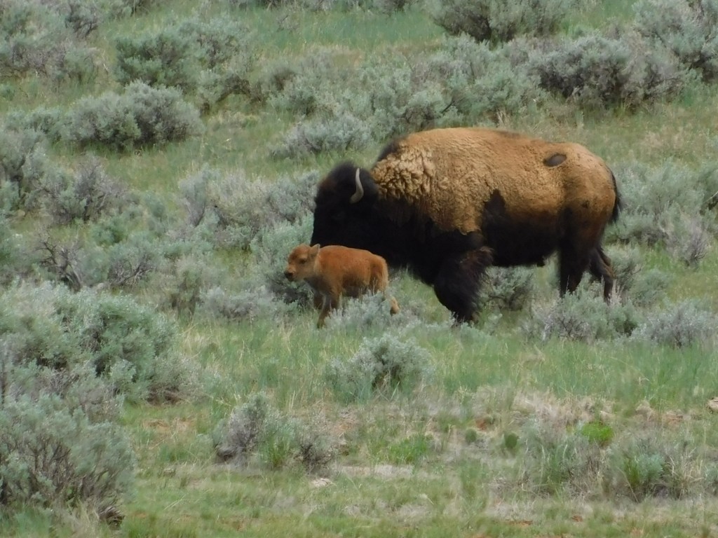
There was a road which led to a large open area where there were bison roaming:
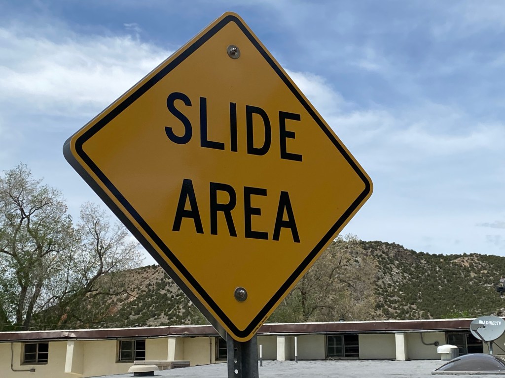
When I finished taking that loop road and was driving back to the lower area of the Park I saw this sign:
Which was there because of this:
Everybody’s a comedian….
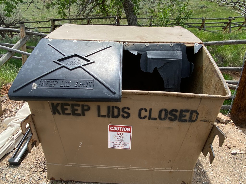
I did have to laugh at something just across the road from where I parked to take the two photos above:
“Honest, I tried to comply Officer but zee lid, she was broken…”
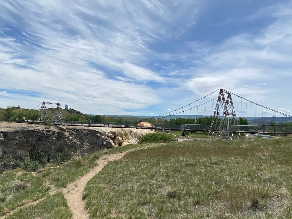
I drove back into the main area of the Park and consulted a map online to find out where the swinging bridge which Sam had told me about was located. Turns out it was just a short walk from where I was parked, though signage would NOT have directed me there…
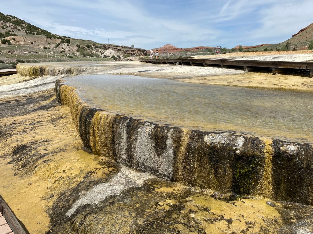
I was on the lower of two boardwalks constructed over the flowing waters. Of course the one I was on was a dead end so I had to backtrack and go up to the other one. These boardwalks are there for a reason, folks, at places like this and in bigger parks like Yellowstone. People are supposed to STAY ON THE BOARDWALK. People have literally been seriously burned, or in extreme cases, boiled to death (and I do mean literally!) by straying off the boardwalk for that perfect (and perhaps LAST) selfie.
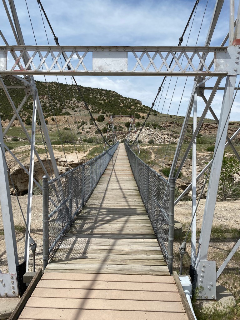
Sure enough, I arrived at the swinging bridge which crossed the Big Horn River.
And here were some of the views, from the bridge itself and the other side:
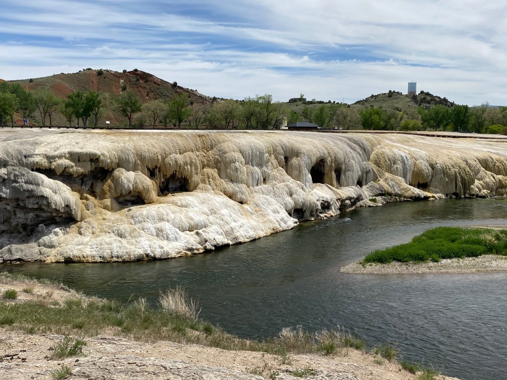
This is looking back towards the area with the boardwalk:
And this was looking toward the general area of the Park. You can see a domed facility which contained one of the bath houses and one of the several waterslides scattered throughout the Park. The river then continues (right side of photo) on past the Park and the town of Thermopolis to head toward points south (like the Wedding of the Waters):
Here are some closeups of the water draining from up near the boardwalks down to the river below. Sam had told me that I might see some interesting colors based on various algae which grows at certain temperatures but I basically only saw yellow and off-white. And of course any time one is near a place like this there is an ever-present smell of sulfur in the air.
And stay tuned folks – tomorrow we have an exciting (I hope) new feature coming to the blog!
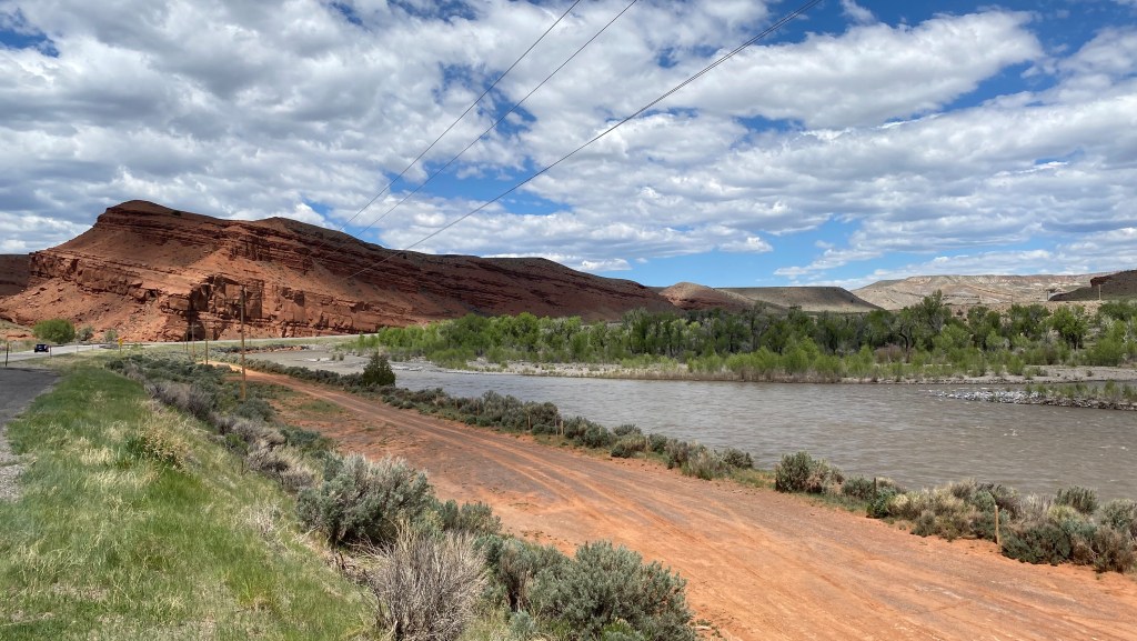
After driving through Wind River Canyon on Tuesday I continued north on Highway 20 towards the little town of Thermopolis. Shortly after getting out of the Canyon I saw signs for a parking area called “Wedding of the Waters”. Curious sort that I am I stopped to take a look:
This is basically a boat launch where one may unload a small boat into the Big Horn River. Now I know what you’re probably thinking… JohnBoy, I thought you said that the river which created the Wind River Canyon was the Wind River. Well, that’s true. This is the same river but here it is called the Big Horn River (having come south from the Bighorn mountains near Sheridan, WY, north of here). Just south of this boat launch is the “wedding of the waters” where the river changes names, one of the few places in the world where this occurs.
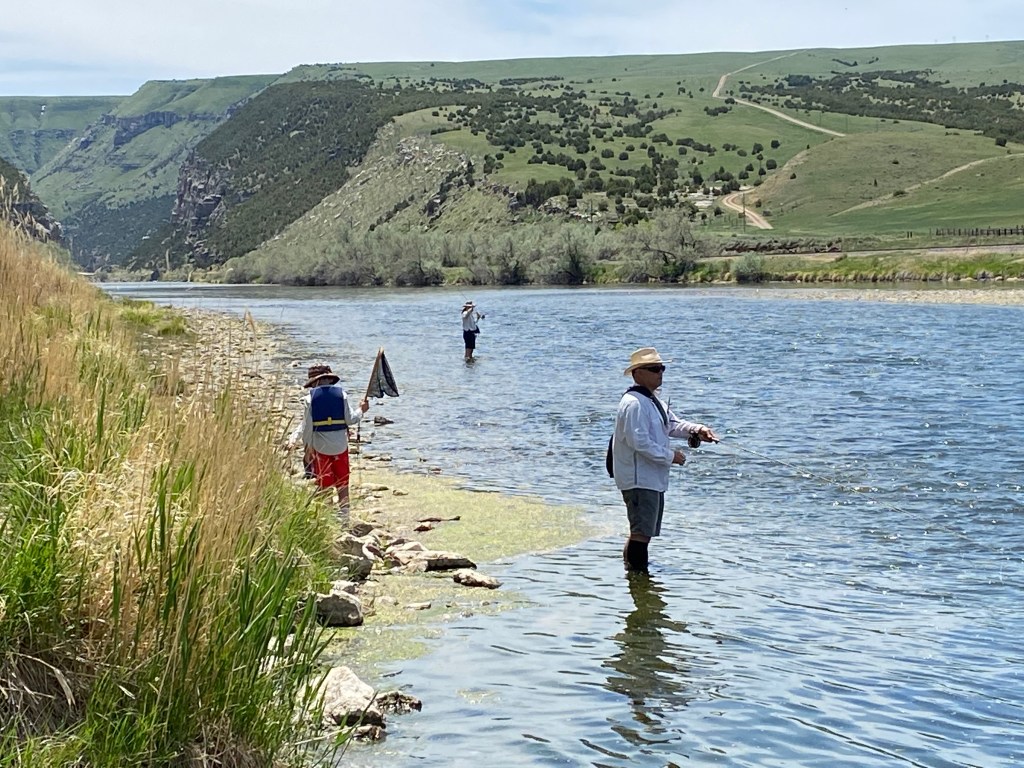
There was a family of a father and two sons just getting ready to unload their boats into the river. I walked out on the adjacent pier and asked if it was ok to take their picture for the blog. Before doing that I looked to the left and saw a few folks fishing downstream:
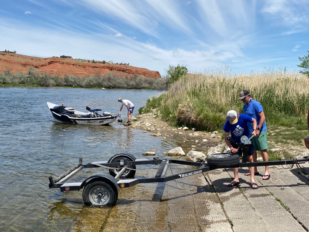
And to my right were the guys launching their boats:
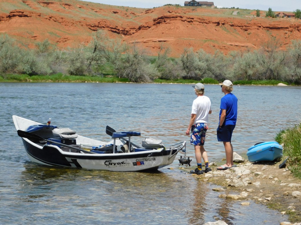
And I say boats because in addition to the small boat you see in the photo above there was also a blue kayak which was on the other side of their truck from this vantage point. By the time I walked up to get a photo of it from the other side the father pulled the truck into the parking area so I walked with him back down to the pier and the kids had moved the kayak to the shoreline near the other boat:
There were also two young ladies and their little dog waiting their turn to carry their kayaks down to the river (and the dog had the cutest little kayak!…. Just kidding).
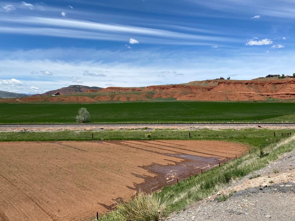
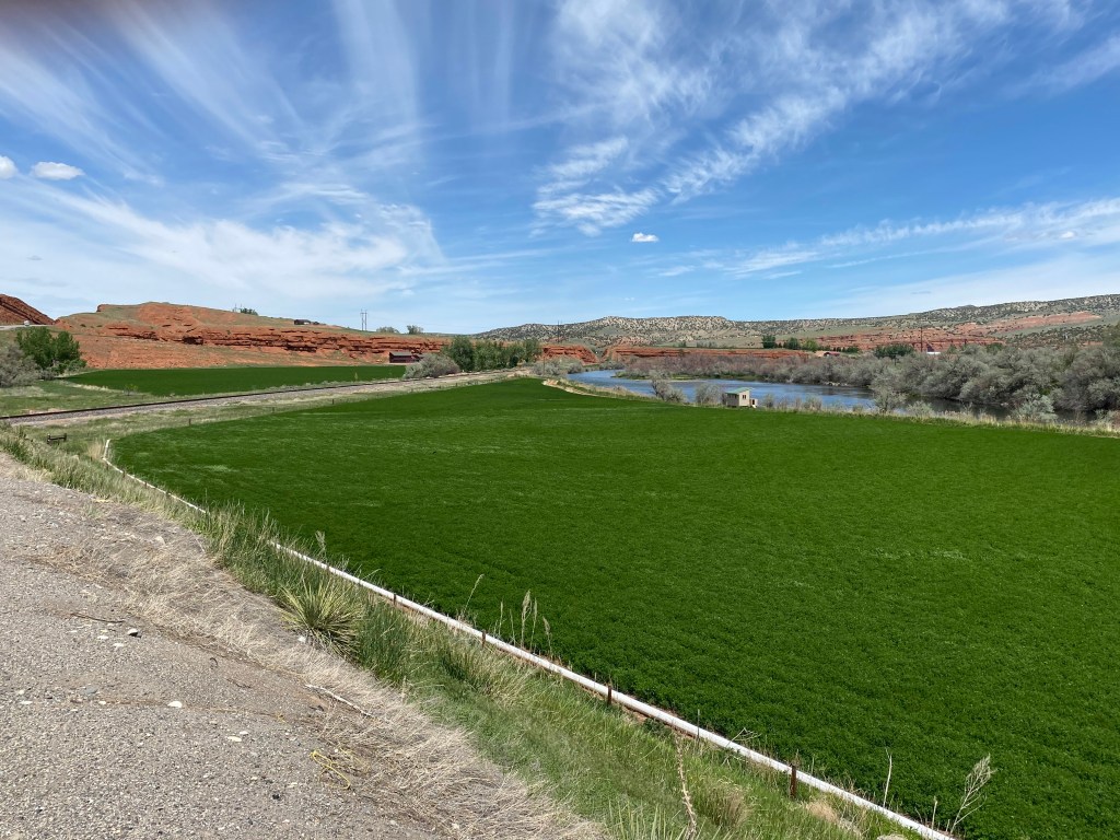
As I left the boat launch to continue north there was some beautiful, lush farmland on both sides of the river:
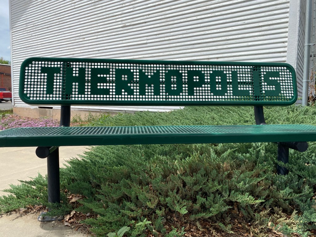
I finally made it to Thermopolis, a cute little town with a population of about 2,800.
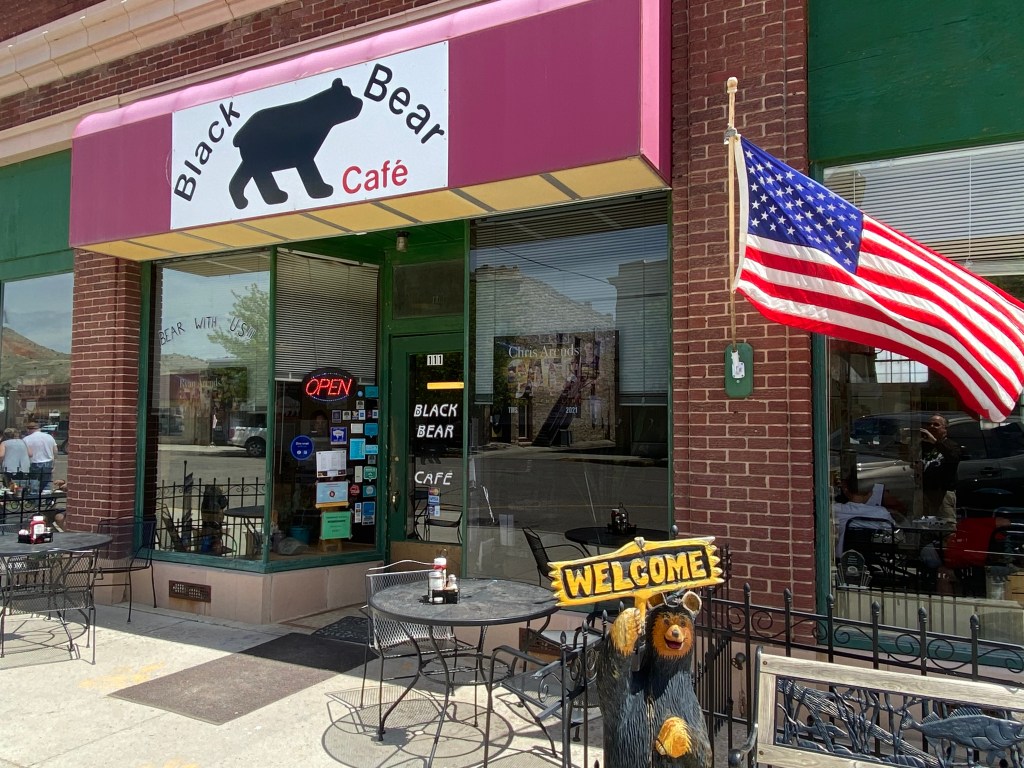
There were lots of small shops and eating establishments:
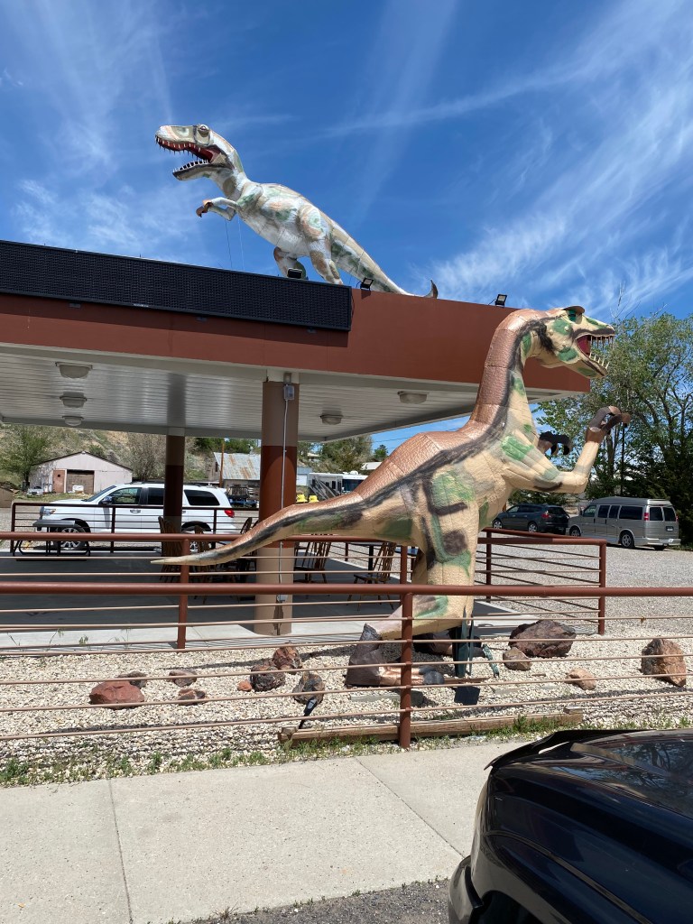
As I drove into town I noticed this unusual pair off to the left of the road:
Apparently this area is big on dinosaurs. Downtown there was this statue:
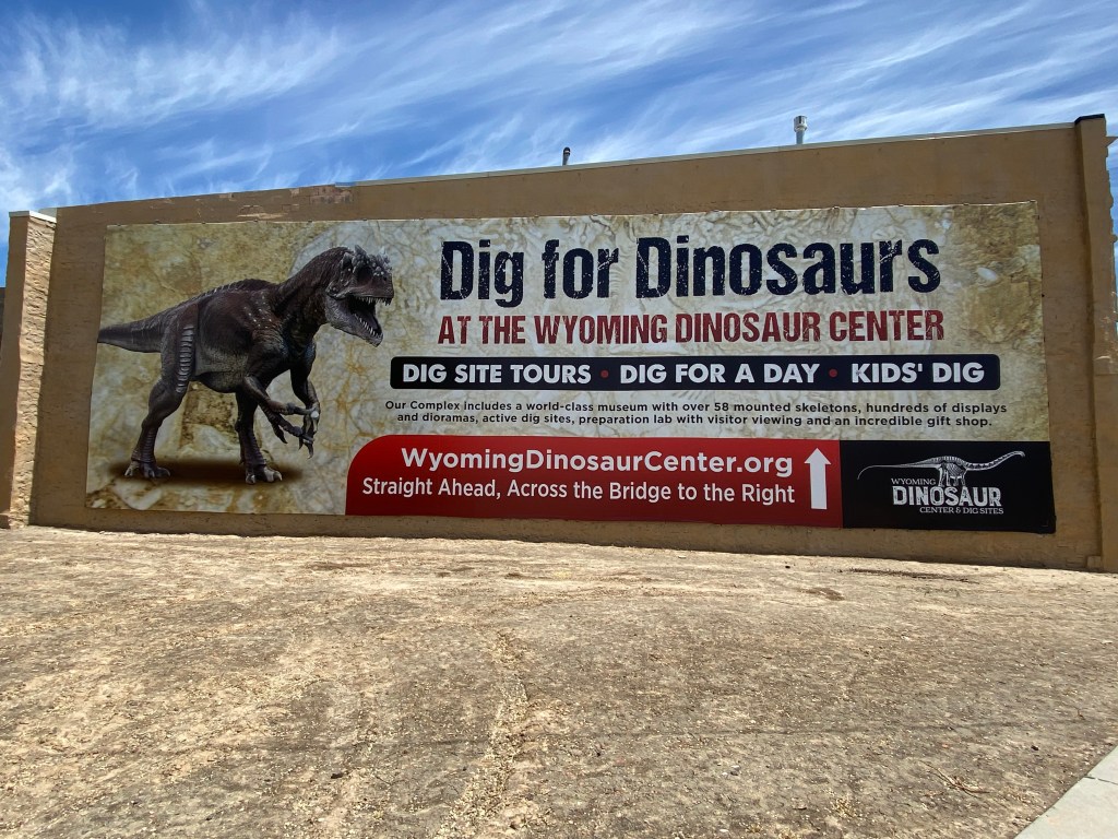
And just outside of town is this establishment:
I didn’t go there this trip but after reading the reviews on TripAdvisor and checking to see if I get a AAA discount (I don’t) I will definitely stop when I pass through town later this month on my way up to Cody. You will be hearing more about dinosaurs after one of the daytrips I will be taking with my brother and sister-in-law (and maybe Sam, too) one day this coming weekend.
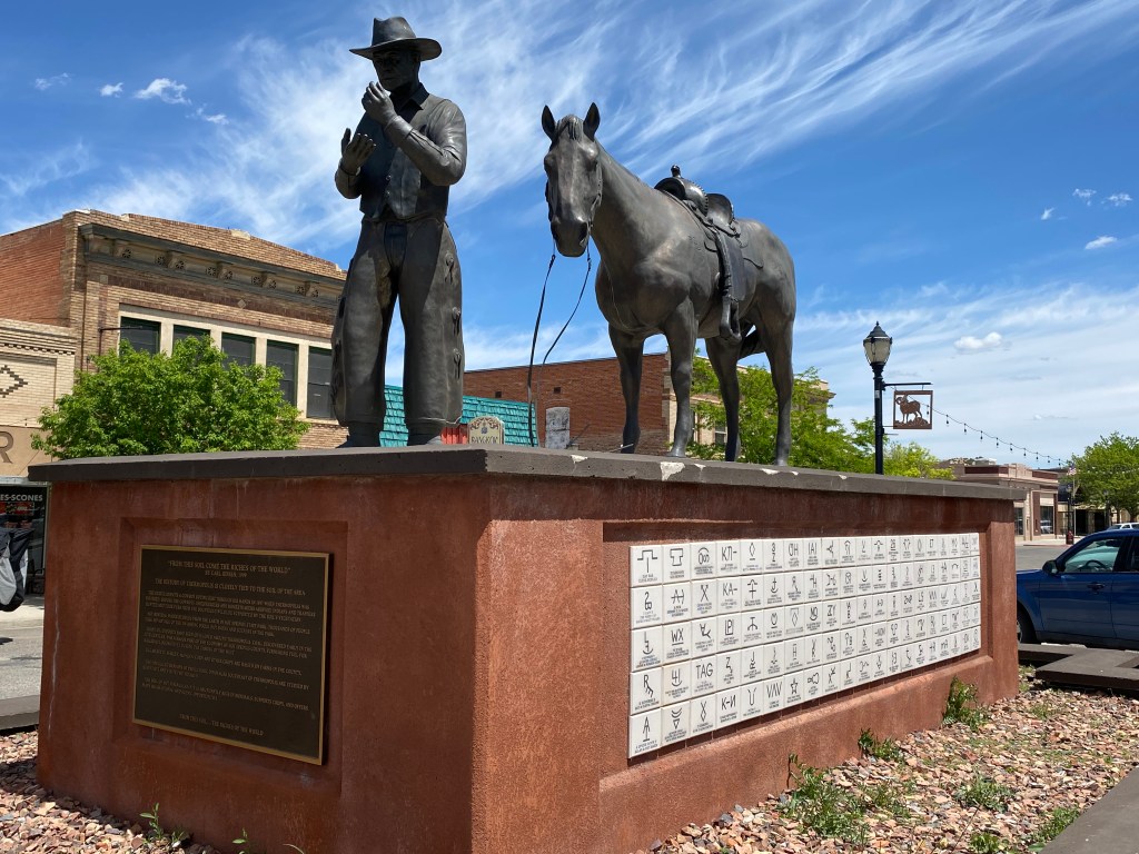
As I was taking the photo of the first pair of dinosaurs the ladies in the car parked next to me told me to be sure to check out the horse statue downtown. Sure enough, there it was, in the center of the main shopping district:
On both sides of the statue were the “brands” of various Wyoming ranches. These represent the names of the ranches and are burned into the sides of their cattle. There were roughly 200 on each side and I won’t show them all but here is a sampling:
And don’t bother looking for the Yellowstone Dutton Ranch. It’s in Montana, silly!
Tuesday I headed northeast from Lander again, past Riverton, and on up to the tiny town of Shoshoni. There I turned left on Route 20 towards the town of Thermopolois, about which which I will make a separate post.
After I got past Riverton I saw these horses, including two young foals, just off the highway to the left:
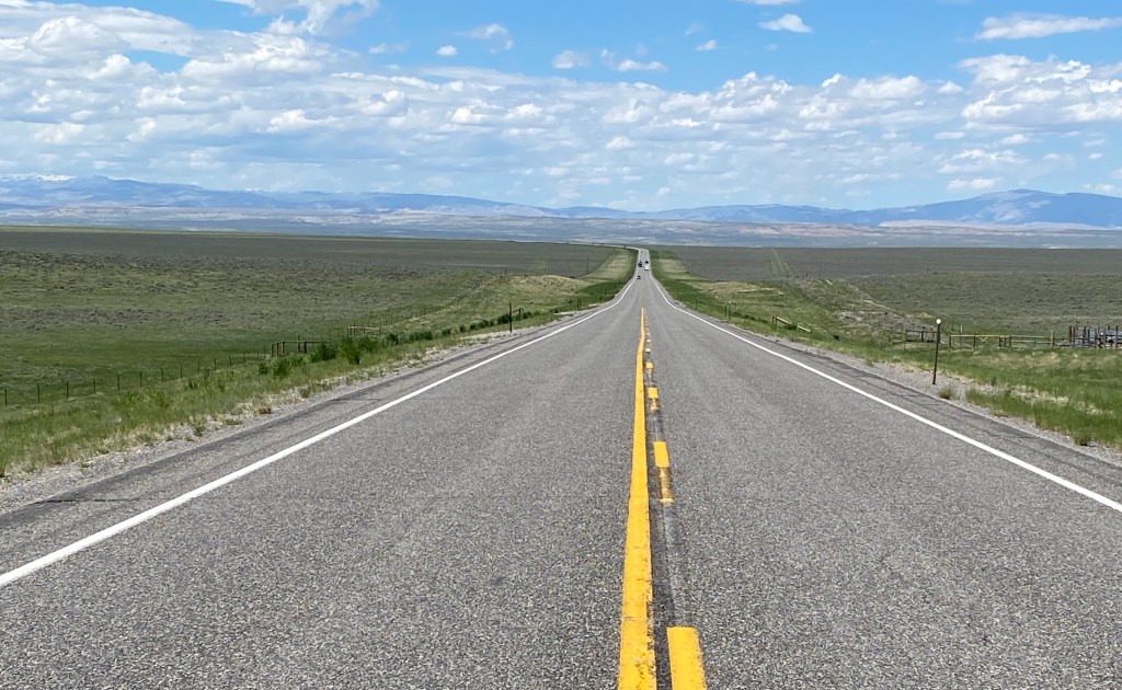
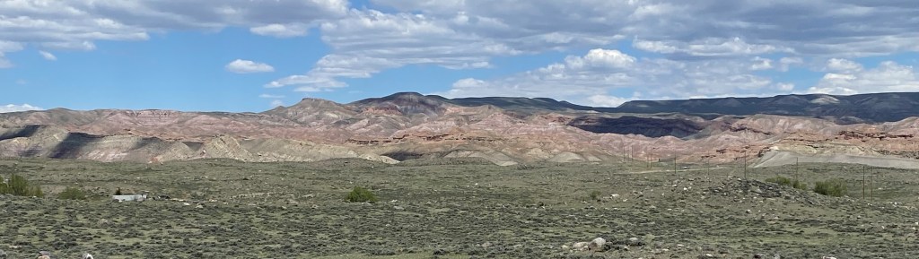
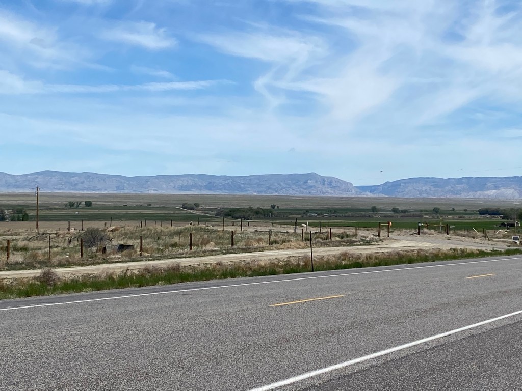
Then the road really opened up. Off to my left, in the distance, was a mountain range and I didn’t realize at the time that that was exactly where I was going.
As you can see, between where I was and the mountains there is lots of flat, open space. Just a little further up the road this is how it looked of to my right:
On the left side of the highway at that spot was this large rock formation:
I continued northeast on Highway 26 and when I got to the one-light town of Shoshoni I turned left on Highway 20.
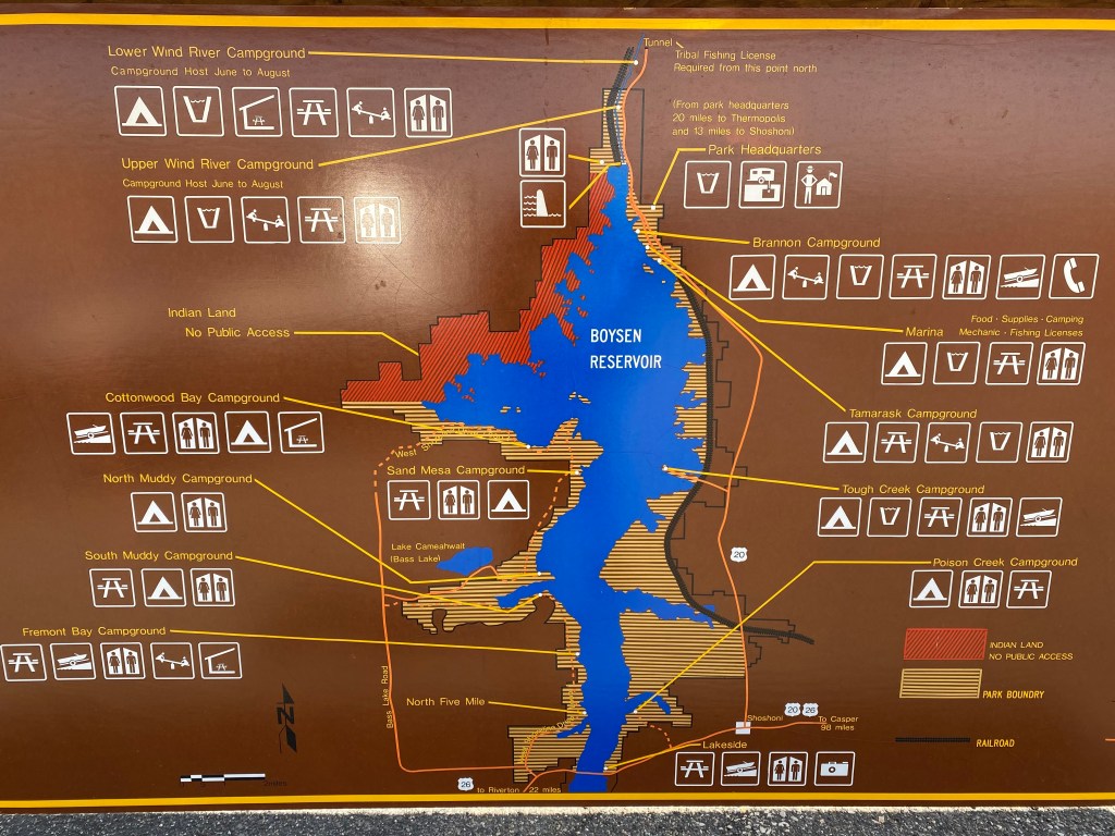
I started seeing more and more water on my left as I drove near the Boysen Reservoir. I didn’t have my Boysen brochure with me so I didn’t venture onto any of the access roads but I may make a separate trip up later this month and will add that to the blog in a future post. It is a popular recreation and camping area as evidenced by this map.
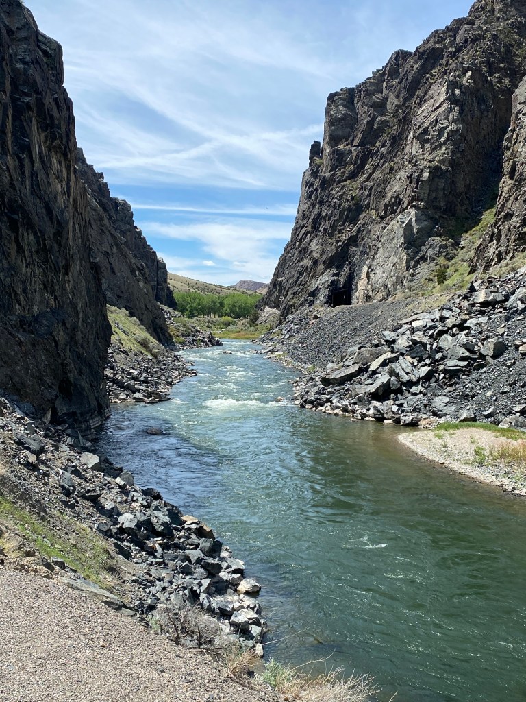
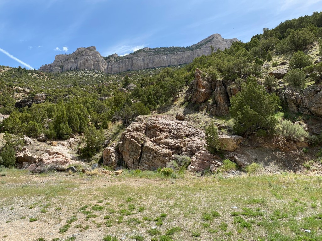
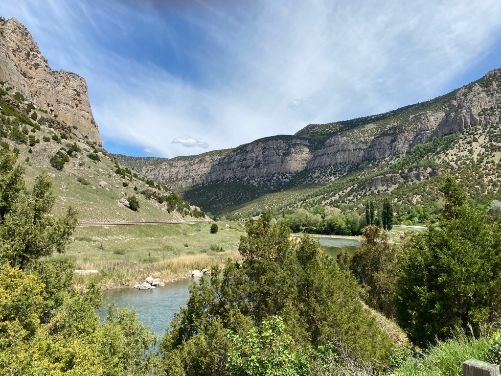
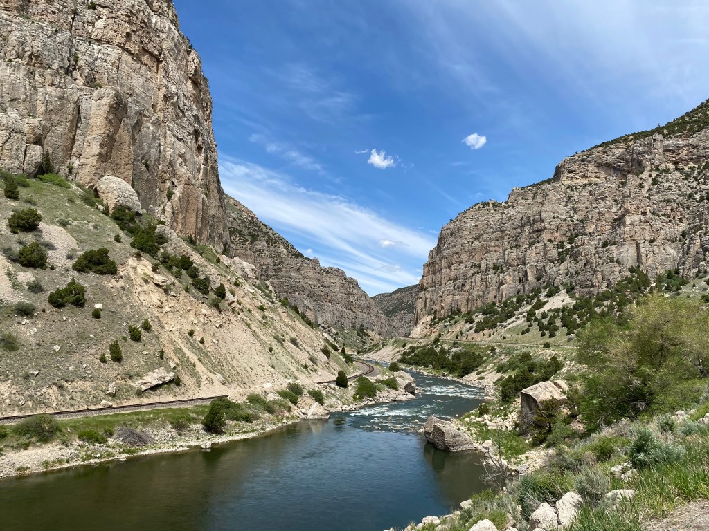
Now the fun part of my day was going to begin – my drive through 14 miles of Wind River Canyon. As you may have guessed, the canyon was created by the Wind River which carved a slot through the Owl Creek Mountains which run roughly west-to-east. Route 20 runs up the east side of the river and there is a single railroad track on the western side.
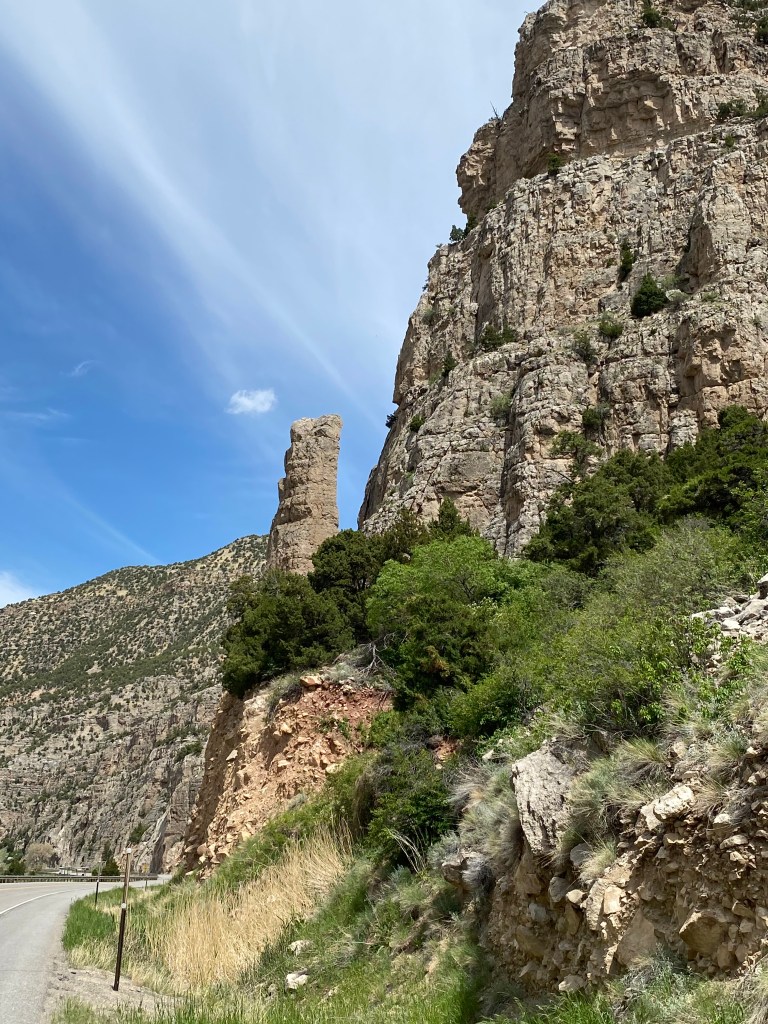
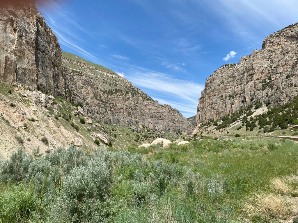
Here is some of the things I saw as I drove through the Canyon:
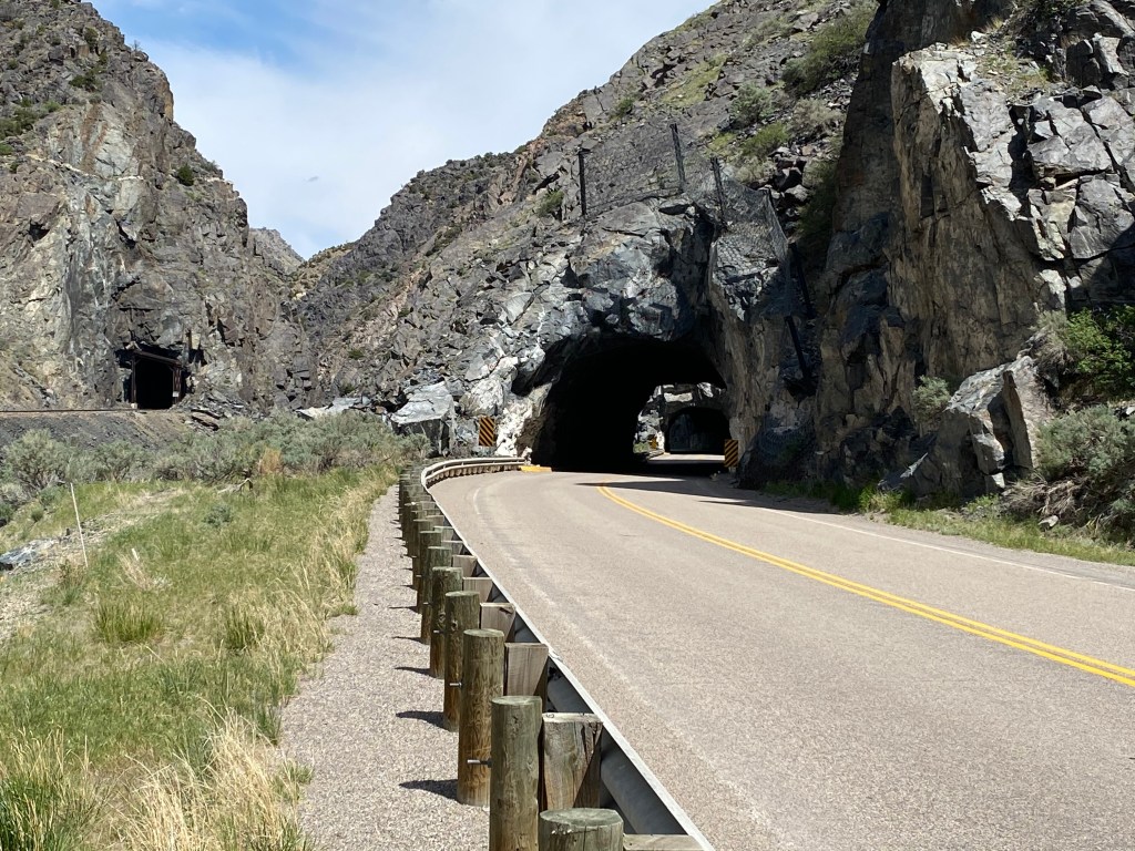
I had turned around so my car is facing the “wrong” way, and my headlights were on because I had already driven through some small tunnels which you will see shortly.
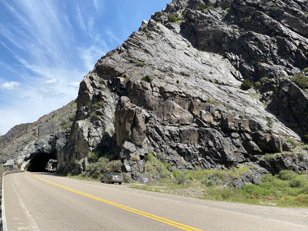
The photo below is one of three short tunnels I drive through. To the left you can see a similar tunnel for the trains.
And from where I took that photo you can see how tiny my car is compared to just part of the mountain to the right of the road.
At this point on today’s trip I was only 70 miles from home. As I have learned in the last two weeks, within 100 miles of wherever you are, the terrain can change quite a bit.
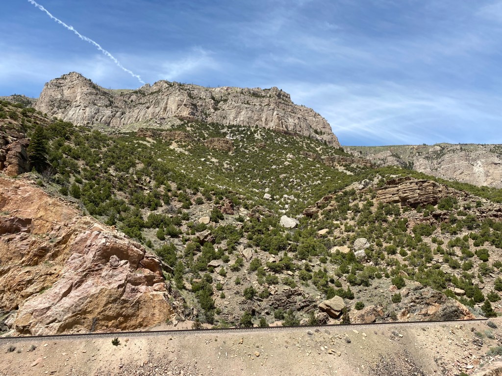
After I got through the narrow, rocky southern portion of the canyon it opened up a bit and there was vegetation and trees at various elevations.
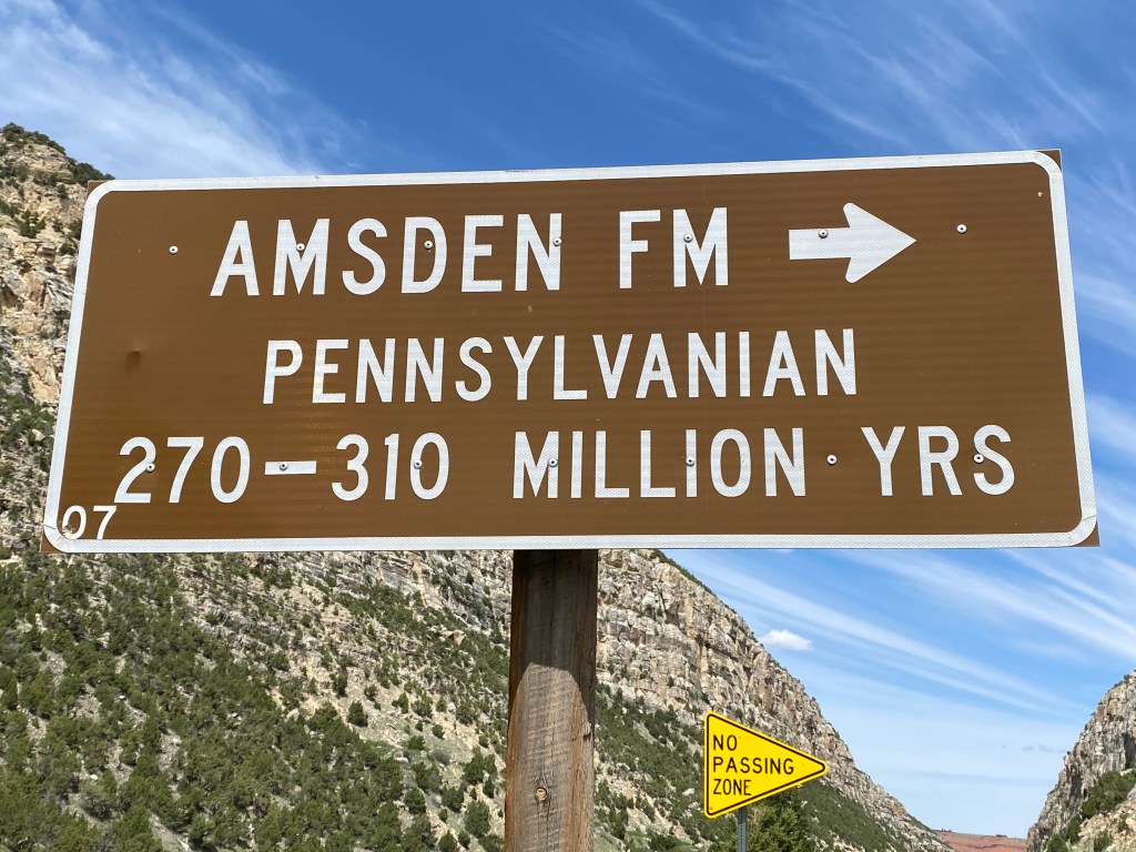
Every mile or so there was a sign indicating the approximate age of the rocks exposed on the right side of the road:
At one point I could see where there had been a small rock slide which would have blocked the railroad tracks on the other side of the river. I had already taken a photo from further back so I knew it had been cleared or else I would have called 911 and had them report it to the railroad:
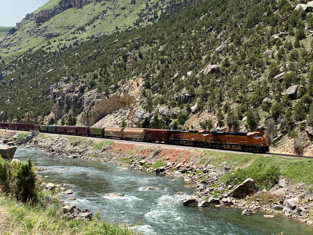
And the fact that it was clear was confirmed a short while later when a train came roaring through:
And my guess is that train was about a mile long.
An absolutely gorgeous drive on a beautiful day, which would have been even more fun in my brother’s Mustang convertible! He’s offered to let me use it but I am still at the “oh, look at that over there” stage and am scared to death I’d wreck it.