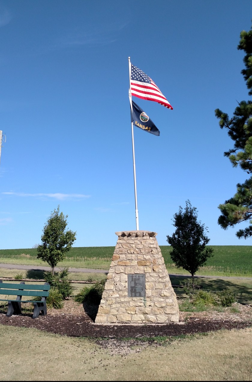
This marker represents the Center of the Conterminous (aka Contiguous, aka Lower 48) United States. The actual GPS coordinates put the center about a half mile away but that is private property so they built it here to keep the riff-raff off the farmer’s land. The site is about 2 1/2 miles northwest of Lebanon, KS.
When the government decided to erect a marker back in 1918 they projected the approximate location by balancing a cardboard cutout of the United States on a fulcrum (true story). The site they zeroed in on turned out to be only about 20 miles from the actual coordinates that surveyors plotted. Not bad for government work!
————–
Two more things I missed out on seeing this trip: The Kansas Barbed Wire Museum (in Lacrosse KS) and the Roller Skating Hall of Fame (hate that I missed that!) in southeast Nebraska. They are both on my future-visit list.
One thing I saw while on the road today (mainly in Nebraska) were about 20 long trainloads of coal heading east, presumably to deliver it to the White House for the winter. Coal’s fixin’ to make a big comeback, ya know….. I can picture it now, Mike Pence in the basement, shovelin’ coal into the furnace…..

Gonna buy stock tomorrow
LikeLike