And as I take the tracks into the sunset…

…well, something like that.

This was taken this evening after I had dinner in Wenatchee.  As you may have guessed, this was kind of a slow news day.  I opted to stay close to town for a change, get caught up on some paperwork and computer correspondence, buy some stuff for my new camera (a monopod to help steady it on zoom shots, etc.) and clean up and re-arrange things in my car.  I also checked out some things here in Wenatchee, which is actually a neat little town and has a beautiful waterfront along the Columbia River.

Tomorrow I bid Wenatchee a fond adieu and the JohnBoy show moves on to Bend, Oregon (for a full week.  Yippee).  It has been an incredible 5 days in Washington.  The weather was fantastic and I covered a lot of territory, but saw many amazing and interesting things.

Peak-a-boo…

IMG_0198

… I see you hiding behind that mountain….   (Sorry, I couldn’t resist the spelling pun).

As I was driving down towards Mount Saint Helens on Thursday I noticed the snow-covered mountain lurking in the distance.  Given the lay of the land I surmise that it is Mount Hood, which is in northwest Oregon (Mount Saint Helens in is southwest Washington state).

I’m heading down to Oregon tomorrow so believe me, you’ll be getting a closer look.

UPDATE: It is actually Mount Adams, which is in Washington state.  Elevation 12,276 feet, and is really not that far from Mount Saint Helens.  I am driving south towards Oregon and there was a sign pointing out which mountain on the horizon was Rainier and which was Adams.

Enumclaw, Washington

After I visited Mt. Rainier on Wednesday I got back on the scenic east-to-west road I had used to get there and continued on west to Enumclaw (NASCAR driver Kasey Kahne’s hometown. Congrats, Kasey, of your big win at the Brickyard last Sunday!).  As I started driving north toward the scenic road which would take me back east to Wenatchee I saw this sign and had to go check it out.

I turned and started driving down the road to get to the Park.  I didn’t see any more signs for a while go I asked Google (I have a button on my phone which lets me ask Google to look things up for me, similar to Siri and Alexa on other platforms) to tell me how to get to the Park. She (I haven’t given her a name) has a charming British accent and came back with the response “Here is some information on Flaming Geezer State Park” which I thought was hysterical (but I imagine that is a very different kind of park altogether….).

Sure enough, the Park was another mile or two down the road.  When I saw there was a $10 entrance fee I wondered exactly what I would be seeing, so when I got to the entrance I asked the young lady what a flaming geyser is.  She explained that there is methane coming up out of the ground which creates a flame above the surface.  I asked if it was something better seen at night and she said no, you can clearly see it during the day.  So I ponied up my ten bucks and went in to take a look.

I’ll keep you in suspense and post pictures tomorrow.  There was also a “bubbling geyser” a short walk away from the flaming geyser (no extra charge!).  No cheating now.   Don’t get ahead of me and look it up online, children.

Dry Falls State Park overlook

IMG_0028

This was also taken on Monday on my way to Wenatchee using my new camera.  I was going to post a comparison photo with one taken using my cell phone camera but suffice it to say that from now on I will just use the best picture I have available.

As I pulled in to the adjacent parking lot I noticed the gazebo and large gap below and to the left of it.  There is a walkway which juts out from the gazebo and over the gap to the vertical rock on the left to allow people to look down in to the canyon.  If you have good eyes you can see the metal fence which borders the walkway.  I’m afraid of heights and didn’t go out there.

ComSat Earth Station near Omak, Washington

IMG_0002

IMG_0017

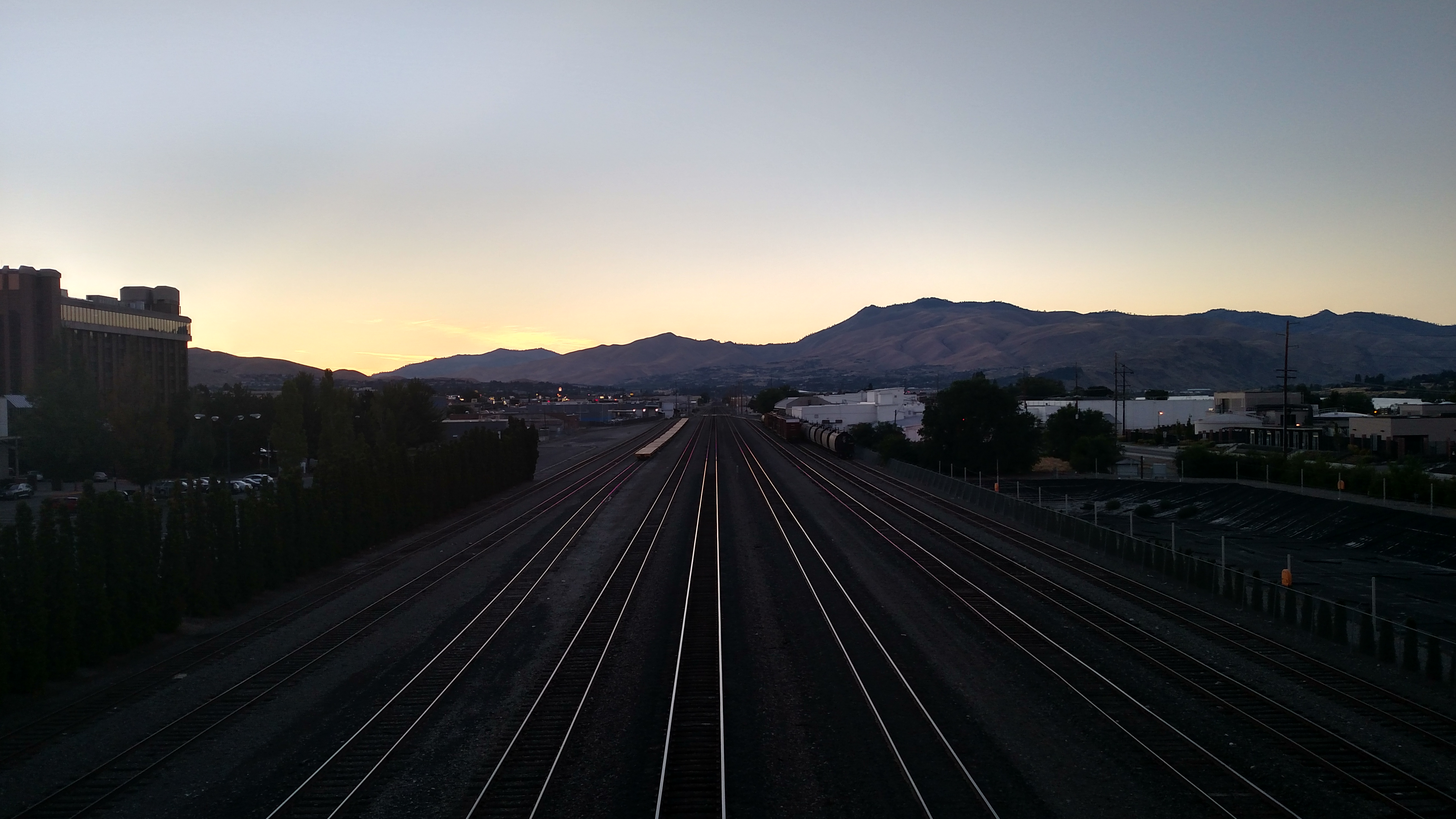
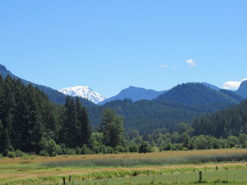
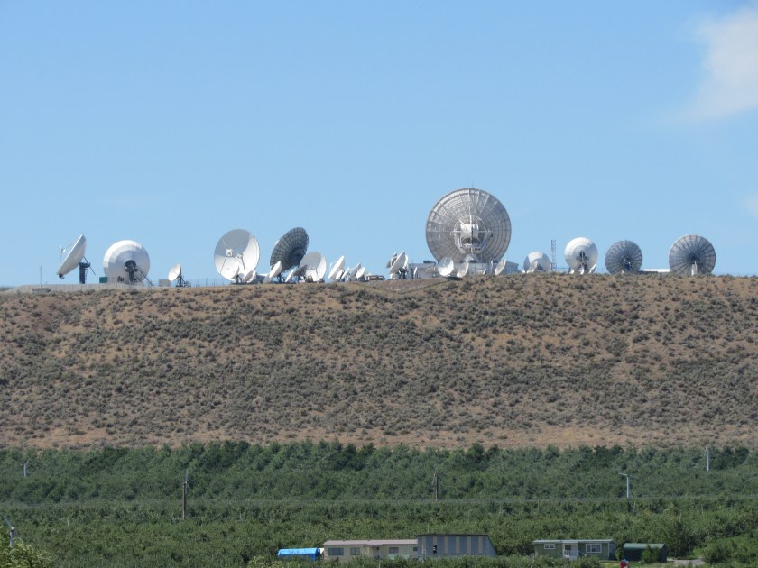
As I was driving south of Omak, Washington on my way from Idaho to Wenatchee on Monday I saw this group of satellite dishes on the top of a hill about a quarter mile off the highway.  Those of you that know of my connection to, and fascination with, radio telescopes know that I’d be all over this….

These were taken with my Canon camera given the distance from the road.

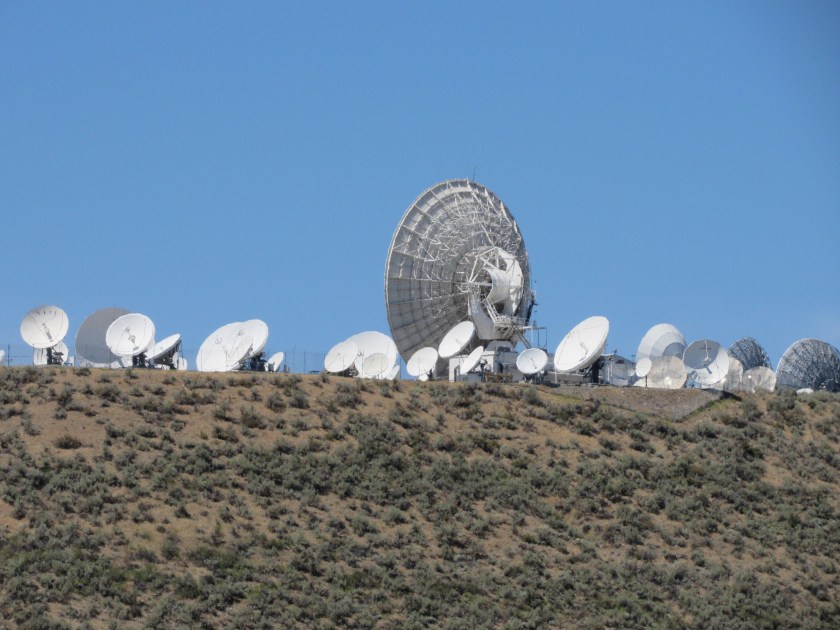
This is the former ComSat Earth Station, now owned by US Electrodynamics Corporation.  These are very similar in appearance to telescopes at the radio astronomy observatory near my mother’s hometown in West Virginia.  ComSat is short for Communications Satellite.  These dishes are receivers which collect signals from satellites orbiting the earth.  Most of these are “fixed”, meaning the don’t move and only point at one source (the same way a DirecTV or Dish Network satellite dish attached to your house lets you watch tv).  The largest dish you see can be moved (remotely, with a series of motors) to point at different sources the way most radio telescopes do.

There are more than 50 dishes at this location which receive communications and other data for a variety of companies and agencies. TV video feeds, radio and computer data, etc. all flow through here.  These dishes also collect signals from GPS (Global Positioning Satellites) which help air traffic controllers track aircraft.  This facility also provides data to the Department of Defense (and probably other, undisclosed agencies).  There are Earth Stations like this all over the world.  It is a private facility and not open to the public.  The dishes and receivers can be operated remotely and the facility itself is probably only manned by maintenance and security personnel.

Those of you who travel up and down Route 81 in western Virginia probably have seen the telephone Earth Station next to the highway near the Mt. Jackson/Bayse exit.  Those much larger dishes (probably 4-5 times the size of the largest one you see here) are for companies like AT&T and Verizon to support their telephone and data systems.