Belle Fourche, South Dakota

Pronounced “Bell Foosh”.  Why, I don’t know….

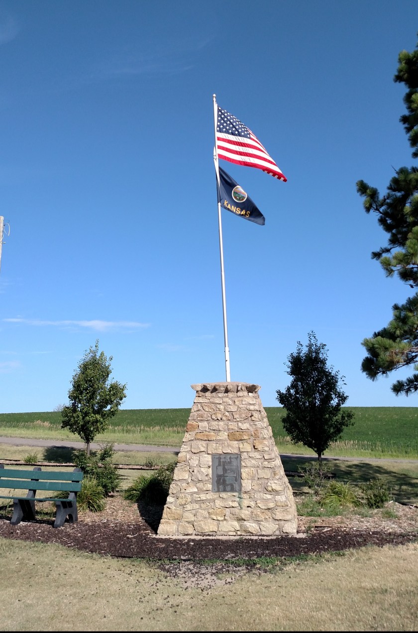
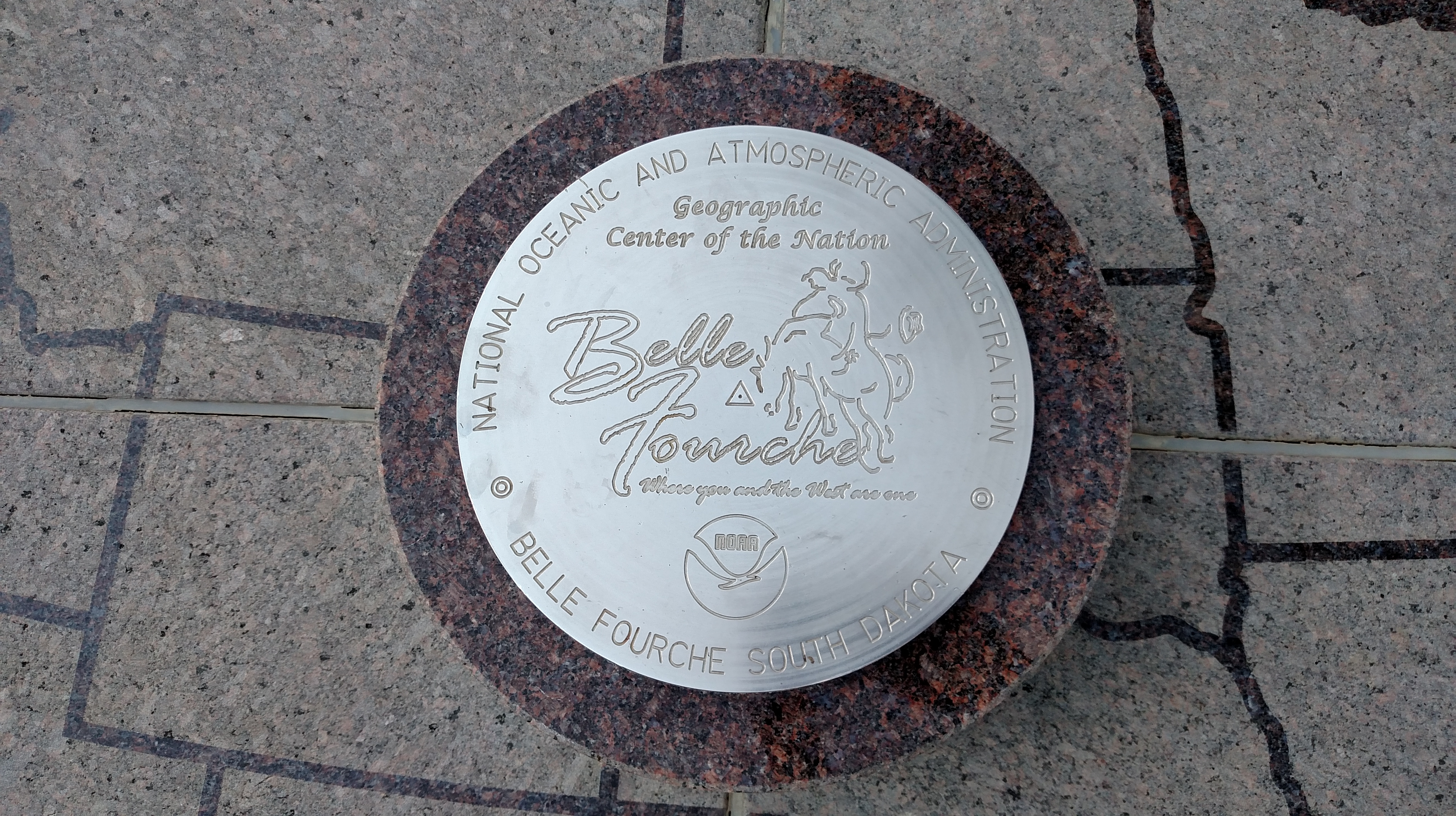
This marker denotes the Geographic Center of the United States (all 50 states).  It is in a city park downtown whereas the actual location of the GPS coordinates is about 20 miles north of town.  Belle Fourche is about an hour northwest of Rapid City.

This designation occurred in 1959 after Alaska and Hawaii were added as states.  Before that the site was in, you guessed it, Lebanon KS.  I thought I was going to have another brain teaser on my hands when the sign in the park stated that the Center moved here from Smith Center, Kansas.  Well I looked that up and it is just down the road from Lebanon, and is the county seat, so that may be why it got the mention on that particular sign.

I hear that Puerto Rico is starting to make noise about becoming the 51st state.  Who knows where that event would move the Geographic Center (or the Population Center). Actually, I bet someone, somewhere knows.  Sam???  Jimmy???  Anyone care to wager an educated guess?  I’m looking for something a little more precise than “east and south”.

The Geographic Center of North America is near Rugby, North Dakota.  I would have thought the Canadian influence would have pushed it further north than that but Alaska goes pretty far north so evidently that had already been factored in.  I guess it’s good I’m not the one figuring all that out.

——–

On my way back to my Airbnb from Belle Fourche I stopped in Sturgis, which is Mecca for motorcycle enthusiasts.  Didn’t see too many bikers, but then it was over 100 degrees today so all that leather would be quite warm.  I saw lots of gigantic nightclubs and bars which probably host some pretty wild parties.  One of the bigger clubs had a hundred or more American Flags in a field in front of the complex as a tribute to veterans.  Impressive!  The town population increases dramatically (in multiples, probably) when a bike rally comes to town.

Badlands National Park, South Dakota

This was my second visit to the Badlands.  I was here many years ago but it was nice to come back and spend more time enjoying it.  It was a hot day (100 degrees before noon, and a high in the Park of 108) so it was not too crowded.  Plenty of room in the scenic overlooks and parking areas and didn’t even have a wait in the restaurant at noon on a Sunday.

As with Carlsbad Caverns, the pictures don’t do it justice.  Everyone should visit to see it for themselves.  Only saw two bison roaming around (free range) but saw lots and lots of prairie dogs.  Unfortunately there has been a big outbreak of the sylvatic plague in the prairie dog community (which is lethal) so there are now warning signs to keep a safe distance (not hard to do since they are pretty skittish, though I do have a picture of one on my foot taken at Devil’s Tower many years ago.  Those little guys had gotten very accustomed to having people around).

——–

Before getting to the Badlands I made the obligatory stop at Wall Drug.  For those who haven’t been there – it is the “South of the Border” of the northwest US.  Signs along the interstate for miles and miles (though smaller and not as witty as Pedro’s) woo the folks driving down the road to stop at Wall Drug. It is a family owned, full city block in size, drug store/tourist trap in Wall, SD.  As was the case years ago, it was packed.  I stopped, took a picture and was on my way.  Didn’t spend a dime.

Hey Kim Jung-un – I got yer ICBM right here…

You are looking at the business end of a Minuteman II Intercontinental Ballistic Missile, housed in the Delta-09 Silo just down the highway from Wall Drug (literally, the next exit).  This baby can fly up to 7,500 miles and strike within 900 feet of it’s target.

OK, OK, so we haven’t been keeping these active since the early 90’s (or have we??? – cue the suspenseful sound effects…..) and maybe this is only a replica.  But you can bet we have even bigger and better missiles scattered all over the country in a silo near you.

When I went up to Brevard, NC two years ago to see some radio telescopes that are located there I heard stories that the site supposedly housed several missile silos as well.  And there is that mysterious underground facility which is supposed to exist just outside Chapel Hill, NC.  Who knows where the missiles might be….  The Biltmore House???  The Greenbrier???  Mar-a-Lago???  But enough rumor mongering.  We have to keep KJU in suspense so he doesn’t do anything stupid.


For your viewing pleasure I present… Carhenge

It’s just like Stonehenge…. but with cars!

At first I thought this was just the manifestation of some guy’s corn-mash-induced stupor: Hey, let’s get a crane and some old cars (and trucks), paint them gray to look like rocks and replicate the iconic Stonehenge site.  Now let’s see…. wherever shall we put it?  How about just outside Alliance, Nebraska…

Actually this was designed by a man who had worked in England for many years and came up with the idea as a tribute to his late father.  Jim Reinders built it in 1987 and it is now overseen by the Alliance Arts Council.  There were quite a few people there when I stopped by, including a Boy Scout troop and a church group.  I have several closeup pictures, or you can find lots of photos online.  It really is quite clever…

… AND it will be in the direct path of the total solar eclipse on August 21, 2017 (11:49 AM Mountain Time) so make your travel plans now!

——–

I had a long day on the road getting to Rapid City, SD (12 1/2 hours including my few, brief stops) but it was a very pleasant drive.  I’ll be here 4 nights and on Wednesday morning I head up to Bozeman, MT for 5 nights.  Haven’t seen any wildfires yet but I think I’m getting close.

Lebanon, Kansas

IMG_20170708_095042450

This marker represents the Center of the Conterminous (aka Contiguous, aka Lower 48) United States.  The actual GPS coordinates put the center about a half mile away but that is private property so they built it here to keep the riff-raff off the farmer’s land.  The site is about 2 1/2 miles northwest of Lebanon, KS.

When the government decided to erect a marker back in 1918 they projected the approximate location by balancing a cardboard cutout of the United States on a fulcrum (true story).  The site they zeroed in on turned out to be only about 20 miles from the actual coordinates that surveyors plotted.  Not bad for government work!

————–

Two more things I missed out on seeing this trip: The Kansas Barbed Wire Museum (in Lacrosse KS) and the Roller Skating Hall of Fame (hate that I missed that!) in southeast Nebraska.  They are both on my future-visit list.

One thing I saw while on the road today (mainly in Nebraska) were about 20 long trainloads of coal heading east, presumably to deliver it to the White House for the winter. Coal’s fixin’ to make a big comeback, ya know…..  I can picture it now, Mike Pence in the basement, shovelin’ coal into the furnace…..

Cawker City, Kansas

You are looking at the largest ball of sisal twine “made by a community,” which is actually larger than the largest ball of sisal twine “made by an individual” (who is now deceased), so I guess that makes this the Largest Ball of Sisal Twine EVER!!

As The Donald would say: “It’s HUGE”.  It was started in 1953 and by 1957 had grown to over 5,000 pounds.  When the man who started it died in 1974 the ball was comprised of 1.6 million feet of twine.  According to the signage it now contains over 8 million feet of twine (the hardware store is making a killing….), which works out to just over 1,500 miles!  The ball currently weighs 20,078 pounds, is over 8 feet in diameter and has a circumference of 43 feet.