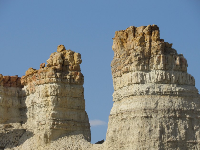
Here are some of the things I saw in Cedar Breaks National Monument, near Parowan, Utah a few days ago.
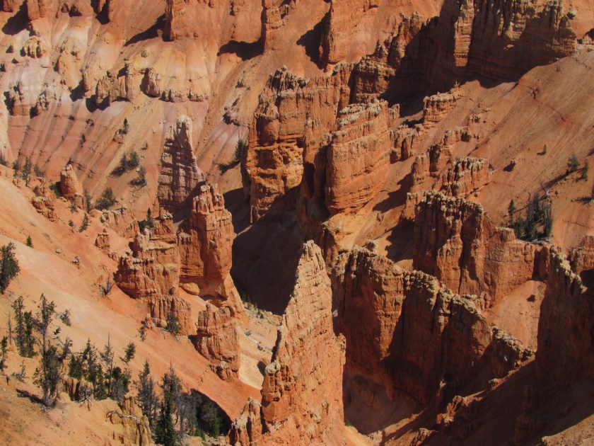
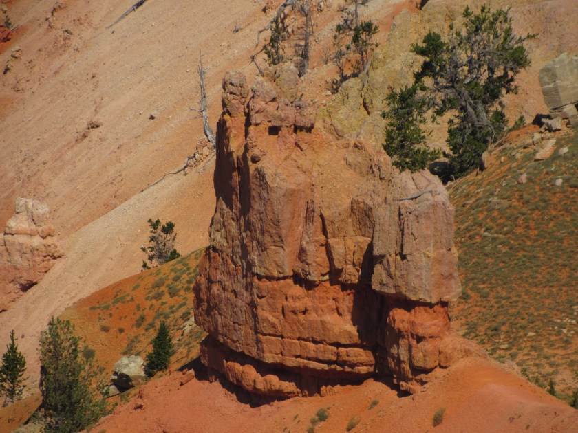

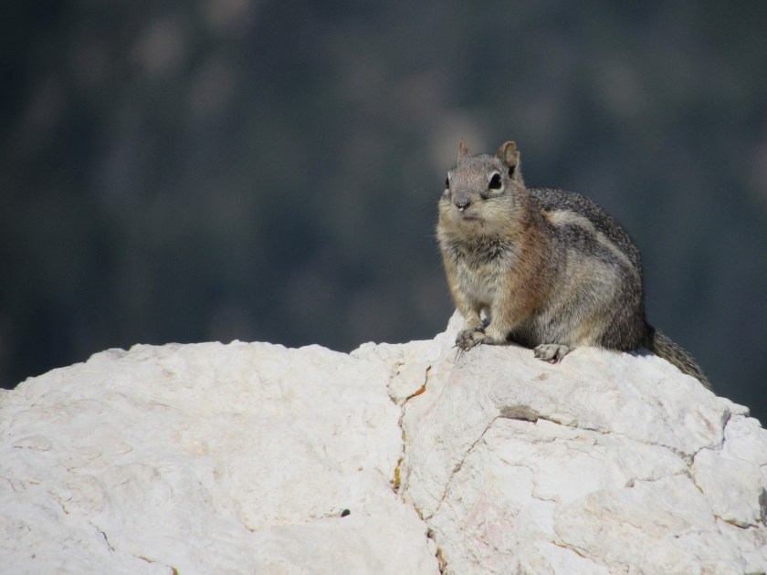
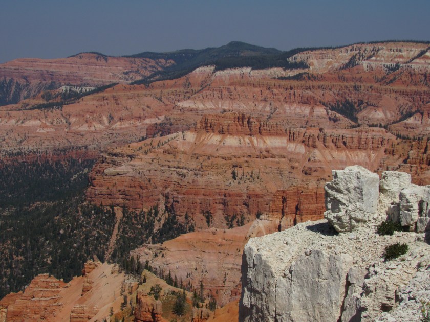

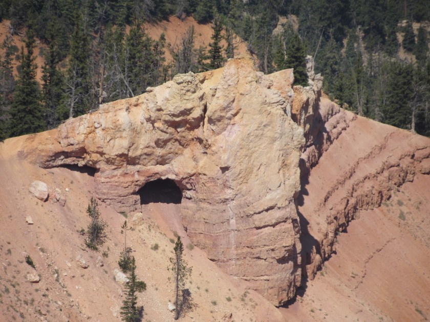

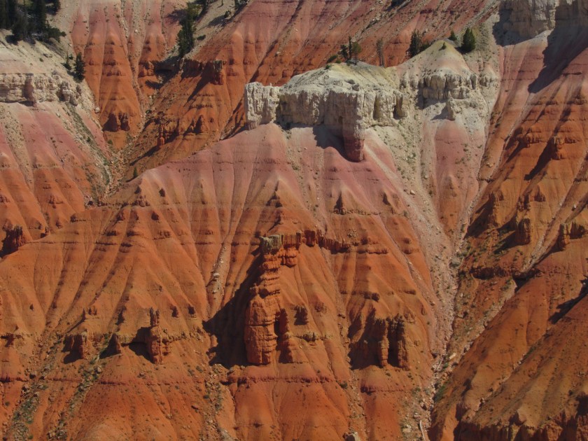

Here are some of the things I saw in Cedar Breaks National Monument, near Parowan, Utah a few days ago.
Today I made a big clockwise loop on scenic roads. I headed east from where I was staying in Grand Junction, Colorado to Route 65 which took me south past Mesa to the town of Delta. From there I proceeded further south to Montrose, where I stopped briefly at a National Park. I got back on the road and headed even further south to Ridgway (with a quick side trip to Ouray for a photo op), went west to Placerville and north on Route 141, back to Grand Junction.
I’ll post the Mesa Scenic Drive pictures separately, probably tomorrow. Here are other things I saw today.
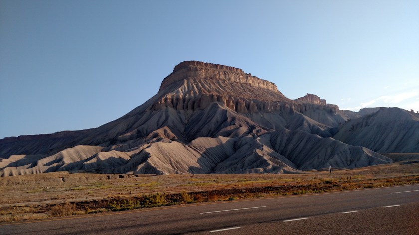
Before even getting out of Grand Junction I saw this formation along Interstate 70. It still boggles my mind that stuff like this is found right along the highway.


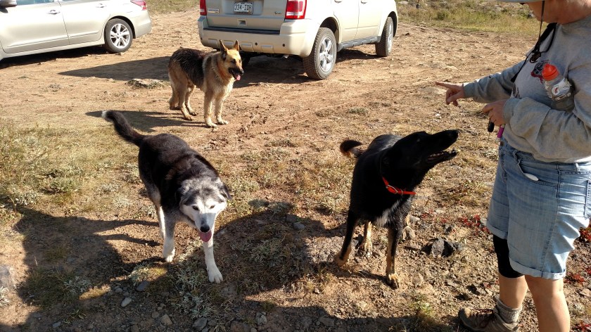
I stopped to take a picture of this lake and found a woman who had her three dogs out to enjoy the day.
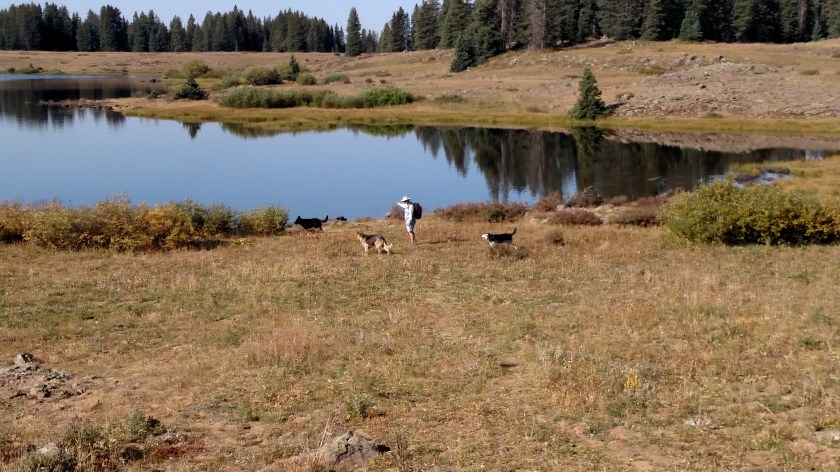
Clockwise from the top, meet Gemstone (brown), Dancer (black) and Kilo (gray and white). I didn’t write down the nice woman’s name and don’t recall what it was. I believe she said she’s from nearby Delta.
This was an unusual find in the little town of Delta.

And these were two corn fields which straddled Route 50 near Delta.


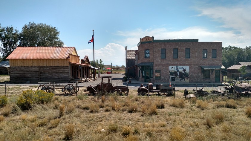
After leaving Black Canyon of the Gunnison National Park I saw this little recreated village on the way back to Montrose. What caught my attention was the Bull Durham sign (I live in Durham, NC, where the movie Bull Durham was filmed. It was also a cigarette brand, manufactured in Durham).

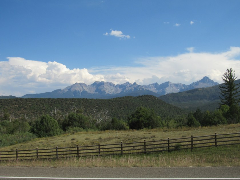
This was taken after my little side trip to Ouray. I am now heading west towards Placerville, CO.
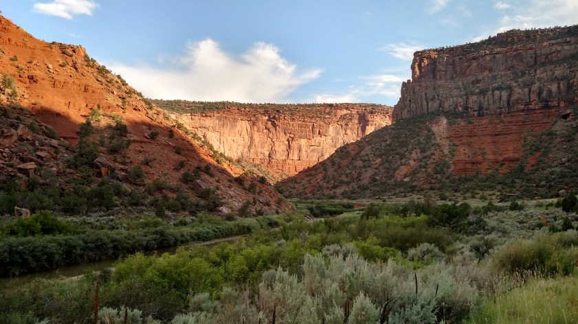
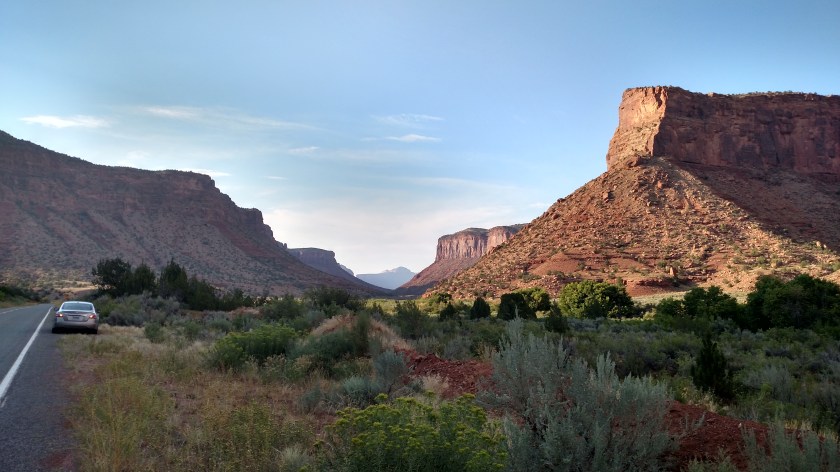
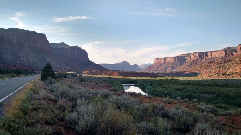
And these were taken late in the day as I proceeded north on Route 141.

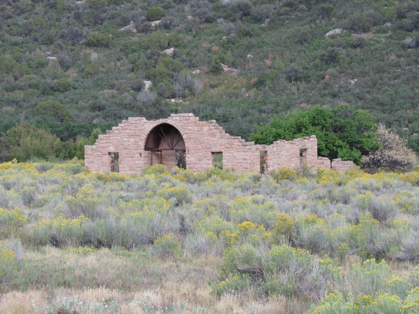
In a field below this mountain is all that remains of the Driggs Mansion.

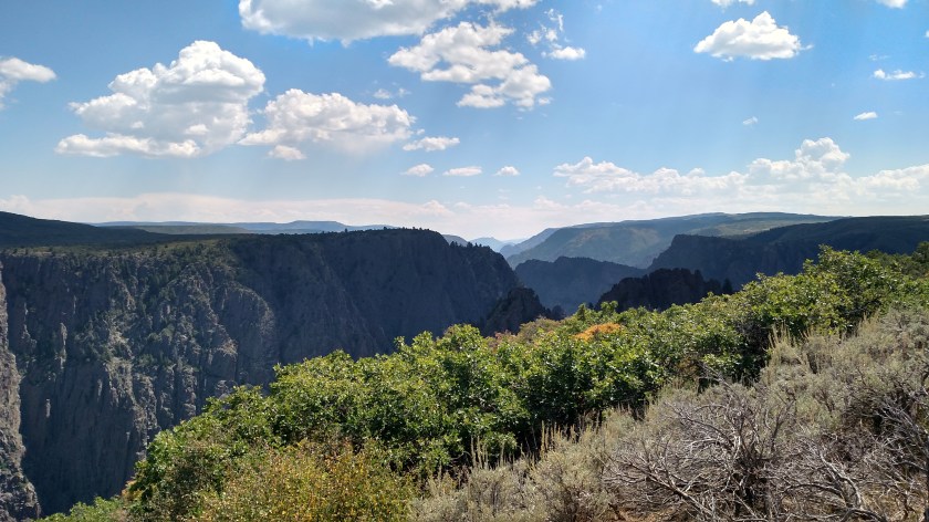
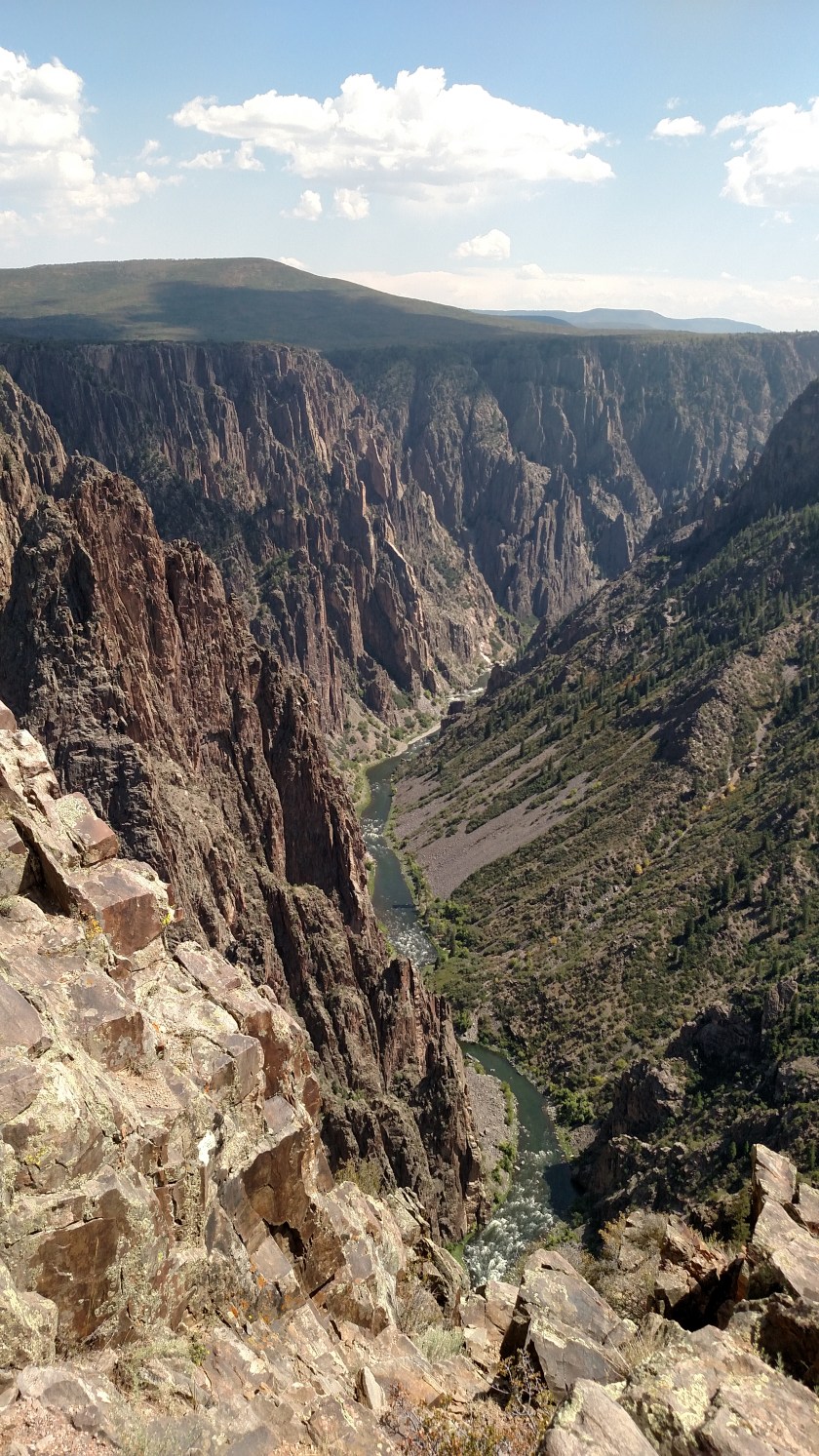
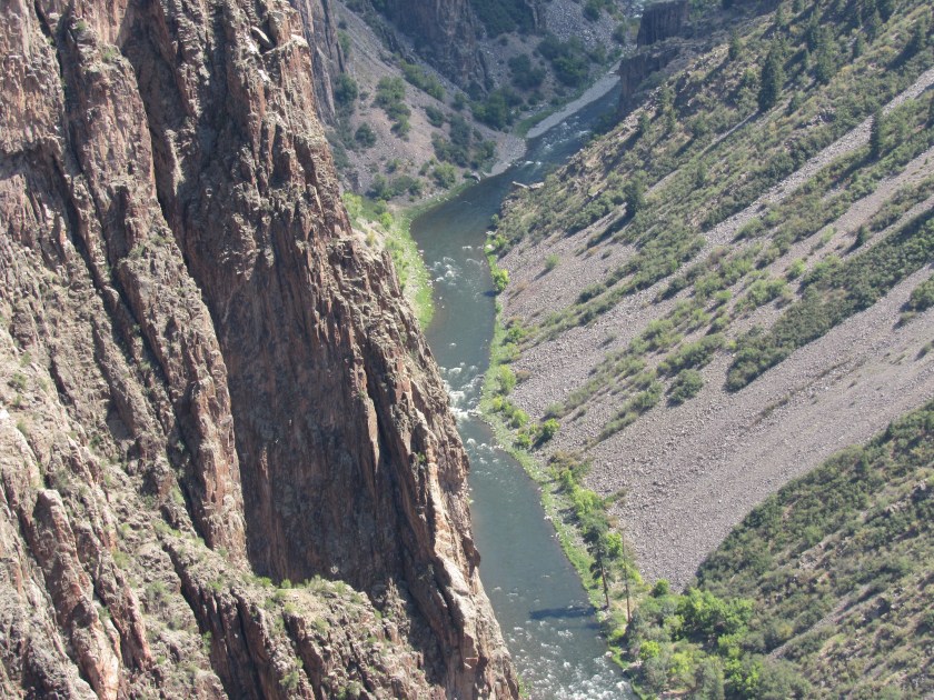
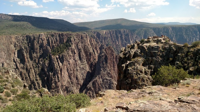
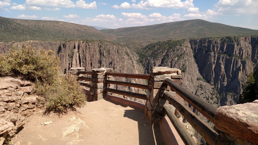
Black Canyon is a National Park located about 10 miles east of Montrose, Colorado, along the Gunnison River.
Or is it Black Cow of the Gunnison?? This was what greeted me on the way in to the Park.
I didn’t get a chance to visit the entire Park but it definitely whet my appetite for a return trip next May on my way out to California to start my 2018 road trip.

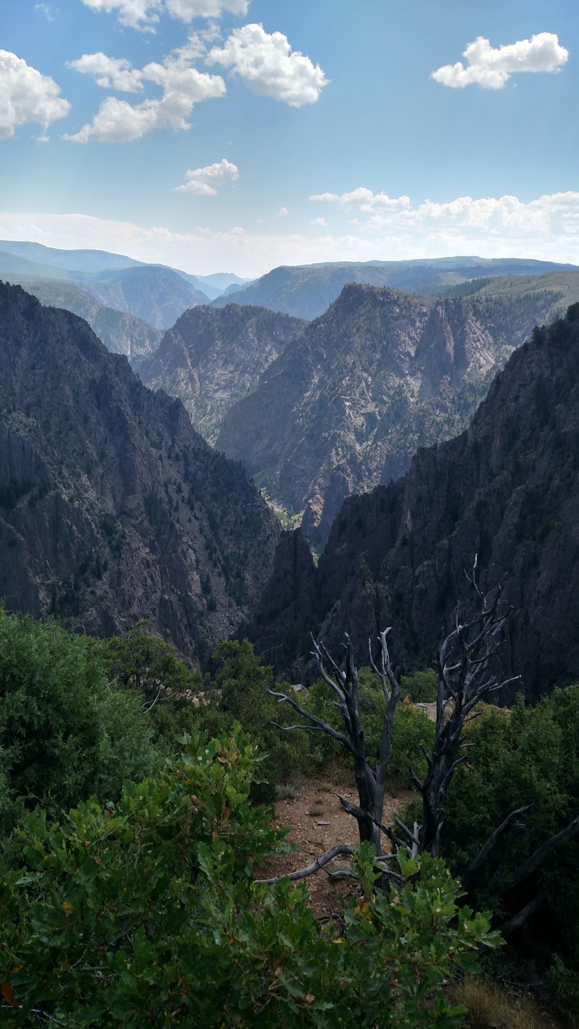

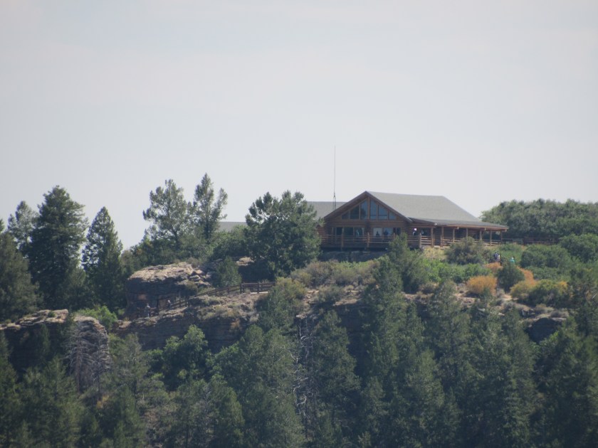
And to give you some idea how deep this canyon is, here is a photo of the view from an overlook. Then I’ve zoomed in on the Visitor Center which is at the top of the right (darker green) mountain.

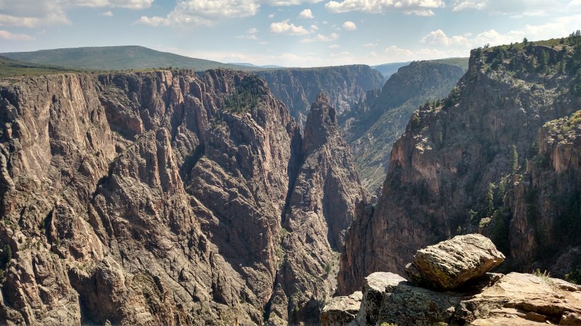
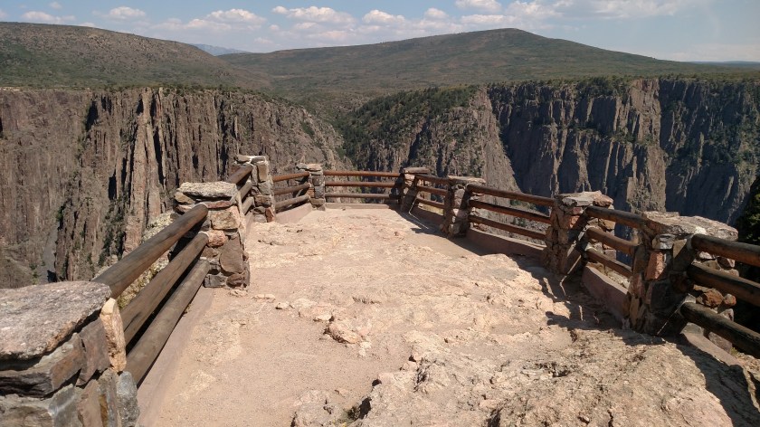
Here are some photos from two of the overlooks along the Rim Drive. I didn’t have time to stop at all of them.


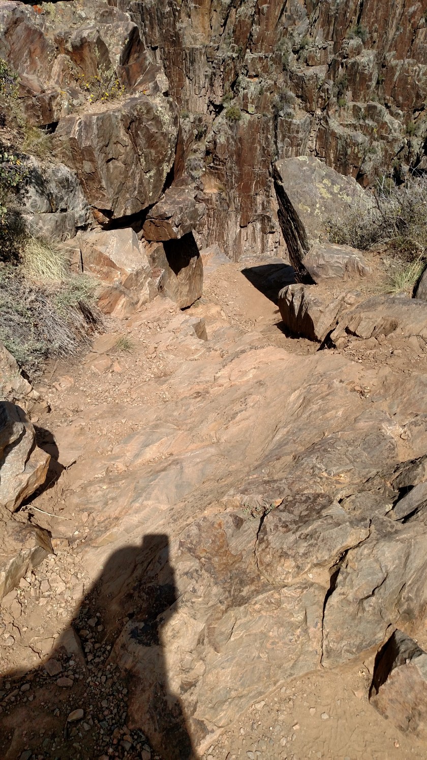
You couldn’t pay me enough to go down a few steps down to this unshielded viewing spot. The light brown rock is on my side of the canyon. The dark brown rock beyond (directly above) it is on the other side of the abyss.
I swear to God this actually happened today exactly as I’m about to tell it.
While at Black Canyon of the Gunnison National Park I went to the overlook area outside the Visitor Center. At one of the wooden railings (shown below) I leaned out a little to take a picture with my smartphone while commenting to the people standing near me that one of these days I’m going to drop it while doing such foolish things, given my clumsiness.
I proceeded further out the observation deck which, interestingly, slopes downward as it goes further away from the Visitor Center, giving an added sense of impending calamity to Mr. Smiley Pants I’m Afraid of Heights JohnBoy.
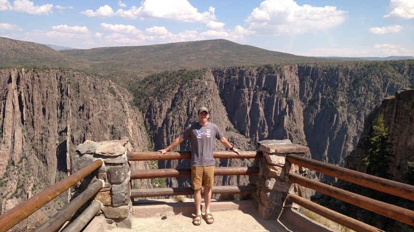
I recruited this volunteer (who was visiting the Park from New Jersey with his girlfriend) to show that from my vantage point I was looking downward. I also learned, as we were walking back to our vehicles, that they both attended East Stroudsburg University in Pennsylvania (I used to live in Stroudsburg).
This is a popular place for visitors to have their pictures taken and, sure enough, a woman asked if I’d mind taking a group photo of her and her friends. I said of course I wouldn’t mind, put my phone in my pocket and took the two devices she gave me, one a digital camera which appeared to be more complex and expensive than mine, and her iPhone. I took two pictures with her digital camera. I then transferred it to my left hand and in doing so became JohnBoy the Juggler.

(Photo credit: circusberzerous.co.uk)
When she had given me the phone I observed and commented out loud that just about every other iPhone I have used to take other people’s pictures with during this trip had a cracked screen (not a fake screen cover, which you can buy, but an actual cracked screen) and I said “guess you never dropped it, eh?”. I even joked about being afraid of dropping my own phone over the edge earlier.
As I was swapping the two cameras the iPhone slipped out of my right hand. I was able to keep hitting it from below to keep it in the air until I finally grabbed it.
Disaster was averted.
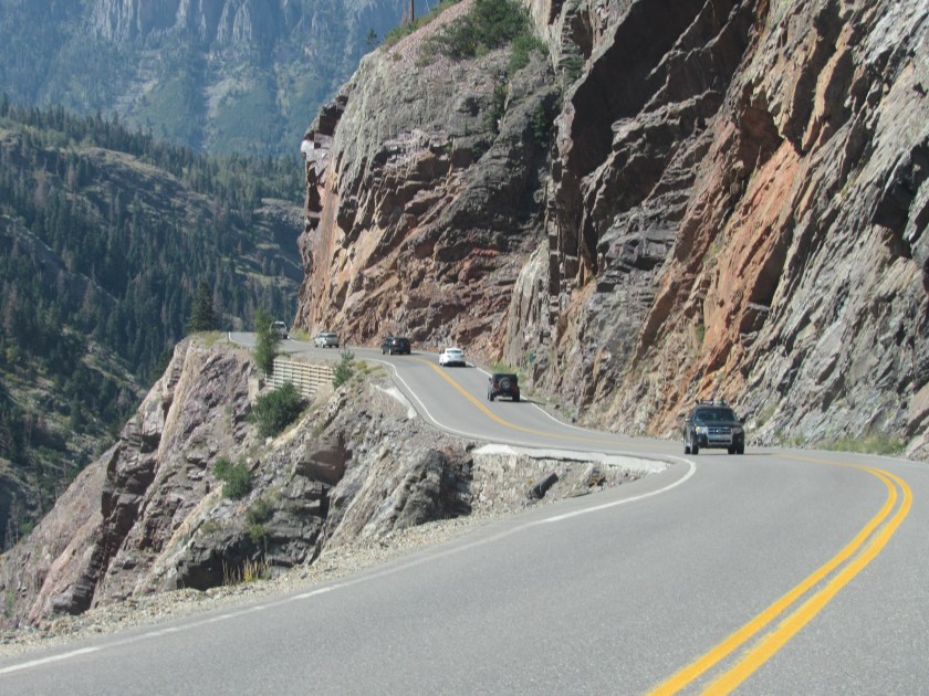
My travels today took me close enough to Ouray, CO that I had to go back and cheat death once more in order to get photographic evidence of my claim that you would drop straight down off the road if you should drive over the edge.
As you can see, these were taken from the relative safety of the northbound side of the road. I still couldn’t bring myself to release my death grip of the steering wheel going the other way, although there was an even better spot to make my point.
From this vantage point you can see three spots where the drop off is straight. One near the top, where the highway department has reinforced the bank underneath the road (thanks, guys!) and also left of the Jeep and below the Jeep. I have zoomed in to that area to further illustrate my point, and to show Shawn that I STOPPED IN THE ROAD to take these pictures, even though the signs clearly told drivers not to stop.

I also found this photo online which, according to an anonymous Facebook source, was taken by a local and is on display in an Ouray micro-brewery. In it you can see the river far below the road’s edge. The photographer clearly has a sense of humor, as well as no apparent fear of heights.
(Photo credit: Unidentified source)
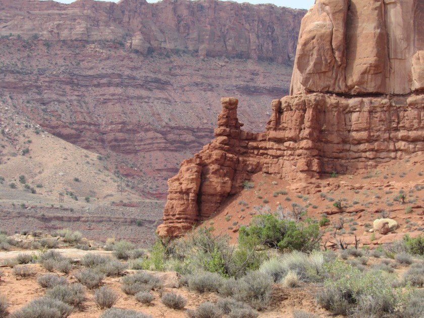
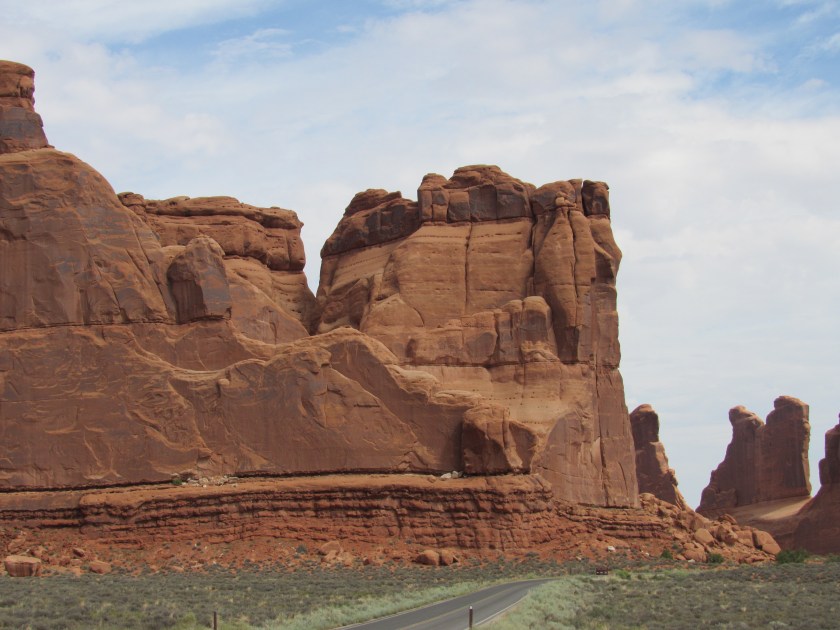
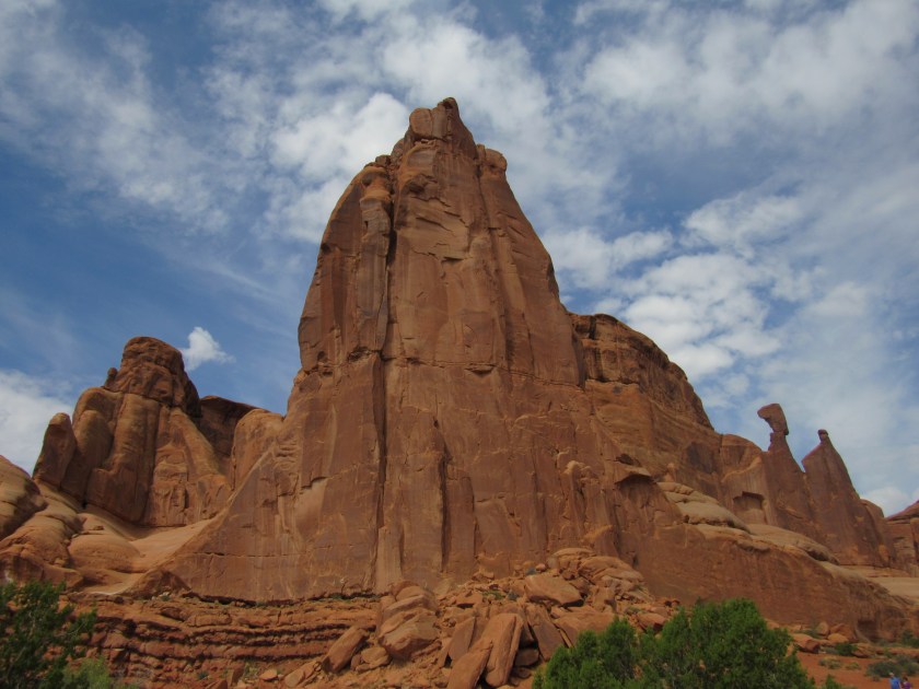
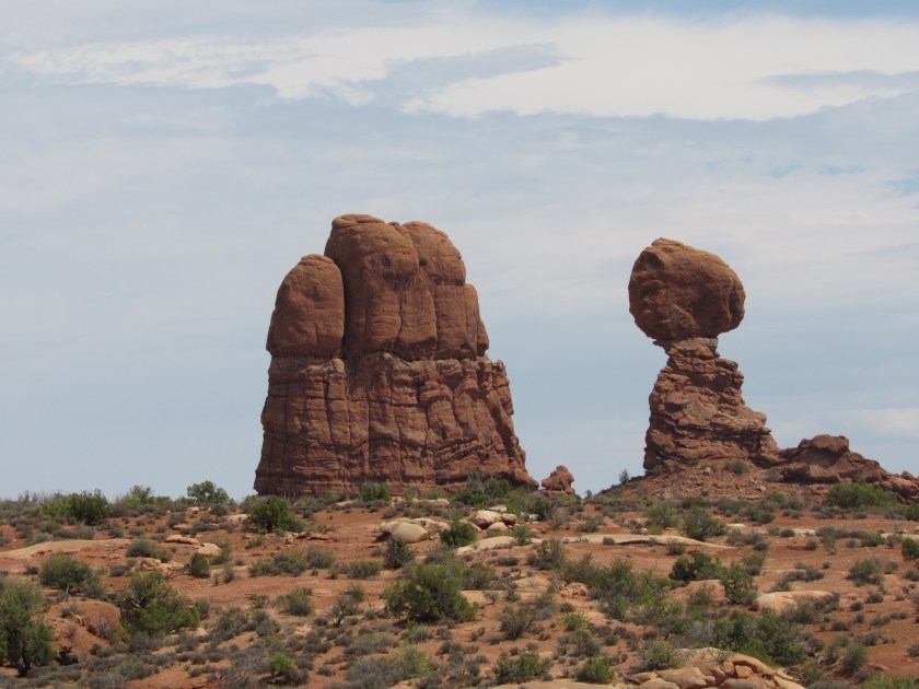
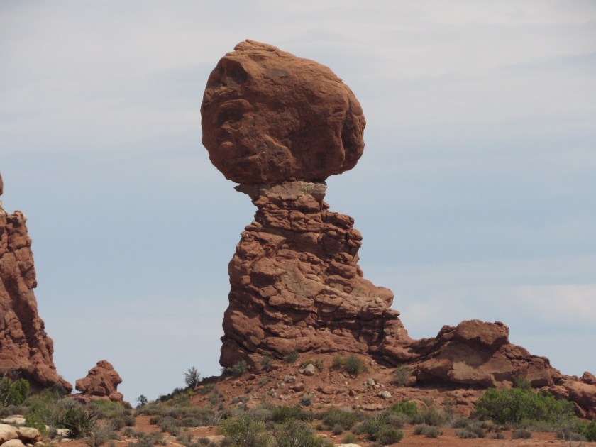
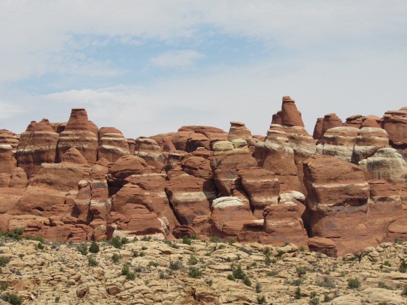
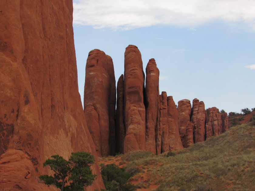
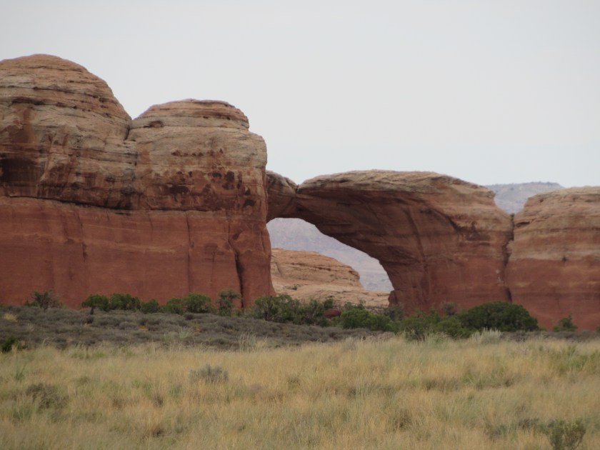
Here are some of the things I saw while driving through Arches National Park in Utah.
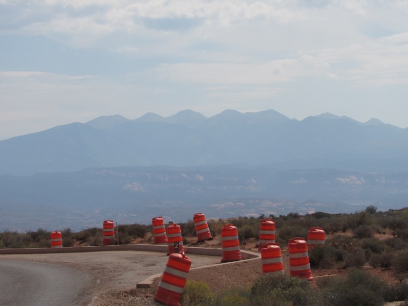
I should mention that crews are prepping the roads and pullouts in the Park for re-paving so there are orange barrels all through the property. In fact, from Sunday through Thursday they kick everyone out at 7 PM so they can get their work done without totally disrupting the flow of traffic during the day.

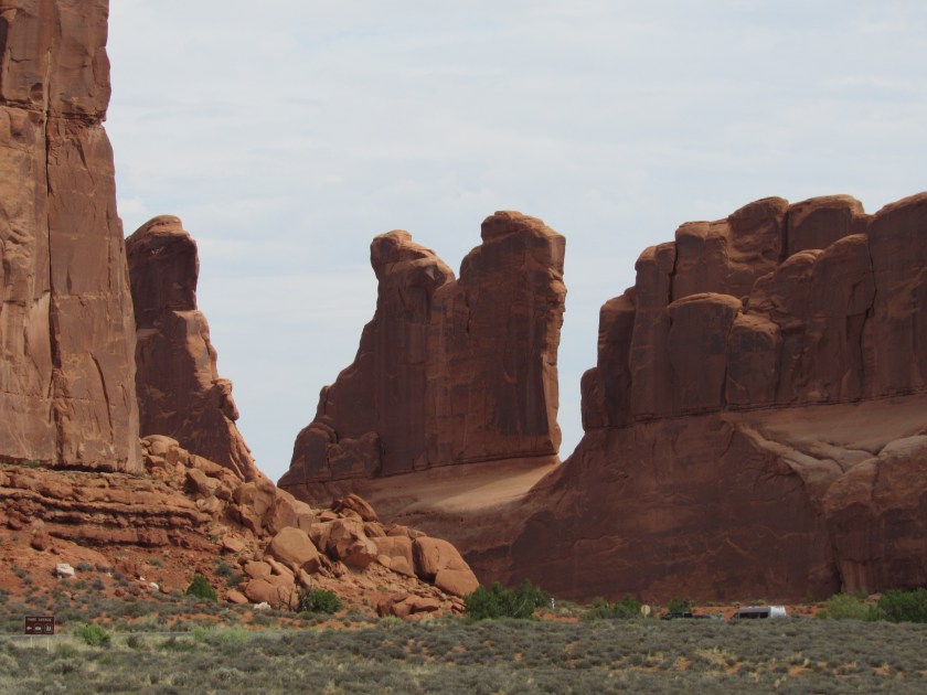
If you look closely at the bottom right corner of the photo above you’ll see the tops of vehicles driving through the Park. This gives you some idea how big these rock formations are. There is also a brown road sign in the lower left corner.
Again, look at the road at the bottom of the photo above to gauge the size of what you are seeing.
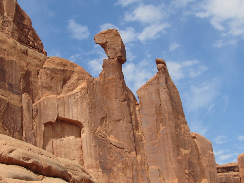
Here are some of the things I saw while driving through Arches National Park in Utah.


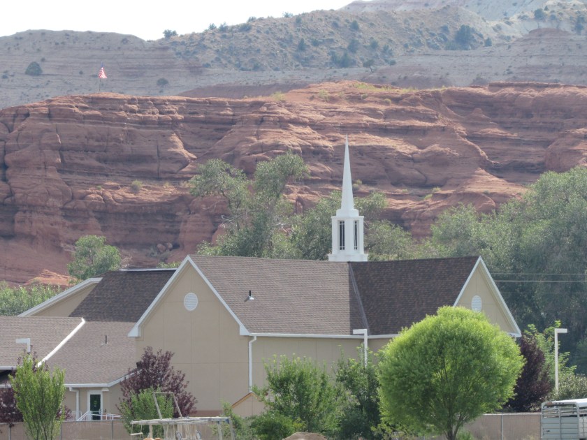
I stopped at the Calf Creek Campground and Recreation Area in Grand Staircase – Escalante National Monument in southern Utah for two reasons. First, I had met the couple who are working there for the summer as campground hosts while I was visiting Capitol Reef National Park earlier in the week (they were also visiting that Park on their day off). They said I should stop in and see them while touring the Monument. I did so, and spent about a half hour visiting with them there.
Secondly, a young lady where I was buying provisions in Richfield, near where I was staying in Joseph said that I should stop at Calf Creek to see the beautiful waterfall. I wasn’t willing to hike the 3 miles in to see it up close but the campground hosts told me how to see it from a vantage point just a short walk off the highway, high above. I tried, but just couldn’t spot where it was. The pictures I found later online are very nice and I wish I could have seen it firsthand, even if only from a distance.
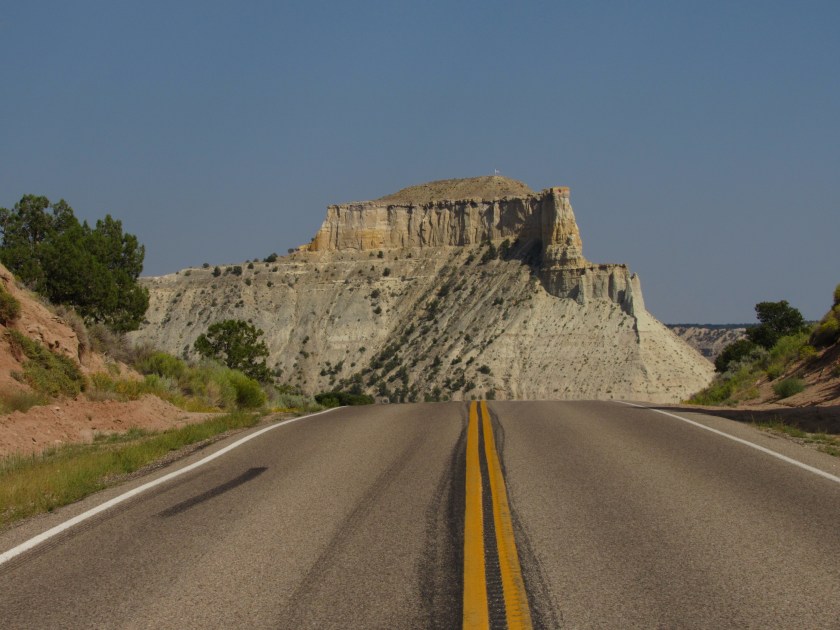
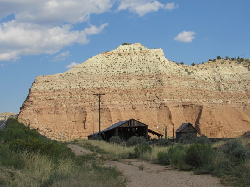
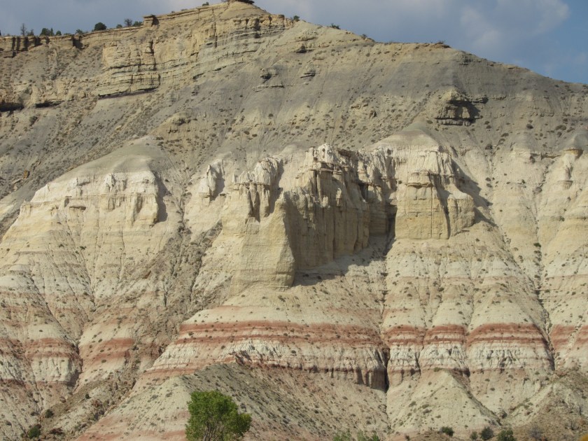
After leaving the campground here are some of the things I saw before leaving the portion of the Monument I had seen today (I’ll be touring the southern portion of this huge Monument in about a week when I am staying in Kanab, UT).

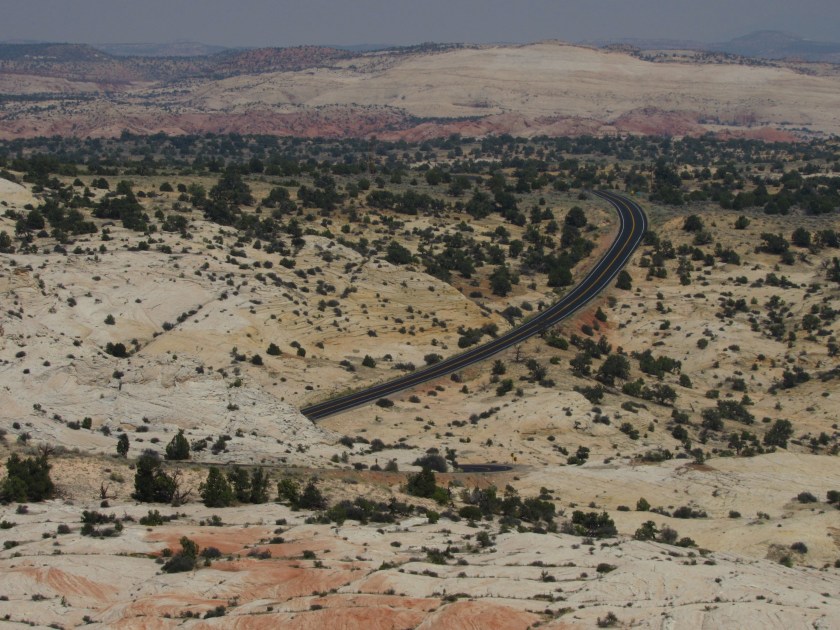
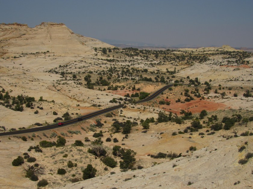
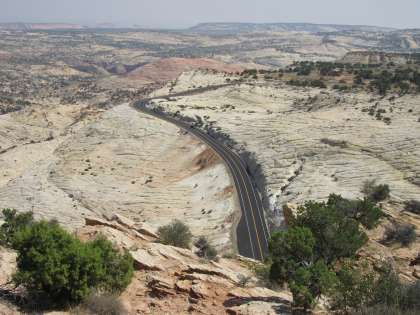


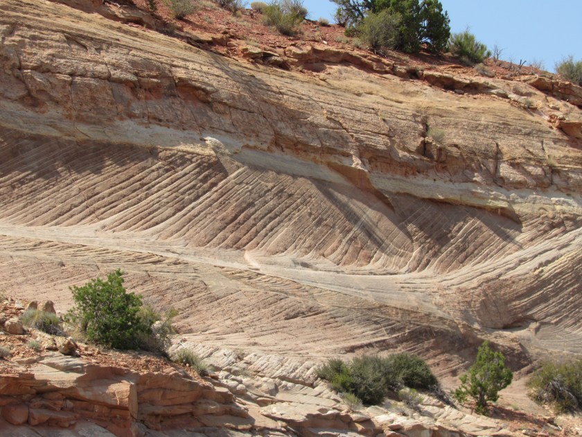

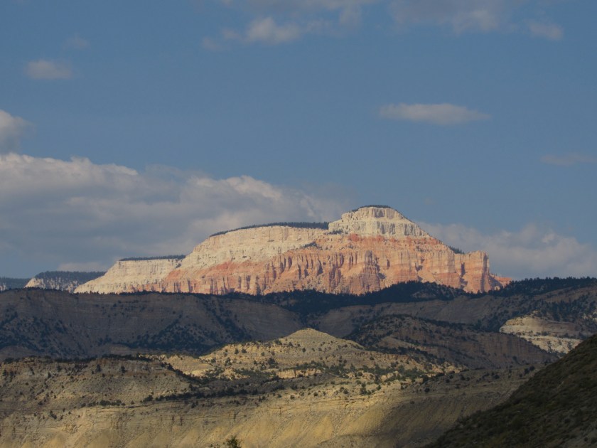


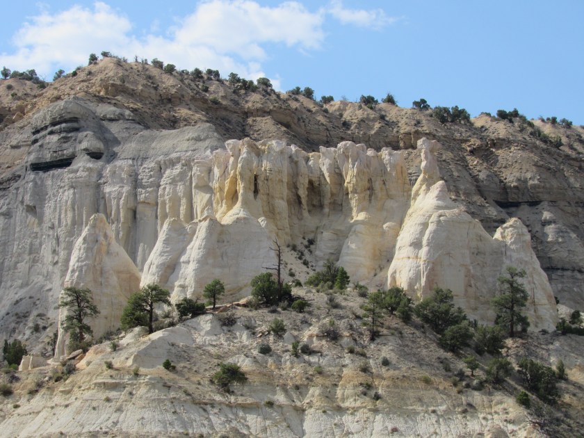
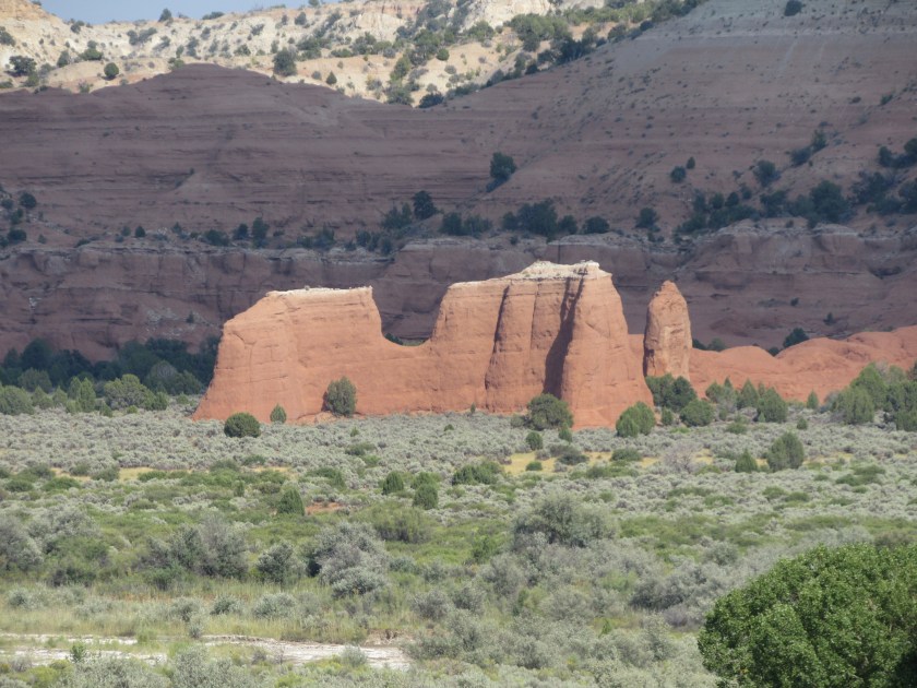
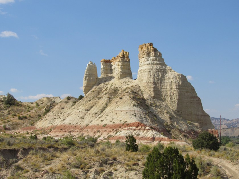
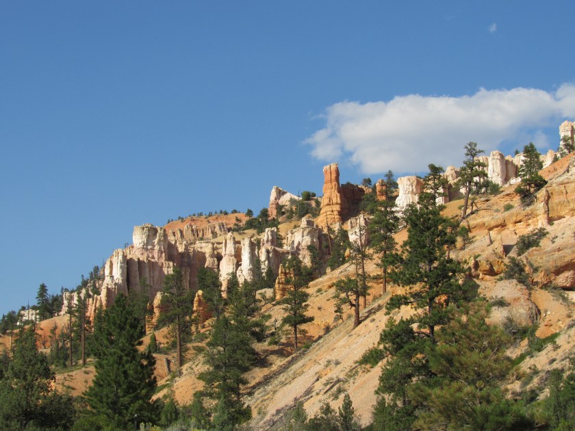
Here are more of the things I saw while driving through Grand Staircase – Escalante National Monument in southern Utah.


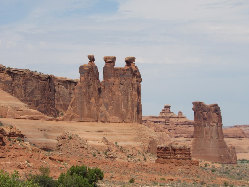
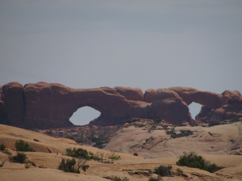
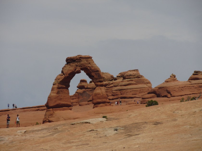
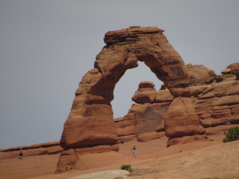
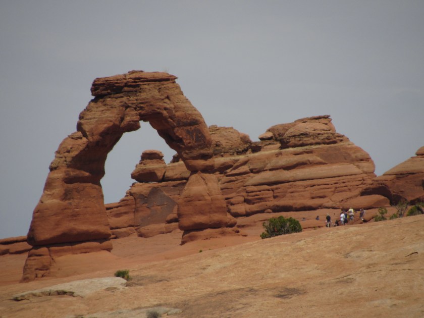
As promised, here are the arches I saw Thursday while I was at Arches National Park.


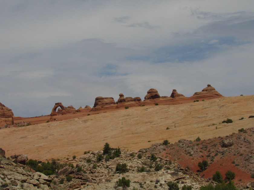
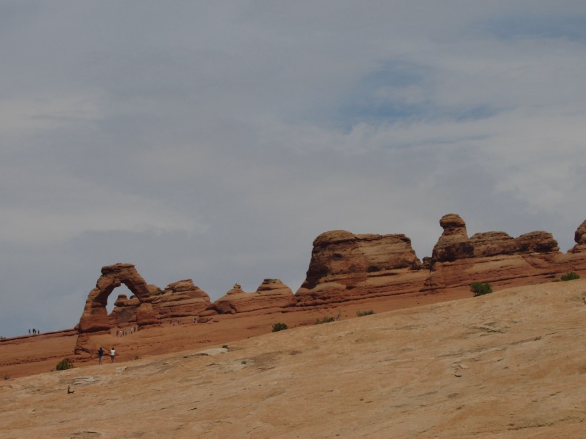
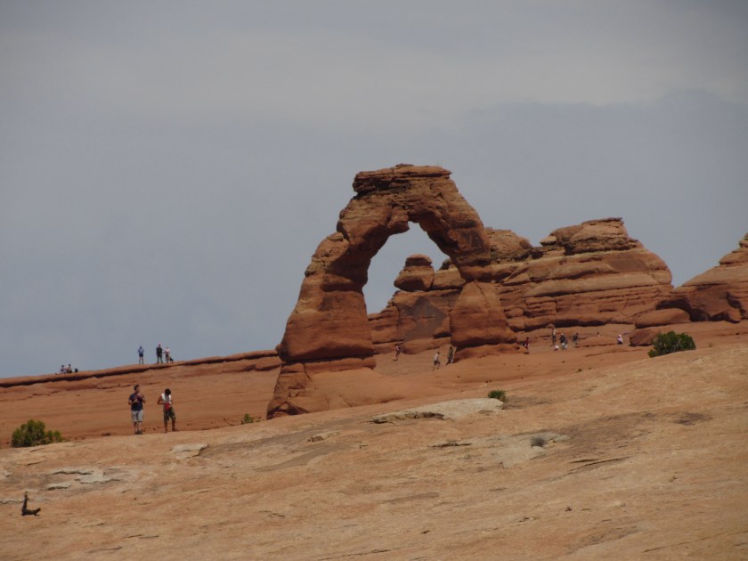
The main attraction at Arches is Delicate Arch. If you’ve ever seen a Utah license plate, you’ve seen Delicate Arch.
And don’t adjust your set. As seen from the vantage point where I took these photos the ground at the Arch does slope quite a bit downward from right to left.
I’m going back to Arches on Sunday on my way to Grand Junction, Colorado. There was a small section of the Park which was closed the day I was there and it is supposed to reopen for the holiday weekend.
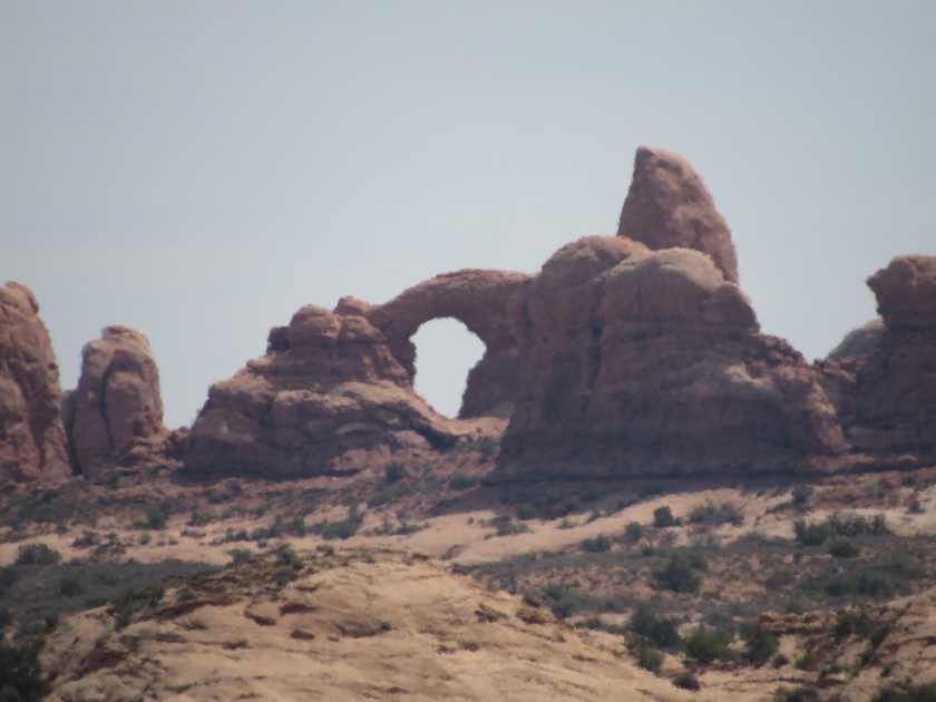
I’ll post the other “zoom” pictures from Arches at a later date. I hit you with a lot of brown pictures yesterday so I’m going to add a lot of other colors today.
