Southwest Oregon Coast – Post 1 of 2

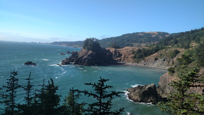
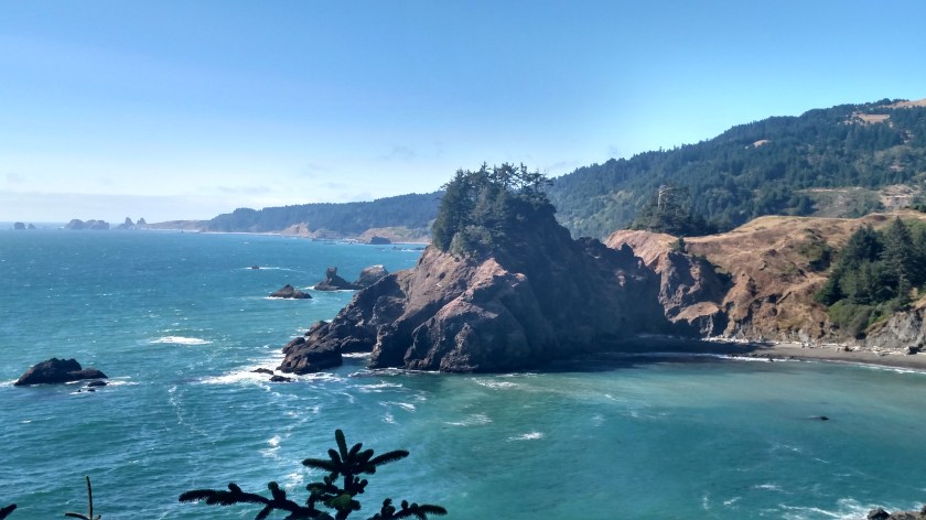
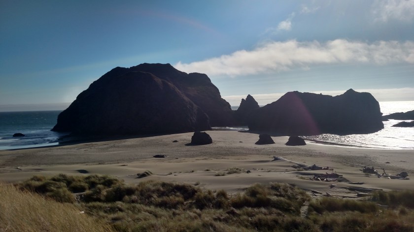
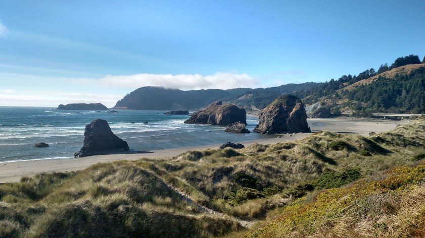
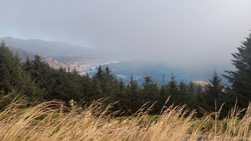
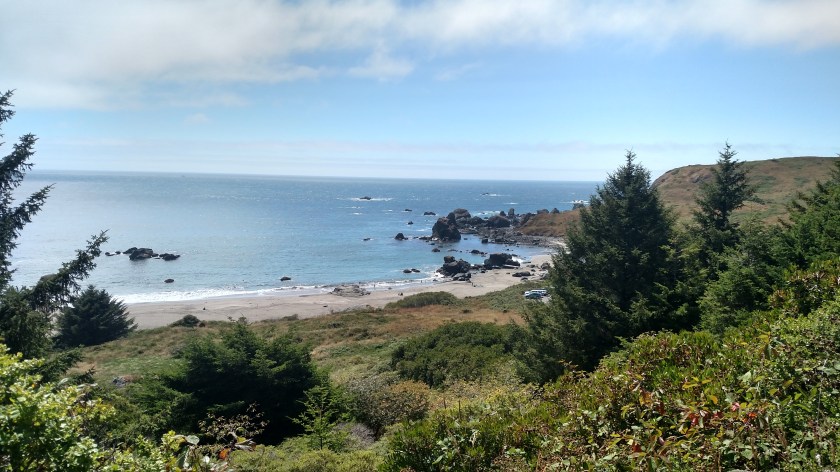
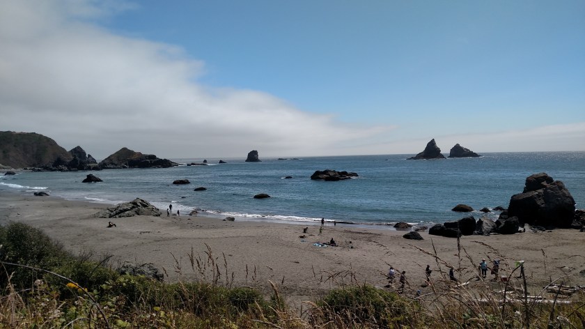
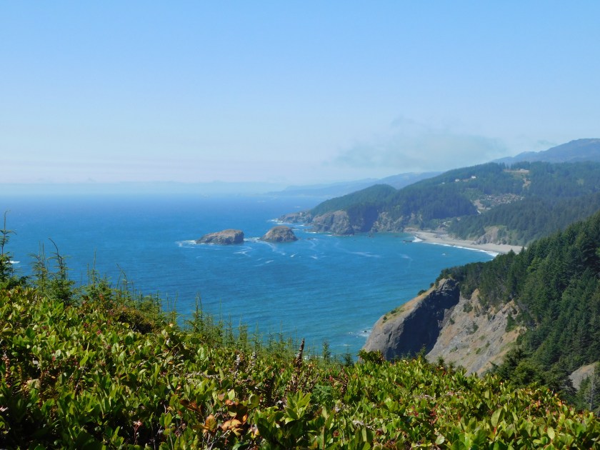
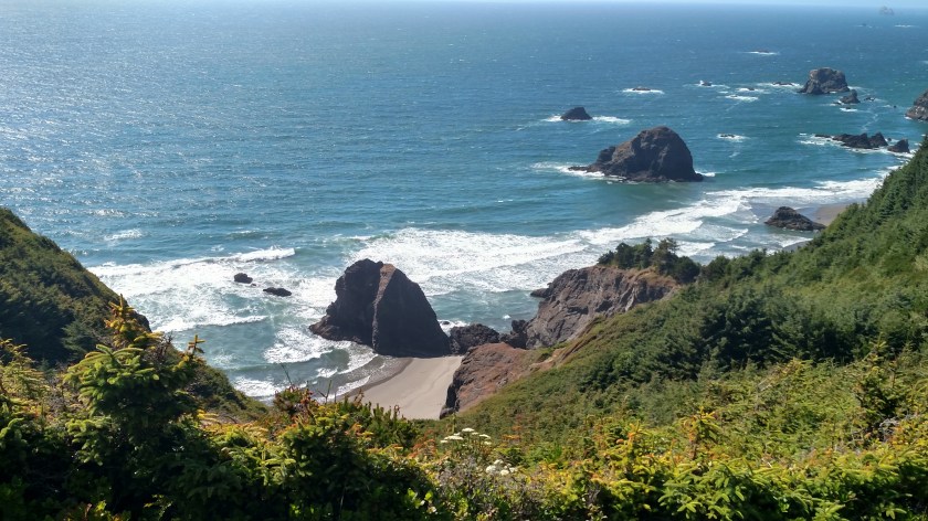
Friday I crossed into Oregon from California and drove up the first 30 miles of the coast.  The Oregon coast is 343 miles long and, by law, is all open free to the public.  If what I saw in the first 30 miles is any indication, I think I’m really going to like it here!

All the photos in this post were taken from the dozen or so overlooks along the Samuel H. Boardman Scenic Corridor – a 12-mile portion of Hwy 101 which began soon after I entered the state.  One overlook was closed (from the tallest bridge in Oregon, which was having some work done and was reduced to one lane, with the pedestrian portion closed) and two or three others required steep walks to get to the viewing areas, but I stopped at all the rest.

About 3 o’clock Friday afternoon the sun finally burned through the marine layer and the blue sky started reflecting nicely off the water.
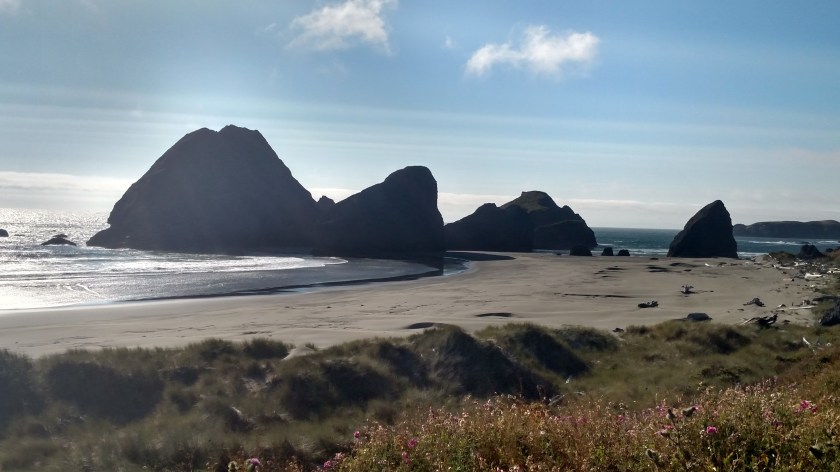
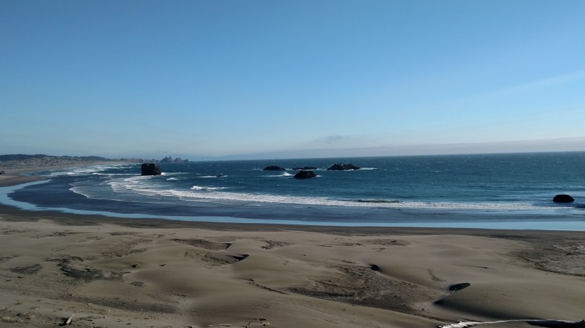
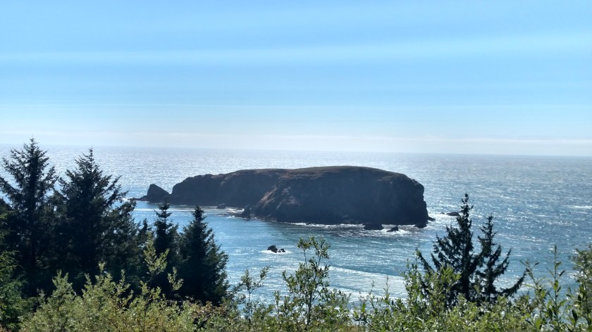
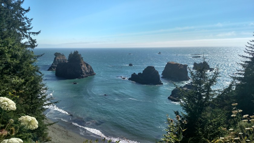
IMG_20180727_150506116_HDR

IMG_20180727_151641989

IMG_20180727_151646189

IMG_20180727_152248778

DSCN4220

This is Whale Rock:

IMG_20180727_155850800_HDR

IMG_20180727_163122169_HDR

IMG_20180727_170633366_HDR

IMG_20180727_170858056

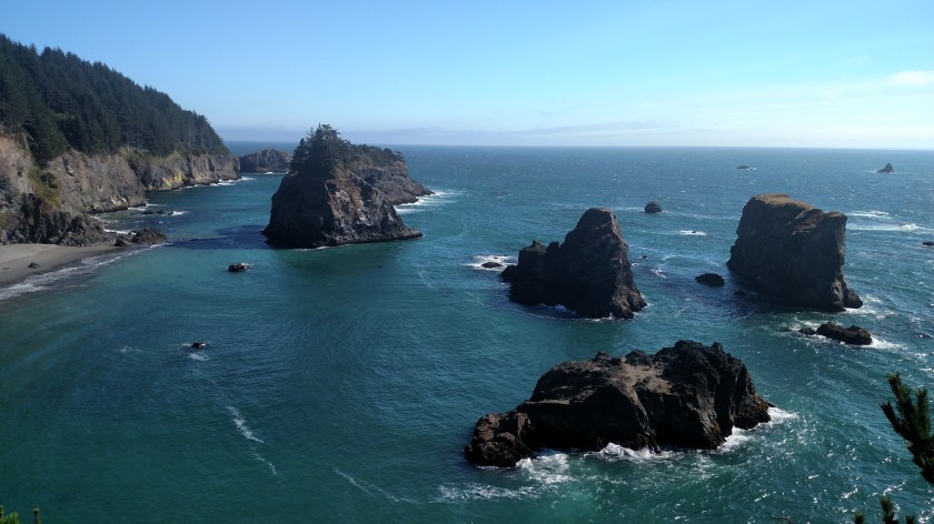
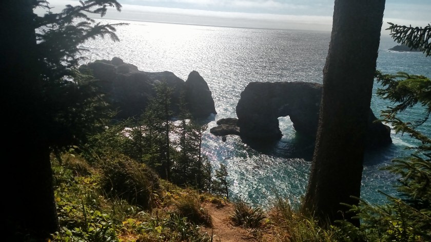
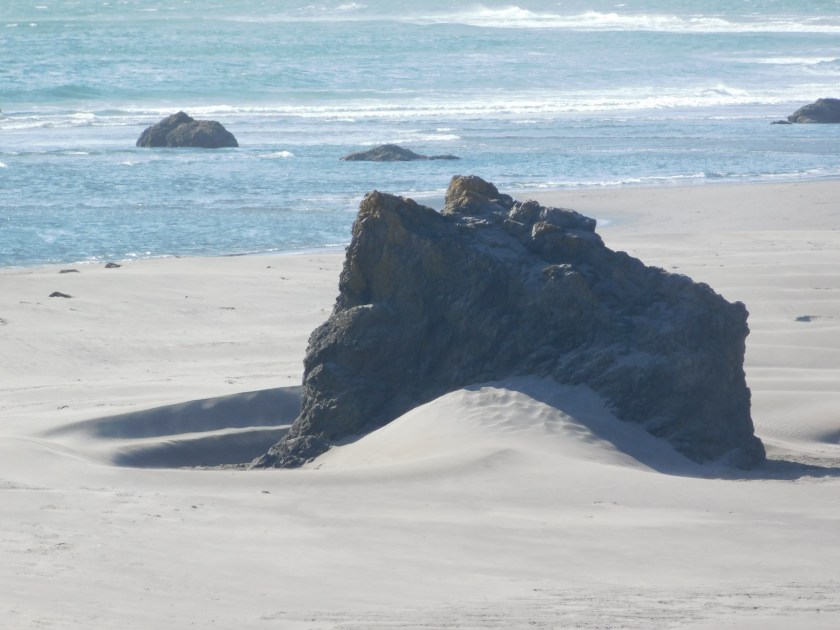
This is Arch Rock, at the final overlook along the Scenic Corridor.  At 511pm when I took these the afternoon sun created a glare off the ocean.  I will definitely be back Saturday and possibly Sunday to get photos from the same vantage point.

IMG_20180727_171152633

IMG_20180727_171209559


Southwest Oregon Coast – Post 2 of 2

Friday I drove up the first 30 miles of the southern Oregon coast after crossing over from California.  Here are some of the incredible views I had throughout the afternoon (and because it was afternoon some were taken looking into the late day sun.  I hope to get pictures from the same vantage points Saturday with the sun behind me).

IMG_20180727_171310762

IMG_20180727_171630893_HDR

IMG_20180727_175135698_HDR

IMG_20180727_175656152_HDR

IMG_20180727_175710943_HDR

IMG_20180727_180101135_HDR

IMG_20180727_180117451_HDR

IMG_20180727_180202265

IMG_20180727_180243279

DSCN4314

DSCN4315

From high up on a hill, looking down below a cloud (which you can see in the 3rd photo above):

IMG_20180727_181541410

Shortly after taking these photos I arrived in the little town of Gold Beach where I’ll be staying for two nights.  I will backtrack to these same areas on Saturday and hopefully have the sun behind me, although the marine layer often doesn’t burn off until early to mid-afternoon so the sun will then be above me.  Depending on how Saturday goes I may hang around here Monday as well, as I will be staying 3 nights at my next stop further up the road so I’ll have more time to see things up that way.


Wind Surfing on the Pistol River

The brochures for this area in Oregon promise “world class wind surfing” and I got a small taste of it when I arrived at Pistol River State Park around 530pm Friday.  The water in the foreground is where the Pistol River empties into the Pacific Ocean (which, as you may have guessed, is in the background).

IMG_20180727_173806753

The first place I parked I saw these two wind surfers, a man and a woman, zipping back and forth across the river.

DSCN4242

DSCN4228

The sky was clear and it was extremely windy so they both took advantage of that to practice some literal wind surfing – getting airborne:

DSCN4237

DSCN4246

DSCN4262

DSCN4270

DSCN4283

In this next photo she is easily 6 to 8 feet off the water:

DSCN4287

DSCN4293

I’ll be in the area two more days, and there are supposed to be some great wind surfing spots further north, so I imagine I’ll be seeing more of this.