Here are more photos of the Carter House Inn, located in downtown Eureka, California.
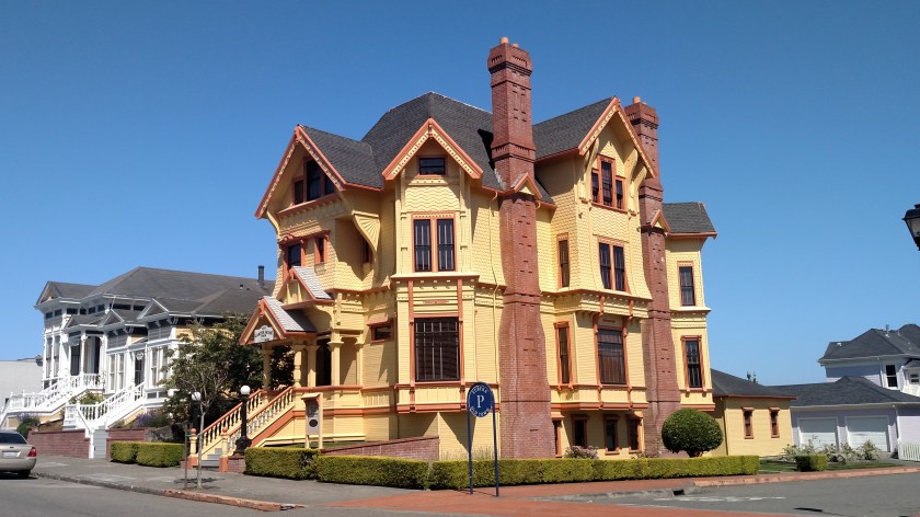
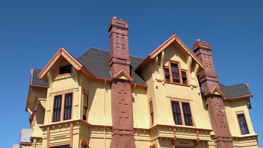

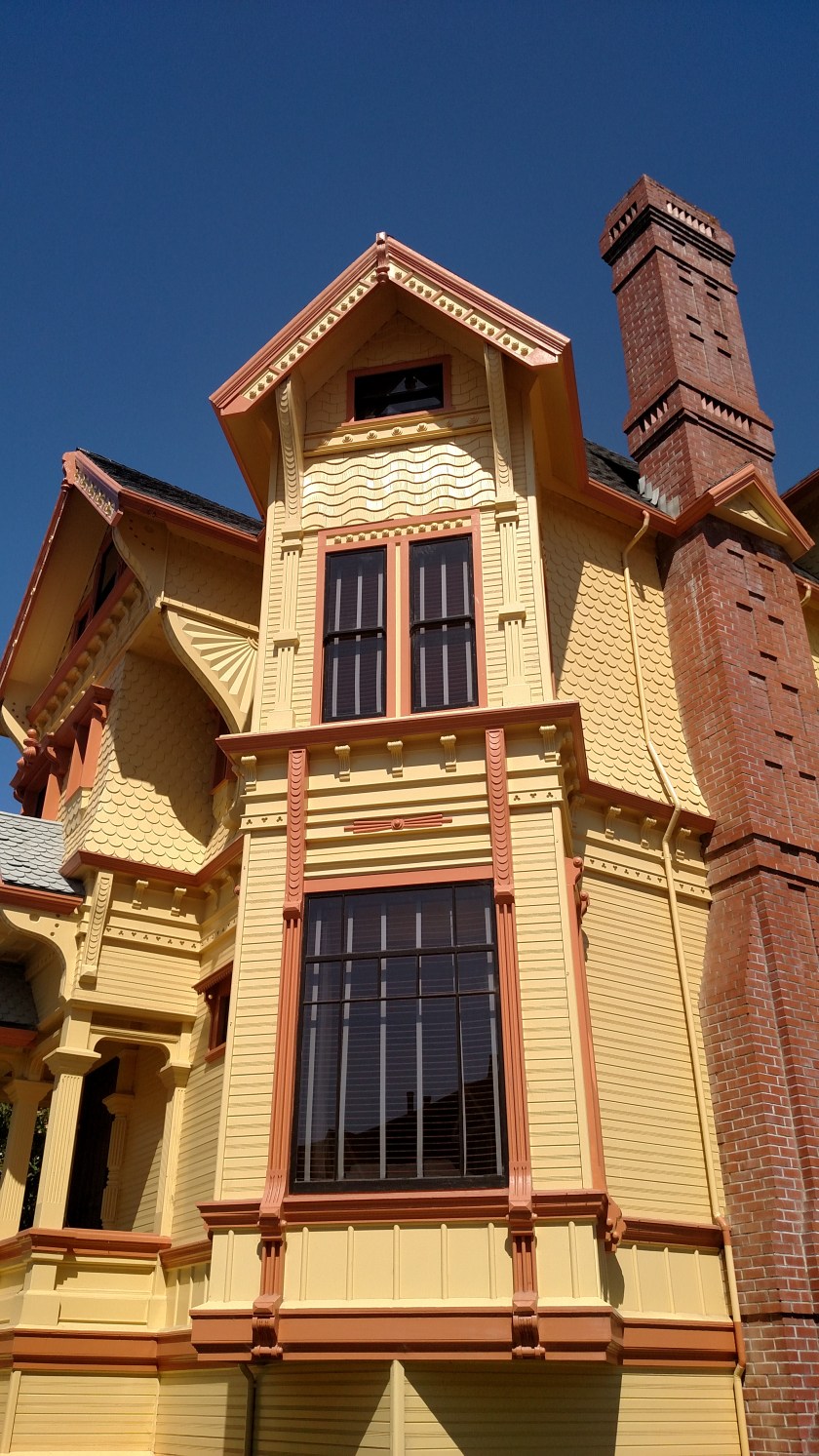

Here are more photos of the Carter House Inn, located in downtown Eureka, California.
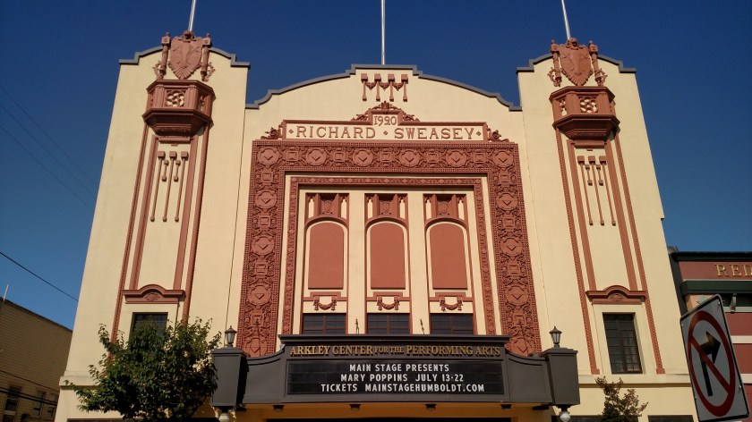
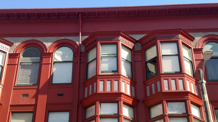
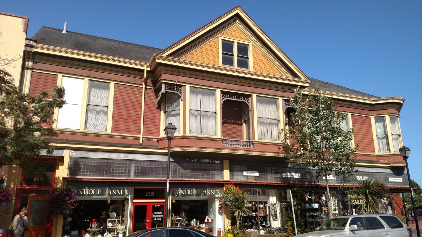
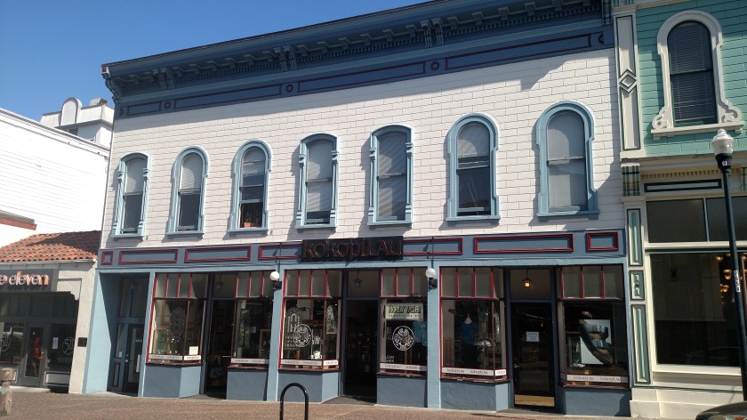
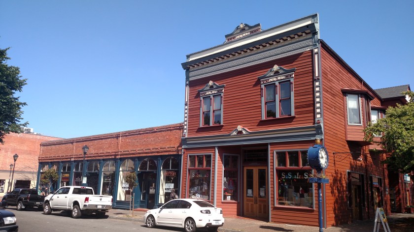
Here are some commercial properties I saw last Saturday morning while doing a walking tour of “Old Town Eureka” in downtown Eureka, California.


And this is a huge mural I saw painted on the side of a building near where I had parked my car:
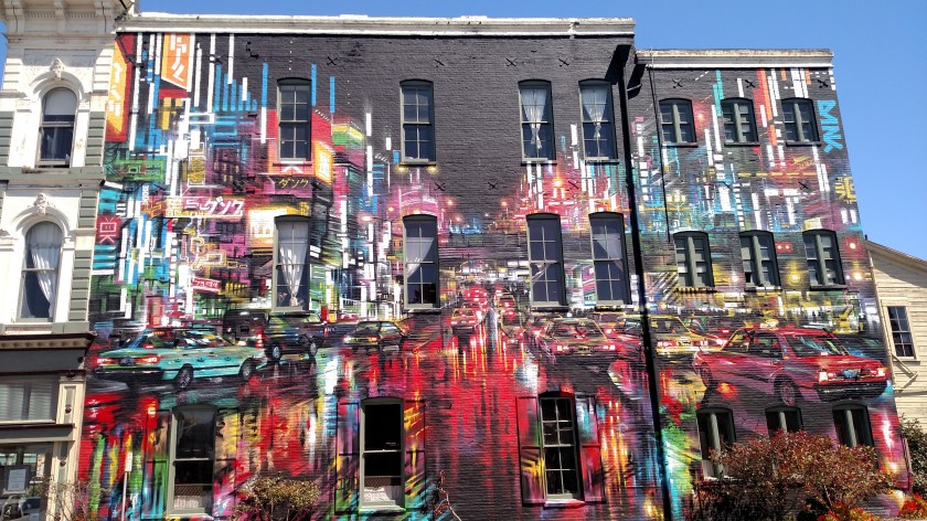

And giving credit where credit is due:

Friday of last week I drove from where I had been staying in Ukiah north to Arcata, which is about 10 miles north of Eureka, California. When I stopped at the Visitor Center in Eureka Friday evening I got a map with a walking and driving tour of the town highlighting many Victorian and other homes in the section called “Old Town Eureka”. Saturday morning I drove back to town to take a look:
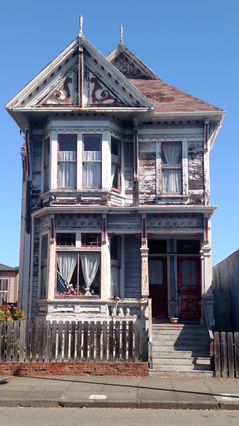
This is a fixer-upper which looks like it could use some TLC – but it certainly has potential.
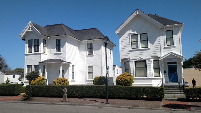
Then there were these six houses all in a row. While maybe not considered Victorian they are well maintained.


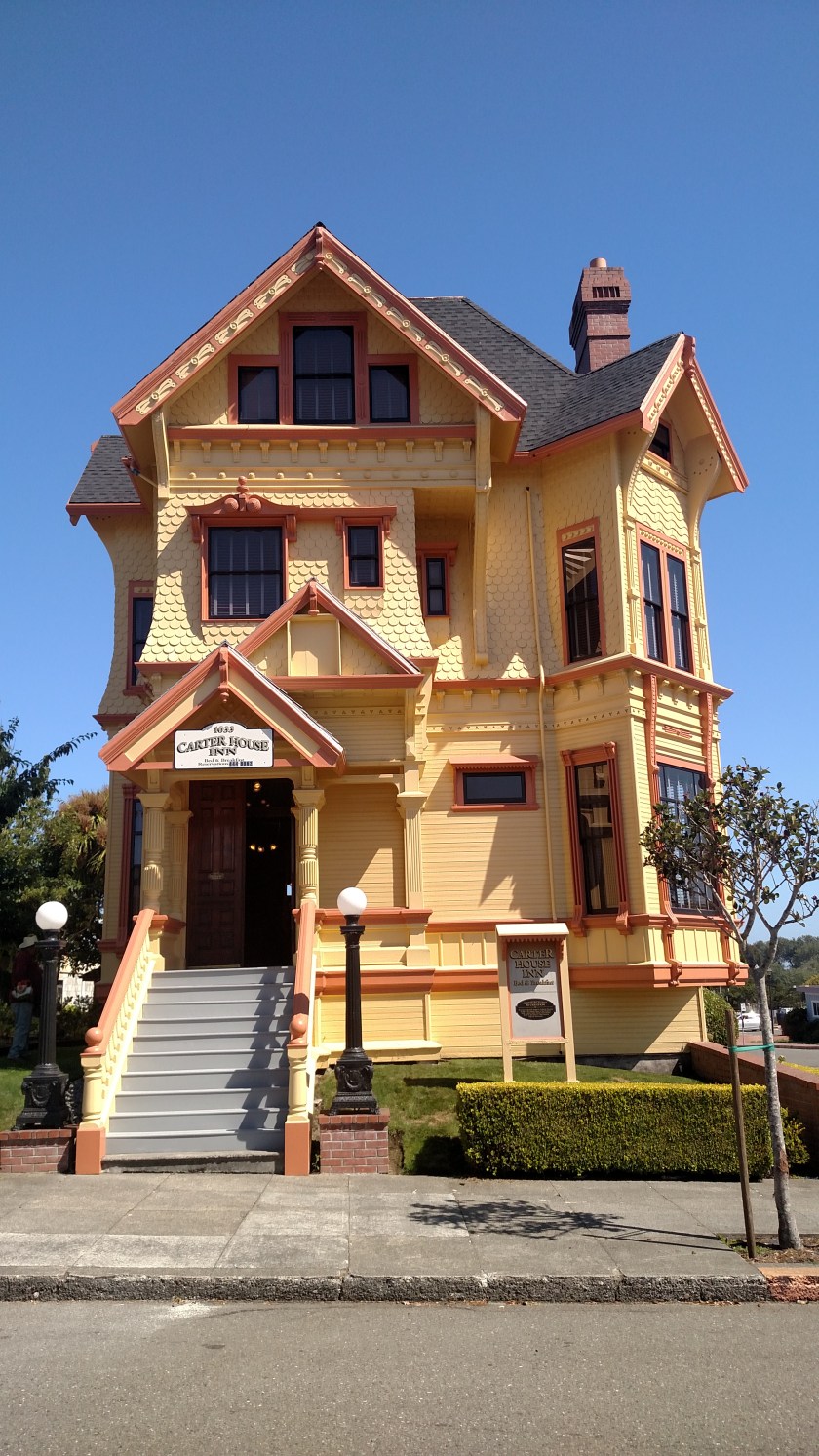
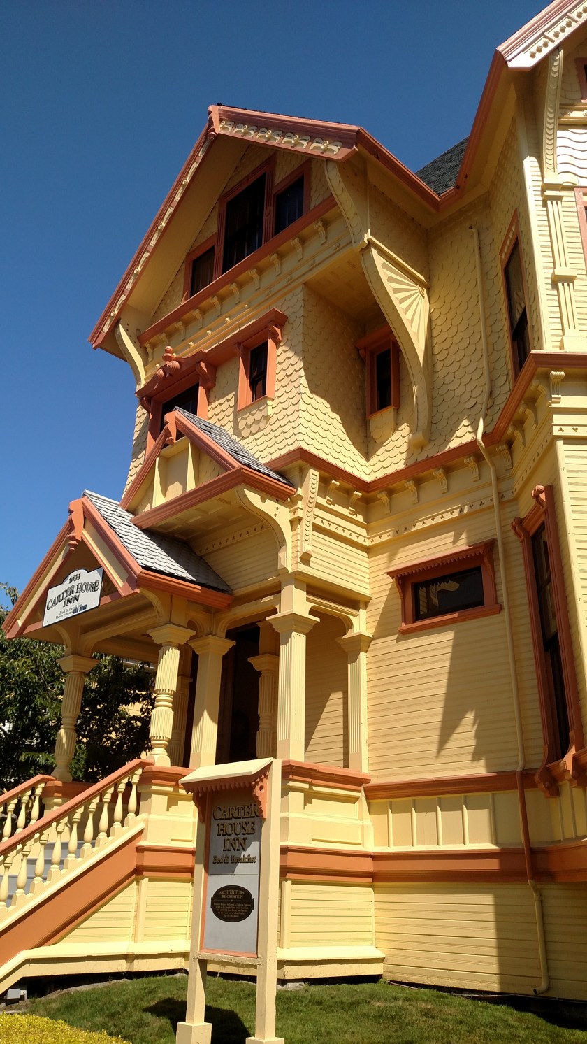
Looking for something with a little more color? OK, how about this?

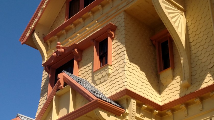
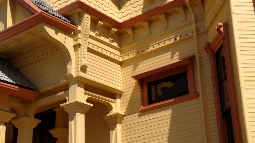
That house is so cool I’m going to do a separate post with closeup photos of various portions.
Looking for something even more elaborate? OK, this ought to do the trick:
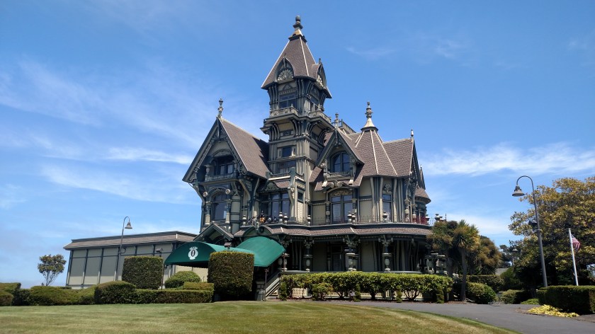
That is the former “Carson Mansion,” built in 1885 by pioneer lumberman William Carson. It is one of the premier examples of Victorian architecture in the United States, perhaps the world It was almost demolished, which was going to cost $ 35,000. Well, an organization bought it for that price and supposedly spent over two million dollars painting and restoring it to it’s current condition. It is now a private club, the “Ingomar Club” (named for Mr. Carson’s favorite play). There are rumors and lawsuits about the behavior within the confines of the club but I’m content to just stick to the exterior.
Here are some other photos (I didn’t want to venture onto the property since it is private).


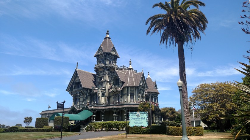
There are other photos, including interior shots and a great photo of the house painted and lit up for Christmas, online.
Here are a few more houses I saw while doing the walking tour of Eureka.

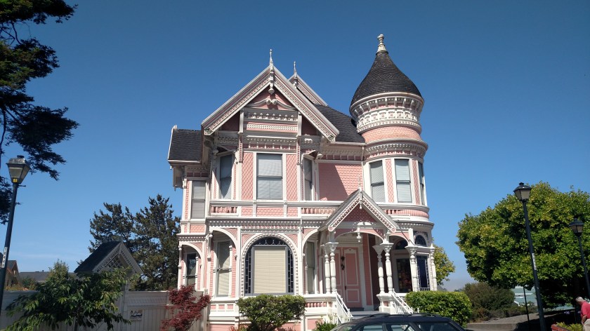
This is “Pink Lady,” built for Mr. Carson’s son Milton as a wedding gift, and is right across the street from the Ingomar Club. It is now a rental property and there are some amazing interior and exterior photos online.
Hard to tell because of the bright morning sun but this last house is lavender in color.

Wednesday morning I drove about an hour east of where I had been staying in Redding, California to visit Lassen Volcanic National Park. This Park was the main reason why I left the coast of northern California and traveled inland (only to be greeted by 100+ degree temperatures!).
Lassen Volcanic National Park was created by Congress in 1916 after a series of volcanic eruptions of Lassen Peak in 1914 and 1915. Scientists and seismologists are particularly interested in Lassen because it is one of the few places in the world which contains all four types of volcanic, or hydrothermal, formations. They are Composite (or stratovolcanoes), Shield, Plug domes, and Cinder (or Scoria) Cones.
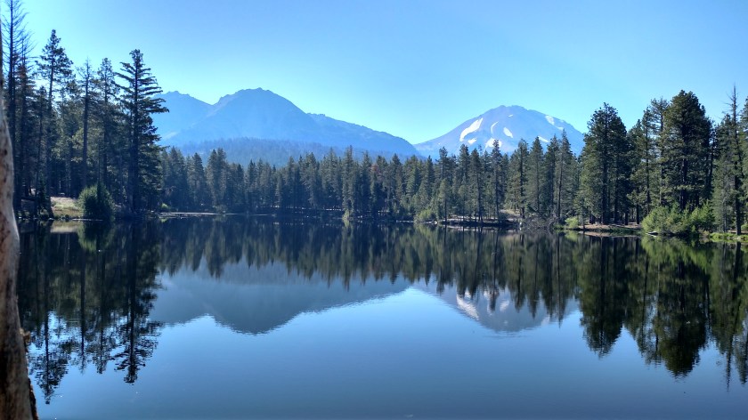
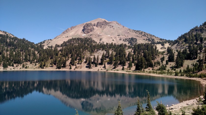
I arrived at the northwest entrance of Lassen at around 830am local time and the Visitor Center didn’t open until 9 so I had time to take a leisurely walk around Reflection Lake:
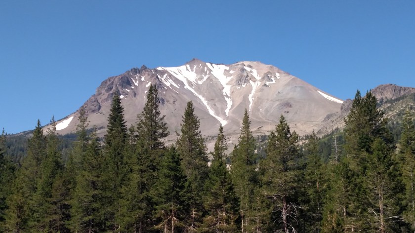
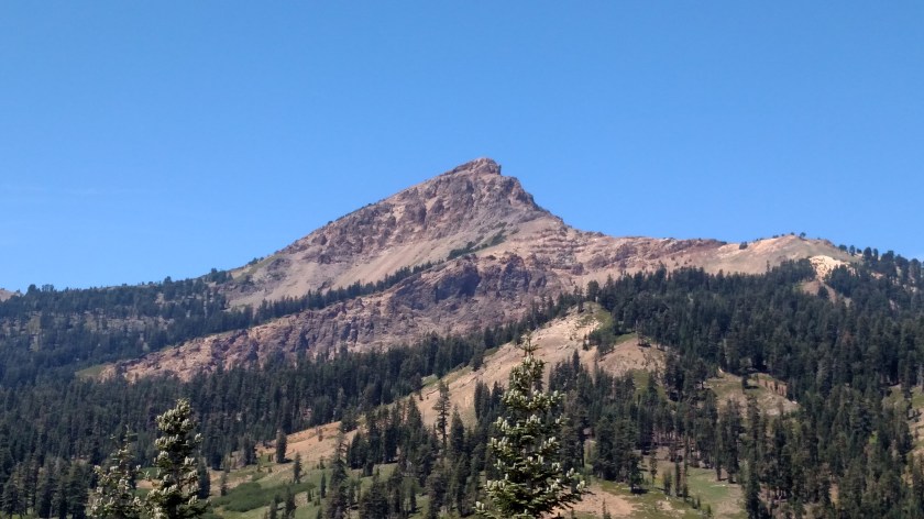
This is Lassen Peak. It now has a maximum elevation of 10,457 feet. The park entrance is at around 5,000 feet elevation and most of my time in the Park was at that elevation or higher, so the temperatures most of the day were very pleasant compared to what I experienced while in Redding.
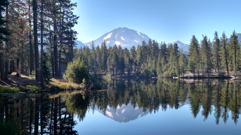
Walking around the lake you can now see formations called Chaos Crags to the left of Lassen Peak. While they appear to be about the same height they are actually shorter (only 8,530 feet) but are much closer to where I was taking these photos.
And here are just Chaos Crags (actually a series of 6 “plug dome” volcanoes).


I then went to the Visitor Center and learned more about the history of the Park. To look at a map of Lassen, Google “NPS Lassen Volcanic Map” and on the first page you will see the brochure map which you may then print locally. The main, paved road only curves through the westernmost side of the Park. As was the case at Yosemite, Sequoia and Kings Canyon Parks, which I visited earlier this trip, I can only see a very small percentage of the Park from the main road and to get to most areas you must hike (which I don’t) or travel on unpaved roads (which I am reluctant to do). I should also mention that, generally on the eastern side of this and the 3 Parks mentioned earlier, the Pacific Crest Trail, a 2,600 mile-long trail similar to the “Appalachian Trail” in the East, traverses these Parks taking hikers north and south along the western side of the country, from Mexico to Canada.
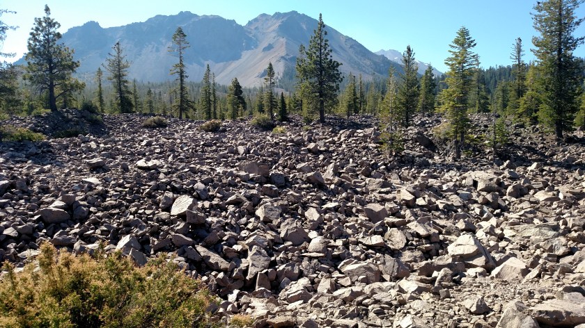
I left the Visitor Center and the first place I stopped at was Chaos Jumbles, a huge rockfield created over 300 years ago by a series of avalanches which resulted from the collapse of the northwest face of Chaos Crags. The thing that impressed me the most about this was the incredible distance these (substantial) rocks traveled just by the massive force of the avalanches. The initial release traveled more than 4 miles and stopped only after CLIMBING over 400 feet on another hillside!
These rocks came from Chaos Crags, which is in the distance. The rockfield continues a considerable distance behind this vantage point as well.
Further up the road I came to the “Devastated Area,” this one caused by the series of eruptions of the northeast face of Lassen Peak just over 100 years ago.

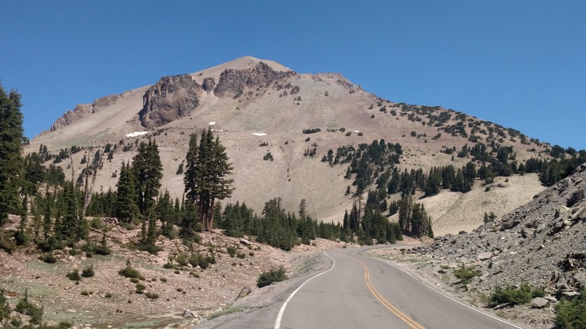
I continued on around the Lassen Park Highway until I got to the closest point the road gets to Lassen Peak (and also the highest point the road reaches, at 8,511 feet). This was the snow still on the ground just off the left side of the road:

I was now looking at the “backside” of the mountain which gets longer exposure to the southern Spring and early Summer sun and no longer has much snow left on it.
But I did have a very nice view looking down at Lake Helen, with Mount Diller and Pilot Pinnacle off in the distance:

Here are more photos I took Wednesday at Lassen Volcanic National Park in northeast California.
This is looking back at Lassen Peak after driving down the hill and around to the other side of Lake Helen.
And this is a closer view at Mount Diller and Pilot Pinnacle.

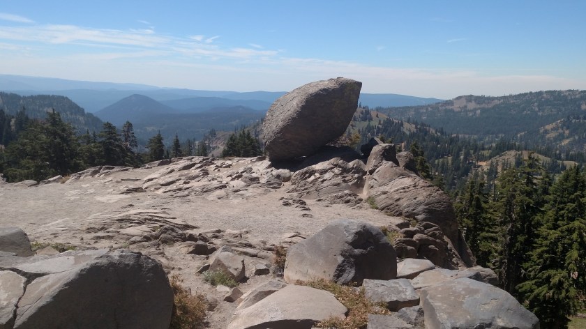
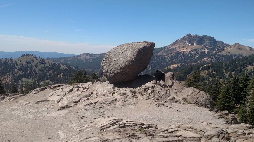
This huge rock (I should have gotten pictures when there were people out taking photos near it) was at a scenic overlook (out here they call them Vista Points) near an area called “Bumpass Hell.” That area is now off limits to hikers as the Park Service is making repairs and improvements to the trail leading to it. Bumpass Hell, named after Kendall Bumpass – the man who discovered it, is a series of mudpots, fumaroles and sulfuric springs similar to what I saw last year at Yellowstone National Park.
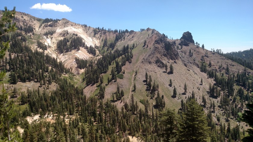
This was a hillside further down the road.

This is Brokeoff (not Brokeback!) Mountain, what’s left of the Brokeoff Volcano which erupted approximately 600,000 years ago with a force estimated to be 50 times that of the Mount St. Helens eruption in 1980.
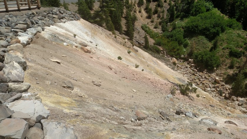
And shortly before leaving the Park at the southwest entrance I stopped at the “Sulphur Works,” an area similar to Bumpass Hell but located right next to the road.

This is a mudpot. It is much more interesting to see in action (I took a short video but can’t post it on the blog). A mudpot is a bubbling pond of hot, gray water (bubble, bubble, toil and trouble…) and releases a pungent sulphur , rotten egg, odor.

These sulphur formations often leave very colorful side effects.
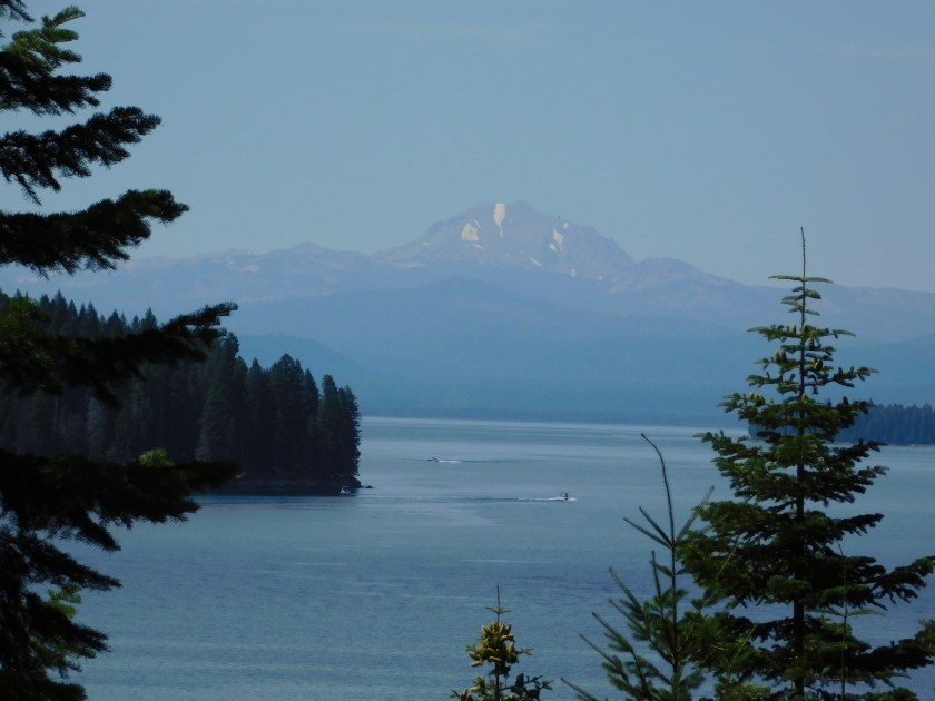
And this was taken from a vantage point near the southeast shore of Lake Almanor, about 30 miles from the Park as I headed south towards where I am staying in Quincy, CA.
No photos.
Yesterday I traveled over to Lassen Volcanic National Park, about an hour east of where I was staying in Redding, California. I entered the Park through the northwest entrance and left via the southwest entrance. I am planning to go back up to the Park today (I am now staying in Quincy, CA, south of the Park) but as I check the InciWeb Wildfire website I see that the L1 Spring Fire was reported yesterday afternoon around 230, close to the south entrance. It was initially reported as only 12 acres and there isn’t an update yet this morning (I am posting this at 550am local time). Hopefully I can still get in the south entrance and I was already planning to get back to Quincy via an eastern route and not the way I came down here yesterday.
At Yosemite National Park the Ferguson Fire in still causing big problems. A firefighter lost his life last weekend when the bulldozer he was operating overturned, crushing him underneath. He was an experienced operator, clearing brush to create a “fire break” line. That fire has been particularly stubborn as it is in a difficult to reach area and retardant dropped from aircraft is ineffective because the tree canopy prevents it from reaching the ground. Visibility at Yosemite is not good, nor is the air quality, as the smoke it pretty much staying in the area. Weather forecasts for the area are not favorable for improvement.
When I leave Quincy tomorrow morning I’ll he heading north on a series of scenic roads and crossing the state line into Oregon, staying in Klamath Falls over the weekend (I had my tires rotated there last year one of the days I visited Crater Lake). I have been keeping an eye on the Klamathon Fire but, while substantial in size, it is located well west of the town I’ll be staying in. It remains to be seen what effect that fire will have on the areas I plan to visit while up there.
About a week and a half ago I stayed in Ukiah and there had been a fire close to there but I saw absolutely no indication of it and didn’t notice haze or any smoke odor. I am keeping track of a few small fires in Oregon, where I’m headed next weekend after wrapping up my time in California.
And I heard last night that Scenic Route 1 south of Monterey has now reopened after last year’s devastating landslide. Because of favorable conditions this Spring they were able to complete the road reconstruction ahead of schedule.
I am reviewing photos from Lassen Volcanic National Monument now and plan to post them before I leave for the Park later this morning.
