
Looks to me like he’s saying “See you later, alligator…”


Looks to me like he’s saying “See you later, alligator…”


Or no power at all!


I just started calling them that so that’s who they shall be. This couple was standing on a rock which was sticking up out of the lake and took turns jumping in.
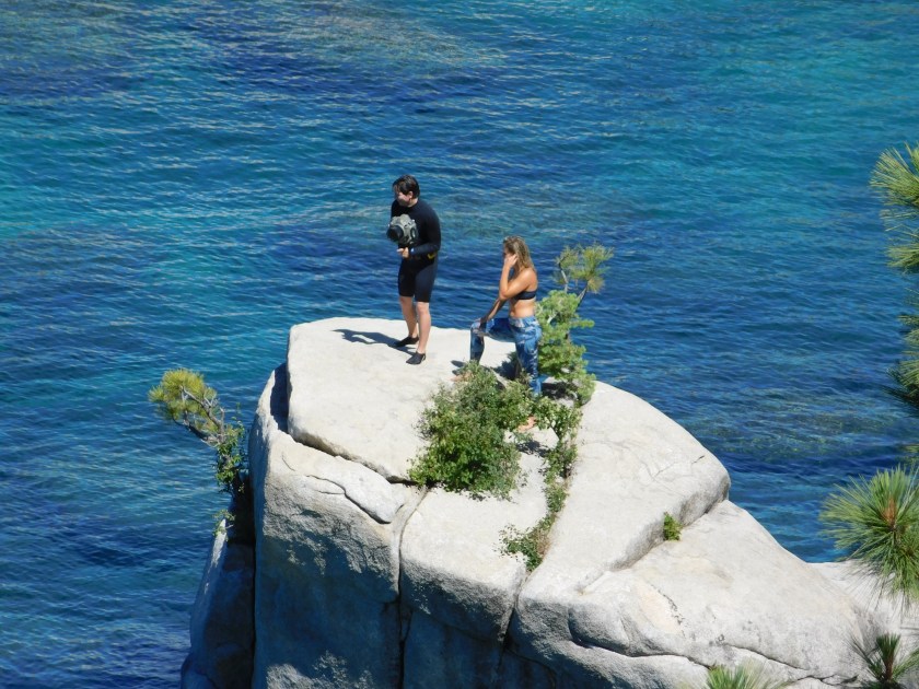
She jumped in almost immediately after I took the photo above. Here he is helping her back up onto the rock.

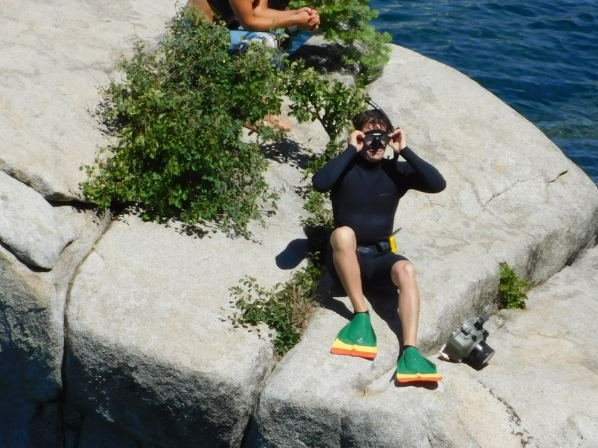
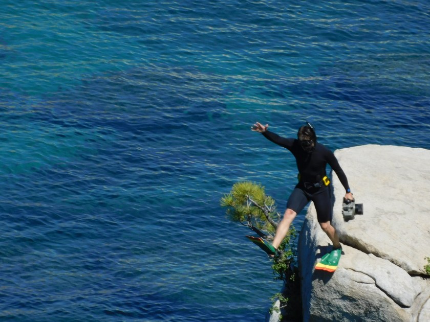
Next, he put on goggles and flippers. Note the huge underwater camera next to his feet:
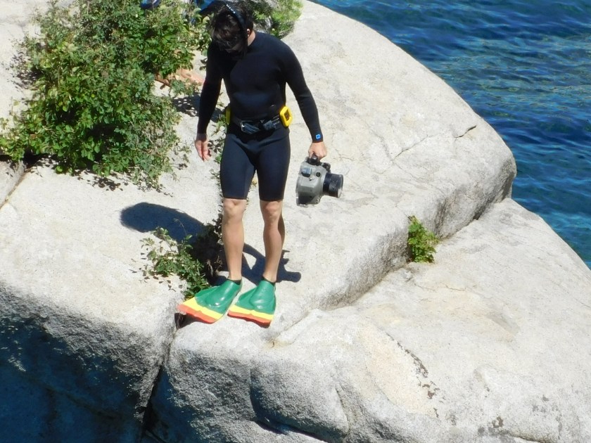
Ready….
Bombs away!
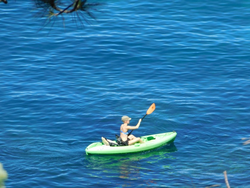
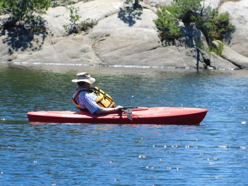
And here is a guy who had been floating nearby on a kayak who wanted to get in on the fun:

The girl was real cagey – I could never catch her in the act of diving but she did several times.
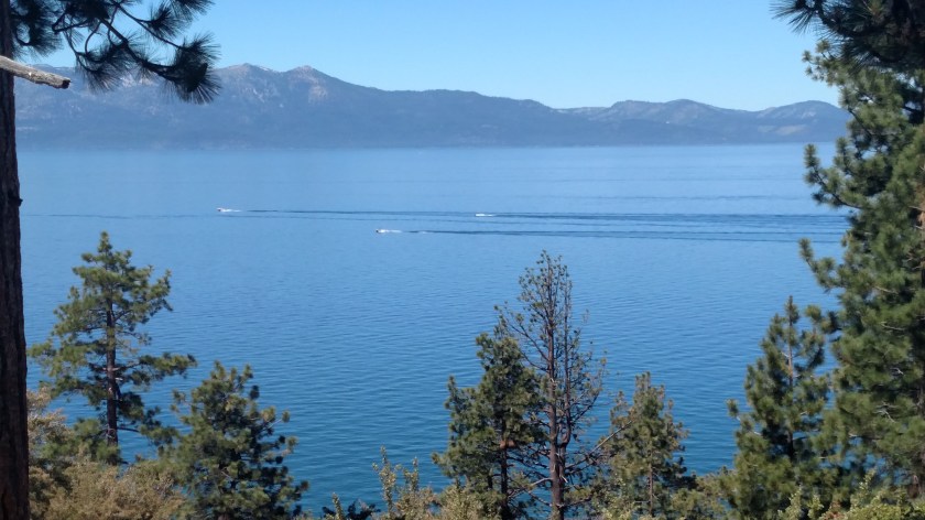
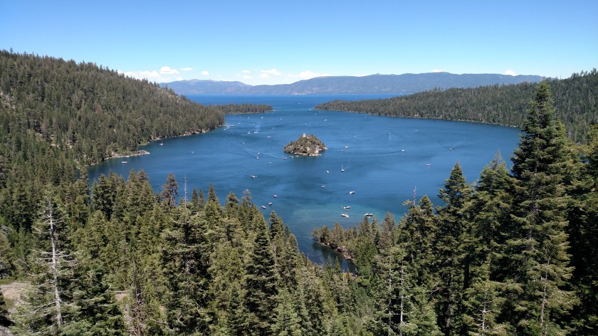
Monday morning I drove down to Lake Tahoe from where I am staying in Sparks, Nevada. It is an easy drive which takes less than an hour. I took Route 395 South, then Route 431, the Mt. Rose Highway, and drove down to the lake after having crossed over Mount Rose (reaching a driving altitude of 8,900 feet). This was the view from an overlook as I started down the southwest side of Mount Rose:

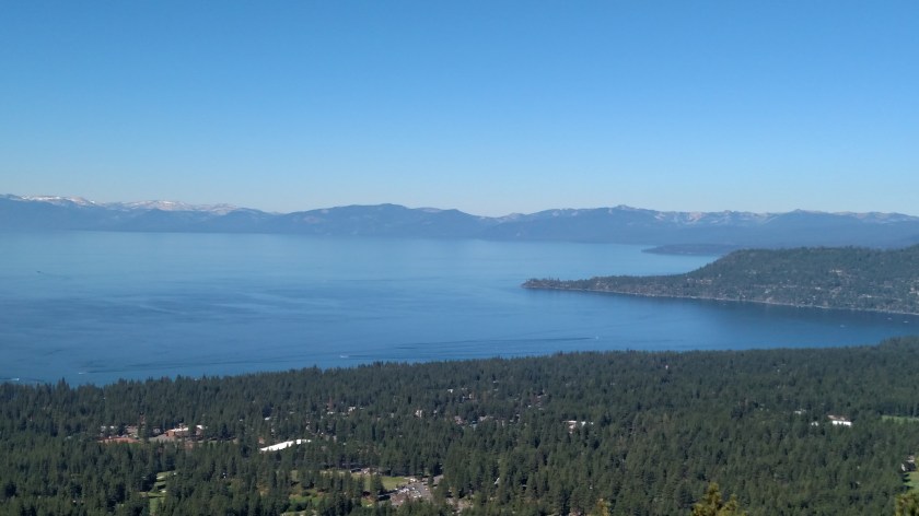
Lake Tahoe has a surface altitude of 6,225 feet above sea level and covers 191 square miles. There are casinos and ski areas near the lake and many wealthy people live here (behind electronically controlled gates).
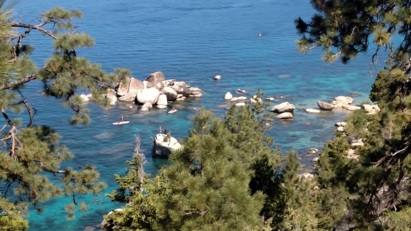
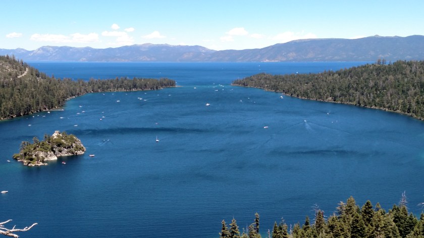
When I got down near the lake I was in Incline Village. I started driving around the lake by heading south on Route 28. They were doing road construction and had many potential overlooks and parking areas closed (and what wasn’t closed was private). I saw some great views but had absolutely nowhere to stop. Once I got past Sand Harbor things started to improve and I ended up fairly happy with the photos I took. Here are shots from various locations on the east side of the lake:
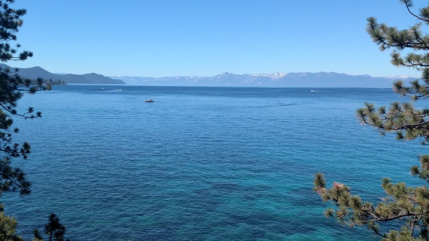
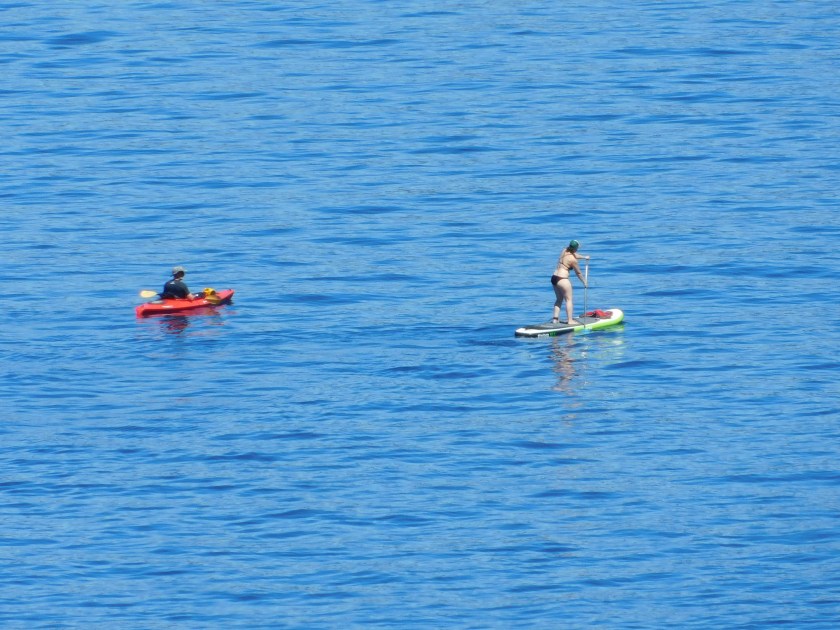
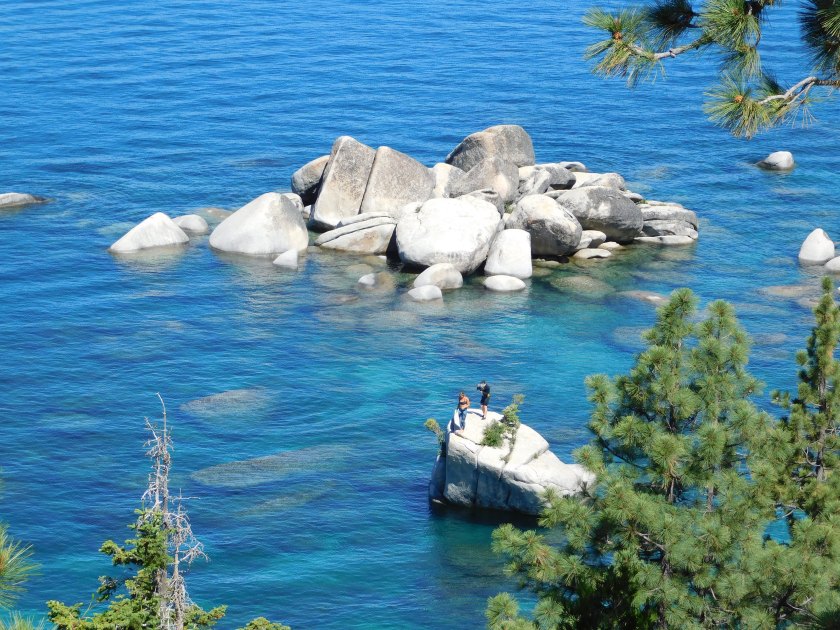
One thing I’ve always heard about Lake Tahoe is the amazing water clarity and colors which can be seen – almost like in the Bahamas.

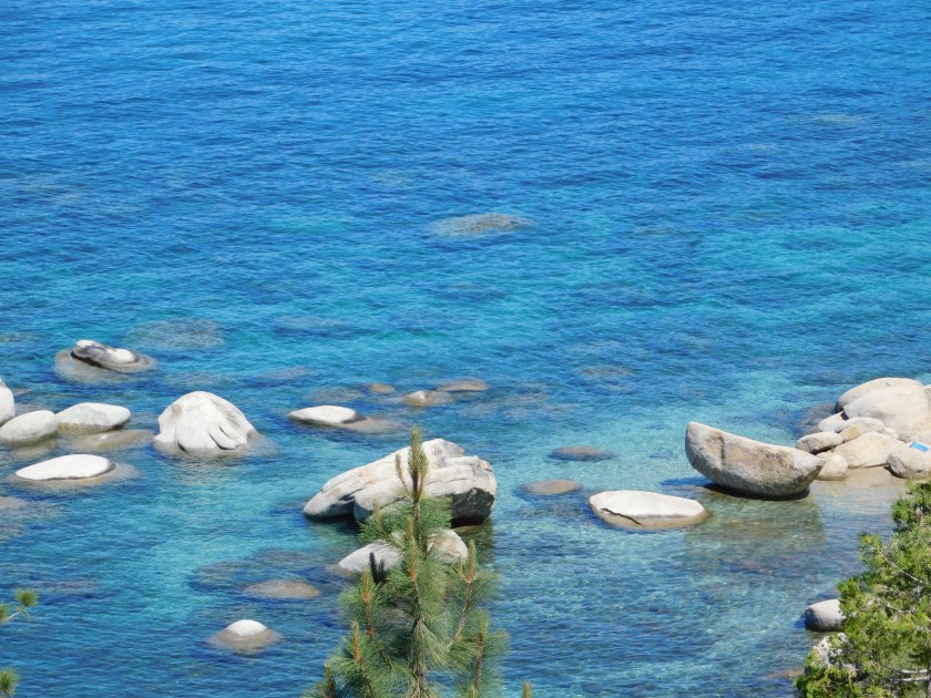
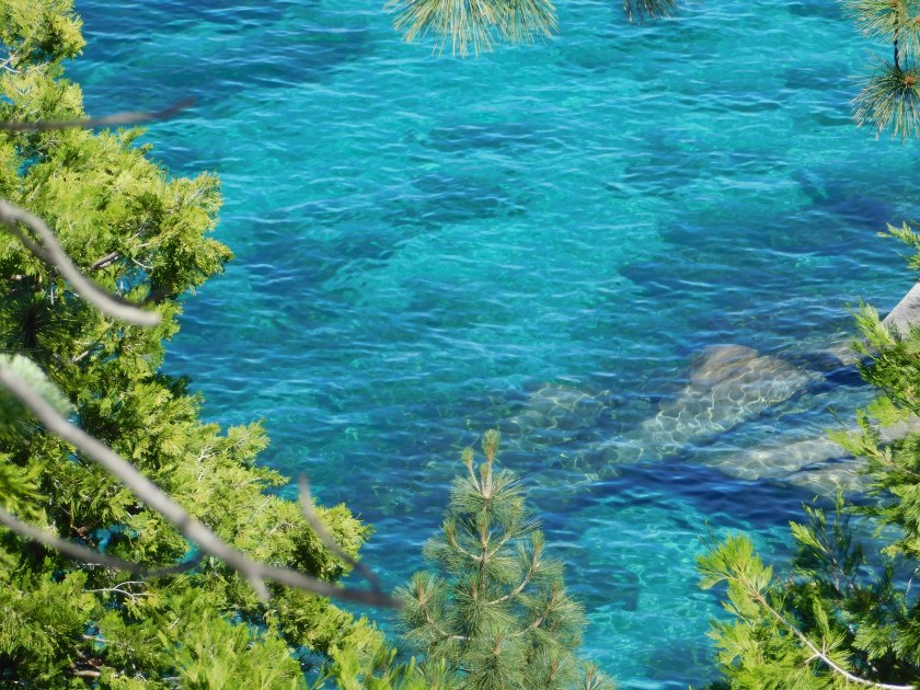
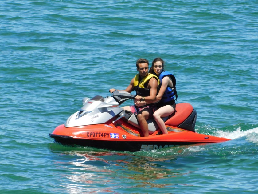
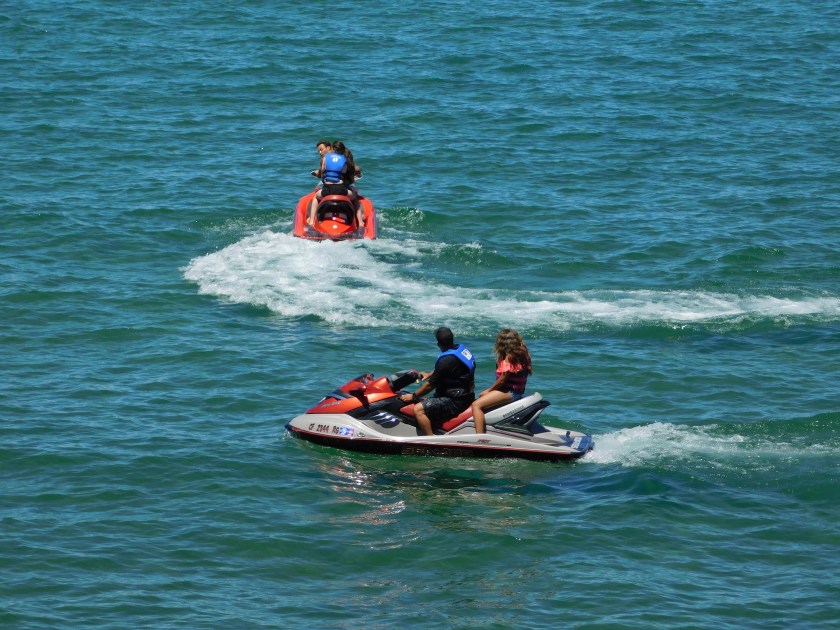
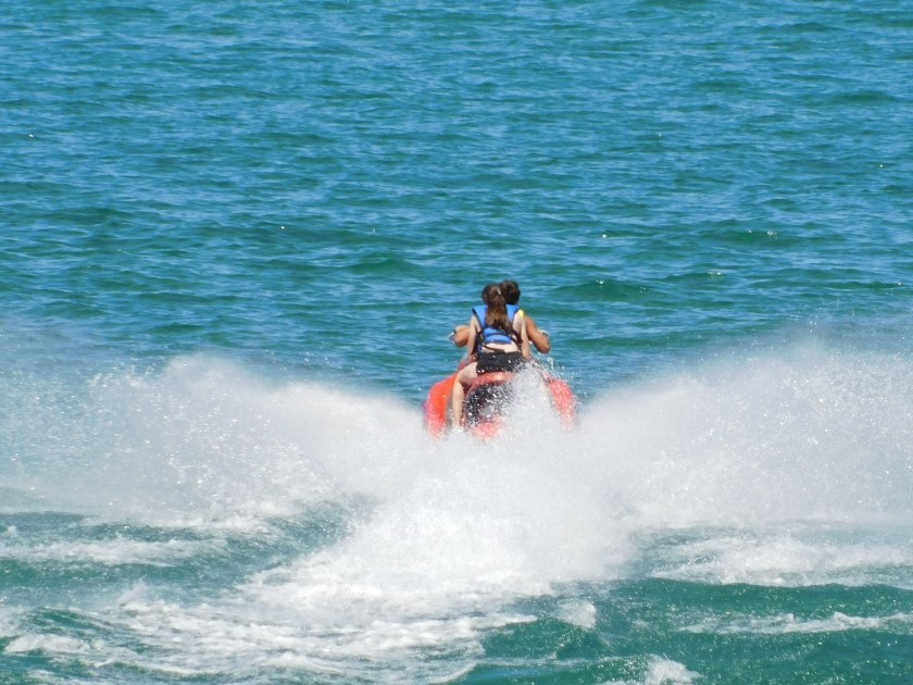
There are some people on and in the water around these rocks. You’ll be seeing lots more of them when I post closeups taken with the digital camera.
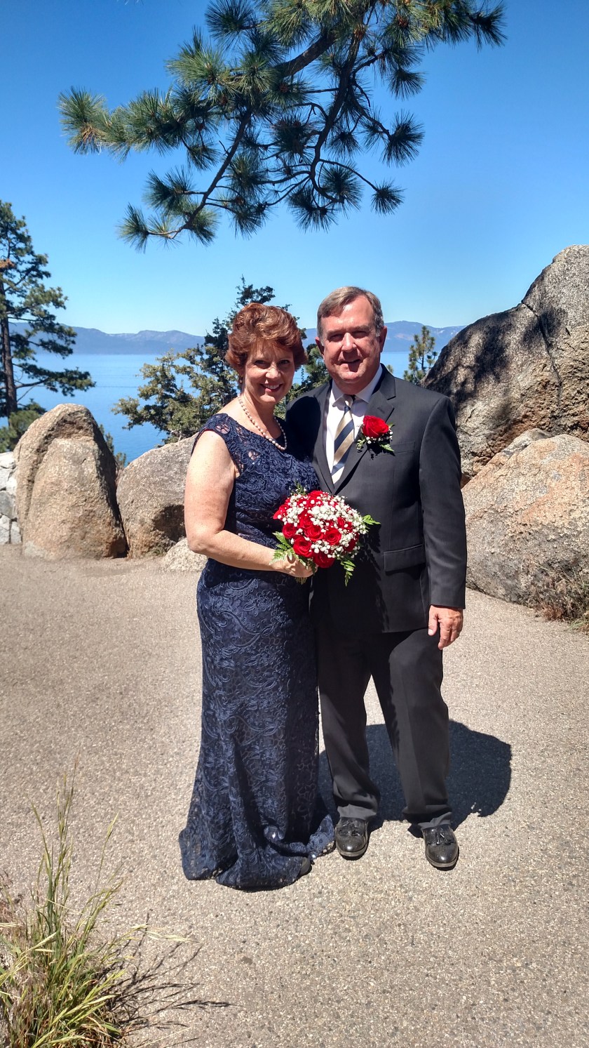
When I got down around Cove Rock I found these newlyweds (or soon to be) posing for pictures with friends of theirs. I asked if I could take one for the blog:


I took many closeups using the digital camera from the eastern shore as well as from South Tahoe and will be posting them shortly, just as soon as I group them by topic.
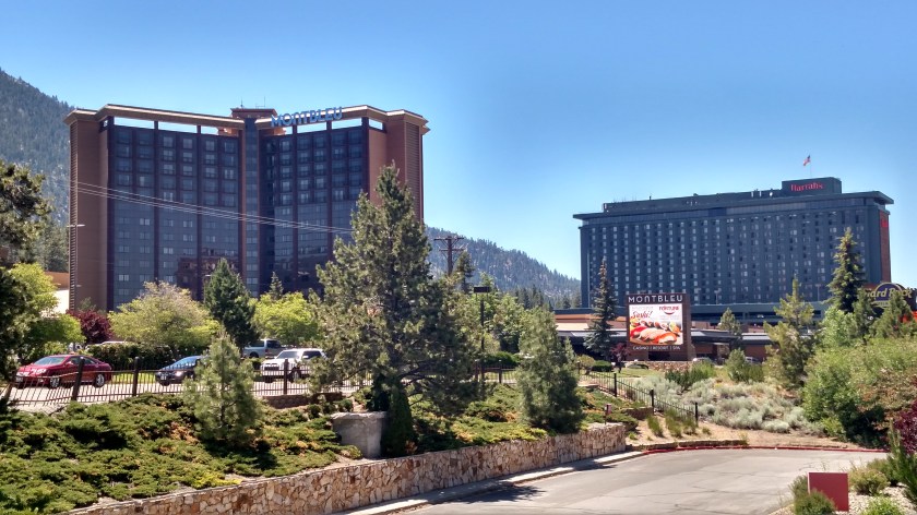
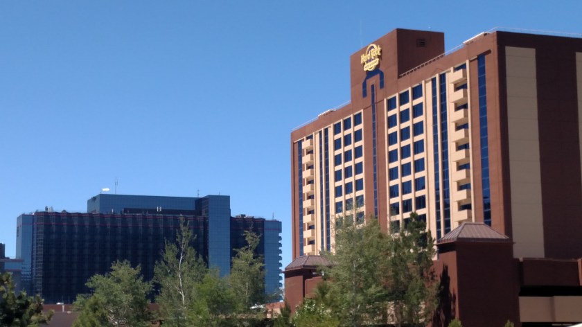
Stateline, just before you get to South Tahoe, is where most of the major casinos are located in the Tahoe area. Here are four which had big, impressive buildings:
Montbleu and Harrah’s
Harvey’s and Hard Rock
This area was pretty congested as it was now lunch time so I paid attention to my driving and didn’t look around for any of the others. There are lots of small casinos and there may be more big ones, too. I didn’t make it around to the north side and I don’t remember if there were any big ones up there on the Nevada side of the state line. I was in Tahoe about 20 years ago with my brother David and his wife Kendra.
I did notice while I was at a red light that there was a Baja Fresh restaurant on the opposite side of the street. There used to be one in Raleigh which I really liked to eat at, but it closed, as have most if not all of them on the east coast. There motto used to be: Eat Fresh. No freezers. No microwaves. No can openers.
I had two yummy chicken tacos (which is what I always got in Raleigh) and since it had been so long I got a Mahi fish taco as well. I’m looking forward to visiting lots of little taco joints once I get back out to the coast later this week, and enjoying lots of good fish when I’m in Oregon and Washington later this summer. Now that I know Baja is still around out here I’ll have to keep an eye out for them.
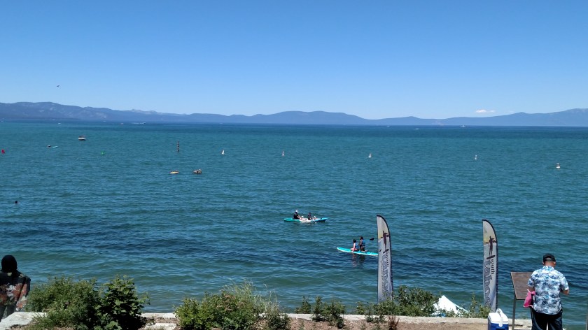
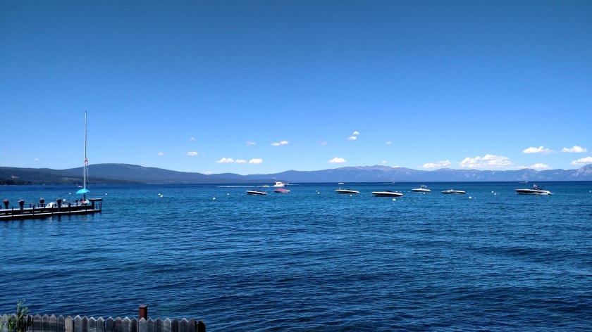
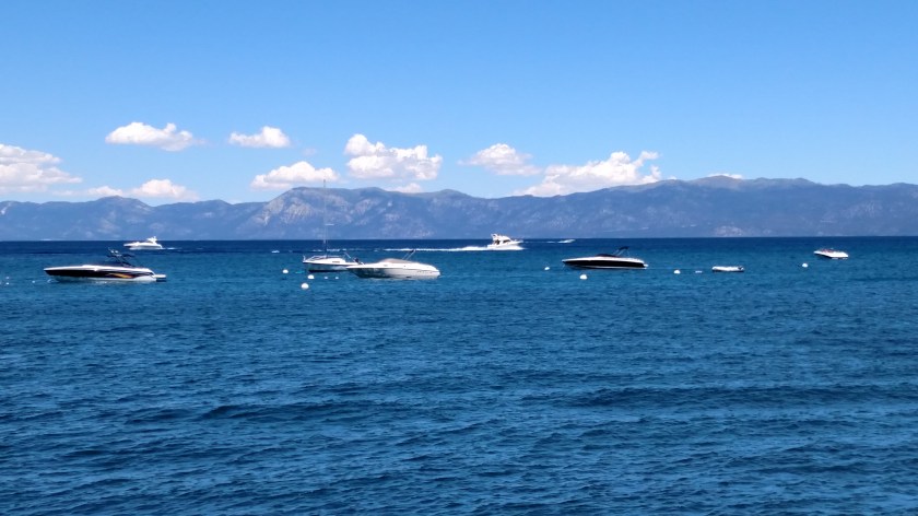
After lunch I parked a few blocks from the South Tahoe beach and walked back to spend about a half hour in the shade taking pictures and just relaxing. For a while I put both cameras away and just enjoyed watching everyone having fun. Considering the proximity to July 4 it wasn’t nearly as crowded as I was expecting.
This 3-shot panorama was the opening scene at the South Tahoe boat launch and beachfront:


The rest of the photos I took from this area were with the digital camera and I will post them separately later today.
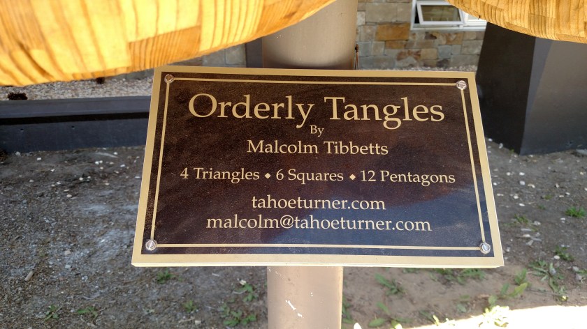
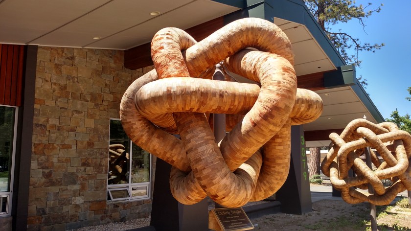
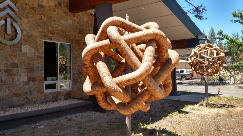
Walking back to the car I noticed these pieces of artwork in front of an office building:

I then starting driving up the west side of the lake. Actually the post title says Lake Tahoe, Nevada but from this point on, until I get back to the state line when driving east on Interstate 80, I am now in California. About the western 2/3 of the lake is in California and the east side is in Nevada. There are casinos east of the state line where it intersects the lake on the north and south shores.
I timed it perfectly heading back north as the shifting sun stayed behind my back. The main thing which surprised and disappointed me about the west side was that it rose quite a bit in elevation in relation to the lake, and stayed a pretty good distance away from it. I was really bummed that there weren’t more overlooks. It seemed that when I got a glimpse of a great view there was absolutely nowhere to park. And when I could park the view was mostly obscured by trees. The first overlook (they call them Vista Points out here) was absolutely PACKED, with overflow along the road (illegally) and people everywhere so I just kept on moving up the road.
I was able to sneak in shots from a few places, though:
And this was a marina up near Meeks Bay.

This guy was just firing up to head out onto the lake.
They were doing road construction on this side of the lake, too, and after I took these pictures I hit a long line which advanced very slowly. I decided I had enough fun for one day so I bailed out in Tahoe City and headed up towards the dreaded interstate on Route 89 rather than go all the way around the lake as I had originally planned. I got to the lake at about the one o’clock position on a clock face and left it at about 10 o’clock, so I did see 3/4 of the shoreline.
No photo.
The good news is it appears the Evans Fire is under control. It saw no growth overnight and as of 1218pm Pacific Time it is listed at 63 acres and 50% contained. I saw absolutely no smoke rising from the area when I drove into Reno this morning.
Kudos to the fire crews which quickly got a handle on this event. I read last night that in addition to ground crews they used one multi-engine tanker (airplane) to drop retardant, several single-engine planes and 4 helicopters. The same thing happened last year south of Bend OR when I was there, a fire there was started around 4 pm and various agencies immediately employed various resources and quickly got it under control.
Authorities think the Evans Fire was human-caused and are looking for the owner of a Jeep Cherokee which was seen in the area early Sunday morning.
Last Sunday, June 24, I decided to drive on some scenic roads north of where I was staying in Sonora, California. My plan was to take Route 4 northeast about 80 miles to the little town of Woodfords where I would get on Route 88 and take it southeast to Jackson, then get on Route 49 back to Sonora. First I had to get to Route 4…
From Sonora (I was actually staying in Tuttletown, just west of Sonora) I took Route 49 north. First stop, not far up the road, was up Jackass Hill Road to see the Mark Twain Cabin:
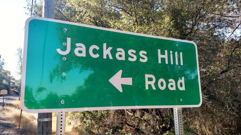
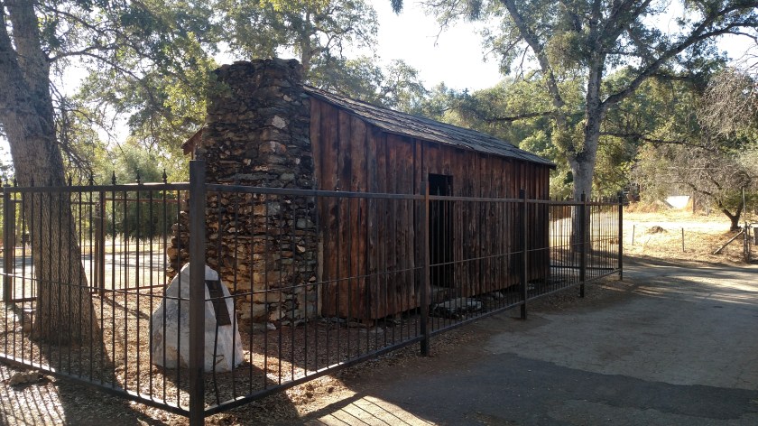
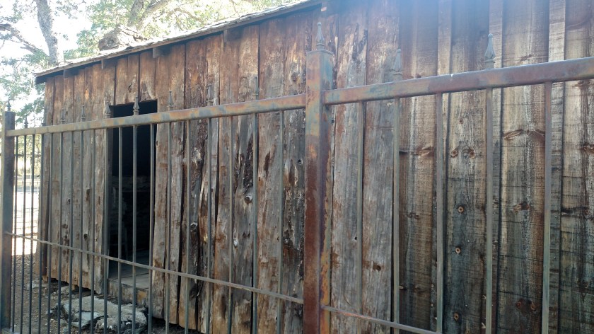
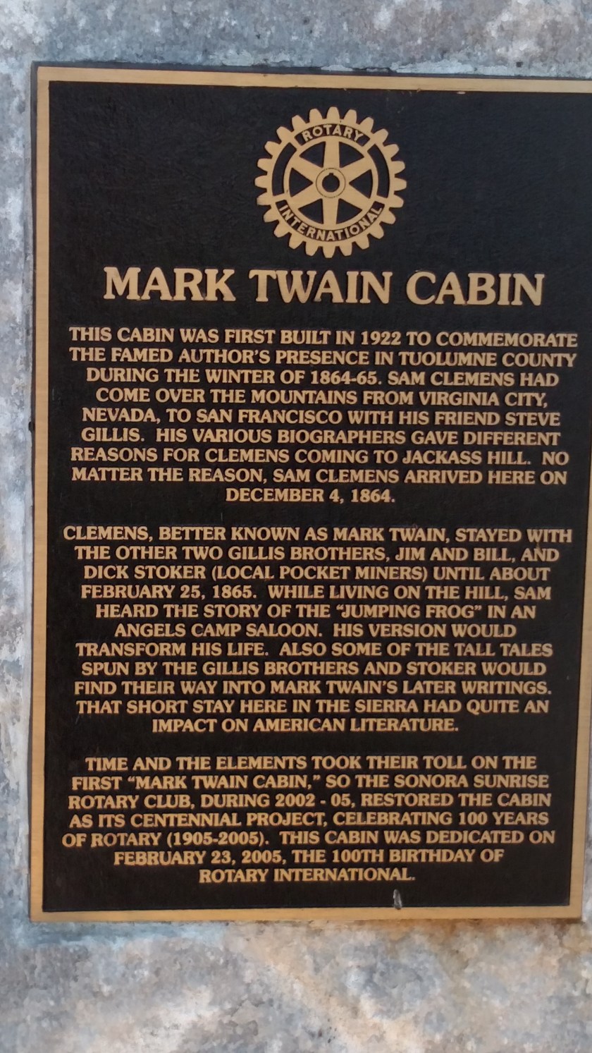
The sign talks about Twain’s friendship with the Gillis brothers. The Airbnb I was staying in last week is on land once owned by the Gillis family. While my hosts now own the house they live in, someone else owns the mineral rights for whatever is underneath it. In other words, if they strike gold by digging up their driveway it won’t belong to them. Descendents of the Gillis brothers still lived in neighboring houses until just recently. (I hope I got all those facts straight).
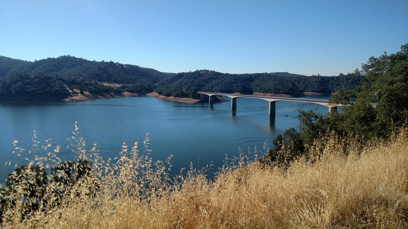
Back out on Route 49 I continued north towards the little town of Angels Camp. First I had to cross a bridge over New Melones Lake.
Before getting to Angels Camp I went through an area known as Frogtown.
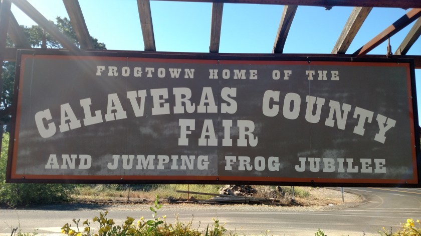

They take their frog jumping here VERY seriously.
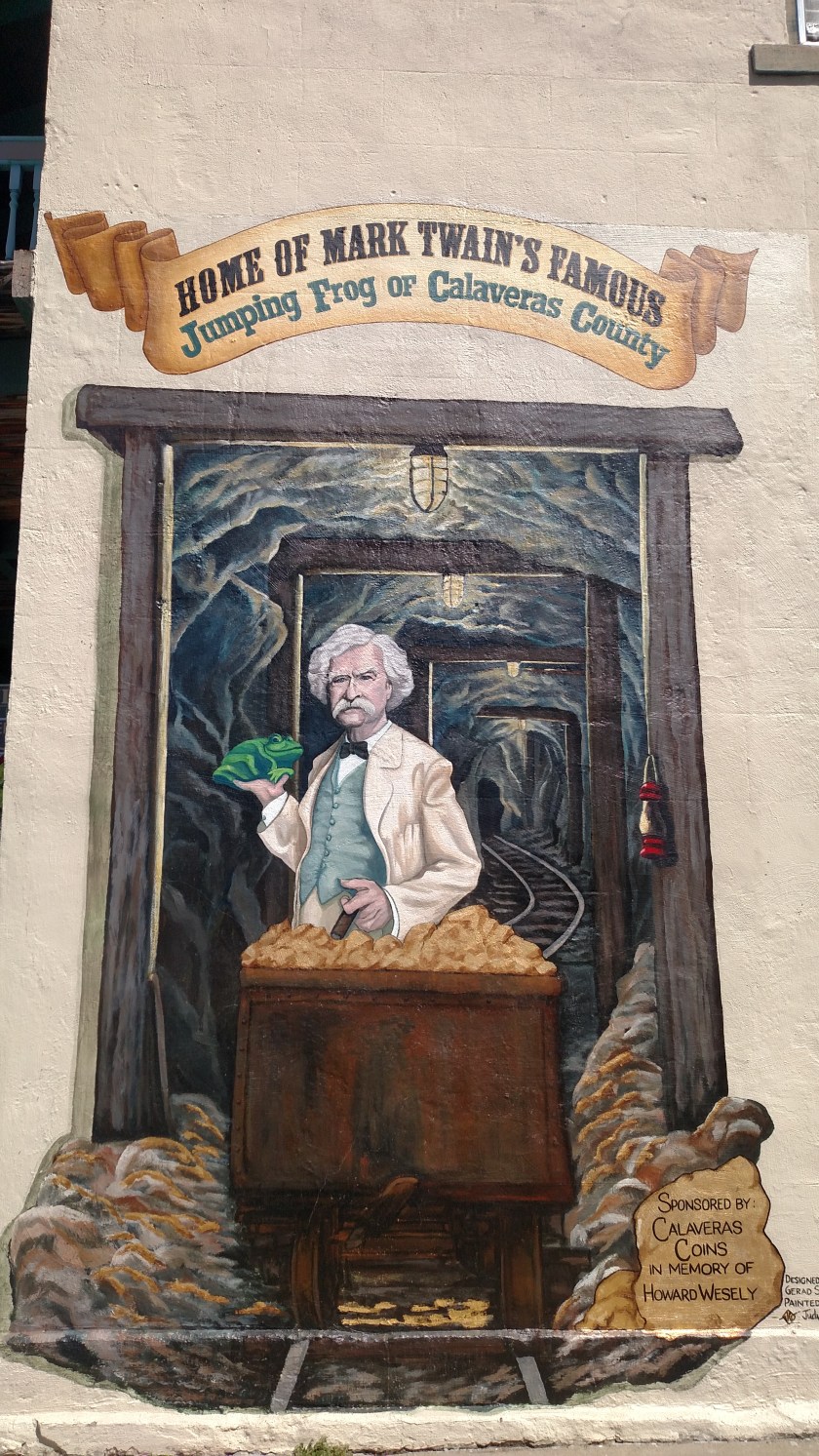
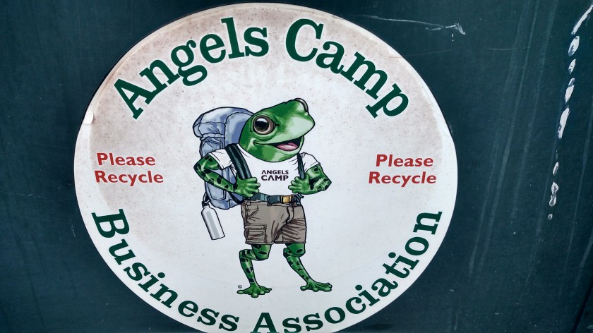
This was what I found when I got to Angels Camp:

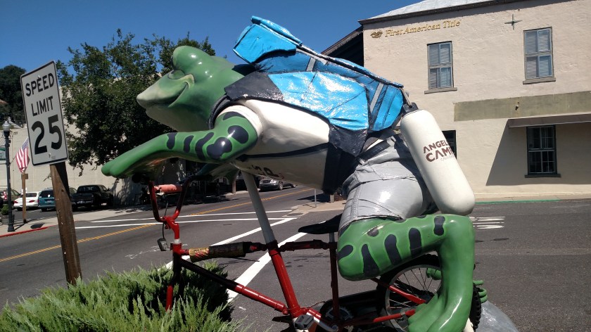
On the side of a building:
On the side of a trash receptacle:
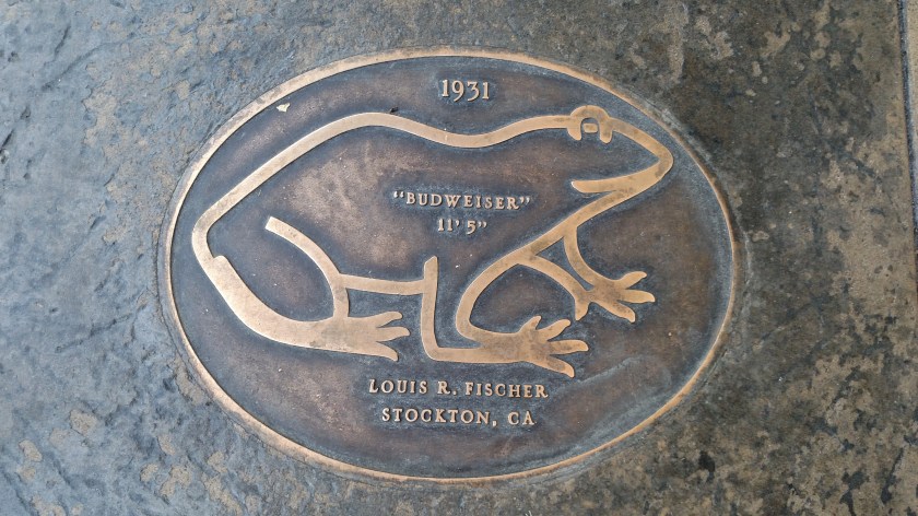
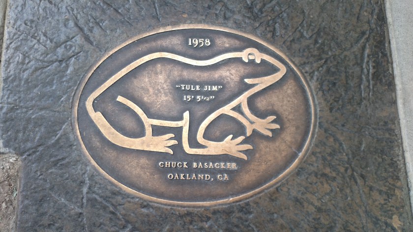
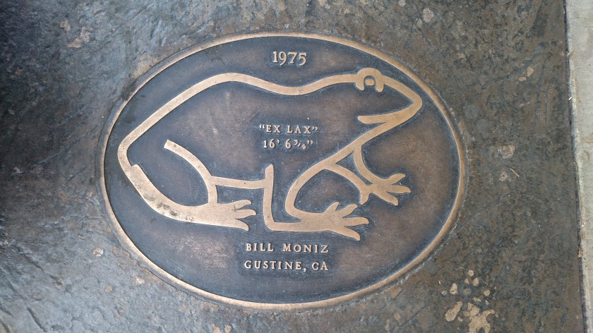
And embedded in the sidewalk – a virtual “Hall of Fame” of past winners. Note that the jump lengths get longer as the years go by. Steroids?? Rigorous training?? 5 Hour Energy Drink??

At Angel’s Camp I finally picked up Route 4 and started driving northeast.
I diverted off onto Parrott’s Ferry Road and came to an upper portion of New Melones Lake. While I was standing on the bridge a speedboat came zipping by:
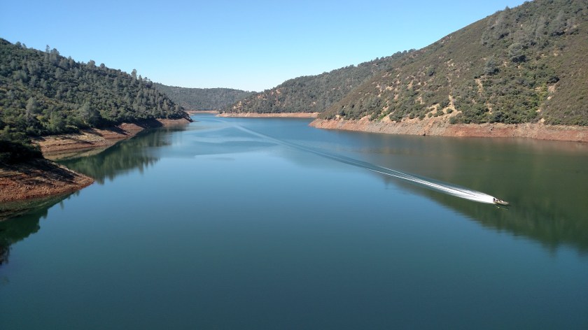
The wake created an interest visual effect when it reached the far shoreline:
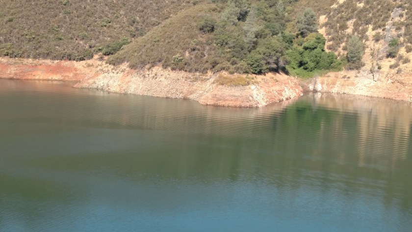
I went back to the car to get the digital camera but no other watercraft came by to repeat the magic. I came back to this spot on another day but it was windy and the lake wasn’t as calm so the ripple effect probably wouldn’t have looked as good.
Back out on Route 4 I continued northeast and stopped at Calaveras Big Trees State Park (see prior post from last week called that). I also stopped at Lake Alpine, site of the somewhat failed bald eagle episode (see prior post on that, titled “The eagle had landed”).
I took this right before the eagle was first spotted:
I did go back to the path where I had taken the eagle pictures on Thursday of last week and waited two hours but never saw the eagle again. I got there around 130 and the eagle had probably just eaten lunch and was off somewhere enjoying a nice eagle siesta.
Shortly after leaving Lake Alpine I came across this relaxing scene:
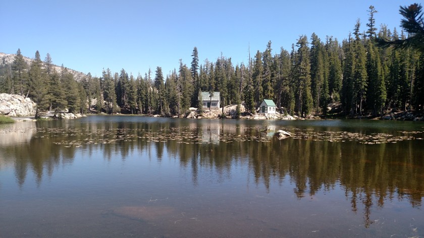
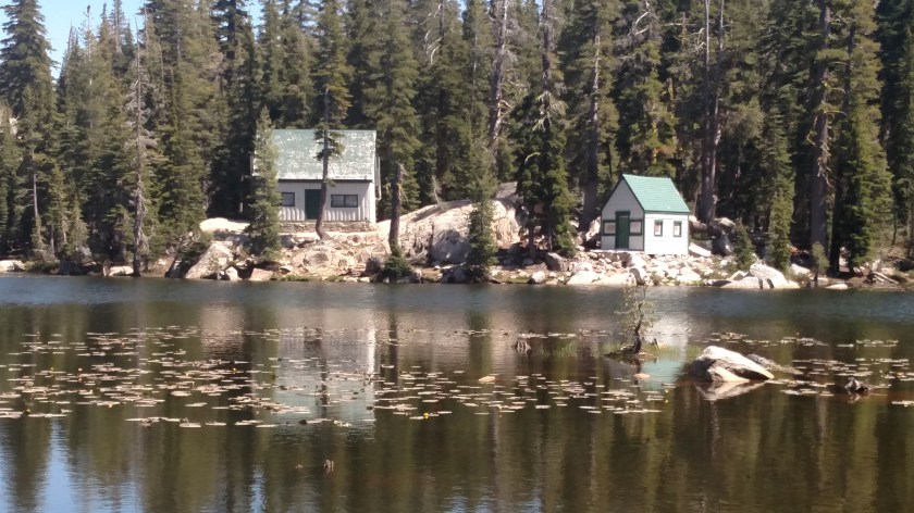
Somehow I don’t think I’d build my dream cabin at a place called Mosquito Lake, which is exactly what this lake is called.
And I’m not talking about kidneystones!
The 3 scenic roads I drove last week near Sonora, California all go over large mountains, part of the Sierra Mountain Range, at their northeast end. Route 108, the southernmost road, crosses Sonora Pass (elevation 9,624 feet). Route 88, the northernmost road, crosses Carson Pass (elevation 8,573 feet). In between those two is Route 4, the subject of this post, which crosses both the Pacific Grade Summit (elevation 8,050 – just up the road from Mosquito Lake) and Ebbett’s Pass (elevation 8,732 feet).
These were taken Sunday, June 24 as I drove one of two scenic roads north of Sonora, CA where I was staying last week. I opted not to go to Yosemite National Park until Monday and, instead, drove northeast about 80 miles on Route 4 (one of my primary scenic roads), then went further north and traveled southwest on Route 88. These were taken at the northeast end of Route 4, after I went through Ebbett’s Pass:
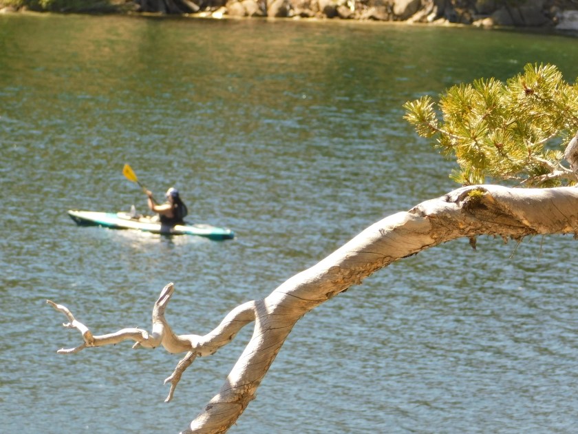
This was at the Kinney Reservoir. I tried getting artistic using the tree limb.


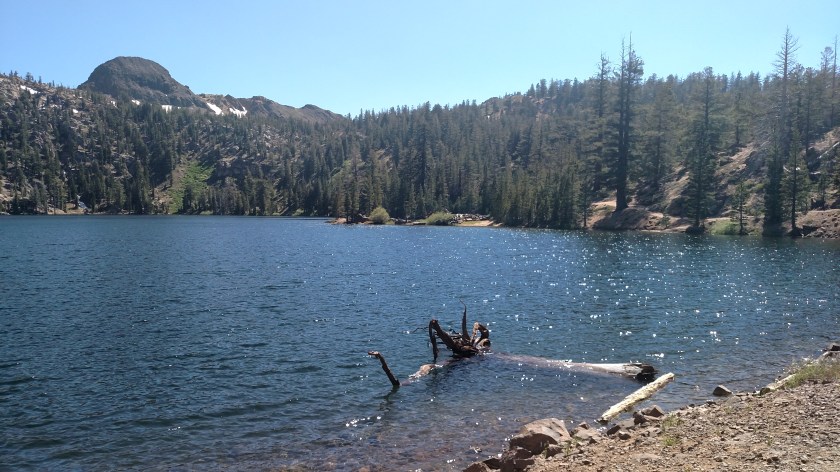
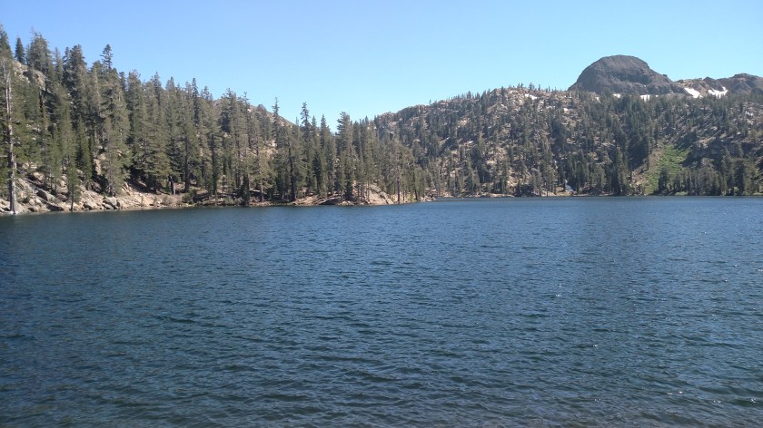
This is another angle of the reservoir from further up the road:
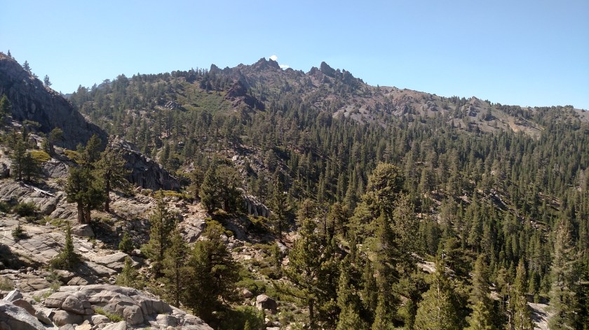
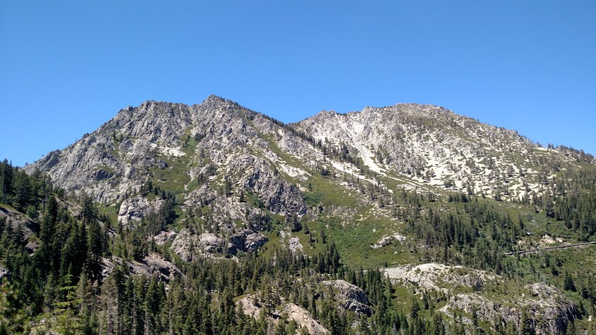
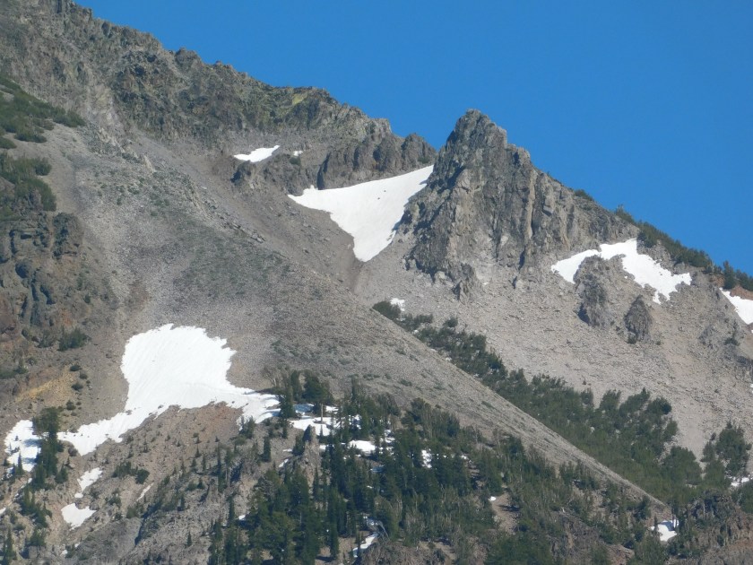
I believe this is Highland Peak, looking south from Highway 4:
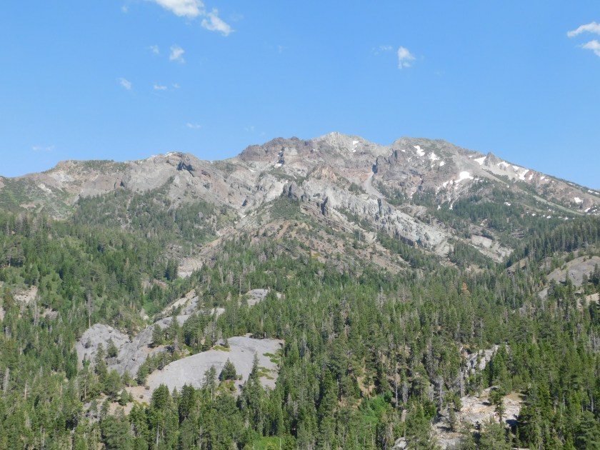

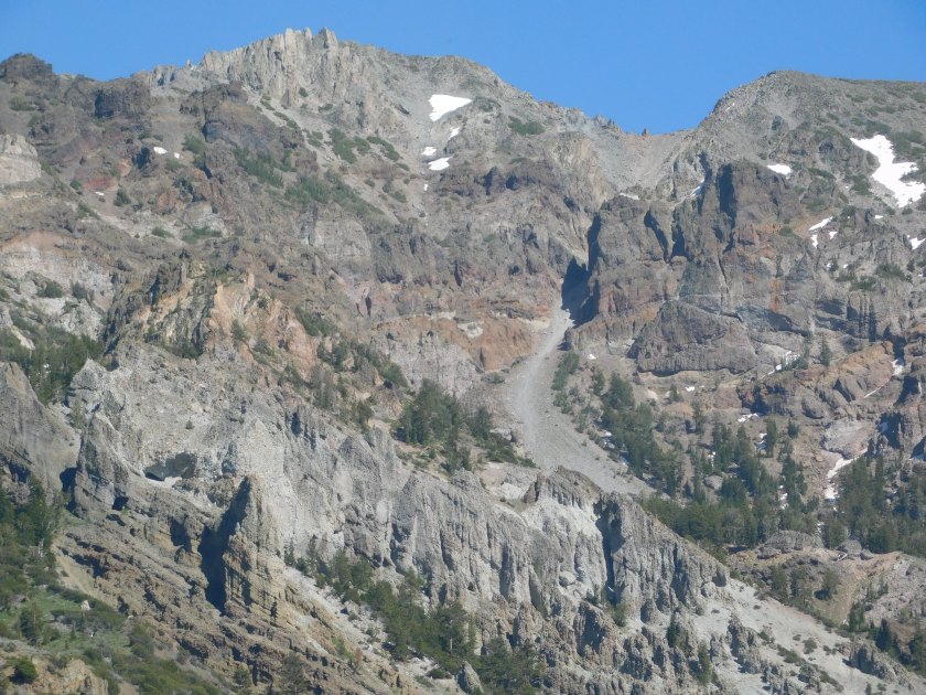
And yes, that’s still snow on the mountain.
And these are some other things I saw before getting to the little town of Markleeville and heading north to pickup Route 88 and take it back to Jackson and then get on Route 49 south to return to Sonora.