Birch Aquarium

September 18, 2014

This is the Aquarium in San Diego

IMG_0169

IMG_0168

IMG_0206

IMG_0207

My new camera didn’t do a very good job with indoor photos, but I did manage to get a few decent ones:

IMG_0172

IMG_0197

IMG_0200

This is a picture of a picture – a Munk’s Devil Ray jumping out of the ocean:

IMG_0213

Among the various exhibits was one of sea horses.  Those photos are all pretty blurry but I do want to share these two variations.  I will follow them with better photos I found online.

IMG_0235

IMG_0236

The two photos above are of Weedy Seadragons.  They are only found near Australia.  Below is a Leafy Seadragon, also found only near Australia.

IMG_0243

Here are better photos I found online:

WEEDY SEADRAGON:

weedy_cover-1024x512

(Photo credit: scubadiverlife.com)

LEAFY SEADRAGON:

leafy-sea-dragon-fish

(Photo credit: animalsake.com)

Water Water Everywhere…

September 2014

I guess I can’t post pictures from southern California without including shots of the harbor near San Diego…

IMG_0074

IMG_0075

IMG_0262

IMG_0263

IMG_0266

IMG_0288

The photo above is of Ocean Beach.  While I was there (to get a yummy, healthy Acai Bowl) I learned that this is where the jets departing from the San Diego airport fly to get out over the ocean.

And then there’s the ocean:

IMG_0286

IMG_0285

IMG_0160

IMG_0161

IMG_0162

IMG_0165


San Diego – Various

September 2014

Here are some other things I saw while visiting the San Diego area.  This is the Hotel del Coronado, out on a narrow peninsula south of town.

IMG_0084

IMG_0087

IMG_0089

One day I drove out east of where I was staying in Escondido (to go to the Julian Pie Company in Julian, CA).  Along the way I approached this mountain which was covered by huge boulders.

IMG_0094

IMG_0096

IMG_0098

And one of the days I was downtown I saw this larger-than-life Scrabble game in progress:

IMG_0260


Simon Says STOP

September 2014

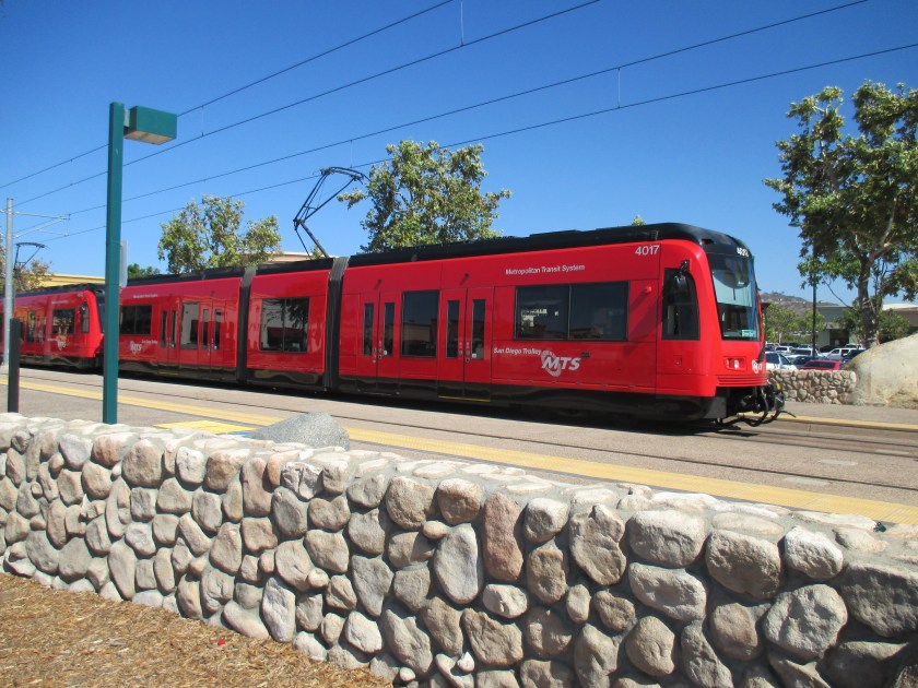
I made an earlier post which tells about various rail-based transportation options I used to travel around the San Diego area.  This is a “street trolley” I also rode one day while downtown:

StreetTrolley

I have ridden these in many other cities (Savannah, St. Augustine, New Orleans and Key West, just to name a few) and they are a GREAT way to get acquainted with a city, especially if you have limited time there.  For one price you can ride around town all day and have the driver explain what you are looking at and not have to worry about traffic or parking.  You can get on and off at any of the stops so I generally ride the entire length, then go again and get off to spend more time at venues which interest me or to take photos.

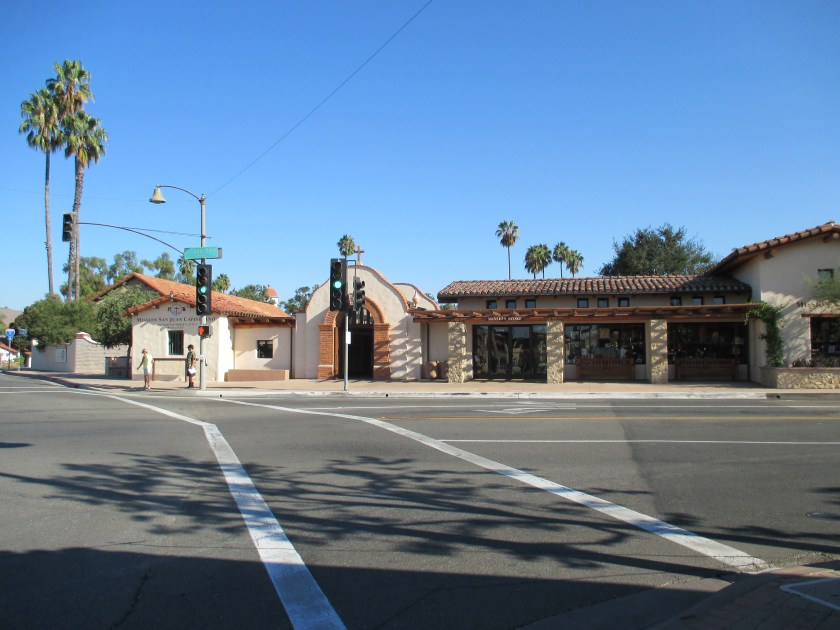
One of the places we visited on the San Diego tour was Balboa Park, a HUGE (1,200+ acres) city park east of town which features the San Diego Zoo and many, many museums.

While we were driving through Balboa Park the driver told what I thought was an amusing story, one which I have repeated to several people and which I will share with you now.

First, another photo to help tell the story:

BalboaStory

This is part of a photo I took of a map of the area while I was out on Point Loma.  I have cropped the photo to focus on two specific things:

First, the San Diego International Airport – at the center of the photo.  Second, Balboa Park – the green area above and to the right of the tan area (downtown San Diego) in the lower right corner.

The black line separating the tan and green areas is a highway.  Balboa Park is above where the highway “dips,” then goes up a little before dropping almost straight down.

The San Diego airport only has one runway to service large passenger jets.  It slopes from west-northwest to east-southeast in the photo.  Because winds are almost always coming in off the ocean, jets generally land by coming in near the downtown area and depart by taking off west, towards the ocean.

OK – If you take a ruler and extend the runway right you will see that the approach path  crosses directly over the southernmost part of Balboa Park.

Now – the amusing story the trolley driver told us:

There is an outdoor amphitheater at the southern end of Balboa Park called the Starlight Bowl.  Because it is close to the airport, jets are quite low as they pass overhead.  Consequently the noise from these jets presents a problem for people watching and listening to performances at Starlight (again, an outdoor, open-air facility).

Solution – The theater established a set of small, strategically placed “traffic lights” (red/yellow/green) which could only be seen by on-stage performers, the orchestra and the orchestra conductor.  During the performance a “lookout” would watch for approaching aircraft and turn on the yellow light, then, when the plane reached a specific point, the red light.  When the red light came on EVERYTHING stopped.  Performers froze in place and the orchestra stopped playing.  After the jet passed the yellow, then green light would come on and everyone would resume with the production.

After explaining this the driver started a cassette tape which played the following:

Oh-o-o-o-Oak

(pause)

Sound of jet flying over

(pause)

-la-homa where the wind comes sweepin’ down the plain….

I find this story very amusing, however in researching this post (and after repeating this story for years) I learned that although I was in San Diego in 2014, the Starlight Bowl fell into disrepair and closed in 2012, so while what the driver told us was true (at one time) it doesn’t pertain any more.  I’m glad I didn’t stick around to go to a performance and experience it for myself.

Patrons didn’t find it very amusing as productions suffered from numerous interruptions and what might have been a two-hour show could easily extend to almost three.


Point Loma

September 2014

I ended up out at Point Loma three times during this trip.  I drove out there the day I arrived (not far from the airport and close to a restaurant where I wanted to have lunch).  I drove up again during the week (when I took most of these photos) and again the morning I left, before dropping the rental car off at the airport.

SanDiegoDowntown

(Photo credit: tripsavvy.com)

Point Loma is the white peninsula in the lower left portion of the map above, left of the word Coronado.  This is what it looks like looking out from the downtown area:

IMG_0081

From out at the end this is the view looking back down towards the city:

IMG_0314

And looking out towards the ocean:

IMG_0316

Here is another map to help with understanding the area:

IMG_0295

Point Loma extends south to the Cabrillo National Monument (at the lower left of the photo).  Downtown San Diego is the tan area in the right potion of the photo.  The San Diego airport is in the upper center of the photo.  The much larger ‘X’ at the lower-center of the photo are the runways of the North Island Naval Air Station.  That base also services a number of aircraft carriers.  The San Diego area has a HUGE military presence – of all branches (Army, Navy, Air Force, Marines and Coast Guard).

While I was up on Point Loma a large military aircraft took off and as it banked left towards the ocean it flew very close to where I was standing.  The camera I bought at the beginning of this trip only has an 8X zoom so you can see that the airplane wasn’t very far above me as it passed by.

IMG_0293

IMG_0294

San Diego

September 16 & 17, 2014

This was the only time I have been to San Diego (and my first stay of more than 2 days in California on my own) so even though I had a rental car (a spiffy Dodge Charger) I was a little nervous about driving in the “big city”.  After studying maps & brochures I decided to try mass-transit and found that it was an excellent, low-pressure way to explore the area.

SanDiegoMap Better

(Photo credit: sandiegoasap.com)

I was staying at a timeshare in Escondido (top, center of map).  Tuesday I drove down to Santee (lower right) which is the outer-most stop of one of three rail-trolley routes.  I could park my car there for free.

TrolleyLightRail

I could buy a day-pass and ride these clean, comfortable, air-conditioned trolleys all day.  They would take me LOTS of places.

SanDiegoTrolley

(Photo credit: sdmts.com)

Santee is the northernmost stop on the Green Line and from there I could ride it all the way to Old Town where I could switch to an identical trolley on the Blue Line to take me downtown.  There I could switch to a trolley on the Orange Line.  Between the three lines I could go to most of the popular spots in the city and not have to worry about traffic or parking.  I could get on and off as much as I wanted.  Over the course of the day I rode all three lines in their entirety, always sitting on the same side of the trolley so I would see “both sides of the tracks”.  It was a great, inexpensive, no-stress way to see the area.

At one point I rode the Blue Line all the way south to the border with Mexico.  I got off in a town called Chula Vista and walked to a small restaurant where I had what were possibly the best tacos I have ever eaten (and I’ve eaten lots of tacos!)


The next day I decided to take this concept to the next level.  Escondido is the end-point of a light rail line called Sprinter.  I could park for free and ride the Sprinter from Escondido 22 miles west to Oceanside on the coast.

SprinterLightRail

There I would switch to a “real train,” the Coaster, which would take me to downtown San Diego.

CoasterTrain

I bought a day-pass for each and spent the better part of that day seeing the surrounding countryside and the ocean without having to worry about traffic or parking.

Mission San Juan Capistrano

September 15, 2014

On my way back south from Long Beach to the San Diego area I stopped in the town of San Juan Capistrano to visit the well known Mission there.

IMG_0014

As has been the case with many Spanish Missions I have visited on the west coast, the exterior walls surround a peaceful oasis within.

IMG_0018

IMG_0016

IMG_0022

IMG_0025

IMG_0026

IMG_0029


IMG_0044

Now, the problem…

I said “well known” above because many people are familiar with the legend of the swallows coming back to Capistrano.  For decades the Cliff swallows would leave their home in the fall to fly 6,000 miles south to Argentina for the winter.  On or about March 19 the following year they would return to Capistrano.

Well, now they don’t.

Here is one of the reasons the first photo in this post is “tight” on the front corner of the building.

IMG_0015

What was once a nice, quiet, remote location is now right in the center of town.  The locals are not quite sure why the swallows are not returning en masse to the Mission and for several years have tried various tactics to coax them back, including “pre-building” nests for them.

IMG_0045

Evidently the swallows aren’t having any of it and have chosen to hang out elsewhere.


Long Beach, California & Palomar

September 15, 2014

Since my posts up to this point have been primarily from trips I have taken west of the Mississippi River I thought I’d continue that theme and go back in time to a one-week adventure to the San Diego area in 2014.  One of my brother’s let me use a week at a timeshare property and I chose one in Escondido, California, about a half hour northeast of San Diego.  I flew out on a Sunday, rented a car and bought a digital camera – nothing flashy, just a cheap, flat model about the size of a credit card (only thicker). This trip was pre-blog and pre-smartphone (I was still using a flip-phone!).

I had something I wanted to do up in Long Beach, which is about 2 hours northwest of San Diego, and I figured since my body was still on east coast time and I’d be up in the wee hours of the morning that I’d take advantage of the darkness to drive up to Long Beach and be there when the sun came up.  I was able to travel on main highways which had a fair amount of traffic but I’d be up there early enough to avoid the worst part of rush hour.

map of newport beach california map of newport beach ca luxury assessment district status maps

(Photo credit: aishouzou.org)

Escondido, where I was staying, is in the lower right part of the photo above and Long Beach is slightly above and to the left of the green square in the center.  I drove west to Oceanside, then northwest on a series of highways to Long Beach.

I found a spot out between the ocean and Long Beach Harbor and arrived just as it was starting to get light out.

LongBeachQueenMary

On the left side of the photo above you can see the red and black smokestacks of the Queen Mary, a British luxury liner which is now a hotel, permanently docked in Long Beach Harbor.  The dome on the right of the photo used to house the “Spruce Goose,” a huge wooden airplane designed and flown by reclusive billionaire Howard Hughes.  That airplane has since been moved to a museum in McMinnville, Oregon (use the calendar grid on the homepage to see my post dated August 6, 2017 or search for “Spruce Goose”).  The dome is now a cruise ship terminal.

LongBeachCruiseShip

LongBeachSunrise

I stayed in the area until sunrise, determined that the place I actually came up to Long Beach to see wasn’t open on Mondays (surprise!), and drove back south towards San Diego, this time taking smaller, coastal roads – part of the Pacific Coast Highway.

I made a stop in San Juan Capistrano but will talk about that in a separate post.

When I got back down to Escondido I decided to drive up into the mountains northeast of where I was staying to visit Palomar Observatory.  I could see one of the huge white domes on top of the mountain as my flight was approaching San Diego.

IMG_0046

Inside that dome is a reflecting telescope with a 200-inch mirror, the largest of several at this facility and one of the largest in the world.  It is an “optical” telescope in that scientists and astronomers see what it is pointing at, but it has no lenses.

IMG_0048

I took a photo of the telescope inside but it didn’t come out very well (new camera and all…).  I took a photo of a photo inside showing the telescope assembly but have since decided to post a photo of the actual telescope I found online instead.

The 200-inch Hale Telescope at Palomar Observatory

(Photo credit: astro.caltech.edu)

Palomar Observatory sits at approximately 5,600 feet above sea level.  It is only about 30 miles northeast of Escondido but it took over an hour to get there driving up the mountain roads.