Sequoia National Park

Monday I drove in to Sequoia National Park, which is only about 45 minutes east of where I am staying in Visalia, CA.  Although I usually try to get out and about early in the day, I didn’t leave the house until 9 because I wanted to stop downtown at the Visitor Center which wasn’t open on Sunday.  After getting maps, brochures and recommendations I set off for Sequoia.

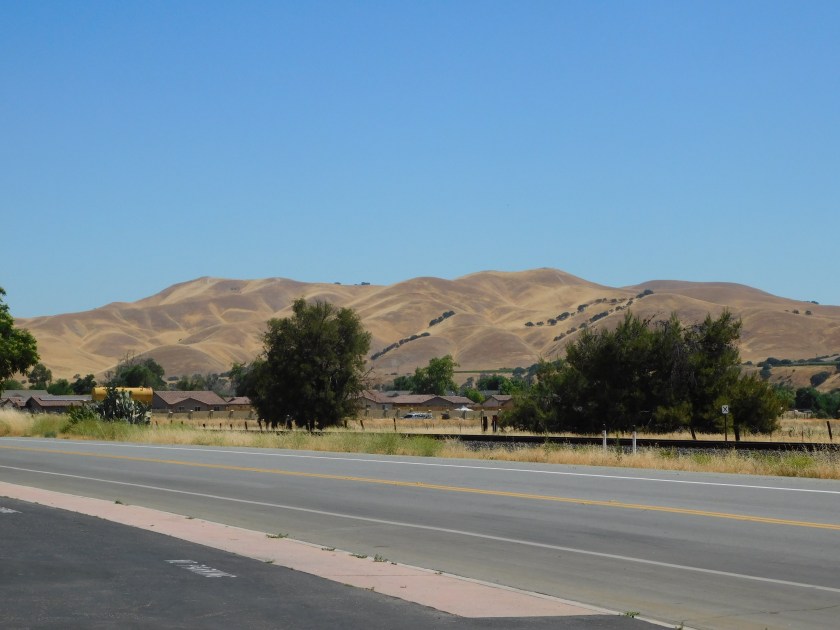
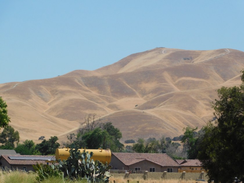
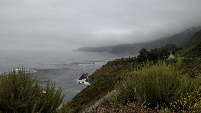
I drove past this big lake on the way to the Park.

IMG_20180618_100529140

IMG_20180618_100739851

IMG_20180618_103542935

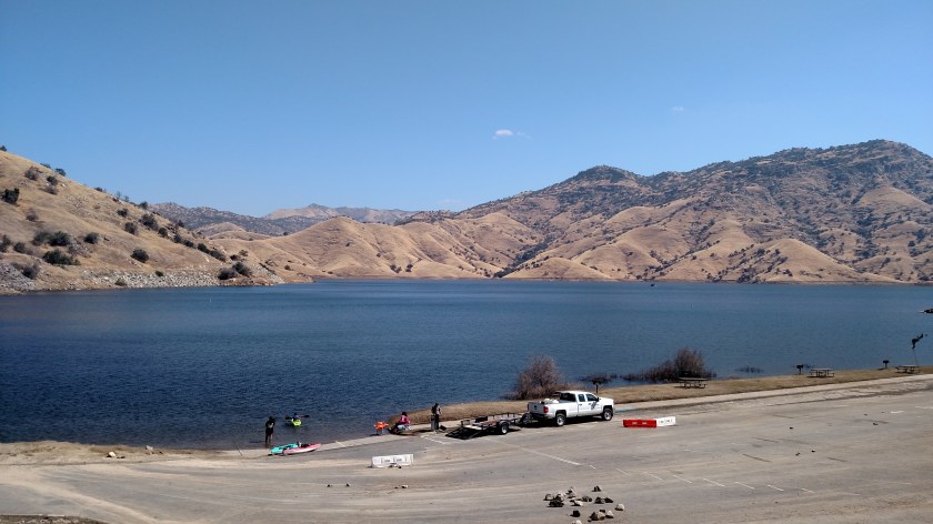
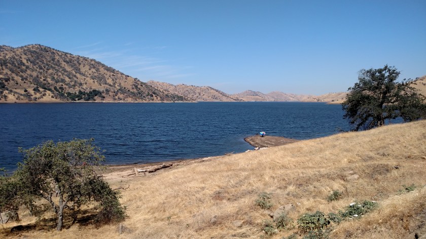
I would drive past the lake again in the afternoon on my way out of the Park, when I would see what I am quite sure was a bald eagle (white head, white tail, long black wings) flying above it.  I went back to find a legal place to stop and by the time I got in position it had risen way up above the lake, too far away to even zoom in for a picture.

Before getting to the Park I drove through the little town of Three Rivers.  I stopped there to get a sandwich to take into the Park so I could enjoy a picnic lunch.  When I got to the Park entrance there were signs warning of road construction, with hour-long delays at times.  When I stopped at the Visitor Center I saw a sign that said if I left there at quarter after the hour I would make it through the construction zone before the hourly closure.  I looked at my watch and it was 1116.  I hopped back in the car and resumed driving (obeying all speed limits in the Park, of course).

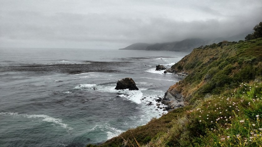
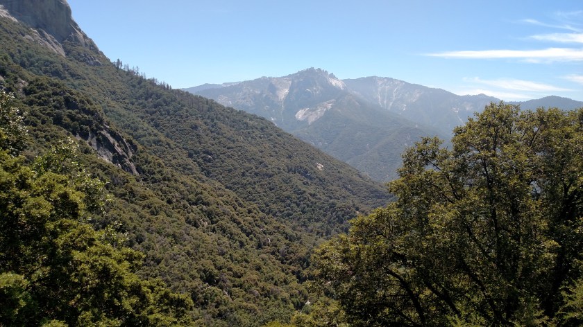
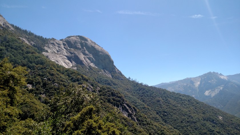
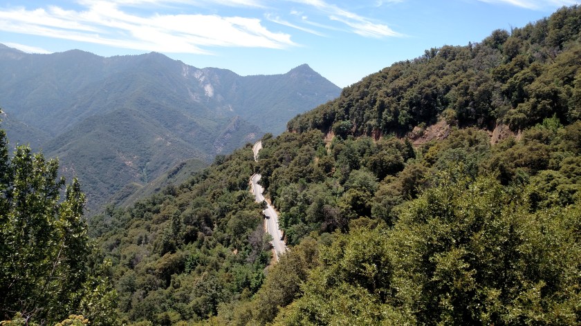
Well, I got up to the zone at 1146.  And sat in line.  I thought I had missed my window of opportunity.  I ate my picnic lunch sitting in my car.  I did get out and take these pictures while I was waiting.

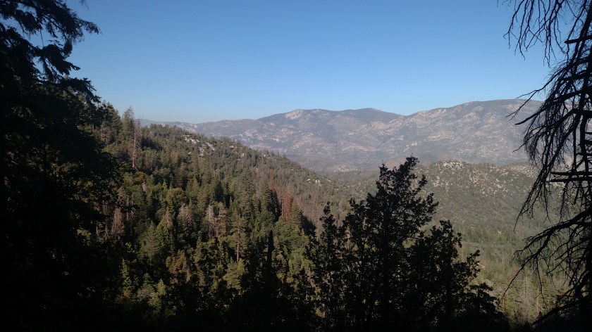
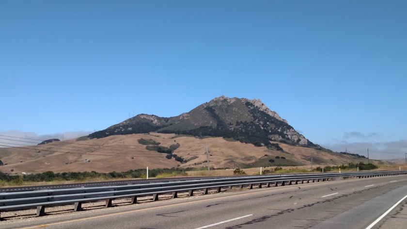
In the distance are the Castle Rocks, at 9,180 feet elevation.  (I was parked in the road at around 5,000 feet, I think).

IMG_20180618_115610237

And this is Moro Rock, at 6,715 feet elevation.

IMG_20180618_115614983

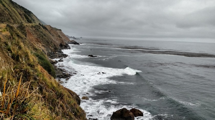
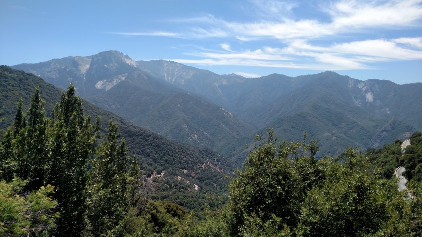
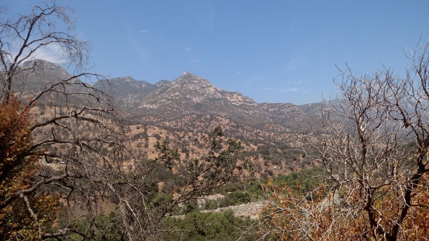
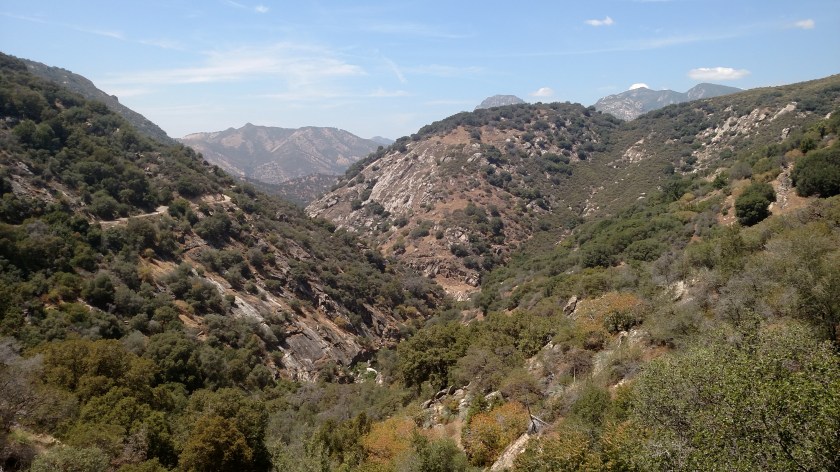
I turned around and started driving down the mountain.  I studied the map while I had sat waiting and discovered that I really didn’t intend to be where I was anyway!  I had planned to turn right after entering the Park on a road which dead-ended east of the Park, then go back and drive a scenic loop to the southeast of Visalia.  I was now on the road which goes northeast, deep into the Park, which I wasn’t planning to do to until Tuesday.

I stopped on the way down and took these:

IMG_20180618_120229943

IMG_20180618_120241613

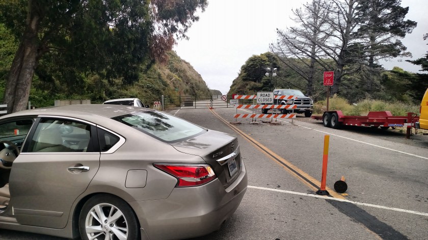
I stopped at the Visitor Center and told them they needed to fix their signs.  Turns out it was my error – I has misunderstood a large sign that told about the road opening at 1130.  I thought that was the target I was trying to beat.  It seems that the road opens on the hour, not the half hour.  The sign I saw was for 1130 PM, when they close the road for several hours at night and only open it once at that time.  I suggested they clarify the fact that during the DAY the road opens at the top of the hour.

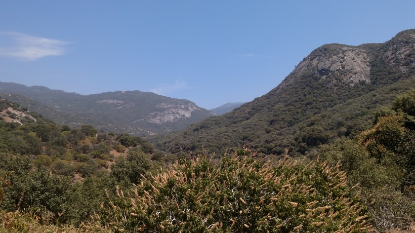
I also learned that the road I had been planning to take all along is outside the Park, about 2 miles before the entrance.  I exited the Park and went and drove part of it.  It was paved but not in very good shape, and was narrow.  I only went about half way back the full distance and decided to turn around and leave, as I wasn’t seeing anything really impressive anyway.  It’s a good thing I did, as the next road I planned to take took much longer than I thought it would and I had already wasted enough time…

Before leaving I did get these pictures:

IMG_20180618_133721658

IMG_20180618_135646517

IMG_20180618_135858832

As I was driving through Three Rivers I stopped to get this picture of a Paul Bunyan statue.  The sun was behind it when I passed it earlier.

IMG_20180618_143946725

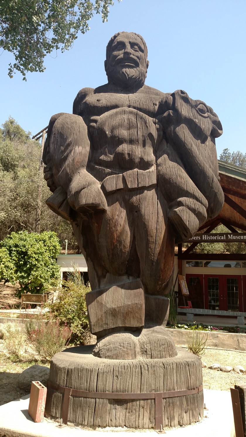
This was created in 1941-42 by Carroll Barnes.  It is 16 1/2 feet tall and 9 feet wide.  It was created from a single 200 year old sequoia log that weighed 40 tons (weight before cooking!).

Giant Sequoia National Monument

After exiting Sequoia National Park for the day on Monday (I will be back there for a full day on Tuesday) I drove south on a series of roads to get to the Giant Sequoia National Monument – South Unit, which is located south of the Park (and there is a North Unit north of Kings Canyon National Park).  Evidently these areas didn’t qualify for inclusion in the Park itself.  My plan was to make a big clockwise loop on a series of scenic roads before heading back to Visalia.

I suppose I should have stopped to take more pictures in the National Monument area but it evidently experienced a large fire years ago and many of the steep slopes towering over the road on which I was driving had been stripped of trees and vegetation and all that remained was dirt and large rocks – not a good combination on their own.  I could just imagine me standing there wearing my Safety Sam vest and holding my digital camera saying “Oh, look” while a 50 ton boulder came rolling down and squashed me like a bug.

I did get this photo looking back at the direction I had come, where the sun would soon be setting.

IMG_20180618_164911573

Actually, another reason I didn’t take many pictures is that I was afraid I was putting myself “on the clock,” a phrase I adopted last year when I would take so many pictures and talk to so many people throughout the day that it would be dark by the time I got back to where I was staying.  The loop I was making didn’t look all that long on the map but now that I was driving on it I realized it was a series of slow, winding mountain roads.  At least the roads were two lane, with a double yellow line down the middle – unlike the mountain road I drove on out by the coast which could barely accommodate two average sized vehicles opposing each other.

I drove up to around 6,000 feet elevation, twice,  and the temperature cooled from what it had been in the Park, so it was a very pleasant, if slow, drive.  After driving through the burned out areas the trees were plentiful and it was not unlike driving in the North Carolina or Virginia mountains.  Later in the drive there were some nice views of a big valley and big mountains off in the distance.

IMG_20180618_173106974

IMG_20180618_173203879

IMG_20180618_173718377

And today was my first experience this trip encountering cows in the road.  Many places in the West warn drivers of free-range cattle in the road.  As I was driving down one of the mountains there were some cows meandering in the road and I flashed my lights at a Sheriff’s truck coming the other way (uphill, into the setting sun) to warn him of the road hazard.

I did make it back home before dark, and will have a full day in Sequoia National Park on Tuesday.

5 week update

For those of you who are interested, Tuesday night, June 12 marked 5 weeks on the road.  So far on this trip I had driven 7,394 miles, compared with 9,984 in the first 35 days of my “Texas loop” last year and 14,654 miles on my Northwest trip last year.

My average per/gallon cost of gas has risen to $ 3.00 this year (no surprise, in fact I would have guessed it would have been higher) compared to $ 2.01 on the Texas trip (gas down there was dirt cheap) and $ 2.28 on the Northwest trip last summer.  I have been lucky to find some comparatively lower priced gas by shopping around and studying online price maps while at my Airbnb stops.  I use GasBuddy (both the app and online with my computer) and often know where I will buy gas well before I get to an area.  Gas prices in California vary widely and you really need to stay on your toes so you don’t pay too much.

Weekend Update

No, this isn’t going to be a post about Saturday Night Live (although for years WU is about the only part of SNL that I actually watch).  This is to update you on the last two days I spent here in California.  As you will find out, it was a rather low key weekend as evidenced by the fact that Saturday I only took 66 pictures and Sunday I took exactly 2 pictures (I normally take a few hundred every day).

Saturday was a travel day, as I went from near coastal Monterey to a town inland named Visalia.  The point-to-point distance between those two towns isn’t very great, and I will be staying in Visalia a whole week, so I intended to take advantage of one more day on the coast – beautiful Carmel, the 17-Mile Drive near Pebble Beach, perhaps the Monterey Aquarium.  None of that happened.  There was a heavy cloud cover when I left the house.  I postponed Carmel and the 17-Mile drive because of the cloud cover, hoping that it might burn off by mid-day (providing sunshine for better quality pictures).  I ruled out the Aquarium because it was too expensive, and I’ve been to some nice aquariums already.  When studying my maps I realized that I was neglecting the Pacific Coast Highway north of Monterey (towards San Francisco) so thought maybe I’d drive up that way and kill time and see how the weather for the day unfolded.

I drove north to Santa Cruz (whose college team mascot is a Banana Slug! Thanks to my friend Shawn, a frequent blog commenter, for bringing that to my attention).   I stopped at a Mission there and took a few photos but it was in a residential section of town and there were lots of telephone and electrical poles, wires, etc. and I have decided that the pictures aren’t blogworthy.  The cloud deck had also descended to the point where it was almost fog and there was a heavy mist in the air requiring me to actually use my windshield wipers at times.  Next I headed northeast toward San Jose, hoping to check out a Mission there.  Well, traffic bogged down and after crawling for about a half hour I decided to bail out and head back south on the PCH.  The section I covered earlier in the morning wasn’t nearly as picturesque as what I experienced between Los Angeles and Monterey.

Before getting back to the Monterey Peninsula I headed east to pickup “The 101” to make better time.  It became sunny where I was (which seems to happen when you get a few miles away from the water) but I could see that the coast was still socked in.  I drove south to the little town of Soledad.  There I found, you guessed it, another Mission.

This is the Mission Nuestra Senora de la Soledad, founded in 1791:

IMG_20180616_124539678

IMG_20180616_124559543

IMG_20180616_124611270

It sits out in the middle of a bunch of farmland west of the highway and away from town.  This Mission wasn’t very big, but it had beautiful flowers in the front.

IMG_20180616_124644488

IMG_20180616_124728404

IMG_20180616_124810178

I hopped back on the highway and continued south to Pinnacles National Park.  This small Park is the most recent to gain National Park status, I believe in 2012.  This was the only Park I have visited to date which was a disappointment.  Let’s just say it took longer to drive in and out of the access road than I spent taking pictures.  I drove in, took about 7 minutes taking pictures (which I have decided aren’t blogworthy either), and left.  There are two access roads, one from the west and another from the east.  The Ranger said it takes about an hour and a half to go around and go in the other side, and he said the photo opportunities were better on the side I was on.  Evidently this is more of a hiking Park than a “see the beauty from the road” Park.

When I got back out near the highway I could see in the distance that the coast was STILL socked in (it was now almost 2 o’clock in the afternoon) so I decided to head east to Visalia.


In Visalia I am very near the western entrances of both Sequoia and Kings Canyon National Parks, and I will be staying here an entire week.  I posted my blog in the morning and when I left the house around 10am it was overcast.  I drove downtown to stop at the Visitors Center (which wasn’t open on Sundays), walked up and down Main Street, drove out near the mall, got a haircut, got my car washed, and had lunch.  It was still cloudy so I decided to go back the house and clean up the interior of my car and do some rearranging of “stuff” in my luggage and belongings.  I wanted to get some different clothes than what I had been wearing out of the trunk, throw away paperwork and notes which I had been accumulating, and file away maps and brochures from earlier in the trip.  Then I took a nap!  When I woke up the sky had cleared but I never left the house (other than to sit in the backyard talking to my Airbnb host).  I spent the rest of the afternoon and evening talking my Airbnb host’s ears off.  Chris and Nicole are a nice young couple, both teachers on summer break, and I regaled them with stories of my travels, my blog, and my basic life history.

Monday I will go in Sequoia NP and, depending on how long I’m there, will drive some scenic roads south of Visalia.  Looking at the maps it looks like there aren’t many paved roads in either Park, although the one up in Kings Canyon is much longer and appears to be lots of winding, mountain roads.  My guess is that I can probably do both Parks in three days, but I may need to go back in if some photo ops are better in the afternoon than the evening.  I do plan to spend more than 7 minutes in each Park!

El Camino Real

When I was on “The 101” the other day my GPS unit reminded me that it is also referred to as “El Camino Real” (pronounce the last word as two syllables: re-AL).  That term is Spanish for “The Royal Road” and it is sometimes called “The King’s Highway”.  I had driven on a portion of this road when I visited San Diego a few years ago.

This is the symbol which you see many, many places along the road.  A bell, hanging from a lamppost.

IMG_20180615_122346477

Although this road is found in other places, in California it represents a 600-mile stretch of road which connects 21 Missions, several Presidios, and other places of historic significance.

Mission San Miguel Arcangel

Friday I headed north from where I had been staying in Nipomo as I would be spending one night on the Monterey Peninsula before heading inland to some of California’s National Parks on Saturday.  I drove north on “The 101” and stopped briefly in the little town of San Miguel.  Just off the highway I found my target.

This mission was established in 1821:

IMG_20180615_102915704

IMG_20180615_103511028_HDR

IMG_20180615_103729227

IMG_20180615_103924294

IMG_20180615_104605808

IMG_20180615_104650116

As I had been driving north on the highway I noticed a line of mountains off to my right.  These mountains looked very similar to some I had seen in southwest Idaho last year.  They are covered in tall, dry grass and, from a distance, look like they are soft and blanketed in velvet or velour.

DSCN1614

DSCN1615

DSCN1616

Mission San Antonio de Padua

After visiting the Mission in San Miguel I drove a little further north to the town of Bradley.  The California Department of Transportation website recommends that travelers take “The 101” all the way up to Monterey, then backtrack south on Route 1 (the PCH) to view the scenery north of where that road is closed.  I saw a nice shortcut using smaller roads, which I prefer anyway, that would take be out on the PCH much closer to the closure.

I exited “The 101” and proceeded northwest on State Route G18.  This would take me to the little town of Jolon, near the Fort Hunter-Liggett military base.  I didn’t want to see the base, but instead stopped at this Mission, which was established in 1771:

IMG_20180615_122710295

IMG_20180615_115639247

IMG_20180615_115701572

IMG_20180615_115720775

IMG_20180615_120350656

IMG_20180615_120302697_HDR

IMG_20180615_120905259

IMG_20180615_120937766


Getting to the coast (Subtitle: My GPS unit is trying to kill me)

After visiting the Mission in Jolon, CA I continued northwest on what would become Nacimiento-Fergusson Road.  This 24-mile stretch which would take me out to the coast starts out fairly level and is a beautiful, scenic road.  Eventually it becomes heavily wooded as it starts to climb the eastern side of the Santa Lucia Mountains and at this point becomes a narrow, winding mountain road with an increasingly steep grade.  Did I mention it was narrow?

There weren’t any places to pull over and stop until I had almost reached the top, and there were no houses or cell phone service, so good luck if you break down.  I quickly learned why this was not the posted detour to get back out to the Pacific Coast Highway.  Did I mention it was narrow?  There were places where I had to come to a complete stop when I met a vehicle coming the other way before we could squeeze past each other.  God forbid someone tries to drive this road in an RV or hauling a big trailer.  Did I mention it was narrow?

I finally reached the peak, at 2,780 feet elevation, and began my 7-mile descent to the coast.  It had been sunny on the east side of the mountains but the marine layer was still lurking on the west side:

IMG_20180615_132158556_HDR

The pictures don’t do it justice.  It became very thick and I did stop at few turnouts (there were more of them on this side) but it is hard to take pictures of fog.

This was looking down off the side of the embankment:

IMG_20180615_132729772

Oh, and this was when my GPS unit tried to kill me.  This side of the mountain had sharp curves (over 100, I read. Believe me, I didn’t take the time to count them), steep dropoffs and, most importantly, NO guardrails.  Bicyclists call this the “Death Road”.  At one point my GPS said “left turn ahead” and when I quickly looked down at it she wanted me to make a 90-degree turn left in 50 feet.  Which would have plunged me into the abyss.  I had already thought to myself “This would be a great place to drive off the road if you didn’t want anyone to ever find your car or your body”.  Don’t worry, my meds aren’t giving me suicidal thoughts as many apparently do according to the TV ads.

This was looking back up after I got below the cloud deck.

IMG_20180615_134241397

And this was when I could finally see the ocean below me:

IMG_20180615_133626530

Once I reached the PCH I could drive 8 miles south before reaching the point where it is closed for road reconstruction.

IMG_20180615_134846792

IMG_20180615_134925572

IMG_20180615_135348535

IMG_20180615_135430479_HDR

IMG_20180615_140020977

IMG_20180615_141001176

IMG_20180615_141231079_HDR

I finally reached the “end of the road”.

IMG_20180615_141707154

And if you thought the price of gas in Death Valley was outrageous, wait ’til you see this.  This is what the gas station in Gorda, about 200 feet from where I took the photo above, was charging:

IMG_20180615_141906123

I went on the California Consumer Affairs website to see if I could report this as price gouging but apparently those rules only come into play for 30 days after a disaster.  You can barely see it in this photo but the last customer wisely only bought 2 gallons.  But again, if you’re dumb enough to come here and need gas, you deserve to pay this price!

Pacific Coast Highway to Monterey

After reaching the point where I could not proceed further south I turned around and headed toward Monterey.  The coast remained overcast with the marine layer so the pictures don’t look all that great, but the scenery was still very impressive.

IMG_20180615_150412763

This next series of photos make me look stupid.  I know, I know – some of you are thinking, Well?….

When doing my research before embarking on this trip I had read about the Bixby Bridge, a very picturesque bridge along the PCH where a gazillion car commercials have been filmed.  As I approached this bridge I very carefully positioned myself at various points to take photos.  I just discovered to my shock and dismay that this is NOT the Bixby Bridge.  I did drive over it (the BB) later in the day (and I will admit I thought to myself – I wonder?…) but I believe this bridge was a lot more impressive, so let’s just pretend…

DSCN1636

IMG_20180615_151333295_HDR

IMG_20180615_151555697

There you have it – full disclosure.

Now I know I have this next one right.  Further up the road I came to Julia Pfeiffer Burns State Park.  While I’m sure the Park itself is very nice, most people (including me) never even go in through the entrance.  Outside the Park entrance, across the PCH, is this:

IMG_20180615_153416488_HDR

You may not notice it in the first picture, but allow me to zoom in some:

IMG_20180615_153423264_HDR

This waterfall cascades down on an uninhabited beach.

DSCN1653

As I resumed driving north my next point of interest came in the form of a big rock sitting in the ocean.  This is the Point Sur Lightstation, which sits atop a 361 foot tall rock.

IMG_20180615_160947251_HDR

DSCN1664

DSCN1666

And further up the road, before I got to Carmel, I saw this:

IMG_20180615_161931219_HDR

When I reached Carmel I hit Friday night rush hour traffic, complicated by road construction.  I had intended to spend some time in Carmel before going to Monterey but decided against it.  If the marine deck had dissipated I may have even gone back before the sun went down but alas, that will be what brings me back here someday.

Thursday morning

Thursday morning when I left the house it was overcast and foggy.  I kind of expected this might be the case in the mornings, this close to the water.  A woman I spoke with down in Santa Barbara (where I took the golf course picture on Wednesday) said the locals call this phenomenon the “June Gloom”.

I drove south from where I was staying in Nipomo down to Santa Maria.  I drove through town and, frankly, wasn’t terribly impressed so I just kept on going.  Rather than going back north on “The 101,” an often busy 4 to 6 lane highway, I opted to continue west and pickup Route 1, which I had driven up to Nipomo on the day before.

When I got to Route 1 I passed through a little town named Guadalupe.  I noticed something I hadn’t seen the day before when I drove through town.

IMG_20180614_082820912

This brought back another childhood memory.  I was born in a suburb of Chicago, Illinois and one of my childhood memories (we moved to Pennsylvania when I was 12) was of my father going out for Chop Suey, a Chinese food similar to Chow Mein.  I don’t often see Chop Suey on Chinese food menus, but I thought it was odd to see both Chicago and Chop Suey on a storefront in little Guadalupe, California!

Next up after Guadalupe was Oceano.  I was told I should drive out to see the sand dunes.  Well, it was overcast and windy, which made it quite brisk at 9am local time.

IMG_20180614_085235485_HDR

IMG_20180614_085314545

It wasn’t recommended that I drive my car out on the beach so I left and continued north.

When I got to Pismo Beach (say the ‘s’ like a ‘z’) Route 1 joined “The 101” and I continued north on it.  After branching off from “The 101” in San Luis Obispo it was sunny until I headed back out towards the coast and once again there was a heavy overcast.

I saw this mountain before getting out by the ocean (you can see the clouds in the distance):

IMG_20180614_102629352

Then it was cloudy and not conducive for much picture taking.

IMG_20180614_105930903_HDR