Antigonish, Nova Scotia

July 21, 2019

My short scenic drive Sunday ended in this little inland town (pronounced anta-goNISH) not far from the bridge which will take me over to Cape Breton Island tomorrow.

IMG_20190721_124156864

IMG_20190721_123419381_HDR

IMG_20190721_123430077_HDR

I finally found some plaid!!

IMG_20190721_123455987

IMG_20190721_123801986

IMG_20190721_123906477

IMG_20190721_124047656_HDR

IMG_20190721_124301046

I was hoping to drive a little further today but there were thunderboomies approaching from the west so I hopped on TCH-104 and scooted back over to New Glasgow, arriving there shortly before the rain let loose.  The storms were with a cold front which would lower the temperature and humidity.  The heat wave which has affected much of the eastern US made it up here too, though not quite as bad.  My two days in New Glasgow reached the mid to upper 80’s in the afternoon, somewhat unusual for this area.

New Glasgow to Antigonish, NS

July 21, 2019

Sunday I made a short road trip east of New Glasgow.  I headed over to Routes 245 and 337 to drive along the “shark’s fin”:

IMG_20190721_091825923

First stop – Arisaig where I found a harbor, a lighthouse and a lobster Interpretive Centre.

DSCN7871

DSCN7868

This is the current lighthouse, a replica of the original.  The first lighthouse was built here in 1895 and was modified a few years later.  It was destroyed by fire in the 1930’s.  Volunteers built this replica in 2007.

IMG_20190721_103134045

IMG_20190721_103806201

Next to the harbor there was a little restaurant serving Sunday brunch out on their deck.  Meet Killan who was entertaining the customers with some fiddle music.  I’m getting closer to Scotland every day….

IMG_20190721_104447970_HDR

This is the St. Margaret of Scotland church, across the highway from the road leading down to the harbor and lighthouse.

IMG_20190721_105240242

Further up the road was this canoe in a small pond on someone’s property.

DSCN7865

Further up the road were these pretty flowers.  Looks like a good opportunity to play “Go ahead, count ’em.  I’ll wait…”

IMG_20190721_110209246

IMG_20190721_110218540

Up at the top of the “fin” I found the Cape George lighthouse.  It is the third one to exist at this location, the first one having been built in 1861.  It sits 360 feet above sea level (I was surprised to see the sign state feet and not meters).

IMG_20190721_112319155

Around the bend from Cape George is Ballantynes Cove, with – you guessed it – a harbor AND a Bluefin Tuna Interpretive Centre.

DSCN7873

IMG_20190721_115310723

For an interpretive centre I didn’t find it very informative.  One of the three things I learned was that the a lens for the Cape SAINT George lighthouse in Newfoundland was inadvertently delivered here to the Cape George lighthouse back in 1908.  Oops.

IMG_20190721_115347018

IMG_20190721_115403760

Second – meet Jenna Gavin, who at age 12 landed this 618 pound bluefin tuna in 2014.

JennaGavin

(Photo credit: cbc.ca)

The third thing: Congratulating Jenna is Ken Fraser (they are both local residents) who himself landed the world record 1,496 pound bluefin tuna back in 1979 – a record which still stands today.  Talk about a “Big Kahuna Tuna”….

KenFraser

(Photo credit: marlinmag.com)


Memory Lane, Lake Charlotte, NS

July 20, 2019

As I was driving east on Route 7 on my way to New Glasgow I came to the little town of Lake Charlotte where I found this roadside attraction.  It is a retro 1940’s village that takes you back in time.  Most of these buildings were transported here from other parts of the province.  Admission for seniors was only $6 so I ponied up some cash and went in to check it out.  Many of the buildings were open but I only went in a few of them.

IMG_20190720_100509850

This was inside the Hocking General Store (Entrance)

IMG_20190720_101113323

IMG_20190720_101123096

The Village garage and gas station:

IMG_20190720_101717316

And by the way, up here in Canada Esso is still called Esso, not Exxon.

The Clam Harbour United Church:

IMG_20190720_101820179

The Little Harbour one room schoolhouse:

IMG_20190720_101839690

The Family barn/garden shed:

IMG_20190720_101929915_HDR

The ice house:

IMG_20190720_102032680

The residence (Webber House):

IMG_20190720_102106401_HDR

The Norm Hutt boat house:

IMG_20190720_102233912

IMG_20190720_102213150

IMG_20190720_102152398

And the fisherman’s storehouse:

IMG_20190720_102317947

IMG_20190720_102350190

There was also a dining hall which served food but I was there before it opened.

IMG_20190720_102600789_HDR

If you like what you see grab your passport and get up here Saturday, October 10, 2019 for the 16th Annual Atlantic Canada Harmonica Festival!


Halifax to New Glasgow, NS

July 20, 2019

Saturday I would head east from Halifax, going further out beyond the scenic roads I drove on yesterday to see more of the southern coast before going north across the province to New Glasgow, the Birthplace of Nova Scotia.

IMG_20190721_054218259

I took the expressway, NS-107 (the blue road), back out to Musquodoboit Harbour (where it ended) and resumed my drive east on scenic Route 7.  I went as far as Sheet Harbour where I turned left and headed north on Highway 374 which would take me to New Glasgow.

If you had asked me that morning what things I might see along the way this would not have been amongst my guesses.  Just before entering the little town of Head of Jeddore I saw these along the road:

IMG_20190720_093436549

Evidently someone is a big “The Simpsons” fan…

These large wooden signs were on both sides of the road, at a kid’s entertainment facility (mini-golf, bowling, etc).

IMG_20190720_093257248

IMG_20190720_093316500

IMG_20190720_093511919

IMG_20190720_093714084

They were spot on.  Looked exactly like the TV characters.  There were a few other things there as well:

IMG_20190720_093351877

Slip inside this costume and you might be chosen to be Marvel Comics next superhero – Grasshopperman???  or woman???

IMG_20190720_093405554

This is a cube shaped rock painted as a Rubik’s Cube.  On NS-107 I had also seen a huge, cube-like rock painted as a die (1/2 of a pair of dice).

IMG_20190720_093837472

There was a house behind the facility and I saw a young couple outside.  I went over to ask if they had done the artwork and the woman said it was all done by her father.

Ready for more water pictures??  One of my sisters-in-law already asked me if I’m bored with water scenes.  I admit they are all kind of blending together but today I saw some exceptionally nice views.  I actually took photos of more but the ones facing into the sun were kind of washed out so I only picked the best ones.

IMG_20190720_094425668

IMG_20190720_094815765

IMG_20190720_095355662

The photo above was taken near a bridge, looking inland.  You can see the water rushing in very quickly, creating several small whirlpools.

IMG_20190720_095434545_HDR

Standing there watching it I could actually the effect of the water coming in sucking in standing water from the right side.

IMG_20190720_095805197_HDR

IMG_20190720_110701123

IMG_20190720_111413058

After getting to Sheets Harbour I proceeded north, passing care-free through my first RCMP (“the Mounties”) speedtrap.  I had my cruise control set right on the speed limit (90 km or roughly 56 mph).  Everything is Canada is metric so distances and speed limits are stated in kilometers.  I set cruise control on the highway but am having trouble not exceeding the lower limits going in and out of small towns (which I do alot of on my smaller, scenic roads).  When I see a sign that says 50 (they only show the digits) my first instinct is to go 50 mph (but they mean 31 mph..).  Route 374 was a pleasant drive, not unlike roads in eastern Pennsylvania or western North Carolina.

I had to chuckle when I arrived in New Glasgow and saw this sign attached to a utility pole:

IMG_20190721_094255863_HDR

IMG_20190721_094314796_HDR


Looks like I’m getting closer to “Celtic country” after all…

After stopping to say hello to my Airbnb hosts I set out for a late lunch and a scenic drive west along Route 6, along the water (I thought) to Amherst, near the border with neighboring New Brunswick.  It ended up being more inland than I expected (look closer at the map, dummy!) but it was still a pleasant drive.

IMG_20190721_054236593

Once I got to Amherst, which I had stopped in my first day in Nova Scotia, I hopped on TCH-104 (the Trans-Canada Highway) for a faster trip back to New Glasgow.  I cruised through another RCMP speedtrap on it as well but once again escaped unscathed.


Halifax & Dartmouth, Nova Scotia

July 19, 2019

IMG_20190721_054140671

Friday I backtracked along the route I had come in to Halifax on to stop at another memorial site which I missed the turnoff for yesterday – this one for the SS Atlantic.

On April 1, 1873 that ship, carrying an estimated 975 passengers, ran aground near the small town of Terence Bay (lower left corner on the map above).

SS Atlantic photo

(Photo credit: theglobeandmail.com)

SSAtlantic

(Photo credit: ssatlantic.com)

The ship, aka RMS Atlantic, was owned by White Star Line (the folks who brought you the also-ill-fated Titanic).  She was sailing from Liverpool, England to New York City.  The ship could be propelled by sails and/or coal-generated steam.  It was a dark and stormy night, to borrow that phrase, and the sails were useless against the strong currents of the storm.  The captain, fearing that they might not have enough coal on board to make it to New York, ordered the ship to stop in Halifax, a port with which both he and the crew were unfamiliar.

The ship was off course and ran aground at 315 am local time on what is now called Mars Head, near the towns of Lower Prospect and Terence Bay.  Lifeboats were lowered but they were all carried off or destroyed by the heavy seas.  Because they were close to shore some of the passengers and crew were able to make it to land and an estimated 562 people died, including all the women and all but one child.  It was the worst maritime disaster in the North Atlantic prior to Titanic and remains the worst Canadian maritime accident of all time.

IMG_20190719_102039682

IMG_20190719_102621566_HDR

IMG_20190719_102540044

IMG_20190719_102704903

IMG_20190719_102747183

IMG_20190719_102945985_HDR

Another moment of silence, please…


Next I headed over to the east side of Halifax to drive on some scenic roads near the ocean.  Before that – lunch.

I was in Halifax and wanted to try their tasty snack – a Donair.  This is similar to a Greek Gyro – a large round of pita bread wrapped around meat, tomato, onion and drizzled with garlicky white Donair sauce.

halfiax-donair

(Photo credit:  Mr. Donair – a fast-food chain, not a person)

Mr. Donair (chain) claims to have created the Donair in the early 70’s, naming it after the Turkish doner.  I ate at a chain called King Donair (“the King of Donairs”) which claims to have introduced Canada to the Donair in 1973.  Boys, boys… don’t make me stop the car…

A Donair is stuffed with Donair meat.   Hmmmmm….  That makes me a little nervous.  Is it from a Free Range Donair??  Cage-Free, perhaps??  And the “secret sauce”??  What’s THAT all about??

The meat is supposedly beef, cooked on a vertical spit and shaved off to place on the pita bread, then curled up with one open end.  The entire thing is then wrapped in aluminum foil.

IMG_20190719_111428878

Mine was quite messy but wasn’t terrible.  My mother would have said “It’s not something I’d miss…”

I resisted the temptation to don one of King Donair’s crowns while I was eating:

IMG_20190719_111347452

After lunch I drove out several small coastal roads (shown in yellow on the map) as far as Musquodoboit Harbour, then south to spend some time overlooking the ocean at Martinique Beach.  I then drove back up to NS-107 (shown in blue) to return to town.  It is a 2-lane, limited access highway with a much higher speed limit.

Close to town I drove to the north side of the city of Dartmouth, stopping at Lake Banook.  It is home to both the Mic Mac Amateur Aquatic Club and the Banook Canoe Club.  There are lots of buoys out in the lake to create “lanes” to help keep all the boaters organized and avoid collisions.  There was a nearby gondola where I could watch the boaters from the shade.

IMG_20190719_152342677

IMG_20190719_152350283_HDR

IMG_20190719_153926917

IMG_20190719_153933893

After watching the boaters for a while I drove up and around another big body of water (the Bedford Basin) and back down to the south side of Halifax where I was staying.


Lunenburg to Halifax, Nova Scotia

July 18, 2019

IMG_20190718_170355567

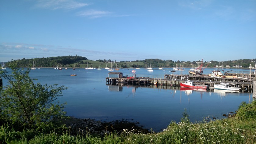
Thursday morning I awoke in Lunenburg and had this view of some of the small boats in the harbor from my window:

IMG_20190718_063757104_HDR

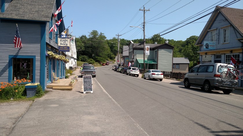
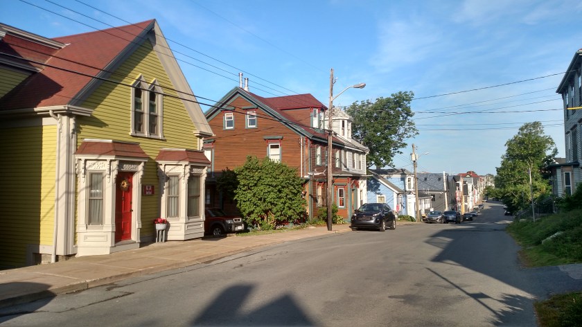
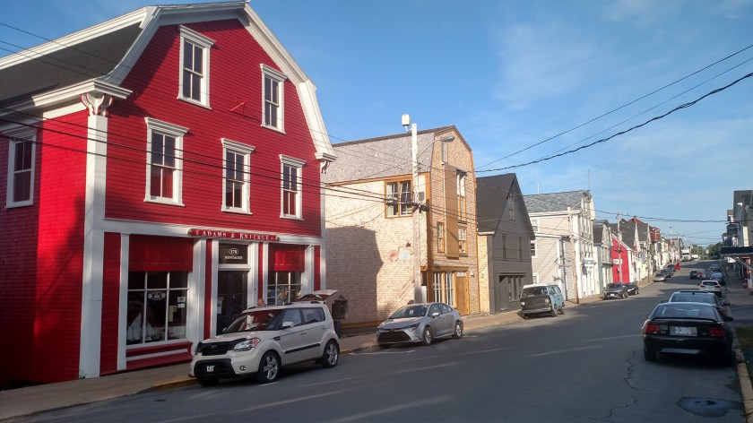
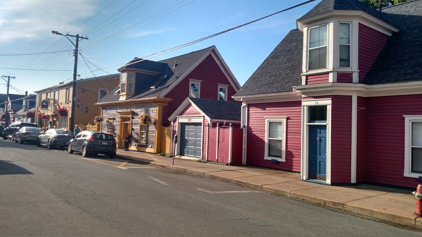
I walked around downtown and the harbor area for about 2 hours.  Lunenburg is a very colorful town, with many brightly colored houses and businesses, trendy restaurants, antique shops and art galleries.

IMG_20190718_074313676_HDR

IMG_20190718_074519035_HDR

IMG_20190718_080012188_HDR

Near the harbor I found this aerial view of the town:

IMG_20190718_074810061

I also walked along the harbor, though most docks were private and off limits.

Here is a better picture of the smaller boats:

IMG_20190718_074137726

And there were some big ones here, too:

IMG_20190718_075206545

IMG_20190718_073854700

There is a cruise ship, the Bluenose II, which is supposed to be based here but I couldn’t find it.

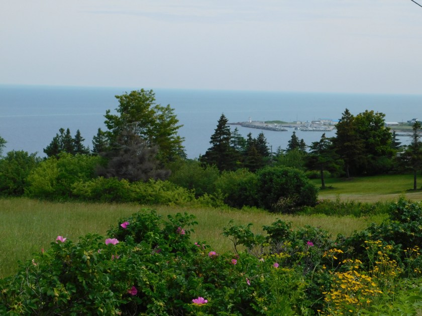
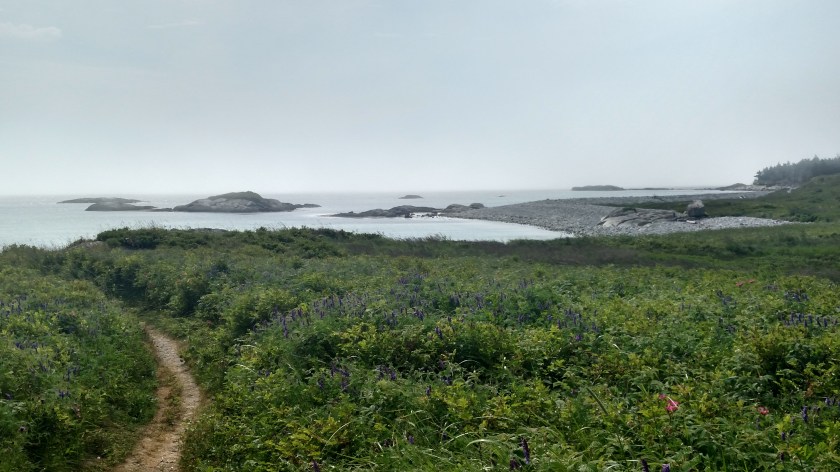
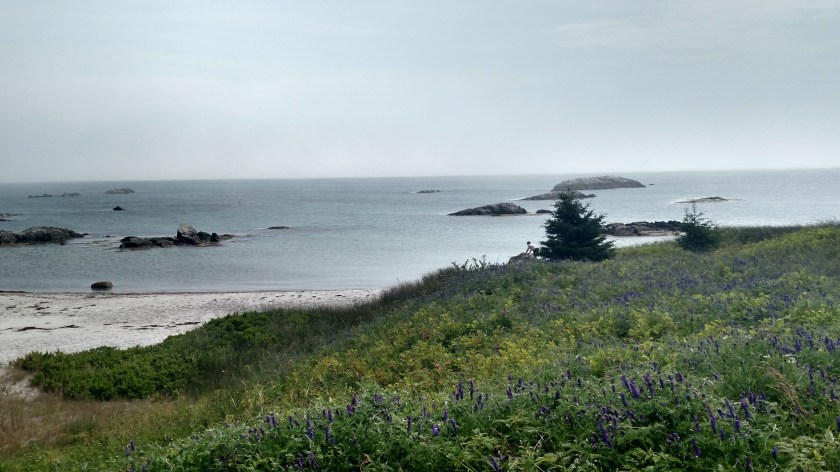
After completing an errand in town for a friend, I headed south to the tiny town of Blue Rocks.  Evidently this town and view is popular with artists.

IMG_20190718_103543052

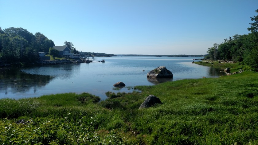
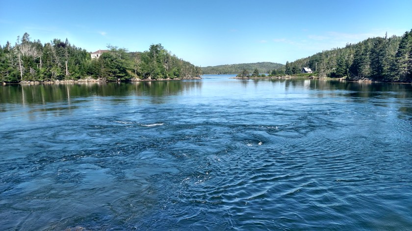
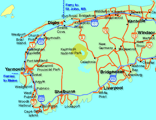
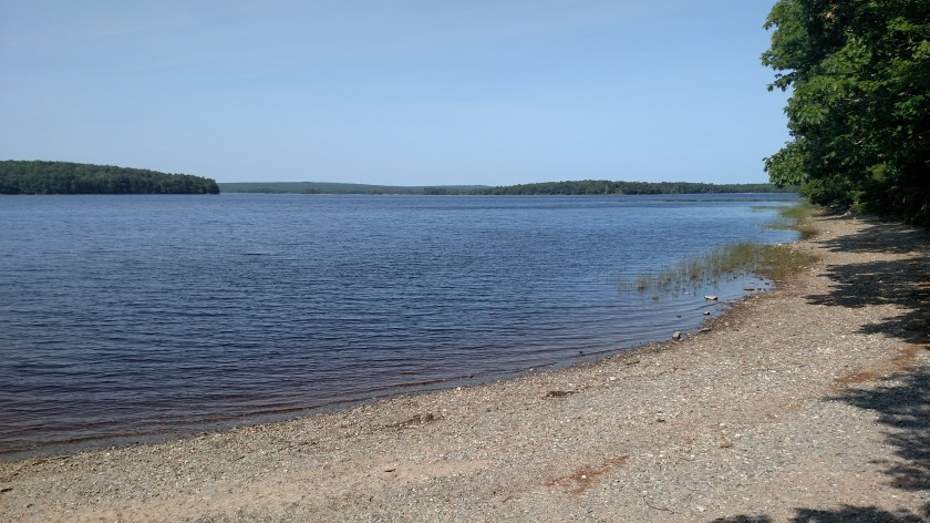
I then began my scenic drive which meandered along the coastline.  I made my next  stop in the town of Mahone Bay.  The popular photo op there is of these three church steeples:

DSCN7850

It took me a while to find the ideal spot to take the photo but there it is.  Paintings often have them closer together but this is how they appear in real life.

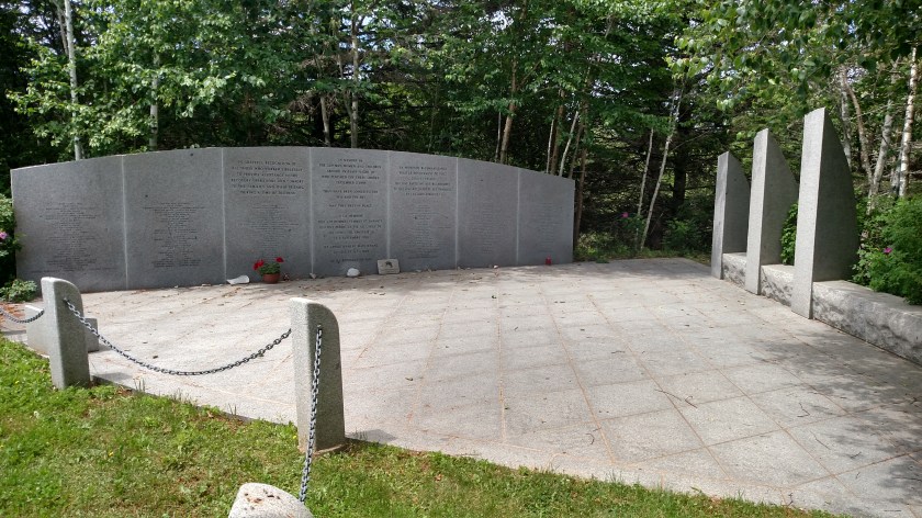
Next I came across a memorial near the little town of Baywater.  Swissair Flight 111 crashed into the ocean about 5 miles offshore around midnight on September 2, 1998 killing all 229 people aboard.

IMG_20190718_122051163

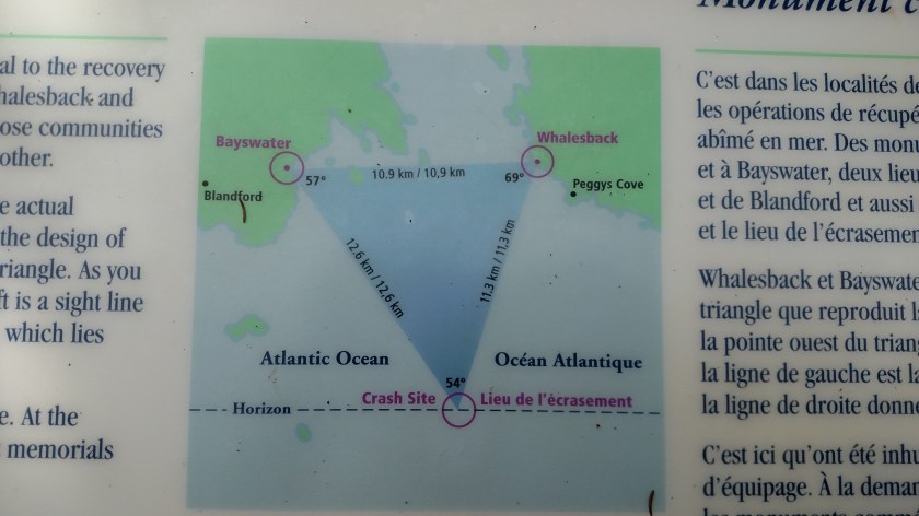
The memorial is in the shape of a triangle because the crash site triangulates to land locations here in Baywater and over in Whalesback (there is a similar memorial there).

IMG_20190718_122006711_HDR

IMG_20190718_121932287

The flight had taken off from New York bound for Geneva, Switzerland.  Shortly after takeoff a fire developed onboard and the captain requested rerouting to Logan airport in Boston.  He was advised that Halifax airport was closer but the fire had gotten out of control resulting in loss of flight control and knocking out the data to the flight recorders about 5 minutes before impact.  It is believed to have plunged into the ocean at high speed.

A moment of silence before moving on please….

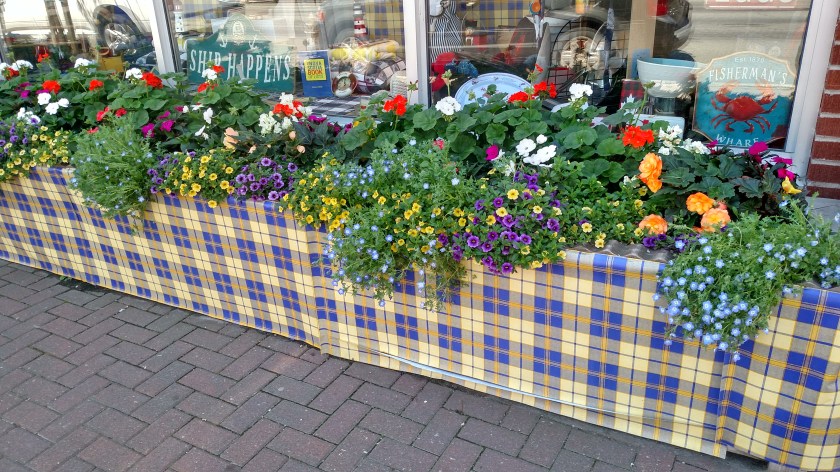
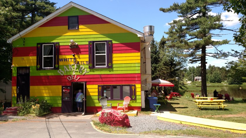
Next I had lunch at a colorful little deli in Tantallon:

IMG_20190718_133744628

I tried something new – a Montreal Smoked Meat sandwich, and a small bowl of split pea soup.  The sandwich was very much like corned beef.  It wasn’t really a soup day but I order pea soup just about every time I see it offered and it was very good.  I resisted buying any sweet treats.  I did stop at a bakery in LaHave for treats a few days ago while waiting for a ferry on the way to Lunenburg (I forgot to tell about it in that post). In addition to an awesome cranberry muffin I had a raspberry coconut bar which was to die for.  I will have to look up the recipe and try making them at home.   For some reason the ferry there is called a “cable ferry” and I had visions of my car being attached to cables, like a zipline, to be thrust across the river but it ended up just being a regular ferry like the ones I have been on already.  Ho-hum.  Someone really needs to think about the zipline idea – it would be much more memorable.

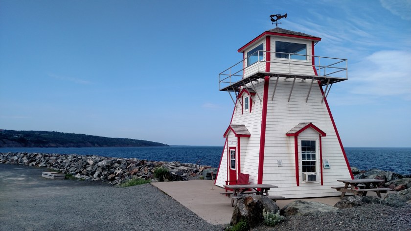
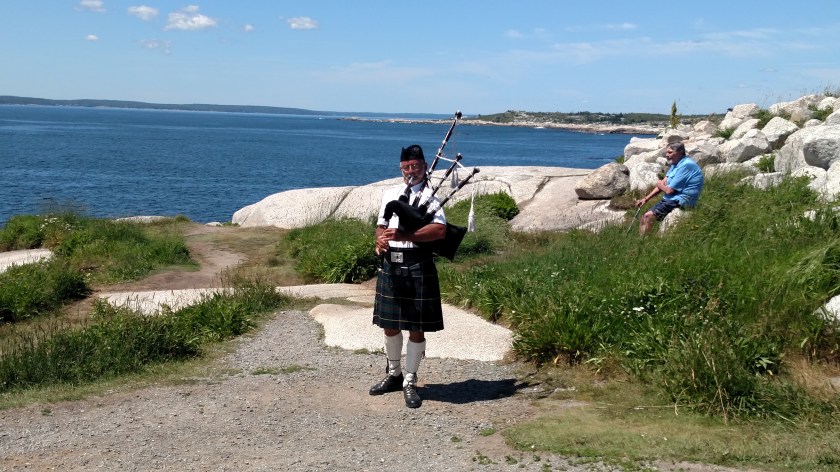
Next I drove past Whalesback and stopped at Peggy’s Cove, a popular (almost too popular) tourist spot which had so many people wandering around along the narrow road that it was a very slow drive in.  For me the big attraction here was the lighthouse.

IMG_20190718_140625985

DSCN7858

Nova Scotia means “New Scotland” and there are supposed to be lots of people from Scotland and Ireland living in the province.  I was expecting to see lots of plaid, family crests and experience Scottish strathspeys, Acadian jigs, Celtic rock and Ceilidh (pronounced KAY-lee) but the first sign of anything Scottish was this guy playing bagpipes near the lighthouse.

IMG_20190718_140953496

I suspect that as I get further north, especially towards Cape Breton Island in northeast Nova Scotia, that my wishes will be fulfilled.  The kid at the Tidal Bore visitor center in Truro already told me that I might experience a Ceilidh at a place he recommended for lunch up there.

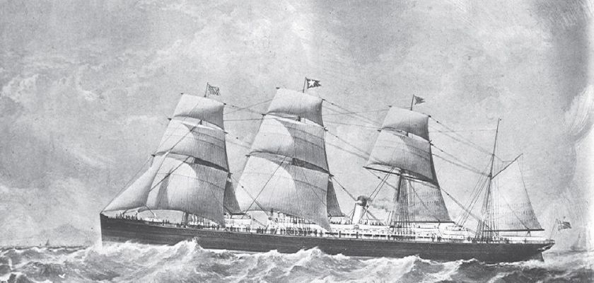
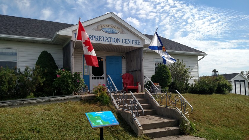
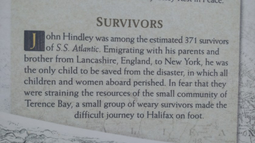
I actually breezed right past another memorial on my way in to Halifax but I backtracked to see in on Friday and I will post information about it separately.

Halifax is a much bigger city than I was expecting and I was somewhat unprepared and intimidated so I scooted down to my Airbnb south of town in order to avoid rush hour and checked in early, washed a load of laundry and got caught up on some blog posts.

Digby to Lunenburg, Nova Scotia

July 17, 2019

IMG_20190718_170340025

Wednesday I drove from the Bay of Fundy side of Nova Scotia down to the Atlantic Ocean side. I went southeast on Route 8, past Kejimkujik National Park (stopping again at the big lake briefly to study my notes in solitude) to the town of Liverpool. From there I drove west to Keji’s Seaside location (see separate post), then went back northeast and took one of my trusty scenic routes from Liverpool back and forth out along the water, ending the day in beautiful little Lunenburg.

I had intended to drive out around the extreme southwest end of Nova Scotia on a series of coastal scenic roads (indicated on their map, not mine) but my Airbnb hostess talked me out of it. She said there really wasn’t much to see and that many of the coastal areas around Yarmouth are private property and people don’t want visitors stomping around taking pictures. She also said it would take an inordinate amount of time and in hindsight I think she was right. The only big thing I know I missed by taking the Route 8 shortcut over to Liverpool was seeing this unusually shaped lighthouse at Cape Fouchu, near Yarmouth:

CapeForchupic

(Photo credit: novascotia.cioc.ca)

Several times today I saw little village signs as I drove which were different from ordinary signs I generally see. Here are two of the more interesting ones:

IMG_20190717_084025792_HDR

IMG_20190717_123702282_HDR

When I arrived in Liverpool I enjoyed my first dose of “timbits” during this trip. For those of you who don’t know what I’m talking about – in the United States we have Dunkin’ (Donuts), a chain of shops which have doughnuts, coffee and other breakfast fare. Well in Canada, and lucky portions of the upper Midwest and northeast US, there is a Canadian chain called Tim Hortons. Dunkin has “Munchkins,” tiny round doughnut-holes you can pop in your mouth and eat in one bite. Tim Hortons has “timbits”. If I do say so myself, I have shown incredible discipline in not going to Tim Hortons every day I have been in Canada but today I was weak and stopped in for a box of 20 assorted timbits. They were fresh and yummy!

My current Airbnb host just told me that Krispy Kreme, which we swear by in North Carolina, tried to make a go of it in New Glasgow but couldn’t compete with Tim Hortons.  I also meant to mention that as I was leaving Tim Hortons the other day with my “tidbits” bounty I noticed a sign in the inside of the exit door saying “See you tomorrow”.  Ah, the power of suggestion…

Moving on – just before driving through West Berlin I saw this this amazing tree in someone’s yard. I turned around and went back to take this photo (which doesn’t accurately reflect how stunning it was, especially in bright sunlight against a green background looking at it from the road in the other direction). I donned my Safety Sam best for the first time this trip and proceeded to take pictures.

IMG_20190717_122054225_HDR

The gentleman who lives in the house came out when he heard my car door shut and asked if I was having difficulty. I said no, I was just taking pictures of his tree. I asked if he knew what kind it is and he said it’s a dogwood. That kind of surprises me because we had dogwood trees in Pennsylvania and I never remember seeing trees that were this prolific with flowers. He said the mayor of his town encouraged people to plant them many years ago, and even provided the plants. Here is a closeup of the blooms:

IMG_20190717_125013843

It is from a different, but equally beautiful tree (I did see a lot more further up the road). Thinking back to when I was growing up in PA I think the dogwoods there were white, not pink.

Further up the road my little scenic road took me to Port Medway and I followed the signs out to see their lighthouse.

IMG_20190717_134612379_HDR

IMG_20190717_134706911_HDR

I spent a long time speaking with one of the co-owners. He and a group of friends bought the lighthouse several years ago and it was moved to this location. They are renovating it and it looks great. They’ve already spent more than $ 30,000 in removing and replacing 2 of the exterior walls which had fallen into serious disrepair. There were two artists set up on the property painting.

I ultimately made it up to Lunenburg where I would be spending the night before continuing on to Halifax. I arrived at my Airbnb earlier than usual (in light rain which had just moved in) because I wanted to try and get caught up posting the blog after delays in Granville Ferry. While I was working the house cat snuck in my room and took a nap on my bed, behind me as I was sitting at a table working.

IMG_20190717_185322931

I looked again about an hour and a half later and she was still racked out.

IMG_20190717_203233231

Kejimkujik Oceanside

July 17, 2019

Wednesday I left Granville Ferry and headed southeast past Kejimkujik National Park (stopping there for a while to study my scenic road book for the day’s activities).  Continuing southeast on Route 8 I reached the town of Liverpool, along the Atlantic coast, about an hour later.  I then drove southwest on 2-lane, controlled access NS-103 and exited near the town of Port Joli.  A short drive out to the water and I arrived at Keji’s coastal location.

To complement the main Park which is way inland, a location next to the ocean to help reflect Nova Scotia’s 4,600 miles of coastline was established.  An adjunct was recently added adjacent to the original seaside Park to help protect two estuaries.

There are two walking trails from the parking area out to the ocean (and this is a good opportunity to mention that since leaving Maine earlier this trip, photos of large, non-lake bodies of water were the Bay of Fundy, or it’s sudsidiaries.  From this point forward, at least until I reach Quebec province, they will now be the Atlantic Ocean).  I opted for the shorter walk (still a hike) out to Harbour Rocks.  A lengthier route which went out and around Port Joli Head was longer than I wanted to walk, and was rated as “Difficult”.

This was a view as I drove in towards the parking lot.

IMG_20190717_095637038_HDR

When I got to the unattended entry kiosk there were several warning signs, among them:

IMG_20190717_100733819

I was there on July 17.  About halfway out to the water a family overtook me on the walking path (I had stopped to photograph some flowers).  A boy about 12 years old asked me what his chances were of encountering a bear.  I told him it was possible but probably unlikely.  I also relayed the tips I read at the entrance:  Make yourself big (waving your arms and making noise), always look the bear in the eyes (backing away if you need to), and NEVER turn and run.  I didn’t tell him that if he did run he shouldn’t run any faster than me!

Someone later told me (and I subsequently read online) that this oceanside location was recently closed for a period of time due to increased bear activity.

I finally made it to within sight of the water – trust me, it’s out there:

IMG_20190717_104428707_HDR

There was just a hint of coastal fog that literally burned off within a few minutes of my taking that photo.  It had been generally overcast but now the sun was shining brightly.

IMG_20190717_104959659_HDR

There was a small beach area open to the public:

IMG_20190717_105011550_HDR

IMG_20190717_105006405_HDR

You can just make out the kid that asked me about the bear to the left of the bigger pine tree, up on a large rock.

Further north there appeared to be a much larger beach area but signs indicated it was off limits to visitors.  Protected Piping Plovers (say that 3 times fast…) are nesting, and I think sea turtles are too.

IMG_20190717_110802187

Because of on-site research, visitors are not allowed off the trails unescorted so there wasn’t anything else here to see or do and I headed back to my car.

Bear River & Digby Neck

July 16, 2019

DigbyMap

(Photo credit: shinealightblog.wordpress.com)

Tuesday morning I set out from Granville Ferry (east of Digby and north of Annapolis Royal on the map above) to drive to Kejimkujik National Park, about a half hour south.  This was the view looking east near the bridge I had to drive over to get to Annapolis Ferry:

DSCN7822

This is an osprey, guarding her nest on a utility pole right next to the parking lot where I took that photo.  I had heard her up there squawking the night before when I had stopped to view the river.

DSCN7818

Once I was done at the Park (see separate post below), and at the suggestion of my Airbnb hostess, I took a series of small roads to the little town of Bear River (not shown on the map but located diagonally between the 8 above the Park, denoting the highway number, and the town of Smiths Cove, just south of Digby).

IMG_20190716_120918379

IMG_20190716_120951282_HDR

IMG_20190716_121127742

The buildings on the right in the photo above are all built on stilts, as seen from this view from the other side of the river:

IMG_20190716_122323419

Bear River is hosting their annual Cherry Carnival this weekend.  In addition to pie eating and pit spitting contests the highlight of the carnival is the Greased Log competition, where a telephone pole is liberally coated with grease, placed in the river and contestants are given a prize if they can successfully walk all the way across it.  Evidently it is quite a hoot.  My Airbnb hostess very enthusiastically told me about it, as did a gentleman who I met while taking these photos who has lived here all his life.

After seeing Bear River I drove up through Digby and out onto Digby Neck, a long, thin peninsula which juts out into the Bay of Fundy, parallel to the mainland.  I stopped at Lake Midway Provincial Park where I saw this guy kayaking back to where his wife and daughters were picnicking nearby:

IMG_20190716_134900823

Next stop was Sandy Cove on the inland side of the peninsula.  This photo was taken at 205 pm, on my way west:

IMG_20190716_140518318

And this is the same scene at 455 pm as I was returning to Digby.  You can see how much the receding tide had dropped in the meantime:

IMG_20190716_165534434

Next stop as I drove west was the ferry which would take me across the “Petite Passage” over to Long Island.

IMG_20190716_145457387_HDR

IMG_20190716_143726820

I drove all the way across Long Island to the town of Freeport.  I could have taken another ferry across the “Grand Passage” to Brier Island but decided not to.  One thing I missed by not going was a chance to see this lighthouse in person:

Brier_Island_Lighthouse_(1)

(Photo credit: en.wikipedia.org)

I drove back east on Long Island and stopped to see Balancing Rock.  This involved a long walk out a dirt path and wooden walkway to a long set of stairs (235 of them) which would take me down to the water’s edge.

IMG_20190716_152421201

Here is the reward:

IMG_20190716_152617631

What you are seeing is a columnar basalt sea stack, about 30 feet tall, which is perched precariously on the rock below.

IMG_20190716_152624926

IMG_20190716_153123496_HDR

The signage on-site teases the viewer about the weight of the column but I can’t find the exact number online.  Legend has it that a fisherman once tied a rope to it and tried to topple it without success.  According to the sign a cubic meter weighs 3 tonnes (slightly more in US tons).  Evidently the column weighs several tons.

Feeling exhilarated, the climb back up those 235 stairs wasn’t as bad as I was expecting.

Kejimkujik National Park

July 16, 2019

Don’t be intimidated by all those k’s and j’s.  Just stick an ‘a’ right in the middle of it and it is pronounced pretty much just how it looks.  keji-ma-COO-jik.  I will explain the origin of the name later in this post.

“Keji,” as it is called by the locals, is about a half hour southeast from where I was staying in Granville Ferry.  It is an inland, heavily wooded park with a huge lake on the eastern side of it, featuring many islands of all sizes.  There are also lots of smaller lakes in the Park.

Keji map

(Photo credit: pc.gc.ca)

Here is a photo of the map I was given at the Visitor Center:IMG_20190718_202448914

The map doesn’t show the entire lake or park, only the main road which goes down the eastern side of the lake.  I drove to the last parking area inside the “box” in the photo.  There were only two vehicles in the parking area when I arrived and there wasn’t a soul in sight.

IMG_20190716_101701889

IMG_20190716_101706436

IMG_20190716_101714308

From pre-trip research I knew there wouldn’t be much for me to do here but I sat for a long time just enjoying the solitude.  There are lots of hiking trails and camping areas.  But they say the best way to see Keji is from the water.  This is paradise for canoers and kayakers.  It is also a great place for stargazing as it is in the remote southwest end of Nova Scotia and is well protected from light pollution.

Later in the morning some other folks arrived – a young family with two kids who frolicked in the water, another couple with two dogs who thoroughly enjoyed playing fetch in the water at the far end of the beach, reserved specifically for pets, and four ladies who arrived with their canoe who were about to embark out to one of the islands to spend the day.  One of the ladies knew my Airbnb hostess.

IMG_20190716_110920400

IMG_20190716_110323845

The name of the park is derived from the Mi’kmaq phrase for “little fairies”.  Fairies, or gnomes and elves, are featured prominently in petroglyphs found in the Park.  Mi’kmaq (pronounced mick-maw) are the indigenous people who inhabited the area and they lived in all of the Maritime provinces except the Labrador part of Newfoundland and Labrador, which was inhabited by the Inuit people.

The names and numbers in the photo below denote regions where the Mi’kmaq lived. Keji is located near number 7 is the lower left corner.

IMG_20190716_101020486

There are still many proud Mi’kmaq descendants living in the area today.

Here is some interesting artwork from the sign which had the map showing the provinces with Mi’kmaq settlements.

IMG_20190716_101132985

IMG_20190716_101140614