Prince Edward Island – Day One

August 8, 2019

This post contains photos taken on Thursday while on PEI which have not appeared in other posts.  These are pretty much in order and cover a variety of places and topics.

PEI is a long island which kind of slants from northwest to southeast but to make direction references more succinct I will use north/south/east/west.  There are three main sections, west, central and east.  I believe I read that the island is about 175 miles long but I will verify that and may change the number after I post this. CONFIRMED

IMG_20190810_074135102

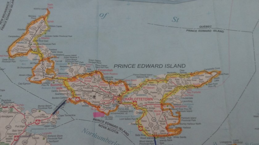
I had scenic roads plotted all over the island (my primary roads, from the book I am using as a guide, are always highlighted in orange) but since my visit was cut short from four days to effectively one I had to prioritize my to-do list and try to maximize my time there.  I was staying in the southeastern coast of the central section (highlighted in pink).  The roads I decided to focus on were in the western section.  I did not go to the eastern section at all.

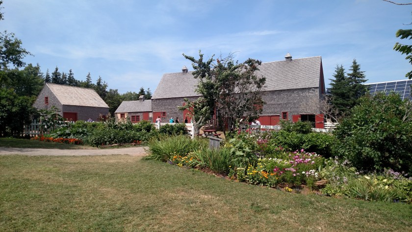
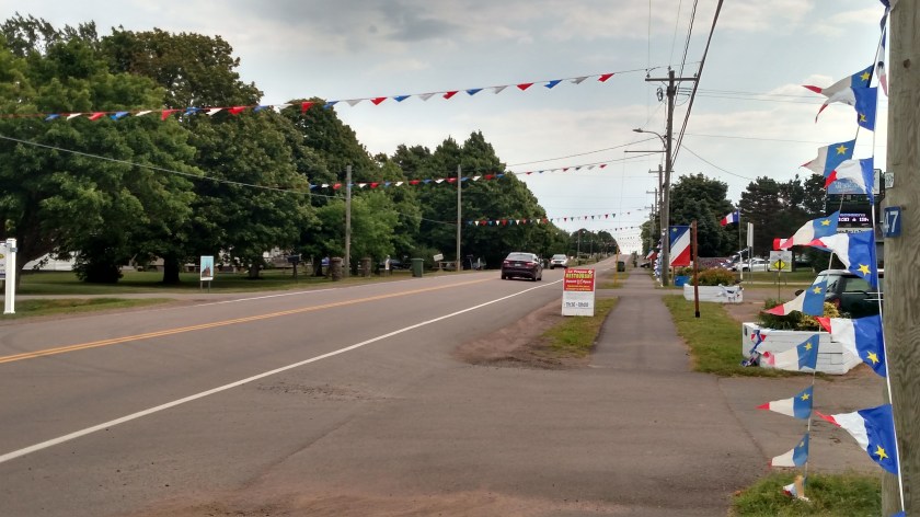
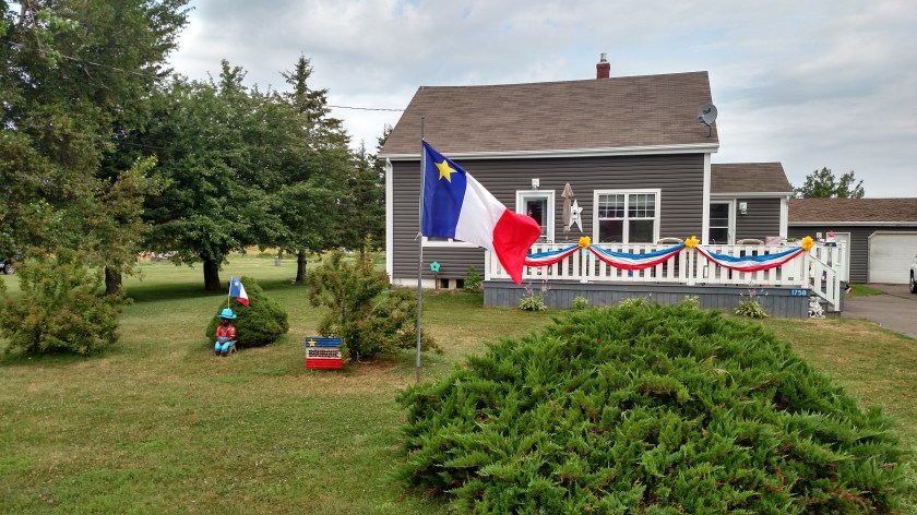
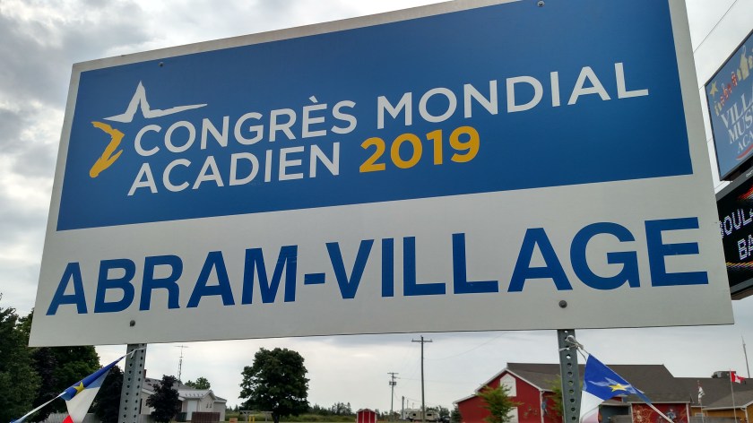
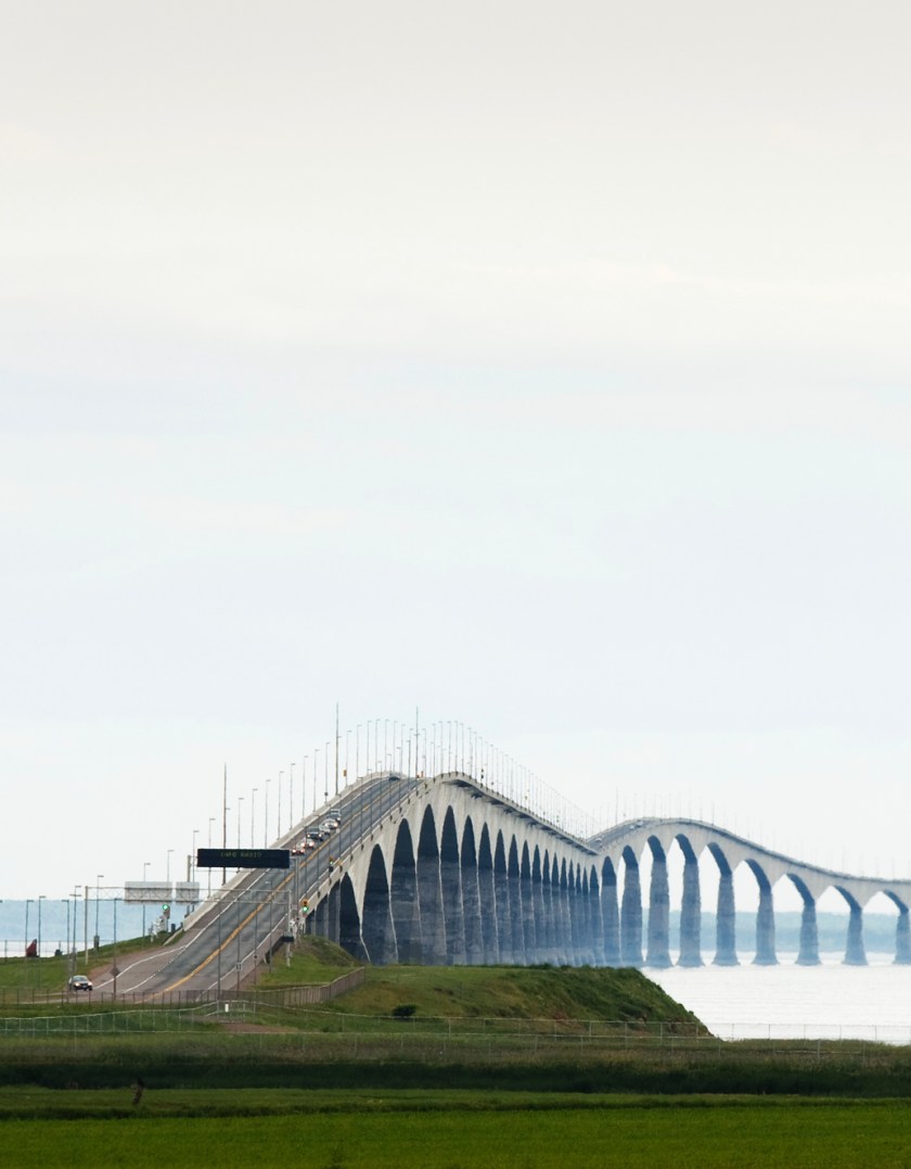
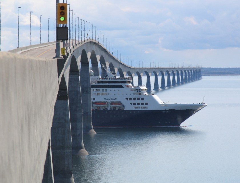
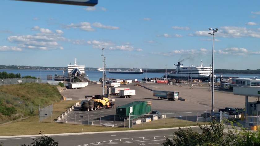
I started out fairly early Thursday and drove back towards the Confederation Bridge.  The weather was not conducive to me getting good photos there so I moved on to Summerside, the second largest city on the island which is located at the point where the central section meets the western section.  I spent some time and took some photos there but am not happy with how they turned out.  I then drove along my first scenic road, Route 11, on the southern coast of the western section of the island.  This is where I happened upon the Acadian village where the big celebration is taking place (see separate post).

When I reached the northern end of Route 11 I decided to cross the island to the north coast and go back east on scenic Route 12.  I was planning to have lunch at a restaurant in the central section so that is why I changed direction.

This boat was along one of the small roads I was using to go from south to north.  It is a large fishing boat in someone’s yard.

IMG_20190808_112055933_HDR

This is an elementary school playground in little Ellerslie, PE.  Evidently their schools colors are maroon and white, eh?

IMG_20190808_112645064

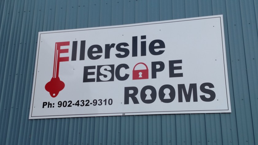
Just a few hundred feet from that playground I was quite surprised to see this sign on a large metal building.  Ellerslie has a population of less than 500 people and is a good distance from the two largest cities on the island, Charlottetown and Summerside.  While Escape Rooms are all the rage right now I find it hard to believe this was a good location location location….

IMG_20190808_112919004

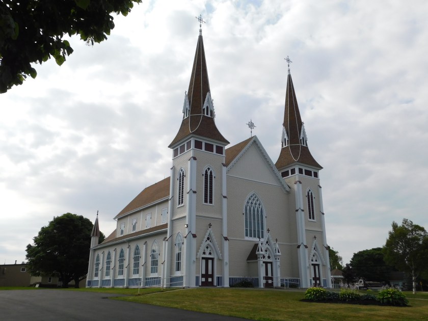
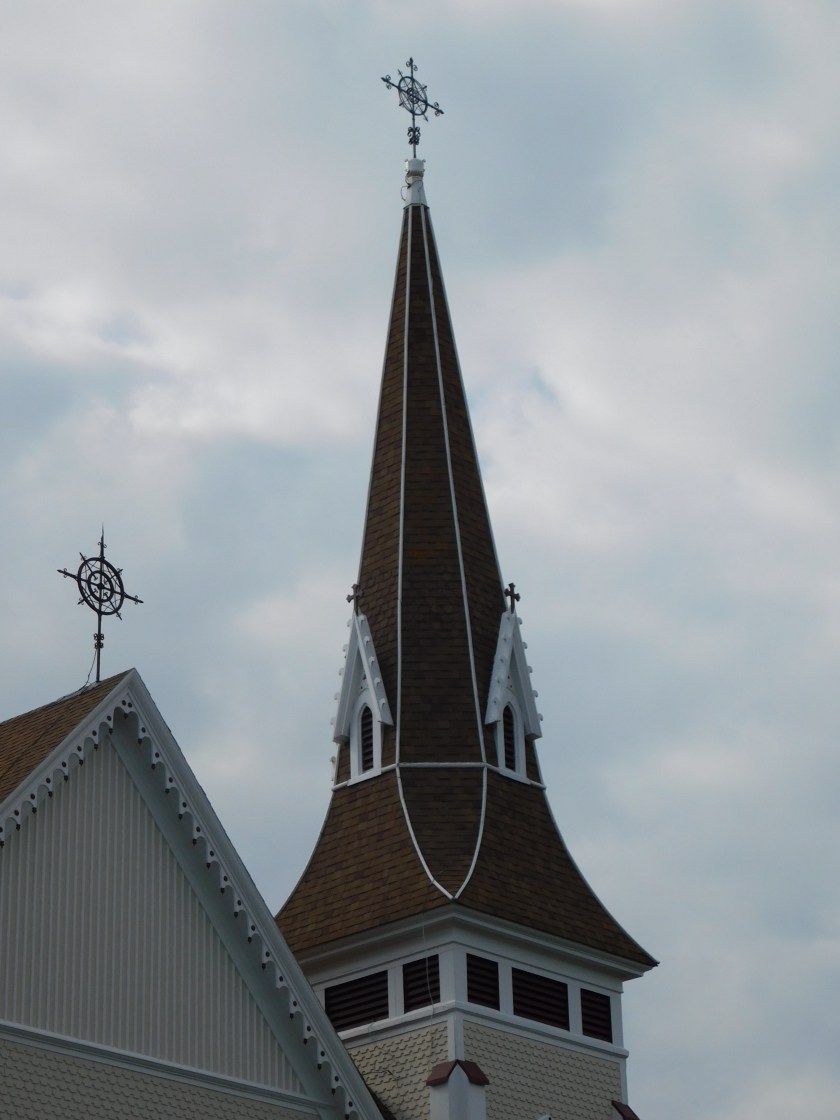
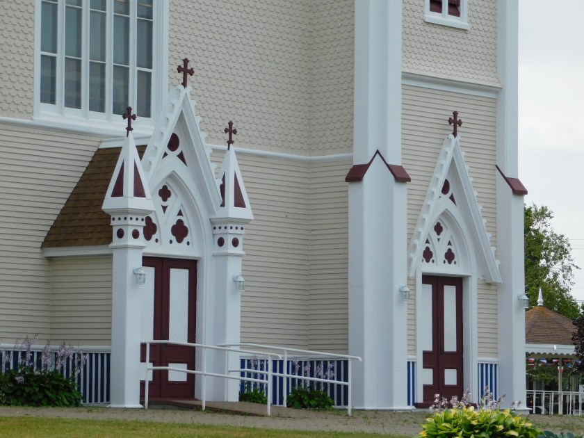
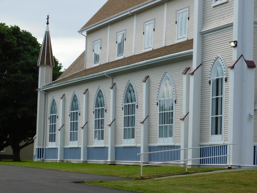
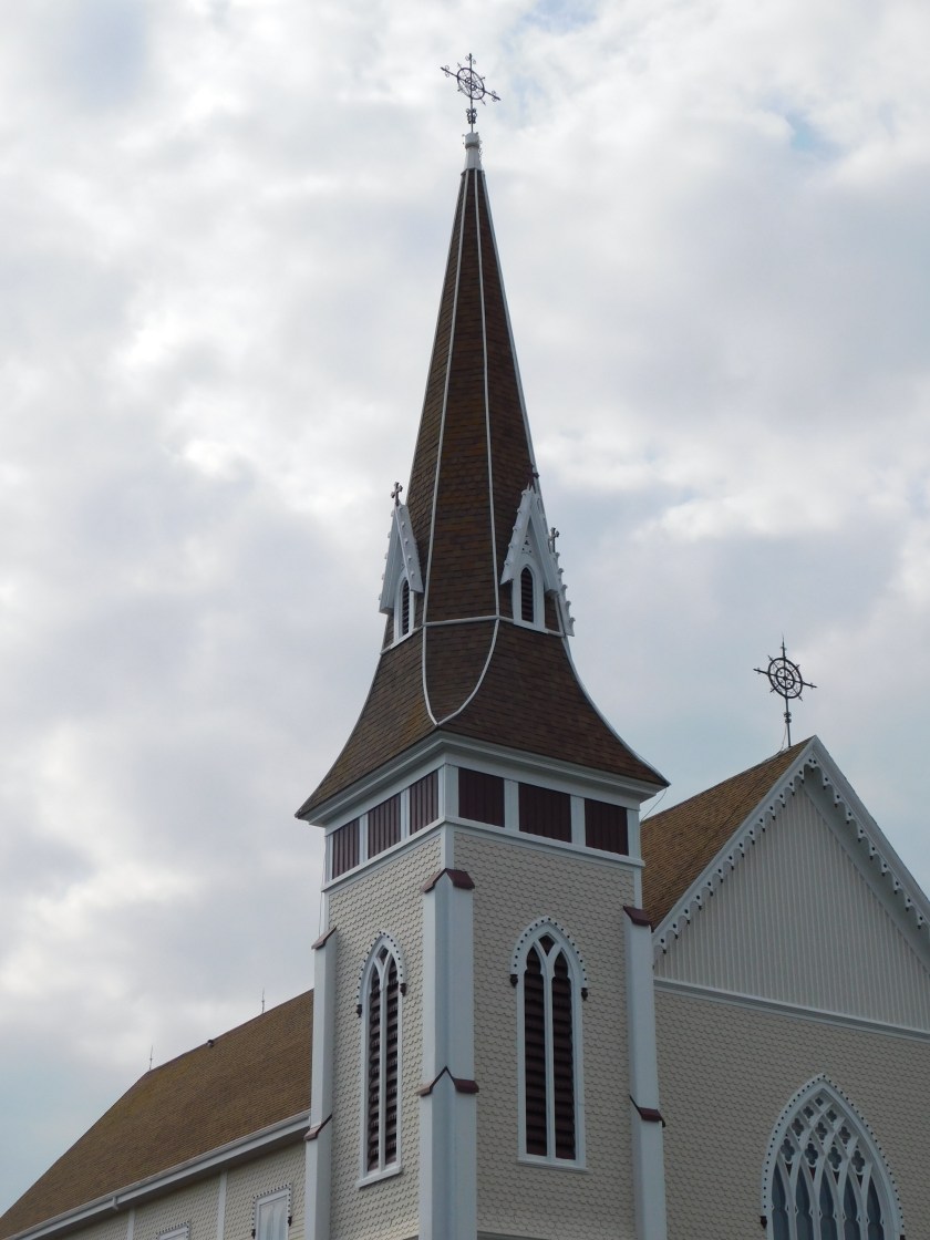
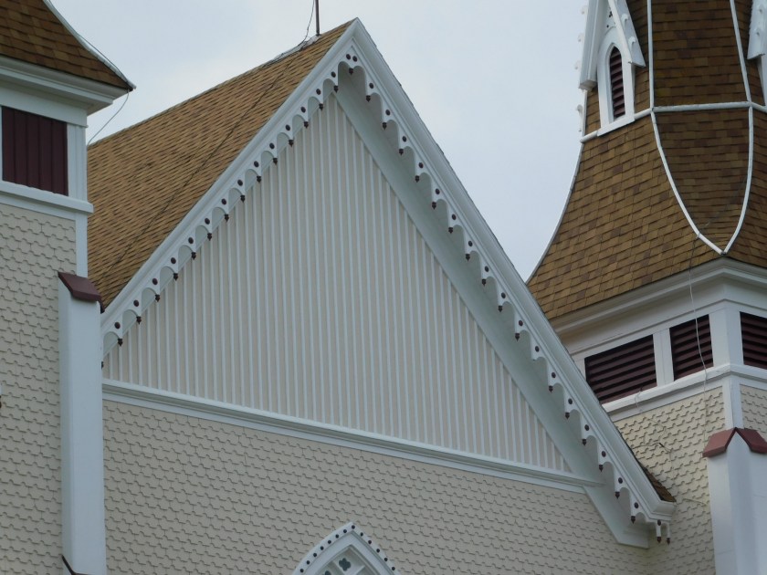
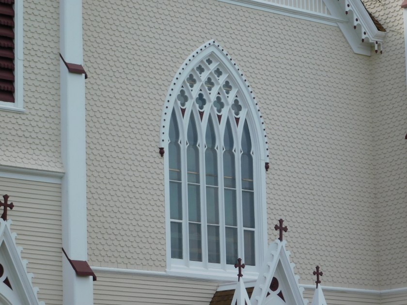
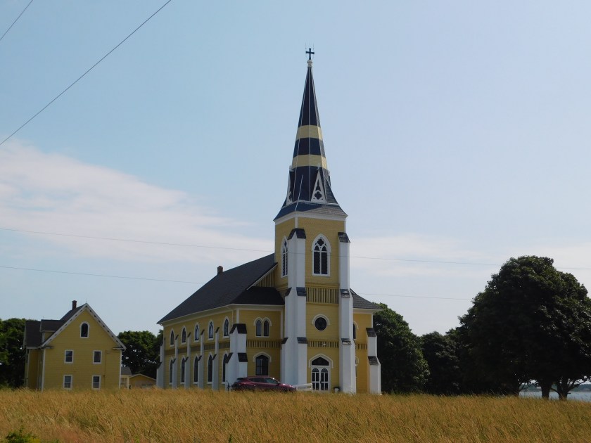
This is another beautiful church I found in my travels on the north coast.  It is Saint Patrick’s Roman Catholic Church.  It was out in the boonies so I don’t know exactly what town it is in.  I had seen another, almost identical building but white with red stripes on the steeple, which I drove past every day I was on the island as I left home and drove west but when I got close to it I saw that it badly needed a paint job and had fallen somewhat into disrepair.  This one, however, looked very nice.

DSCN8621

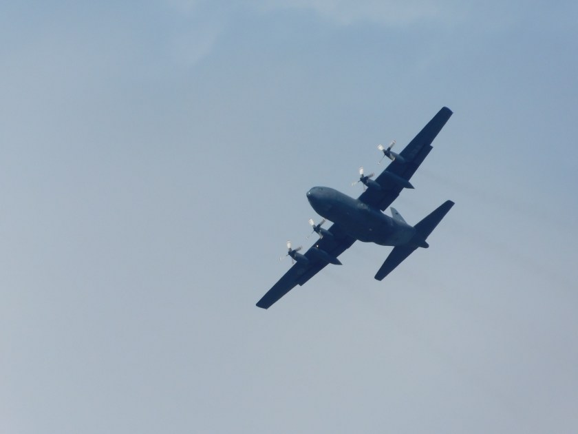
As I was getting into position to take the church picture I saw this large prop plane taking off from an airfield facing the opposite side of the road.  I was using my digital camera and took quite a few shots with the zoom lens as the plane banked and turned to it’s right.  When I was done with the sequence I realized a woman had stopped her car in the road as she didn’t want to interfere with my shots.  Canadians are so considerate!  I waved to thank her but wish I could have spoken with her briefly as well.

DSCN8608

DSCN8612

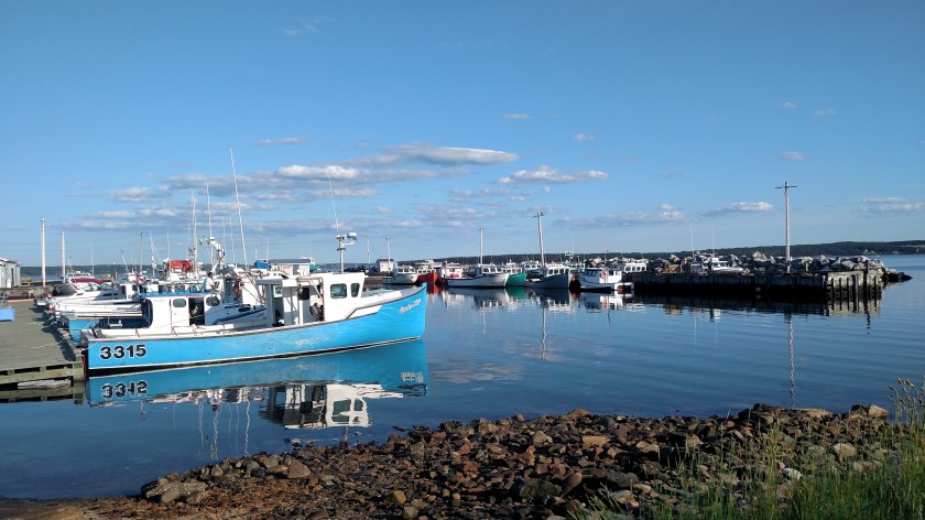
Next I headed to the restaurant in North Rustico Beach on the north coast of the center section.  It was PACKED, with a long line out the door.  I didn’t even bother to park the car (not that I would have found a spot anyway) so I headed off to the Anne of Green Gables house to the west and decided I’d try again later.  I did stop at a waterside boardwalk nearby to take a photo of this tourist fishing boat group going out to sea while avoiding a group of kayakers paddling in the harbor.

DSCN8639

After the Anne of Green Gales house (see separate post) I drove back east through a portion of nearby Prince Edward Island National Park, a long, thin Park which is mostly a controlled access scenic drive high above but very close to the water, which is the Gulf of Saint Lawrence looking north from anywhere on the island.  From the south coast of the island one looks out over the Northumberland Strait which is the body of water the Confederation Bridge spans.  I read that nowhere on Prince Edward Island are you more than 10 miles from at least one of those two bodies of water.

IMG_20190808_141340844

IMG_20190808_141330493

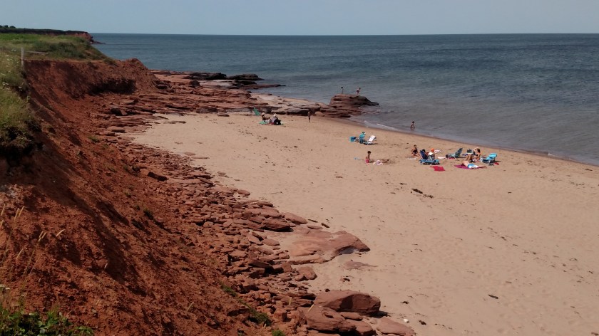
PEI is famous for it’s red dirt and red sand beaches.

DSCN8649

DSCN8651

I will be posting more about PEI in the future.


Anne of Green Gables

August 9, 2019

Thursday, while driving on some of my “primary” scenic roads on Prince Edward Island, I visited the town of Cavendish, on the northwest coast.  There I found the house which inspired the children’s classic (insert title of post here…) written by Lucy Maud Montgomery is 1908.  Parents of young girls from all over the world bring them here to visit (and I’m sure many adults who enjoyed the book as a child come here as well).  I came here at the request of a friend in Durham (an adult) who badly wanted a photo of the house.  She was ecstatic that I made it here when texted her a photo yesterday afternoon.

IMG_20190808_133359234_HDR

IMG_20190808_133641321

IMG_20190808_133636122

And this is Anne:

IMG_20190808_133844902

No, really, that is Anne.  At least that’s what she told me.

Inside the Visitor Center is an area where young girls (and maybe even older girls or adults) can don a red wig with pigtails, a period dress and straw hat and have their photo taken in front of backdrop while holding a sign which says “Green Gables”.  The backdrop isn’t even a painting or enlarged photo of the house, just some artistic scene.  I thought that whole thing was kind of lame considering what their parents had to pay to get them here and get them in to see the house.

So Anne is another photo op and a chance for these little girls to me misled thinking they really met Anne of Green Gables.  I took a photo of one such young girl having their photo taken by her parents and when the girl had removed all the props I asked the parents if it was ok to post the photo on the blog.  They said they preferred not, which I fully understand and is the reason I always ask.  I had a similar situation in a big National Park in the western US and, again, was told no.

So anyway, I see “Anne” (wink, wink) chatting and posing with some young girls near the back of the house and when the visitors moved away and their daughter was out of earshot I said “So you work here?” leading up to the question as to whether or not I could post her photo on the blog.  She replied, in a perky, whimsical voice – “No, I’m Anne…. I live here” and employed the sweeping hand motion I’m sure she has had plenty of practice doing.  Bless her heart, she’ll probably grow up to have psychological issues.  At least the people in the Mickey Mouse costume at Disney World get to wear a mask.

Oops – perhaps I should have warned “Spoiler Alert”…..

This property, while technically not a National Park, is a Canadian Historic Site and, as such, is managed by Parks Canada.  Sounds like a great spot for the “red chairs” and sure enough, I found them tucked away behind a row of hedges near the front yard of the house.

IMG_20190808_133416718_HDR

Here is the view the two young ladies seated in the chairs were enjoying:

IMG_20190808_133508825_HDR

The open field in the distance is now one of the fairways of a golf course.  Somehow I doubt that was in the book.

Fore!

Seeing as the site was managed by Parks Canada my Discovery Park Pass got me in for free, which was a relief for two reasons.  One, I didn’t have to pay, of course, but more importantly two, I didn’t have to wait in the loooooong line of parents waiting to bring their little girls in.

Acadian Pride

August 8, 2019

Thursday morning I set out to explore several of the “primary” scenic roads in the northwestern portion of Prince Edward Island.  If I hadn’t missed a turn while trying to follow Route 11 (it can be a tricky little bugger) I would have never seen what I am about to share with you.

As I entered the rural municipality of Abram-Village (that’s how it is spelled, with the hyphen) it was immediately evident that there was some sort of celebration going on.  There were flags and banners everywhere.

IMG_20190808_103703117_HDR

IMG_20190808_103157090_HDR

I parked the car and went into a local business establishment.  I explained that I was from North Carolina and had just arrived on the island the night before.  I asked if the flags I was seeing, three equal vertical bands of blue, white and red, with a yellow star in the upper left corner, was the provincial flag of PEI.  With obvious pride she replied “Oh no, it’s the Acadian flag!”

The Acadians are descendants of the original French settlers in this part of North America, specifically the Canadian provinces of New Brunswick, Prince Edward Island and Nova Scotia, plus the area around the town of Gaspe in extreme southeast Quebec province and finally a portion of the State of Maine in the US.

Their flag is basically the French flag with the addition of the yellow star, the Stella Maris, in the upper left corner.  That star represents the Virgin Mary, a national Acadian symbol and patron of the mariners.

They are celebrating this event:

IMG_20190808_103827047_HDR

This is the Acadian World Congress, a reunion of sorts.  It is a festival of Acadian culture and history held every five years at different locations.  Abram-Village is part of a “region” of Acadian communities known in this part of PEI as Region Evangeline (I don’t know to add the proper “punctuation” – the little slashes above certain letters).  I spoke with a couple today who live down near Digby and Granville Ferry, Nova Scotia where I stayed for two nights a few weeks ago.  They said there is a large Acadian region just south of there along the coast south of Digby, as there are scattered about everywhere in the areas I mentioned.

And it isn’t just all flags and banners:

IMG_20190808_103536571

IMG_20190808_103610711

The photo above is of a large pinwheel, almost as tall as I am.  There was one of each side of a driveway and they were spinning rapidly in the stiff breeze.  I’m impressed that my smartphone camera was actually able to freeze this one in place.

IMG_20190808_104212269

IMG_20190808_104315542

Saint John the Baptist Catholic Church

August 8, 2019

I started out Thursday with the intention of seeing as much of Prince Edward Island as I could given the limited amount of time I will now be here due to my late arrival.  The majority of the scenic roads I had mapped out are in the northwest part of the island so I headed that direction.

This church is located in Miscouche, PE (the island’s name abbreviates to PEI but the provincial abbreviation is just PE).  It is one of the oldest wooden churches on the island and is absolutely stunning.

DSCN8585

DSCN8586

DSCN8587

DSCN8588

DSCN8589

DSCN8590

DSCN8591

DSCN8593

Of all the places I’ve been, houses of worship are often the most impressive structures I’ve seen, be they churches, synagogues or temples.

Think ya used enough dynamite there, Butch?

August 8, 2019

IMG_20190808_100441532

I was going to title this post “Overkill” but as I was walking back to my car after taking the photo I decided that what is perhaps the funniest line in Butch Cassidy and the Sundance Kid is even more appropriate.

I all the years I’ve traveled on the highway I can’t say as I’ve ever seen a semi-tractor hauling a camping trailer before…  These two were, in fact, hooked together and ready to roll.  I think this may become my new homepage photo for the blog.

Confederation bridge

August 8, 2019

Here are photos I found online of the massive bridge I drove over to get out to Prince Edward Island last night.  I was impressed with it from the moment I first saw it as I approached (illustrated perfectly in the first photo):

Confederation_Bridge cbj.ca

(Photo credit: cbj.ca)

As you can see, it takes you high over the water very quickly for the entire length of it, unlike the Chesapeake Bay Bridge near Norfolk, Virginia, which runs very low over the water.  There is also a “hump” which takes you even higher for a short distance so big ships may pass underneath without disrupting vehicular traffic on the bridge:

ConfederationBridge.com

(Photo credit: confederationbridge.com)

The bridge is 8 miles long, one of the longest in the world built over, at times, icy water.

Incredible!

I made it!

August 7, 2019

(No photo – I didn’t take a single one today…)

I barely made it to my Airbnb on PEI before it was too dark to see.  My car wasn’t finished until 2pm local time and I went back to my Airbnb in North Sydney, transferred my stuff to the car and pretty much drove non-stop to PEI (at least as far as taking pictures was concerned).  I did stop briefly at the Welcome Center when I crossed into New Brunswick for maps and it’s a good thing I did because I overshot my exit (not by much, fortunately) to get to the Confederation Bridge. I was looking for Route 15 when I should have been looking for 16.  The sign did say PEI but didn’t say anything about the bridge.  When I passed through here a few weeks ago I thought the sign clearly indicated the route to the bridge.

No worries! (I just may adopt that phrase myself….)

Now I need to focus my attention to my plan for tomorrow.  I will highlight my routes on my new, bigger map tonight and figure out the best spot to go early to have the sun behind me, work my way out to the northwest tip of the island, then backtrack with the sun behind me in the afternoon until I get to Charlottetown.  I definitely want to have lobster and PEI mussels in town tomorrow night.  I wanted to get there tonight as well but didn’t have time before it got completely dark.

And it occurred to me last night that I really won’t have a full day on PEI Friday because it is a travel day to get up to Miramichi.  Fortunately it isn’t all that far away and I already have a plan to spend the morning here and move up there midday.  I can split those scenic drives in New Brunswick into three parts (Fri/Sat/Sun) because my next stop after Miramichi isn’t very far away either.

And I have a new dilemma on my hands….  My GPS unit has vanished mysteriously.  I know I had it Sunday night because I had just finished programming it for my original Airbnb and a restaurant for guidance after I filled the car with gas.  I didn’t really dig around for it but based on where it was it logistically couldn’t have gone far.  I hate to point fingers without proof but if it is in fact gone it could only have happened during my panic calls Sunday night (though I was near the car most of the time while that was happening) or at the repair shop.  It was locked when it was towed and I took the keys up to the shop Tuesday morning.

Oh well, I didn’t like it very much anyway.  Things happen in threes so now I have that jinx behind me (SD card for camera in St. John’s, car in N. Sydney and now GPS unit in ???).  Will go to Walmart and buy another one in the next day or two.  I don’t use it much but do like having it, especially since I am not using my phone except on wifi so Google maps isn’t an option.  Plus, there are areas where my phone doesn’t have a signal anyway (like central Newfoundland or in parts of the Colorado mountains).  And it still might turn up.  I was hunting for it by feel while I was driving but there can’t be that many places it could be.  I will look again first thing in the morning.


Ready or not, PEI, here I come…

August 7, 2019

Later today, if the repairs to my car are completed as planned, I will finally drive west to Prince Edward Island, aka PEI, where I was supposed to have been for the past two days.  If you’ve ever seen PEI Mussels listed on a restaurant menu now you know what that means, this is where they harvest them.

IMG_20190807_052137627

I’ll be driving west from where I am in North Sydney (off the map to the right) primarily along the Trans Canada Highway, highlighted in yellow in the lower right corner.  I was originally planning to drive the orange “shark fin” today but I already did that while I was based in New Glasgow, highlighted in pink at the bottom center of the map (see earlier posts).

I almost titled this post “Decisions, Decisions” as I have several options open to me today.  There are two ways to get out on to PEI, a ferry which I have indicated with a blue line at the southeast end of the island, or the Confederation Bridge, also marked in blue, at the southwest end of the island.  I know what you’re probably thinking – “It’s a no-brainer, JohnBoy, the shortest distance between two points…you should know that!”.

Not so fast, Sparky.

Believe me, I’ve been burning up MapQuest trying to work out a solution.

North Sydney to Charlottetown, the provincial capital of PEI and close to where my Airbnb is located, via the ferry is 222 miles and takes 5 hours and 37 minutes, which includes the 75 minute ferry ride.  Via the bridge it is 337 miles and takes 5 hours and 52 minutes, again, an apparent no-brainer as to which option to choose.  BUT, and it’s a big but, the ferry only runs every so often.  It isn’t like they’re going to say “Ok, you’re here JohnBoy, lets go!”  The ferry going from the mainland to the island runs at 245, 430 and 6pm, and at earlier and later times but those are the only realistic choices as it will take me 3 hours just to get there, assuming no accidents, construction delays, another breakdown, or getting pulled over by the Mounties.  Add to that the fact that there were many “primary” scenic roads I was planning to traverse during my 4 days on the island and most of them are on the west end of the island and now I only have 2 days there. Add to THAT the fact that the ferry costs $60 USD and going over the bridge to the island is free.  Like going in to Manhattan Island in New York, they let you in for free but charge you to get out!  I will pay a hefty toll to cross the 8-mile bridge when I leave PEI on Friday.

Now I know my friend, former co-worker and occasional blog commenter Shari would say I’d be “going around my ass to get to my thumb” to take the bridge, a southern expression whose source I still haven’t quite figured out.  Use it the next time you want to tell someone they are going way out of their way and see what their resulting expression is.  I know what it means I just don’t know what it “means”.

I am planning to take the bridge but may “call an audible” (an American football term for a last minute decision change) based on when I actually get on the road and what time I could be at the ferry dock (and with no reservation there is no guarantee I would actually get on it once there).

I’ll let you know how I make out….


On the road again…. YAY!!

August 7, 2019

As I write this Wednesday morning I was told I am just hours away from getting my car back after repairs have been effected.  Sunday night, after I got off the ferry upon returning from Newfoundland, I stopped to get gas (which is WAY cheaper here – 10 cents per liter and I put 63 liters in Sunday night – that’s enough for two boxes of “timbits” for crying out loud!) and after moving away from the pumps to get out of the way for lots of other people from the ferry who had the same idea, parked and with the motor running entered the addresses of my Airbnb over in Sydney and a restaurant there I was planning to have dinner, in my GPS unit.  After doing that I looked up and saw white smoke coming out from under my hood, over by the passenger side headlight.  I quickly shut the car off and slowly opened the hood.

Turns out the compressor for the air conditioner was fried.  I was safely off the road in the gas station parking lot.  I activated all the functions of my cellphone so I could make calls for help.  I’ve been “flying under the radar” by only using many of the features on my phone while on wifi at my Airbnb’s in the evening.  Verizon Wireless charges $5/day just for data access while traveling in Canada.  For my 7-week trip here, that adds up and I’d much rather spend that money on lobster for me than give it to them.

CAA, the Canadian equivalent of AAA in the US, towed the car to a nearby shop which primarily sells tires (that is CAA’s only obligation – to get me to the nearest CAA affiliated garage).  This happened Sunday night and Monday was a provincial holiday in Nova Scotia (see earlier post) so the garage wouldn’t be open until Tuesday.  Tuesday morning they diagnosed the problem and ordered the compressor unit.  It is supposed to arrive later this morning and they should have me on the road after it is installed.

Here are two purchases I made in town yesterday:

IMG_20190807_052531354

One is a fire extinguisher, which the Safety Sam in me knows I should have had all along, if not for me perhaps to come to the aid of a stranded motorist who is having a bad day.  Safety “Sam”, after all, stands for Good Samaritan and has nothing to do with my nephew named Sam.  I have been known to stop at traffic accidents or for cars which have broken down in precarious spots to help direct traffic or slow people down while wearing my trust Safety Sam vest – a bright yellow vest like highway workers wear.  I now wear it, sometimes daily, because I get in and out of the car so much taking photos, often crossing or walking along busy roads.  I used to keep a fire extinguisher in my car but after it’s useful life was over (they are only good for about 10 years) I discarded it and never replaced it.

My other purchase was a big boy wallet.  I haven’t used a wallet for many years, opting instead to just fold my paper money and keep my driver’s license and whichever credit card I am using at the time (I have several credit cards which I rotate use of and keep the others in a metal case which supposedly protects them from being “hacked” by ne’er-do-wells with sophisticated electronic eavesdropping equipment) inside the “wad” .  Well, Canadian bills are slightly larger than US currency and my little bundle, wrapped tightly with a celery-stalk rubber band, bends the edges of the Canadian bills so I decided it was time for a real wallet!

My 3 bonus nights in North Sydney, NS

August 7, 2019

The car trouble I experienced after getting off the ferry I had ridden back from Newfoundland on Sunday forced me to spend three more nights here, with the very same Airbnb hosts I had stayed with for three nights two weeks ago while touring Cape Breton Highlands National Park and The Cabot Trail west of here and before boarding the ferry north.  The ferry terminal is literally just up the road from their house.  I called them in my panic Sunday night assuming that they were booked.  I knew it wasn’t available, for Sunday night anyway, back in May when I made all my reservations for this trip, but called thinking perhaps they might have had a cancellation.  Fortunately for me they did, and Monday and Tuesday nights were available as well.  Whew – BIG sigh of relief!

Unfortunately I didn’t make it over to Sydney, just east of here, where my original reservation for Sunday night was, or over to Prince Edward Island for the first two of four nights I have reserved there (in the same house).  I did not cancel any of those nights so those hosts will get paid in full.  It wasn’t their fault that my car acted up and they, in good faith, had held their rooms open to welcome me.

All that said – here is a quick look at the little town of North Sydney:

IMG_20190805_082349180

Here is the ferry terminal as I walked in to town last night to get some exercise and to make a purchase I was unable to complete earlier in the day.

IMG_20190806_173302417

On the left, directly facing the camera, is the Leif Ericson, which I had taken a photo of from our ship as we docked on Sunday.  As I explained in that earlier post about the ferries, it sails from here to Argentia, Newfoundland and back every other day (it is a 16-hour trip one-way so it goes up one day and returns the next).  The ship on the right is the one I had ridden on Sunday and as I took this photo was just starting to disgorge the travelers from today’s journey.  Between those two is a third ferry which appears to be identical to the one I had ridden on.  The presence of that ship puzzles me – it was moving slowly left to right in the photo as if waiting for one of these two ships to leave (there are only two docks at this terminal).  I went in two stores to look for the item I was trying to buy and when I got out to the water just a few minutes after I took this photo, it was gone!  And if you look closely at the left side of the photo, between the Leif Ericson and the mystery ferry, there is a very tall, white cruise ship just setting sail, presumably from Sydney, Nova Scotia – just east of here.

After making my purchase at the second store I walked down to the waterfront across from the “main drag” where several restaurants and shops are located.  Before even getting to the water I saw this vehicle parked along the street.  I had seen it driving earlier in the day as I was walking back home from the repair shop and wasn’t quick enough to get my phone out and take a photo then.

IMG_20190806_181346600_HDR

It even had a badge hanging from the rear view mirror (which is on the windshield laying flat against the hood – it is a Jeep after all…).

IMG_20190806_181338298

Further down Main Street (which I believe is actually called something else but let’s just pretend) there is a boatyard which makes boat repairs.  This large red ship was back in the water after having been in drydock two weeks ago when I was here.

IMG_20190805_182844589

And last night this large blue ship was in drydock.  It wasn’t here when I walked downtown the night before.

IMG_20190806_181908994

And finally, the little pleasure craft and fishing boat harbor here in North Sydney:

IMG_20190806_182112775

I’ve been fortunate, in some ways, to have had this unexpected break.  It gave me a chance to get caught up on the blog and after getting over the initial panic and uncertainty of what happened Sunday night, actually relax a little bit and enjoy two beautiful days.

And I’ve been getting more exercise.  I bought a Fitbit about a year and a half ago and last fall set a minimum 10,000 steps per day goal to try and walk more and build up some more stamina.  When on my trips, especially on travel days, I don’t always hit that goal.  The last two days, however, with multiple walks to the repair shop, Walmart, the grocery store and downtown, I walked 17,189 steps on Monday and 23,456 steps Tuesday – a personal daily best for me.

Hey, when life gives you lemons, make lemonade… but if life gives you melons, you may be dyslexic!