Miscou Point Lighthouse, et al

August 11, 2019

Sunday I drove all the way out to the end of Miscou Island, the furthest point northeast one may drive in New Brunswick, and there I found the above referenced lighthouse:

DSCN8832

It was sooooo windy (this was the very, very windy day) that they actually have to tie down their lighthouse!!

DSCN8825

DSCN8827

DSCN8826

This was also where I found another little painted rock:

DSCN8815

DSCN8814

I guess I should find out what this is all about.  Maybe it’s leading me to treasure!

I’ve always assumed that these were all hand-painted but this one may be decals.  I didn’t think so at the time, but looking at the photos I took I think they are.  I will scrutinize future ones more carefully.

This was also the place where I was confronted by the mime who shooed me away from his goofy little car.  Somehow I doubt that he was the one who left the purple rock.

As I was driving south from the lighthouse to get back to Lameque, where I took the osprey photos, I saw a house of a different kind.  This homeowner was constructing a rather large teepee (perhaps a future Airbnb venue??).

DSCN8740

DSCN8741

This is who is doing the work (if you want to get a quote).  Tell them JohnBoy sent you and they’ll say “Who?”.

DSCN8742

And I also saw this authentic teepee on the site of what will be a new indigenous people cultural center:

DSCN8833

IMG_20190811_141300964_HDR


Miramichi to Tracadie-Sheila, NB

August 11, 2019

Sunday was a travel day as I moved from one Airbnb to another but it wasn’t very far away and there was lots of time to tackle a “primary” scenic road in extreme northeast New Brunswick.

IMG_20190810_155951741

Before we said goodnight (or more accurately good morning, as it was well after midnight) after our long dinner and post-dinner conversation my hostess in Miramichi told me to expect two things after I left town and headed north.  One – that I would see lots more Acadian displays which, as you will see, was true.  Two – I would start to see and hear things almost exclusively in French, which also turned out to be true.

Shortly after I left town I saw something I certainly didn’t expect:

DSCN8659

Wait.  What?  Did I take a wrong turn after I left Kouchibouguac or am I still feeling the effects of all the wine we drank?  No, it’s just a tiny little town on the road I was on.

When I stopped in Tracadie-Sheila to check out where my Airbnb for the night would be I saw this Acadian ear next to a hearing-aid store right up the road:

IMG_20190811_102958557_HDR

People show their pride in mysterious ways.

This next one had bizarre elements as well.  As I was driving up on Miscou Island after having seen the colorful boats and tried to take photos of hovering seagulls, I drove past a house on a small road with some unique Acadian stuff.  After seeing the display I turned around so I could park on their side of the road.  I went past their driveway so I wouldn’t block it and parked near the end of their house.  As I was getting the digital camera out I noticed something in my peripheral vision.  Past the edge of the house this giant bird moved from right to left to the edge of the fence and stopped, like it had heard me pull up.  It sat there watching me.

DSCN8730

And as if that isn’t strange enough, the wind (this was the very, very windy day) was blowing left to right from this vantage point so it wasn’t like the wind pushed it to that corner of the pool.

I got out of the car and took my photos:

DSCN8732

That is what I wanted to come back for.  It appears to be make of rope used on fishing boats.

DSCN8734

DSCN8735

And there was a small mat hanging on the house itself:

DSCN8736

As I was walking back to my car (and I never set foot on their property, I was using the digital camera so I could zoom in from the road) people came out of the house and asked me, in French, what the hell I was doing taking pictures of their house.  I don’t understand French but that seemed to reflect their general mood and I can interpret arm movements.  I held up my camera and said “taking pictures of your beautiful things”.  The woman then gestured to the end of the house where that damn bird who evidently alerted them that I was out front was and said, in French, “Well what about THAT!?”. I don’t understand French but that seemed to reflect their general mood and I can interpret arm movements.   Again I said, ” I took pictures when I saw the bird appear”.  The man then tried to sell me some of the things (funny how they can magically speak English when they want your money) but I told him I was traveling for another month and lived a long way away.  I left before that damn bird could get my license number….

Here are a few more Acadian things I saw.  I’ve included two from the next day just to keep them together.  There won’t be any more for a little while but I suspect they will show up again later in the trip.

DSCN8737


IMG_20190812_091223627

IMG_20190812_091758301

GPS 4.0

August 13, 2019

After the unfortunate events in North Sydney a little over a week ago I went out and bought yet another GPS unit for my car while I was out on Prince Edward Island. Because of where I go I can’t always use GoogleMaps on my smartphone (either no service at all or not a strong enough signal to drive the app). I like having a unit in the car to help give me accurate ETA estimates and, obviously, guidance to my Airbnb’s, restaurants and grocery stores while I am on the road or when in unfamiliar areas.

IMG_20190808_203136610

This time I bought a Garmin.

Here is a quick summary of my troubled past with GPS units:

GPS 1.0 – A Magellan. A gift from one of my brothers. Loved it but couldn’t update maps for free. Stuck with it for a long time but new streets and destinations made it less and less effective. Status – Obsolete. When I thought about replacing 2.0 before buying 3.0 I actually considered paying the money for a map update but when I looked on the website they didn’t even have map updates available for it any more. It wouldn’t have worked in Canada anyway….

GPS 2.0 – A TomTom. Never really warmed up to it. Maps wouldn’t update, despite two attempts and several calls to TomTom. Used it a long time but finally bought a new one to replace it. Not Canada capable. Status – In the trunk of my car as a backup (for the US only).

GPS 3.0 – Another Magellan. Since I liked the first one so much I thought I’d go back to that brand. Apples and Oranges. It’s not nice to hate, but I hated it. We had many knock-down, drag-out arguments and, at times, didn’t speak to each other for days – and on long days in the car she is the only person I have to talk to.  Despite constant threats I never did throw it (or any of the others) out the window.  Honest.  That would be littering.  Towards the end she didn’t have the correct time (off by like 47 minutes) or even know what frickin’ time zone I was in, neither of which I could correct via Settings.   No surprise that there’s no setting for time zone – IT’S A FRICKIN’ GPS UNIT – it’s supposed to know precisely where I am!!!  Of the three, the only one Canada capable.  Status – MIA, but I hope she irritates the person who has her now as much as she irritated me all these years.  Good riddance!

So far GPS 4.0 is getting great marks. I very much like the way she handles herself and I haven’t even read the manual yet so I should be able to tweak it and make it even better. Highest volume setting isn’t very loud (I don’t hear well) and the destination entry seems to be a little confounded but I may be able to tweak it.  Fingers crossed that this is the beginning of a long and beautiful friendship.

Gander, Newfoundland – Redux

August 13, 2019

When I was staying in Miramichi, New Brunswick a few days ago I had several long conversations with my hostess there covering a variety of topics.  Of course we talked about Airbnb experiences and she was curious where all I had stayed in Canada.

When I mentioned Gander she asked about September 11.  I basically said “What about it?”.  Turns out the airport in Gander, Newfoundland was where many international flights were diverted to when the “land immediately at the nearest aircraft-capable airport” order was issued to all domestic flights in the air as well as international flights bound for the US (mainly from Europe).  I think the ones in the Pacific went mainly to Guam, Hawaii or western Canada.  I kinda sortof knew about this but thought the bulk of the Atlantic flights had landed in Iceland or Greenland.

Gander091101

(Photo credit:  twitter.com)

They had them parked in the grass, which created it’s own set of problems, so that others could land until all flights were safely down.  They then lined them all up on the tarmac as you see in the photo above, until the “all clear” was issued.

Gander almost doubled it’s population when 38 jets were forced to land there (in addition to those which were already scheduled to be there for a total of 47 on the ground!).  The townspeople rallied to help house and feed the 6,700 passengers and crew who had this unexpected layover.  They became known as the “plane people”.  Gander became “casserole city” and the local Walmart ran out of almost all their food and clothing stock.  Due to the heightened security risk given the events which occurred that day everyone was a suspect and passengers were denied access to their luggage.

There was a documentary, “You Are Here”, made about the event and how it affected Gander.

Gander has a huge runway, partly due to the military presence there and the big cargo jets they use.  It was, in fact, on the list of potential emergency landing sites which were determined in advance worldwide for the US Space Shuttle program should one of the Shuttles have needed to make an emergency landing mid-flight (as was Stewart-Newburgh, New York, near where my older younger brother lives).

Can you imagine being an air-traffic controller at an airport and after getting the “Mayday” call having to say “Shuttle Endeavour, you are cleared to land – Runway 7 Right”.  Fortunately that never had to happen at a civilian airport, though they did make one unplanned landing at White Sands in New Mexico.


Canadian sign language

August 13, 2019

I know I am now a few days behind posting (AGAIN) and I am accumulating lots of pictures which I think will be worth the wait. I’ll get to them eventually. Please allow me two or three slightly off topic and out of sequence posts and then I’ll get back to my real job. I think I’m in for the night now (4pm local time) – rain in the area and I just had an early dinner and another beer (aside to Eric – Rickard’s Red last night and Heineken Extra Cold (not Gold, Cold) today). My dinner and beer last night after I arrived, plus sleep deprivation from my bender in Miramichi (uh oh, JohnBoy’s hittin’ the sauce again….) PLUS all the driving and picture taking yesterday made me a sleepy buckaroo and I was up again in the wee hours today fretting about the accents issue. I only did one quick post last night before going to bed because I had to thoroughly edit the text as all the events listed above really did a number on my “poke and hope” typing skills.

Here are more road signs I’ve seen in the last day or two. Canadians LOVE pictures on their signs….

IMG_20190813_104142978_HDR

Road freezes at 0 degrees Celsius – pretty straightforward.

IMG_20190813_110247901

Four-way Stop. Again, a no-brainer. See, this makes driving up here fun – it’s like playing Pictionary.

IMG_20190813_082654532_HDR

A toughie. Levitating School Bus (and a young couple who just broke up).

IMG_20190813_122102753_HDR

I’m not really sure but I’m thinkin’ Farting Tires, perhaps?

(Actually loose gravel in the upcoming construction zone you silly goose)

And my favorite:

IMG_20190813_082404704

Exclamation Point Ahead

Or

Rotate it a little counterclockwise and it could be Thelma and Louise.

I saw another one yesterday which I can’t figure out. I tried a few searches for it online without success. I’ll keep an eye out for it elsewhere as I proceed north. I know where it was but it was too far to backtrack. And I have more from my private stock and that I found in said online research but I’ll save them for another time.

Let’s talk accents….

August 13, 2019

… and I’m not talking Southern accents, I’m talking accents used in written text.

I am currently in the Quebec province of Canada and will be going to Quebec City in a few days. I have been expecting, and have now experienced, signage and words, names of cities and streets, etc. to be written exclusively in French. It will get “worse” for me before it gets better. I took French in high school (why, I don’t know – I have German ancestry) but can’t speak a lick of it. I probably wouldn’t have done any better with German.

I know that many of the words and names have accent characters (grave, aigu, cedilla, circonflexe and umlaut) above or below the English alphabet characters. I have been unable to incorporate those accents in my posts and asked a good friend of mine back in Durham for help. My friend is from Italy and speaks several languages so I thought he might know a “quick and dirty” way to solve my dilemma.

My friend uses a Mac and I use a PC. He bought his computer in Switzerland when he went to college and it evidently has a more “international” keyboard. He even got his hands on a PC to see if he could resolve the issue for me.

He gave me several suggestions including “Ctrl+” key sequences, buying an International keyboard, buying a plastic overlay for my current keyboard, etc. He even sent me an email with all the vowels, the letters generally requiring accents, in all the variations, for me to just cut and paste!

My friend has spent considerable time and effort helping me (and believe me, he has far more important things to do with his time) and unfortunately it all appears to be for naught.

For example, early this morning I tried to cut & paste just the letter ‘e’ with the correct accent from the list he sent me to properly write Gaspe, the town I am in. It didn’t work and I just now cut his entire section of sample letters, in all variations, from his email and here is how it “pastes”:

à è ì ò ù

á é í ó ú

â ê î ô û

ä ë ï ö ü ÿ

Ç ç Œ Å“Â

Yikes! It’s all Greek to me….

I very much appreciate his efforts but will continue to just write words and names without the appropriate accents. I know better, but we tried!


UPDATE – A few minutes after this post originally hit I tried entering two words in WordPress (the blog). I tried this because when I sent another friend an email this morning the word I wrote, through no action on my part, contained a Cedille (the squiggly thingie under the c): façade

Another word I tried: entrée

Yowza – this is making me crazy!

Gaspe (no) Perce (no) Gaspésie (that worked) Riviere (nope) Centre d’interpretation de la dime (hell no, it should have had two) Point-a-la-Garde (no) Le Parc Regionale (nope) Saint-Francois (no)

Saint-Francois-d’Assise (still no. Thought maybe on a new line would help)

Apres ski (nope) Voila (Nope – disappointed….) Viola (nope – just to see if I could trick it)

Fini (none required)


UPDATE – 8/16/19

Issue resolved!   My friend back in Durham taught me how to add accents to text in WordPress (where this blog resides).

A Very Windy Day

August 11, 2019

Sunday I left where I was staying in Miramichi, NB and drove north along a continuation of the Acadian Coastal Drive, a scenic road I had driven part of south of Miramichi the day before.  I drove past where I would stay Sunday night in Tracadie-Sheila (highlighted in pink on the map below).  Just past the town of Pokemouche there were several roads which were on my “primary” scenic roads agenda (highlighted in orange and the basis for this trip).

IMG_20190813_061750744

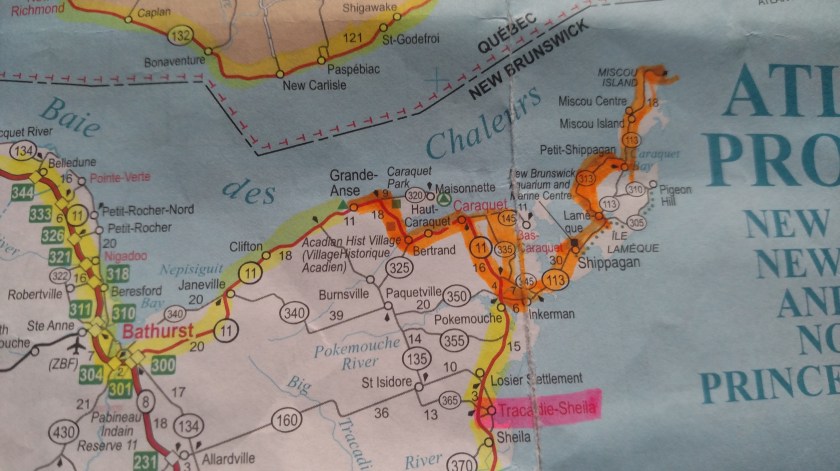
I stopped in the town of Shippagan to take pictures of the colorful boats (see separate post), then crossed a low bridge and over a long causeway to go out on Lameque Island.  As I did this I noticed two or three seagulls hovering to my left, just out over the water and maybe 40 or 50 feet above the causeway surface.  It was a very, very windy day and the seagulls were able to point into the wind, extend their wings and just hang there, without even needing to flap their wings.  I have been frustrated ever since getting my first digital camera three years ago (I miss you, Canon!!) trying to get photos of birds in flight.  Now these were just seagulls, mind you, but a bird in flight has an intrinsic beauty to it, even if it’s a pigeon.

I parked beyond the end of the causeway, donned my Safety Sam vest, grabbed the camera and walked back towards the bridge.  The seagulls were gone.  A few were down floating on the water.  I waited.  And waited.  I decided not to wait any more, I had places to be and things to do, and went back to my car and left.  I’d have to come back this way to get back to the mainland and maybe it would still be windy enough for the seagulls to be here when I got back.

I drove across Lameque Island, making a few stops for pictures along the way, and eventually crossed a much taller bridge which would take me out to Miscou Island.

DSCN8728

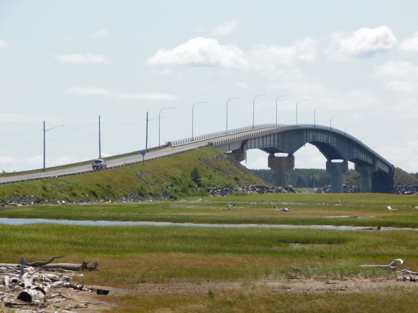
You can see a full size pickup truck driving up the bridge.  Near the top of this bridge, more seagulls hovering.  As my friend Shawn would say – Ha!

I’ve got you my little pretty…. (Shawn wouldn’t say that, the Wicked Witch in the Wizard of Oz did).

I parked at the bottom of the bridge, grabbed my camera, this time also donning my floppy hat which covers my ears and the back of my neck (and my bald spot) as it was a bright, sunny day and I thought this might take a while.  I walked up to the top of the bridge.

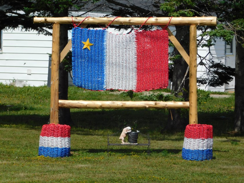
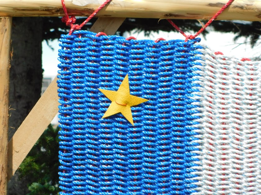
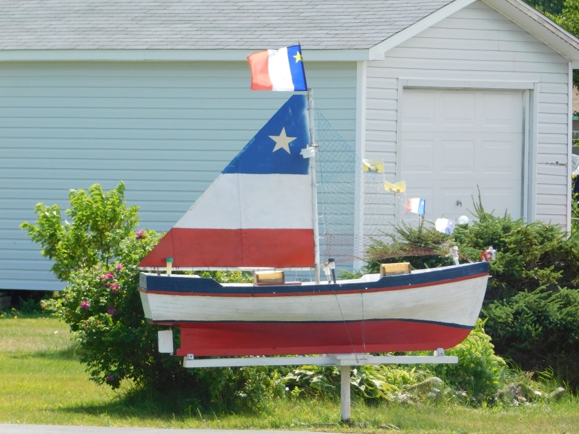
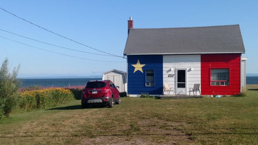
Seagulls notwithstanding, there was something else I wanted to take a picture of.  There was a large building on the Miscou Island side of the bridge with a huge Acadian flag painted on it’s roof:

DSCN8719

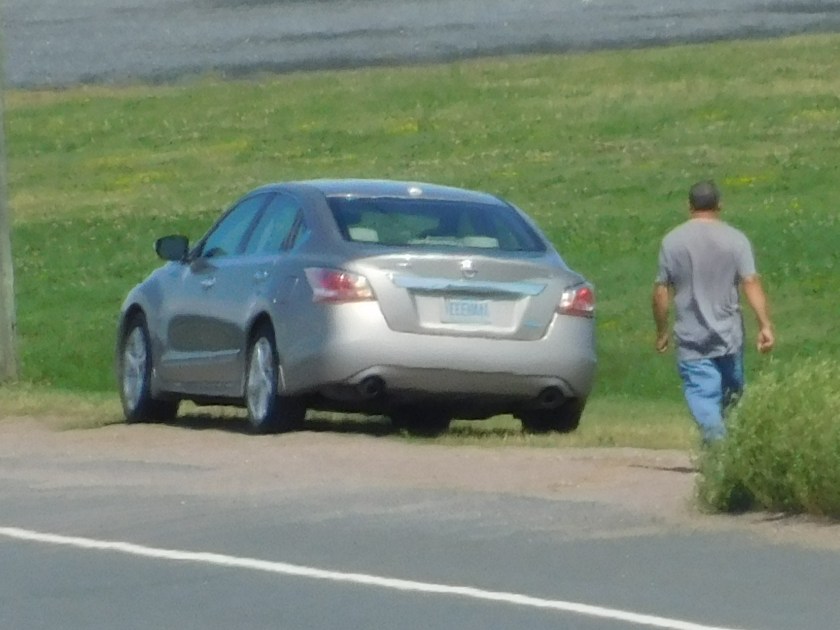
If you look at the bottom right of the photo you will see my car, safely parked off to the side.  In the lower center part of the photo you will also see a man walking towards my car.

Forget the seagulls, now I focus my attention (and camera) on this guy.  He walked past my car, checking out my license plate.

DSCN8722

YEEEHAAA, ha ha, very funny.  He continued walking towards the bridge.  Then he turned around and started going back.

DSCN8724

At this point I started walking back towards my car as well.  It was locked but given the events of the past week I didn’t want this guy to even think about getting his grubby little hands on my new GPS 4.0, which I haven’t even talked about yet.

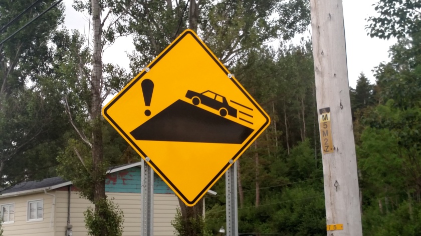
The good news – he just kept on walking (and probably has perfectly nice, normal sized hands).  So I walked back up the bridge.  Hmmmm….. no more seagulls.  Perhaps they were frightened away by the Safety Sam vest which, by design, isn’t exactly an Invisibility Cloak.  I waited.  It was very, very windy.  In fact, up on this tall bridge it was very, very, VERY windy.  Since I was wearing my floppy hat I actually thought I might do the whole Sister Bertrille thing (The Flying Nun, Sally Field, late ’60’s, look it up) and get carried off to PEI.

It was so windy that I had already given thought to the fact that I probably wouldn’t even be able to hold the camera still taking zoomed in shots of the seagulls anyway.  I had been planning to brace myself along the substantial metal railing while focusing on the seagulls, trusting that it was securely affixed to the bridge but after hearing them making creaking noises (it was VERY windy) I began to worry about the structural integrity of the bridge itself.

I abandoned my plan and went back down to my car.  Once down there I started taking pictures of other things, like this Jolly Roger flag on one of the nearby boats at the marina next to the large building.

IMG_20190811_125637959

I continued my journey as I knew there were other things awaiting me.