Final Morning on Newfoundland

August 4, 2019

Saturday night I stayed in the little town of Margaree, a short distance east of the ferry terminal at Port aux Basques.  When I finally arrived there, later than I had planned because I had been out to the lighthouse beyond Margaree, my hostess suggested that I also check out the town itself in the morning.  Her house was the second one on the road in to town and there was lots more there to see beyond that.

I was in the kitchen the next morning visiting with another Airbnb guest (she was traveling on a motorcycle and would also be on the same ferry as me) and we watched as our ferry arrived.  It had left North Sydney, Nova Scotia around midnight and was arriving just as it was getting light out.

It had rained overnight but had stopped for a short while.  It resumed raining lightly as I was taking my stuff to the car so these shots were mostly taken with the car parked on the left side of the road and the drivers side window down.

IMG_20190804_071623855

If you look closely at the photo above you’ll see someone coming in towards the town’s harbor in a small boat (he or she had just turned to their right).  The harbor is outside the frame of the photo to the left.

IMG_20190804_073226484

IMG_20190804_073643702_HDR

The next 3 shots were taken in the span of about two minutes, the second and third each about 100 yards further up the road that the previous one and with a similar but different view as the first.  You can see a lighthouse-like structure way off in the distance.

IMG_20190804_073653512_HDR

IMG_20190804_073753341_HDR

IMG_20190804_073849206_HDR

Final Full Day & Evening on Newfoundland

August 3, 2019

Saturday I drove all the way across Newfoundland from St. John’s in the northeast to Port aux Basques in the southwest, almost 600 miles (although the road curves north quite a bit before turning back south so it isn’t a straight shot) which took about 9 1/2 hours (just driving time, without stops) on the Trans Canada Highway.  Of course I did make a few stops but tried to make them quickies.  I wanted to stop and visit a bit with the people I stayed with my first night on the island before going to my Airbnb for the night, this one located even closer to the ferry.

IMG_20190803_082355420_HDR

The photo below was as I was driving over a long bridge.  To my left was this structure with both a seaplane AND a helicopter!  I presume they offer rides and tours of the area (or are very well-to-do Newfoundlanders).

DSCN8508

Further down the shore was this hangar for another seaplane (you can barely see a wing inside the hangar).

DSCN8512

The next shot is from a scenic look off which I had stopped at on my way east a few days earlier.  That photo had been taken in the morning, looking towards the sun.  The sun was now higher in the sky resulting in a much better photo.

IMG_20190803_101559087_HDR

While I was in that overlook parking area I walked over to speak with the couple who were experiencing a delay in their travel plans.  A few miles back they had driven over a short bridge on the TCH, before and/or after which there is often a very rough bump (sometimes VERY rough).  Evidently it was enough to completely shear off the wheel studs on the back wheel of their big camper.  Help had already been summoned and before I left a young man arrived who thought he might actually be able to fix in on-site.  They were a  very nice older couple who live in Newfoundland, so at least they weren’t trying to catch a ferry – AND they had a place to stay!

IMG_20190803_100628585_HDR

I stopped in Corner Brook to wash my car (Newfoundland wants to keep their dirt here  – seriously! – though I somehow doubt that the car wash I went to will separate the “wheat from the chaff” as it were and return the dirt to it’s rightful place…) and made it to St. Andrews with plenty of daylight remaining.  They even invited me to stay and join them for dinner!

They knew exactly where I was going to be staying that night and recommended that I drive all the east on that road until it ends at Rose Blanche, where I would find a lighthouse.  They also said it is a great road for photo ops, which another friend had also told me.  They were right!  I didn’t take many photos as it was shaded and starting to get dark, but I will return there on my next trip (probably early next year) and spend a whole day just going up and down that road.  There will be excellent morning and evening opportunities.  The landscape is amazing.

IMG_20190803_195526231_HDR

Here is the lighthouse at Rose Blanche:

IMG_20190803_200409218_HDR

DSCN8551

DSCN8554

Those were taken literally just 2 or 3 minutes before the sun was going to set.  I was going to come back early the next morning before checking in for the ferry but rain moved in overnight so I didn’t drive all the way back out.  I barely made it back to my Airbnb before it got dark.


North Sydney/Port aux Basques Ferry

August 4, 2019

Here are photos of the ship I rode on Saturday to sail from Port aux Basques, Newfoundland to North Sydney, Nova Scotia.  My seat was on Deck 9, the highest level passengers may go to indoors (and there is an open sun deck on top). I paid extra for a reserved leather recliner in a limited access area (next to window and with an electric outlet so I could use my laptop to draft posts to cut & paste into the blog – same thing I did coming north).

IMG_20190722_191700758_HDR

IMG_20190804_085820312

My seat was right next to, but slightly above, the highest orange lifeboat (enclosed to protect riders from the cold water). I was on the opposite side of the ship and my seat was facing the back of the ship as we sailed.  When slightly standing I could see the top of the lifeboat but when fully seated I couldn’t.  The young man who had made my smoothie at the snack bar on our deck mid-afternoon told me that in the winter months they sometimes cancel the ferry if the seas are too rough (and this is a BIG ship).

A thunderstorm had just passed through Port aux Basques as we were leaving.  This was the view from my window as the ship began to move:

IMG_20190804_112046198

And further out at we neared the open water:

IMG_20190804_112522240

Here is a view of part of the private seating area from my seat:

IMG_20190804_135139305_HDR

And out my window once we were at sea:

IMG_20190804_135145930

Again, that orange lifeboat and white crane mechanism wasn’t visible if I was fully seated.

Once we were underway you could barely tell the ship was moving.  The ride was incredibly smooth, especially when we sailed north 10 days earlier, and Saturday the only time I really sensed movement was when I got up to walk.

Here is the view of the Leif Ericson, located at the next dock over when we arrived in North Sydney.  It is a slightly smaller ship and sails to Argentia, Newfoundland, which takes 16 hours.  The ticket costs more and many people book a stateroom (even more expensive) to sleep in while the ship sails.  The tradeoff is that Argentia is much closer to St. John’s, which is where most people want to go.  Those people have a choice – a less expensive and shorter boat ride but a 9 1/2 hour drive to St. John’s, or a more expensive boat trip and less driving time & distance.

IMG_20190804_174037521

Going north my trip took 6 hours and coming back took 6 1/2.  Round trip cost $ 250 USD for me and my car.  The distance between the two towns is 114 miles.


Compare that with a ferry ride I took across Lake Michigan in the mid 80’s.  I had taken my mother and two younger brothers to central Wisconsin to visit my grandmother and aunt in the town where my father is buried (and now Mom, Grandma and Eileen are as well).  We drove out through Chicago, where I was born, but came back via ferry from Manitowoc, Wisconsin to Ludington, Michigan – a distance of about 60 miles, taking 4 hours.  Today it costs around $180 one way.  We made that crossing to visit a friend of ours, the guy that got me my first accounting job in Pennsylvania who, shortly after I started working, returned to Michigan with his wife and kids to be near his wife’s parents.

We sailed on an old, clunker, rustbucket workhorse of a ferry (ah, the memories…..) on what had to have been the highest waves on Lake Michigan EVER!

EVER!!!

Booooyyy was I sick!  I remember Dave was cooking BBQ chicken on the grill and I couldn’t possibly conceive putting anything in my mouth.  All I wanted to do was lie down and be quiet.


St. John’s area – Miscellaneous

August 1 & 2, 2019

Here are various things I saw while visiting the St. John’s area which I haven’t put in other posts.

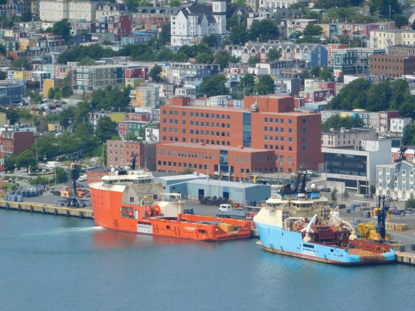
This blue cargo ship was just arriving the first morning I went downtown:

IMG_20190801_094653073

This big orange ship was already docked:

IMG_20190801_094753149_HDR

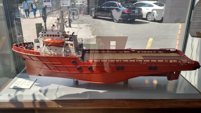
Both of the ships above are short, snub-nosed cargo ships which, I presume, ferry small cube-shaped metal boxes to and from larger cargo ships which couldn’t fit in the harbor.  This is a model of one I saw in the Visitor Center downtown:

IMG_20190802_110644537_HDR

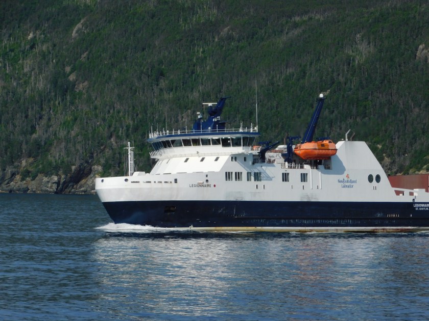
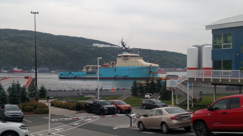
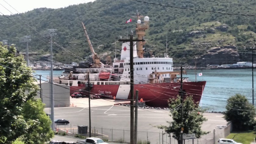
And this is a large Coast Guard vessel, parked where the big orange ship had been the first day:

IMG_20190802_122840305

This is one of the several Supreme Court buildings I saw while I was in St. John’s, which is the provincial capital of Newfoundland.

IMG_20190801_100225018_HDR

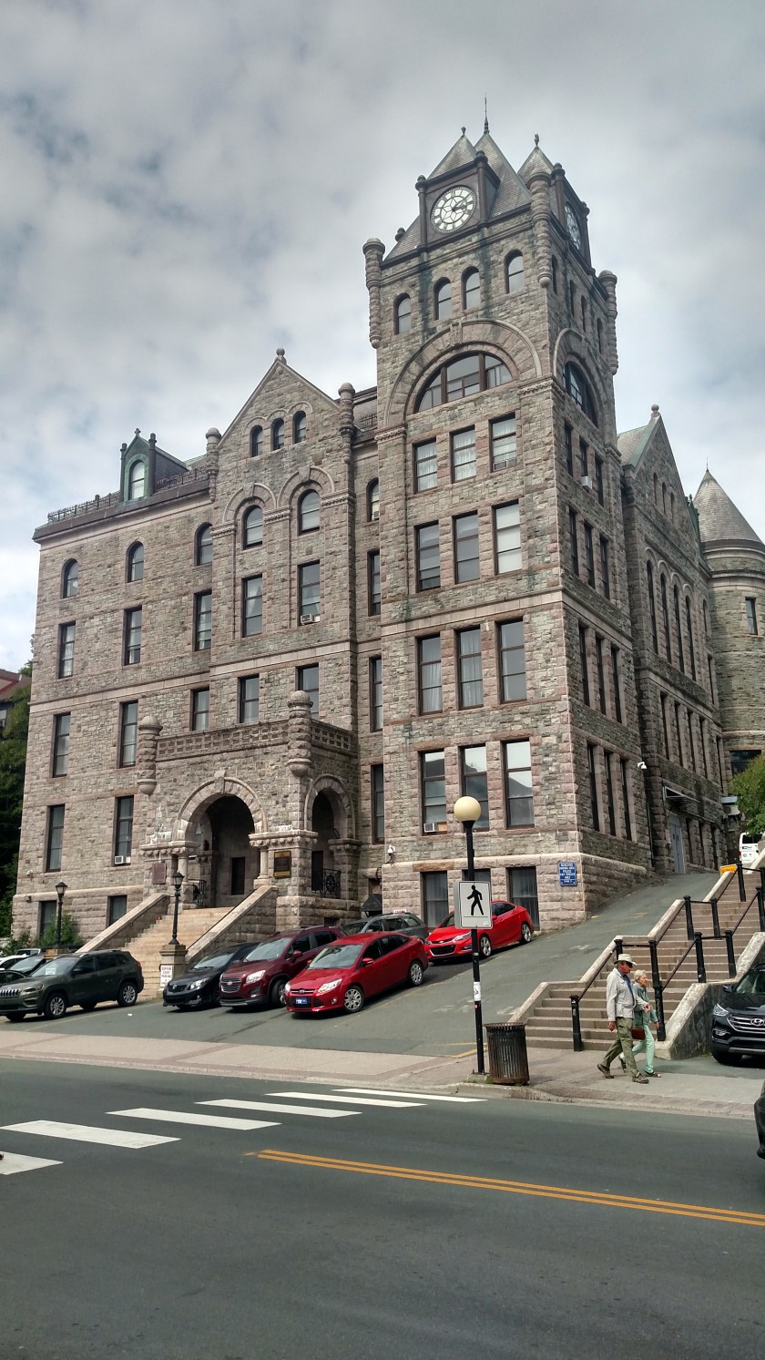
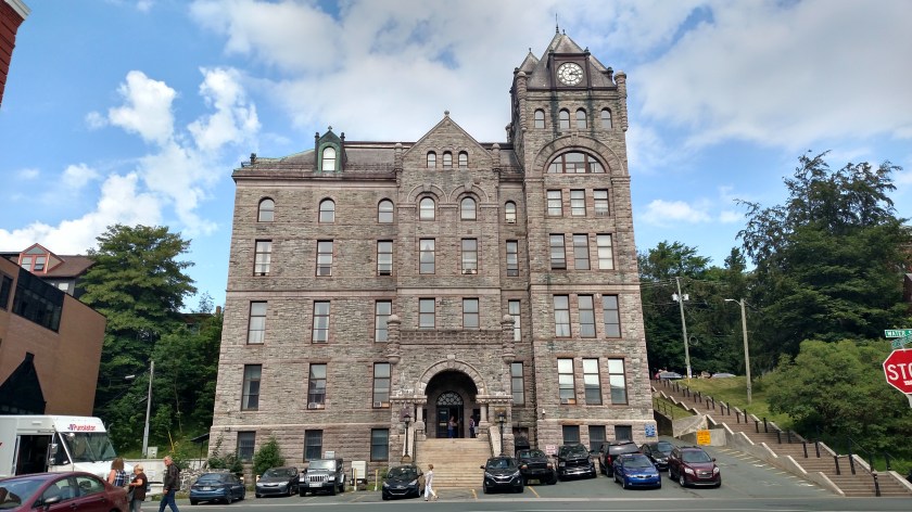
I texted that photo to a friend in Durham shortly after I took it and was telling someone working in downtown St. John’s selling tickets for one of the Hop On/Hop Off transportation companies that I had to re-take it because there was too much street and not enough building.  Well, when I went back to do it again I learned that the photo I took was pretty much my only option since I was trying to fit the entire building, including the turret on the right, into the shot.  Here is the same building straight on from the front:

IMG_20190802_103406025_HDR

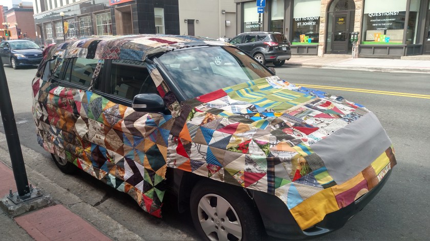
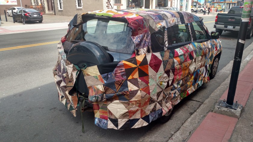
Struggling with gift ideas to give someone or suggest for yourself?   How about this smart looking quilted vehicle cover…  It even has a screen sewn into the front panel so you can drive with it on and not overheat your motor!  Clever, indeed.  I bet it adds a lot of weight to the vehicle when it gets wet, though.

IMG_20190801_102740836_HDR

IMG_20190801_102754357_HDR

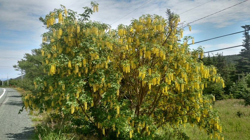
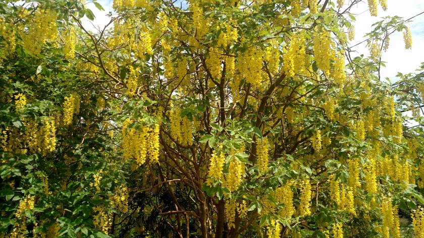
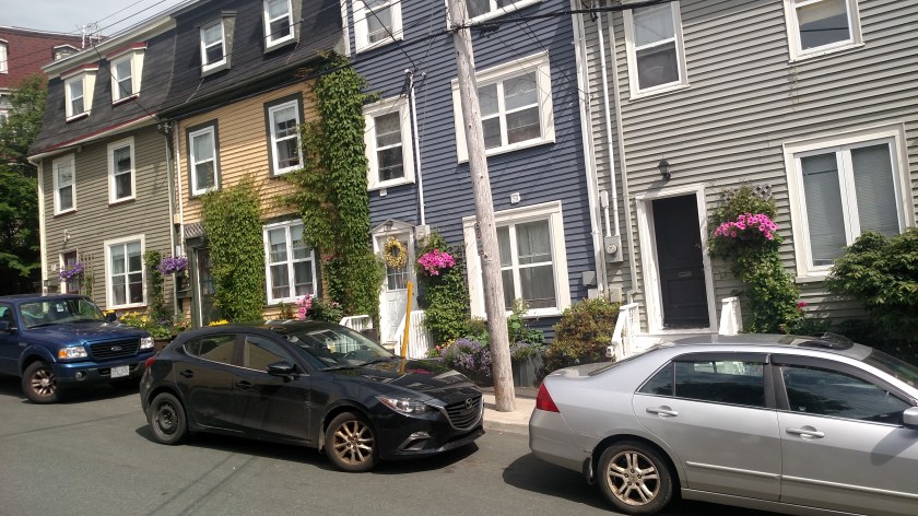
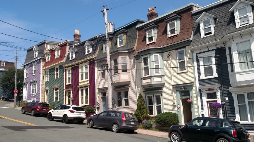
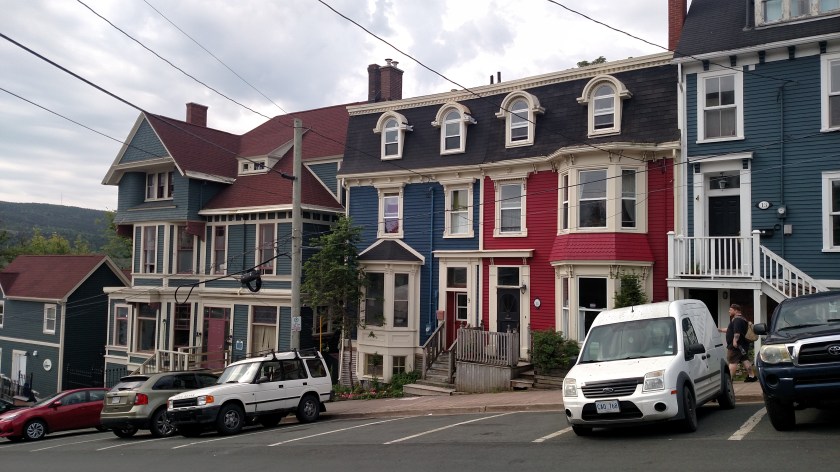
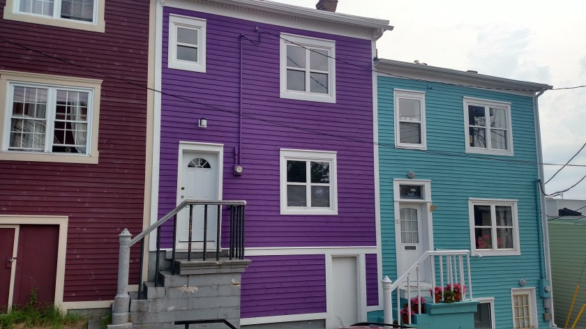
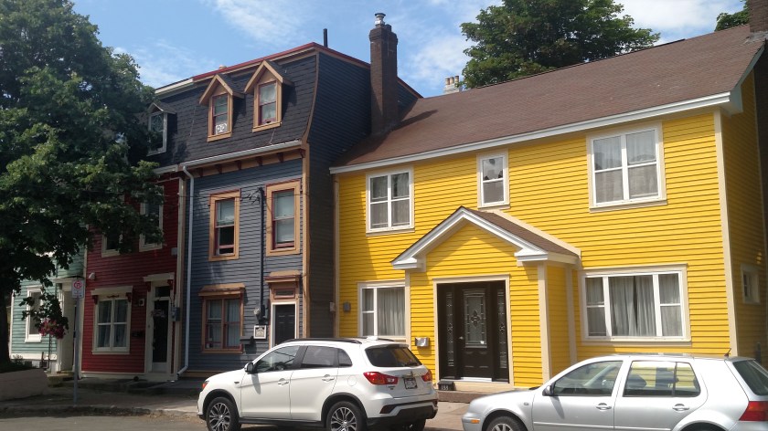
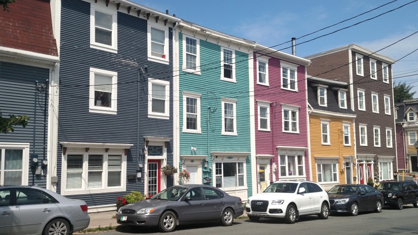
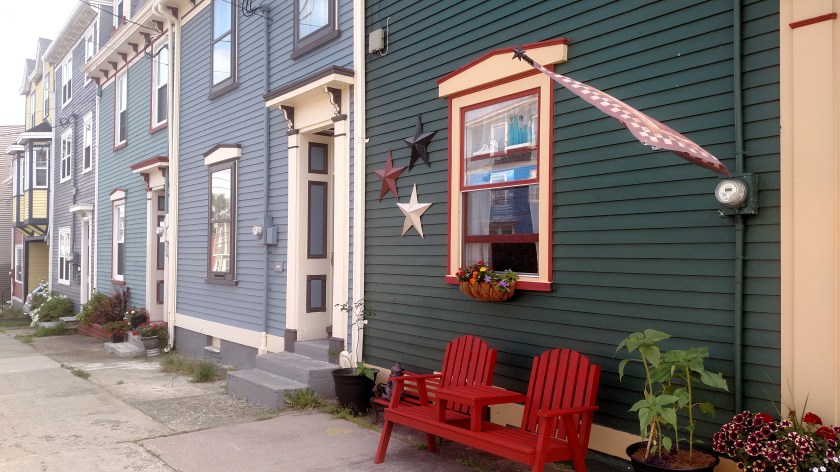
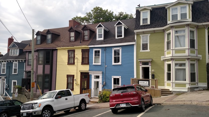
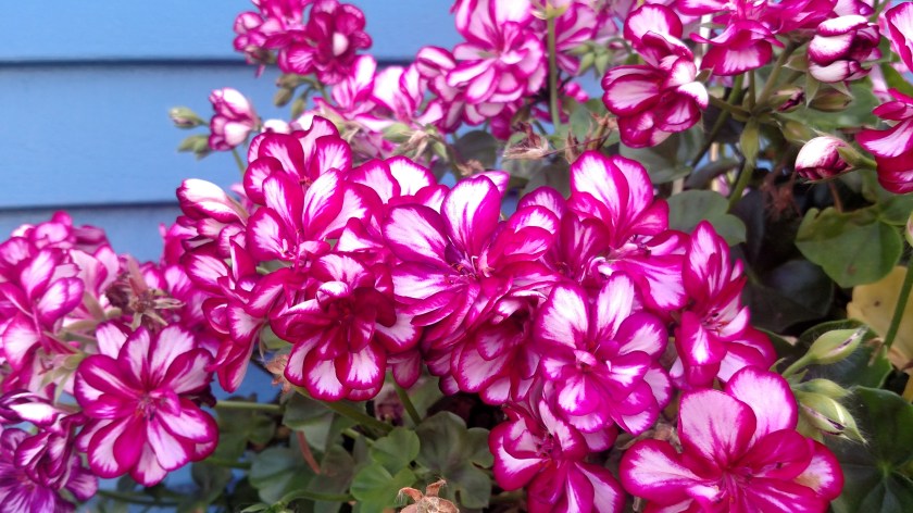
Here are some pretty flowers I saw while taking pictures of some of the houses in town:

IMG_20190801_120200043

IMG_20190802_095925771

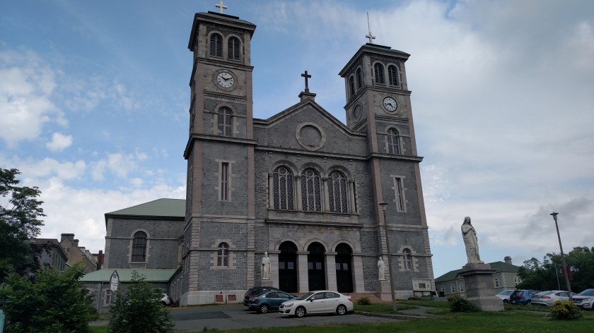
This is the impressive Basilica of Saint John the Baptist, high up on a hill overlooking the city:

IMG_20190802_093327460

The Railroad Museum on the south side of town:

IMG_20190801_123239134_HDR

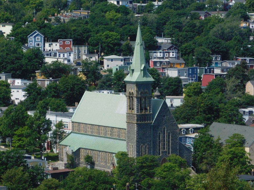
And this is a church I saw while descending the hill into town coming back from out at Cape Spear:

DSCN8486

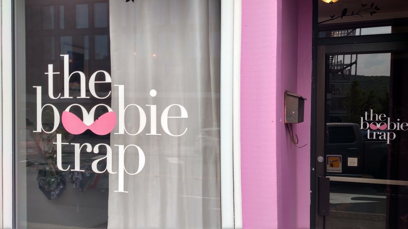
A great name for a women’s lingerie shop:

IMG_20190802_102637818_HDR

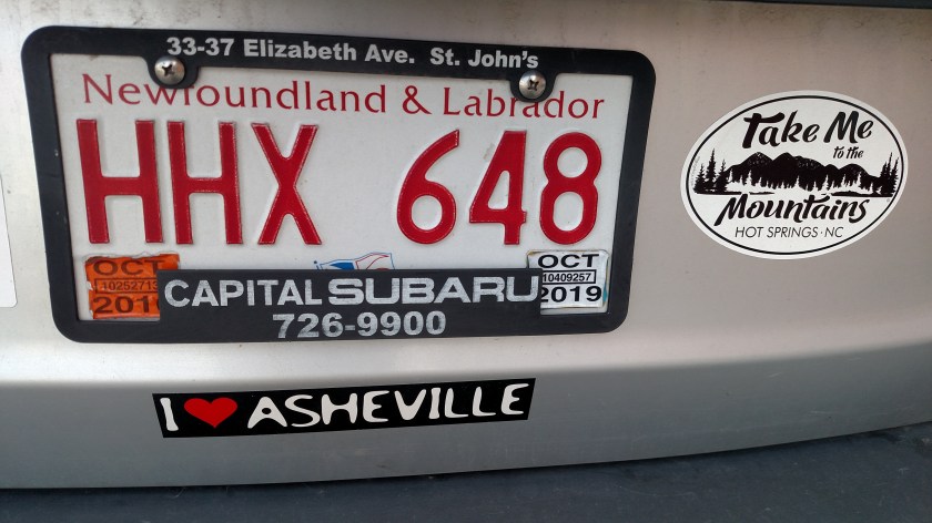
Oh look, people from Newfoundland & Labrador like to visit North Carolina, too!

IMG_20190802_100048074

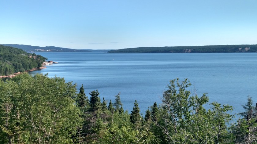
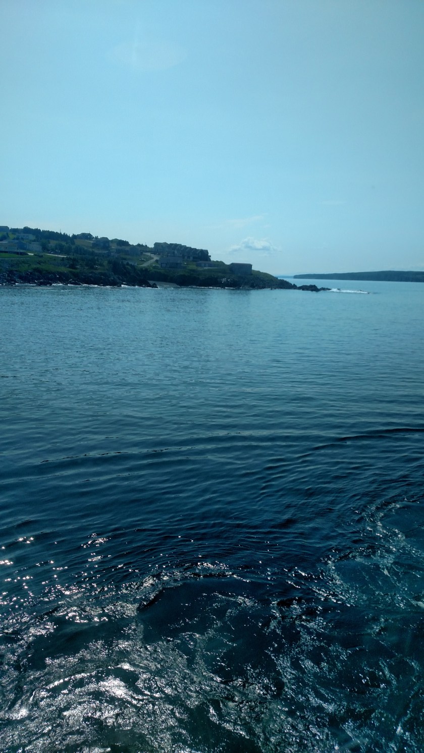
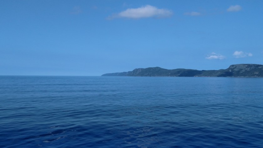
And finally, the view right before I turned off Torbay Road each night as I was going home.

IMG_20190802_132925924

The second day I was downtown I had a problem with my digital camera while I was taking the shot of the big Coast Guard ship.  I went home to troubleshoot it on the computer and discovered that the tiny plastic slider on the SD card had come off and the card was “locked” so I couldn’t write picture to it.  The solution I found online (put a piece of tape over the empty space where the slider had been) didn’t work so I headed to Staples to buy a new card.  Evidently I’ll need to be more careful handling the card when I take it out every night to download the daily picture bounty to my laptop.

Also, I had discovered that I was putting way more miles on the car than I was expecting to during this trip and was due for an oil & filter change.  I saw a place on the way into town that provides that service and took the car in for the necessary maintenance.

Then I found a place which had all you can eat ribs (oh boy!!) and I enjoyed that for dinner, plus two beers (and entered a contest twice, once for each beer, from which I will be winning a nice barbecue grill courtesy of Labatt’s!).  This was at a chain called Montana’s and they were the best ribs I have had in a loooong time.  I really miss Oh! Brians.


Bell Island

August 1, 2019

Thursday was my first full day in St. John’s and I had a list of “touristy” things to see and do.  On that list was taking a ferry out to Bell Island, west of the upper right portion of the Avalon Peninsula where St. John’s is located.  From where I was staying in Torbay it was only a short drive to the ferry.  Many things downtown didn’t open until 10am or later so I decided to go out to the island first.  When I got to the ferry dock I could see that the island was socked in with fog.

I turned around and headed downtown to walk around until things there started to open, then up to Signal Hill, then out to Cape Spear (see separate posts for all three) and came back to give the island another try mid-afternoon.  By then it was clear and gorgeous so I took the 20 minute ride over on the ferry named Legionnaire.

DSCN8488

Legionnaire was different than the other ferries I had ridden so far, kind of a Mama Bear in that it was larger than the 12 and 18 open vehicle ferries I had ridden various places yet much smaller than the huge ferry I had taken from Nova Scotia up to Newfoundland (which had three parking levels, plus several passenger levels, thank you very much).  This one even had a platform that raised up in the air once cars were loaded on it so they could fit more underneath!

IMG_20190801_143622948

Despite the relatively calm appearance of the water the ferry rocked back and forth from side to side during the trip, which I found rather unsettling. You’ll see evidence of that shortly.  Fortunately it was only a 20 minute ride.

This was as the ship was turning around after backing away from the dock (where it parks head-on for vehicles to drive on through the nose.  It then backs in to the dock on the other side and we drive off the back.)

IMG_20190801_143957862

This is where we were going:

IMG_20190801_144023075

And this is where we were coming from:

IMG_20190801_144043750

Once I got out to the island I became very frustrated very quickly.  I hadn’t done much homework about the small island (my bad) other than knowing than that there was a lighthouse I wanted to see and a road that made an oval around the island.  I thought there might be good photo ops of the mainland as well.

There was no sign indicating where to go once I got off the ferry and I stopped at the Post Office to ask if there was somewhere I could get a map. The woman working there gave me the choice of two nearby places, one of which was closed (guess they weren’t selling many #2 Mine tours THAT day!) and the other was a dumpy little gift shop type place that wanted 2 bucks for a map of what was quickly, in my mind, becoming their silly little island.  I had already spent $10 for the ferry and paying more money for a map didn’t go over real well with me in this tourism driven area where things like that are generally free, so I stormed off in a huff and drove right back to the ferry dock to go back to the mainland.

I rode a different ferry back (two different ships go in opposite directions every half hour or so to allow time for loading and unloading) so going back east I was able to see Legionnaire in action.

Here were the waves hitting our ship almost sideways, causing it to rock back and forth. Note how the larger and more top-heavy Legionnaire is listing one way in the first photo and the other way in the second one.

IMG_20190801_160816954

DSCN8491

DSCN8494

At least it was a nice day to be out on the water!

IMG_20190801_160800523

IMG_20190801_160803808

Cape Spear

August 1, 2019

Thursday afternoon I drove out to Cape Spear, southeast of St. John’s.  It was a beautiful drive out and along the way I saw this gorgeous tree next to the road. I have no idea what it is.

UPDATE – I had no idea…  Now I do!! A good friend from back in Durham informed me that it is a False Acacia, which he learned from the lyrics of a beautiful song by an Argentinian folk singer.  My friend, who’s from Italy, is studying music and composes music.

IMG_20190801_124530242_HDR

IMG_20190801_124548199

Once I made it out to the Cape (the easternmost point in North America) I enjoyed another twofer – there were two lighthouses, the current one which as you will see is still operational, and the original one, shorter but higher up on the hill, which has been recently restored.

DSCN8477

IMG_20190801_130830807

It took me a lot of tries to get the timing right and catch the green light.  Ah, the beauty of digital cameras where you can just click, click, click and then eliminate the bad shots.  That is one reason I take so many pictures in a day – many are duplicates to try and ensure I get a good one out of the bunch.

DSCN8468

DSCN8470

While I was out there taking photos the big yellow Air & Sea Rescue helicopter I had seen up in Gander flew down the coast from the north and made a wide circle around the tall lighthouse (photobombing everyone taking selfies). It flew back north and made another orbit over the open water before flying away.

DSCN8440

DSCN8443

DSCN8447

IMG_20190801_125909384

DSCN8449

DSCN8454


Signal Hill in St. John’s, NL

August 1, 2019


Thursday morning I drove in to St. John’s, only about 8 miles from where I was staying in Torbay. After walking around town to get acquainted with the many restaurants and shops, and looking at some of the large boats in the harbor (including the blue one which was just arriving), I drove up to a large park called Signal Hill, high above the city. The structure at the top of the hill is Cabot Tower and is visible for miles away from town.

DSCN8423

DSCN8419

DSCN8421

DSCN8422

As you would imagine, the view from atop the hill is spectacular.

This is looking down towards the downtown area and harbor:

IMG_20190801_111732108

DSCN8427

This is looking northwest, towards the airport and the town of Torbay where I was staying:

IMG_20190801_110750410

I didn’t get a map of the park itself so I don’t know what all the various structures in the park are but you could see the lighthouse, way down close to the water:

IMG_20190801_111325042_HDR

DSCN8415

And a walking path which goes down to a huge rocky area, also close to the water:

IMG_20190801_111332885_HDR

I didn’t go down to either one because I’d then have to come back UP.

Looking down towards the museum and Visitor Center (and the road I had driven up on) is an area where people were sitting on bleachers watching reenactments of various things. The people in period costumes (uniforms) would periodically fire off the big cannon or shoot their weapons (blanks, I’m sure).

DSCN8409

There was also an area where you could see cannons aligned to protect the harbor from intruders.

DSCN8424

And this was the “Powder Room,” I mean “Powder House,” where gunpowder was stored away from the main building:

IMG_20190801_111532041

What did you learn today?

August 5, 2019

I learned, much to my dismay (selfishly), that today is Civic Day in Nova Scotia, Canada.

Nova_Scotia flag

(Photo credit: flagmartcanada.com)

I know this because my car broke down last night after I got off the ferry and most businesses (including car mechanics) are CLOSED today.  An inconvenience for me, but there are many positive aspects of it.  It happened in a gas station parking lot, not on the road (and not out in the middle of nowhere in a spot with no cell service and no place to walk to for help (and perhaps very little traffic)), the weather ended up being ok and not stormy, I was able to get in the same Airbnb I stayed in for three nights before taking the ferry north 10 days ago (there were people with reservations but they cancelled), and it is nice today so I walked to the store for two days worth of food.  My original hostesses, one over in Sydney, where I was supposed to stay last night, and one for the first of 4 nights in the same house over on Prince Edward Island, were very understanding.  The woman in Sydney even offered to come get me, and tried to help diagnose the problem over the phone!  CAA (the Canadian equivalent of AAA Motor Club) towed me to a garage within walking distance of where I am staying and I will be there bright and early when they open at 730am tomorrow.

Someone told me last night that today was Boxing Day in Canada but that is, in fact, the day after Christmas.  Civic Day is celebrated in certain Canadian provinces on various dates based on each province’s “birthday” or other significant event.

So HAPPY CIVIC DAY Nova Scotia – I will celebrate it by getting caught up on my blog!!


More Jellybean Houses

August 1 & 2, 2019

Here are more of the colorful Jellybean Houses I saw while in St. John’s last Thursday and Friday (see previous post).  These were in spots where utility poles and wires distracted somewhat from their beauty.

IMG_20190801_103737486

IMG_20190801_113758855

IMG_20190801_115151480

IMG_20190802_093513132

IMG_20190802_095337338_HDR

IMG_20190802_095700993

In this environment even a white house looks great:

IMG_20190802_095731660

And evidently some folks paint their stairs & railings and put pretty flowers out – and some don’t:

IMG_20190802_100238805_HDR


Jellybean Houses – St. John’s, NL

August 1 & 2, 2019

Thursday and Friday I spent the day in and around the large town of St. John’s in northeast Newfoundland. This is one of the posters currently being distributed by the Visitor’s Bureau promoting the town.

IMG_20190803_111530915

These are called Jellybean Houses because of their color and variety.  They actually call it Jellybean Row (because they are rowhouses) but that isn’t an actual place, just the concept.  These colorful houses are everywhere in the city of St. John’s.  I took lots of photos, and could have taken lots more, but I will try to only share the better ones. While the pictures on the posters are pristine and clear of vehicles and utility poles & wires, real life is a little messier.  I do have some relatively “clean” shots which I will post first, followed by more cluttered shots in another post. Many of the residents plant pretty flowers which often complement the color of the house and it is unfortunate that parked cars often block the view of them.  I guess we can’t all live in Disneyland…..

IMG_20190801_113910457

I tried to take photos of the houses on the sunny side of the street, though sometimes I took them of the shady side but at an angle so the sun wouldn’t distort the shot.  You will also notice that many buildings are level, whereas others are staggered in height, sometimes quite a bit.  The streets parallel to the waterfront in St. John’s increase in altitude very quickly and walking up or downhill is very steep, like being in San Francisco.

IMG_20190801_114021689

IMG_20190801_094126145_HDR

IMG_20190801_115308688

I waited in the shade across the street in front of this yellow house for a few minutes as a well dressed man methodically scraped at a sticker on the door using his fingernail. When it became apparent it was going to take a while I decided to go elsewhere and come back later. I walked to his side and commented “that looks tedious” not to be a wiseass but just to acknowledge his effort. He explained that he owns this house and just had a new front door unit installed, with glass side windows. He basically said “You’d think that for $ 4,000 they would have at least removed the barcode!”.

IMG_20190801_120148562

I did come back later and as you can see, remnants of the sticker are still there.

More houses:

IMG_20190801_120230989

If you look closely at the blue house in the photo above you will see that even the mailboxes have multi-colored house designs on them.  This was what I was referring to in a post I made several days ago of an old building located in a fishing town with one of the sides painted to emulate the Jellybean Row concept.

IMG_20190801_120324240

IMG_20190801_121425337

IMG_20190802_093424261

IMG_20190802_094700178_HDR

IMG_20190802_100032542_HDR

I saw many other things in St. John’s which I will address in other posts.