Tule Lake National Wildlife Refuge

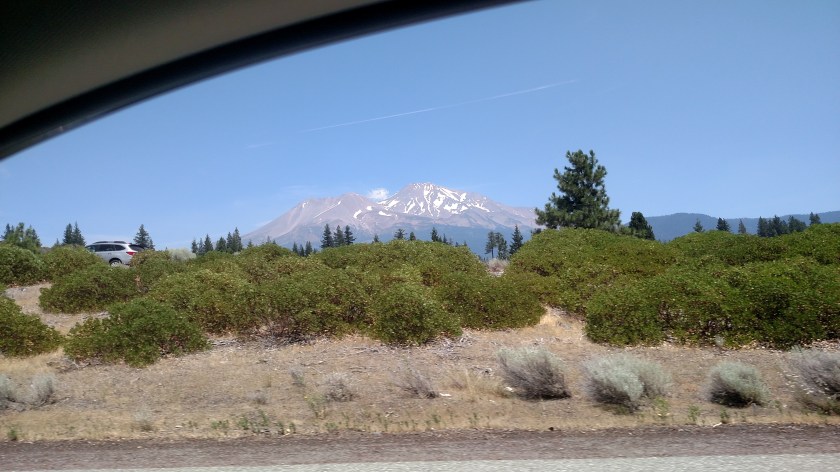
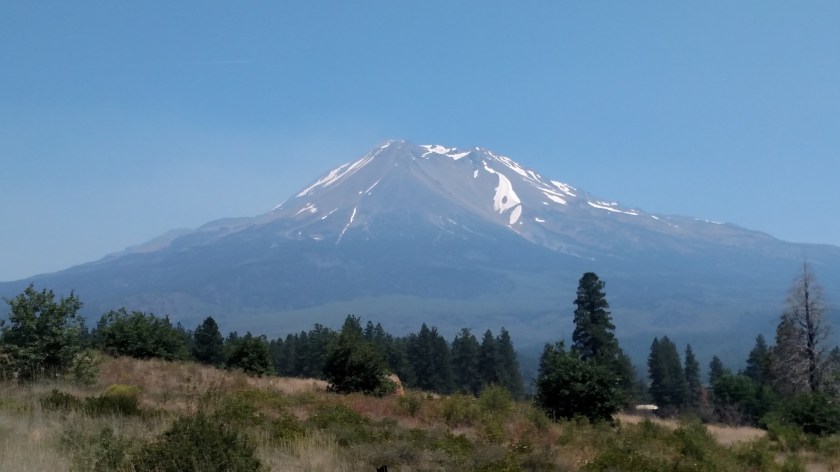
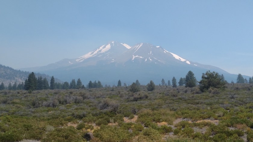
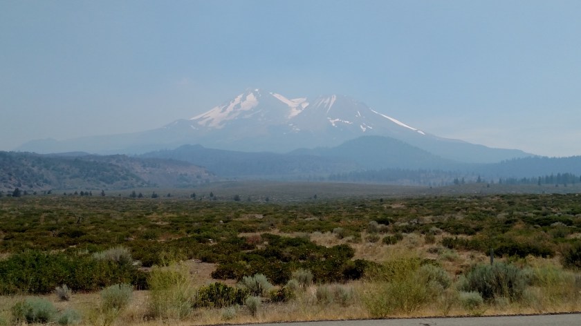
Saturday I drove down to visit the Lava Beds National Monument (which I will have other posts about). Now while I am staying in Klamath Falls, Oregon for a few days, the Lava Beds are about 45 miles south, in northern California. Both on the way to and from the Lava Beds I passed through portions of the huge Tule Lake National Wildlife Refuge. Here are some photos I was able to capture today using the digital camera:

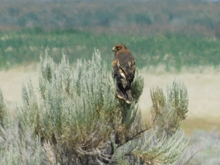
I’m quite sure this is a Northern Harrier (a type of hawk). It was pretty far off the road but I could tell it was very big:

DSCN3565

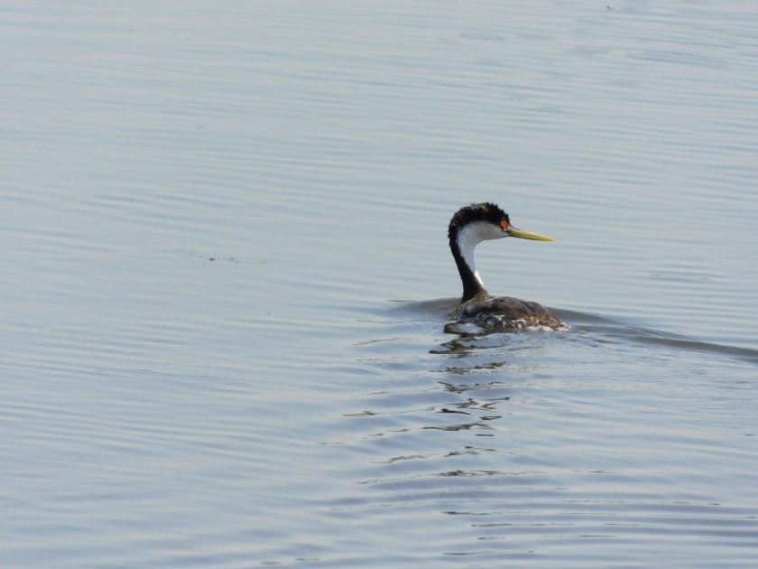
This red-eyed wonder is a Western Grebe. They are like loons and some waterfowl I saw while I was in Arcata (but haven’t posted about yet) in that they will dive underwater for a minute or more while searching for food. They really do have red eyes, although I think I was real lucky on this shot to get some great sun reflection (kind of “red eye” for birds!):

DSCN3571

DSCN3574

DSCN3582

This is a Red-winged Blackbird:

DSCN3589

And as I watching several of these to try and get these shots this one took flight towards where I was parked:

DSCN3592

This is an American White Pelican. This Wildlife Preserve near Klamath Falls was the first place I ever saw a reference to these (I was here briefly last year after visiting nearby Crater Lake), although I never actually saw any until I was in Aurora, Colorado (near Denver) towards the end of my trip last year (Search for “Pelican Point” on the Home page, or use the calendar there to locate posts from 10/16/17).

DSCN3601

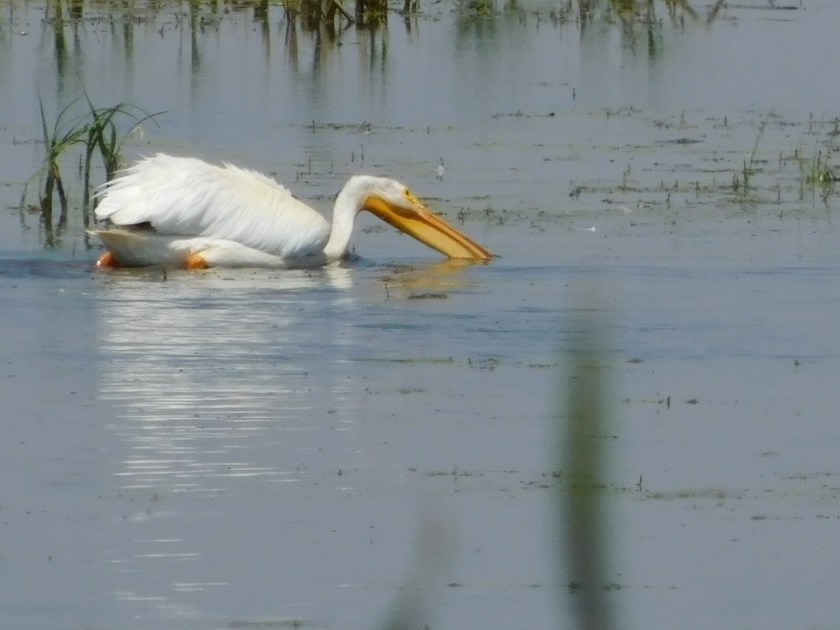
Unlike brown pelicans who dive from the air for fish these pelicans sit on the water and dip them out. Then they lift their heads and swallow their catch.

DSCN3603

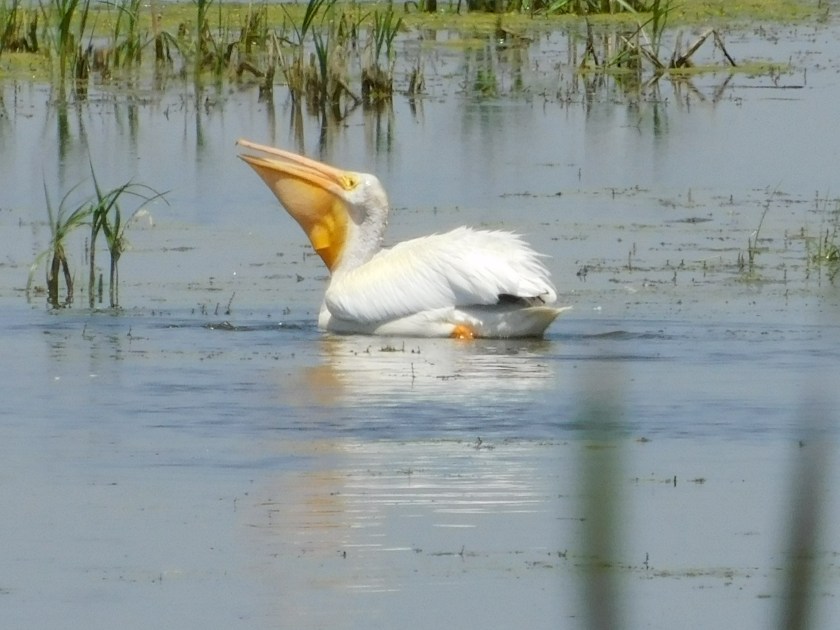
Then, like bobbing for apples, they go back for more…

DSCN3604

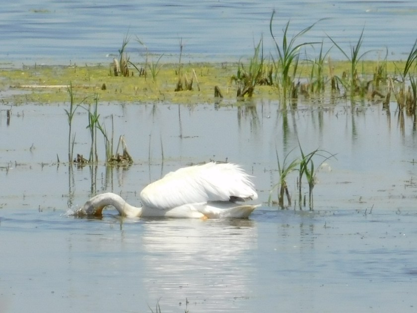
They release the water from their pouch (but not the fish)…

DSCN3605

Then lift and swallow:

DSCN3606

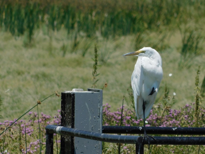
Finally, this is a Great Egret, perched on a nearby work platform, grooming itself while keeping an eye on the lake:

DSCN3612

DSCN3615

DSCN3625

DSCN3629

I may go back down to the Preserve on Sunday and try my luck getting more pictures.

Mount Shasta’s Disappearing Act

I didn’t plan for this to happen but here goes….

Friday was a travel day as I drove from where I was staying in Quincy, California up to Klamath Falls, Oregon (which, by the way is pronounced CLAM-ith, not CLAY-mith as I have been saying for the past year).  My series of scenic roads took me around the western side of Mount Shasta, a 14,179 foot tall mountain in northeast California.  Little did I know that the Klamathon Fire had occurred near Mount Shasta beginning back on July 5th, and lingering smoke was still very evident in a widespread area north and west of the mountain.  Here is a series of photos I shot while traveling through the area Friday afternoon.

I took the first two pictures only to send to a friend of mine in Durham, showing her the snow on the mountain.  They were taken as I approached the mountain from the southeast.

115pm, from a Vista Point (scenic overlook) along Route 89, SE of the mountain:

IMG_20180720_131510829

130pm, from the little town of McCloud, SSE of the mountain.

IMG_20180720_133018647

151pm, from Interstate 5 (while stopped in one-lane highway construction traffic, Shawn), west of the mountain:

IMG_20180720_135149141

200pm, now on Route 97, northwest of the mountain, and starting to drive north and east away from it:

IMG_20180720_140032848

214pm:

IMG_20180720_141412958

217pm, from the vantage point where I took the photos in the previous post, Klamathon Fire:

IMG_20180720_141720117

220pm:

IMG_20180720_142011660

224pm:

IMG_20180720_142408325

And finally, 232pm, from another Vista Point specifically built for folks to stop and view the mountain – which you can now barely see:

IMG_20180720_143217510

Klamathon Fire

Friday was a travel day, as I drove from where I was staying in Quincy, California north to the town of Klamath Falls, just across the state line in Oregon. To get there I took a series of scenic roads which would ultimately take me out to Interstate 5 (pardon me, “The 5”) near Mount Shasta, California. When I exited “The 5,” after only having been on it for 9 miles, I got on Route 97 which would take me northeast to Klamath Falls. As soon as I got away from the dreaded interstate and got to an elevation where I could see off to the left this is what I encountered:

IMG_20180720_141724933

Wildfire smoke. Big time. I knew about the Klamathon Fire and knew it was up this direction but didn’t know to what extent, if any, I would interact with it or exactly where it was. Now I do.

Off to the left of the highway from this vantage point is (or was) the little town of Holbrook, which is where the fire was located. The Klamathon Fire started July 5 and has damaged or destroyed 38,000 acres of land and 82 structures. A 72 year-old man was found dead in his home and his death is linked to the fire (I’m not sure if it was from fire itself or smoke).

Here is a panorama looking left from my vantage point parked along Route 97. There are lots of things (large and small mountains, etc) out there but you can barely see them:

IMG_20180720_141732196

IMG_20180720_141734901

IMG_20180720_141737568

IMG_20180720_141740025

Holbrook is not far from where I took these photos and is about 60 miles southwest of where I am now staying in Klamath Falls.

Ferndale (Houses) – Post 1 of 3

Ferndale (population 1,371) is a little town about 20 miles south of Eureka, California which is best known for it’s large number of Victorian homes and buildings.  I drove down to Ferndale Sunday morning of the weekend I was staying in Arcata.  Here are some of the houses I saw:

IMG_20180715_084420873_HDR

What I loved about this first house is that the gutters off the main roof, instead of feeding the rainwater through a drainpipe, dropped it through a series of little cups which would overflow and send the water to the next cup down the line.  The narrow drainpipe in the next photo removes water from the small roof over the front porch.

IMG_20180715_084437196

IMG_20180715_084651580

This next photo was taken shortly before 9am, while it was still overcast.  When I came back in to Ferndale from having driven out to The Lost Coast I revisited some of the houses to get better photos after the sun had come out.

IMG_20180715_085744046_HDR

Same house, shortly before 1pm:

IMG_20180715_125806768

Same thing with this next house, the “Gingerbread House,” which is right across the street from the white house shown above.

Morning photos:

IMG_20180715_085820046_HDR

IMG_20180715_085832825_HDR

IMG_20180715_085840168_HDR

And early afternoon photos:

IMG_20180715_125530017

IMG_20180715_125549408_HDR

IMG_20180715_125629703

IMG_20180715_125703979

Other houses in town:

IMG_20180715_085951367_HDR

IMG_20180715_125325487

IMG_20180715_125221990

IMG_20180715_090204790_HDR

IMG_20180715_090121766_HDR

IMG_20180715_090141354_HDR

IMG_20180715_090231830


Ferndale (Houses) – Post 2 of 3

Ferndale (population 1,371) is a little town about 20 miles south of Eureka, California which is best known for it’s large number of Victorian homes and buildings.  I drove down to Ferndale Sunday morning of the weekend I was staying in Arcata.  Here are some of the houses I saw:

IMG_20180715_093428660_HDR

IMG_20180715_093443590_HDR

IMG_20180715_093523531

IMG_20180715_093505812

IMG_20180715_093614201_HDR

IMG_20180715_093657240_HDR

IMG_20180715_093744204_HDR

IMG_20180715_093741094

IMG_20180715_093800442

IMG_20180715_093827107

IMG_20180715_093811316

Ferndale (Houses) – Post 3 of 3

Ferndale (population 1,371) is a little town about 20 miles south of Eureka, California which is best known for it’s large number of Victorian homes and buildings.  I drove down to Ferndale Sunday morning of the weekend I was staying in Arcata.  Here are some of the houses I saw:

IMG_20180715_093852868_HDR

IMG_20180715_094110698_HDR

IMG_20180715_094126861_HDR

IMG_20180715_094139073_HDR

IMG_20180715_094145338

IMG_20180715_094215896_HDR

IMG_20180715_094339907

IMG_20180715_094424964_HDR

IMG_20180715_094520375_HDR

IMG_20180715_094537215_HDR

IMG_20180715_094550385_HDR

Ferndale (Buildings), et al

Ferndale (population 1,371) is a little town about 20 miles south of Eureka, California which is best known for it’s large number of Victorian homes and buildings.  I drove down to Ferndale Sunday morning of the weekend I was staying in Arcata.  Here are some of the things I saw:

IMG_20180715_083627250_HDR

IMG_20180715_125032871_HDR\

IMG_20180715_083700014_HDR

IMG_20180715_083826144

IMG_20180715_083859334

IMG_20180715_083949552

IMG_20180715_084028139

IMG_20180715_084132110

IMG_20180715_084146471

While I was walking around Ferndale I noticed this variation of an artichoke (a globe artichoke), which has a huge purple flower on top.

IMG_20180715_084333159

I also noticed, about 3 blocks back from Main Street, what I thought were going to be terraced gardens going up a hillside.  Turns out it is a cemetery.

IMG_20180715_084844101

I then took a few steps right across the road to include the sign…

IMG_20180715_084858595_HDR

I guess they just couldn’t bring themselves to say “Dead End”

IMG_20180715_084911453_HDR

The Lost Coast Redux – Post 1 of 2

After visiting the little town of Ferndale I decided to give seeing The Lost Coast another try, this time approaching from the north (Ferndale is where the road starts/ends depending on your direction of travel).  Immediately after leaving Ferndale I started to climb what would turn out to be a relatively small mountain.  While it had been overcast the whole time I was taking photos in Ferndale, as I drove through the heavily wooded road winding up the mountain I realized the sky above me was now blue, and I assumed that I had actually driven up through the cloud deck.  That assumption was confirmed when I reached a clear plateau at the top of the mountain and could look out at the clouds over the ocean.

These were taken starting at 1029am and I was at an altitude of 1,884 feet according to the MyElevation app on my phone.

IMG_20180715_102957676

IMG_20180715_102929007

IMG_20180715_103005246

IMG_20180715_103502759

I resumed driving (while it still had some deteriorating-condition issues this road was much better than I was anticipating – believe me, after the fiasco trying to get here from the south on Friday I had REALLY lowered my expectations…).  I drove back down through the clouds (I was curious at what altitude the cloud tops were but by the time I had driven that far down the mountain I had lost what little cell phone signal I had on the Ferndale side of the hill so the app didn’t work) and finally reached the foggy coast.  It was now 1101am and I had traveled about 12 miles south from Ferndale.

IMG_20180715_110104601

IMG_20180715_110112485

IMG_20180715_110344444

IMG_20180715_110645147

IMG_20180715_110648961

IMG_20180715_110700458

(story continues in Post 2 of 2)

The Lost Coast Redux – Post 2 of 2

Well, they say timing is everything….   I was enjoying the serenity of sitting by the road, watching and listening to the ocean when the sun finally started to break through the fog – at least right in my little part of the world.  This sequence of photos started at 1114am.

IMG_20180715_111431876_HDR

IMG_20180715_111439465_HDR

IMG_20180715_111547752

IMG_20180715_111700130

IMG_20180715_111914744

IMG_20180715_111955975

I’ve posted several photos from my vantage point looking south and once again, over the course of just a few minutes you can see more and more blue sky in them as the fog either lifted or started moving out to sea.

IMG_20180715_112306443

IMG_20180715_113418584

IMG_20180715_113422217

I decided I had seen enough and didn’t try driving any further south on the road as I didn’t want to push my luck.  As I drove back north towards Ferndale I once again drove up through the, now diminishing cloud deck to the totally clear sky above.  When I got to the relatively high plateau I took a few pictures using the digital camera but am VERY disappointed how they came out.  I am learning that the Nikon camera isn’t quite as good zooming in on things as the Canon camera was.

DSCN3479

DSCN3481

DSCN3486

DSCN3495