My Airbnb Experience in California

I must say that I have an amazing string of excellent Airbnb experiences running. While the vast majority of places I have stayed over the past four years have been fantastic, the past month or so has really been exceptional. And I use the term “experiences” as it is much more than just a place to stay. The people who host play a huge role in the success of a stay and their attitude and input (maybe better to say dialogue) really makes or breaks a stay.

I have made a few posts about specific venues but want to take a few moments to recap the past month in California.  I hope you will indulge me.

Visalia – After my stays in Pahrump and Yucca Valley, the week I stayed with Chris and Nicole in Visalia was what really started to build the momentum of my wanting to make this post. This young couple, both teachers, really opened up their home to help me feel welcome, as their reviews indicated they have done with many guests before me. We had many interesting conversations during the week I was there. They are both very intelligent and articulate, and we covered many topics.

Sonora – My week with Barry and his wife Jeri really felt more like a week at a family reunion. This older couple has an absolutely gorgeous home which you can tell is an accumulation of family memories as well as reflecting their personal interests.  Barry’s local knowledge and suggestions for things to see and do which weren’t on my radar was invaluable.  The three of us also had many interesting conversations.

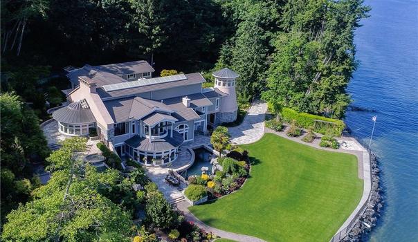
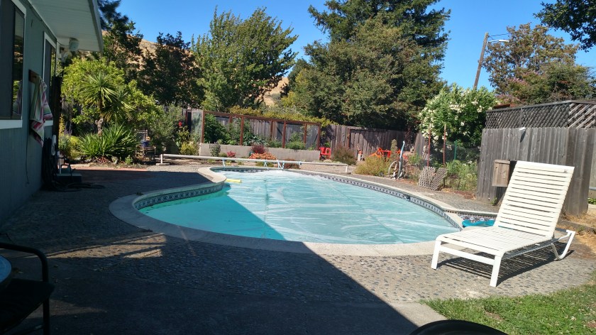
San Rafael – My week with Julia was terrific. She invited me to join her July 4th cookout in her spacious backyard:

IMG_20180708_164033598_HDR

IMG_20180708_164038109

IMG_20180708_164041840

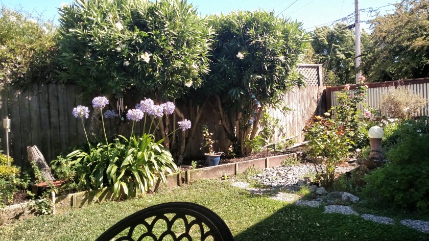
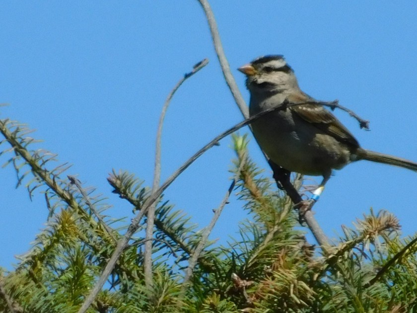
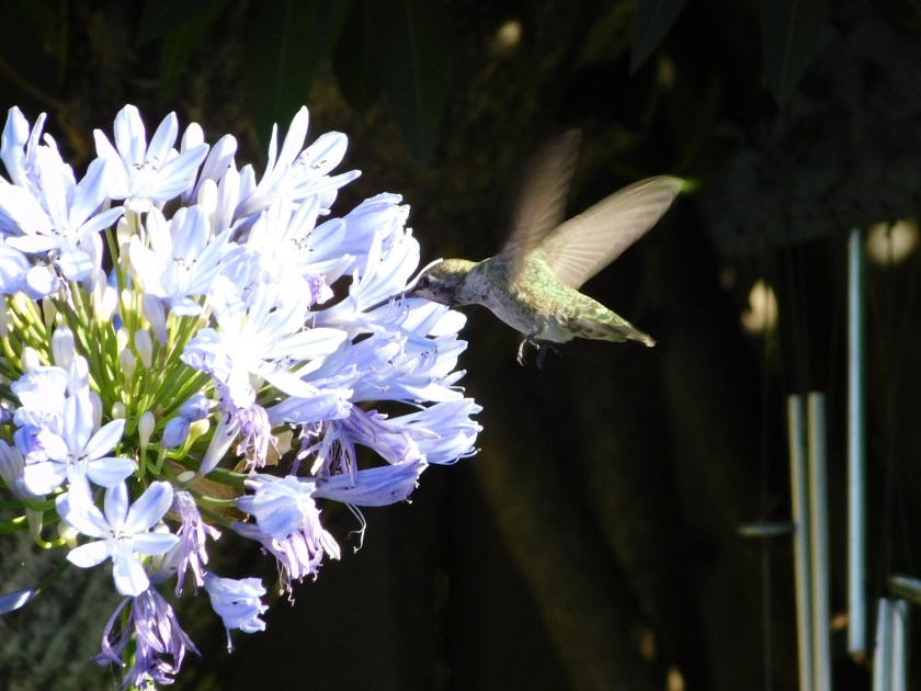
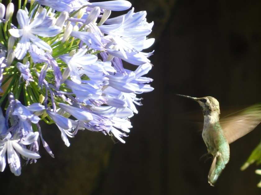
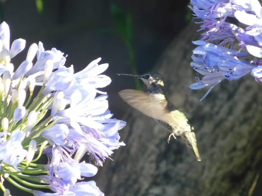
Evenings the rest of the week I often spent sitting outside in the shade (where I took these photos) waiting for the large, green hummingbird to come feed on the purple flowers.

DSCN3124

DSCN2907

DSCN2911

DSCN3075

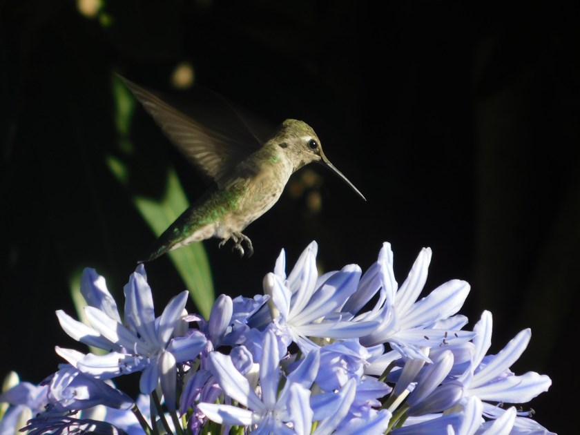
I didn’t realize it at the time but this is actually a different hummingbird.

DSCN3089

DSCN3103

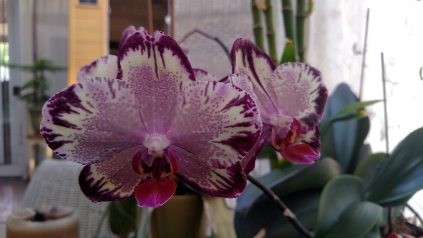
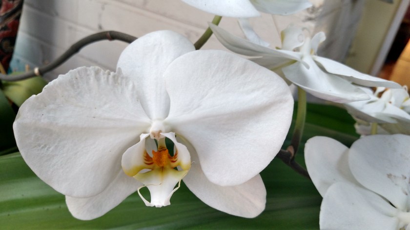
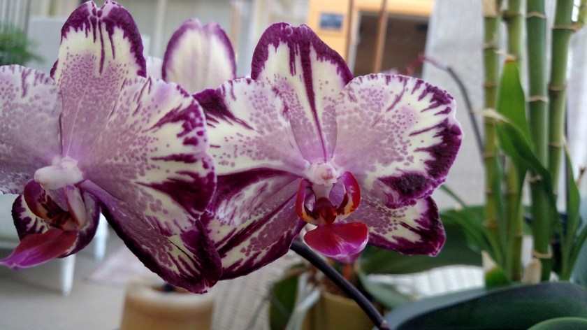
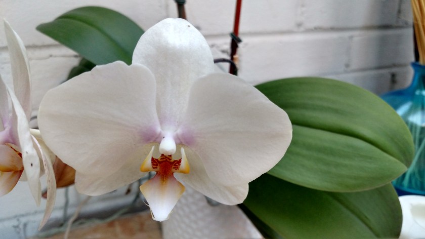
And one day as I was carting stuff outside I noticed the orchids Julia was growing on her indoor porch. I have a particular interest in orchids after having read all the Nero Wolfe books written by Rex Stout. Wolfe is a fictional detective in 1940’s and 50’s Manhattan who had a personal orchid nurse on staff and had 10,000 orchids in the third floor greenhouse of his brownstone.

IMG_20180708_173922780

IMG_20180708_173942330

IMG_20180708_184949065_HDR

IMG_20180708_184903743

IMG_20180708_185002858_HDR

Ukiah – My three night stay in Orell’s home was great and felt like being at home in North Carolina.  I didn’t get to interact with him very much during my stay but enjoyed visiting with some of the other Airbnb guests.

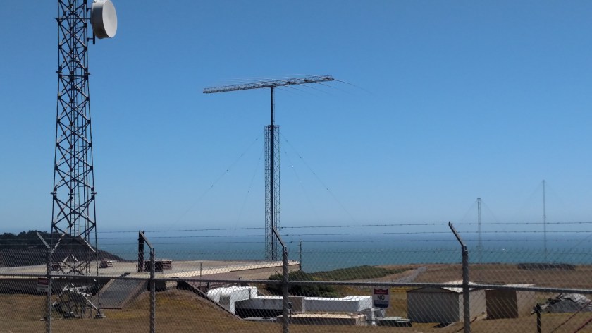
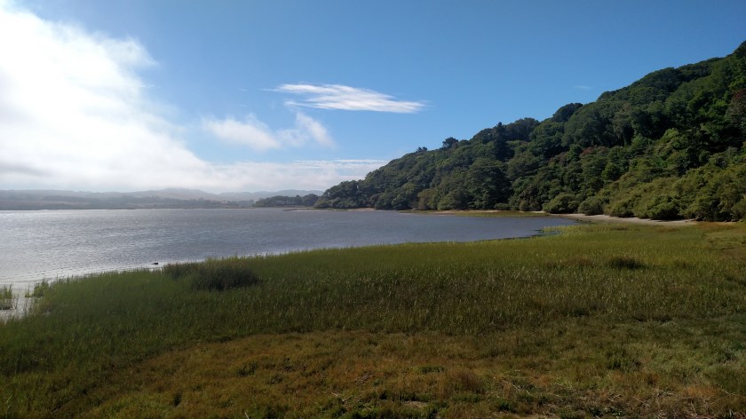
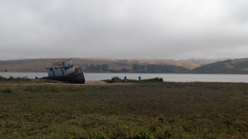
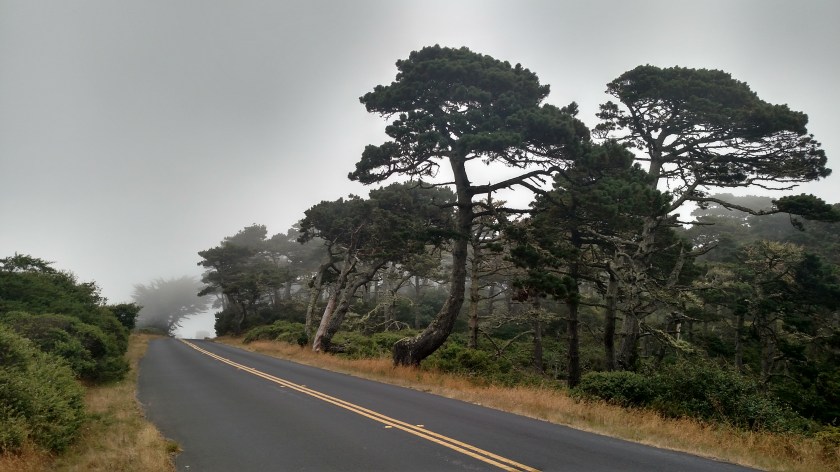
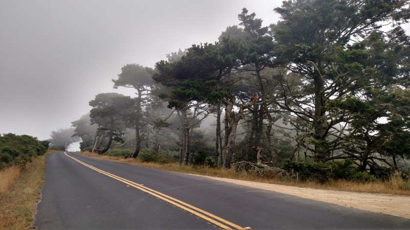
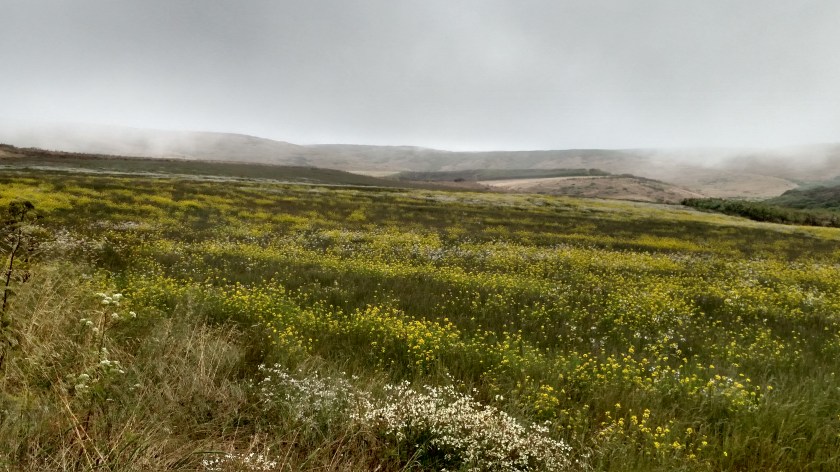
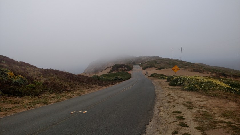
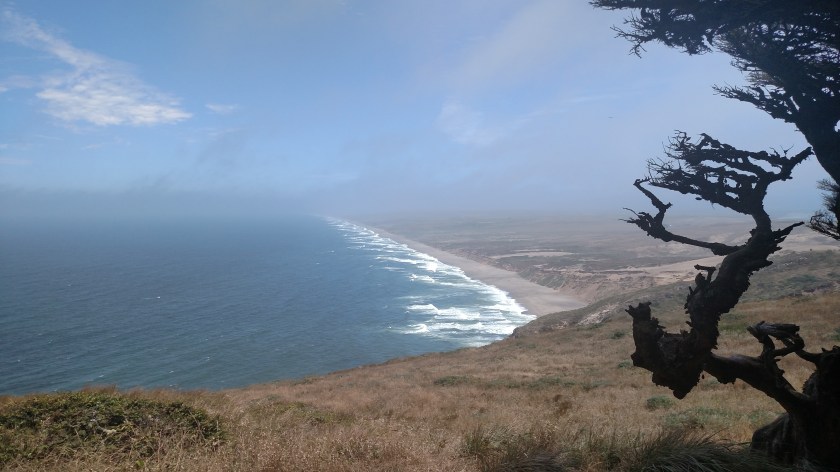
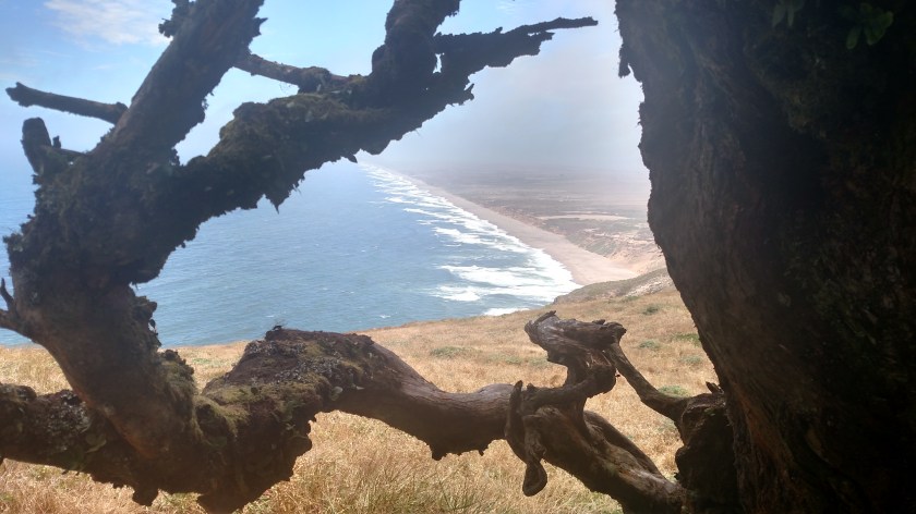
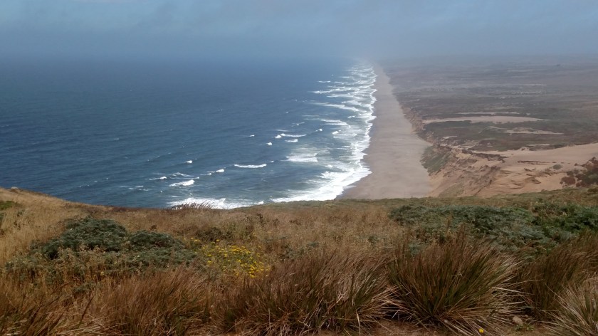
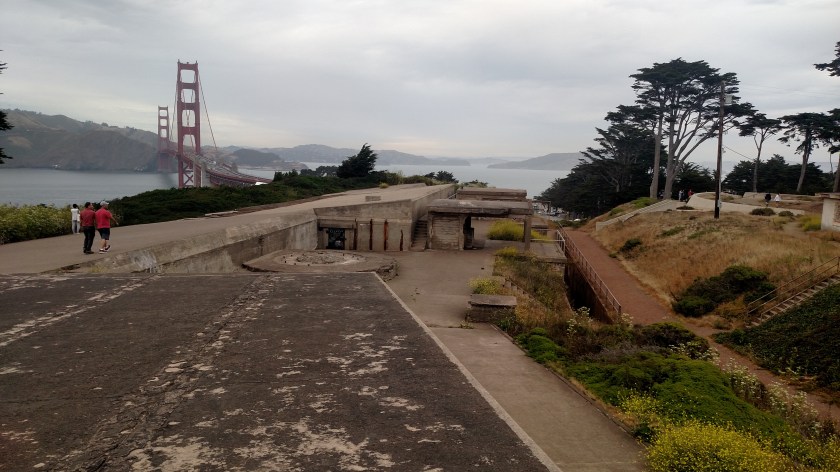
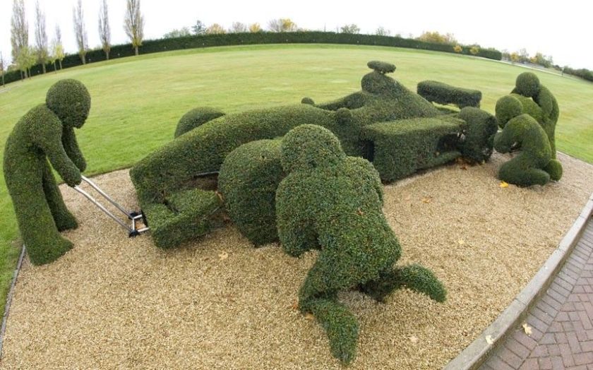
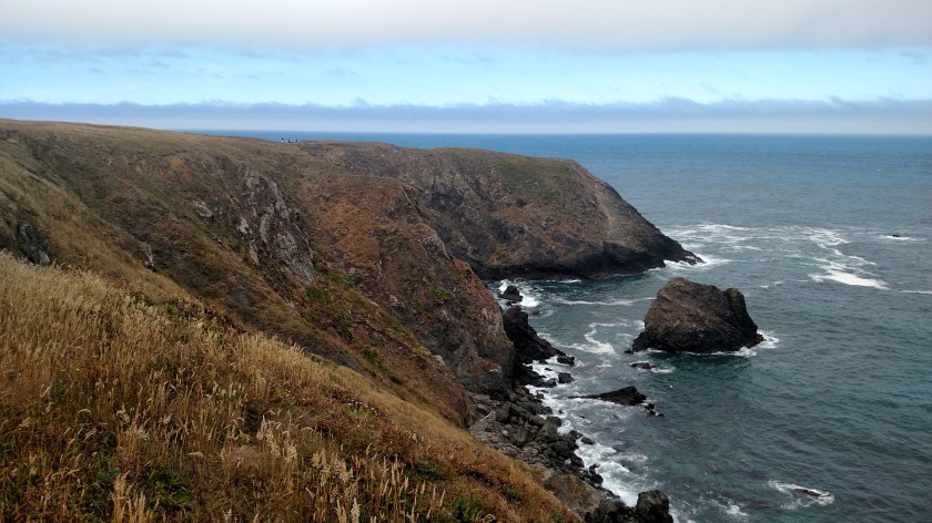
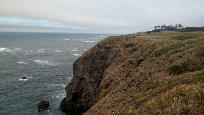
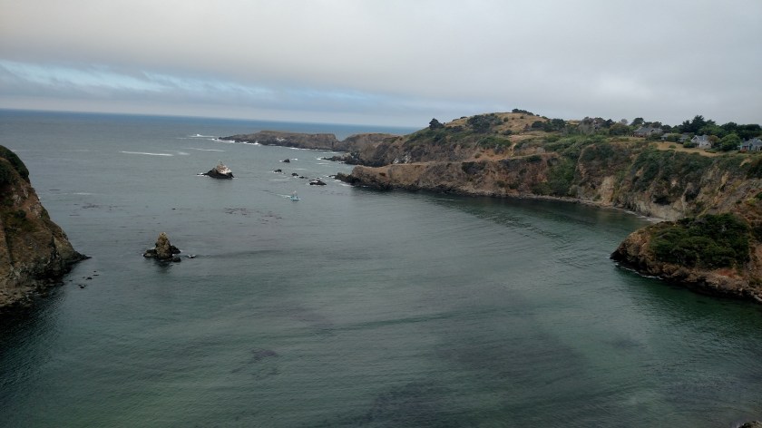
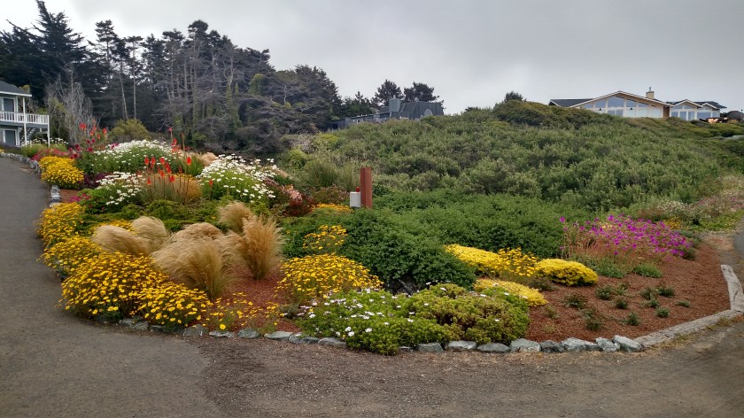
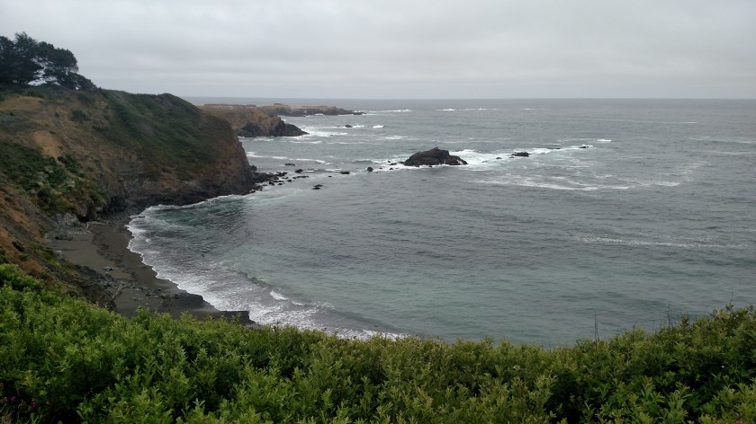
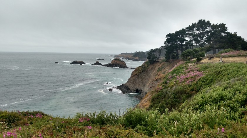
Arcata – I am wrapping up three nights here in Arcata and today will be moving on, inland to Redding on my way to visit Lassen Volcanic National Park for a few days. While I have been spending a lot of time at the coast the last week and a half the forecast for today and tomorrow in Redding are for temperatures of 106 and 109 respectively. Ouch. I have been spoiled by temps in the mountains generally in the 70’s and low 80’s (nice), and at the coast in the 60’s or 70’s (VERY nice). Well, Redding is in the valley (as Ukiah was) and temps there can get a little toasty. I was surprised when I saw this 3-D map of California when I visited the Bay Model in Sausalito:

IMG_20180705_153925765

IMG_20180705_153911961

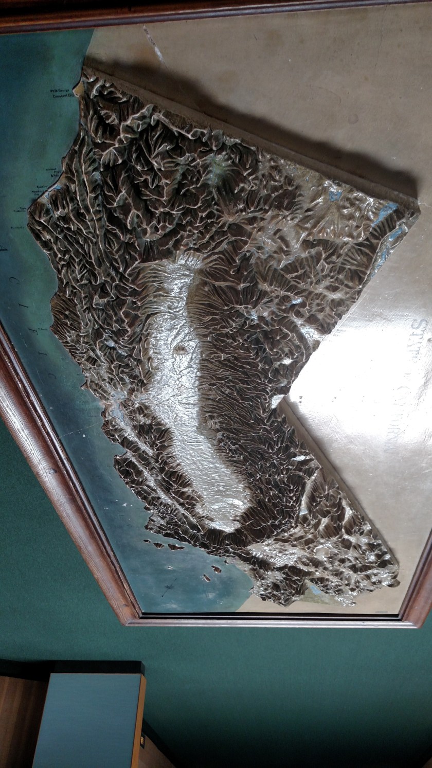
I never realized that California basically has mountains all around it’s edges. Internally (from below the Napa Valley all the way up to where I am now in Northern California) temperatures are often much more intense than other parts of the state because it is a relatively flat valley at low elevation.

I may spend the majority of the day here in Arcata/Eureka before heading to Redding this evening (it is only 140 miles away). Then it will be back to shorts and t-shirts and will put the long pants and sweatshirts away until I get back out to the coast in Crescent City and head north to Oregon.

Sausalito Sunday, et al

Sunday, July 8 I started my day by going back in to Sausalito, California which wasn’t very far from where I was staying in San Rafael.  When I left town a few days earlier I discovered a whole area facing San Francisco which I didn’t know existed.  I also wanted to go to a taco shop which had been highly recommended but which wasn’t open the day after the 4th of July.

The taco shop didn’t open until 11 so I killed some time down by the marina.

IMG_20180708_104520175

IMG_20180708_104537253

IMG_20180708_104605951

These were at the taco shop where I had lunch.  They reminded me of a metal car with a surfboard on top that a friend of mine gave me when he learned how much I like to drive.

IMG_20180708_111634853

IMG_20180708_112408449

As I was walking back to my car I passed a very fragrant plant which I found very pleasant.  I asked someone who was walking their dog on that street and they told me it is a Star Jasmine.

IMG_20180708_114937366

I then drove to the part of Sausalito I only saw briefly a few days earlier.

IMG_20180708_122637386_HDR

IMG_20180708_122651440

DSCN3048

DSCN3055

And lo a behold, here was another office for Engel & Volkers, the high-end German based realtors I mentioned in an earlier post.

IMG_20180708_121538270_HDR

This office is in the original Sausalito Firehouse:

IMG_20180708_121623176

I did a little window shopping….

How about this nice mansion near Seattle:

EngelVolkersMansion

(Photo credit: zillow.com)

4 bedrooms, 6.25 baths, 15,127 square feet.  It can be yours for $20 million.  I guess in this bracket making it $ 19,999,995 won’t win anyone over.

Or how about this yacht – the Seven Sins:

SevenSins2 EngelVolker

SevenSins EngelVolkers

(Photo credit: sevensinsyacht.com)

This 171 foot beauty is on the French Riviera.  If you don’t want the hassle of ownership you may rent it for a mere $332,915 per week (high season) or the bargain price of $315,392 per week (low season).

Or how about the maYbe:

MaybeEngelVolkers

(Photo credit: engelvoelkers.com/en)

You can own this 193 foot yacht and sail it from the French Riviera to the dock of your choice for a cool $40.825 million.


After getting my head out of the clouds I moved on.  I decided to head back out to the coast, taking a slightly different route than I had on Thursday.  Before getting off “The 101” onto Route 1 I saw this tour helicopter getting ready to take off with a group of sightseers:

IMG_20180708_125030152

And parked nearby was this seaplane:

IMG_20180708_125426951

I was tempted to go for a ride but am going to wait until later in the trip when I’m back in Coeur d’Alene, Idaho.  Last year I visited with a couple who operate a seaplane operation there but no other passengers showed up while I was there and the pilot would only go up with two or more passengers.  They were very nice and I think I’ll save my business for them.

I headed back up towards Point Reyes National Seashore.  I wanted to drive the third road there which would take me out to one of the beaches.  Before I got there I stopped at the Point Reyes Bird Observatory, located at the extreme south end of the property.  It was way out towards the end of what became a dirt road.  There wasn’t anyone there but there were directions to a path.  It didn’t look very heavily traveled, and I was a little leery about heading out alone, so I left.  I did manage to get a photo of a bird chirping away at the top of a nearby tree.  I have no idea what kind of bird it is.

DSCN3059

DSCN3060

As I headed back out to the main road I passed what turns out to be a Coast Guard communications facility.  There were a number of unusual antennas scattered about the property.

IMG_20180708_145650792

IMG_20180708_145708260

Point Reyes National Seashore

On Saturday, July 7, while I was staying in San Rafael, California (just north of San Francisco) I made a trip out to Point Reyes National Seashore.  It operates under the jurisdiction of the US National Park Service and is a triangular piece of land which covers approximately 111 square miles.  The long side of the triangle is about 33 miles in length, starting north of Stinson Beach, CA and running northwest up as far as Tomales, CA.  The southern half of that 33 mile stretch is “connected” to the mainland whereas the portion just north of the town of Point Reyes Station is separated from the mainland by Tomales Bay.  To see a map, Google “NPS Point Reyes Map” and on the first page you find select “Park Map”.

Saturday I drove up to the town of Olema and got on the access road out to Point Reyes.  I arrived around 10 o’clock in the morning and there was some coastal fog in certain areas but it was not terrible.  I drove through the town of Inverness and stopped to take a few pictures there:

Looking to the right (southeast) it was sunny and clear…

IMG_20180707_100055193

… but looking to the left, over more of the Bay, it was foggy:

IMG_20180707_100224746

The sun was trying hard to burn off the fog and did peek through partially.  These two pictures were literally taken just 6 seconds apart:

IMG_20180707_100230257_HDR

Further up the road, however, it was still overcast:

IMG_20180707_100832491

I continued north on what is the main road through the Seashore, Sir Francis Drake Boulevard.  Shortly after turning away from the mainland beyond the town of Inverness I turned right on Pierce Point Road and drove north on it until it ended near the northern tip of the triangle.  If I were a hiker I could have continued walking north up in to the Tule Elk Reserve (and would probably have seen some elk) but I did not do that.

Shortly after turning right I stopped in this area of trees as the fog was rapidly moving from left to right across the road.  It seemed darker than what these photos show (I probably had my sunglasses on) and with the rapid movement of the fog and the chill in the air it created a rather eerie, almost macabre sensation.  Although it was 1025 in the morning I found myself thinking I was glad it wasn’t 1025 PM on Halloween with a full moon!

IMG_20180707_102708915_HDR

IMG_20180707_102501266_HDR

This was looking right, away from the road:

IMG_20180707_102529151_HDR

I couldn’t see ANYTHING to the left, as that was where the fog was coming from.

Further up the road the fog lifted enough that I could see things in the distance.  I was pleased that my pictures of this field of flowers turned out ok.

IMG_20180707_104329430_HDR

IMG_20180707_104316392_HDR

I drove north until the road ended, then turned around and went back to Sir Francis Drake Road.  I turned right on it which would then curve left and take me out to the tip of the triangle (the furthest point west in the ocean).  This is where I would find the Point Reyes Lighthouse.  First I had to get there….

I drove out to the ocean at both the North and South beach access roads.  The fog had lifted even more, though as you will soon see I wasn’t quite done with it yet.  I believe this was looking out at the ocean from the South Beach access road:

IMG_20180707_113633156

Then I continued out towards the lighthouse, traveling southwest away from the mainland.  Here is the view I had of the top of the Point, where I presumed the lighthouse would be.  Totally socked in by fog.  This photo was literally taken at noon:  12:00:00:066

IMG_20180707_120000066

I drove as close to the peak as I was allowed to but had to park the car and walk the remainder of the way.  I had seen a sign at the Visitor Center that Point Reyes is the windiest and foggiest place in on the west coast.  Think it wasn’t windy??  This is how the trees near the peak grow:

IMG_20180707_121404750_HDR

Believe me, it was VERY cold and VERY windy at noon on this Saturday!

Well, I walked past the highest point and started to descend on the other side.  I was puzzled.  Where was the lighthouse??  Well, much to my surprise, I found it way down by the ocean:

IMG_20180707_121745296

I didn’t go down the stairs to see it because then I’d have to come back up!.  They put it down there because of the persistent and heavy fog.  I believe the Ranger told me it is only 250 feet above the ocean.

As I walked back towards my car I noticed that some of the fog at the peak was finally starting to burn off so I could now see northeast along much of the length of Point Reyes Beach.

IMG_20180707_123442937

IMG_20180707_123459636_HDR

IMG_20180707_124241385

And when I drove back to Inverness it was much sunnier there than it had been in the morning:

IMG_20180707_135642397

In a few days I would return to Point Reyes and drive out Limantour Road which would take me to Limantour Beach.

The Presidio

On Friday, July 6 I visited The Presidio, a former military base located between downtown San Francisco and the southern end of the Golden Gate Bridge.  This site served as a military base for three countries – Spain, Mexico and the United States.  The US Army, which occupied it from 1848 through 1994, turned it over to the National Park Service which now oversees it as part of the Golden Gate National Recreation Area.

The Presidio (there are several in the US but this is by far the largest and best known) covers more than 1,500 acres and includes former barracks, an airfield, a bowling alley and a cemetery.  It now also has a golf course, hiking and bicycle trails and open park space for the public to enjoy.  Since this was once a military base there are also many concrete “bunkers” which were once used to protect the base and the San Francisco Bay from an enemy attack.

IMG_20180706_105854364

IMG_20180706_130416977

These were houses for military pilots:

IMG_20180706_111020377

And this is the view descending down to the airfield (Crissy Field) from where they are located:

IMG_20180706_111144163_HDR

IMG_20180706_111653578_HDR

The large grassy area is where airplanes used to take off and land:

IMG_20180706_111929473_HDR

These were the general barracks, and a large, grassy “parade field”:

IMG_20180706_113439185

The red things are large plastic chairs (to either sit up in or lounge)…

IMG_20180706_113513027

… as demonstrated by these cheerful volunteers:

IMG_20180706_114533449

Anyone lose a set of car keys???

IMG_20180706_113716051

A group of school kids who had been frolicking on the grassy field found these.  When no one claimed them they were going to put them back where they found them, but I suggested that they give them to me and I’d take them to the nearby Visitor Center.  I used the panic button on the key fob to locate the car and take a picture of the license plate.  I took the keys and car information to the Visitor Center and put a note on the car.  Before I left the property the keys and car owner had been reunited.

One of the former barracks buildings has been renovated and is now a Walt Disney Museum:

IMG_20180706_114248975

And the one next to it is now the Lodge at The Presidio:

IMG_20180706_121358243_HDR

Next I went to pay my respects at the San Francisco National Cemetery:

IMG_20180706_122020928

IMG_20180706_121929035_HDR

IMG_20180706_121937929

And before I left I went back to take one more look at the Golden Gate Bridge:

IMG_20180706_132244451


Egad!  While researching facts about The Presidio for this post I discovered that I missed my chance to see the Yoda Fountain!

Yoda-Fountain TheSomewhere

(Photo credit: TheSomewhere.com)

LucasFilms, Ltd, the company which made the original StarWars movies, is based in San Francisco and their headquarters are on the grounds of The Presidio.  I guess The Force wasn’t with me the day I was there…

Go Back There Again, I Must


Nike Missile Base

This missile base is located just northwest of the northern end of the Golden Gate Bridge.  According to our tour guide this is the only active site in the United States (we got to keep one and the Russians got to keep one).  The Nike program (pronounced like the sneaker:  NIKE-ee) was started in 1954 and at it’s peak there were more than 300 missile sites scattered around the outer boundries of the country, mainly on the west coast and in Alaska.  I remember that as a kid I saw a Nike Missile Base along Lake Michigan in Chicago (we never knew if the Russians would launch an attack over the North Pole and approach the US over Canada).  There were bases near major US cities and military installations.

The Nike missile was a ground-to-air anti-aircraft tool which carried a small nuclear payload.  Using 1950’s and 60’s technology (long before onboard computer guidance systems were developed) only one missile could be launched from a particular base at a time and it was guided by using two radar systems – one to track the enemy aircraft and one for the missile.  A human would then use radio commands to “steer” the missile to it’s target.  The goal wasn’t to strike it, but merely get close enough so the concussion of the small nuclear blast would damage or destroy it.  The Nike’s were the last line of defense in case an enemy aircraft got past other detection systems and evaded our aircraft.  No Nike missile was ever fired in anger.

These are the two radar antennas:

IMG_20180706_140450940_HDR

The missiles here could be launched and controlled from one of four places: one of the white trailers to the left in the next photo, the Master Control Center located atop the mountain in the background, another white trailer located elsewhere on the property, or the underground portion of the base (which you’ll see shortly).

IMG_20180706_140445231

After a short walk our tour guide took us underground to see the missiles (I believe there were 6 of them).

IMG_20180706_141341756

Our guide had a female volunteer from the tour group push one of the missiles (which are mounted on rails) to the side.  I forget how much he said it weighed but it was substantial and she could easily push it sideways.

IMG_20180706_141512565

One by one these missiles could be moved to an elevator where they were lifted above ground (which only took about a minute – I shot video but can’t post it on the blog).  Once they raised one of the missiles above ground we went back upstairs:

IMG_20180706_141808273

The front of the missile would then be raised on an angle and it would be launched.  You can probably find video of test launches on YouTube.

IMG_20180706_141816109

IMG_20180706_141851102

IMG_20180706_141925888

Humboldt Redwoods State Park

Friday I ended my trip on part of the godforsaken road to The Lost Coast by traversing 6 1/2 miles of recently paved roadway through this State Park.  It was a welcome relief after being on the “Motorific Torture Track” (a toy car set I had when I was a kid) for over two hours.  When they repaved the road through the Park last year they laid it over the existing road which snakes through the trees in a series of lazy curves.  In places the pavement runs right up against the base of the trees.

Some of the pavement in the next photo is obscured by the brown wood chips and dead pine needles.

IMG_20180713_142752695

The next two photos try to illustrate how the road bends around the trees.  In the first, you can barely see my car parked in the distance.

IMG_20180713_143308212

In the this photo I stepped out a short ways into the roadway so you can see how the road bends back to the right just beyond the tree:

IMG_20180713_143328351

If you aren’t very careful, and as you move right in your lane as you meet oncoming traffic, it is actually possible to hit a tree without any of your tires leaving the pavement.

Racecar Topiary

The other day I posted a some pictures of topiaries I saw near Manchester, California.  Mary, a fellow Airbnb guest I met when I stayed in Pahrump, Nevada earlier in this trip, posted a comment asking if I knew what kind of trees they were (I do not).  I never made it back down to Manchester to ask the property owner but Googled it to see if I could find the answer.  While I found other photos, none of the websites where they had been posted mentioned the types of trees, only their location.

While looking at the Google Image results I did find this photo which I thought was really cool.  As many of you know I am a big NASCAR car racing fan.  Well, Formula 1 is a worldwide car racing circuit and one of the major teams, Williams, has this topiary of a Formula 1 car and it’s pit crew outside their team headquarters in England:

F1 Topiary pinterest

(Photo credit: Pinterest.co.uk)


Shelter Cove Lighthouse

I never went to this lighthouse at the southern end of “The Lost Coast” and found this photo online.  When I looked at photos on my phone while on “The 101” coming up from Ukiah Friday morning I thought the “light” portion of this lighthouse was little more than a bump sticking out of the pavement but now that I have looked at other pictures online using my computer I see that it is a little more substantial than that, though not much:

ShelterCoveLighthouse YouTube

(Photo credit:  YouTube)

The Lost Coast

This area, located southwest of Eureka, California, is an actual place. My Airbnb host when I stayed down in Sonora, CA recommended I add this to my “to-do” list so Friday as I approached the area from the south I gave it a shot. It didn’t go well….

The Lost Coast does include part of the Pacific Coast and is accessible (and I use that term loosely) by three small roads. I started in on the southernmost road which branched off “The 101” near Garberville, CA in a little town called Redway. I didn’t get off to a very good start as my goofy GPS put me on the wrong road right off the bat. I caught the error very quickly and found the correct road which was nearby.

After driving about 9 miles I missed my turn (because the directional sign didn’t include the name of the town I was heading for) and when I saw a sign for a coastal town with a “lighthouse” I had already decided I didn’t need to go see I realized I was, again, on the wrong road (and for those of you who are going to say “JohnBoy, just use Google Maps on your phone” – guess what – there was no cell phone service in this area…). I corrected that error (and lo and behold when I was going the other direction the directional sign DID include the town I was heading for) and got on Wilder Ridge Road which is, without a doubt, the WORST ROAD I have ever been on in my life.  20 miles of pure hell.  This made the access road to Chaco Canyon in New Mexico look good.

This road was so bad it was almost comical. It was paved, mostly, although in some spots some or all of the pavement was gone and the parts of the road which were not washed away were just dirt and rock. There were bumps, ruts and potholes EVERYWHERE. I believe there were 3 or 4 places where the road narrowed to just barely one lane due to washout. And right before I got to my little town the road became a series of steep, wide switchbacks, just dirt and rock, which had been carefully graded to be about 3 lanes wide and prepped for paving (yeah, right – probably not in my lifetime). CalTran, the state Transportation department, has made some effort to patch small portions of the road but they missed way more than they got.

The only good part about this hour+ of my life which I’ll never get back is that I did finally make it to Honeydew, California, population 99.

IMG_20180713_132530432

IMG_20180713_133030918

Now I had a decision to make. Do I turn left, right, or retreat the way I came in???

I got out of the car with my trusty map and approached two older ladies who were seated at a picnic table outside the general store. I think they knew what I was going to ask.

The bad part of the road I had just been on was 20 miles long (plus 8.6, not counting the overrun, coming in from Redway). If I turned left towards Petronia and eventually the coast and Ferndale it would have been another 44 miles. If I turned right towards Weott and “The 101” it would have been 25 miles. I had already decided I was going to take the devil I didn’t know over the devil I knew.

Well, the ladies concurred that all three choices were bad.  They said “all the roads are terrible”.  Terrific.  I opted to turn right and head for Weott.  That road wasn’t much better than the one I had already been on but it had retained most of it’s pavement and had fewer dirt and “washout” areas (and by the way, these are all winding, mountain roads). The best part of that choice was that the last 6 1/2 miles before I got out to “The 101” was all new pavement, completed just last year, through the Humboldt Redwoods State Park and was as smooth as a pool table.

I treated my car to a car wash when I got back out to civilization (although it may also need a wheel alignment and new shock absorbers after my excursion).

The other funny thing which happened during the drive in to Honeydew is that there were several areas where there were lengthy stretches of privacy fence installed on both sides of the road (and there was a surprising amount of traffic given both the remoteness of the area and the condition of the sorry excuse for a road). I thought maybe a nudist colony – like who would have time to even look up from the road – but the ladies said “Oh no, they’re all growing pot”.

And as I downloaded the photos from my phone to my computer this morning I noticed that yesterday was Friday the 13th.  Perfect.

Thursday – Various places

I took a shorter route to get out to the coast Thursday morning, not knowing what the conditions would be like when I got there.  I updated the post I made yesterday regarding the “Thank You” sign to include a photo of the area which recently burned which is only two and a half miles from the thankful woman’s house.

I also drove through the same grove of redwood trees, but stopped to take a photo of the road through them.  This is actually Navarro River Redwoods State Park, a few miles southeast of Mendocino:

IMG_20180712_110603099

When I got to the bridge where the road I was on ended and merged with Route 1 the scene was much better than it was the day before.  Yesterday the area beyond the white vehicles on the right was totally obscured by fog:

IMG_20180712_112253267

And this was what the ocean looked like not far beyond that point:

IMG_20180712_113640047

IMG_20180712_113654173

The visibility was much better, though there were high clouds which obscured the sun.  There was only a slight breeze and the temperature was right around 60 degrees, as it had been on Wednesday.  Inland, before I got to the redwood groves, it was inching up towards 90.

Not far north on Route 1 I came to the little town of Albion.  I crossed a long bridge from which I took these photos.  Looking out towards the ocean:

IMG_20180712_114929179

And looking inland, down at a campground and fishing village:

IMG_20180712_115250561_HDR

As I was looking out towards the ocean I noticed a small blue fishing boat I had seen out on the open sea earlier.  It was coming in to unload it’s catch of the morning.  It the first photo it is a little left of the center of the picture.

IMG_20180712_115312198

IMG_20180712_115426743

I stopped further north on Route 1 in Mendocino (see next post) and as I was leaving town on a different street than I had come in on I found this little Bed & Breakfast Inn, perched next to the ocean:

IMG_20180712_123738219

IMG_20180712_123814138_HDR

Here is the view their guests can enjoy by taking just a short walk across the road:

IMG_20180712_123845905

IMG_20180712_124026785_HDR