Perry the Mountain Goat Redux

Before I begin today’s posts let me update one from yesterday.

IMG_20170811_120623625

When I arrived at the Hell’s Canyon office today I saw a “please don’t feed the animals” poster containing a picture of a mountain goat.  This is what Perry would look like up close, not from a quarter mile away.

The Seven Devils

IMG_20170811_101041881

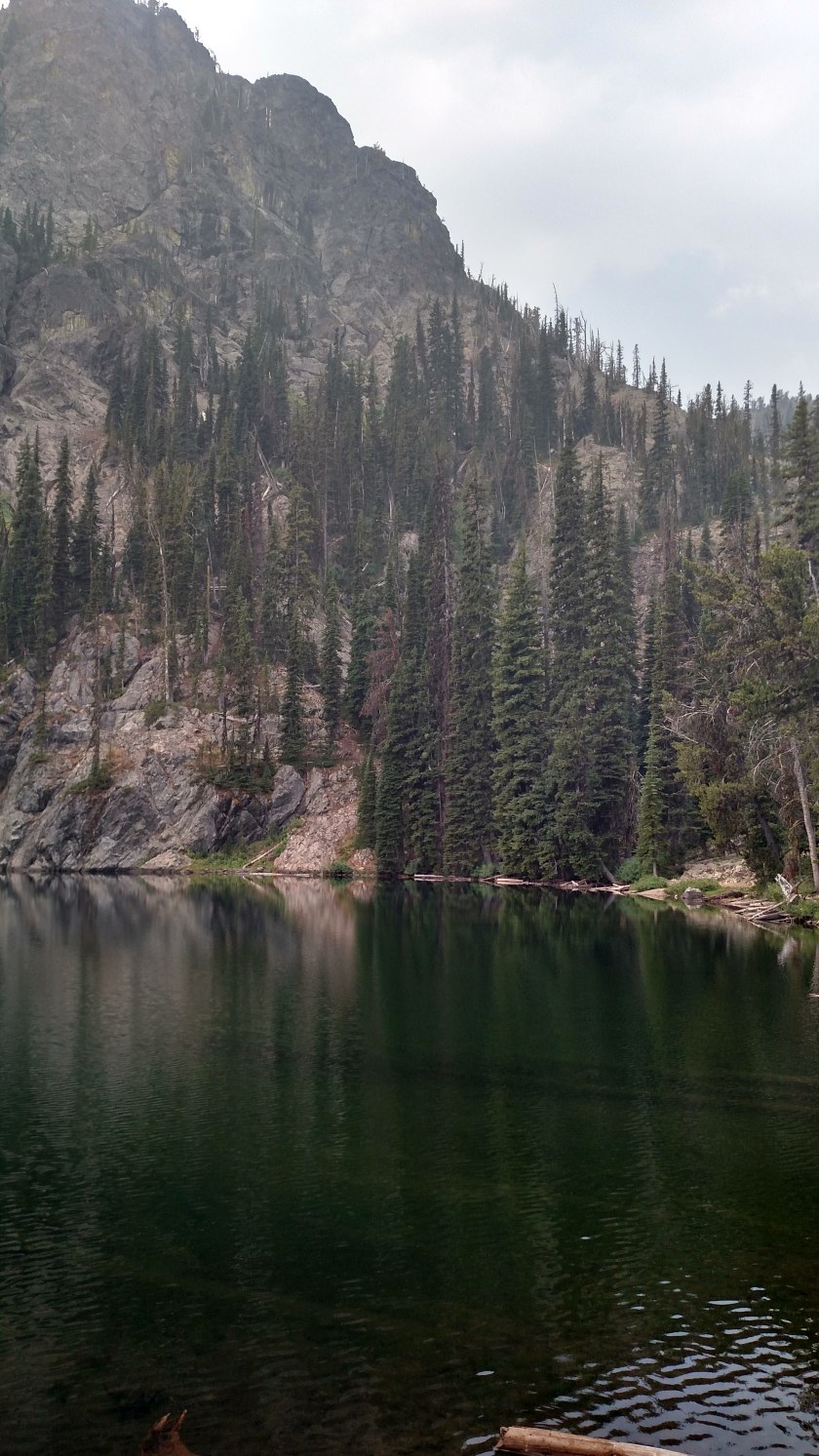
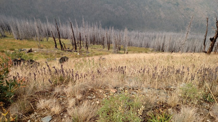
First let me properly identify where I am.  This is the Hell’s Canyon National Recreation Area which straddles the Snake River, separating northeast Oregon to the west and western Idaho to the east (did you follow all that??).  Hell’s Canyon is the deepest Canyon in North America.  The reason I was disappointed (impressed, but disappointed) when I arrived on Wednesday is that I was at the Hell’s Canyon Overlook south of here, which is “only” at 6,982 feet of elevation, far short of the 8,000+ foot drop I was expecting.  The view from there (see previous post) was of the 10-mile wide expanse of the Canyon.  As I said, impressive but not what I was expecting based on my research.

Thursday I drove north of Boise to McCall, Idaho and made inquiries as to how I could get to the 8,000 foot elevation I had read about.  I was referred to the Hell’s Canyon office in Riggins, Idaho which was about another hour north.  I had done some other things Thursday morning so it was mid afternoon at this point, and I decided to come back up here today.

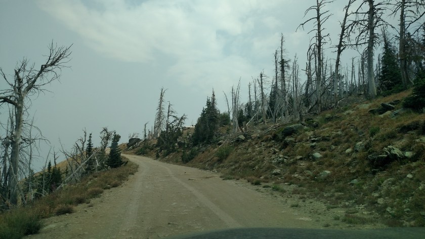
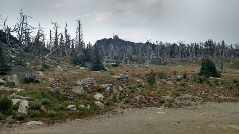
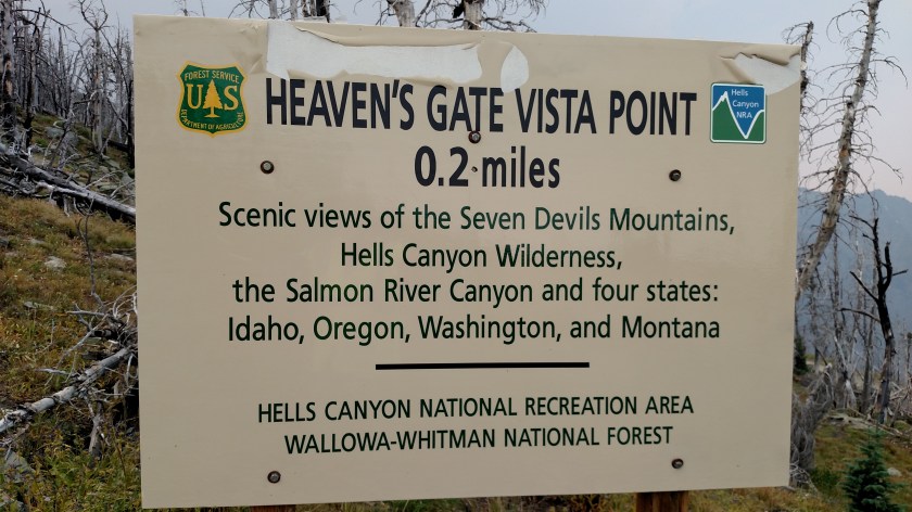
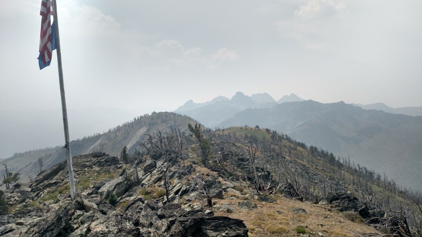
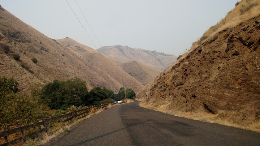
The very helpful woman at the office (thanks again, Donna!) provided me with maps and instructions on how to get to where I wanted to be.  The road seen in the photo above was just south of the office and led me up to an area known as The Seven Devils, a range of mountains.

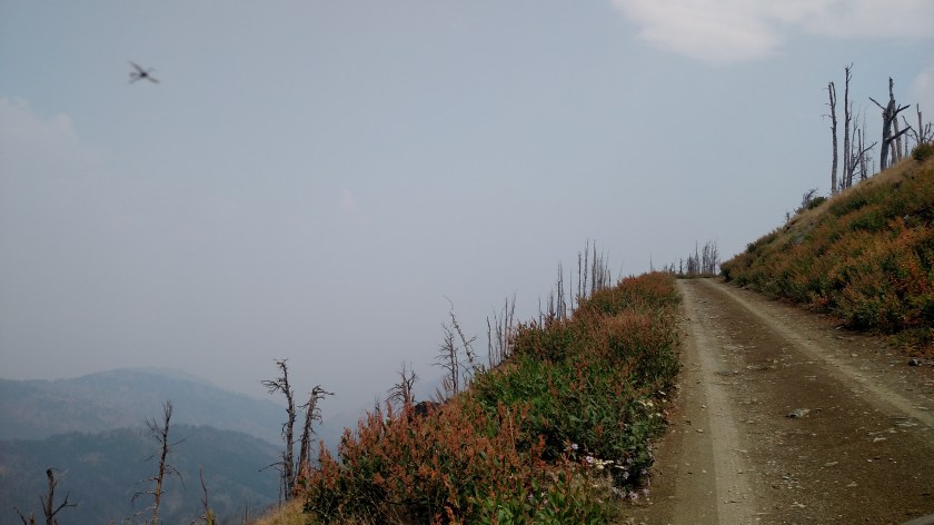
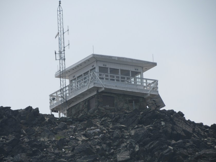
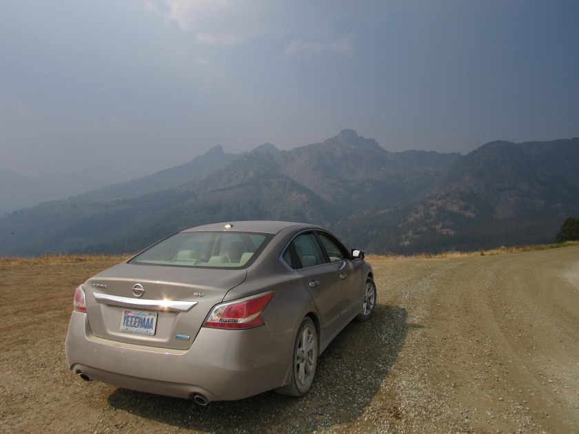
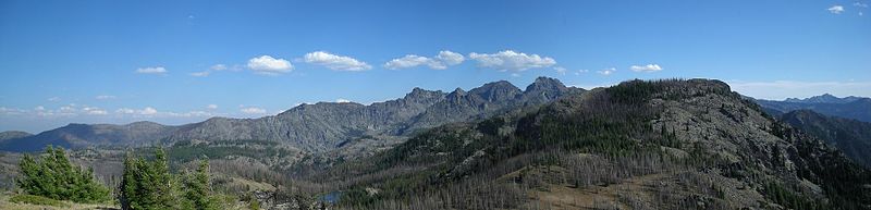
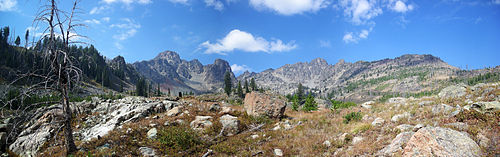
I drove up the 17 1/2 mile road (paved for about 4 and gravel the rest of the way) and reached a 7,500 foot overlook.  The picture below is of three of the seven devils,  The Goblin, The Ogre and Tower of Babel.

IMG_20170811_111940294

I’ll be posting more pictures from here in the coming days, after I have time to review them.

Devil’s Lake

IMG_1375

IMG_1377

IMG_20170811_121312711_HDR

After driving up the 17 mile access road from Route 95 I reached a 7,518 foot elevation observation area.  From there it was a short drive down to Devil’s Lake and Campground.

I didn’t touch the water but a ranger later told me it is always very cold because it is largely fed by snow melt.  It is located down in a small valley below the tall mountains so it doesn’t get much sun to heat the water.

IMG_20170811_112248210

After walking down to the lake to take pictures I walked back up to the parking area where a group of youngsters had gathered before starting a hike.  I told them to definitely go down and check out the lake first.

IMG_20170811_112404333

IMG_20170811_112316339_HDR

I also met and talked with a park employee (who I had seen earlier in the day and would see several more times) and her faithful companion Butler, who was torn between paying attention to the other dog in the picture who had just arrived, or the man in the silly Safety Sam vest.

Heaven’s Gate Lookout

IMG_20170811_113901230_HDR

IMG_1392

IMG_20170811_115132866

The top photo was taken from the Heaven’s Gate Vista parking area.  When I parked my car I was at 8,225 feet of elevation.  The Lookout you see is at 8,400 feet.  It is staffed full time by two people who actually live underneath it.

The original lookout was destroyed by fire in 1958.  The structure you see here was built in 1978.  As you can see from the photos, the top of this mountain suffered a wildfire, the Green Acres Fire, in 2006 although the lookout itself was spared because it is surrounded by a large open area of rock.

I walked up the 2 mile path to the tower (oh… wait…. it’s only  .2 miles.  It only felt like 2 miles because of the altitude!) and spent about an hour talking to the folks who staff it.  They have a full 360 degree view of the area and are constantly monitoring the landscape for new fires.


Looking out from the Fire Tower


IMG_20170811_130822482_HDR

Before walking back down the path to the parking area I took this photo looking back toward the mountains I had seen earlier.  From this vantage point you may now see two more of the Seven Devils, He Devil and She Devil, to the right of the three mountains shown in the previous posts.  The first three had obscured their view because I was to their left as seen from here.

I will be posting more photos from the Tower in coming days after I’ve had a chance to review them.


The Seven Devils – on a clear day

I found these photos online at Wikipedia:

The_Seven_Devils_from_Dry_Diggins_Lookout

(Photo credit: Adam Vogt)

Seven_Devils_Panorama_edit

(Photo credit: Adam Vogt)

So my advice would be – if you plan to visit Hell’s Canyon, and you definitely should, do it before the start of wildfire season.  Snow can keep roads near the observation points closed until late June so I would suggest visiting in early to mid July.  No guarantees, of course.  Mother Nature can be very fickle.

I also heard on the radio this morning that the Pioneer Fire in 2016, which ravaged an area I drove through yesterday, kept burning until snow arrived in the winter.  So visiting in the Fall may not be a good idea, either.  Early summer is probably best.

And I would definitely recommend that you plan to stay for at least a week, especially if you enjoy hiking.  This is the first venue I have visited in the past 2 1/2 years for which I seriously underestimated how long I needed to stay.  The roads are typical mountain roads with lots of twists and turns, are often gravel, and probably contain rocks and potholes which further slow your time in traversing them.

********

After visiting Heaven’s Gate I drove further north to get a closer look at the Snake River.  I’ll post those pictures tomorrow.