Prairie Dogs near Chimney Rock

As I was driving out of the Visitor Center and back towards the paved road I noticed a bunch of prairie dogs running around.  I had seen prairie dogs in the Badlands when I was up in South Dakota at the beginning of my trip but I didn’t have my digital camera then so the pictures weren’t all that great.

I waited until one popped his head out to see if the coast was clear.

IMG_3663

Then I parked my car and waited for more to appear.  It didn’t take long.

IMG_3671

IMG_3669

IMG_3677

IMG_3681

IMG_3686


Wild Turkeys near Chimney Rock

As I was leaving Chimney Rock a flock of turkeys trotted across the road well out in front of me.

Tom/Hen/Chick/Flock.  But it’s not quite that simple, bucko.  An adult male may also be called a Gobbler.  A newborn may also be called a Poult.  Male offspring are called Jakes and females are called Jennys.  And a group is called a Flock if wild, but if domesticated they are called a Rafter.

Oh, the things you learn on johnboystravelblog…..

IMG_3692

IMG_3693

IMG_3695

IMG_3696

IMG_3699


Wolf Creek Pass Overlook

When I met Earl Valdez while getting gas in Fort Garland yesterday (you’ve met his dog, Nia) he told me that when I drove through Wolf Creek Pass there would be a scenic pullout with a fantastic view overlooking the valley to the west.  It was raining when I got there yesterday and visibility was not good, so I went back today as part of my big loop east of Durango.

Boy, was he right….

IMG_20170825_125930861

IMG_20170825_125900564

IMG_20170825_130140041

IMG_20170825_130240648

IMG_20170825_130401826

IMG_20170825_130500556


Pagosa Springs, Colorado

I drove through the little town of Pagosa Springs on my way to Durango on Thursday evening.  It is about an hour east of Durango.  I drove through it twice today, once (going east) as I embarked on my counter-clockwise scenic drive, then going west after I abandoned my grand loop plan due to time constraints (I didn’t want to get home after dark).

I cruised through town heading east but stopped for lunch near the San Juan River before leaving town.

IMG_20170825_120806835

IMG_20170825_120812978

IMG_20170825_120843581

Near the river were some neat little establishments, including the restaurant where I wanted to eat.

IMG_20170825_120732162

IMG_20170825_121157920_HDR

IMG_20170825_121220922

IMG_20170825_120521185

It was just after noon and there was a long line so I opted to just eat the veggies I had purchased earlier in the day and continue driving.

********

After turning around when I got to South Fork and heading back towards Durango I thought I’d have another bite at the apple (actually burger).  Well, there was STILL a long, slow moving line, and I wanted lunch, not dinner, so I left again.  #ImpatientJohnBoy.  #VeryHungryCaterpillar

********

This time when I got to town I stopped to take some pictures.  The first place I saw was a really neat gift shop.

IMG_20170825_145653967_HDR

IMG_20170825_145804479

IMG_20170825_145830878_HDR

IMG_20170825_145813714_HDR

They had some very colorful baskets on their front steps.

IMG_20170825_145704104

IMG_20170825_145712271

IMG_20170825_145720835

And in the window was a huge, very colorful shallow bowl (like you’d use for a centerpiece).  I put the camera right up against the glass to eliminate the reflection so you can’t see the whole thing.

IMG_20170825_145732967

I went in to grab a business card and to tell the person working there that I’d be posting some pictures on my blog.  I ended up buying a much smaller bowl for myself (they are made of plastic-covered telephone wire, wound very tightly).  Everything was fairly pricey but they were all very nice.  You get what you pay for, and talent should be rewarded.

Contact me if you want the name of the shop (upper right corner of blog welcome screen).

There were other photogenic places in town, though too numerous to show them all.

IMG_20170825_150939663

IMG_20170825_151009451

IMG_20170825_151357859

This was the neon sign I noticed as I drove through town the night before (with darkened skies due to rain).  My car just happens to be parked right out front!  Funny how that works….

IMG_20170825_153500726


Pagosa Hot Springs

And you may have guessed that the town is called Pagosa Springs because of the Pagosa Hot Springs, the deepest geo-thermal hot spring in the world.  I never knew there were so many hot springs in this country.  It seems like I’m finding them everywhere.

This is from street level, looking down on the San Juan River after parking my car.

IMG_20170825_151440753

Then just turn your head to the right and, voila, there is the hot springs resort.

IMG_20170825_151435882

Up at street level was this little volcano-like cone which was oozing spring water out the top.  There were no warning signs (like you’ll hear about below) so I presume it wasn’t terribly hot.  The rotten egg-like smell of sulfur in the air was evident.

IMG_20170825_151604169

The clear water cascaded down over these rocks to the river below.

IMG_20170825_151723628

IMG_20170825_151726825

I went down a sloped walkway to river level and and headed right.

IMG_20170825_151814414

IMG_20170825_151944083

IMG_20170825_152017021

I crossed a pedestrian bridge to get to the Hot Springs Hotel.

IMG_20170825_152126202

IMG_20170825_152151467

I looked ahead one month to a Wednesday in late September (after Labor Day).  The cheapest room for two people was $219/night.  Or you can splurge for the John Wayne Suite (or one of several others) for $619/night.  Enjoy!!

Behind the hotel was one of the hot springs.  There was a fairly tall wall around it and warning signs not to touch the water, as it is extremely hot.  I could feel the heat rising off the pool of water, some of which was bubbling.

IMG_20170825_152738409

Out in front of the hotel was a huge chess board.

IMG_20170825_153038675

I noticed these tiny flowers as I got ready to cross the pedestrian bridge back towards town.

IMG_20170825_153102861

A very nice place, if you can tolerate the smell.


Cheyenne Mountain (final thoughts)

No photo.

At the risk of beating a dead horse, I thought of something I forgot to mention about Cheyenne Mountain Complex which I wanted to share.  That led me to do some further research online:

Inside the mountain (one mile in and 2,000 feet below the peak) is a 5 1/2 acre campus consisting of 15 buildings.  Most are 3 stories tall.  These modular buildings sit on huge springs.  The mountain is solid granite and will shield the bunker not only from a nuclear blast but also the resulting EMF (Electro Magnetic Field) which would normally disrupt electricity and computer operations.  There are tunnels leading in to the bunker and two 23-ton blast doors can be closed very quickly when an alarm is sounded (they are actually recessed in side tunnels so they would not face a direct blast).  The doors were last closed (other than for practice) on September 11, 2001.  Facility tours have not been conducted since that date.

In addition to the buildings, there are 3 giant lakes inside the mountain.  One, a 1.5 million gallon spring-fed fresh water lake, provides drinking water for the workers.  Another 4.5 million gallon lake (of water) is used as a heatsink to absorb and dissipate the heat created by generators, computer equipment, vehicles, etc.  A third lake (of undisclosed size) contains diesel fuel for the vehicles and generators used inside the complex.


Great Sand Dunes National Park

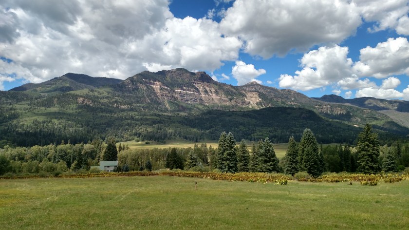
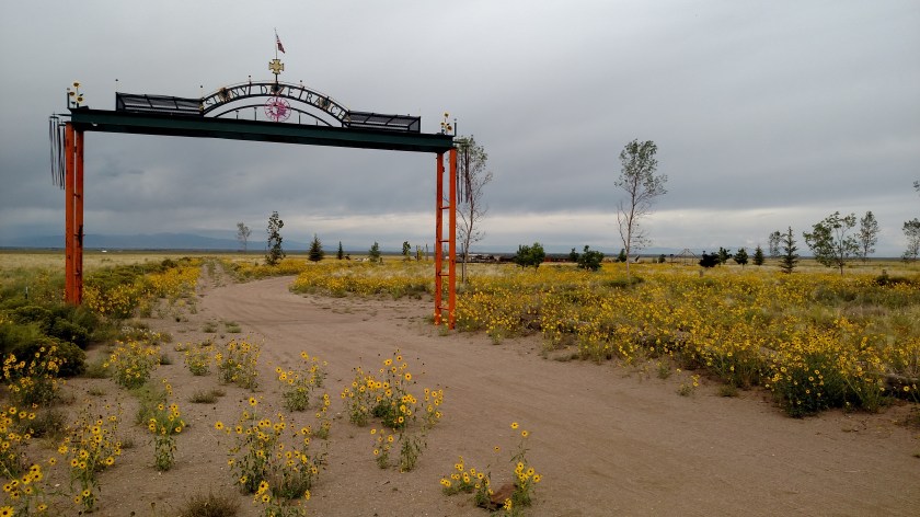
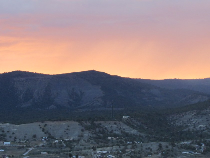
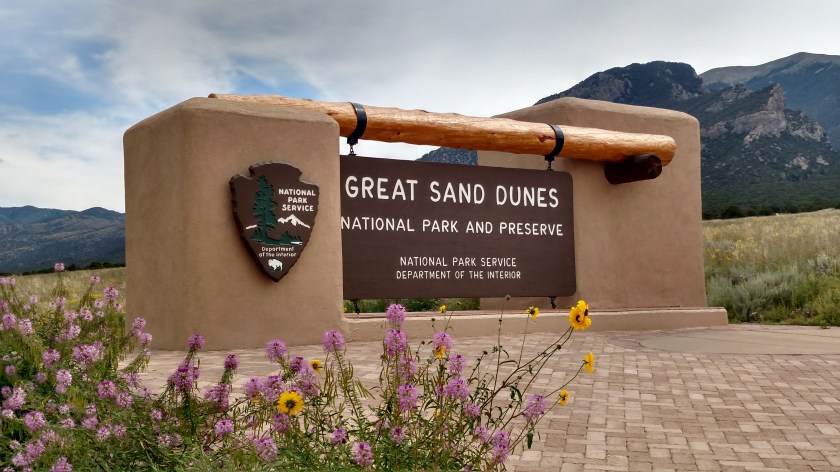
Today I traveled from Colorado Springs south and west towards Durango, where I’ll be spending the next 5 nights.  The major attraction for the day was this National Park, located northeast of Alamosa, Colorado.

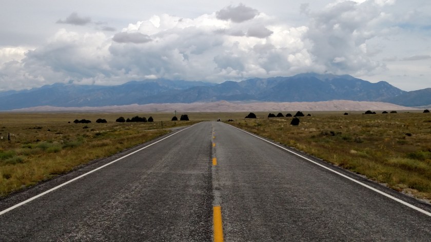
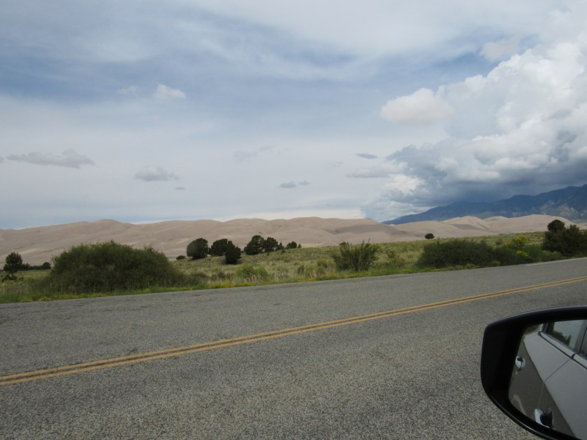
After I turned off Route 160 onto the access road it was a 16-mile drive north to the Park entrance.  This was about 6 miles off the main road, headed right for the Park.  You can see the light colored dunes sitting at the base of the much larger Sangre de Cristo mountain range behind them.  Don’t be deceived by the dunes apparent lack of height.  These are the tallest dunes in North America, as you’ll soon see.

IMG_20170824_111453969

IMG_20170824_112654109_HDR

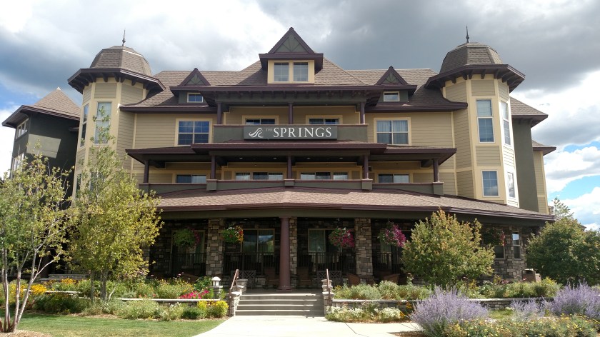
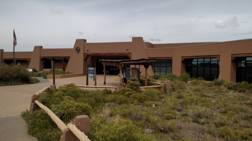
First stop was the Visitor Center.  It was built using “Tromble Wall” technology, which is a passive solar collection system.

IMG_20170824_120738917

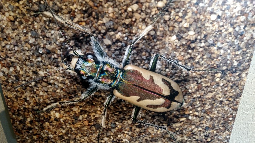
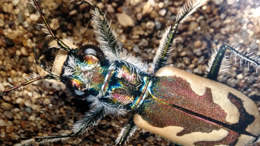
As you would expect, inside were displays and photographs pertaining to the Park.  This is a photo on display of the colorful Great Sand Dunes Tiger Beetle.  This is the only place in the world where it is found.

IMG_20170824_115206470

IMG_20170824_115212572

Another curious creature which was on display (in 3D, though stuffed, not moving about) was this Ord’s Kangaroo Rat.  Not very big, but look at those feet!!

IMG_20170824_120244204

The Dunes were created as the result of sand blowing east from the Rio Grande river (which I crossed after leaving the Park) and it’s tributaries, as well as High Desert further west.  The sand can’t make it over the mountain range and gathers near the base of the tall mountain and, voila…  sand dunes.

IMG_3361

IMG_3392

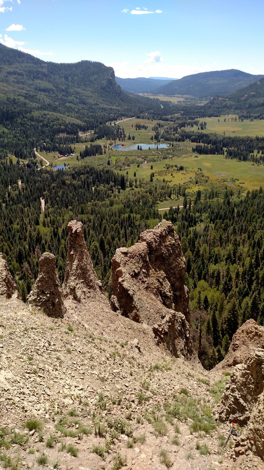
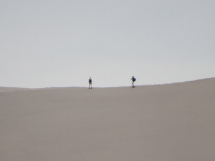
The dunes are constantly changing, shaped by the wind and contours of the land.  And these dunes aren’t exactly what you’ll find at the beach.  The highest peak visible as you drive in from the main road is approximately 650 feet tall (that’s higher than a 60 story building, folks), and there is another set of dunes about a mile and a half further back which is 100 feet taller.

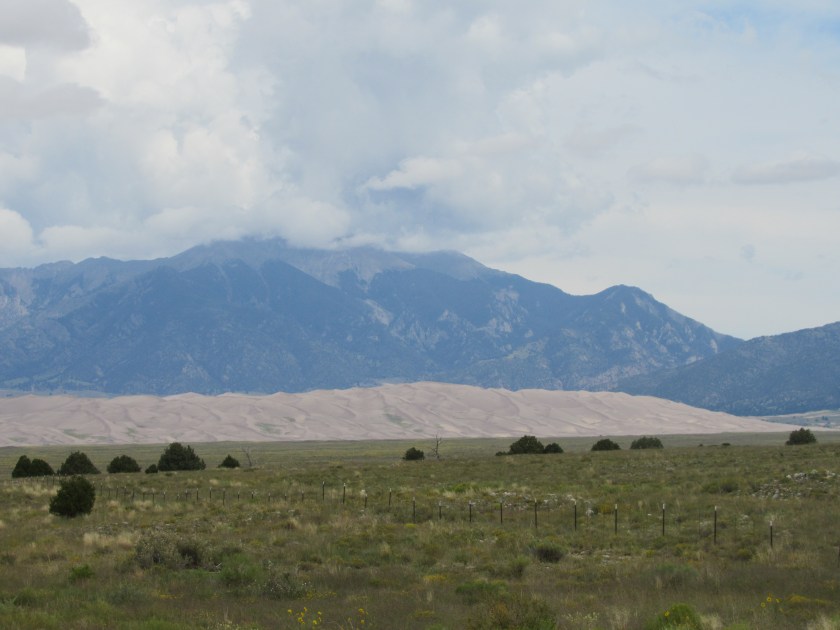
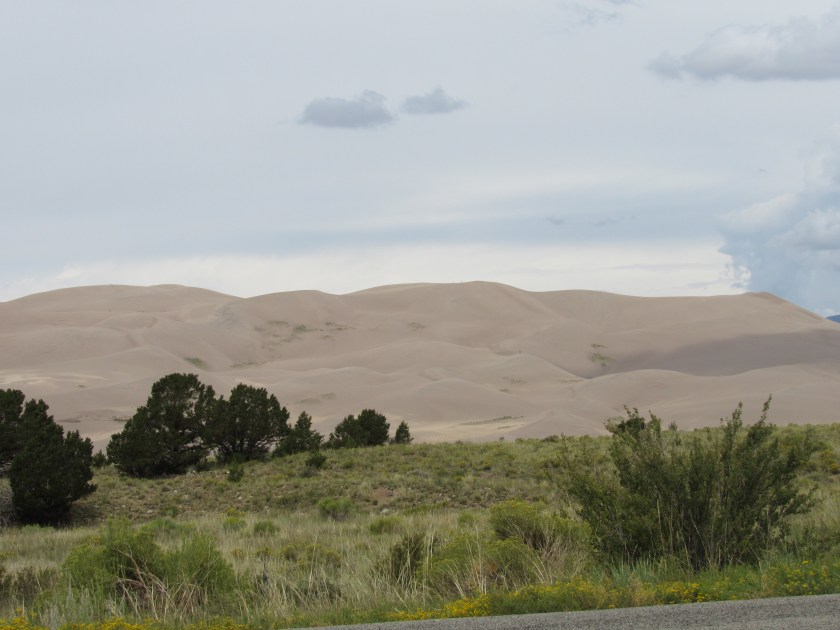
Here is a series of photos to demonstrate the size of these dunes.  This was taken from the side of the road after leaving the Visitor Center.

IMG_3395

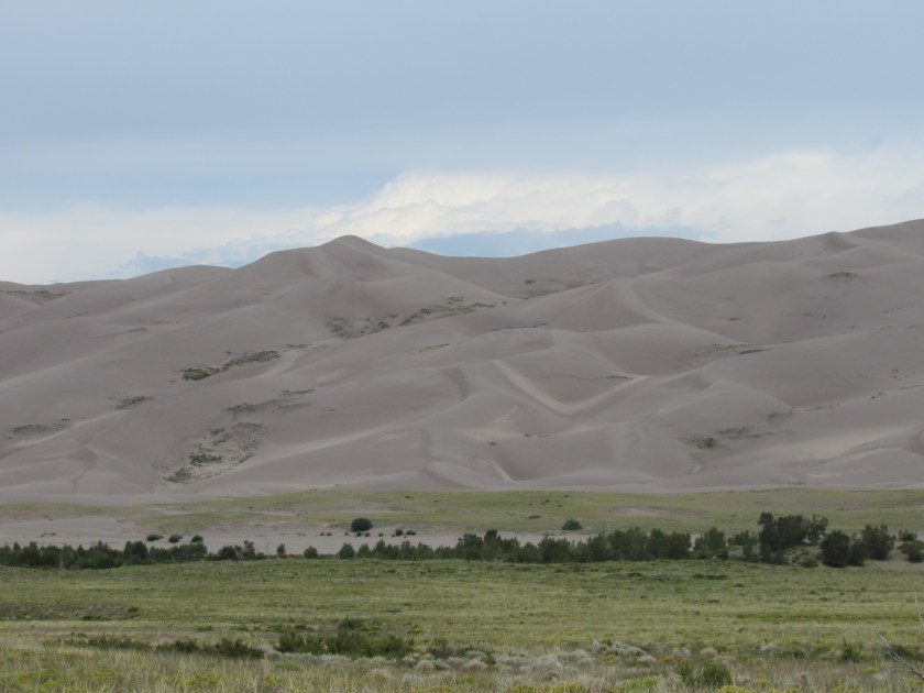
Now I’m going to zoom in to an area just a tad to the right of center.

IMG_3396

And zooming closer, towards the very top of the dune.

IMG_3397

IMG_3404

I turned around and went back to a parking area between the road and the dunes themselves.

IMG_3419

IMG_3422

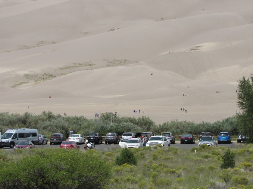
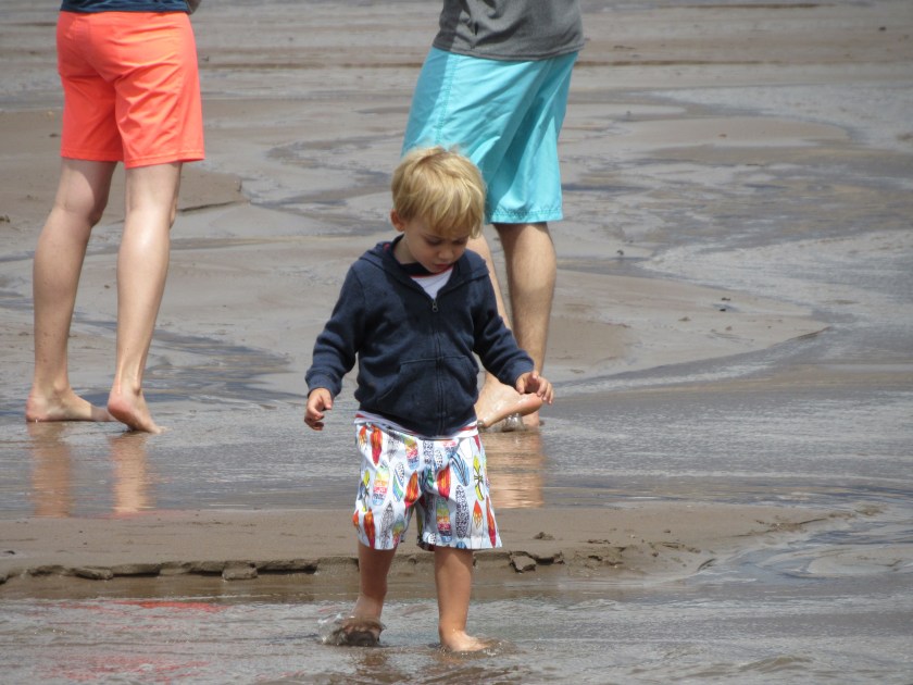
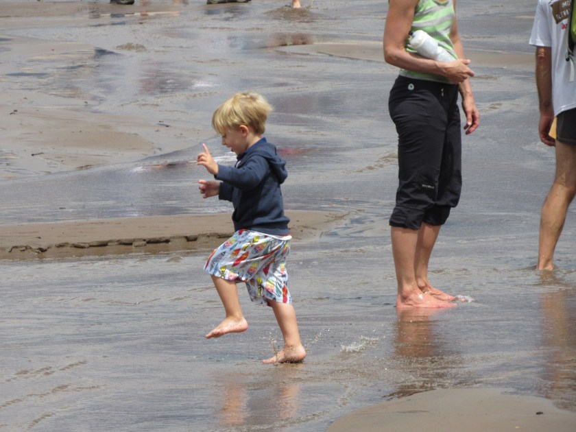
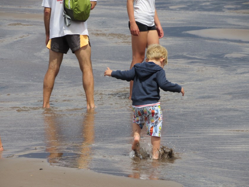
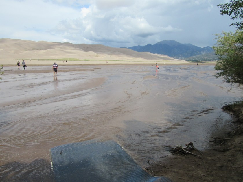
After parking my car I walked towards the dunes and almost immediately found Medano Creek.  It is a wide, very shallow stream which is also ever-changing.  Because of the continuous addition of fresh sand the creek never establishes a permanent route.  Little sand dunes form underwater but are then broken by the flowing water.  Everyone has to wade across the creek to get to the dunes.  Sand temperatures can reach 140 degrees so the Park does not recommend going barefoot.

IMG_20170824_123246956

IMG_3440

IMG_20170824_124042560

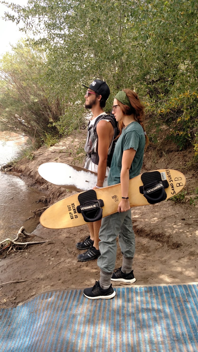
You’ll see some other folks enjoying the Park in the next post.

Although I saw trailers transporting dune buggies (they are very sophisticated these days) and other ATV’s when I was getting gas in Fort Garland, they are NOT allowed in the Park.  There are other areas nearby where those folks can have their fun.  Parents and visitors without kids can rest assured they are safe while climbing on the dunes.  In fact, this is one of the quietest National Parks in the contiguous United States.


Various locations today

On the way from Colorado Springs to Durango I stopped in the little town of Fort Garland for gas.  I noticed this dog, Nia, sitting on the toolbox of a pickup truck at the pump next to me.  Before leaving I asked Nia’s chauffeur if I could take her picture.  He said “Sure, but good luck because she always turns away when I try to get her picture”.  She was a little more cooperative for me.

IMG_20170824_100724439_HDR

IMG_20170824_100742426_HDR

This is the entrance to Sunny Daze Ranch, on the access road to Grand Sand Dunes National Park.  I thought it looked cool with all the sunflowers (there were more between the road and the gate, which is what caught my eye).

IMG_20170824_104318874

This little guy was just having a blast playing in the shallow waters of Medano Creek between the parking area and the dunes..

IMG_3448

IMG_3449

IMG_3457

IMG_3456

And this couple was here from Wisconsin to do a little sand-surfing.

IMG_20170824_123728925

After leaving the Park I started driving out the 16-mile road I had come in on.  When I reached Route 6N my GPS suggested, no, she INSISTED that I take it instead of continuing on Route 150.  I looked at my map and saw that it was basically just the top side of a rectangle and wouldn’t really be any benefit timewise BUT it would take me to the little town of Hooper.  That made me think of another favorite movie, “Hooper” (what a coincidence) starring Burt Reynolds as aging stuntman Sonny Hooper and featuring an all-star cast.  James Best (Sheriff Rosco P. Coltrane from The Dukes of Hazzard) as his sidekick Cully, Jan-Michael Vincent (from Airwolf) as Ski, his younger competition, Adam West (the original TV Batman), as Adam, Robert Klein……. oh…. you get the idea.

IMG_3505

A clever billboard made to look like a postcard (it’s even copyrighted!).

IMG_3503

And as I took Route 17 south from Hooper towards Alamosa there was a liquor store with this sign out front.  Ah, the power of suggestion…..

IMG_3511

And no, I didn’t go in.  I reached over to my on-board cooler and grabbed a cold one of my own (water, that is).

Finally, as I got closer to Durango I passed Chimney Rock National Monument.  I’ll probably be getting a closer look at it tomorrow.

IMG_3519

IMG_3518


Sunset in Durango, Colorado

It was around 7 o’clock local time when I arrived at my Airbnb a few miles south of Durango.  A big rain storm was nearby and created some interesting contrasts of clouds and sun.  These were taken from the guest room windows and the back deck of the house.

IMG_3539

IMG_20170824_194037794

IMG_20170824_194042609

IMG_3537

IMG_3556

IMG_3555