No photos but they will be in an older post referenced below.
Upon my arrival in Cincinnati OH last evening I learned that the Visitor Center, and many other historic buildings, at the North Rim of the Grand Canyon were destroyed by an out of control wildfire on Sunday. Crews were trying to protect the Park from the fire, which was started by lightning, but it managed to get past them. Fortunately, all staff and guests at the Park were able to escape safely and no firefighters were injured. The North Rim will be closed for the rest of the season and probably beyond, as it will be a major undertaking to rebuild everything and make it safe for everyone to return.
I don’t have my photos from that far back on this computer but you may enter “Grand Canyon North Rim – Lodge” in the search box on the Home page to see my post from September 10, 2017 featuring the Lodge (and I believe there were others from that trip as well). Once on that 2017 post, a calendar for September 2017 will be on the right side of the screen to view all the posts from a particular date within that month.
————————————————————–
I am now on the road in earnest so my posts will soon increase in frequency. I am still working on some computer issues. My iPhone sometimes creates two files when I take a photo – a traditional .jpg and a mini-movie which takes up even more space. It wreaks havoc when I try to copy from my phone to my computer (not an Apple product) and it is taking me time to delete them, while keeping the real movies I take from time-to-time.
To quote Gilda Radner from SNL (whose photos and outfits I saw in the Rock & Roll Hall of Fame in Cleveland last week) – “It’s always something….”
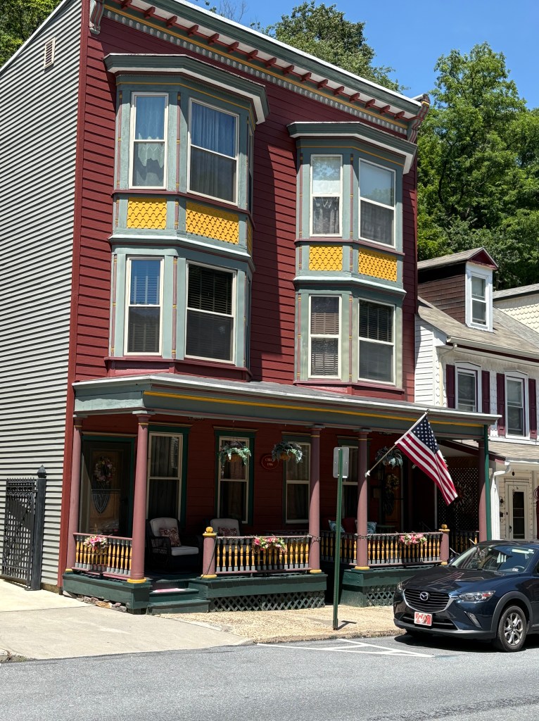
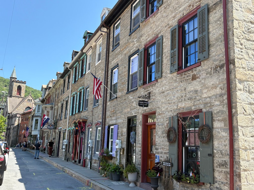
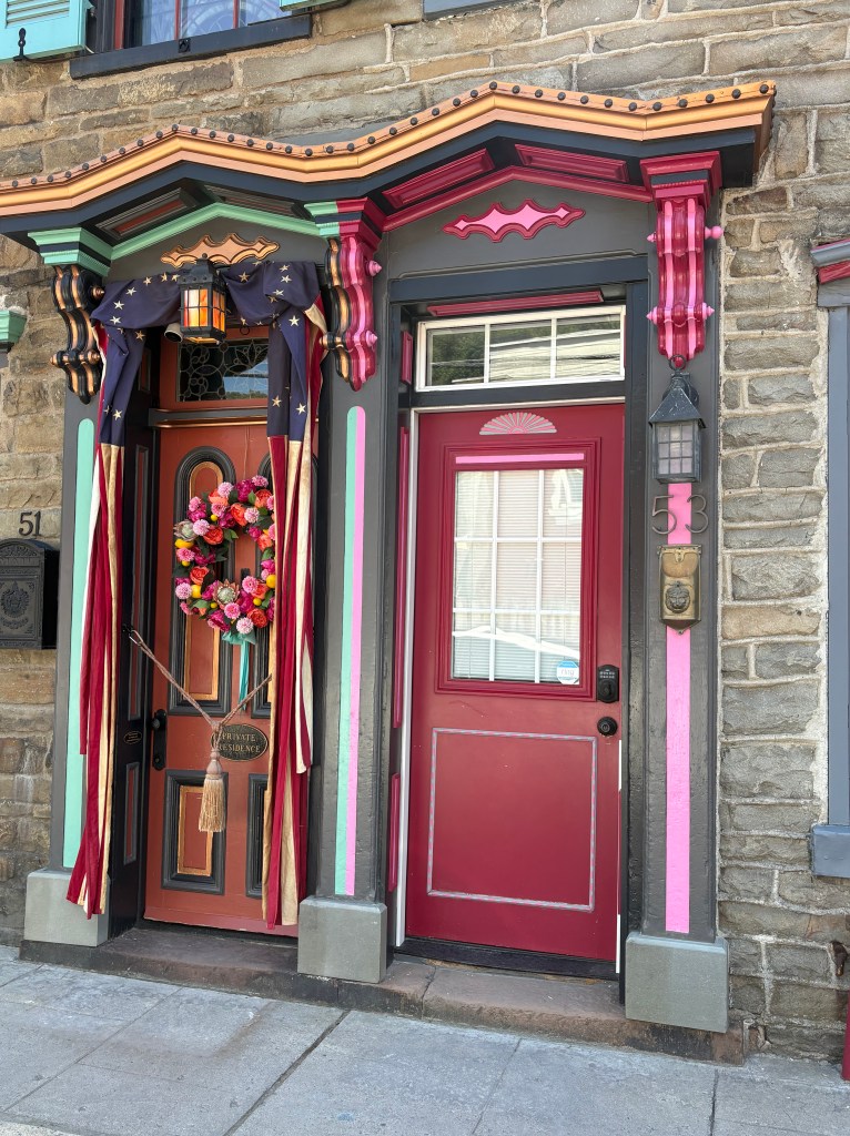
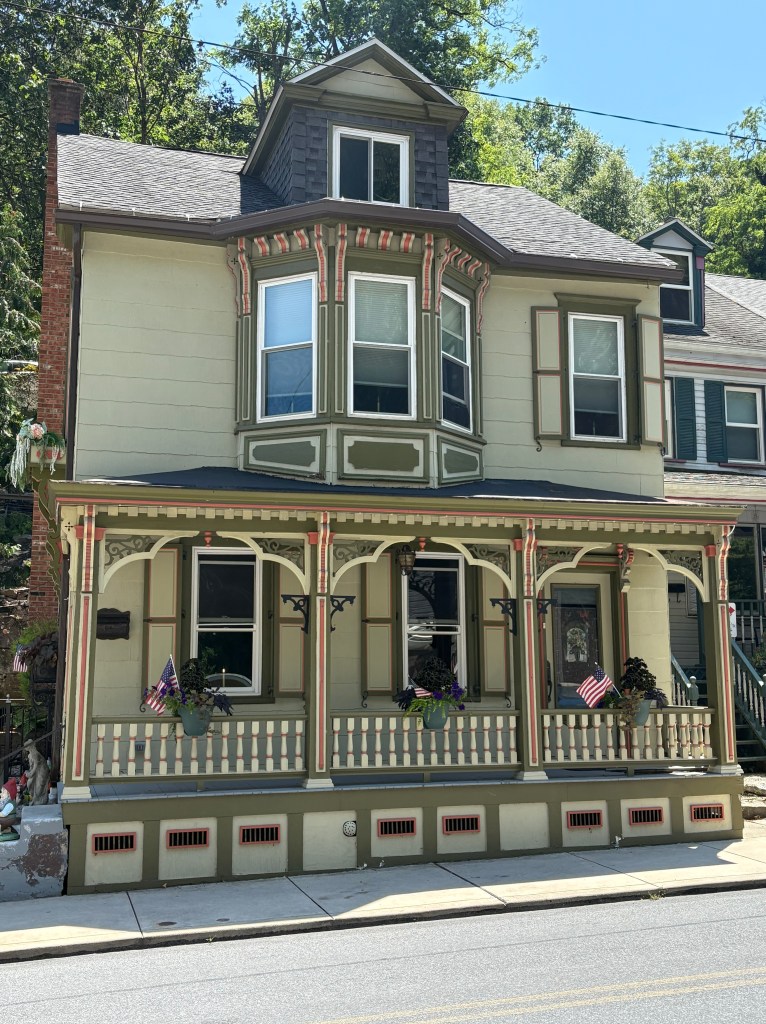
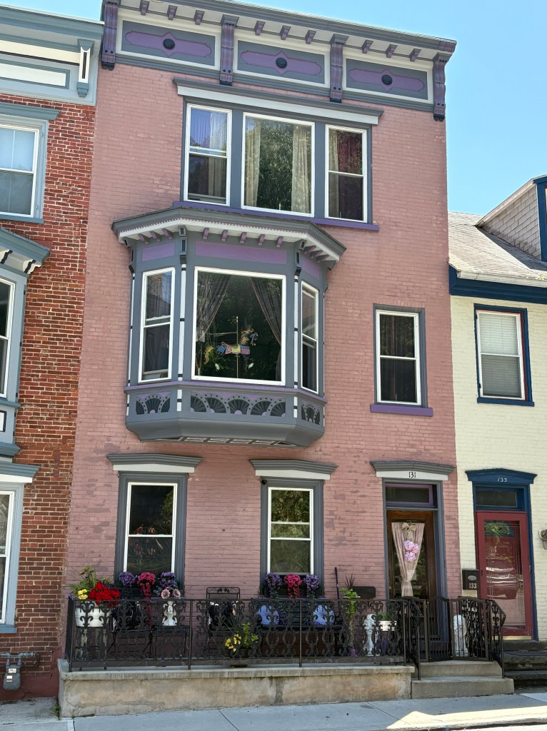
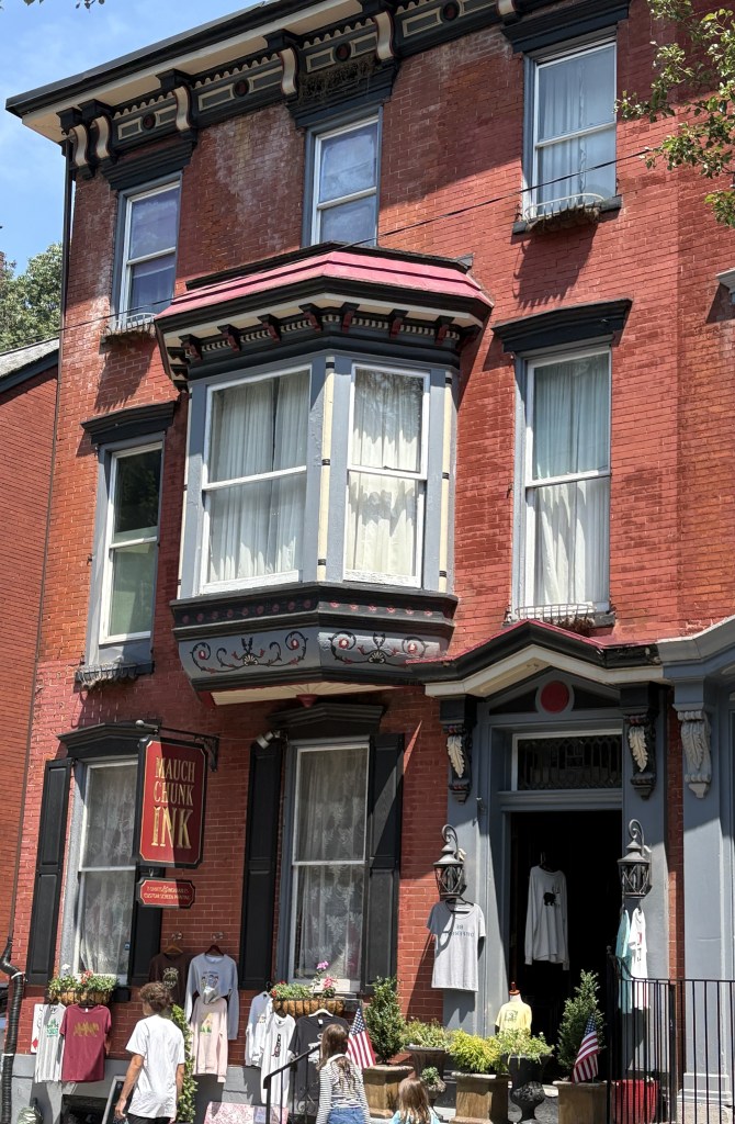
More of the beautifully maintained homes in Jim Thorpe, PA.
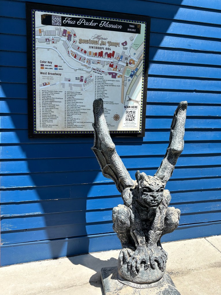
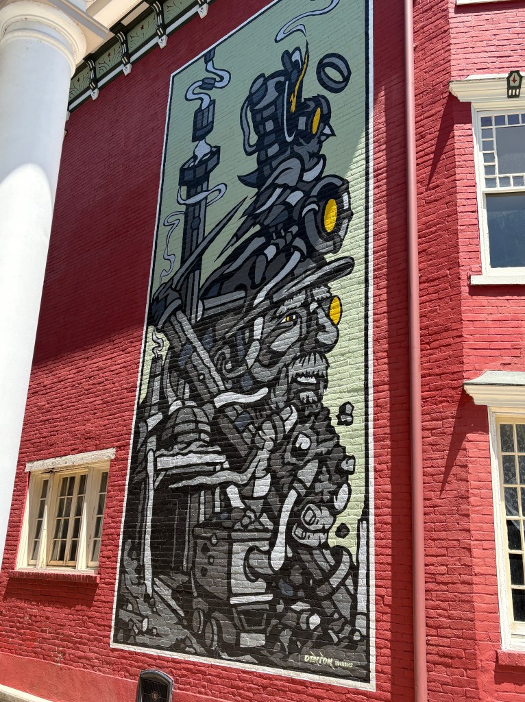
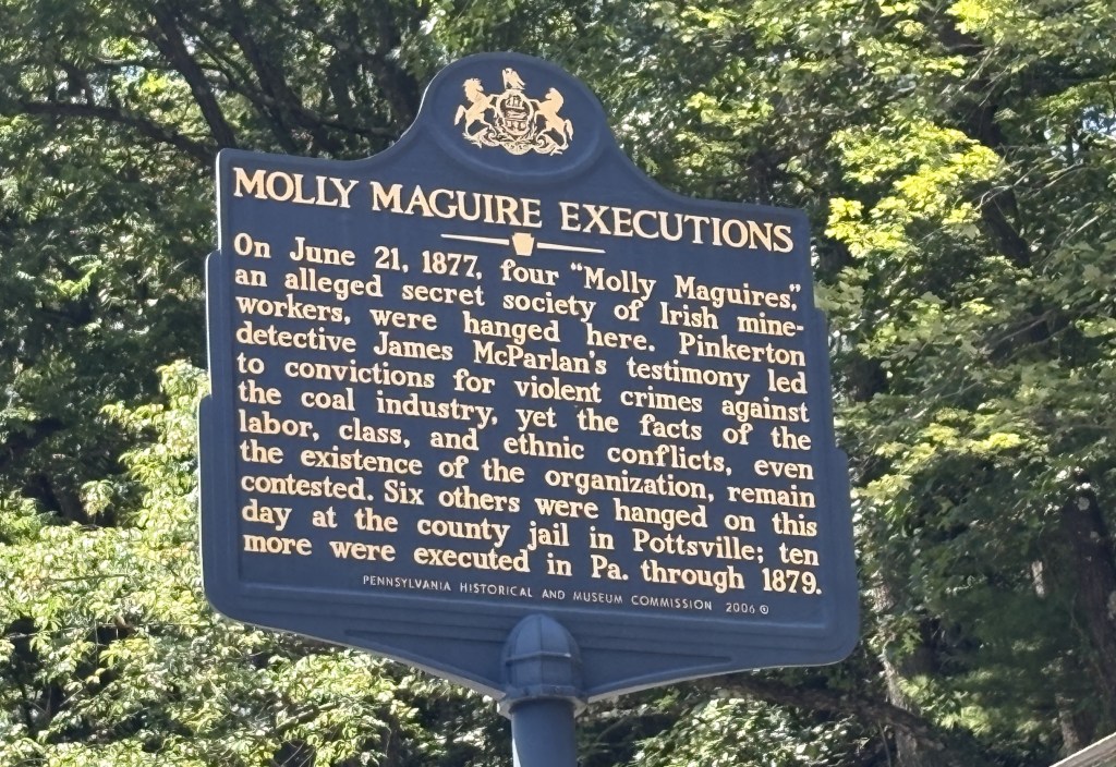
Wait a minute….. how did HE (or SHE) sneak in here???
And a few more buildings as we walked back down towards the train station. We thought five hours was a long time to fill but it went by very quickly. Some day I will drive up to the northern end of the Reading & Northern train line and ride south to revisit this beautiful little town again. I could spend all day here.
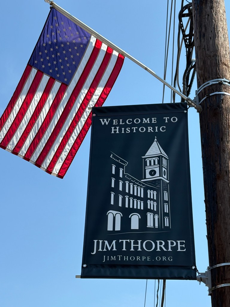
There are many historic buildings in Jim Thorpe and in addition to the buildings and businesses, many residents have gone to great lengths to freshen up and maintain their homes.
The town of Jim Thorpe used to be called Mauch Chunk. The name was changed as a tribute to the first Native American to win a Gold Medal for the United States in the Olympics (see previous post).
There was vehicular traffic gridlock (and it gets even worse when there are festivals in town, or in nearby Allentown/Bethlehem/Easton or Scranton/Wilkes Barre). We were very happy we had arrived by train and didn’t have to sit in traffic or find a place to park!
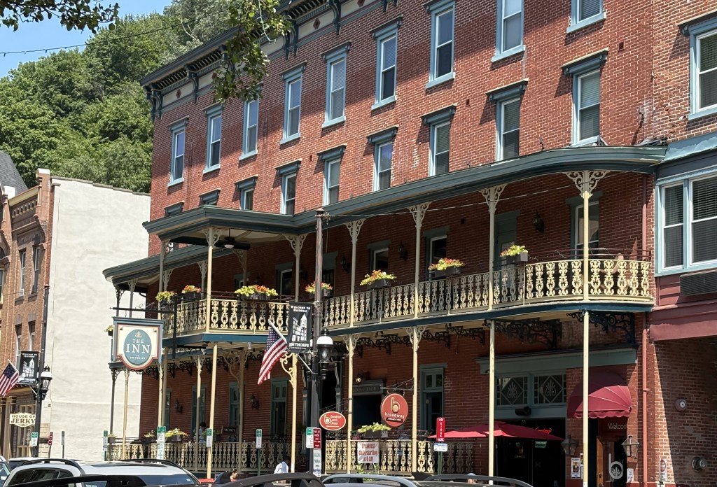
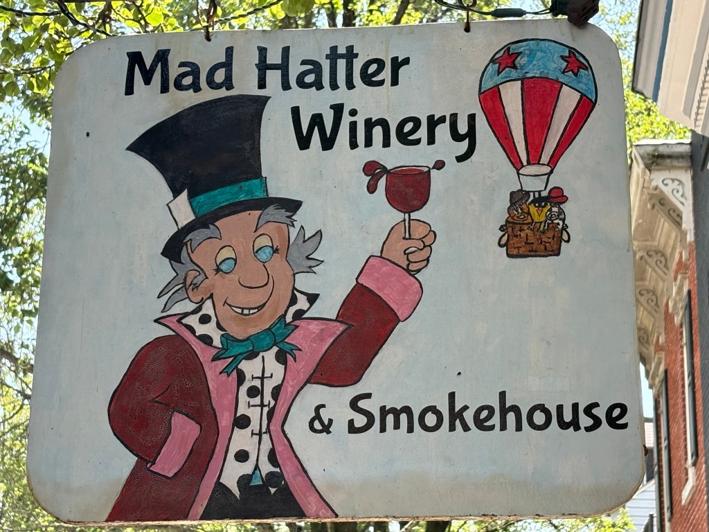
We enjoyed a fabulous lunch on the left side of the building above, in an old firehouse! There are LOTS of great restaurants in Jim Thorpe.
I was glad our restaurant wasn’t adjacent to THIS building!
And another building in JT where we enjoyed a beer while waiting to catch the train back to Reading.
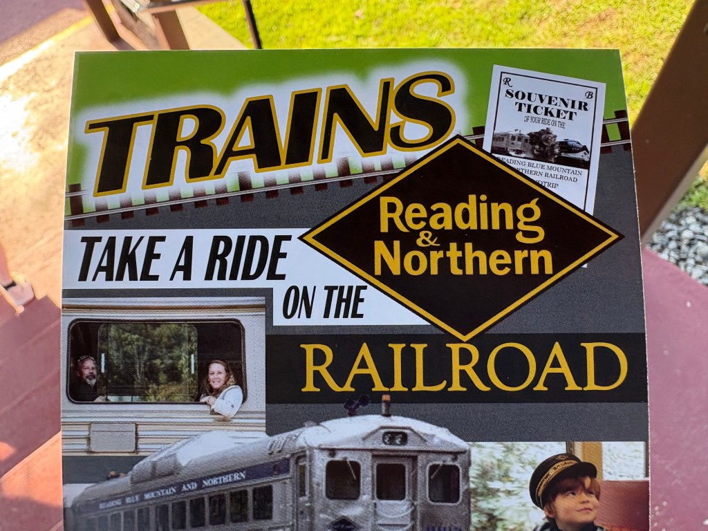
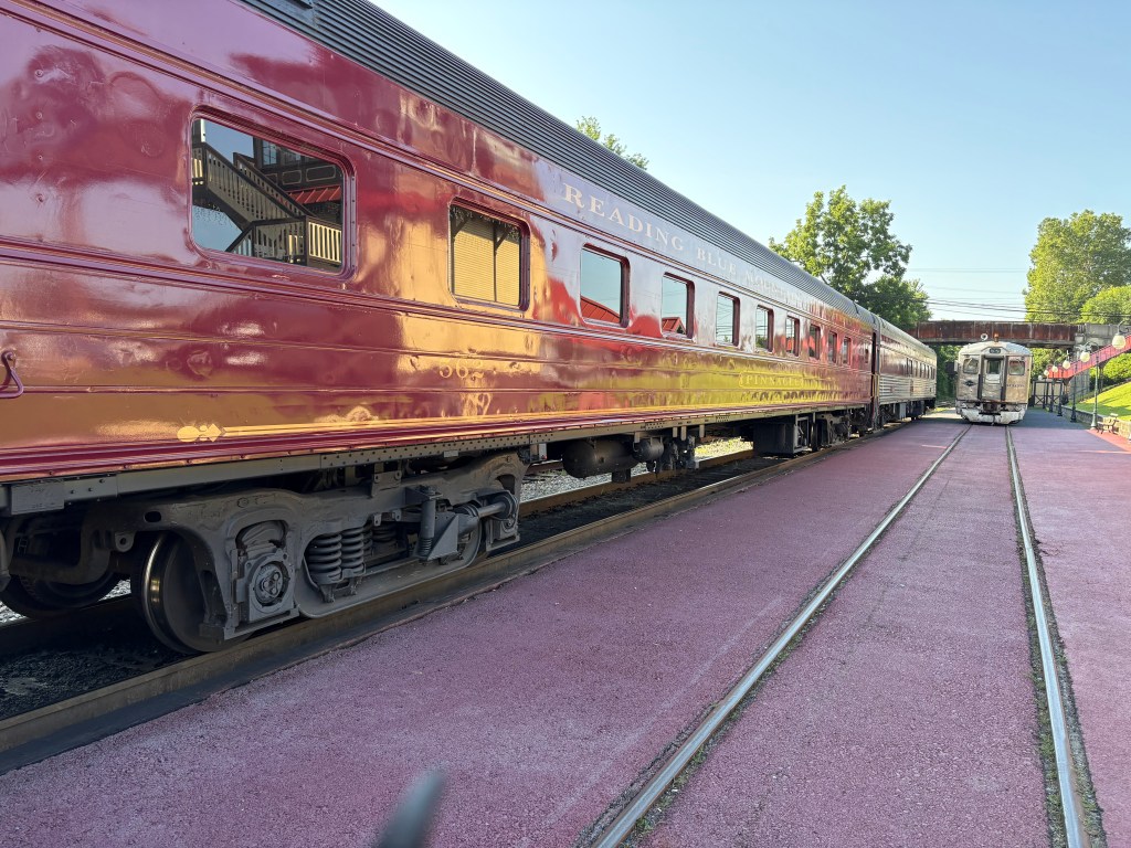
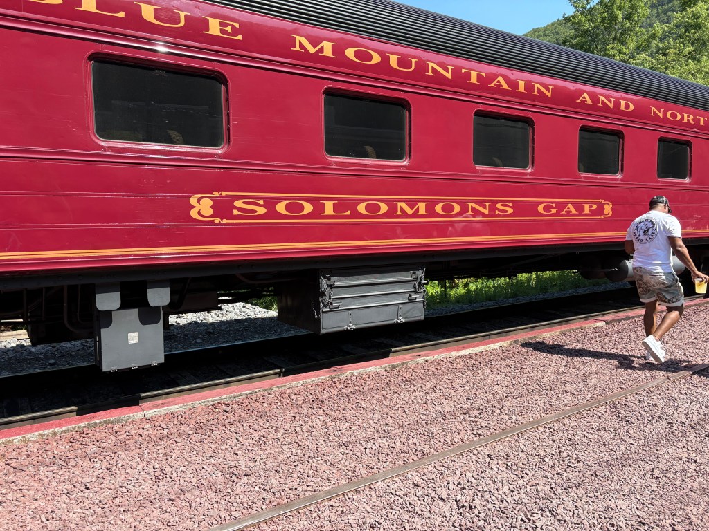
I have been staying with friends in southern Pennsylvania for a few days and they discovered a great train ride for us to take on Sunday. We drove to Reading PA, not far from where they live, and boarded a diesel-engine propelled train which would take us north to Jim Thorpe, PA which, coincidentally, is about 20 minutes from where my older brother used to live!
We literally took a “Ride on the Reading!” (a Monopoly board game reference for those of you not familiar with it).
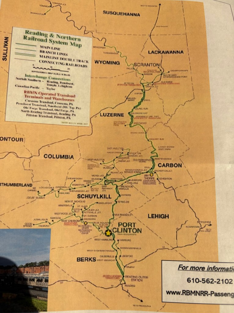
We left Reading (at the bottom center of the map) and rode about two hours up to Jim Thorpe, just left of the word CARBON on the right side of the map. The town of Jim Thorpe used to be called Mauch Chunk but was renamed for the Olympic athlete who was the first Native American to win a Gold Medal for the United States. He played professional football, baseball and basketball and was considered one of the most versatile athletes in modern sports (source: Wikipedia). He won two Gold Medals in the 1912 Summer Olympics (pentathlon and decathlon). A statue of Jim Thorpe is located in another part of town.
But I digress…
It was a gorgeous, relaxing ride through wooded areas, small towns and some beautiful countryside. Several rivers and streams ran alongside my side of the train as we went north. We made two quick stops to pick up more passengers, and when we arrived in Jim Thorpe we were given 5 hours to walk around, have lunch, and enjoy the beauty of this small town. I have driven through Jim Thorpe several time over the years but don’t think I ever got out of my car. It was a beautiful day and we had a great time.
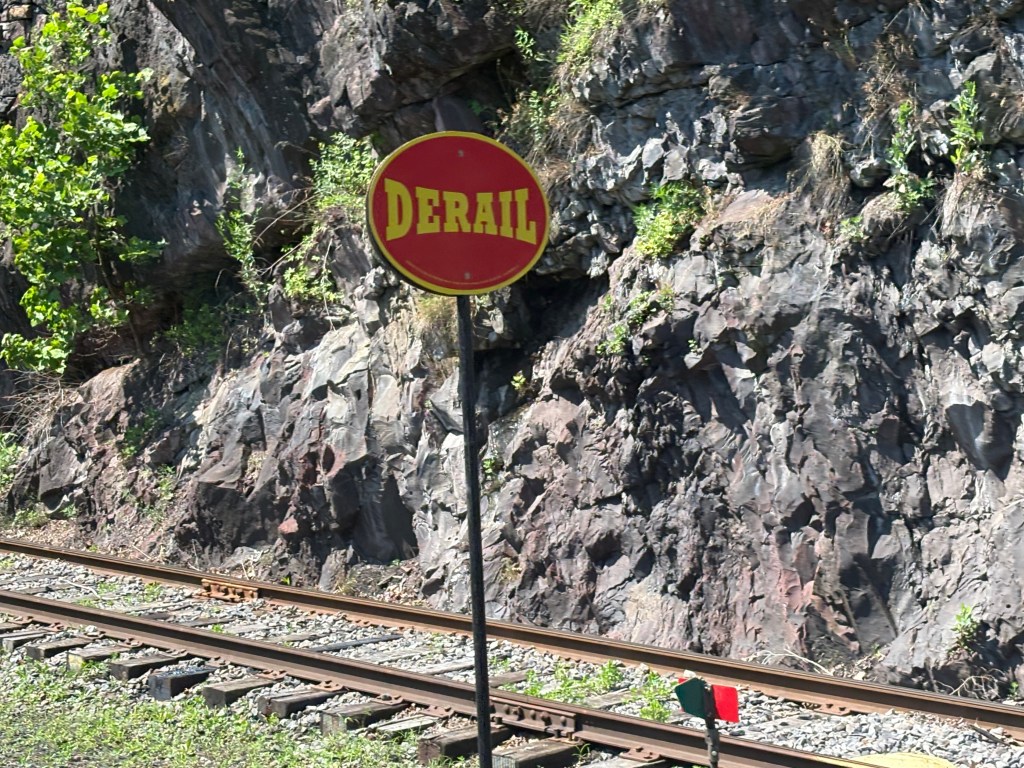
Not a word you want to think about while riding a train! There were several of these along our route, in areas where the train could move gracefully to adjacent tracks.
We finally arrived at our destination and set out to enjoy our time there.
This is a rare real-time post as a heads-up to those of you thinking of taking the “recently-reduced-to-one-lane-each-way” I-40 through the western NC mountains in the next week or two. (This was originally posted June 25)
UPDATE on 6/27/25 PERMISSION GRANTED!! The road has reopened earlier than expected. They had said it would be closed two weeks from June 18, or until July 3, but announced today that is open. Now we just have to hope they don’t get much rain, and if they do, I might consider going another way…
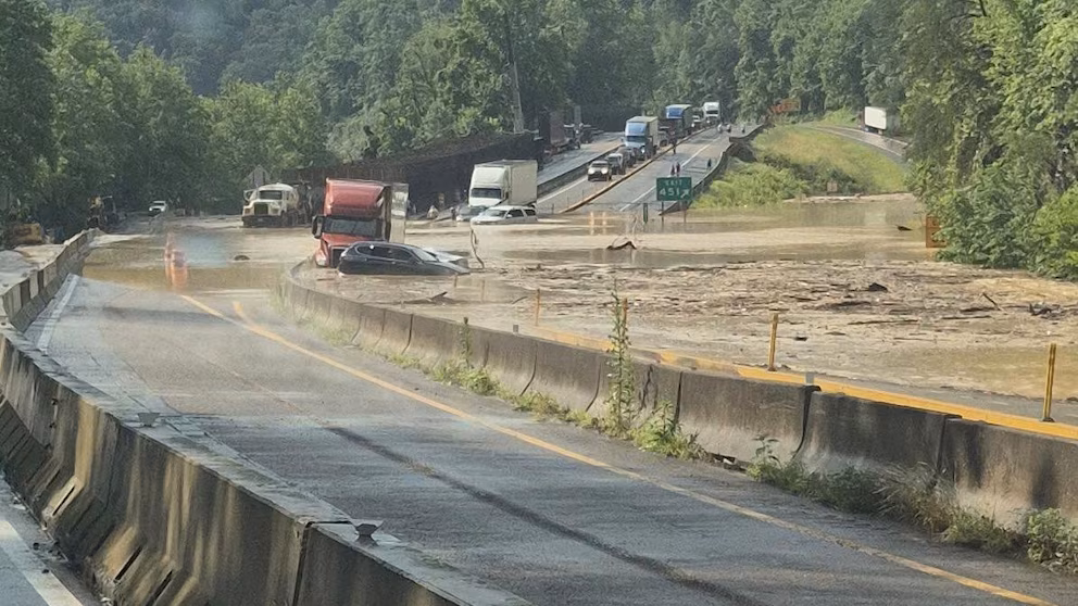
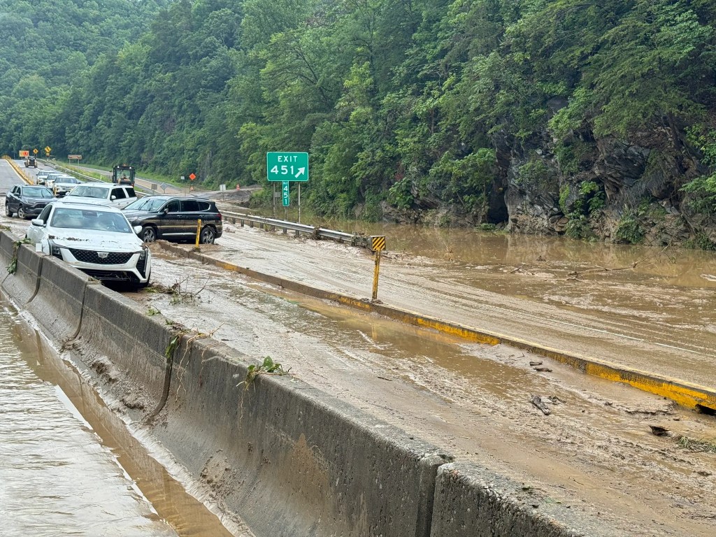
One week ago today, on June 18, 2025, the highway experienced another closure due to a rock/mudslide which flooded the lanes on both the east and west-bound side.
(Photo credit: ABC News)
(Photo credit: Asheville Citizen Times)
For those of you not from these parts, I-40 through the mountains is a narrow 4-lane highway with tight turns, tunnels, and LOTS of truck traffic. It is arguably the shortest distance between two points BUT is prone to many problems. Rockslides, mudslides, accident closures, icing problems and snow drifts in the winter months, etc.
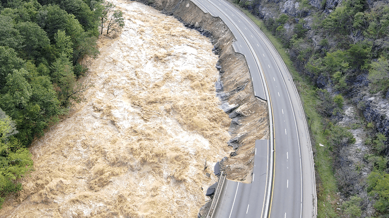
This existing problem was compounded exponentially on September 27, 2024 when excessive rains from Hurricane Helene (on ground already saturated by rains from back-to-back “normal” storms the week before which, because of the mountains, often result in nature squeezing even MORE moisture than normal out of the air) caused exceptionally high water levels in the Pigeon River, which runs adjacent to the westbound lanes of I-40, causing them to collapse, literally, into the river.
Think I’m kidding?
(Photo credit: Raleigh News & Observer)
(Photo credit: WRAL TV)
The highway was closed, obviously, and traffic both ways was rerouted. No small task. This became a priority repair project and after giving the matter some thought, NC Department of Transportation announced plans to have the highway reopened by New Year’s Day.
FAIL (but not their fault)
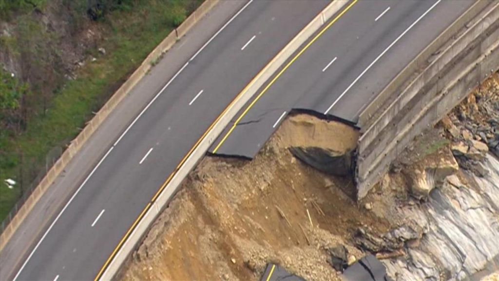
On December 20 (and I don’t know if they were on schedule or not but that is now moot) parts of the westbound lanes collapsed AGAIN.
So now the priority became changing the eastbound lanes to one-lane each direction, at 35mph, big rigs allowed but NO WIDE LOADS!! That idea finally became a reality on March 20, 2025, and worked quite well until last week.
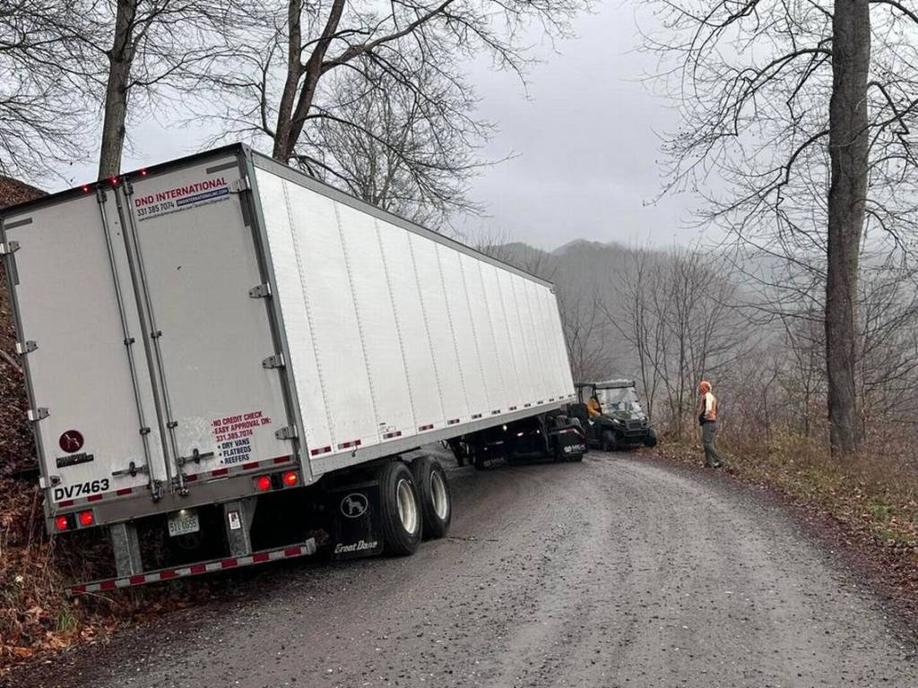
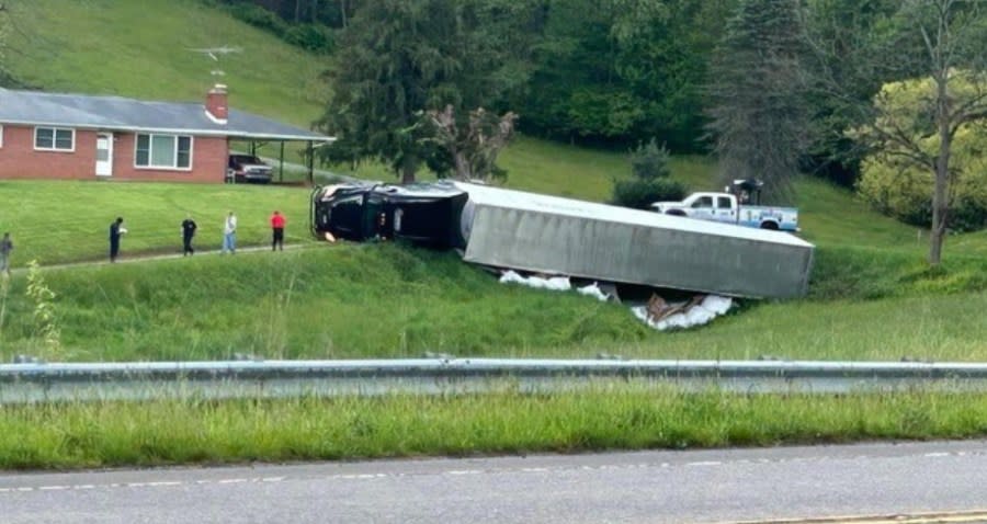
A subsidiary problem which has developed is that truckers, who are notoriously on a tight schedule and are always trying to find a new way to skin a cat (sorry, PETA, just using a common phrase. No ill-intent here…) are taking shortcuts on small mountain roads not designed for the size or weight of such vehicles.
Helpful hint to truckers – when the police and other authorities tell you not to use small mountain roads to transport your precious cargo – DON’T.
(Photo credit: Raleigh News & Observer)
(Photo credit: CBS17)
(Photo credit: Yahoo News)
Fortunately, our hero is not going west to start his next trip. I will be heading north to Pennsylvania and Ohio next Tuesday and will be well north of this dilemma when I start working my way west to Seattle.
And as a final cautionary warning to be mindful of in similar situations – several years ago, during one of the hurricanes which passed over North Carolina (I live in Durham) and flooded long sections of I-95, a MAJOR north/south corridor (used by truckers hauling their precious cargo, parents hauling their precious cargo to/from Disney World, and drug pushers and arms dealers hauling their precious cargo to Lord knows where), when a local TV newsperson interviewed a State Trooper and asked “what’s the best advice you can give people trying to get around this mess?” the Trooper replied, “Two things – one, LISTEN to local authorities who are standing out in the elements for that reason, and two, DON’T TRUST YOUR GPS. It’s going to direct you to the next highway which runs parallel to the interstate. Well guess what, the next THREE highways are flooded, too.”
I hadn’t really thought about that before but he’s right. As I have learned over the years with my GPS units 1.o through 4.0, trust but verify.
No photo. (Already he starts with the “no photo” nonsense….)
I still plan to leave Durham July 1 – a week from tomorrow. Most of the first two weeks will be visiting friends and family in Pennsylvania and Ohio. I doubt if I will post anything during that time (well, I might sneak one or two in since I generally wake up well before anyone else when I visit people).
Once I hit the road in earnest I will be making a series of one or two night stops as I work my way to Seattle WA. I will stay there 4 nights before crossing into Canada. All those stops have already been booked, and I have a few activities and photo ops planned.
After I cross into Canada I plan to spend 8 weeks visiting the southern parts of British Columbia and Alberta provinces, and the southwestern part of Saskatchewan.
Now comes the tricky part. Wildfires. The worst wildfire in Canada this year (so far) seems to be in the upper part of Manitoba, well east of my target area. BUT. Many fires have erupted in all three provinces I plan to spend my time in and are getting more than a little close for comfort. I have booked about three of my projected 8 weeks in Canada already. That puts me near Banff National Park in the Canadian Rockies. After that, who knows…. I am not booking anything else until I get my boots on the ground in Canada and can assess the situation at that time. I have Plans B, C, D and E mapped out, just in case.
My original plan was to spend 8 weeks in Canada, return to Seattle, put my car in storage and fly to Alaska! I have 5 weeks available to spend up there before I must start my departure from Seattle to make my rambling trip through the western and southern US on my way back to Durham by Thanksgiving.
For anyone who might be thinking of robbing my apartment, I have cleaned out all the food from my refrigerator and freezer and have taken my clothes to Asheville and Swannanoa in WNC to help the victims of Hurricane Helene, so don’t waste your time picking the carcass apart in Durham…. not much left here! I have all the good stuff with me – my wits, phone, computer, cameras, FitBit, prescription meds, Passport, new-to-me car and, of course, my Platinum card.
I will start posting some pictures once I depart to head west (instead of north) about three weeks from now, both with road trip pics, though there will be many travel days when I just drive on the dreaded interstate, and several stops I have planned around specific activities. Once I get to Canada I will stop the hysterical historical photos and stories and focus on real time photos of The Great White North (let’s hope it’s not white quite yet).
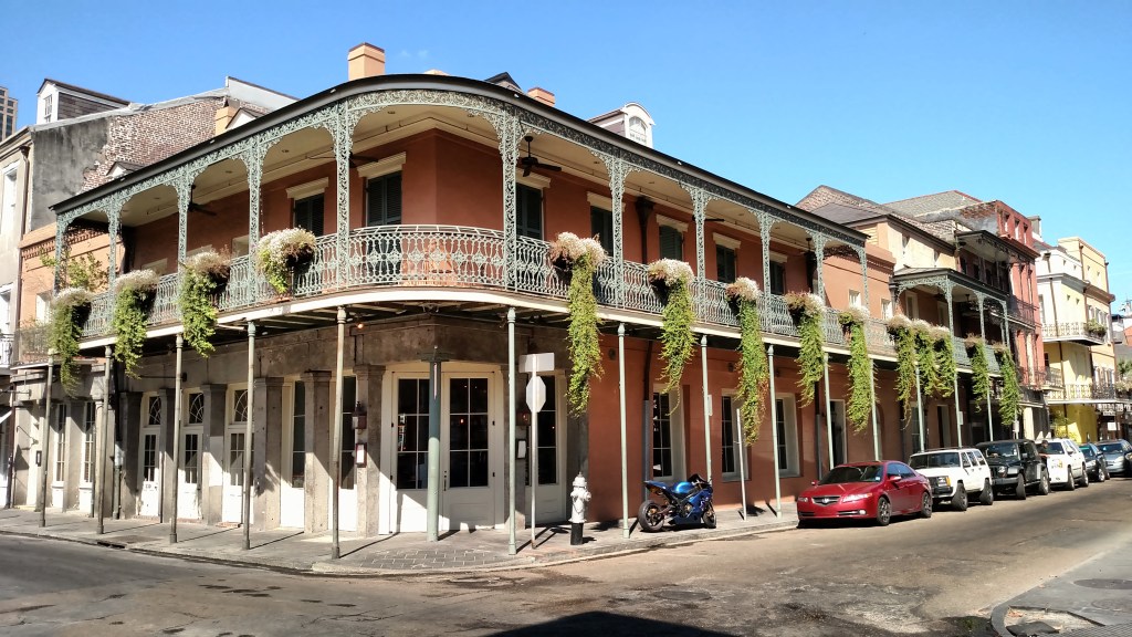
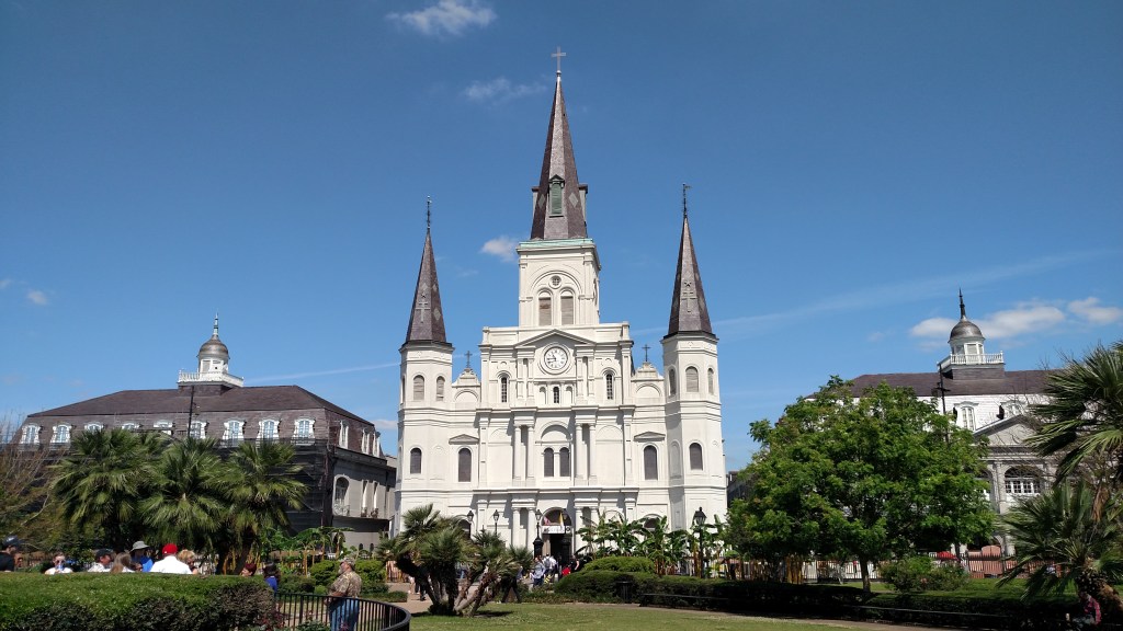
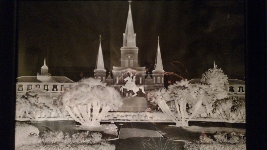
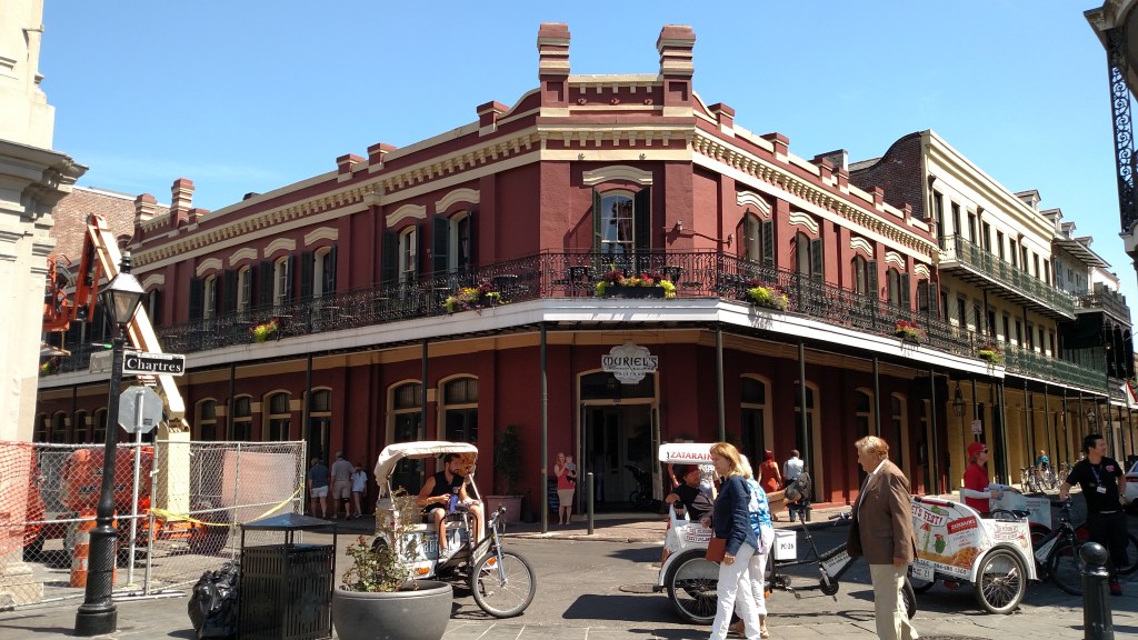
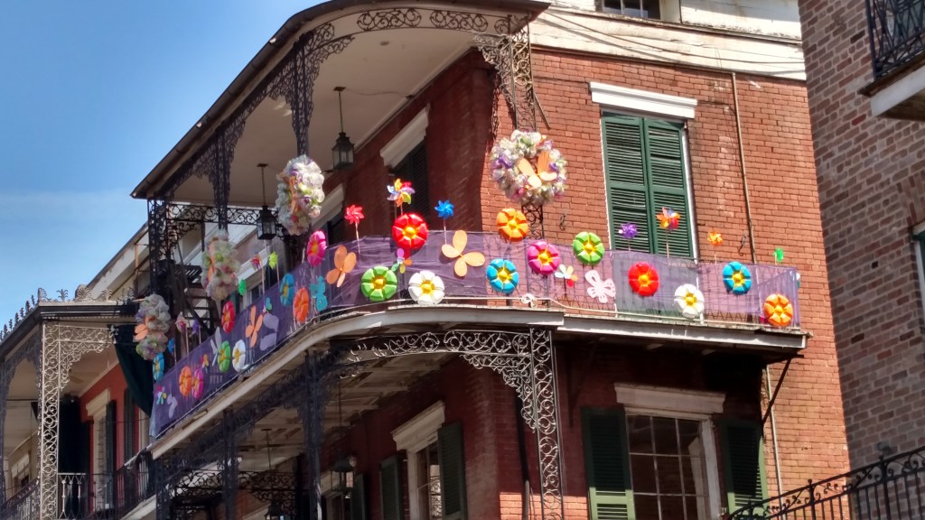
I’ve been working on this for weeks and it is about to start! Let me whet your picture appetite with some photos from “Nawlins” taken in May 2016. That’s New Orleans if you don’t speak southern.
And more importantly, let’s see if I remember how to do this! (Come on, JohnBoy, it’s like riding a bicycle…)
You can’t start a photo array about New Orleans without beignets and chicory coffee from Cafe du Monde.
No, that’s not me… I’m a few pounds heavier…. (where are my rolling eyes emoji’s when I need them)
I won’t tell you where I found this reverse image…
And to answer your next question….
So this is the type of thing you can expect from time to time. Flashbacks from past trips I took before starting the blog. These were taken using my Android phone which took very good pictures but don’t seem to be as big as photos taken with my various iPhones. And this was well before I had any of my digital cameras, the first of which I acquired in 2017.
I have downloaded 3,749 pictures from 2015, and 13,750 pictures from 2016, to my computer. I started the blog in 2017 but I traveled throughout the eastern United States and stayed mostly in Airbnb’s during those two years and other than amusing JohnBoy stories I have shared from time to time (like the Bike Gate fiasco in Memphis) I have just been sitting on them. I know, I know, COVID was the perfect opportunity to have used my isolation to post them but I am a terrible procrastinator.
My next post will spell out “the plan” as it stands right now, at 821 EDT on June 23, 2025. My life seems to be in a constant state of flux lately so we’ll all just have to muddle through this together…..
Those of you that get notified when I post something can probably figure out that something is going on….
I will be resuming new posts to the blog in the very near future. I promise. I pinky-promise. I know you’ve heard this tune before but I am a terrible procrastinator and various events prevented me from implementing this plan in 2022 ((things like COVID, the death of one of my brothers, various health ailments (none serious, fortunately, but time-consuming to diagnose) and the fact that there have been major wildfires in the northern portions of BC and AB the past three years)).
Plans are in the works to head to western Canada soon after the 4th of July (of THIS year). I am definitely going to the three western provinces – British Columbia, Alberta and the western part of Saskatchewan. I already have that all mapped out and it will take 3 months and 17 days (not that anyone’s counting).
I have also decided that I will probably fly to Alaska (!) from Seattle and do some running around up there using various modes of transportation (mush, you huskies, mush).
The post below was accidental but represents part of my efforts to catalog all 1,308 posts made in prior years (almost 10,000 photos posted!). The folks at WordPress have talked me through printing all the post’s titles in bite-size portions. I will create pdf files containing all the entries which I can send to anyone interested. It will then be easy and fun to revisit old posts or perhaps discover posts you haven’t seen.
I will update the header page above as soon as I can remember how to do it (DONE), and will include photos of my new-to-me wheels (a spiffy red 2018 Toyota Camry XLE. Only 79,000 miles on it now but that’s fixin’ to change…). My 2014 Altima served me well for my prior trips (except for that pesky problem returning to Nova Scotia from Newfoundland…), but with over 224,000 miles on it (I bought it with 60k on it) it was time for a newer ride.
Thank you for your patience. I will try not to let y’all down!
This is a work in progress. It represents only a small portion of the list of previous posts. I will create pdf files of all 1,300+ posts-to-date which I can then send to interested persons. Stay tuned!!